
Berry Butte 5,682′
Total Time: 6 hours
Roundtrip Mileage: 6.1
Elevation Gain: 2900′
Trailhead: Grandview Point, pit toilets, no water
Companions: Holly, Brian Joseph

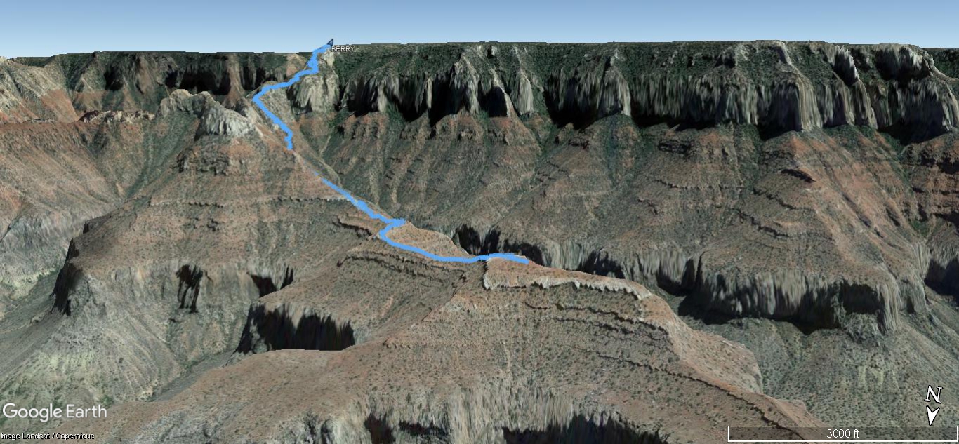
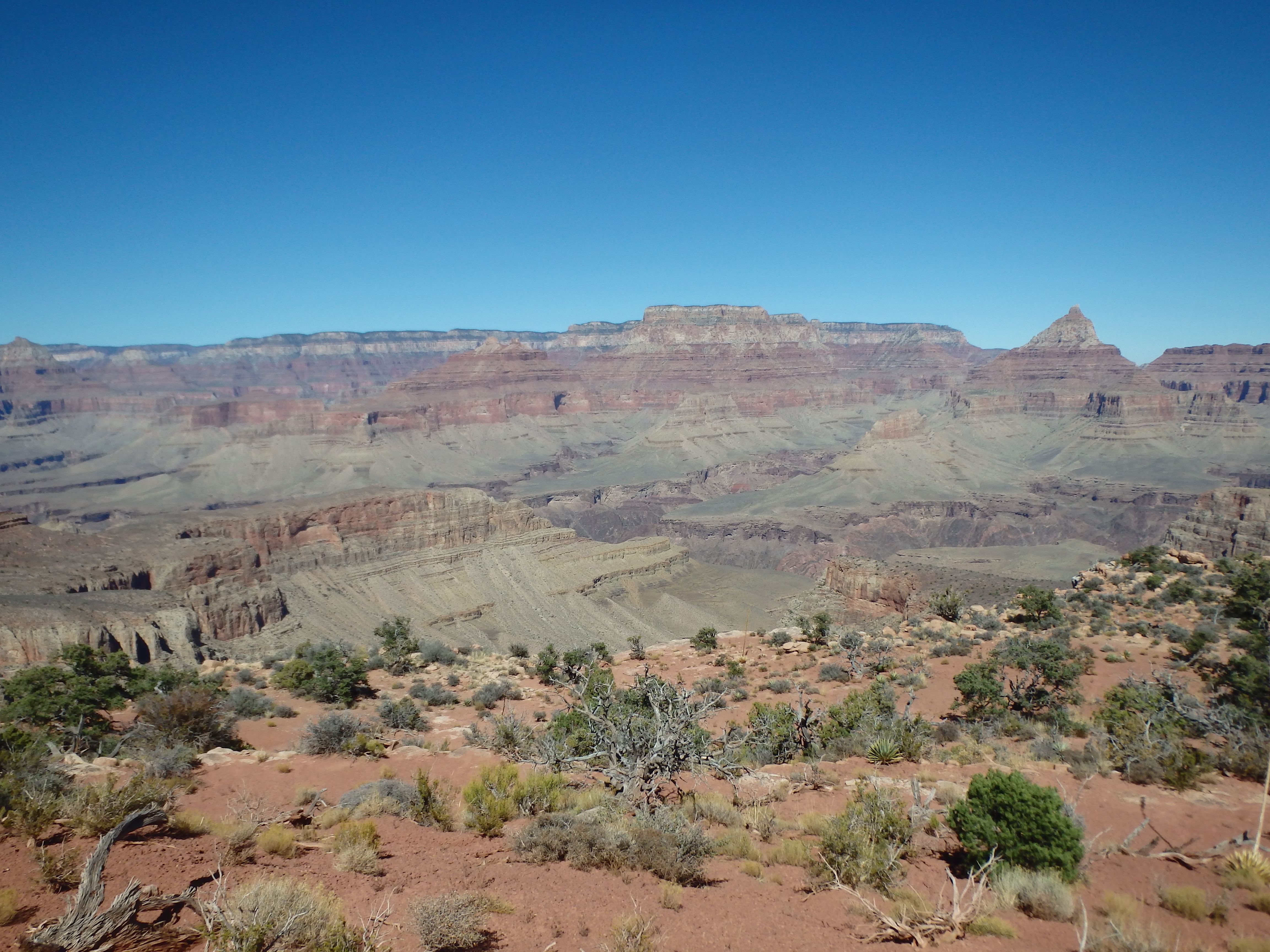
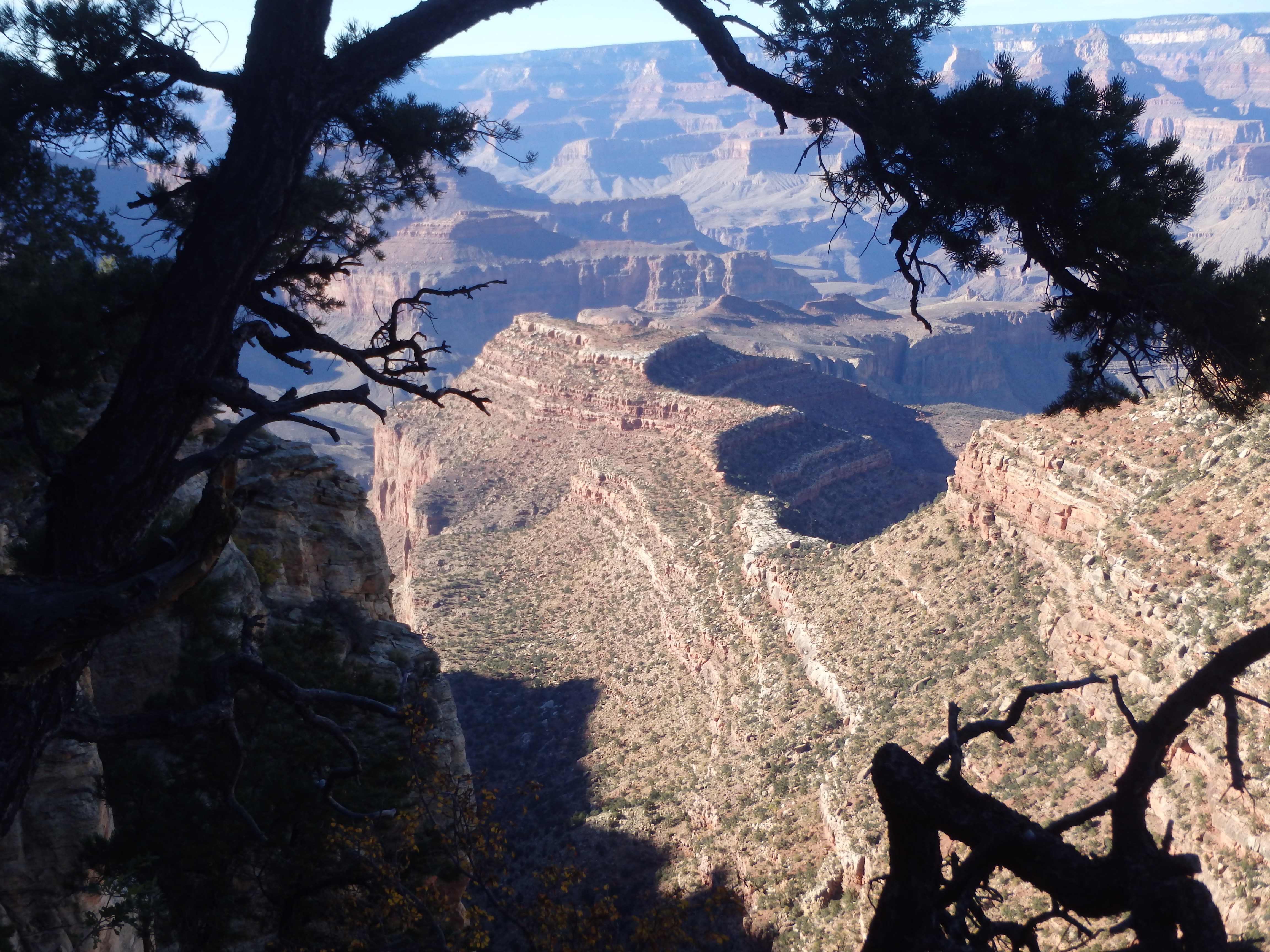
Berry Butte is one of the ‘newest buttes’ in the Grand Canyon, only officially named in 1998. One of the dozen plus non-technical south rim summits with a fairly short approach, it’s a butte I’ve always planned on climbing, but with no big rush to do so. As part of a birthday weekend in the canyon, we had planned to backpack the Boucher Trail and ascend White Butte. But despite getting to the backcountry center shortly after opening, all the permits were full for nearly every south rim trail, and we defaulted to car camping outside the park with some day hiking during the day. I had tortured Holly with a couple of Grand Canyon summits before (Kibbey being the worst), the only one she actually enjoyed being Cedar Mountain one year prior. I was running low on pain-free south rim summits, but thought the 5-6 mile mostly class 2 Berry Butte might be doable. After reorganizing our packs from backpacking mode to dayhiking, we started down the Grandview Trail from Grandview Point, Horseshoe Mesa far below.
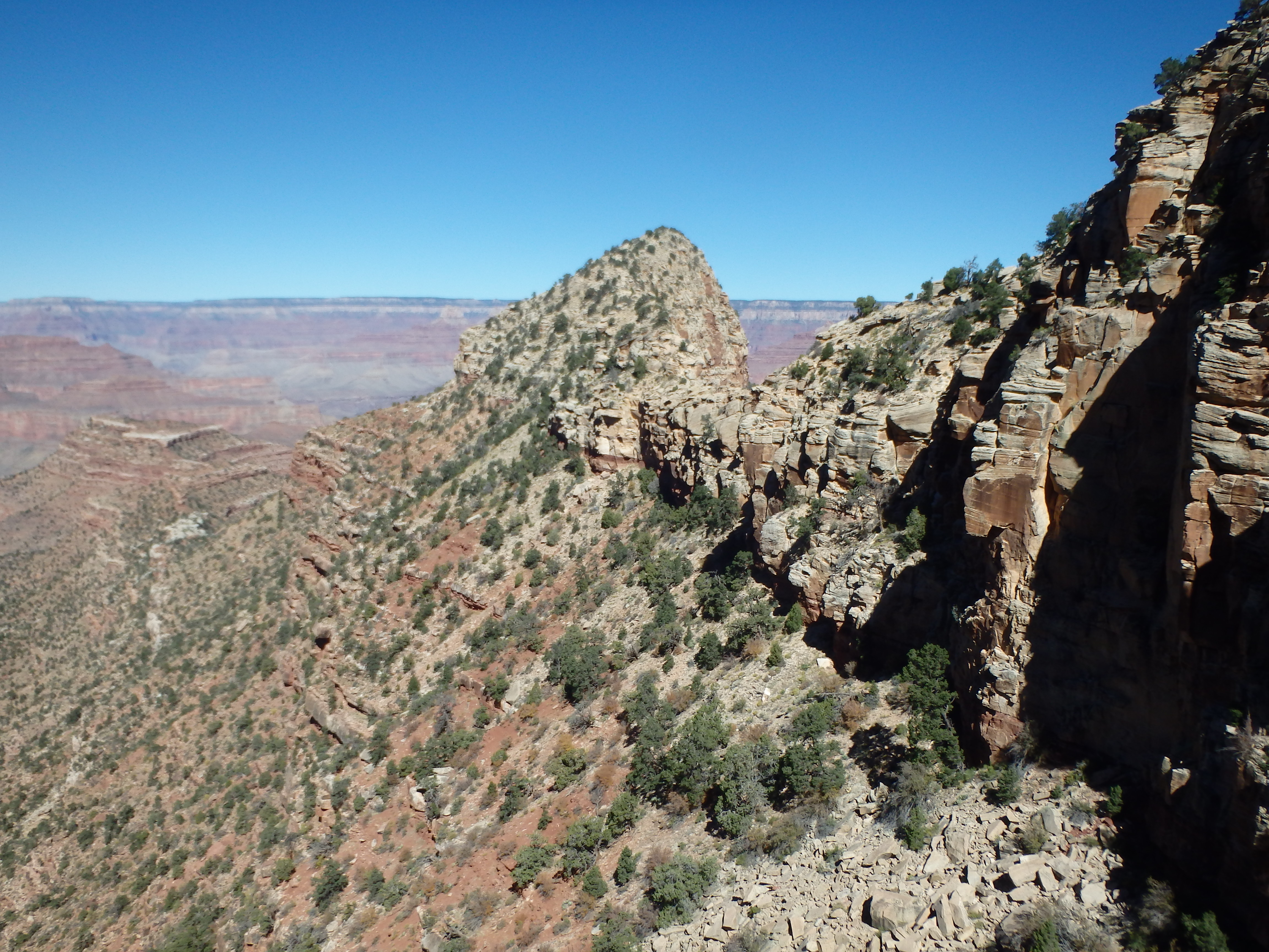
I had briefly considered Horseshoe Mesa which features a class IV summit block and the Cave of Domes, but decided to save it for another time, thinking it would make for an enjoyable backpack option with a nearby spring. Hiking down the switchbacks, we stopped at the first deep notch separating the Cottonwood and Grapevine Creek drainages leading down to the Colorado.
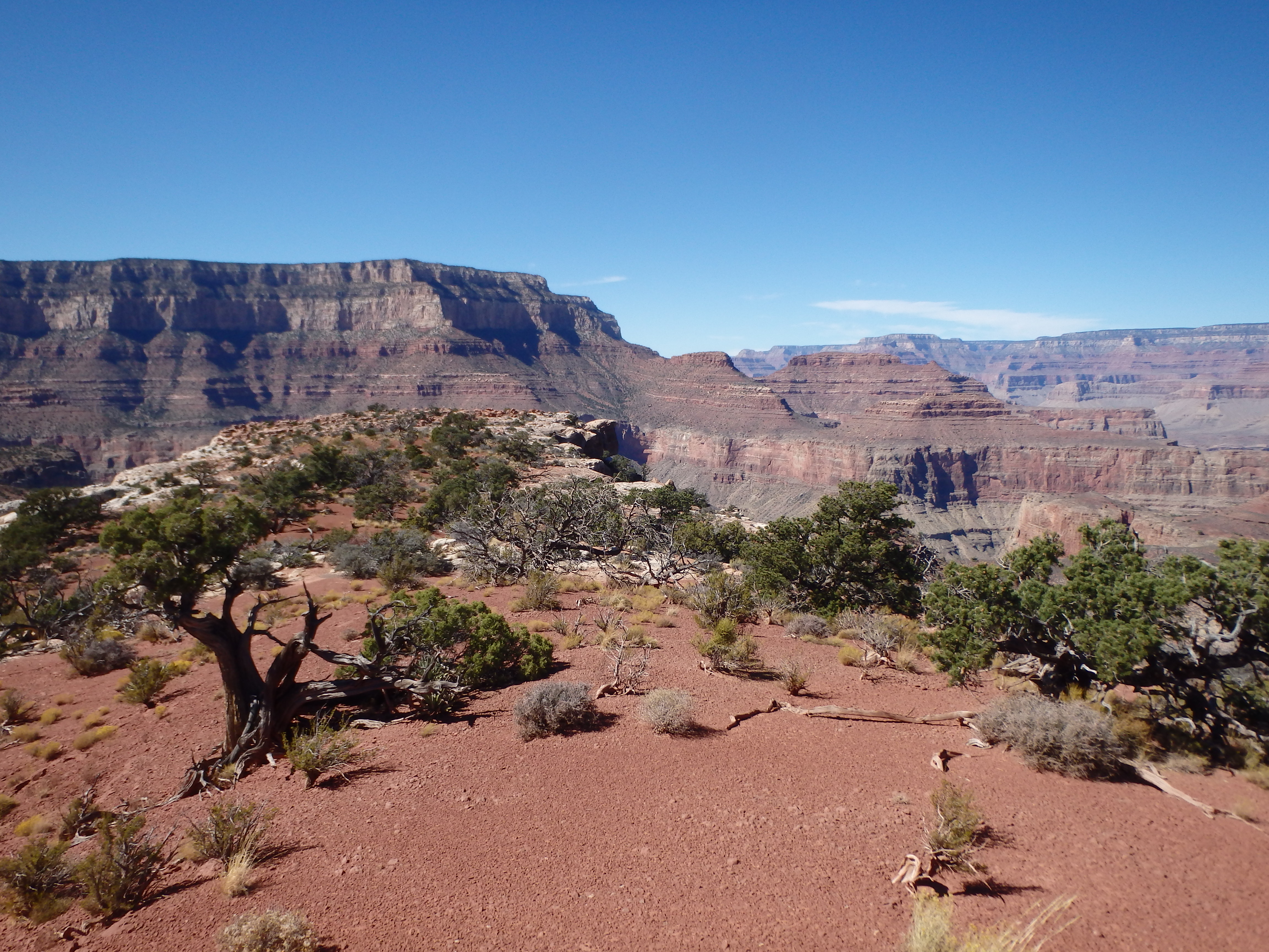
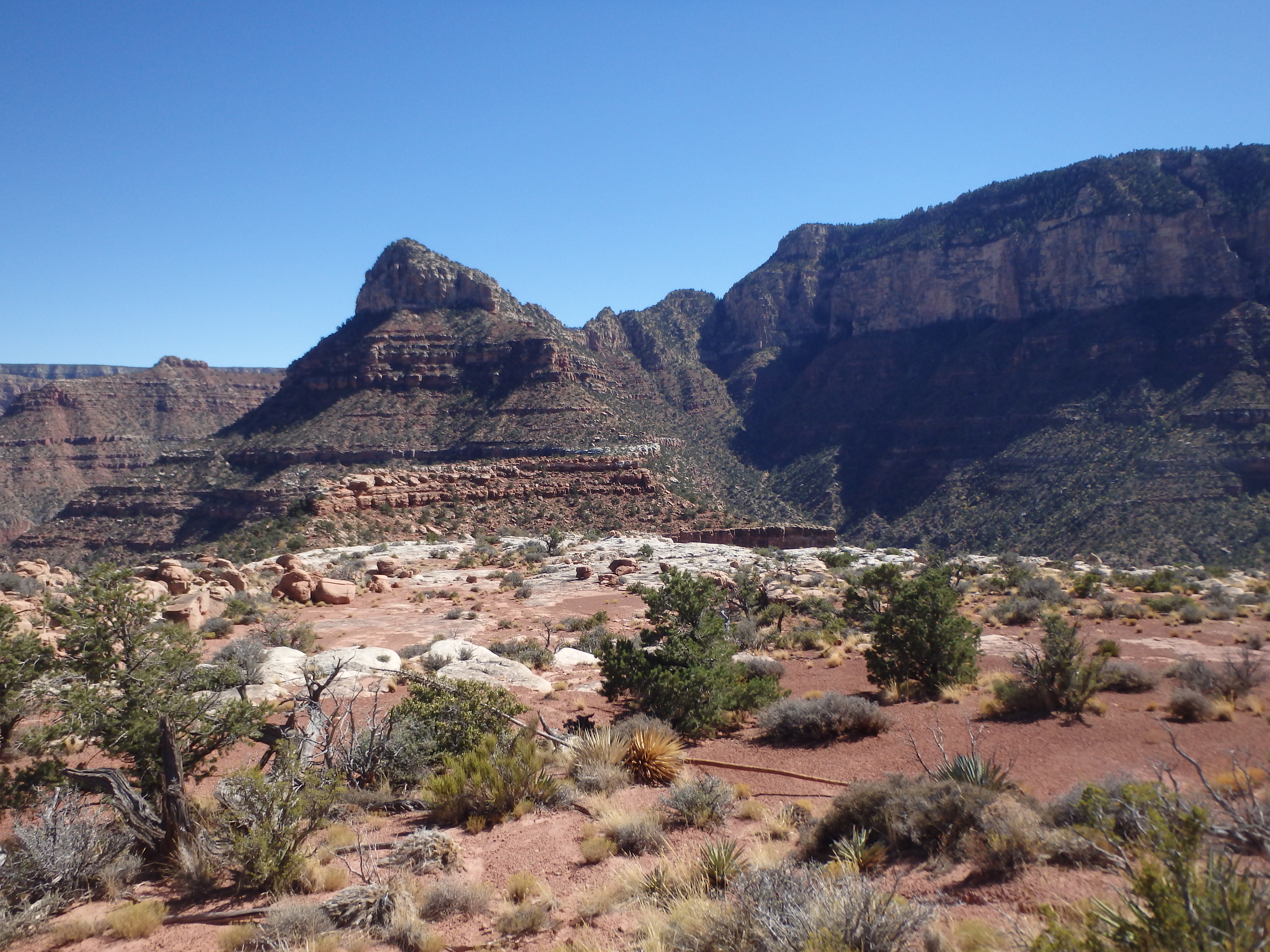
The trail continued beneath a Kaibab escarpment, and just as it hooked east towards the connecting ridgeline to Horseshoe Mesa, we continued south towards Unnamed Butte and Berry Butte below. The upper connecting ridge towards Unnamed Butte was fairly well traveled, other groups either heading down the ridgeline for some privacy, or just getting off trail from Grandview. Some sandstone blocks began to impede further progress, but the blocks could be easily skirted to the west as we descended. About 10 minutes from leaving the main trail, we reached another deep notch with a steep gully draining to the northwest, and a loose class 2 slope to the southwest. This was our route.
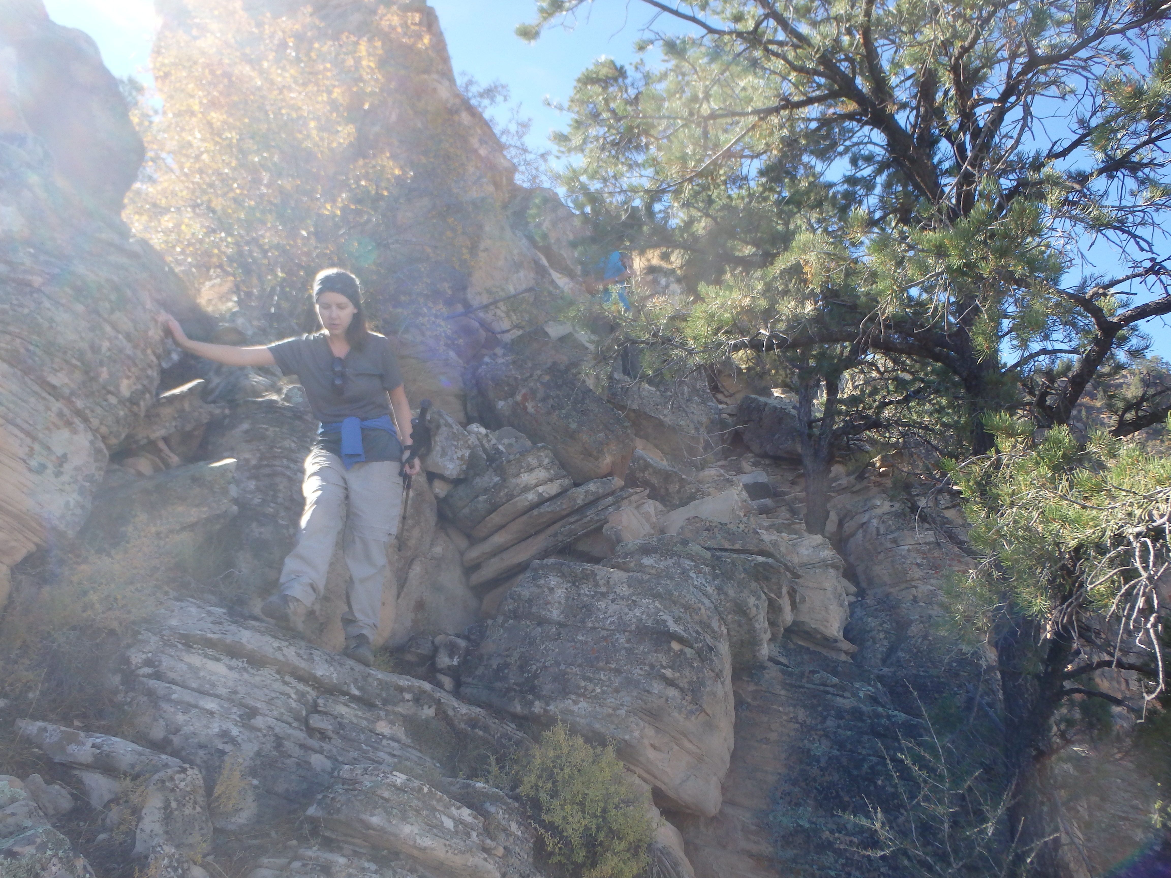
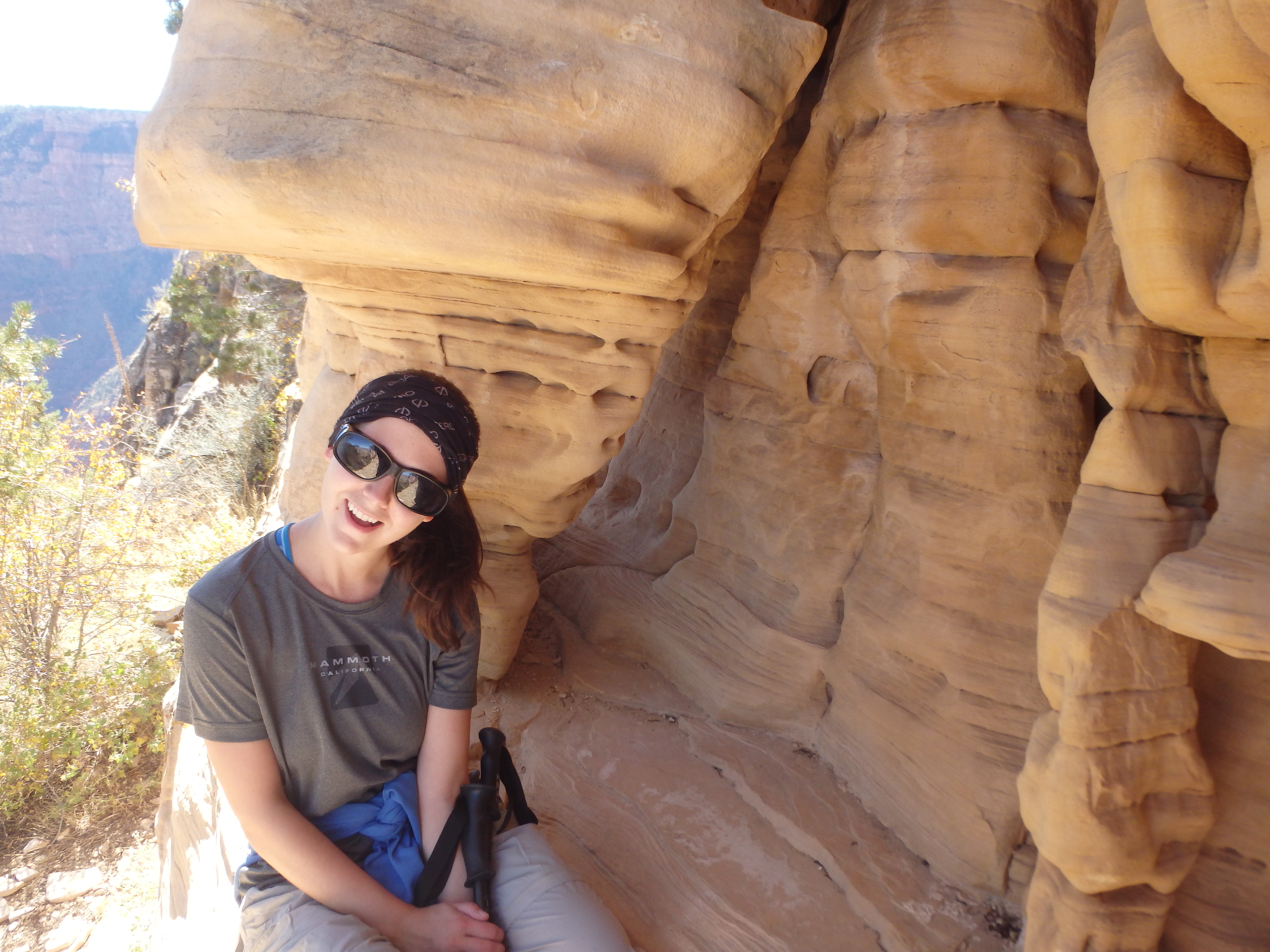
We started down the slope, Holly and Brian moving very cautiously down the shifting sandstone. It was obvious almost from the start that this wasn’t going to go well, neither of them very comfortable on loose class 2. In truth, a fall would really just result on a short slide on your butt, and even the short cliff bands were avoidable. But the terrain was still quite tedious, and we were moving very slow on our descent to the redstone below. We were shortly above the redstone and the familiar guilt began to win over. I suggested we head back, that clearly no one was enjoying this, and that I could always come back another time. Similarly, their guilt was driving them, and they insisted it was my birthday weekend and that the backpack had already fallen through.
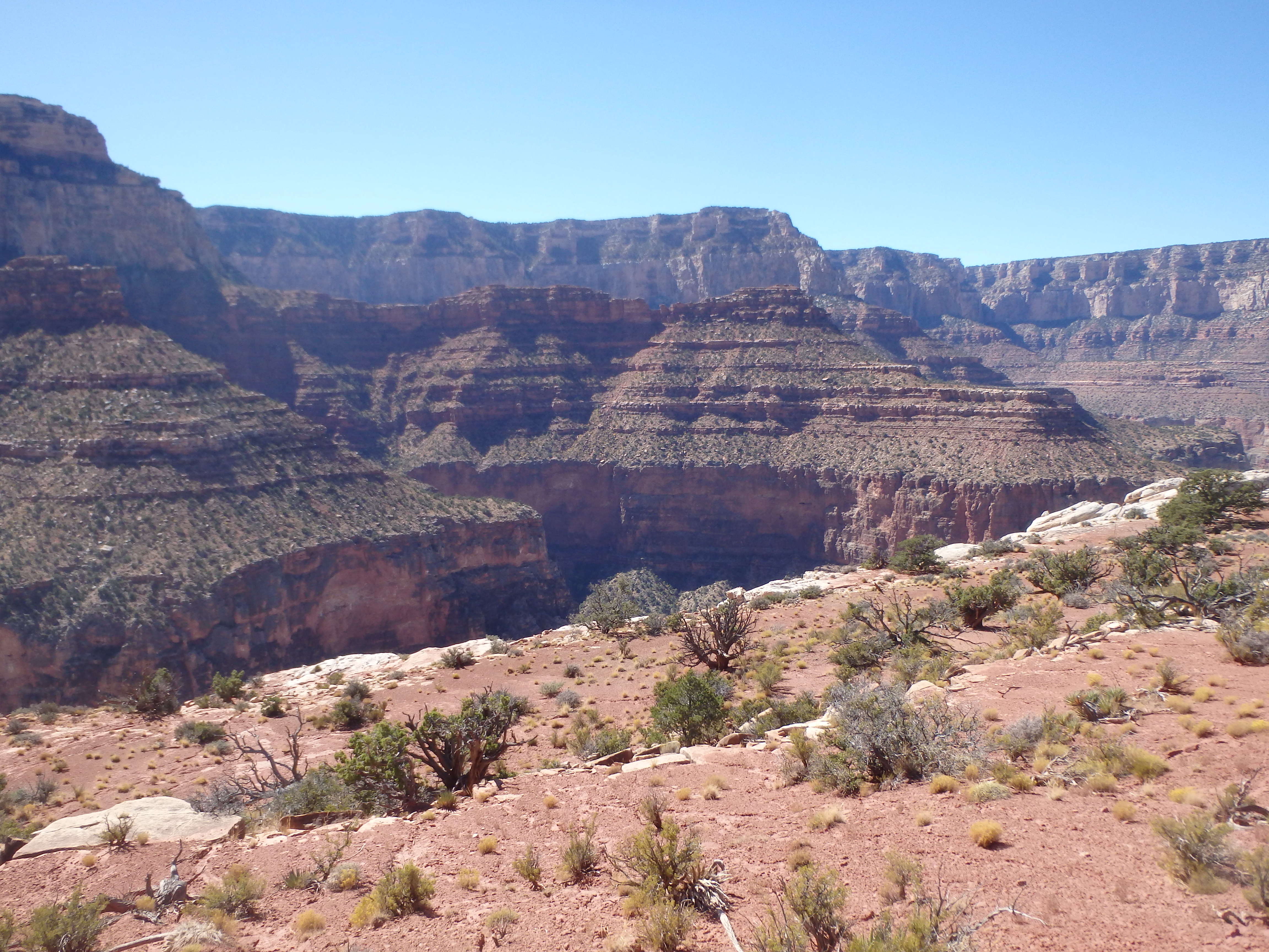
I dropped down ahead to see if the conditions improved in the redstone. While the terrain became a bit more solid, there were still a series of short cliff bands to work through, and there was really no telling how tedious the traverse across to Berry would be. Thus we settled on a compromise- I would continue on alone to Berry, they would climb back up to the ridgeline and wait for me there. This seemed reasonable, and I figured it would take me between 2-3 hours to make it there and back. We parted ways and I continued descending an additional 200′ down some easy cliff bands before beginning my traverse towards Berry. I tried to move quickly now that we were separated, but the terrain was more tedious than I was hoping, very brushy, still very loose, and broken up by at least a dozen gullies coming off of the ridgeline that had to be crossed. It wasn’t until I had almost reached the isthmus between Unnamed Butte and Berry Butte that the brush opened up and the sidehilling ended.
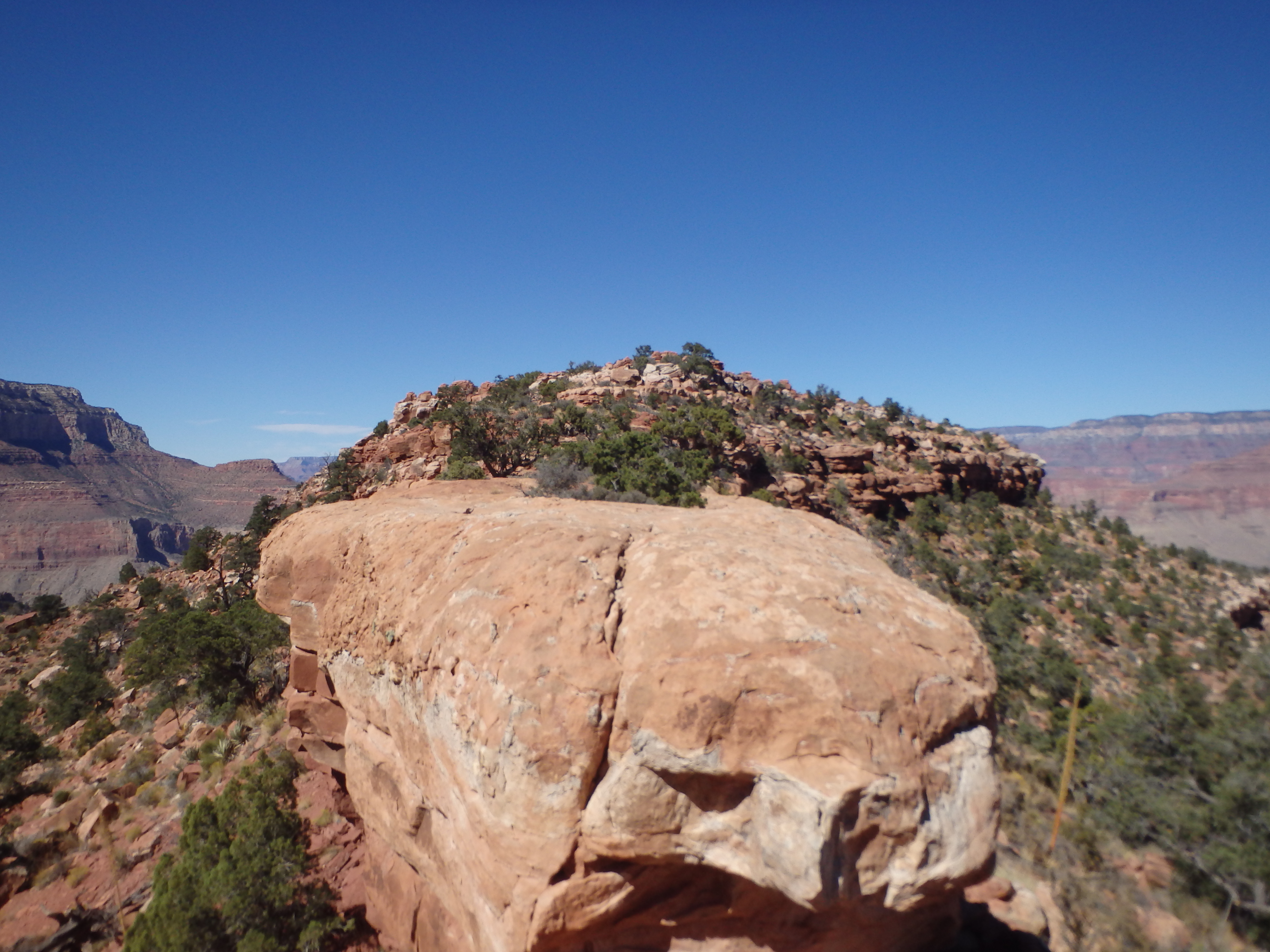
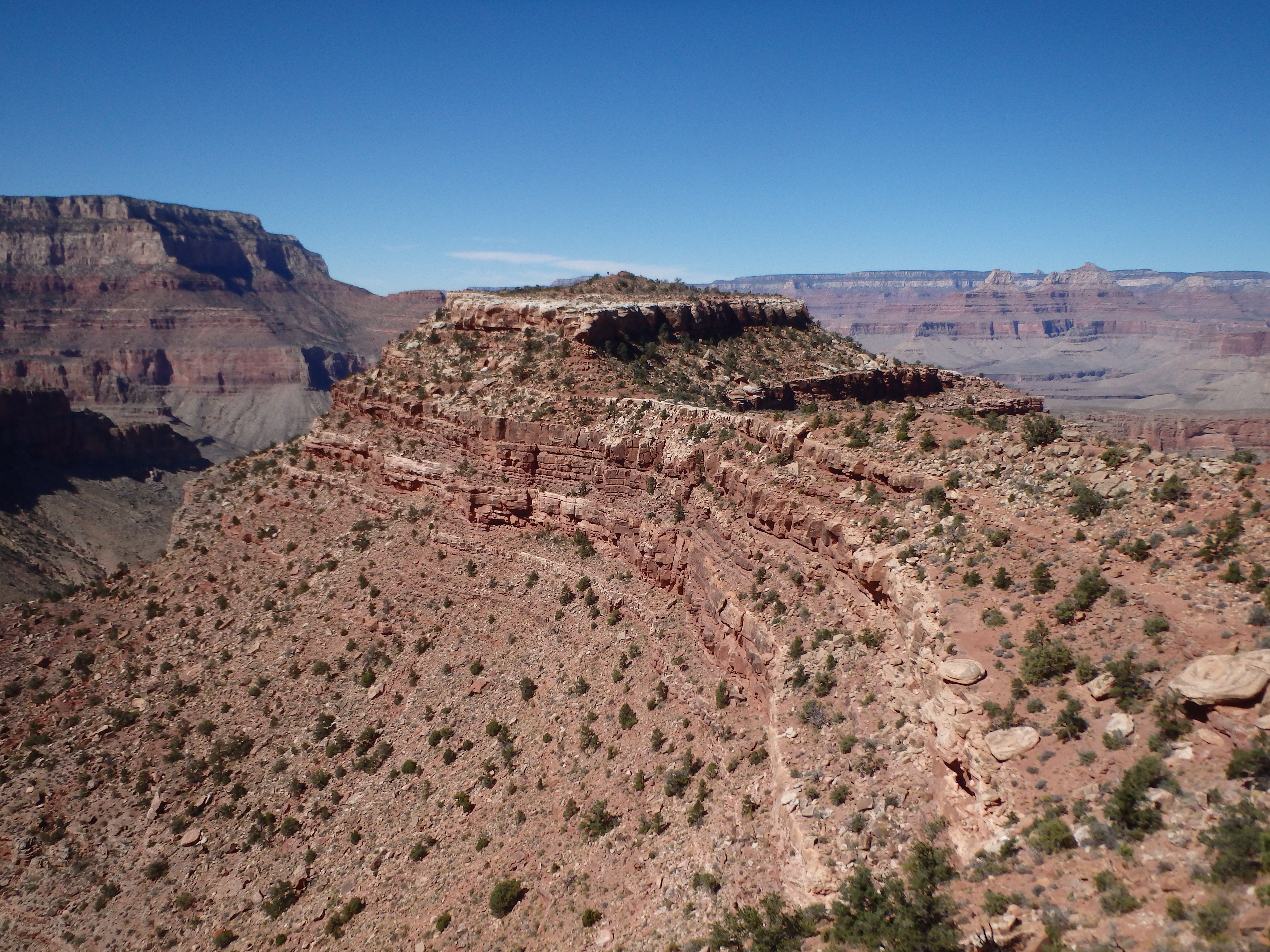
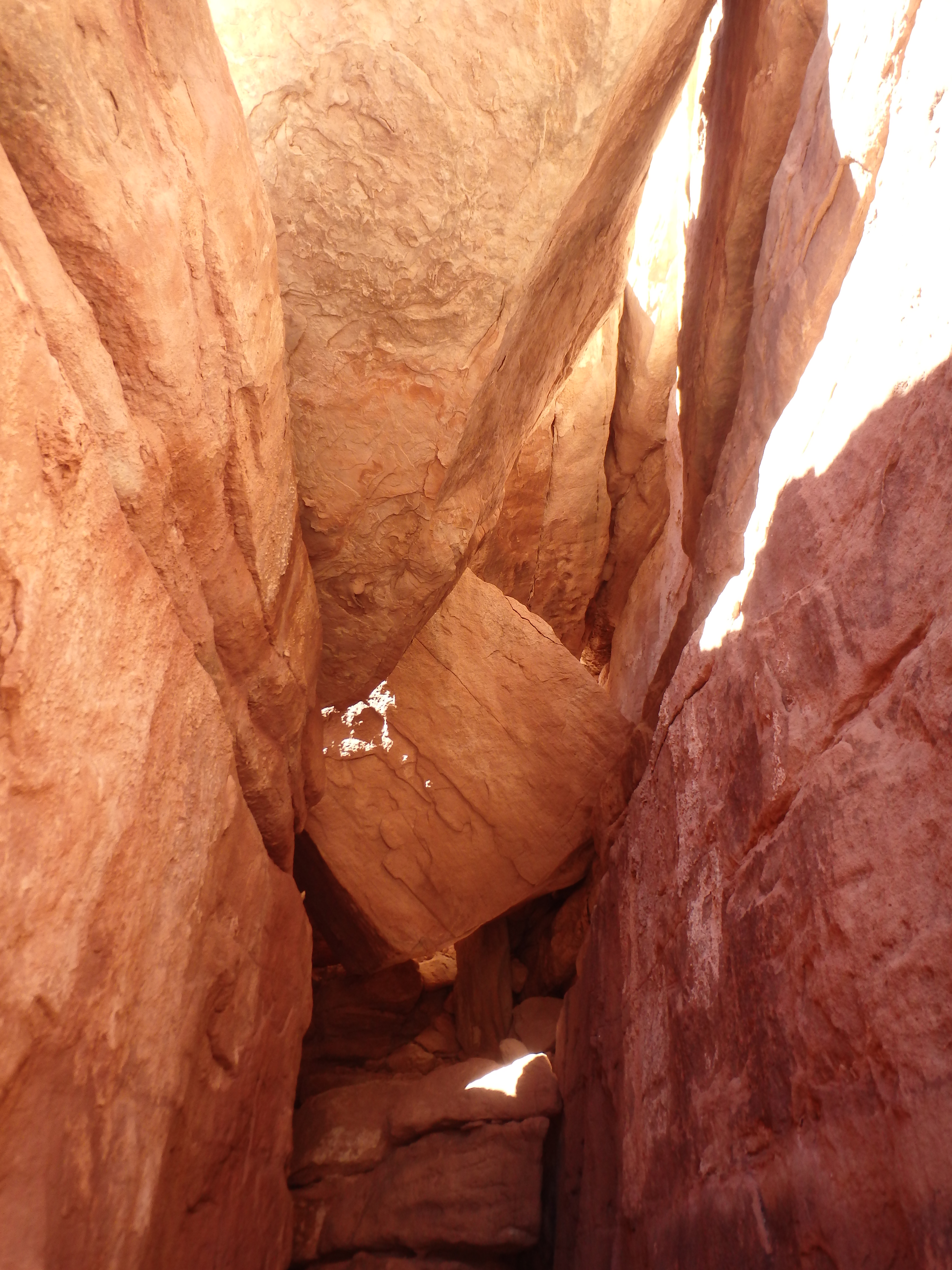
The isthmus was a bit deceptive, and scrambling up a series of blocks that I thought were the summit rocks, I quickly realized I still had the main summit cliffs to surmount. As I neared the summit cliff band, I noticed that some plants smelled like beer, and thought that it strange that I had never smelled that before in the canyon. It took me far to long to realize that the smell was coming from the exploded beer in my pack, which was now soaked with a Four Peaks Hop Knot Tall Boy, one of the beers we had been planning on drinking at the summit. I whipped open my pack to pull out the basically empty can (still not sure what exactly it popped on) and finished what was left inside before dropped my pack and pulling out a water bottle as I went up to the base of the summit cliffs. They were taller than they looked from afar, about 30′ and sheer. Working to the left, I found the key class 3 weakness, a nice chimney with a pseudo-tunnel exit at the top.
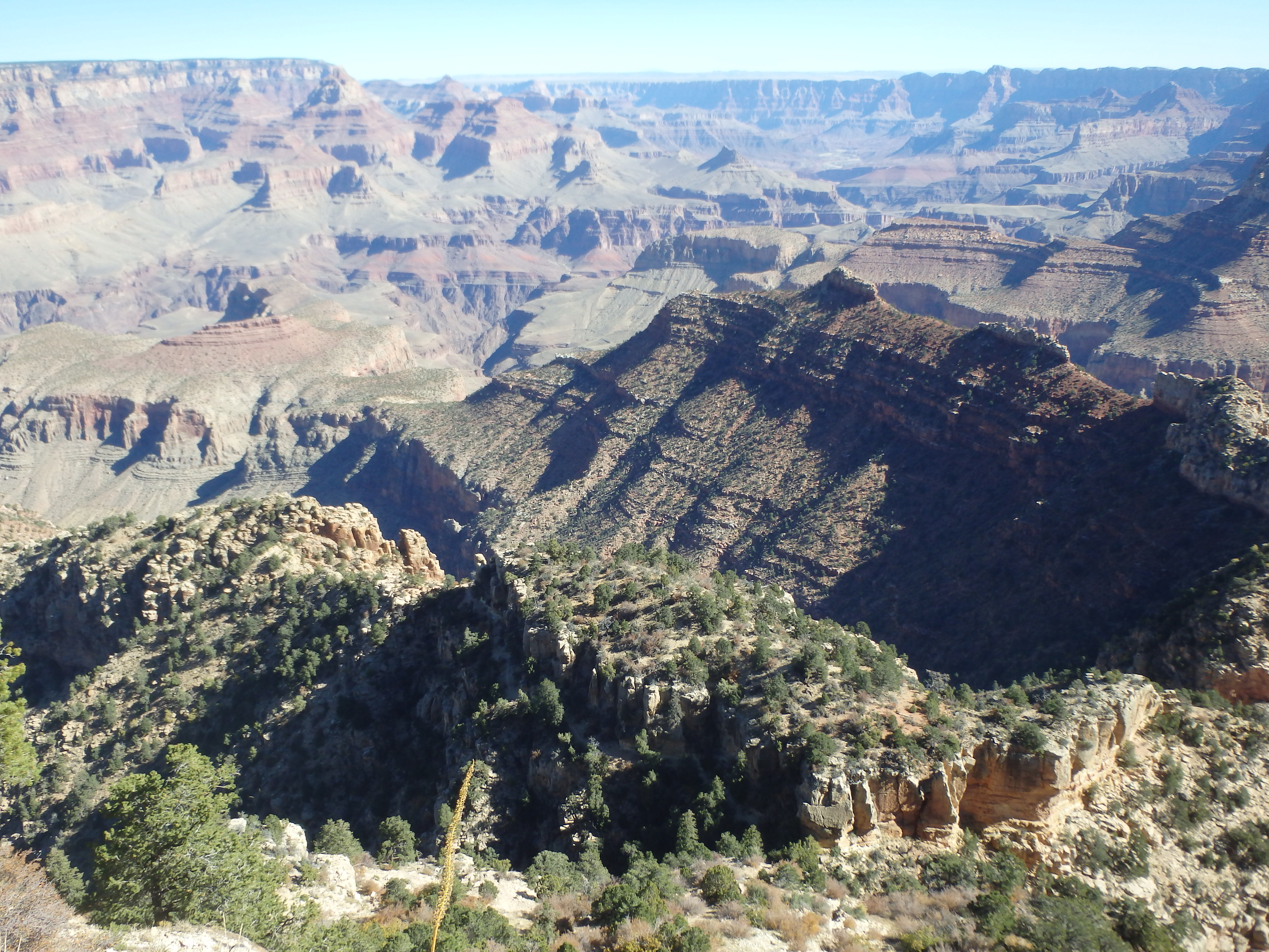
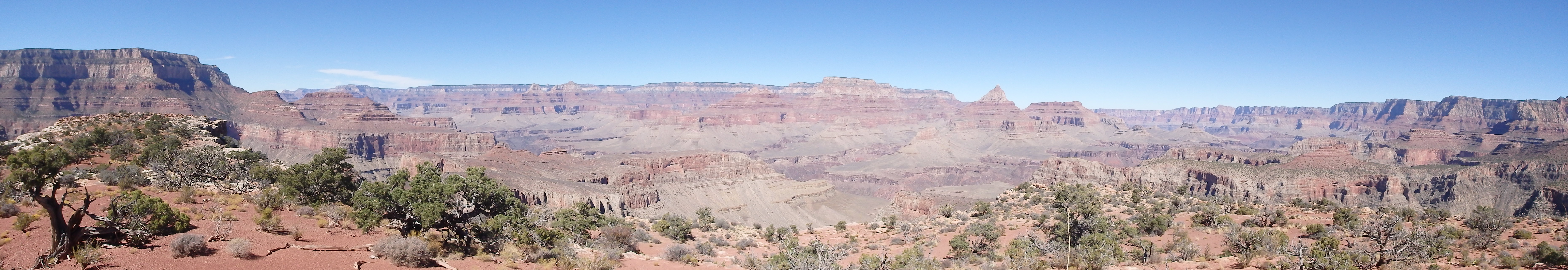
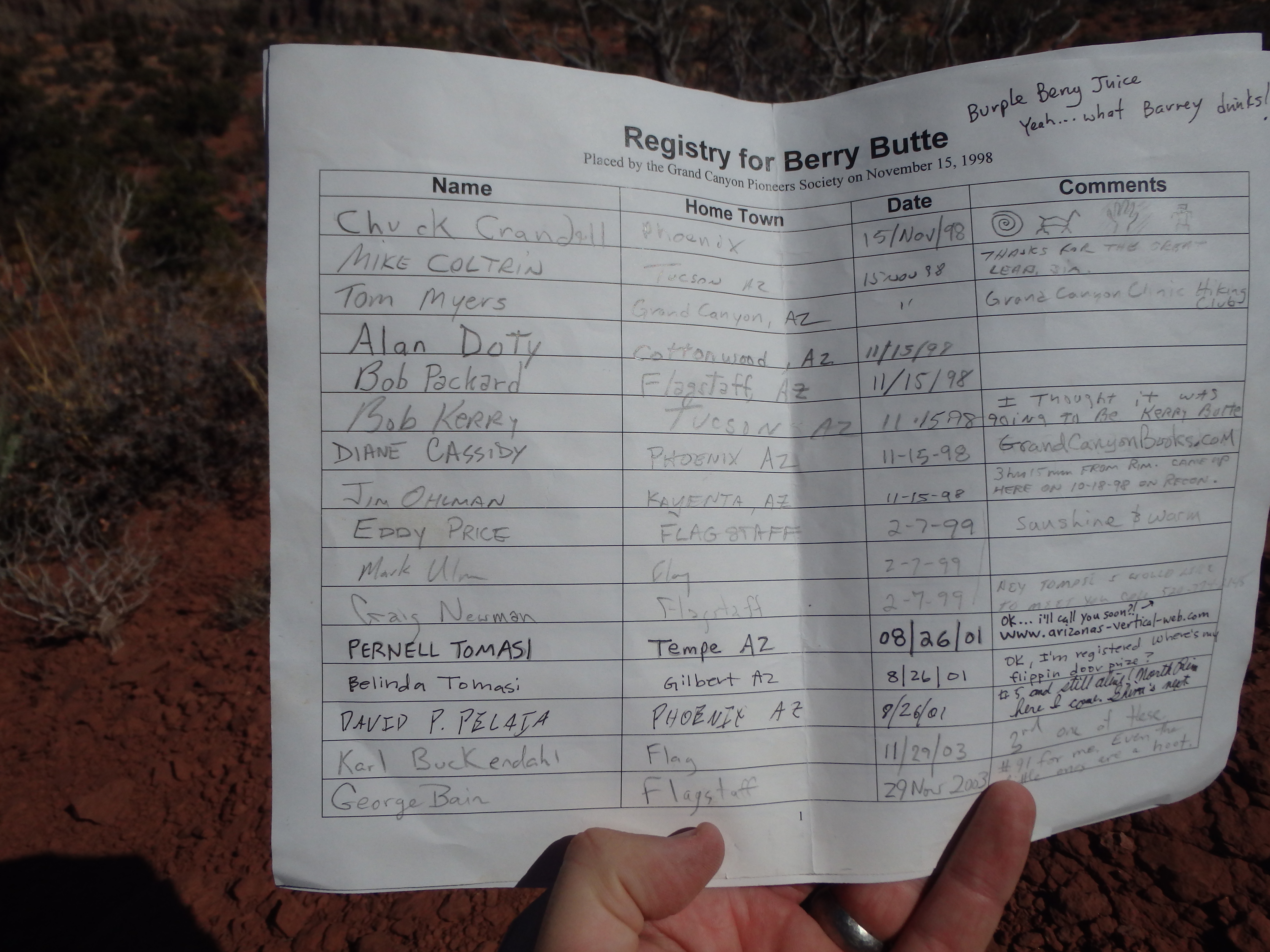
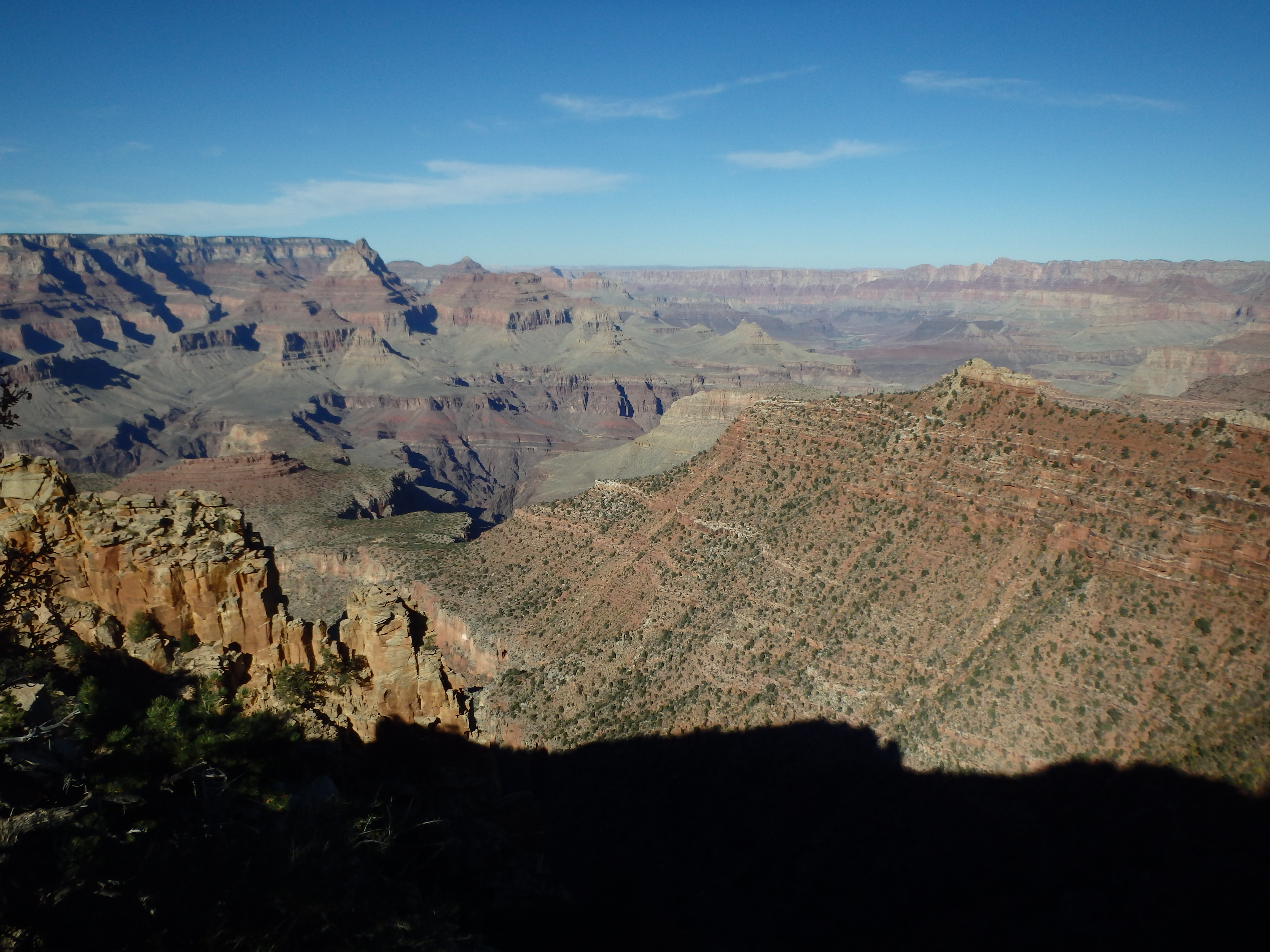
Although steep, there were nice lips and ledges to work up, and I was quickly on the summit plateau. I closed the distance between the butte rim and the summit rocks, and sat down for my first break since separating from the group. The views were most impressive of nearby Vishnu Temple and Horseshoe Mesa, and west to Newton Butte and the ridgeline down from Shoshone Point. I signed into the summit register, only the 48th climber to summit the Butte has seen since it was named in 1998. I expected it to see a bit more traffic with the short approach, but it was rather tedious….
Leaving the summit I dropped through the class 3 chimney and picked up my beer soaked pack, hiking over the isthmus back towards the rim. I tried staying a bit higher on the traverse and initially found this to work out well, with more deer and goat trails across comparatively flatter benches. But as I drew closer, the drainages off the above ridgeline became less forgiving, and I was soon tediously working through the same steep and loose brush covered slopes I had been trying to avoid. I had read that climbing the drainage direct would go, but I opted to climb the class 2 slopes as I had on the descent. Brian and Holly spotted me again for the first time since we parted about halfway up as I made my way back towards the ridgeline. I had been pushing myself on the return in an attempt to meet them as quickly as possible to the point where I had made myself sick, and sat down under a tree to rehydrate. The three of us split one of the unexploded beers while I rested, then we started back up the switchbacks when I felt human again.
It took under an hour to make it back to Grandview Point from the ridgeline and we drove straight to Mather Campground for the showers so I could wash off the sticky beer that had run down my back and pant legs. Lesson learned- if you’re doing any bushwacking or scrambling with plan for summit libations, use a flask.
Alcohol abuse!! Haha, thanks for the trip report. I am going to be giving Berry my second go this weekend. The first time, i tried to descend WAY too early and ended up on nothing but steep surfboard plates. Ended up climbing back up, finding the deep cut gully descent but it was too late by then. **You said there was a 4th class summit block on Horseshoe Mesa? I have been trying to find what the summit block of that was like with no avail. That is on my future list too and it is good to know that it is not JUST a simple walk up! Any more info on that one? Sorry if I am being a bother. I am just stoked to be exploring wacky summits in GC!
Good luck! The loose beta I have on Horseshoe is to attack it from the south trending to the east as you ascend several cliff bands, then traverse west and climb a class 4 crack system through several more rock bands. Sounds like it actually might be pretty tricky.