
Elden Mountain 9299’
Flagstaff
Total Time: 3:30
Round Trip Mileage: 5.2 miles
Elevation Gain: 2500’
Crux: Class 1
Trailhead and Amenities: Elden trailhead off Highway 89A. No amenities.
Companions: Holly
In Northern Arizona around Flagstaff sits the San Francisco Volcanic field, covering 1800 sq miles of the Southern Colorado Plateau with over 600 distinct volcanoes. These range from small vents, to Mount Humphreys and the San Francisco Peaks, which at 12,633’, is the highest summit in the state of Arizona. Just south of Mount Humphreys, separated by a shallow saddle at Schultz Pass is Mount Elden, a large lava dome which dominates the Flagstaff skyline. Unlike the other volcanoes in the area, Elden feautes large areas of sedimentary rock which were uplifted during formation and survived eruption, unlike the pure volcanic rock found on most of the area peaks.
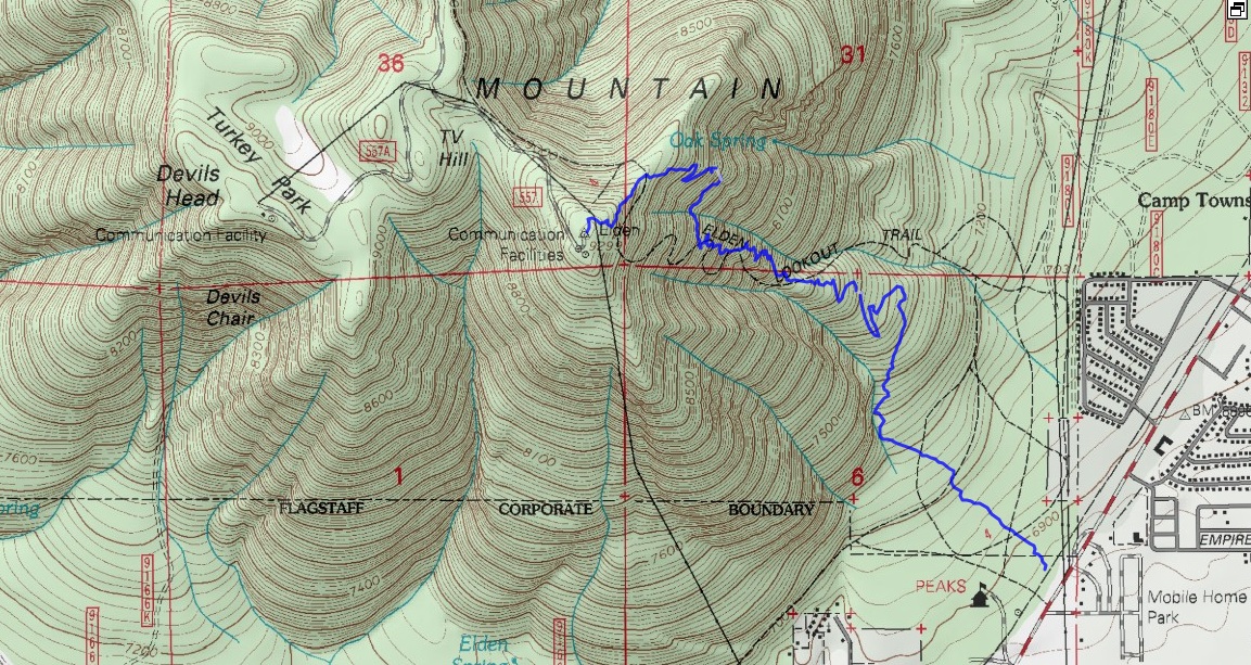
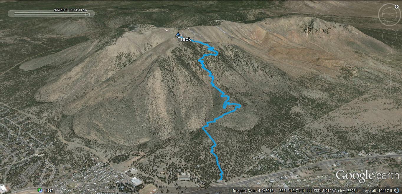
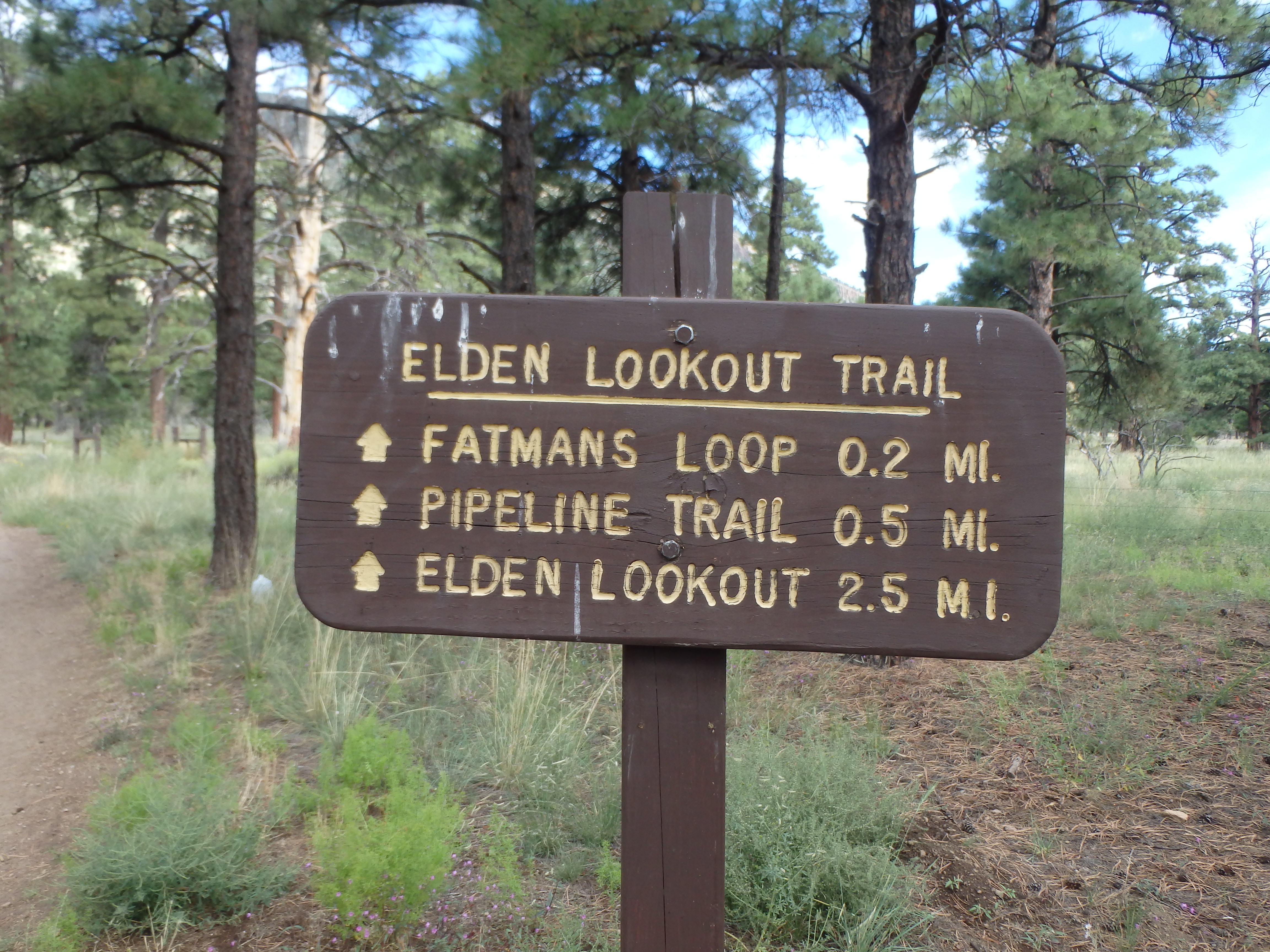
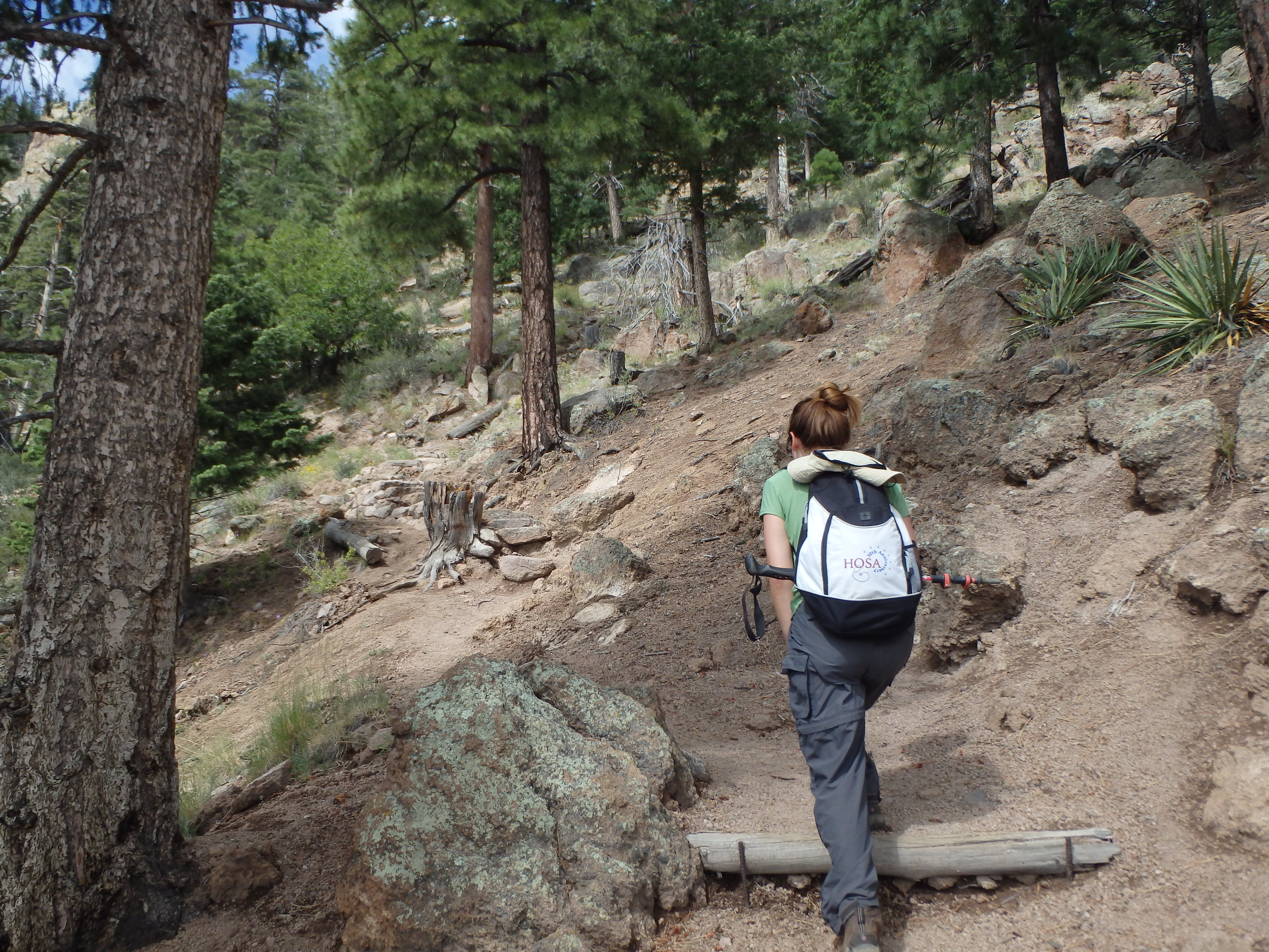
Holly and I were making a weekend of exploring Flagstaff, and with clouds encasing Mount Humphreys, we decided to visit its shorter neighbor. The trail starts off a designated parking lot just off the highway, and heads directly at the impressive south face of Elden. Initially the grade is fairly gentle, but as we drew closer to the base, the trail quickly steepened as we left pine forests behind us. After a few well signed junctions, we were just below the mountain base.

The lower reaches of the trail are quite craggy, with large blocky volcanic steps and more sparse vegetation, giving you ever expanding views of Flagstaff below. About halfway up, the trail reenters Ponderosa pine forest, with dusty switchbacks virtually the rest of the trail to the crest.

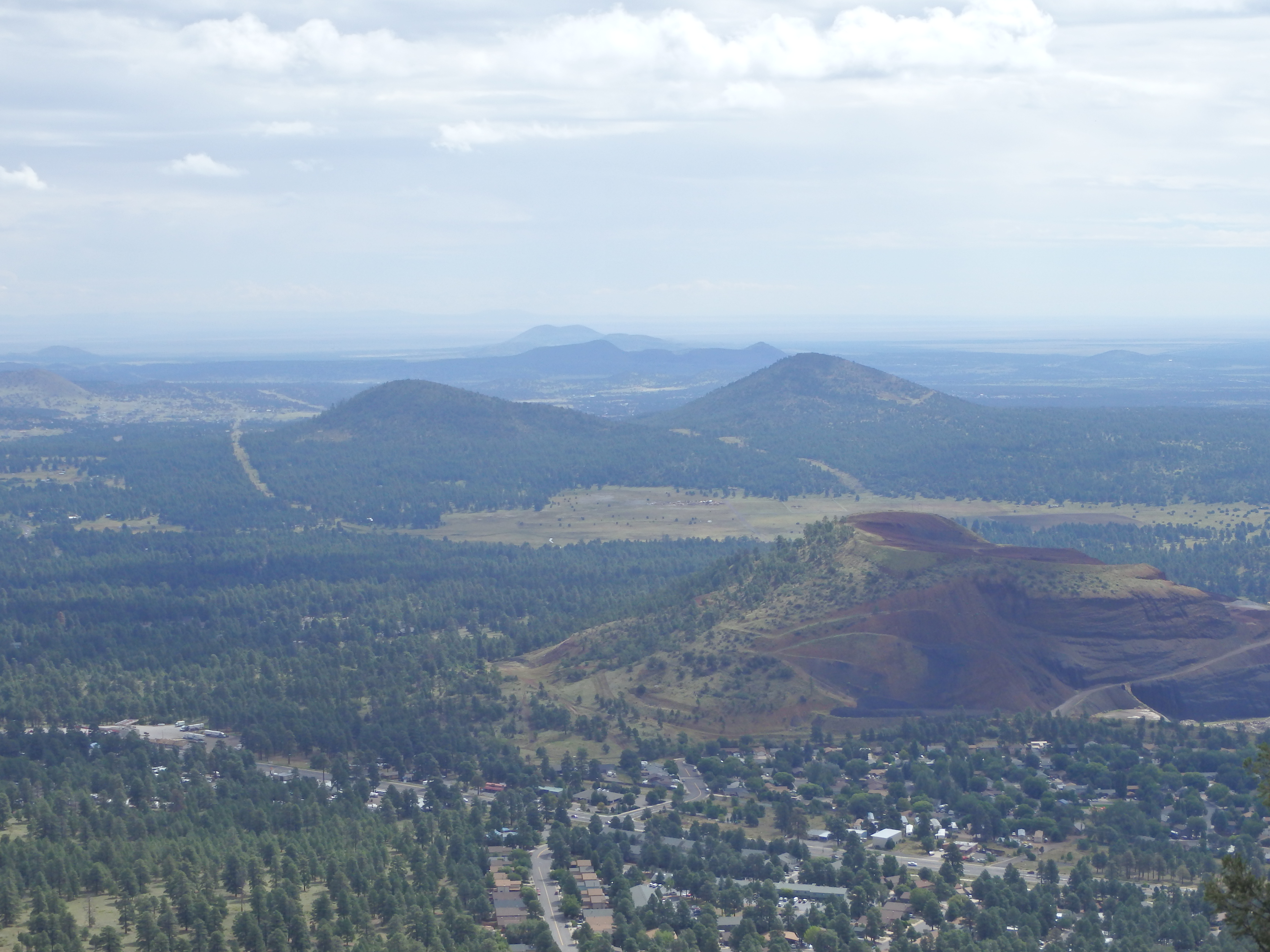

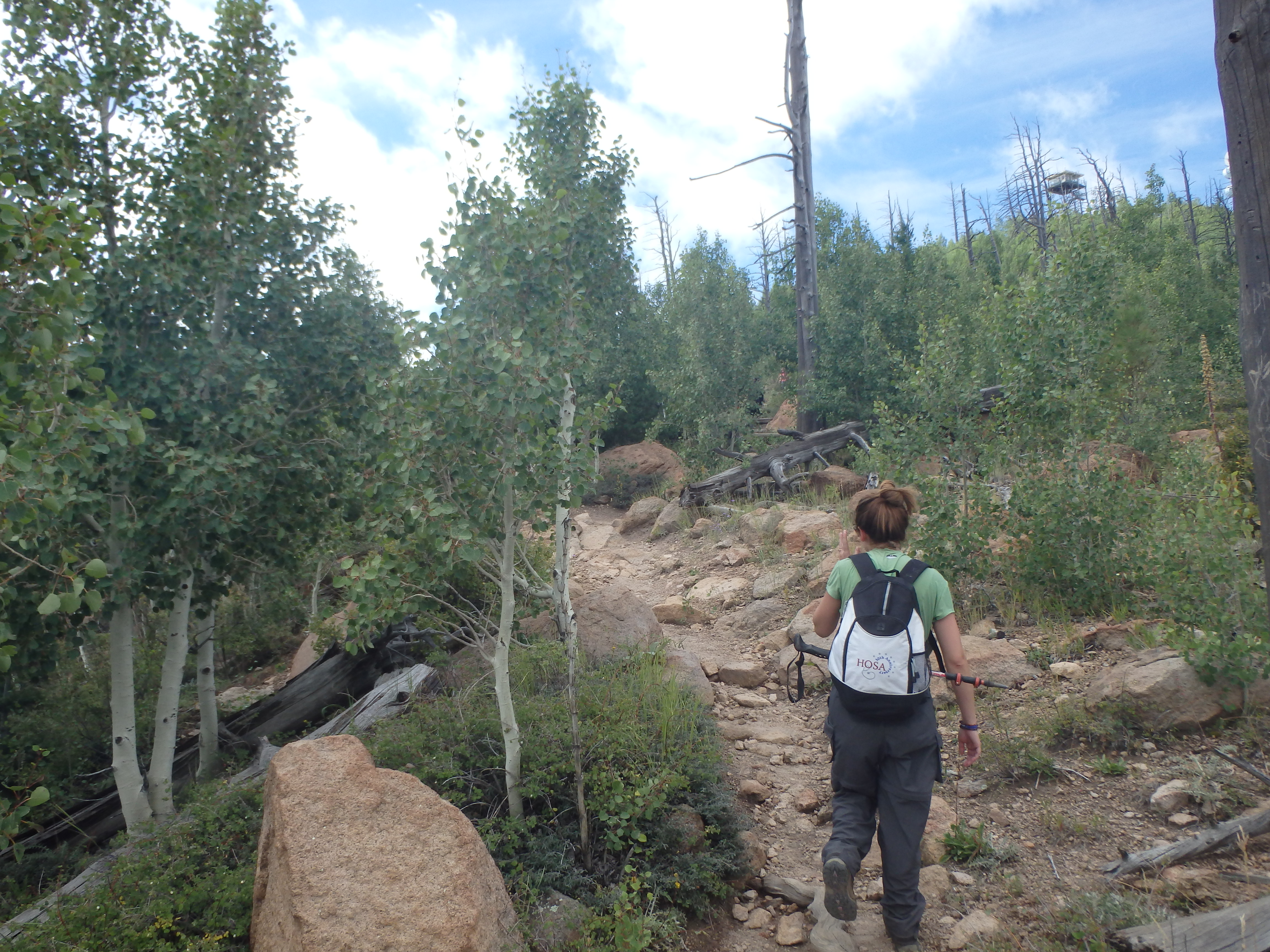
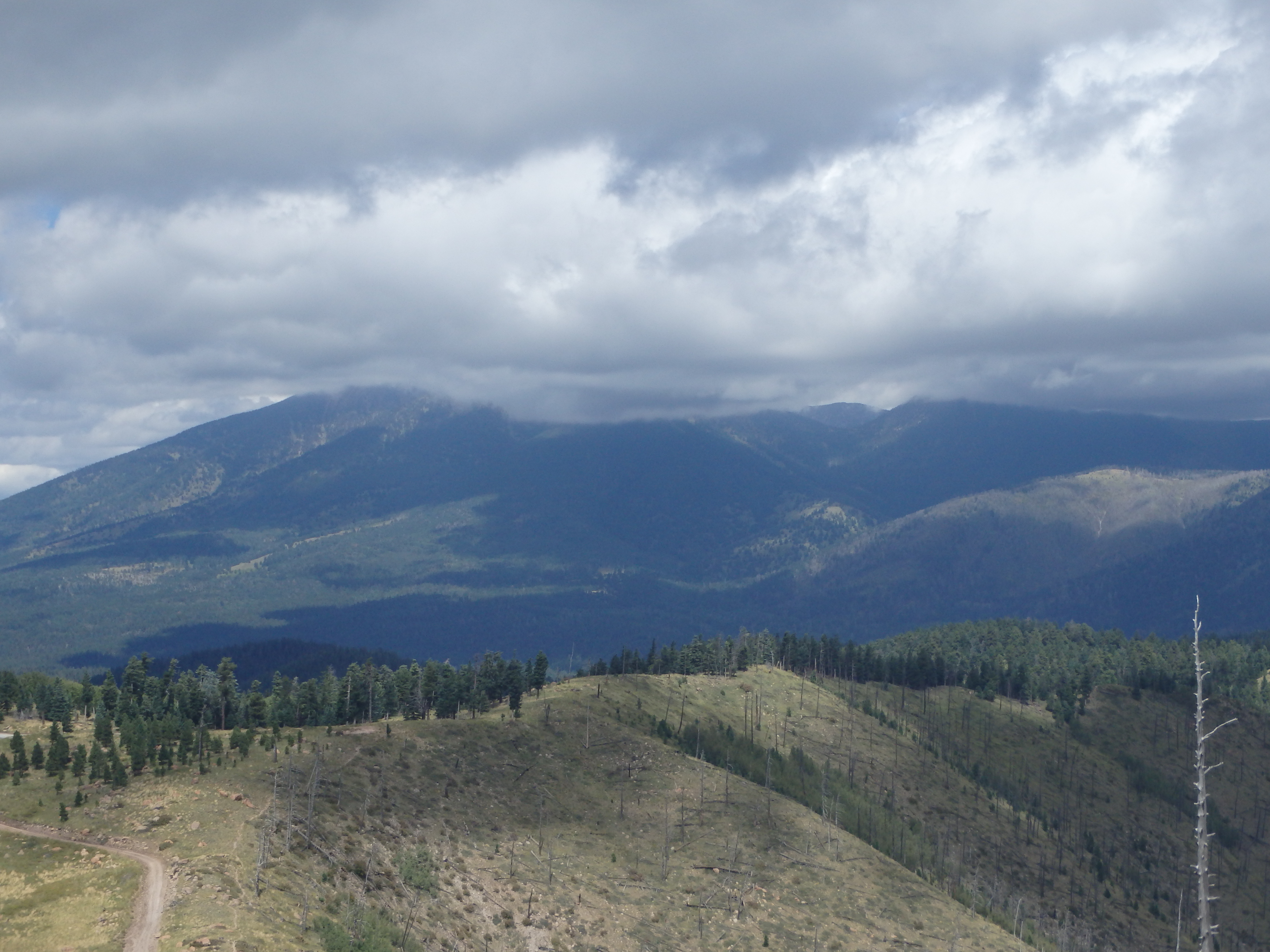
About 200’ below the crest, the trail enters an Aspen forest. At that point it was a little early for any color changes, but it would be quite dramatic in the Fall. After about a quarter mile of hiking in the Aspens, the trail emerges at a gravel road used by service crews for the antennae farm at the summit. At that point, we had our first good look at the Northern slopes of the mountain, still recovering from the Radio Fire in 1977, started by a careless camper.

We walked the final stretch up the road to the manned forest lookout, closed to visitors. We found a nice place to enjoy our lunch and some wine before heading down to beat the afternoon storms. 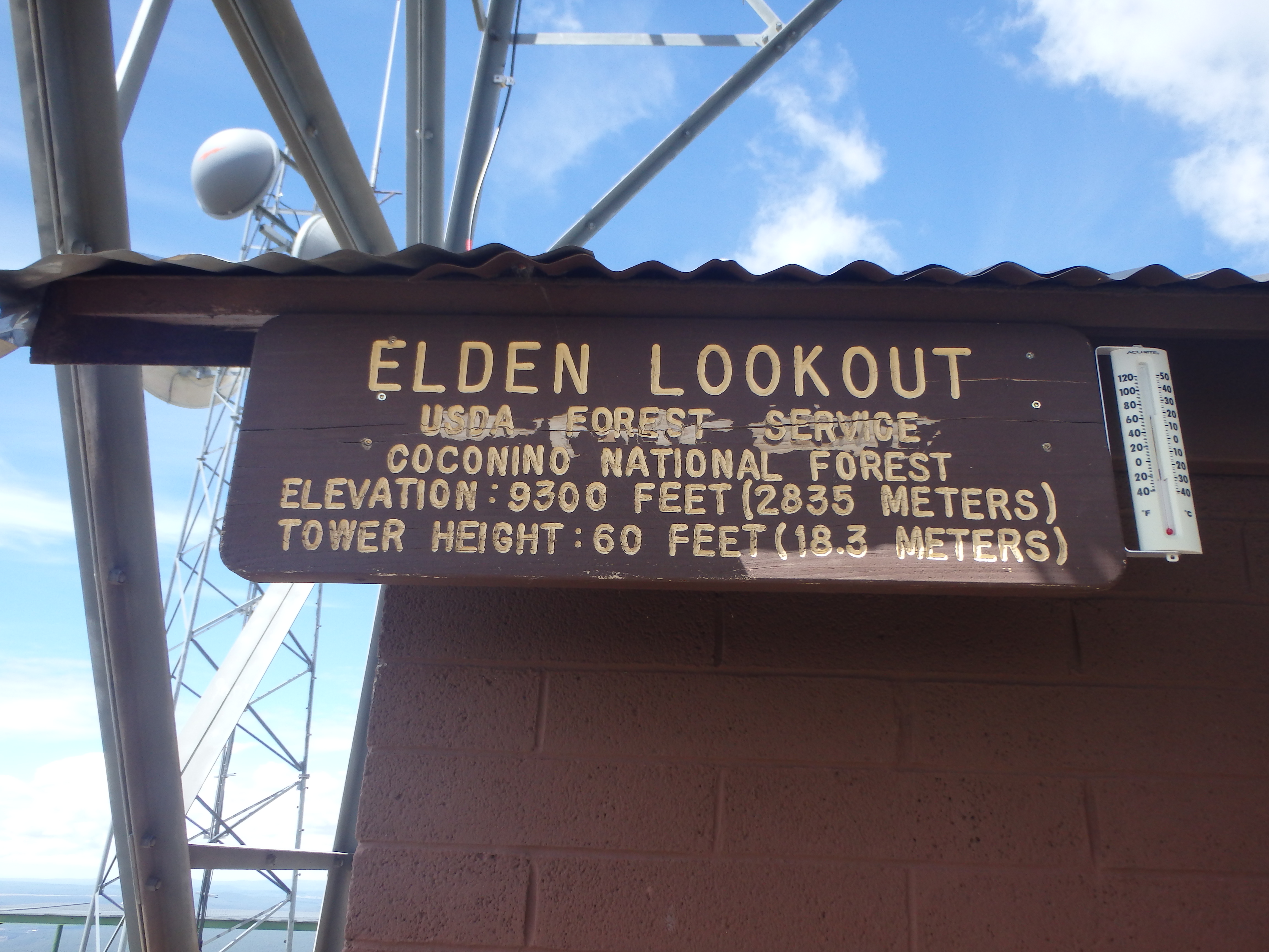

Unfortunately the weather kept us from the scenic chair lift ride that came with our cabin, but we had a great time exploring the lava tube just outside of town.