
Little Dragon 8121′
Total Time: 4 hours
Roundtrip Mileage: 4.1
Elevation Gain: 1,360′
Crux: Class 2
Trailhead: Random pulloff on Point Sublime Road, no services


Along the North Rim of the Grand Canyon, a bit west of the Main Lodge and Bright Angel Point is the ‘Dragon Corridor.’ Named for three different adjacent summits- The Dragon, The Dragon’s Head, and Little Dragon, the corridor is a well established route for helicopter tours as they fly low across the north rim and across the canyon. Dragon’s Head is an extremely desolate summit, lying nearly 6 miles from the rim and requiring a summit of The Dragon en route. Little Dragon, immediately east of it’s larger sisters, is largely overshadowed by the two, and sticks out only about 0.5 miles off the rim. The three collectively see very few climbers, with tedious and brushy approaches, and are located off the rough, high clearance Point Sublime Road. My hope was to climb all three in one day, which would be about 17 miles roundtrip. After securing an NPS permit the night before, I slept off the Point Sublime Road near the turnoff for Little Dragon. I woke up at 4:30AM and finished driving the rest of the way to the starting point for The Dragon and Dragon’s Head where Point Sublime Road crests over Crystal Ridge. Unfortunately, as soon as I parked, it started raining… heavily. I had last checked the weather two days prior, and it had listed a 30% chance of afternoon showers, and nothing about rain so early in the morning. I squeaked out some cell reception to check the radar, and saw a huge thunderhead closing in on my position. It looked like it ‘could’ clear by 9 or 10, and I had been looking forward to the Dragon corridor for a while, so I decided to suck it up and head out. I descended Crystal Ridge towards the rim, finding it a bit brushier than I expected based on my 20 year old beta. I had descended about a half mile when the thunder started. Rain was one thing, but thunder and lightning on a very exposed ridgeline 6 miles off the rim was another thing entirely.

I sat down to contemplate my options. Continuing seemed foolish with lightning already in play for the day, and I didn’t want to climb the Dragon without the Dragon’s Head, since the climb of the Dragon would be required if I ever came back for the Head. It seemed like the entire canyon was in rain, so it didn’t make sense to drive further west to attempt King Arthur’s Castle (another summit high on my list), or to head east for equally long endeavors such as Oza Butte. I decided I would go for Little Dragon, which was so near the rim that if the lightning became frequent, I could easily retreat. So I headed back to my car and drove back to where I had parked overnight, essentially having made no progress since waking up at 4:30 that morning. The starting point for Little Dragon was a bit more arbitrary, and I parked near BM 8290′ with plans to follow the associated drainage all the way to the rim, mostly to make it easier to find my car on the return. The terrain was a mix of pine and aspen with plenty of down logs to make things difficult. It was about 1 mile of hiking to reach where the drainage breached the rim. I had very little beta on getting to the summit of Little Dragon aside from the fact that it was class 2, and decided I would descend the drainage to the level of the saddle between the rim and LD, then traverse over and follow the northern ridge to the top. As soon as I started descending the steepening drainage, things got brushy fast. The pines became mixed with small oak trees with a smattering of my arch-nemesis, the cat claw (acacia). I quickly traversed out of the drainage on to the slopes closer to the connecting saddle, but found things getting progressively worse. I would occasionally find a deer trail, but this would very quickly dead end in a thicket of thick brush that I would have to plow through to continue progress. All the while, the rain increased, and I was sopping wet with water sloshing out of my shoes with every step. I could barely even see Little Dragon through the thick trees.
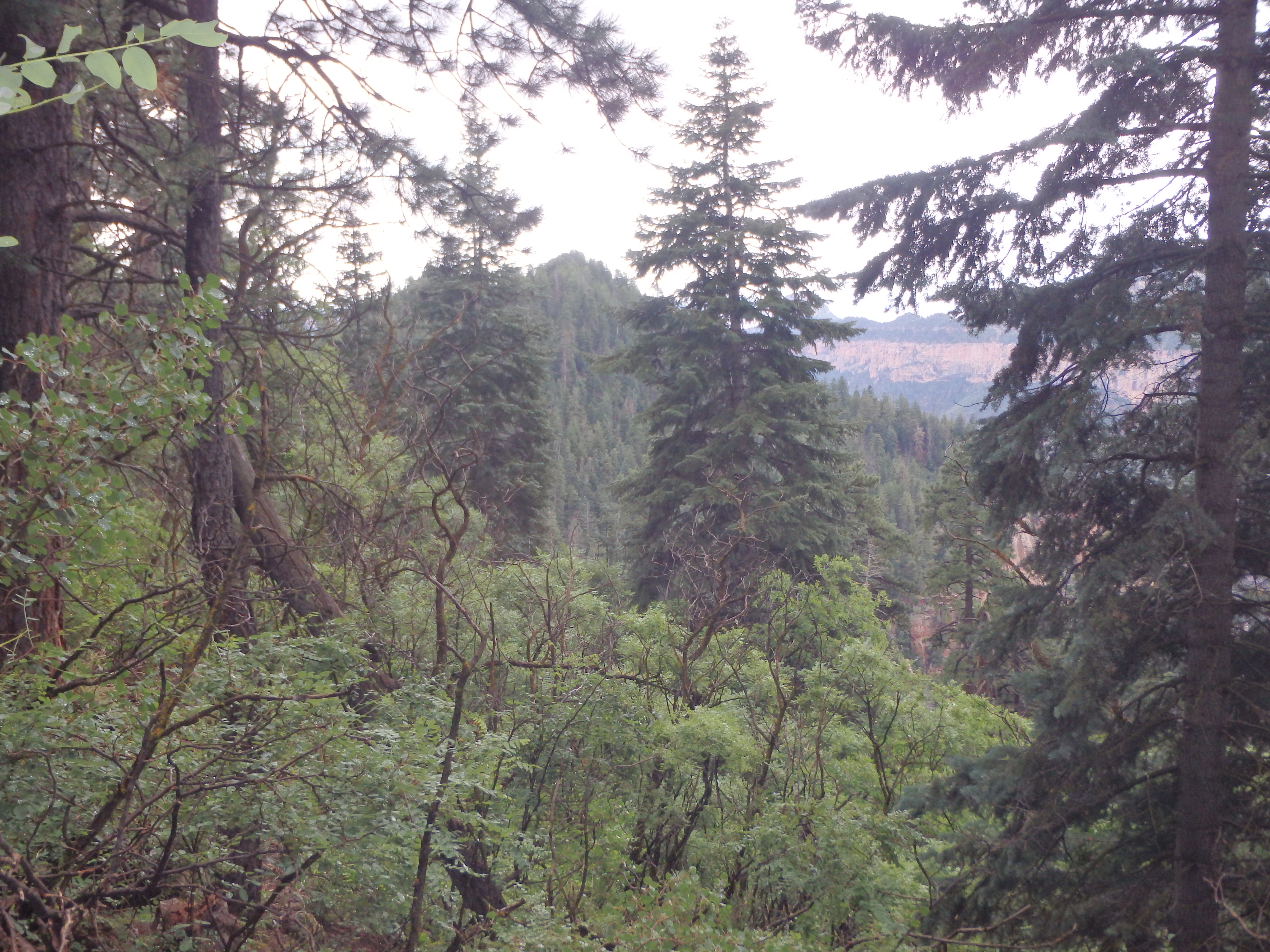
I spent over an hour thrashing through the brush, the day reminding me of the painful route on Kibbey Butte during my first trip to the North Rim…. only soaking wet and cold. At last I reached the saddle between the rim and Little Dragon and my fortunes improved dramatically. A clear game trail continued along the ridgeline towards the summit. While it still had some areas of brush, it may of well have been a fire road compared to the hell I had just gone through.

In a handful of places, I would need to drop onto the west slopes to avoid some rock pinnacles or thick brush, but could always regain the ridge as soon as the obstacle was passed. I reached the first summit which looked about the same height as the further, second summit, but seeing no summit cairn, I continued on another half mile around some large sandstone boulders to the highpoint with a summit register tucked into the small cairn.

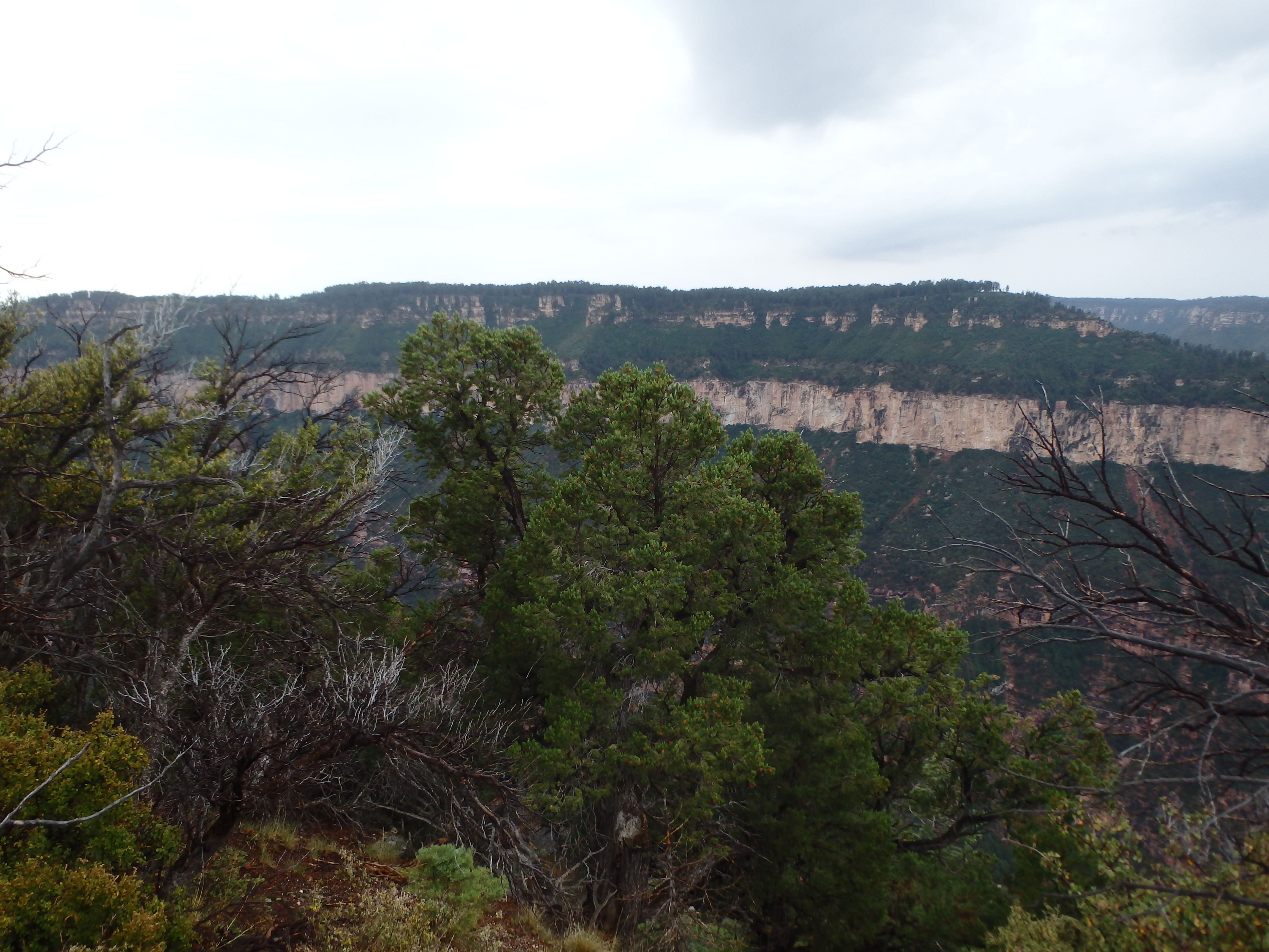
The views were mixed with a number of trees along the summit ridgeline blocking views of the nearby Dragon, and rain and mist obscuring anything more distant. The summit register only had three pages with entries, not surprisingly a fairly unpopular peak given it’s brush and remoteness.

I took a very short break, but was mostly fantasizing about the prospect of dry clothes in the car, dropping down the ridgeline off the summit. Reaching the saddle, I decided I would attempt to stay true to the ridge back to the rim in an attempt to avoid the serious brush I had fought through in the drainage to the west. I found a series of game trails heading up towards the North Rim that were much more consistent than those on the slopes below. About halfway up, some large sandstone boulders blocked progress. Traversing beneath them was proving to be extremely brushy, so I decided to climb them directly resulting in some brief but fun exposed scrambling, one of the few fun parts of the day.

It was short-lived, and I was soon back on the North Rim, the ridge I was following quickly becoming socked in by thick aspens and pockets of acacia. It was easy to see why anyone attempting the peak would get funneled into the comparatively less brushy drainage, only to get screwed on the descent off the rim. I tried to stick to the ridgeline more to see what would work best for future climbers, and found it overall more of a bushwack than the drainage below. Best bet: use the drainage up until near the rim, then bushwack to the ridgeline for the descent to the saddle. I got back to my car about 4 hours after starting off, the constant brush dropping my pace to about 1 mile/ hour for the tedious summit. I immediately peeled off my soaking wet clothing and drove out from the Point Sublime Road, drying my clothes in the cars defroster as I went. The eastern Grand Canyon had received a bit less precipitation and I finished the day with a more enjoyable hike around the three Tritle Peaks, climbing Tritle West and scouting out the technical routes on Tritle Center and Tritle Peak when I returned with a climbing partner, already planning future trips to the North Rim.