
Picketpost Mountain 4375′
Total Time: 3:30
Mileage: 5.1 miles
Elevation Gain: 2600′
Class 3
Trailhead: Picketpost, pit toilets, no water
Companions: Holly
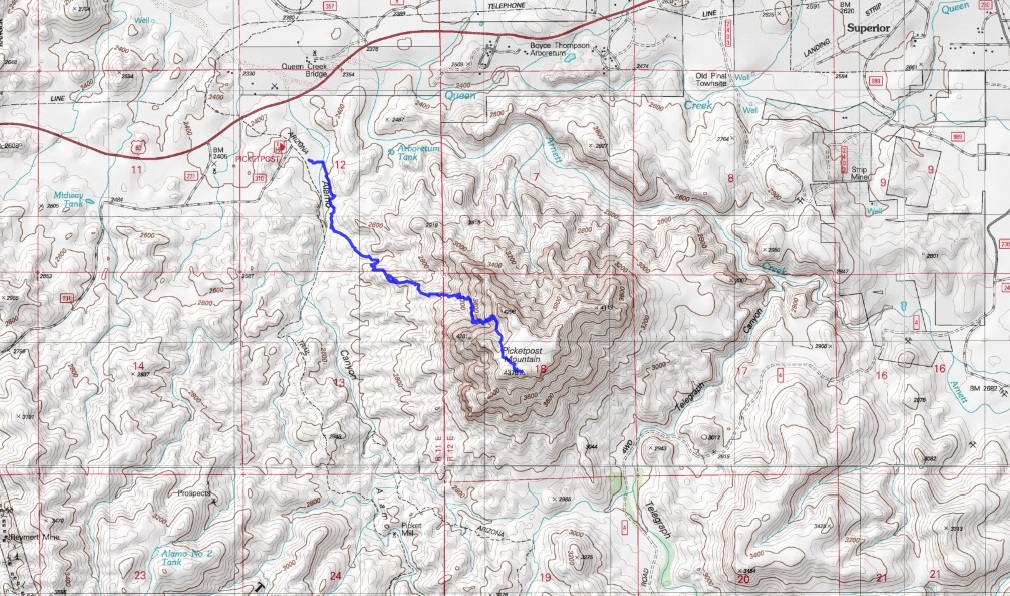

One of the many scenic drives in Arizona is the US-60 from Phoenix to Superior. The highway weaves around the southern edge of the Superstition Mountains, through canyons and tunnels, and through the small town of “Top ‘o’ the World,” at just under 5,000′. One of the most striking features of the drive is Picketpost Mountain, an enormous summit just south of US-60, 30 miles east of Apache Junction. Picketpost rises 2000′ above the small town of Superior, and with no connecting ridgelines or other summits nearby, it stands prominently above the valley. While not technically in the Superstition Mountains, the rugged route has a Superstition’s feel, which Holly had yet to experience during her time in Phoenix. We set out fairly late for Picketpost on a Sunday, reaching the trailhead sometime after noon, taking about an hour from home. The mountain looks very impressive from the trailhead, with 2000′ cliffs shooting up from the desert.

With only 5 miles round trip, we knew we were in for a steep one. The hike started out easily enough, following the Arizona Trail for 0.7 miles to an unmarked but obvious junction to the left, complete with a large cairn.
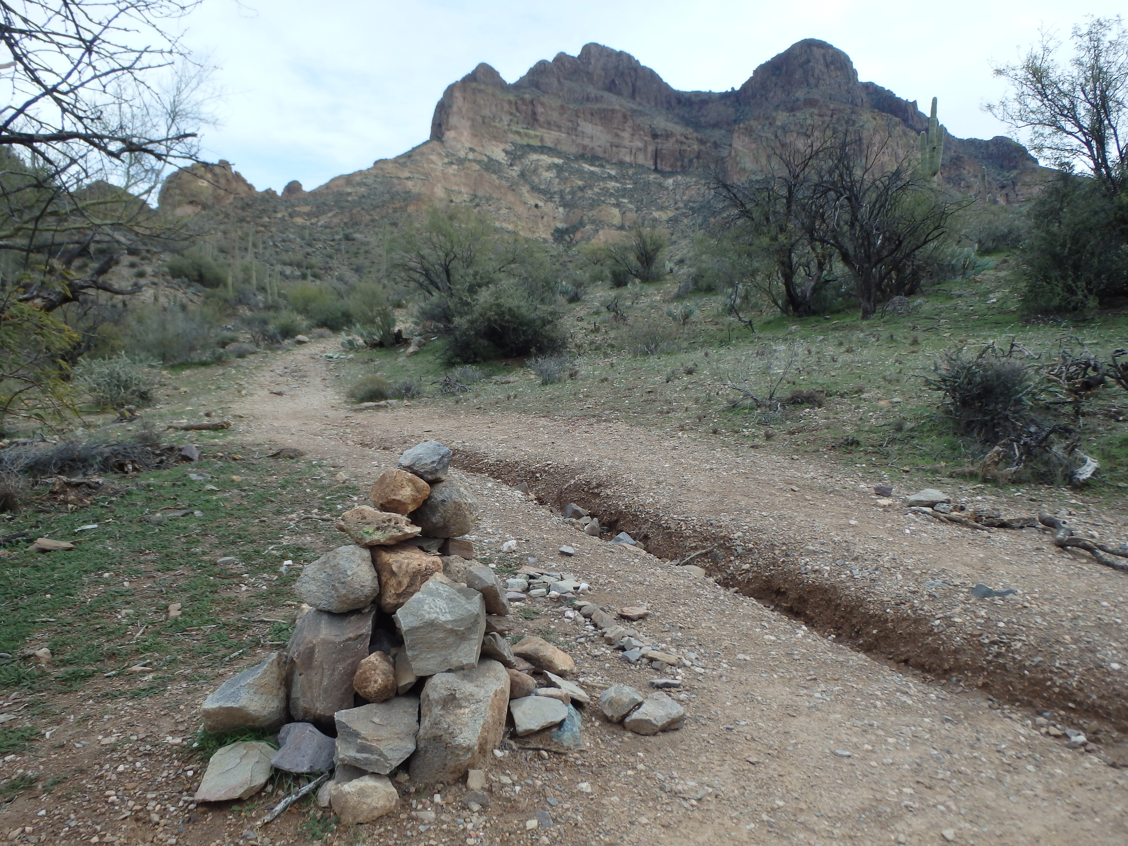
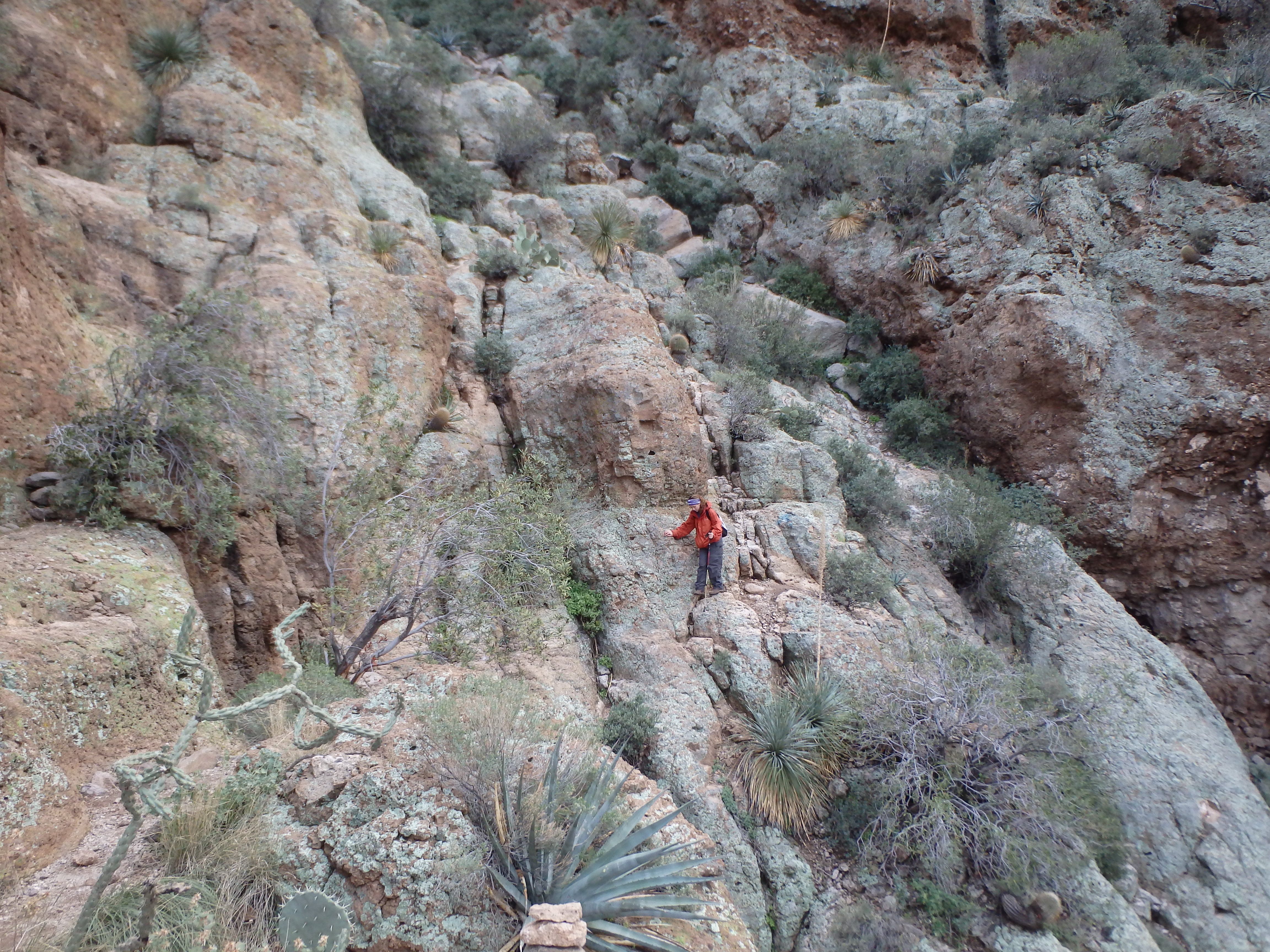
We turned left, and after a few switchbacks, found ourselves along a shallow rib heading directly into the dramatic canyon on the north face. From below, the route wasn’t obvious, although we were assured that it would be well cairned, and sadly, would have the occasional spray painted arrow.
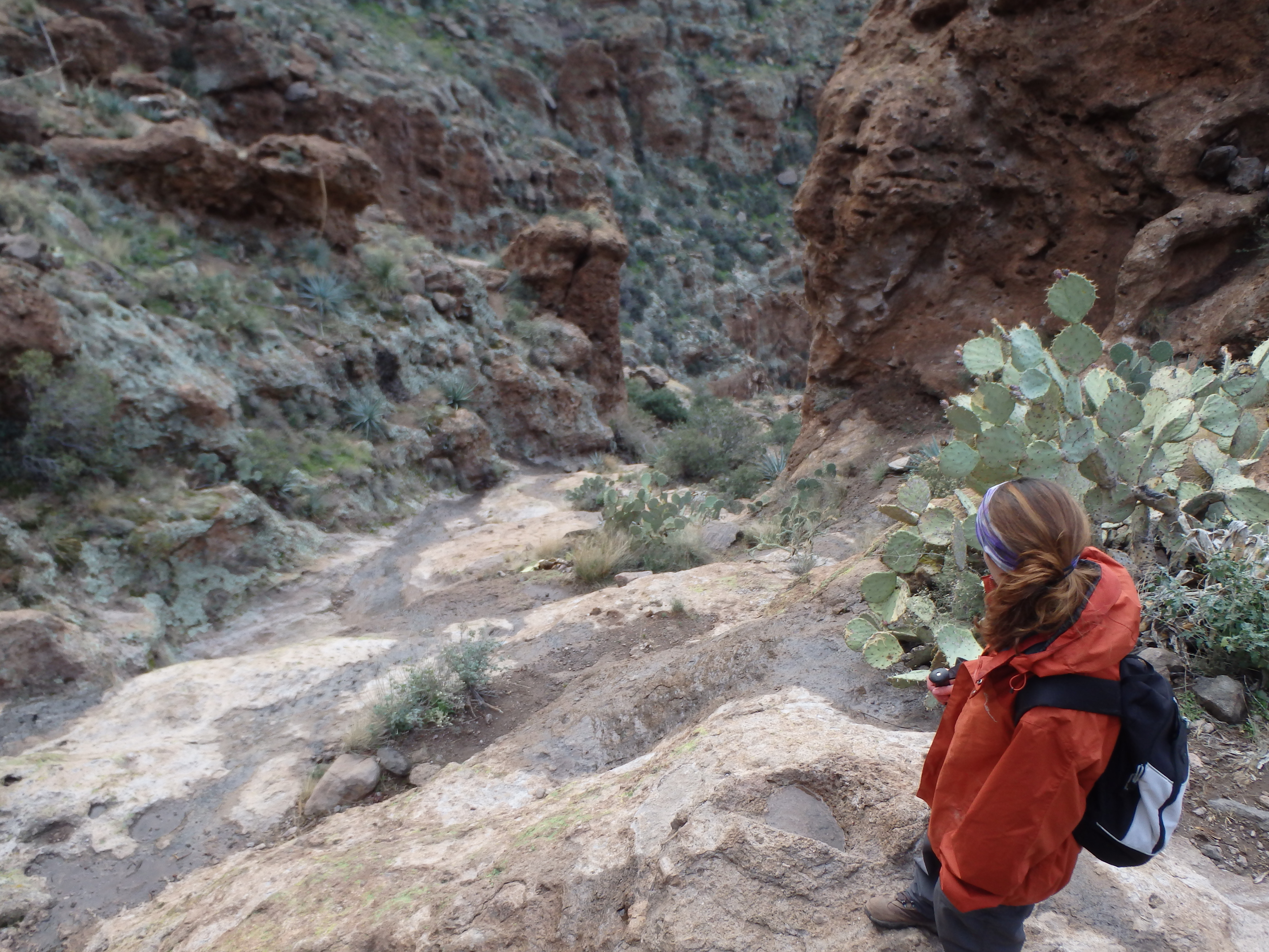
The narrow rib ended at some rock slabs, and the scrambling began. From the rib, the goal was to head up the steep slopes to the lower cliffs bands, bypassing a dry waterfall in the lower canyon. The trail was easier to follow in this section, an obvious trail beat into the dirt. As we rounded into the canyon, the scrambling and route finding became a bit more challenging, swinging around ledges, and heading up the steep gully.
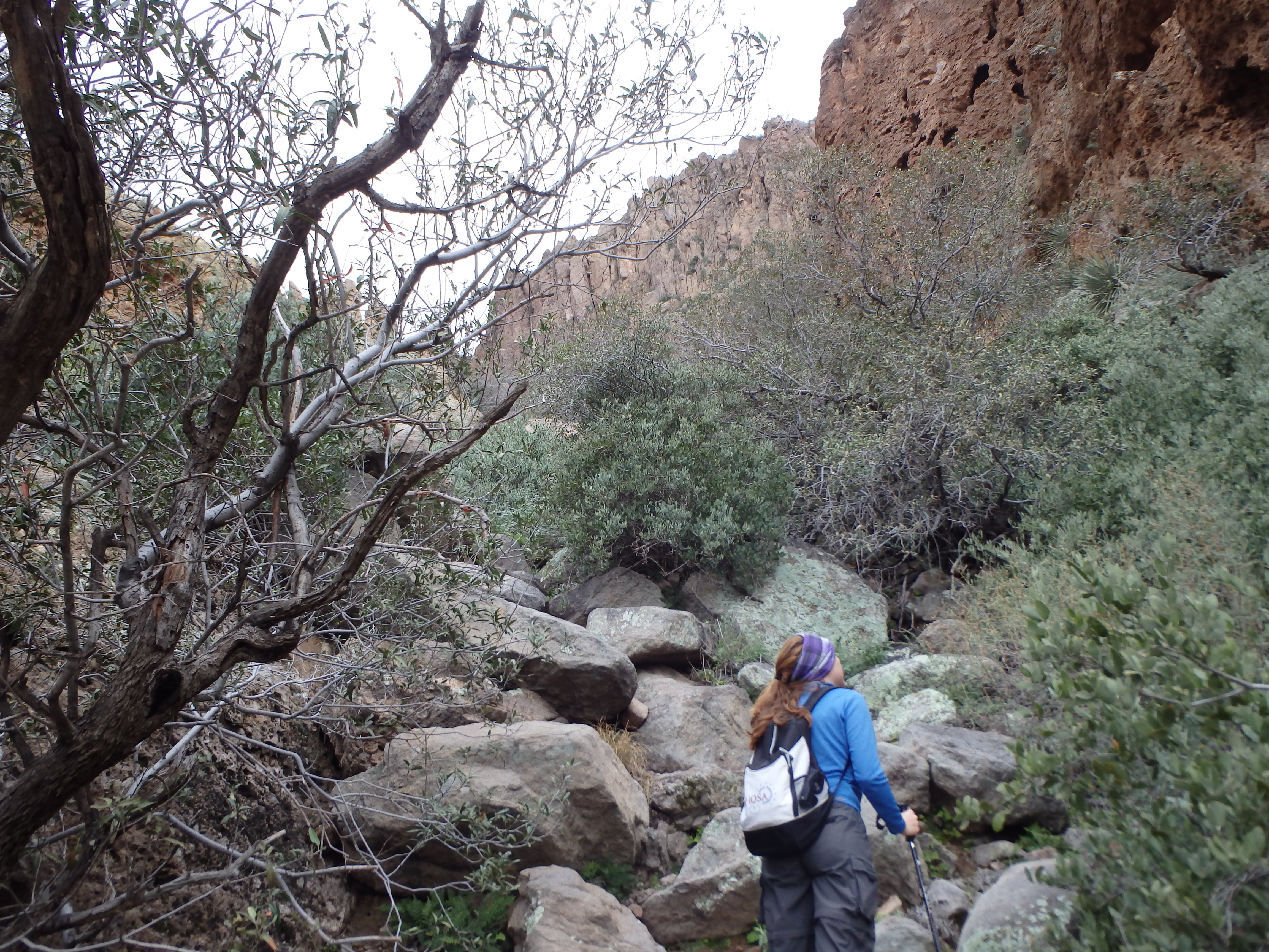
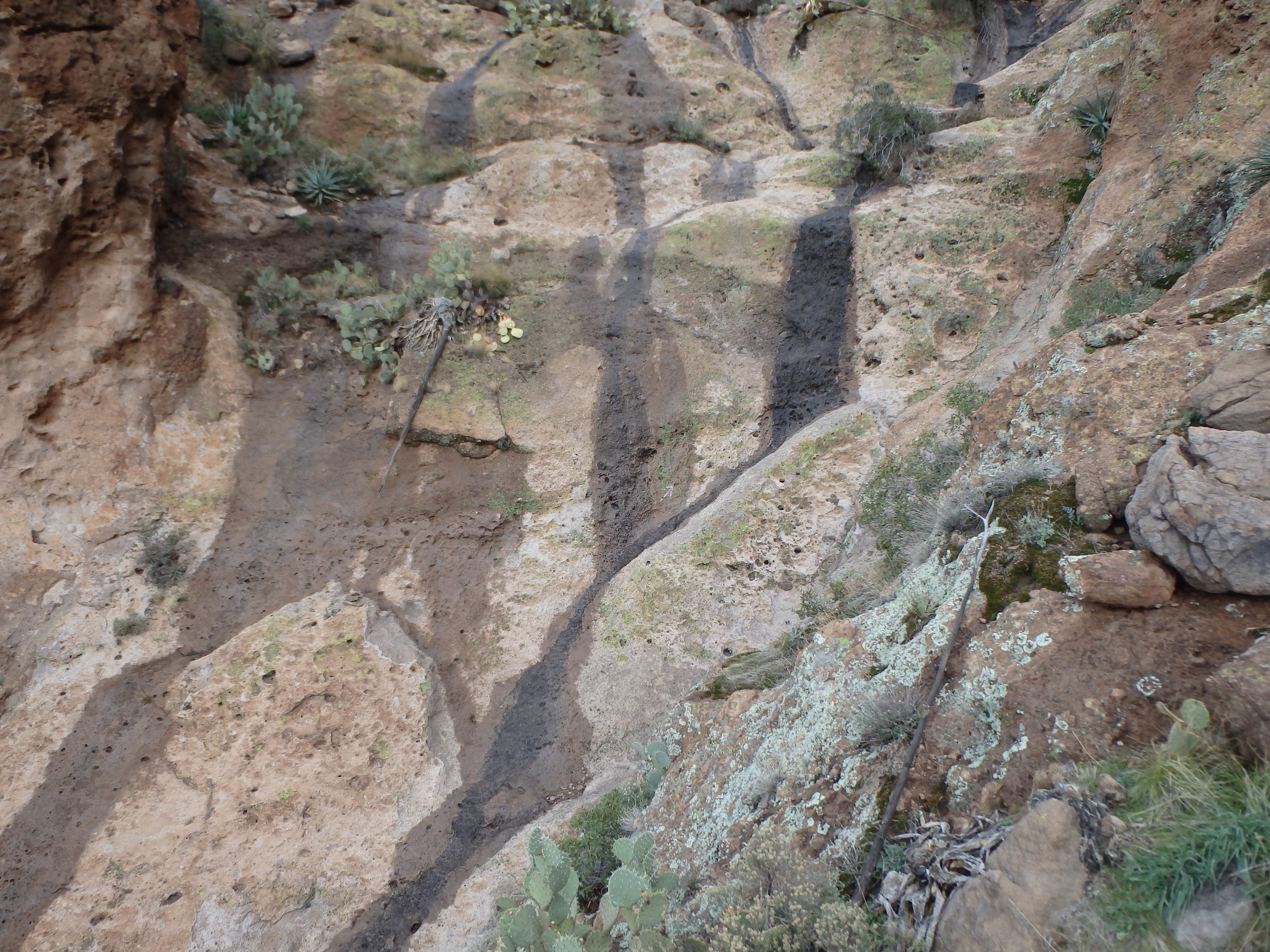
After following the gully for several hundred feet, we followed some tragic spray-painted arrows on the rocks around a rock face to a second gully, which paralleled the deeper one to the right. It was here that we came upon the infamous waterfall that one must climb directly, basically high angled rock slabs running about 100′. While in normal weather, this would have been fine, rains the day before meant that there was actually water flowing in the normally dry falls, making it dangerously slick. We had passed others along the trail that warned us this section was sketchy with the water, and I was happy to find a thin use trail heading up on the right side of the falls which brought us above the steep slabs.
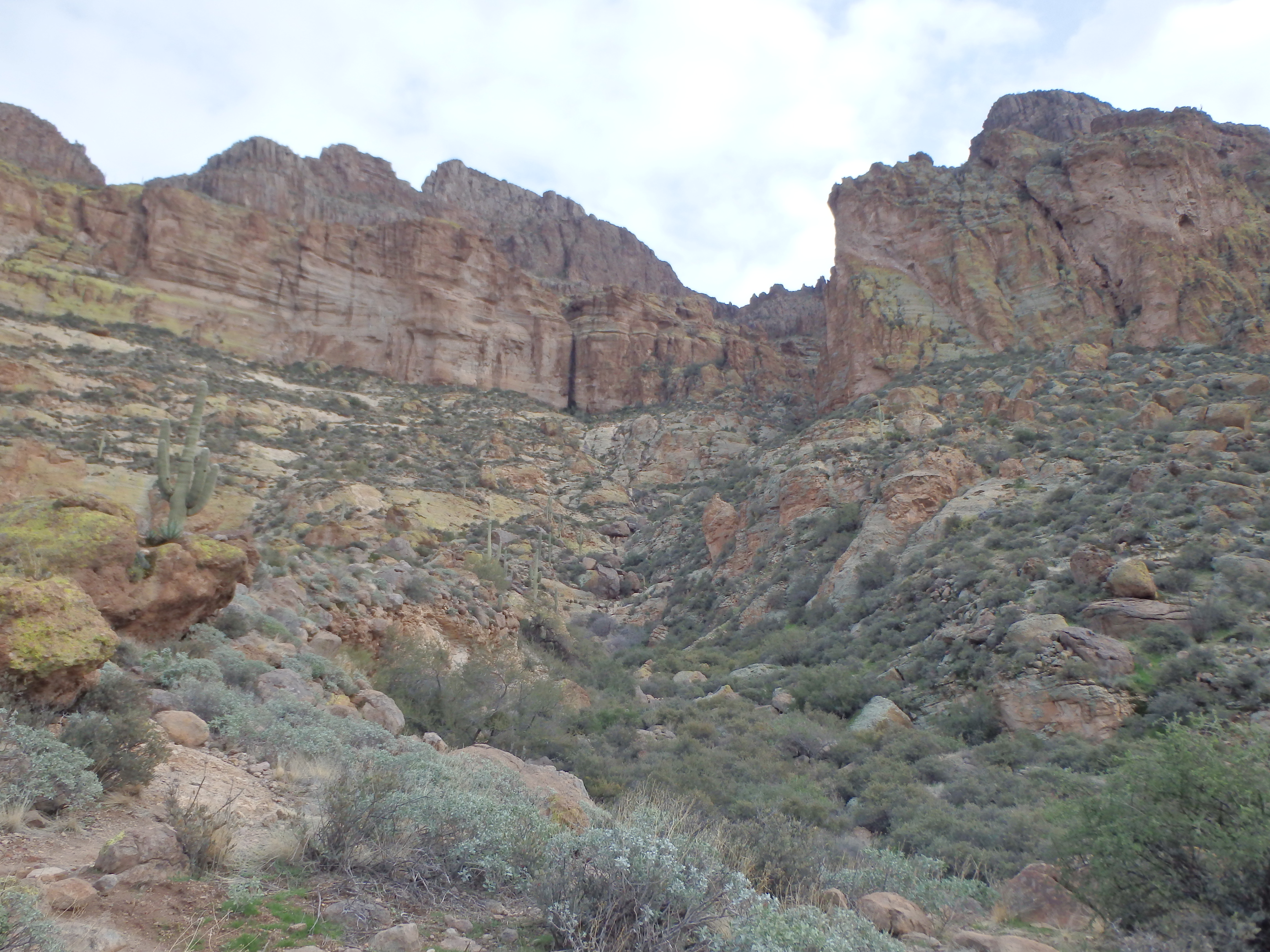
A short bushwack got us to the opposite side and back on the trail. Unfortunately, this final, upper section of the canyon had numerous use trails; all of them work, most of them are loose and unpleasant. We did our best to keep to the cairned trail, but would often wind up on a side branch and have to bushwack along the loose trail to regain the main path. Ultimately, all the side trails funneled back to the main trail, which skirted beneath volcanic rock columns at the canyon head wall.

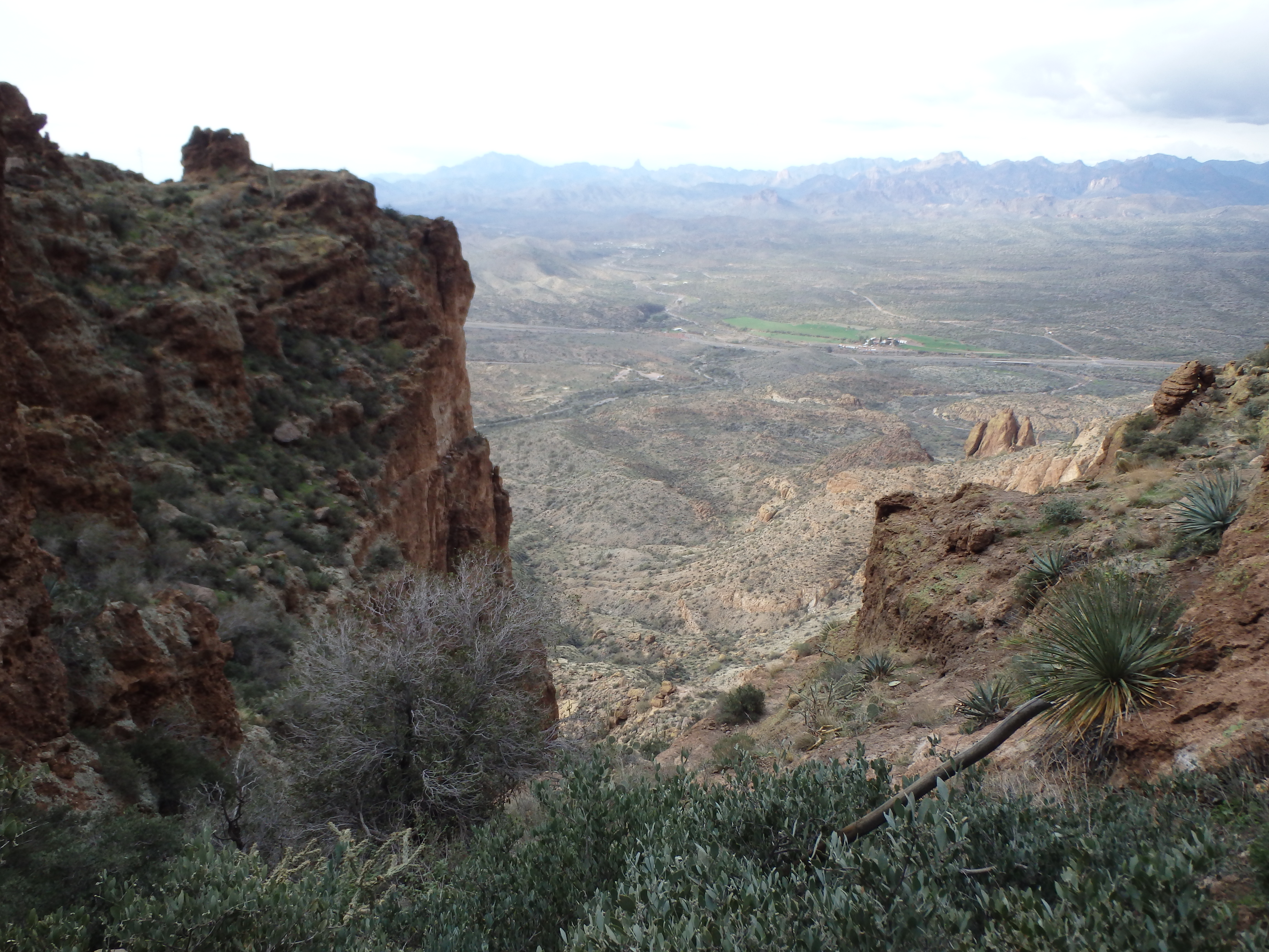
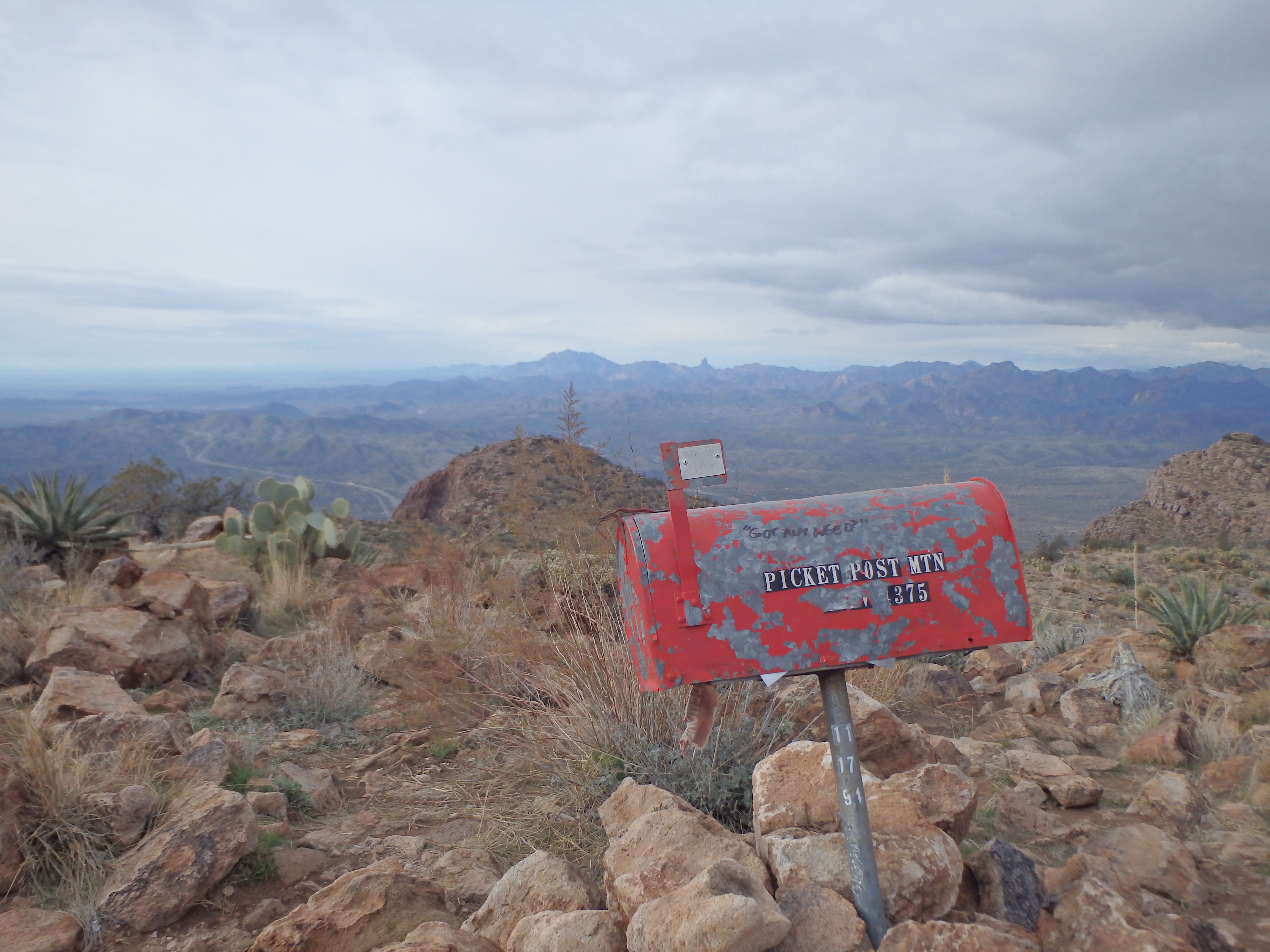
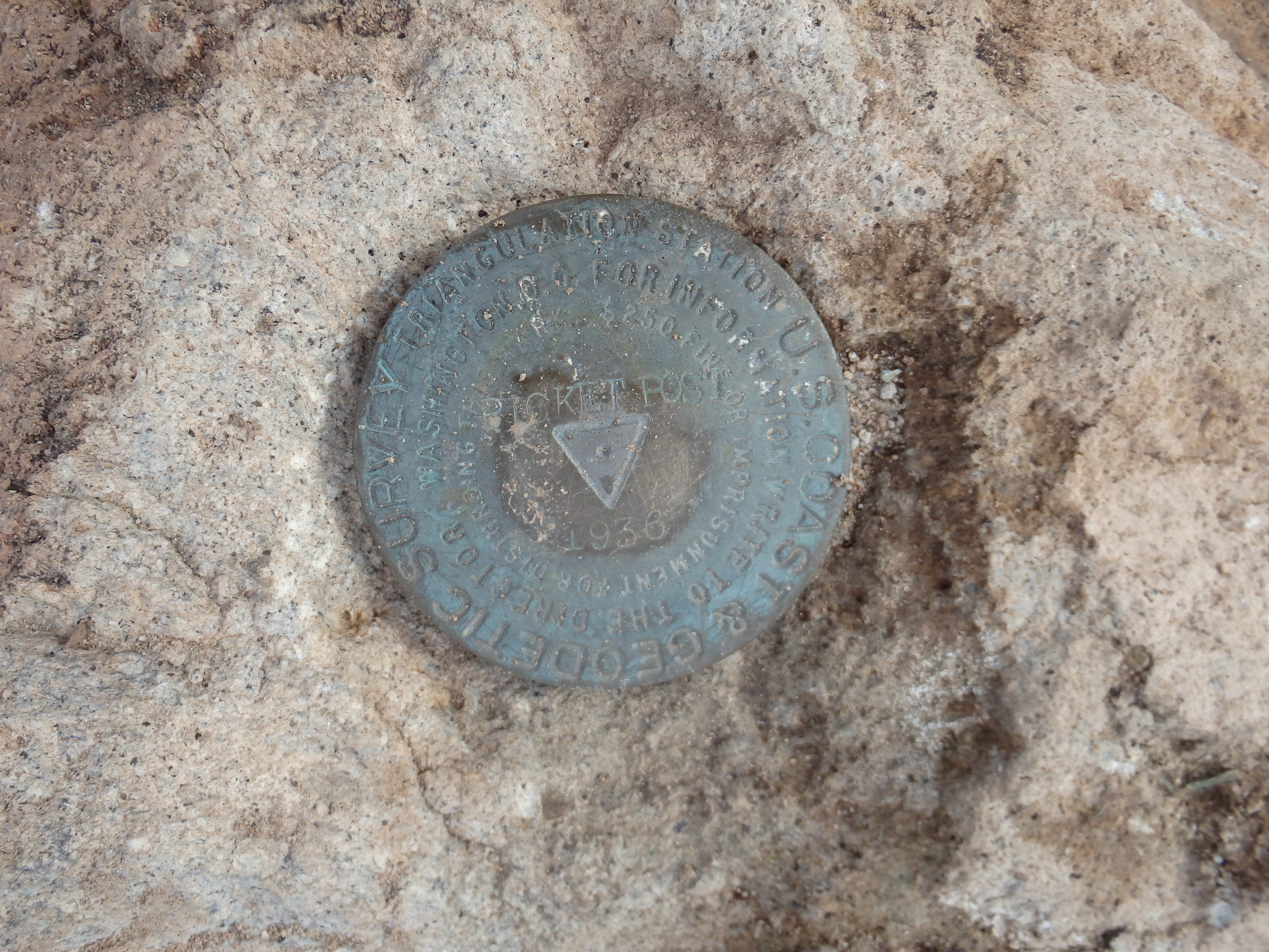
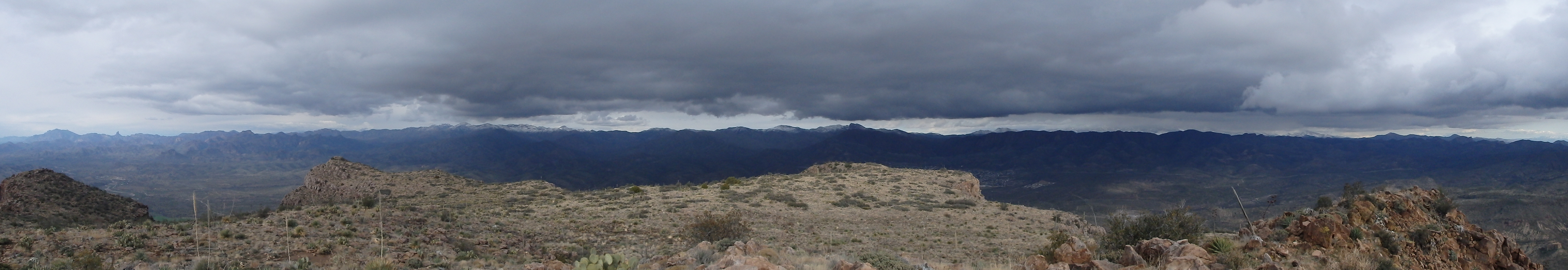
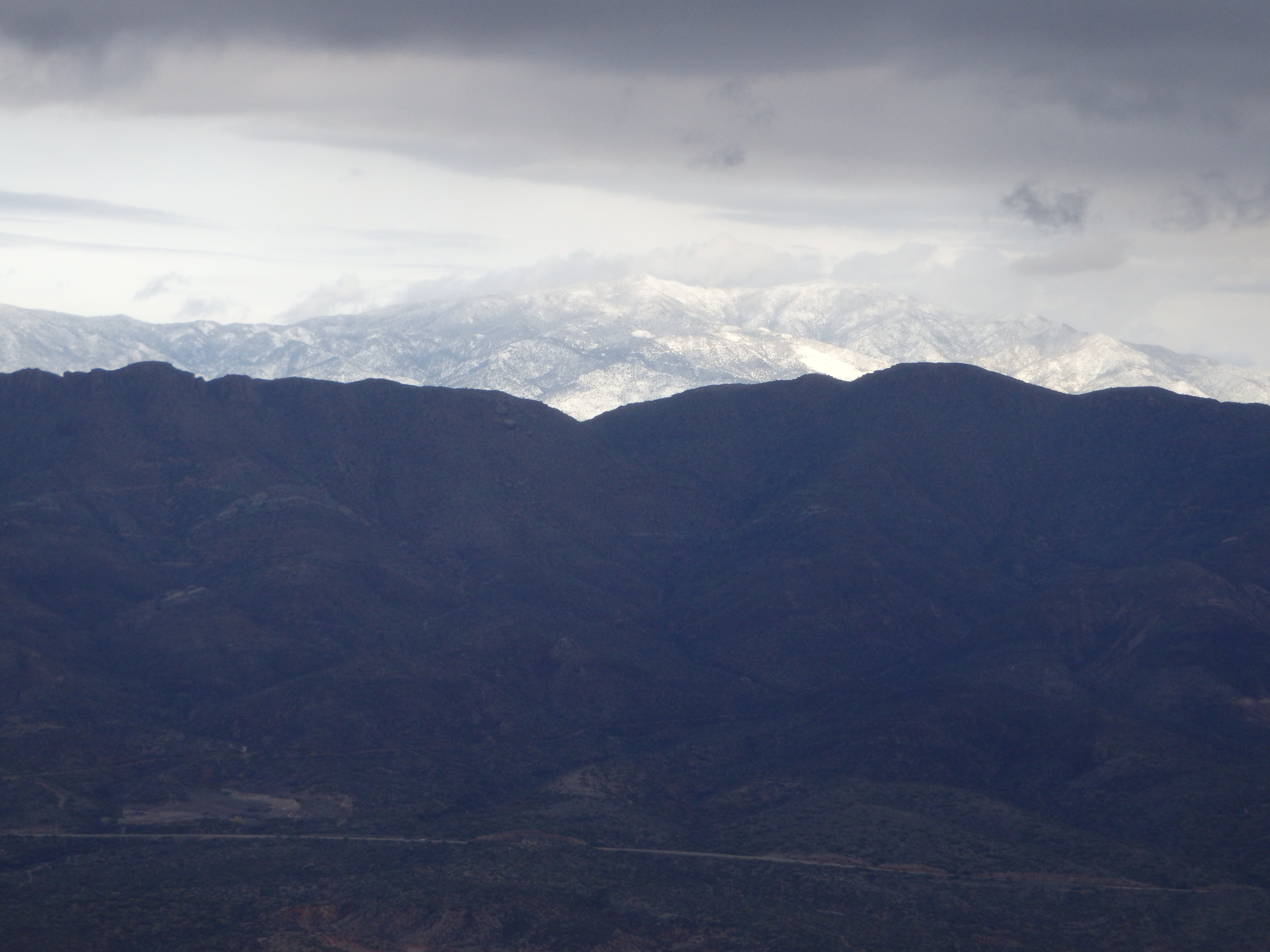
We followed the bottom of the canyon a bit longer until we found ourselves on the summit plateau. Throughout the hike, we were trying to decide if the summit was to the right of the canyon or left. Ultimately, it was neither. The trail weaved around the summit plateau straight south to the highest point, complete with a mailbox with at least 15 shredded summit registers, a bench with half the slots missing, and true 360 degree views. To the north, we could see all the major landmark of the Superstitions, with the higher summits (including Mound Mountain, the HP) covered in snow. Beyond that, Four Peaks, half covered in cloud, would occasionally show flashes of white. To the east, clouds hung low on Pinal Peak, but still above snowline. Far to the south, we could clearly see Mount Lemmon, which had also received plenty of fresh powder.

We cracked open a few summit beers we had brought along with us, and enjoyed the snowy scenery in the distance. After finishing our beers, we headed back down to beat the sunset. With the sun dropping below the clouds, it grew quite cold and we quickened our pace. Holly wanted to try the waterfall down thinking it would be faster, but we quickly abandoned the plan as our descent on the wet slabs was so slow, that we swung back around to the ridge to take the faster trail.
We dropped out of the canyon, following the same route down the gully and around the lower falls.
We descended to the narrow rib below the class III, and made it to the car just as the sun set.