
Pyramid Peak 2269′
Total Time: 2:30
Roundtrip Mileage: 3.8 miles
Elevation Gain: 1100′
Class 3
Trailhead: End of N. Stetson Pkwy. State trust land permit required ($20/ year)
Companions: Holly


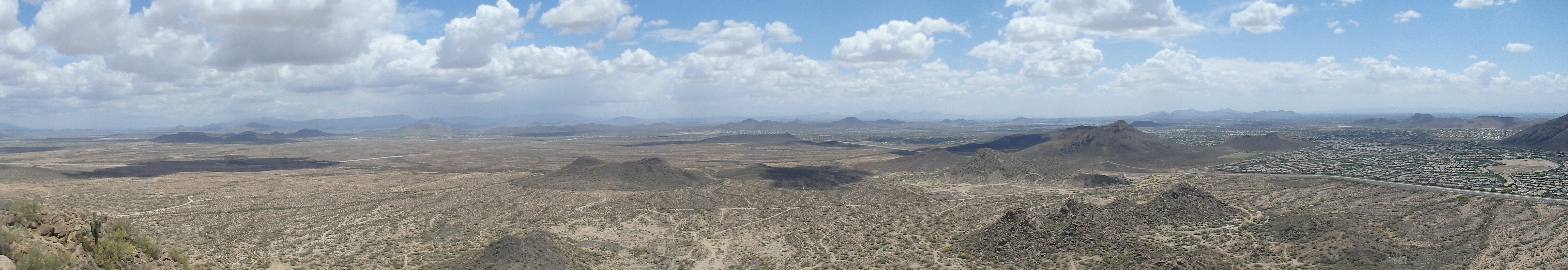
Since the inception of this web site, I’ve tried not to write up any hikes within Phoenix city limits. The majority of these are well signed and well established with plenty of information online. I thought another trip report on a hike up Camelback isn’t helping the hiking community with so much already out there, and I’ve mostly written about off trail adventures with the occasional class I hike. Throughout the year, Holly and I had been hiking the major summits within Phoenix city limits, with a planned list finish on South Mountain. The only other summit aside from South Mt. that remained on the list was Pyramid Peak, located north of the 101 on state trust land. Pyramid Peak is well named, having nearly the same specs as the Great Pyramid of Piza, rising 770′ above the desert (756 for the pyramid), and having an approximate slope of 50 degrees. The summit is trail-less, lying on undeveloped state trust land and requiring a ($20) permit to hike. The edge of the trust land is just north of the Central AZ Canal, and is accessible via a closed off bridge at the end of N Stetson Valley Parkway. We parked off a side street and hiked over the bridge, hopping a small cement barrier to enter the state trust land, permit in hand.


Sadly, although the area is supposed to only be used by hikers, mountain bikers and OHV enthusiasts, it seemed that it was more of a dumping ground than anything else, with garbage scattered across the landscape, from old TVs, car parts and broken glass. Once you got past the litter, the area was actually quite scenic, with rock spires and jagged crags along the base of Pyramid Peak. I had read that there were a number of routes you could take up to the top of Pyramid, and the North Face was the easiest. We followed old single track to the east of the peak and rock formations, and began to swing around the north slope. As the grade increased, we angled for a prominent rock outcrop centered in the middle of the North Face as a line to hike up.


While there was plenty of cacti and scrub to contend with, the footing was actually decent, with a thin layer of grass holding things together. About 3/4 of the way up, there was a short section of some steeper scrambling that required a bit of creativity to work around some of the larger rock formations. I felt like Holly was starting to grow tired of the cross country and was beginning to feel a little guilty when I received some help from above… literally. As we entered a gully through the steepest spot, we looked up into a small Palo Verde tree and found a large Great Horned Owl (her favorite bird) perched next to a small hummingbird.

The owl didn’t seem to mind and we hiked closer, while the hummingbird quickly became upset with my red shirt and buzzed over me as I went past. From the steeper spot the grade eased, and we moved up and over a false summit to the top. A tattered American Flag stood at the highpoint, with two weather beaten solar lights angled to illuminate the flag at night. We sat for a while at the top, watching the previous days storms in the distance, and contemplating another route down.


The S-SE ridgeline looked easier from above then from the base, and it looked like it would go fairly easily. We decided to give it a go to avoid the long loop around the north and found pretty fun class III scrambling over solid rock. It quickly became apparent that this would be the preferred route up, at least in terms of fun-ness factor, not the North side. We dropped onto a high saddle on the ridgeline and cut down a broad drainage to the east.


For the most part, there were good lines to follow with minimal brush, and after squeezing through some tight boulders, we were nearly to the desert floor. We decided to skirt the rock pinnacles to the west and dropped down one final gully, more boulder filled than the others, to bring us back to the broad basin south of the peak.


From there, it was easy hiking across the desert using old single track trails to bring us back to the car.
