
Mount Shavano 14,229′ and Tabeguache Peak 14,155′
Total Time: 9 hours
Roundtrip Mileage: 9.7 miles
Elevation Gain: 5340′
Crux: PD- / Class 2
Trailhead: Shavano TH- 2WD, pit toilets


Mount Shavano and Tabeguache Peak are two Colorado 14ers less than one mile apart. Shavano is the southernmost 14ers in the Sawatch Range, and most well known for the snow climb ‘Angel of Shavano’, a series of broad couloirs on the Eastern slopes of Shavano that have the namesake appearance of an angel with outstretched wings. The route was nearing the end of it’s season in early June, but I hoped for a chance to climb the classic route and tag Tabeguache as well, making for six 14ers during my trip. I was fairly exhausted after my near epic on Harvard, and even though I had set my alarm for 4:30 to take advantage of hard, early morning snow conditions, I had not even gotten my phone to my face to turn off the alarm before falling back asleep, waking up a little after 5 and already behind scheduled. I was parked on BLM land near the base and drove the remaining distance to the trailhead, pounded a coffee, then started up the trail trying to make up time. The trailhead is near Blank Cabin, an old homestead just off the Colorado Trail, which runs the length of the state. I was only on it for about 100 yards until I turned left onto the Mount Shavano Trail, which headed more aggressively uphill. I was fairly sore from my 13 hour day prior, and I was dragging from the start as the trail headed unapologetically upslope. The trail gradually hooked north at 11,000′ and and would ultimately start to switchback as it ascended Shavano’s east ridge. But in order to reach the Angel of Shavano, I needed to leave the trail at around 11,100.’ Beta suggested you could take the trail to the first switchback, then cut into the basin from there, and I thought that might be easier since I wasn’t sure what kind of snow coverage I’d be dealing with. When I reached the first switchback I continued west into the basin and found a problematic amount of deadfall, with plenty of fresh fallen trees from the previous winter. I struggled upwards over more and more fallen logs until I realized there was clear terrain on the other side of the basin, and cut into the open grassy drainage. This gave me my first look at the Angel of Shavano for the day, the snow starting at around 12,000′ with a good portion of the lower section (the Angel’s skirt) melted for the year.


My pace improved in the open grassy basin and I reached the base of the snow, taking a short break to put on my crampons. I found the snow to be in perfect condition as I started up, with plenty of steps from previous climbers and suncups along the way. The climb became methodical, slowly climbing the hard snow making steady progress upwards. I spied a few other climbers on the trail above me, but I was the only climber on the Angel for the day. I reached the Angel’s waist, the steepest section, in about 20 minutes of climbing, and was soon on the gentler slope of the Angel’s chest.

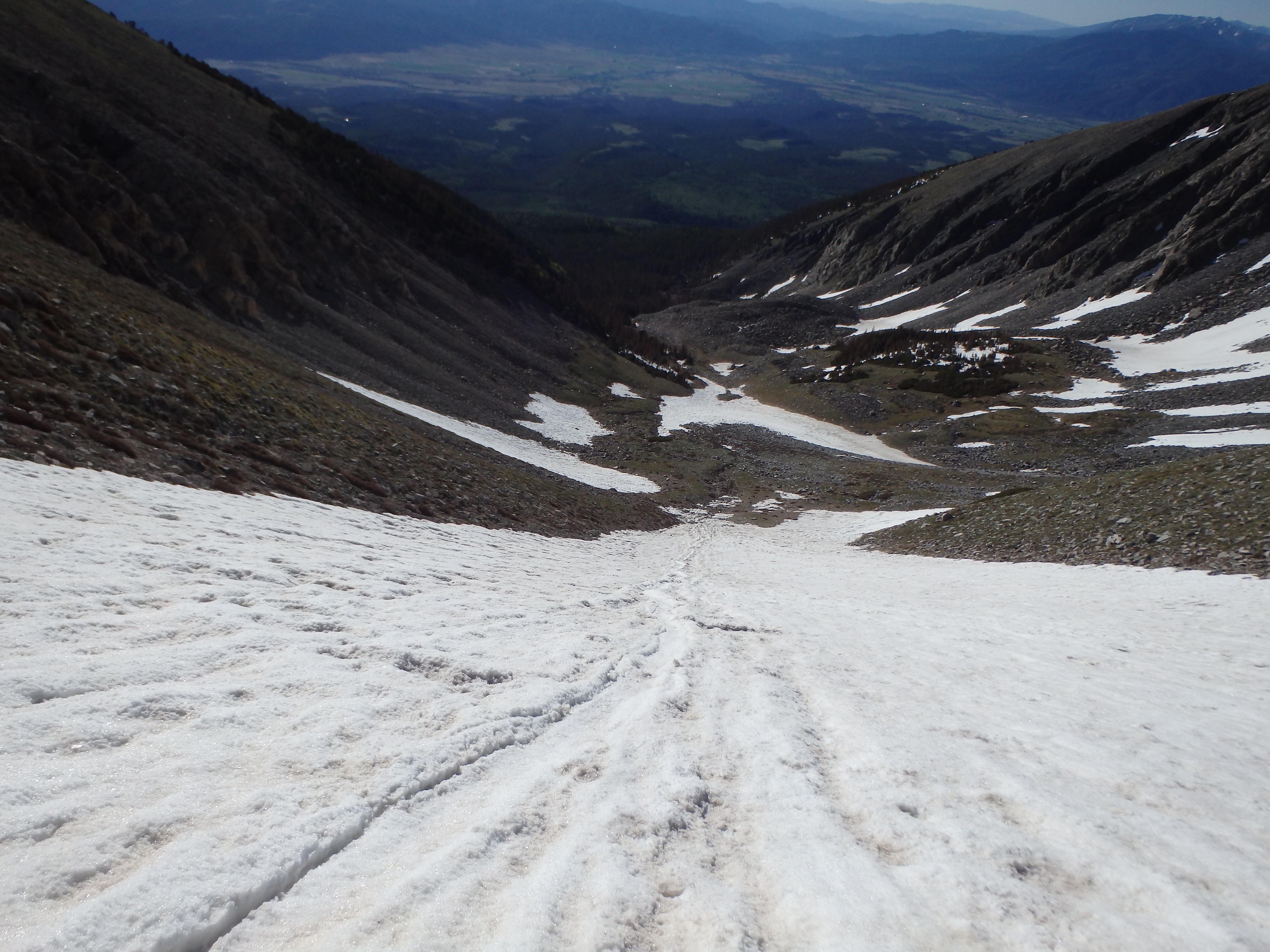
The right arm and head of the Angel were looking a bit patchy, but the Angel’s left arm, which was on partially north-facing slopes, remained in good shape and I was able to climb it to about 13,200′ before running out of snow. I ran into a skier from Fort Collins at the top of the Angel who was planning on skiing down the Angel to the base and we talked for a bit as I took of my crampons for the day.

The summit of Shavano was under 1000′ of snowless trail to go, and I started up the trail as it switchbacked up the rocky south face the remaining distance to the summit, only taking about 30 minutes from the top of the angel. There was a number of hikers already on top, including a guided group from Minnesota up their first 14er. I took their summit photo and sat down to rehydrate and have a small snack, my attention already on Tabeguache Peak.

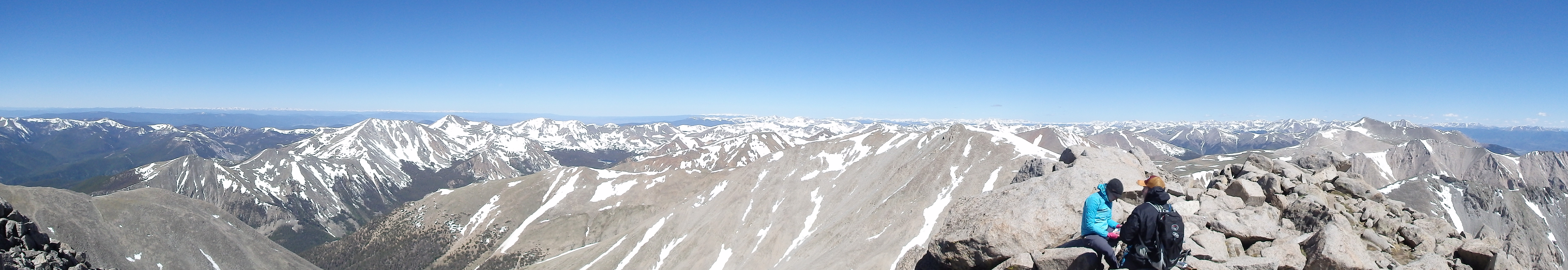
Compared to the long traverse to Columbia the day prior, Tabeguache looked much closer, with only a little snow on the summit ridge that could be more easily avoided. A use trail continued over Shavano down to the connecting saddle between the two 14ers, and stayed snow free up until the saddle. The snow leading up the summit ridge was much softer than the Angel, and rather then take the time to put my crampons back on, I utilized a use trail up the scree and talus on the south facing slopes of Tabeguache and quickly regained the lost elevation to the summit of my 26th 14er, nearly half way there!


The traverse over had gone faster than I expected, and I gave myself another short break, not looking forward to the forced reclimb of Shavano on the return. Two other climbers topped out on Tabeguache and I left the summit to them, dropping back down the scree towards the saddle, occasionally utilizing a standing glissade through the lower angled stuff lower down. I had full intentions to reclimb Shavano, and started up the ridgeline back towards the summit. But about halfway up, I started veering across the eastern summit slopes at a steady elevation. I was moving quickly across the mix of grassy ledges and talus, much of the rock fairly stable allowing me to hop across quickly. I rounded a corner the corner to Shavano’s eastern ridge and dropped down to the wide open grassy slopes.


Normally these shortcuts often backfire on me bigtime, but this one actually worked out in my favor and saved a lot of time and several hundred feet of elevation gain. That being said, if you’re not comfortable on steep talus, stick with the reascent of Shavano. Once on the open, grassy slopes, I started descending back towards the Angel’s right arm, testing small snow patches en route to see how the glissading conditions were shaping up. The strong sun and lack of wind meant the snow was softening nicely, and I did a short test run down the Angel’s right arm with good success. At the Angel’s body, I moved into the center and dug in my axe for the glissade and started down, finding the conditions near perfect- not too fast or too slow.

I dropped 900′ in less than 15 minutes reaching the boulder where I put on my crampons at the base with a very cold and wet behind. I stuck to the low point on the basin on the hike out finding much less deadfall, and found the trail at about 11,000′. I passed the guided group from Minnesota shortly after (they had not climbed Tabeguache) and half jogged the remaining distance of the trail to the car, needing to get back to Denver for my flight back to Phoenix. I made it back to the car about 9 hours after starting out, then headed back to Denver for dinner and flight back to the desert, another successful Colorado trip and group of 14ers ticked off the list.