
Sombrero Peak 4229′
Anza-Borrego Desert
Total Time: 2:45
Roundtrip Mileage: 2.8 miles
Elevation Gain: 2050′
Crux: Class 2
Trailhead: South Indian Canyon, no services


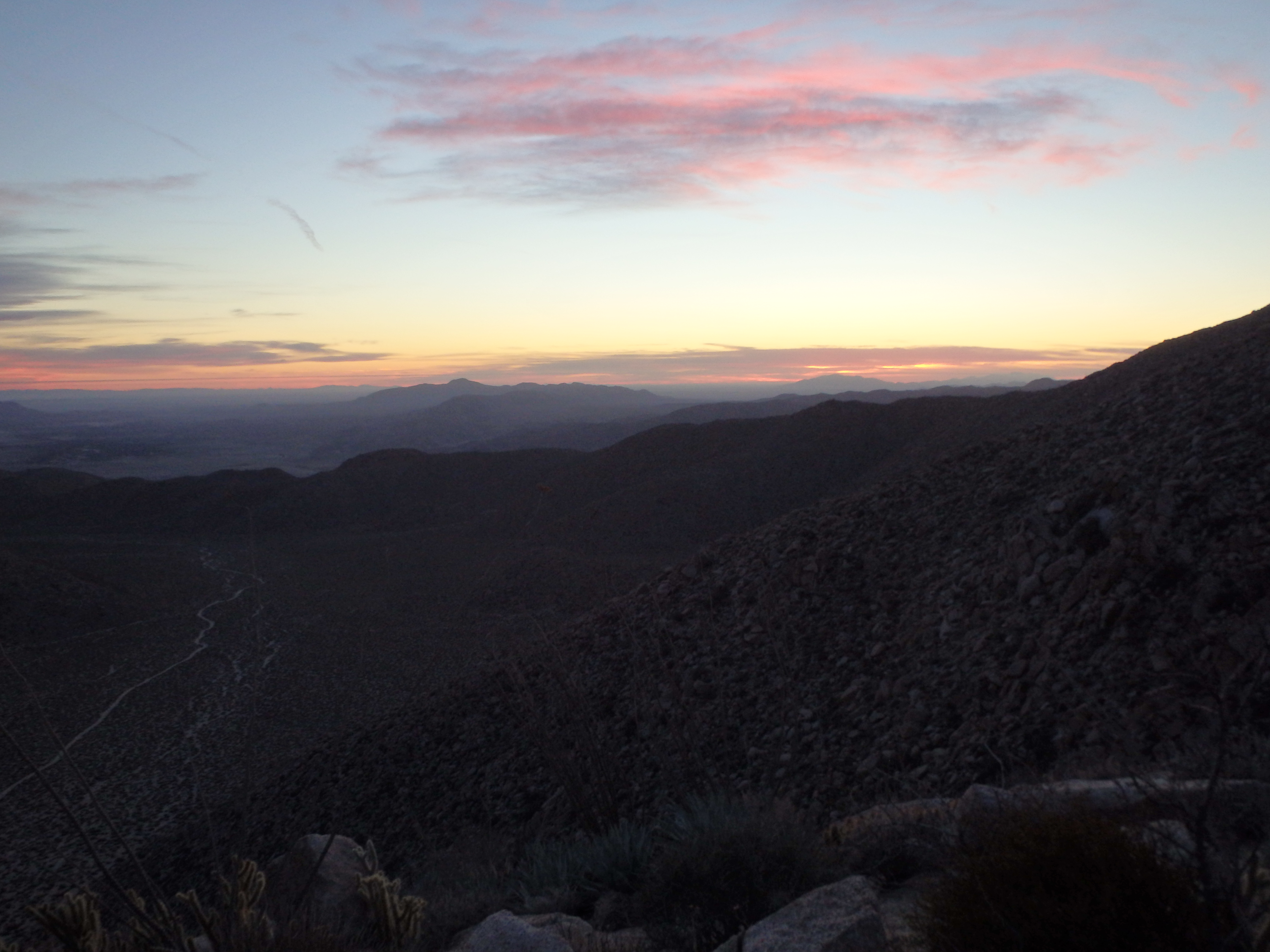
Sombrero Peak sits at the southern edge of Anza-Borrego State Park, a few miles north of the slightly less popular Jacumba Mountain. While they are similar in height and terrain, Sombrero sees a bit more traffic due to an easier drive in (less miles of dirt road) and more information online, including a hike write up on the state park website. Today would be the final day of a 3 day peak binge, and the plan was to hike Sombrero in the morning followed by Ghost and Whale Mountain in the afternoon. I awoke just off the highway shortly before dawn and drove the sandy track down the south fork of Indian Canyon. The road ended at a small palm grove and I parked in the small dirt cul-de-sac at the roads end. As I started up the slopes, there was just enough light to not need a headlamp. From the map, it looked like you could climb the ridge directly or swing up a shallow canyon a bit further west, but in the interest of avoiding brush, I stuck to the steeper but clearer northeast ridge. I reached a relatively flat area about halfway up just as the sun was rising over SE California and Mexico, a beautiful reminder of why I love the desert.
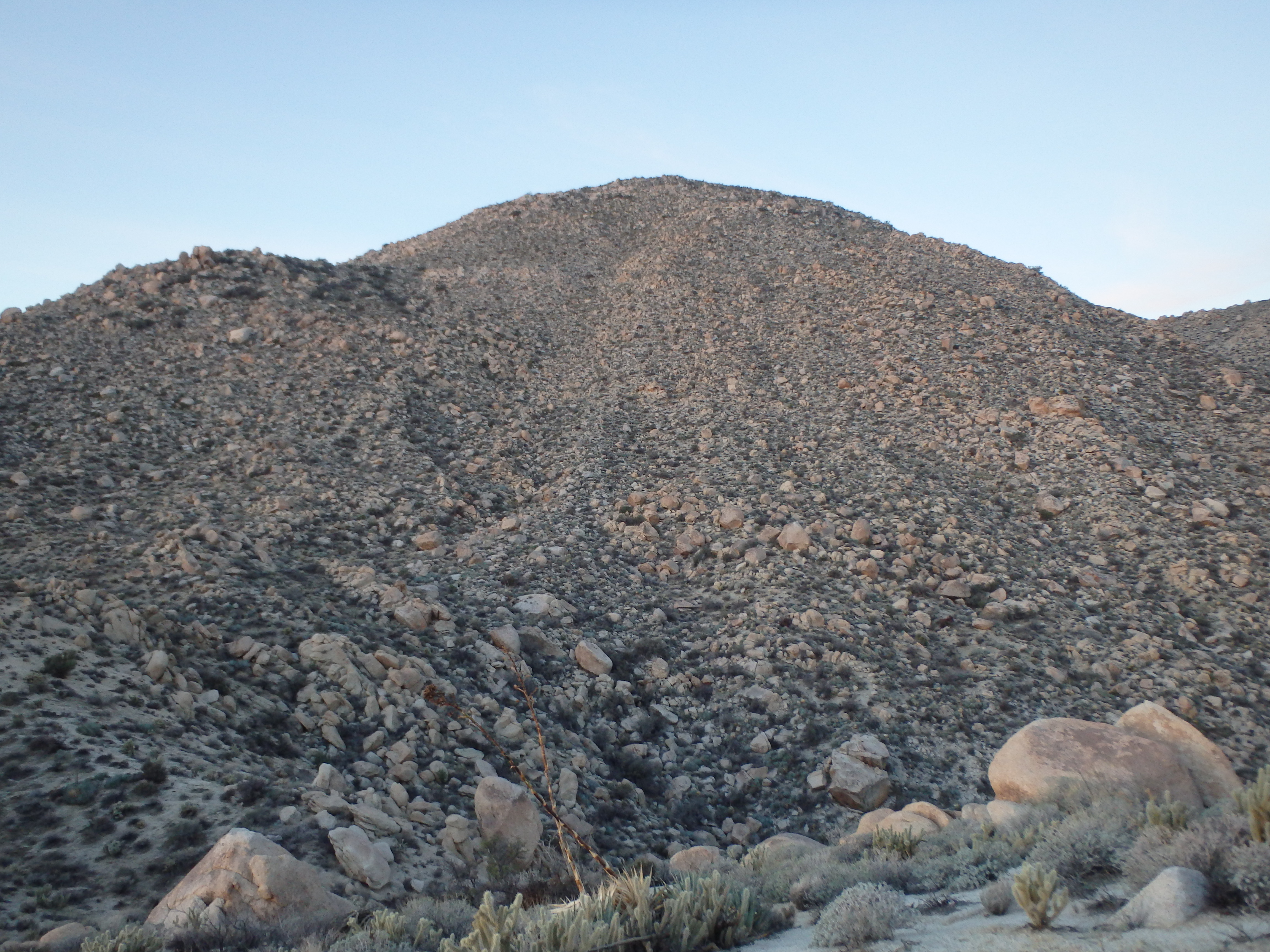
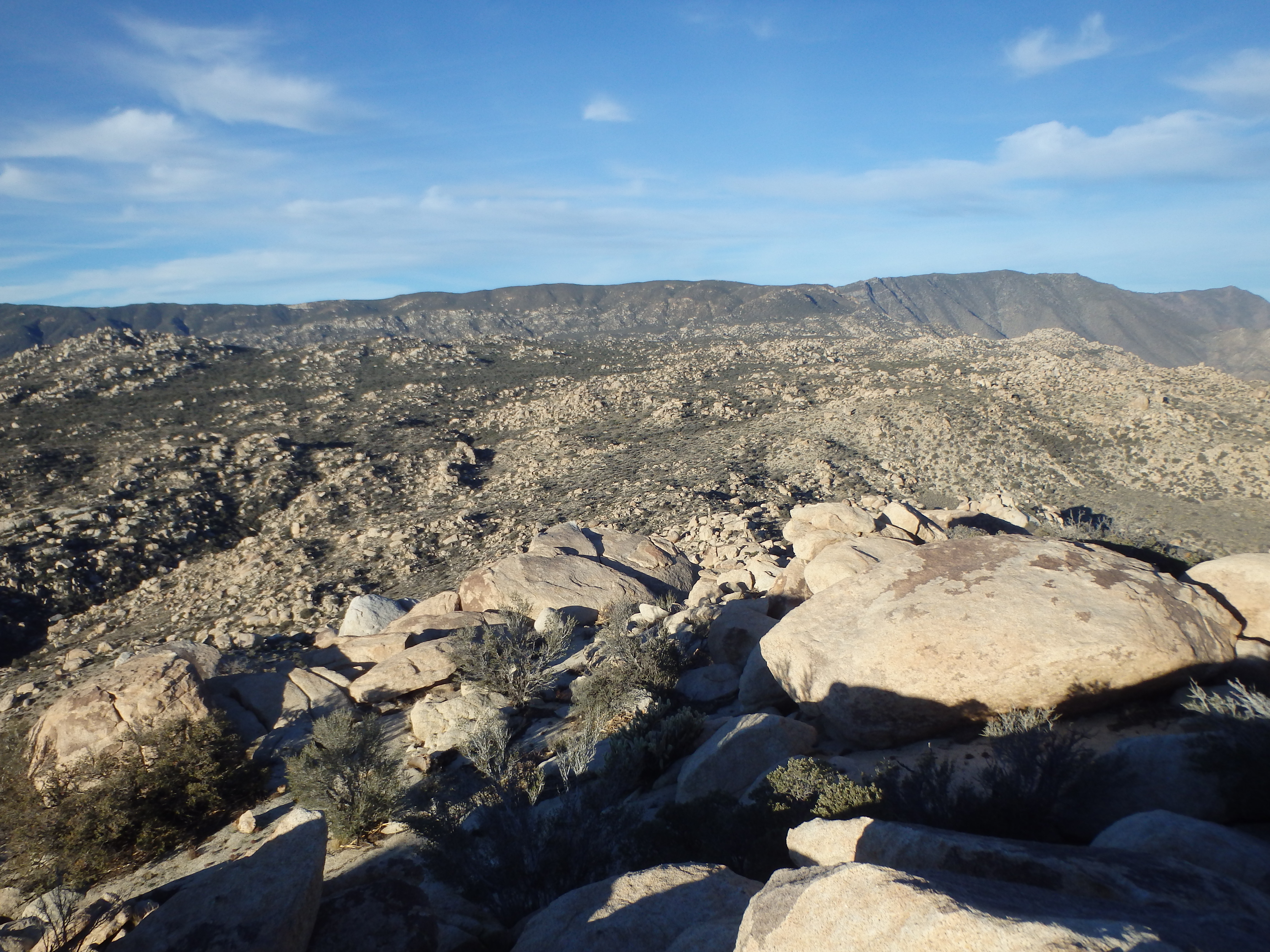
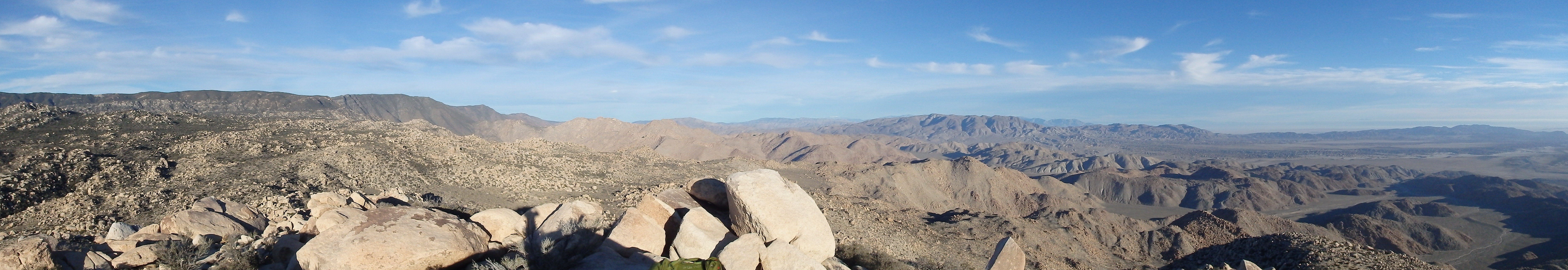
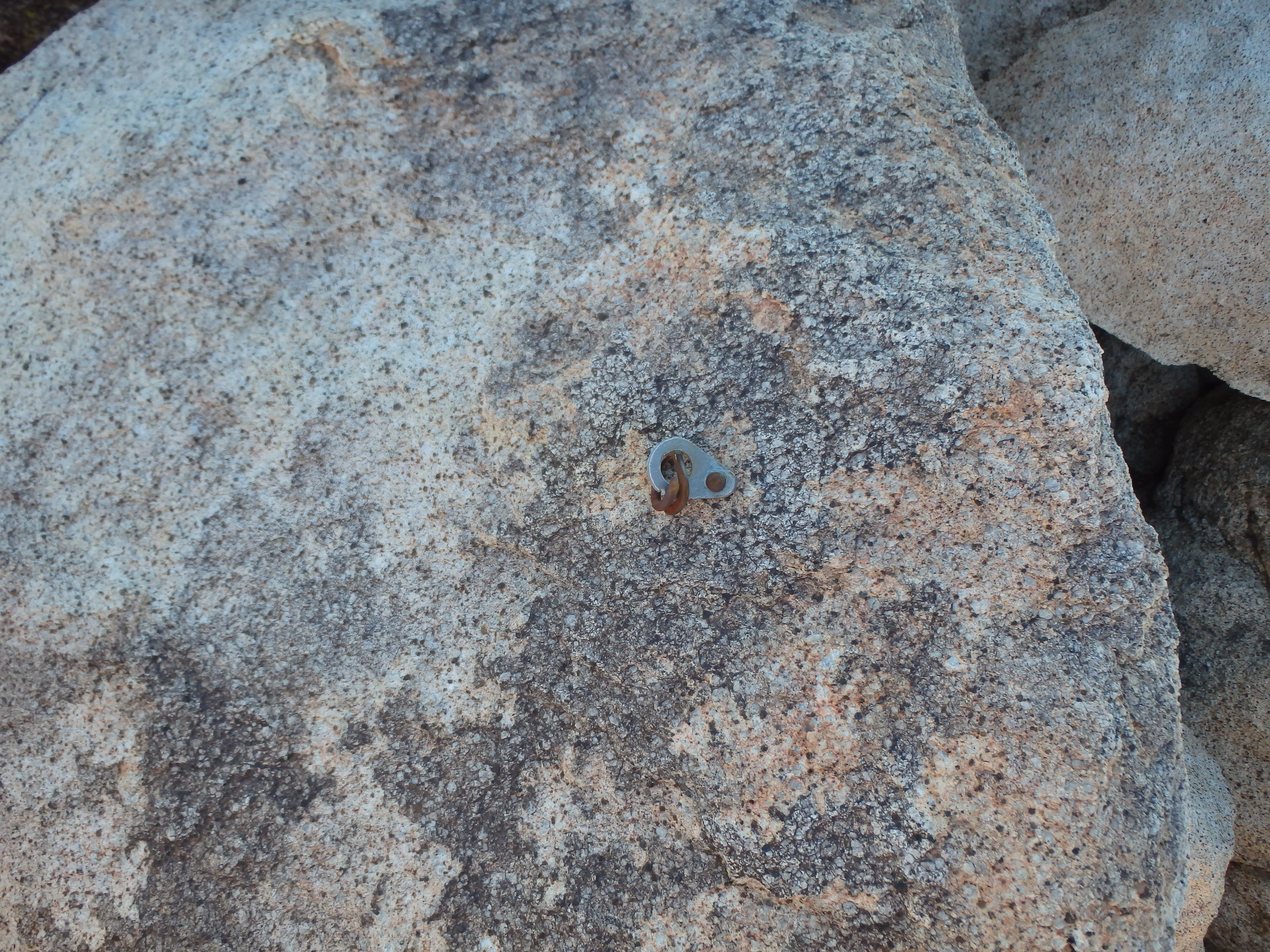
From this angle, the summit was difficult to see and it seemed like there was probably a false summit or two on the map to get over. The terrain was a bit sandy and loose but slowly eased as I ascended. Gaining over 2000′ in about 1.5 miles, it was about as steep as you can get without scrambling. As I reached the top of the major false summit, I picked up a use trail heading up to the rocky high point. The thin trail wove through large granite boulders, increasing in size the higher I went. Reaching the summit, I hopped on some of the larger boulders to reach the highest point and benchmark. The views were outstanding in the early morning light, with Whale Mountain just to the north, Toro and Rabbit Peaks a bit beyond, and snowy, southern slopes and peaklets of San Jacinto barely visible in the distance. I searched around for a summit register, which seemed to have been cut from a bolt off the summit rocks.

Coming up empty and still with a long day ahead of me, I dropped off the summit back the way I came. Dropping off the false summit, I angled towards the canyon I had avoided on the ascent, looking to have less brush than I had anticipated. As I dropped lower, I spotted a few hikers on their way up, seemingly unaware of me as I barreled down the slope towards them. They finally noticed me when I was almost upon them, and we exchanged a quick hello as they ascended a faint use trail that I had missed in the low light. The ravine still had some brush to avoid so I cheated on the sandy slopes slightly above the canyon, plunge stepping down the use terrain quickly to the base. I hooked towards the small palm grove (only a few trees) before making it back to my car, only taking a few hours for the short hike.

I hopped in the car and headed north, cutting into the Little Blair Valley for an ascent of Whale Peak before the long drive home…
Came about a month after you and found the summit register nestled in some rocks just west of the summit. No idea why someone moved. More interested in why there’s a concrete pad with a steel chain at the top of the lower summit just east of the peak.
Yeah I couldn’t make sense of that either. Thought maybe for surveying but that certainly isn’t the most accessible peak in the area to work from.