
Thompson Peak
McDowell Mountains
Total Time: 4:00
Round trip mileage: 10.1 miles
Elevation Gain: 2200′
Class 1
Trailhead: Dixie Mine TH; flush toilets, water, $2/ person
Companions: Holly


Although not the highest mountain in the McDowells, Thompson Peak is the highest summit in the range with a legal trail to the top. With a fire road hike bringing you to an antennae farm at the summit, the hike doesn’t off the most genuine of wilderness experiences, yet it still makes for a great work out with fantastic views across the Valley. The trailhead for Thompson Peak is strangely in the middle of a gated community in Fountain Hills. The parking lot for the trail is located outside the community, and with brand new facilities, it looks more like a California winery than a trailhead bathroom.

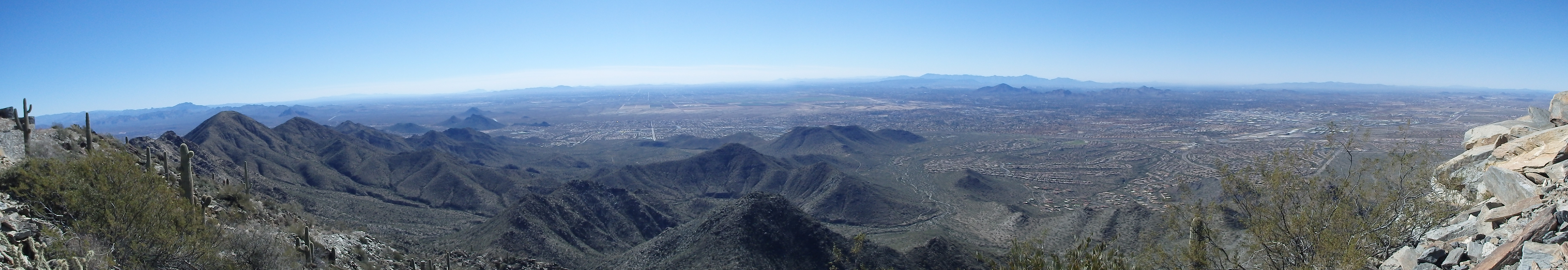
From the parking area, one must walk through the neighborhood several blocks to get to the trailhead into the preserve. Unlike most of the other trailheads in the McDowells, this requires a small entrance fee, $2/ person, which we paid to the Iron Ranger on our way through. Thompson Peak is visible for the majority of the hike, although early on, the trail weaved in and out of about a dozen washes running tangent to the range. The trail meandered through the desert, with great views to the east, already quite high above the basin.

After 2.7 miles, we intersected the main fire road that led to the summit of Thompson. Just beyond the road was Dixie Mine, one of several mines in the McDowells originally owned by the Red Mountain Consolidated Copper Mines Co. in the early 1900s, and turned over to the park system in 1977.

We stopped here for a short break and eyed the road ahead. Up to this point, we had gained very little elevation, and the route significantly steepened with 1700′ of gain in the last 2.3 miles. The grade of the fire road quickly increased, and became paved in the steepest sections, something I’ve only found in Arizona.

As we hit the ridgeline, the road briefly flattened, but we were now subjected to harsh winds which we had avoided all day. Trying to pick up the pace to find shelter from the wind, I was impressed with the steepness of the road switching below the summit, one of the steeper fire roads I’ve been on. At times, we almost needed to steady ourselves with one hand on the near 60 degree slope. The grade eased as we hit the very developed summit. The gate into the antennae area was open, and a group of hikers were taking shelter from the wind behind some of the buildings. We did likewise, and had a short lunch looking out across the valley. We could see all the tents from the Waste Management Open in Northern Scottsdale, and I was glad to be nowhere near the traffic on the 101 far below.
After finishing our light lunch, we headed down the steep road, jogging in places to get back below the ridgeline and out of the wind. The views on the descent were some of the best of the day, looking east to Four Peaks with some lingering snow in the gullys.

We took a short break at the end of the steep stretch before picking up the pace on the flatter ground and hiking the 3ish uneventful miles back to the car.