
Vulcans Throne 5102′
Total Time: 1:09
Distance: 2.0 miles
Elevation Gain: 675′
Crux: Class 2
Trailhead: Lava Falls Trail Road
Companions: Steve Whittingham


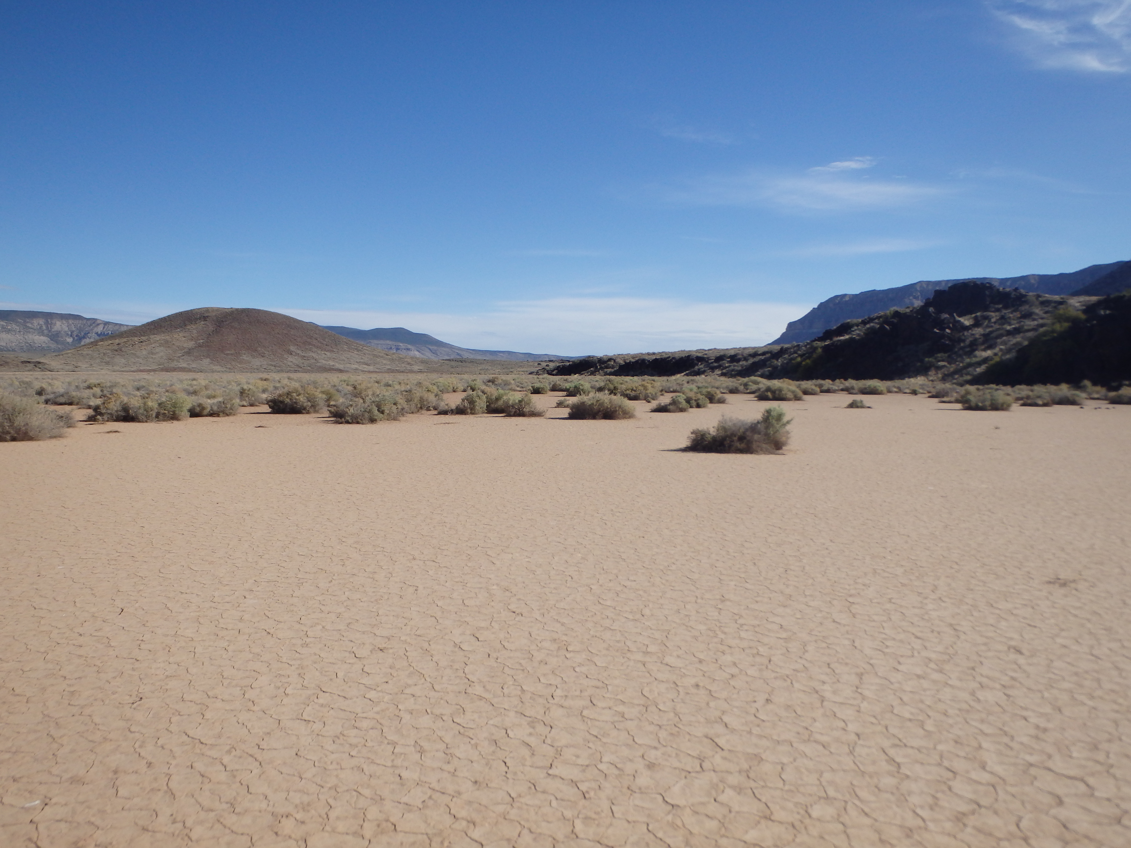
Vulcans Throne is one of the more unusual summits of the Grand Canyon. Unlike the various sandstone and limestone buttes, temples and spires scattered across the canyon, Vulcans Throne is a cinder cone, with fresh volcanic rock spilling down its’ slopes into the Colorado River below. It, along with nearby volcanoes and cinder cones such as Mount Trumbull, would erupt and cause lava flows that would change the course of the river, damming the flow and changing it’s direction. As a cinder cone (and despite the loose rock that goes with it), Vulcans Throne is one of the easiest Grand Canyon summits to climb thanks to the road going to Toroweap, which can get you less than a mile from the base. It is also one of the few summits that don’t require a descent into the canyon, making a climb to the top more of a traditional mountain climb, rather than the typical canyon peak that ends with an ascent back up to the rim. During our first full day at Toroweap, we had hiked the Tuckup Trail in the morning, and I thought we could hike Vulcans from camp fairly easy in the afternoon. The four of us set out heading directly towards the cinder cone, the map showing a pesky 300′ descent into a drainage between us and the summit. Google Earth recon suggested it wouldn’t be too difficult, so we headed off road and into the wash, scrambling down short rock layers towards the summit.

The closer we drew to the peak, the deeper the cleft between us and the summit seemed to be, and after 15 minutes, the girls bailed, preferring to spend their time at the overlook than chasing an obscure Grand Canyon summit. Steve stuck with me, and we continued down the drainage, quickly finding ourselves cliffed out by a 15-20′ overhanging waterfall. Not a great start. We hiked along this cliff to the north, hoping to find a weakness down. A crack looked like it might offer a class 4 passage, but I didn’t want to force Steve into uncomfortable terrain, especially for a summit that traditionally goes at easy class 2.


We hiked along the cliff bands a bit longer before giving up, deciding to give it a run the next morning on the way out. The next day we broke camp by 6:30 and turned down the Lava Falls Trail Road, crossing a small wash before parking at a large muddy turnout near a sunbaked retention dam.
We started out through the sage brush across the parched landscape, the girls quickly falling behind, again not really interested in tagging the summit. With only about a half a mile to the top, we closed in on the base quickly and began working up the steep and loose slopes towards the top. What had looked like a use trail from below turned out to be a mirage, and I led the way up the sketchy pebbles.

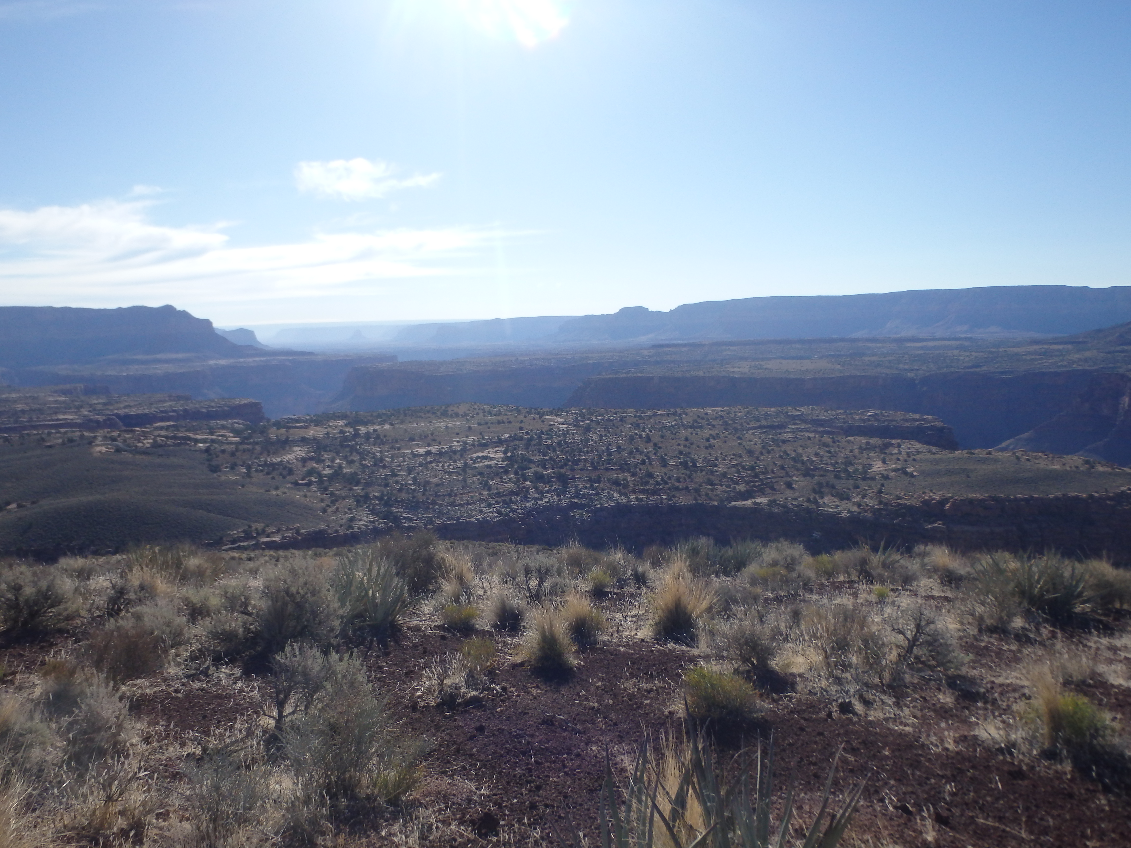
We began to reach the apex of the slopes just as the girls were starting up the base, and I could see them chatting to decide if they should continue on. We pressed on and they were soon out of sight, the grade slowly easing as we neared the broad summit, marked with a large cairn and ammo container for the register. It had only taken 36 minutes from the start. I thumbed through the register to look for familiar names and grabbed some shots of the canyon, with Mount Sinayella in the distance to the east and Mount Trumbull to the north.


We waited briefly to see if the girls decided to go for the summit, but once I saw them working through the sage brush back to the car we started down. I gave Steve a crash course in boot skiing, and we quickly worked down the 500′ in about 8 minutes, our boots completely filled with small pebbles.

Back on the plateau, it was a short hike back to the car, taking just over an hour with about 10 minutes on the summit. It would be the clear highlight of the day, with hours and hours of driving ahead of us back to Phoenix and likely my last trip into the canyon for a bit with the hot summer soon upon us.