
Whale Peak 5349′
Anza-Borrego Desert
Total Time: 4:00
Roundtrip Mileage: 7.7 miles
Elevation Gain: 2500′
Crux: Class 2
Trailhead: Petroglyphs Trail in Blair Valley


Whale Peak sits in the center of Anza-Borrego Desert State Park and is the high point of the Vallecito Mountains. Named for it’s likeness to the giant marine animal by ABDSP ranger Alfred Welcome (I have no idea from what angle), Whale Peak is one of California’s 163 summits with 2000′ or more of prominence, and featured on the Sierra Club’s Hundred Peak Section List. I had wanted to climb Whale Peak for years, but various other adventures in the area (Rabbit, Lorenzens, Toro) kept me from tagging it. But with most of the day ahead after a climb of Sombrero Peak in the morning, it was the perfect opportunity to summit Whale before the long drive back to Phoenix. I left Indian Canyon and drove about 30 minutes to Blair Valley to the Petroglyphs Trailhead, a popular short hike at the base of Whale. I stopped for the short 15 minute hike up Ghost Peak on the way in (only because it’s featured on the Sierra Club’s LPC List) and continued on to the trailhead at the far southeast end of the valley. I started up the sandy trail as it slowly climbs up a shallow saddle separating Blair Valley from Smugglers Canyon. Following the wide trail to the Petroglyphs, I made the mandatory stop at the rock art, protected from the elements by a gentle slope of the rock face.


At this point I had two options- I could head north up Smugglers Canyon and take the first major side canyon east up Whale, or I could continue east up a steeper canyon to the SW ridge of Whale. The steeper canyon looked as though it would be much more direct. I couldn’t find a use trail to nudge me towards one option for the other, so I cut across a number of shallow washes to the base of the canyon cutting up towards the SW ridgeline. In the sandy wash at the base of the canyon I stumbled upon some footprints, encouraging me that I was on the right route.

But about halfway up, the prints disappeared and the sandy slope was replaced by a jumble of boulders and loose shifting rock. I cheated onto the right hand, north facing slopes of the canyon finding the rock to be a bit more solid, but still with plenty of movement to slow progress. I was slowly beginning to regret not trying for the easier route up Smuggler’s Canyon. I finally reached a notch at the top of the canyon and followed this to the ridge proper, giving me my first look at the summit. With Bisnaga Alta wash between myself on the curved ridgeline and the highpoint, it looked extremely far.

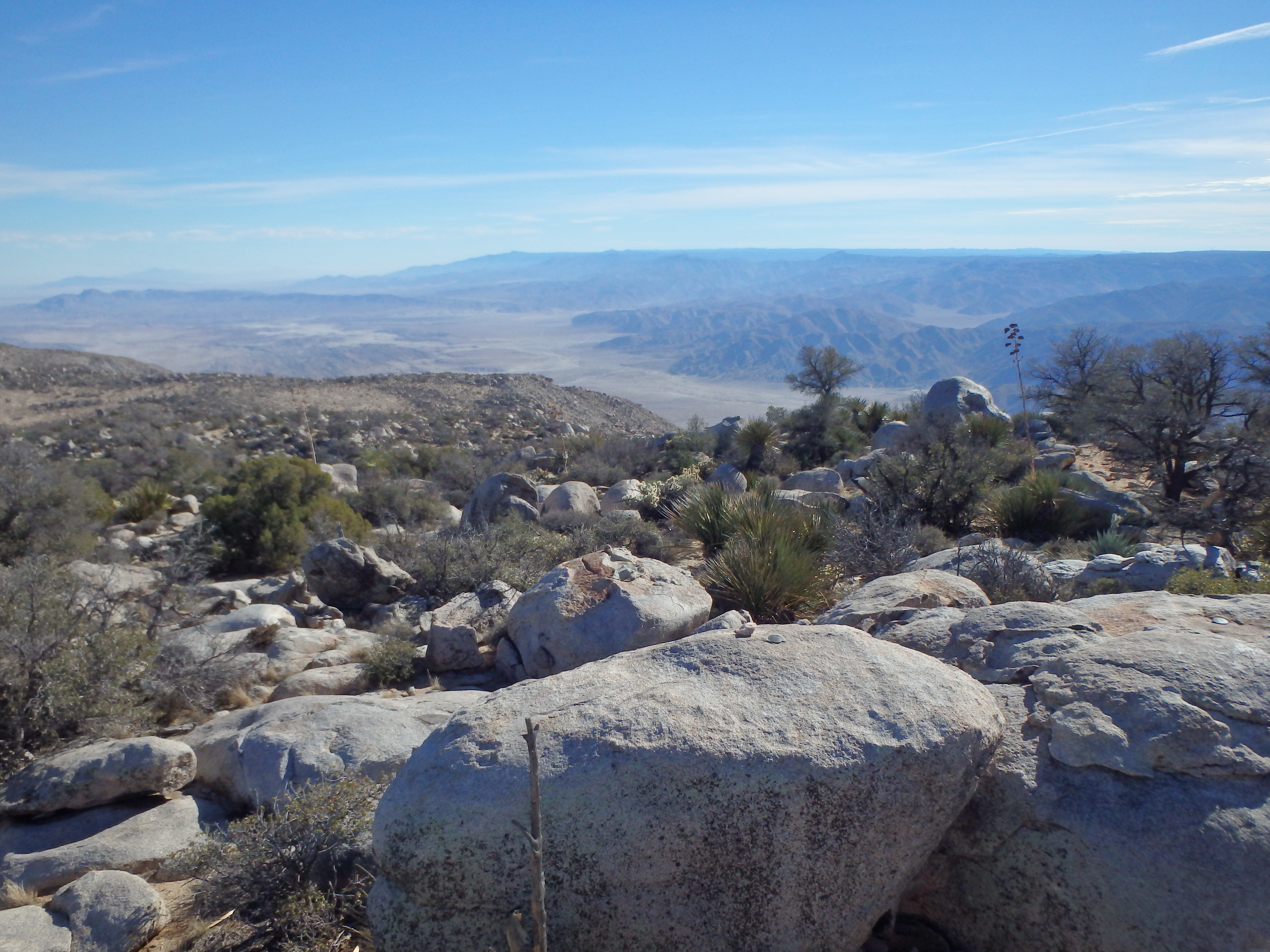
With my work cut out for me, I started up the ridgeline, still no use trail in sight. About 1/3 of the way towards the summit, I spooked a pair of Desert Bighorn Sheep, my second big desert wildlife sighting since the two burros on Picacho Peak the day prior. They scampered off before I could get my camera out, and I continued along the ridgeline. At the final false summit, about 200′ below the highpoint, I finally found the use trail I had been wishing for, coming up from the significantly more popular route up from Smugglers Canyon to the northwest. I followed the trail as it aggressively switched up to the surprisingly broad summit where I scrambled up to the high summit block. The views from Whale were the best of any of the ABDSP summits on the weekend, with views to the NW of the Salton Sea and Salton City. Directly north was Rabbit Peak, Lorenzens and Toro Peak, with the snowy southern slopes of San Jacinto, one of SoCal’s three saints beyond.


I signed in to the overly stuffed summit register in a windbreak beneath the summit rocks before starting my descent. I fully intended to descend the way I came, thinking it would be most direct. But as I dropped off towards the first false summit, I noticed a beautiful trail heading down the NW ridge towards Smugglers Canyon. After days of desert bushwacking, it was too tempting to resist. I followed it as it slowly dropped into a broad grassy upper basin before cutting steeply down into the canyon.
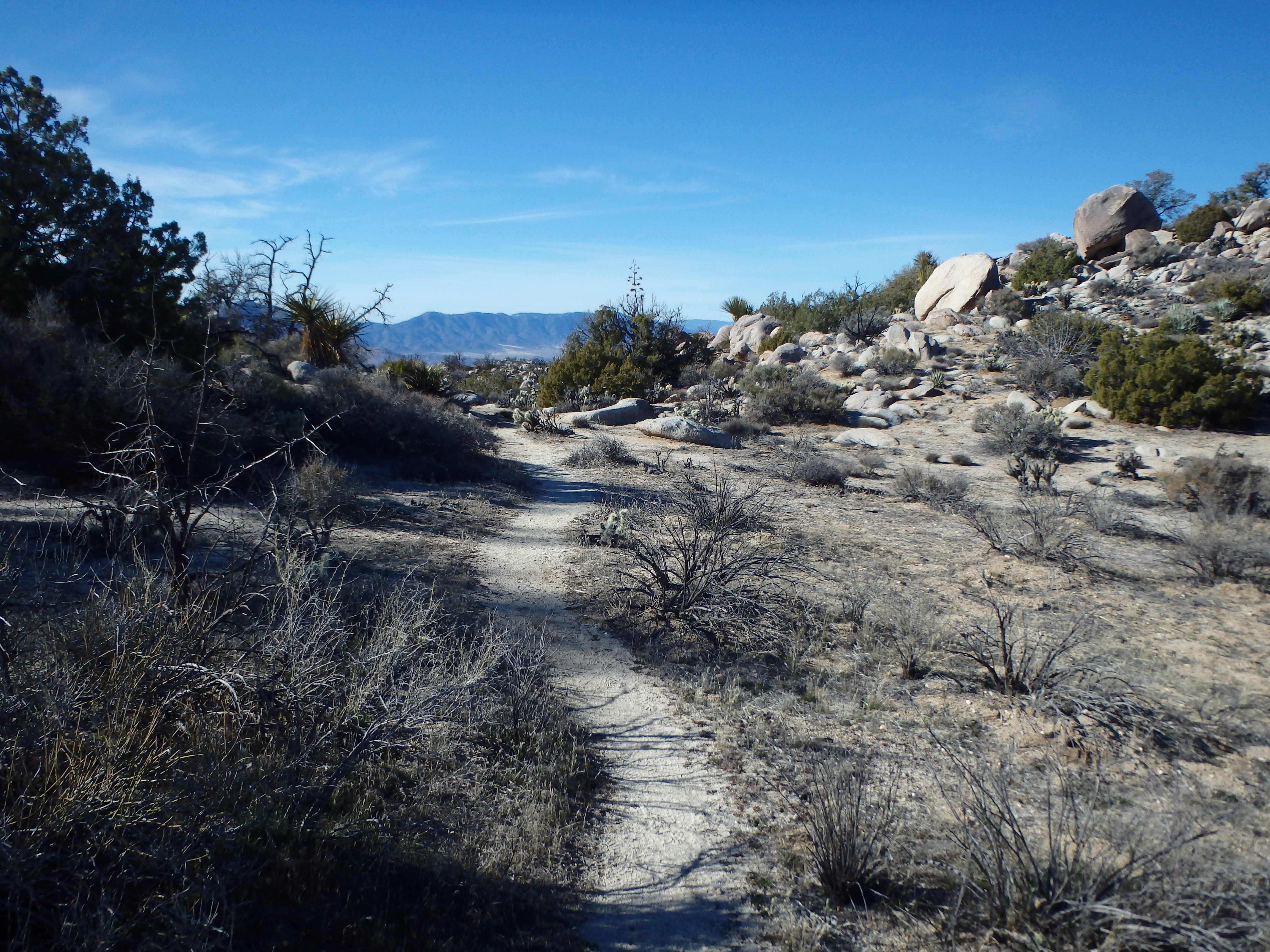
The upper portions of the canyon were sandy and easy to follow, but the further I descended, the more dry falls I had to work around. Overall the route was clean, well traveled, and even had some shade from small trees; I would highly recommend it over my loose ascent route.

The dry falls ended as the side canyon spilled into Smugglers Canyon proper, and I hiked into the open desert, utilizing faint game trails as I worked south back towards the Petroglyphs. A number of people were still hiking in despite the late hour, perhaps taking advantage of the fading desert light for pictures of the rock art. I hustled the remaining section of trail back to my car and tore out of Blair Valley back to I-8. From there, it was a long drive (plus an unfortunate time change) back to Phoenix after a solid 3 days of desert peakbagging.