
Woolsey Peak 3171′
Sonoran Desert
Total Time: 3:00
Distance: 4.6 miles
Elevation Gain: 2000′
Crux: Class 2-3
Trailhead: Agua Caliente Road, High Clearance required for the last 3 miles


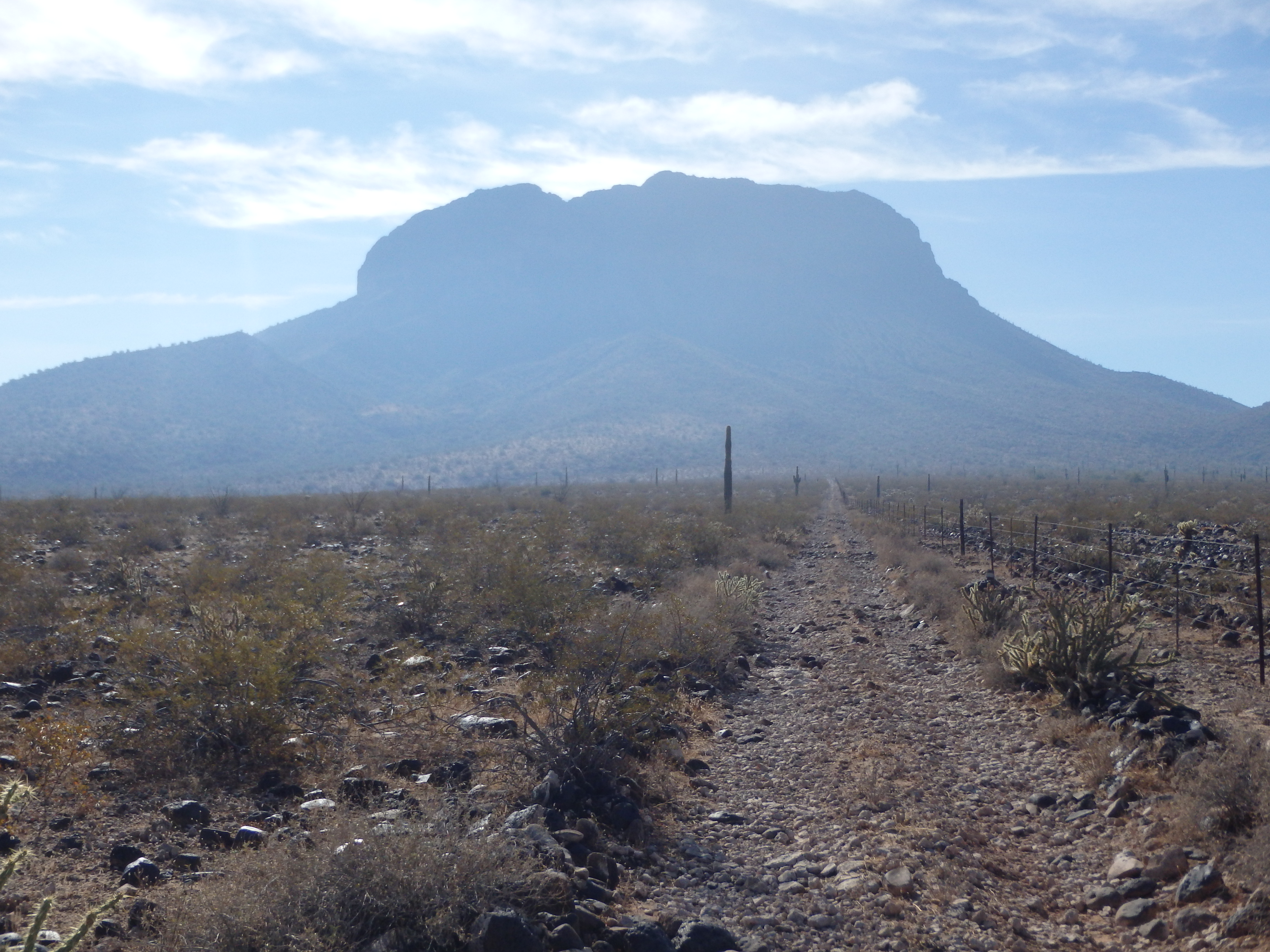
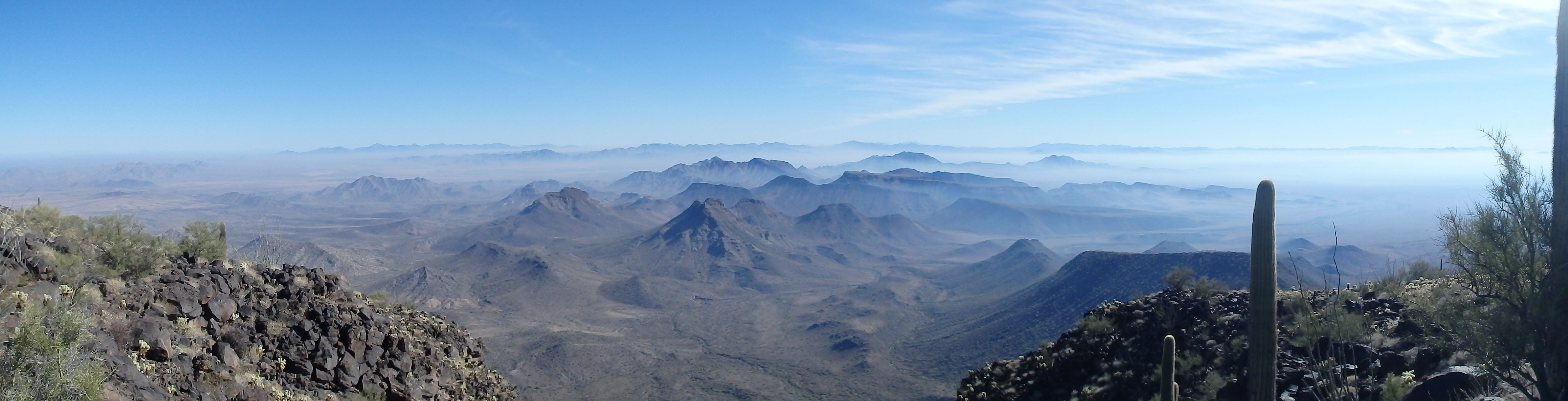
Woolsey Peak in central Arizona is a prominent dome shaped mountain on the skyline of Gila Bend and one of Arizona’s P2K summits. Visible from Phoenix and the I-10 (when the Sierra Estrellas aren’t blocking the way) it was the closest P2K summit to the Valley of the Sun since knocking off Barry Goldwater Peak in September. So with some short morning obligations leaving most of a Friday free, it seemed like a good time to tick it off the list. Although trail-less, the starting point for the remote peak is only about 7 miles from Old US-80, the last 2-3 of which would require high clearance/ 4WD. We had our first big winter storm that week so I was unsure of the condition of the road, but assumed as long as I could drive about 5 of the 7 miles, the extra road hiking would be more than tolerable. Turning off from the farming road of old US-80, the initial dirt sections were pretty easy, and would be passable by most passenger vehicles. The road was reportedly in good shape up until the Old Buckeye Copper Mine 5 miles in, but I encountered a short washed out section about one mile before that which would have been impossible without at least very high clearance, and my AWD kicked in working through it. Reaching the old windmills at the mine, the road entered a wash directly, which was thankfully dry and in reasonable shape. Unfortunately, the climb out of the wash required some AWD, but this section was also short. I basically made it to the end of the road and pulled off at a turn out about a quarter mile from the dead end, ready to start my ascent. A thick haze in the valleys obscured views of Woolsey above and the summit cliff bands looked intimidating as I drew closer.
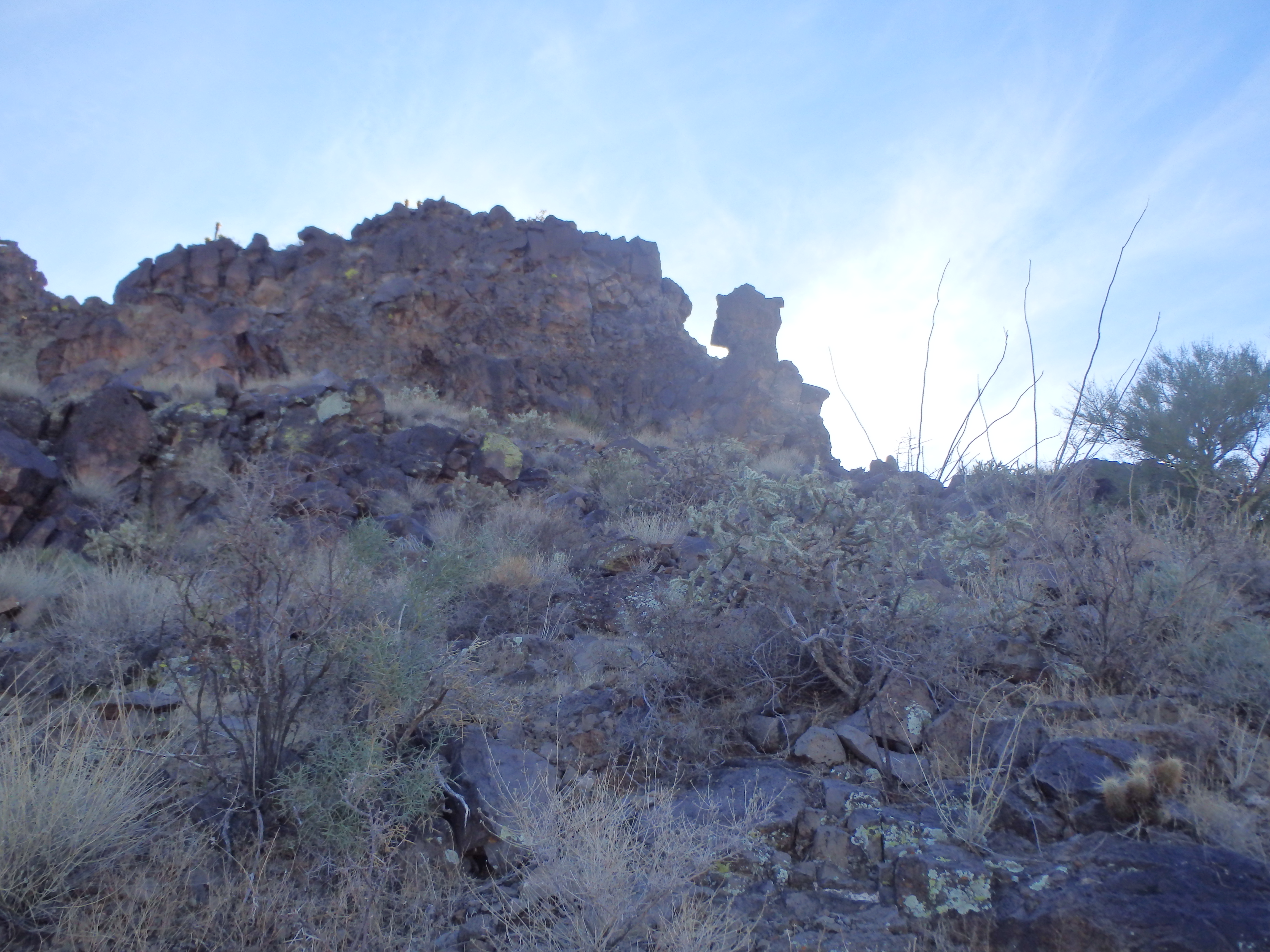
Leaving the car, I followed the last bit of road until it fizzled out, and generally aimed to the southwest towards the saddle between Woolsey and the subsidiary peak 2030′. I cut through some barbed wire just as the slope started to gain some grade. It looked like I was in for a slog, but the dark black streaks of rock were actually very stable lines of talus with very minimal shifting rock. The solid rock made the ascent actually pretty easy and enjoyable and I soon neared the base of the summit cliff bands.
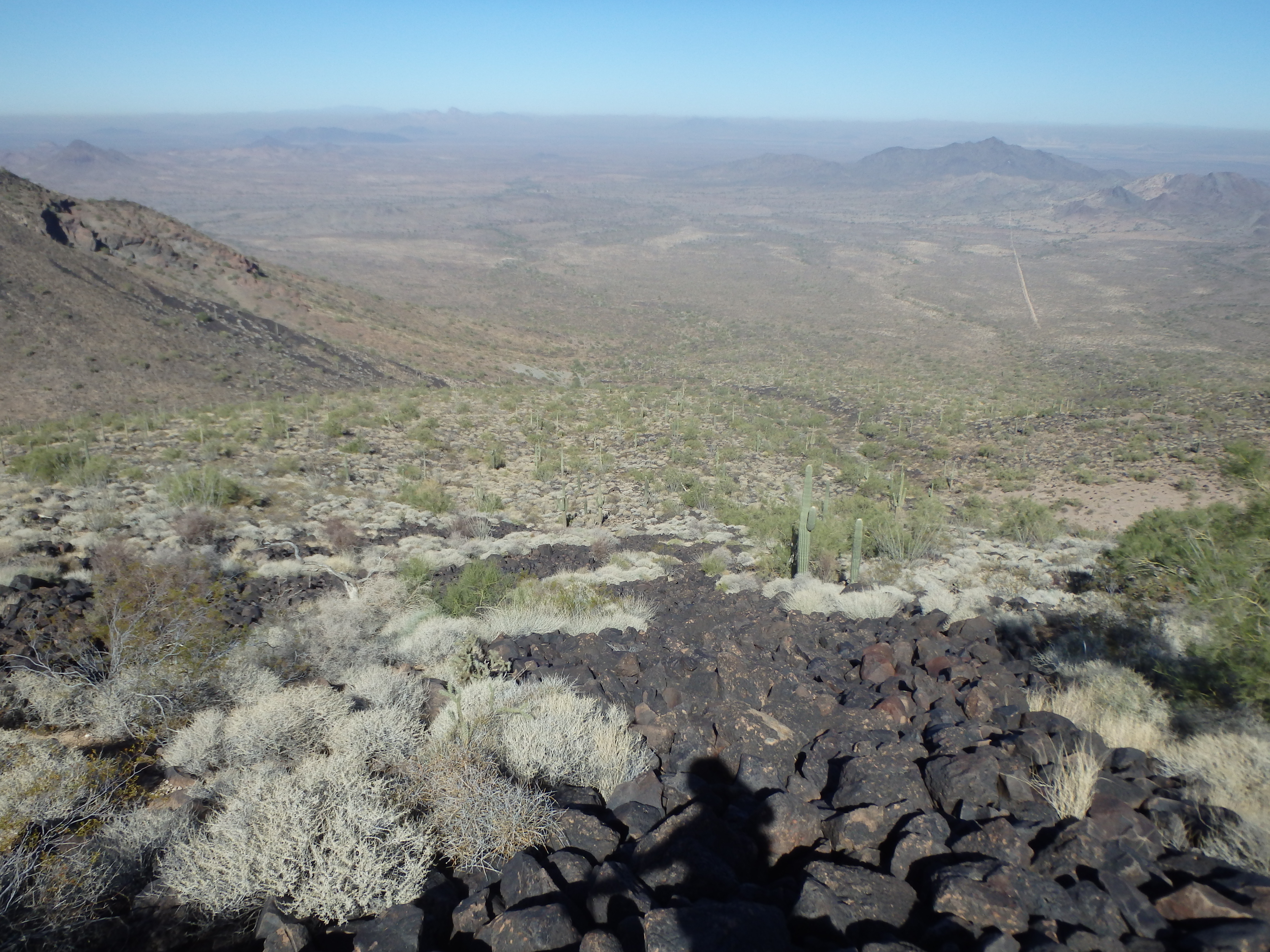
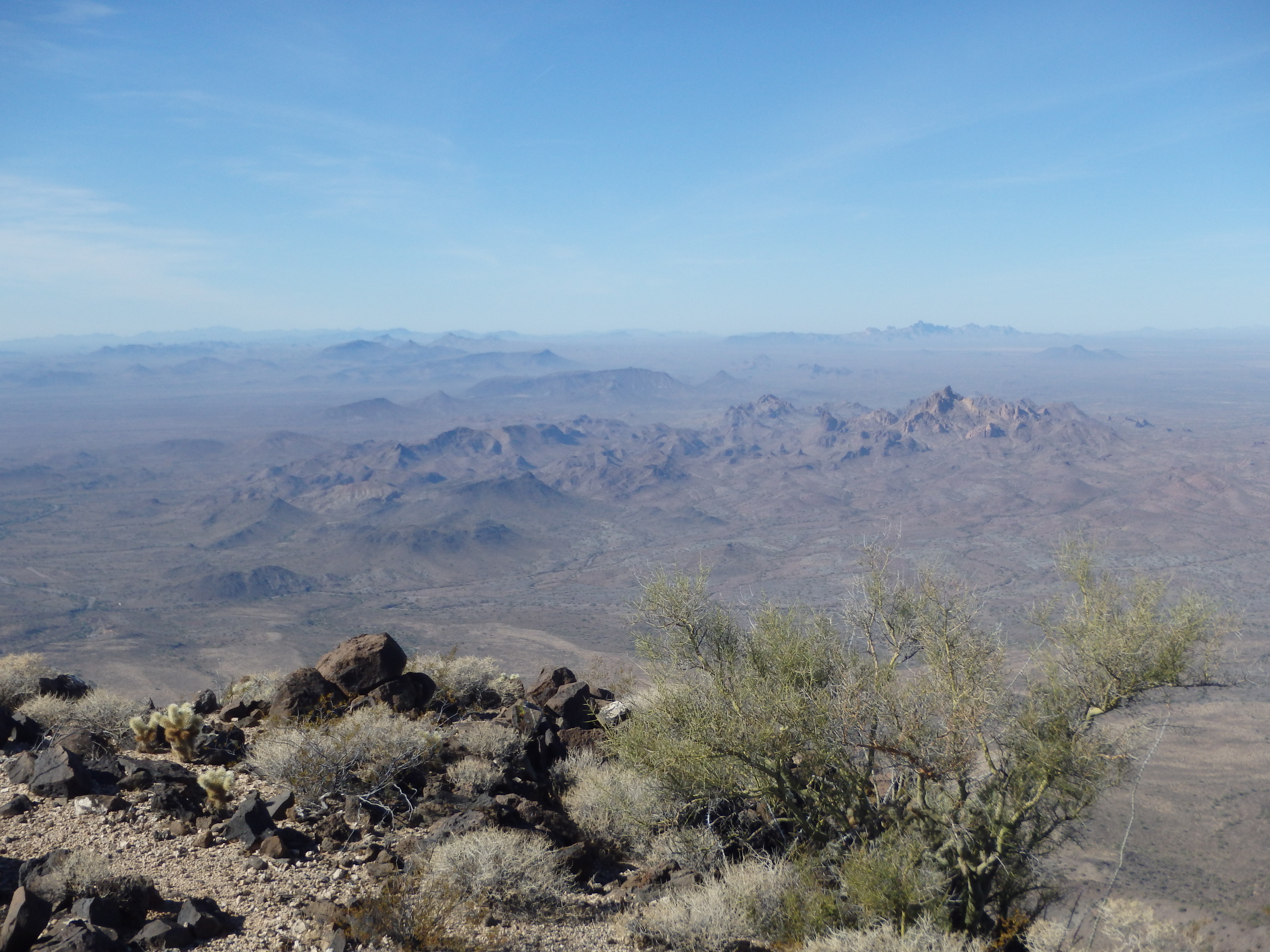
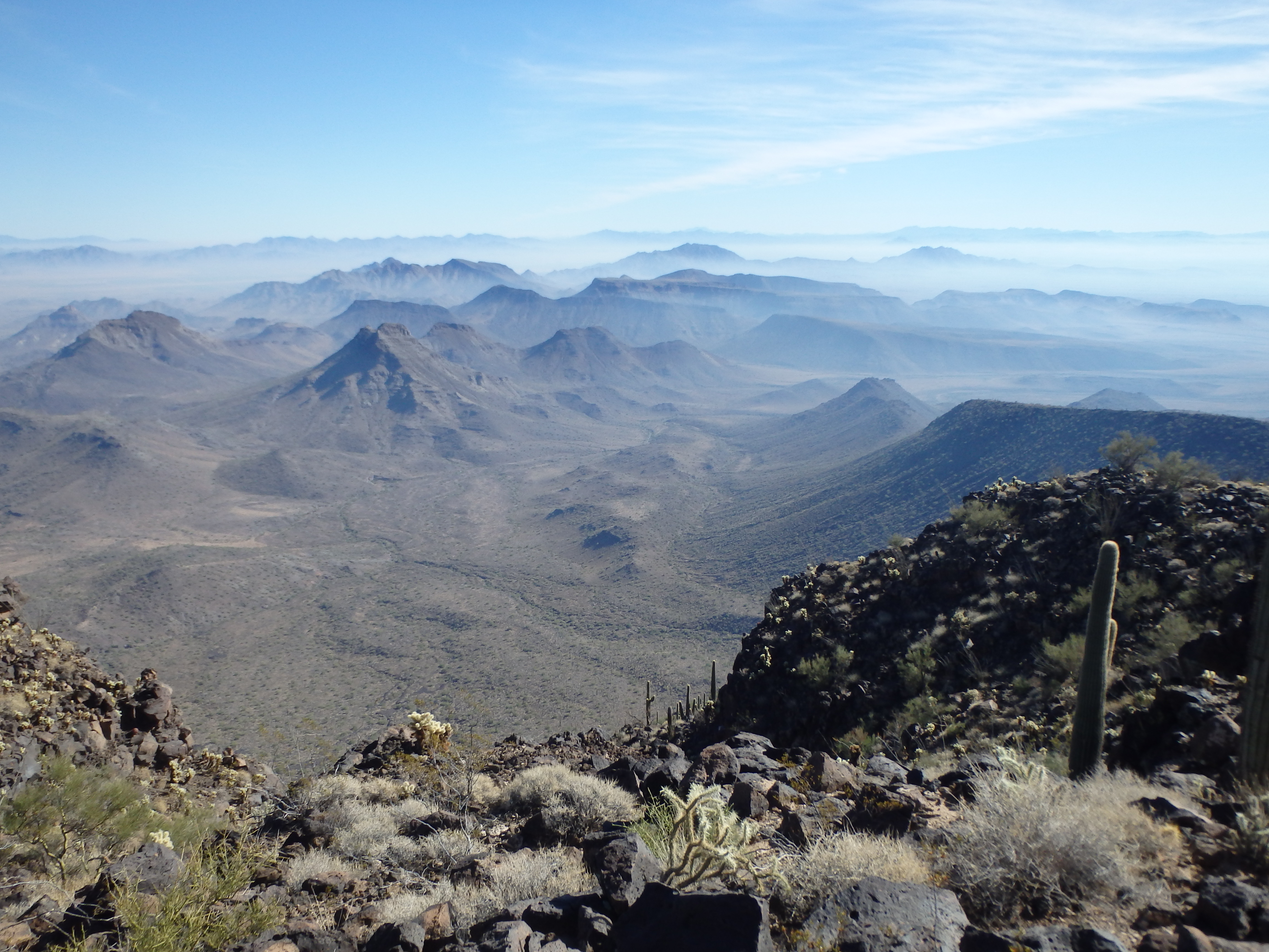
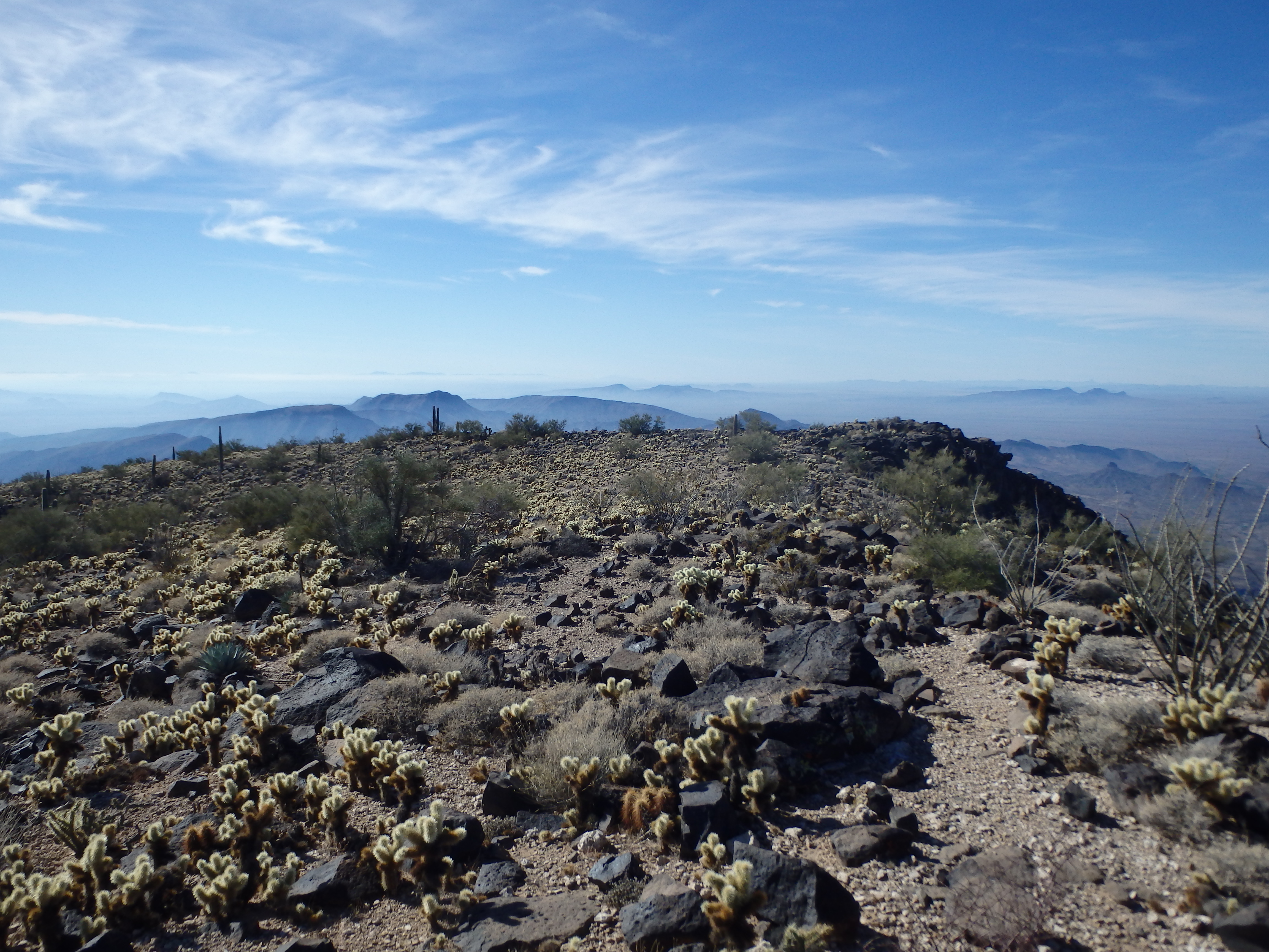
I hadn’t actually researched which gully to head up to reach the summit, but in reality, any of them would have worked, most being a series of class 2-3 ledges. I took the largest gully straight ahead and worked up a number of game trails. The class 2 was looser in the gully, particularly from the recent rains, and I went out of my way to look for more solid class 3 rock. It was a few short rock bands to bring me to the final 30′ of slope below the summit. I was almost disappointed by how quickly and easily the climb went until I hit the summit plateau, and was blown away by the haze shrouding the valleys and dramatically veiling the peaks in the distance.

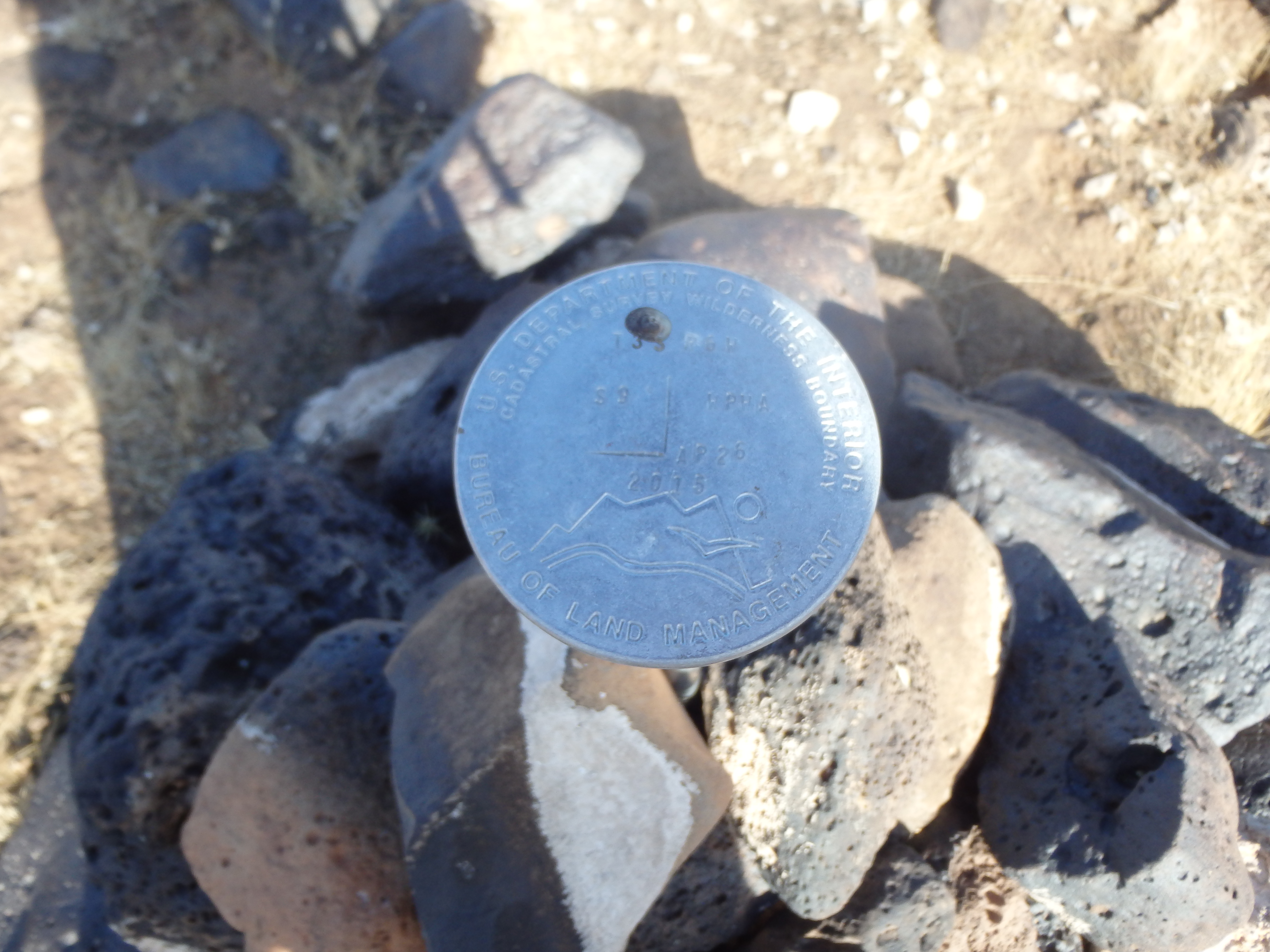
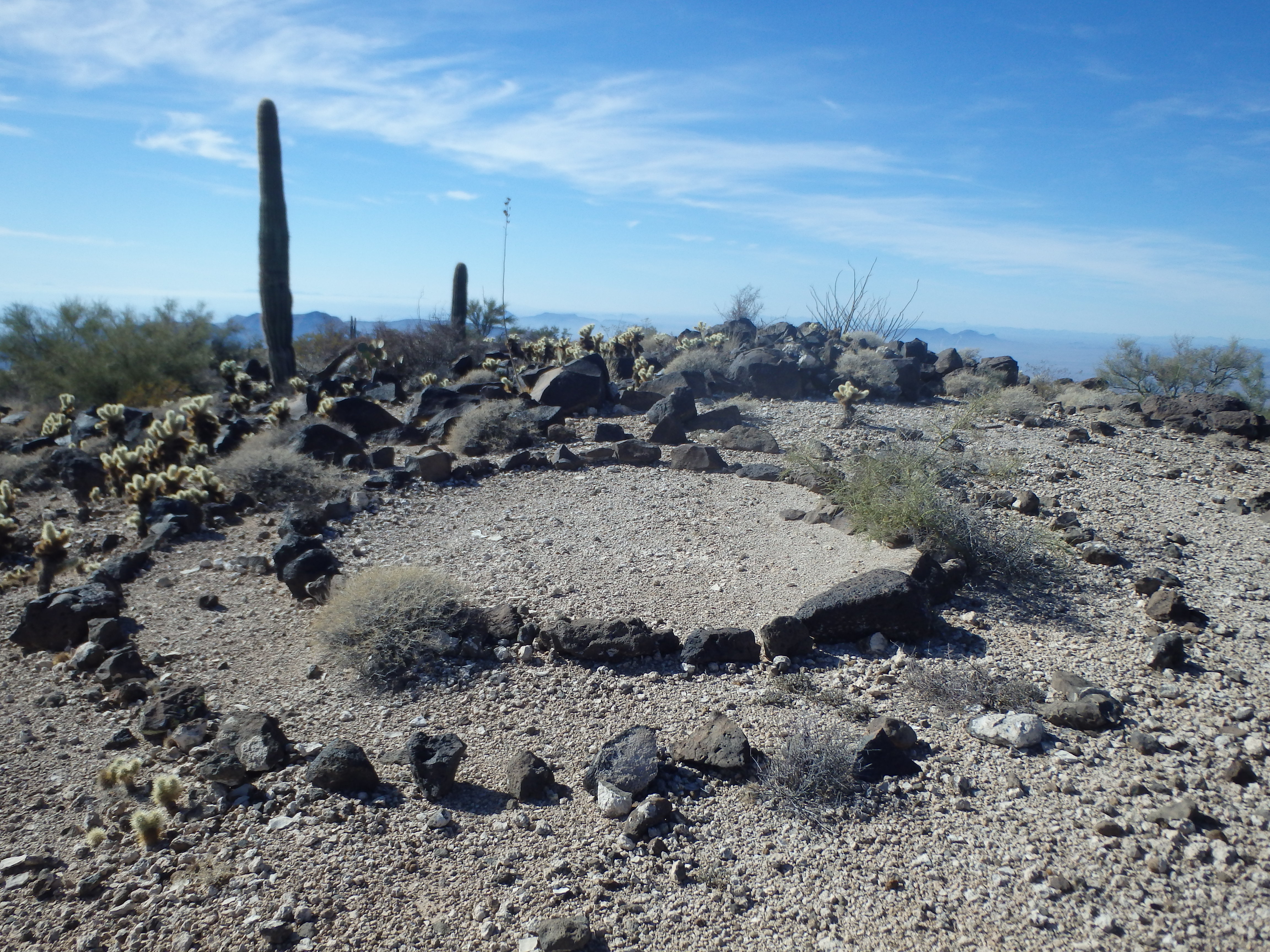
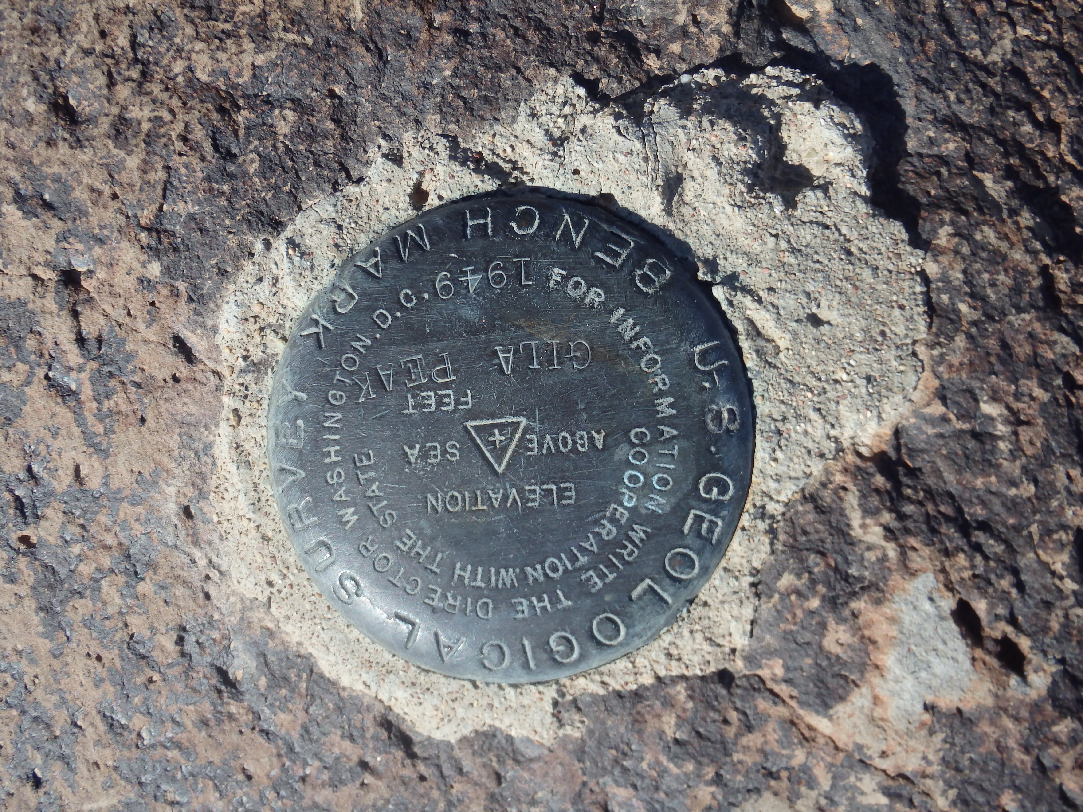
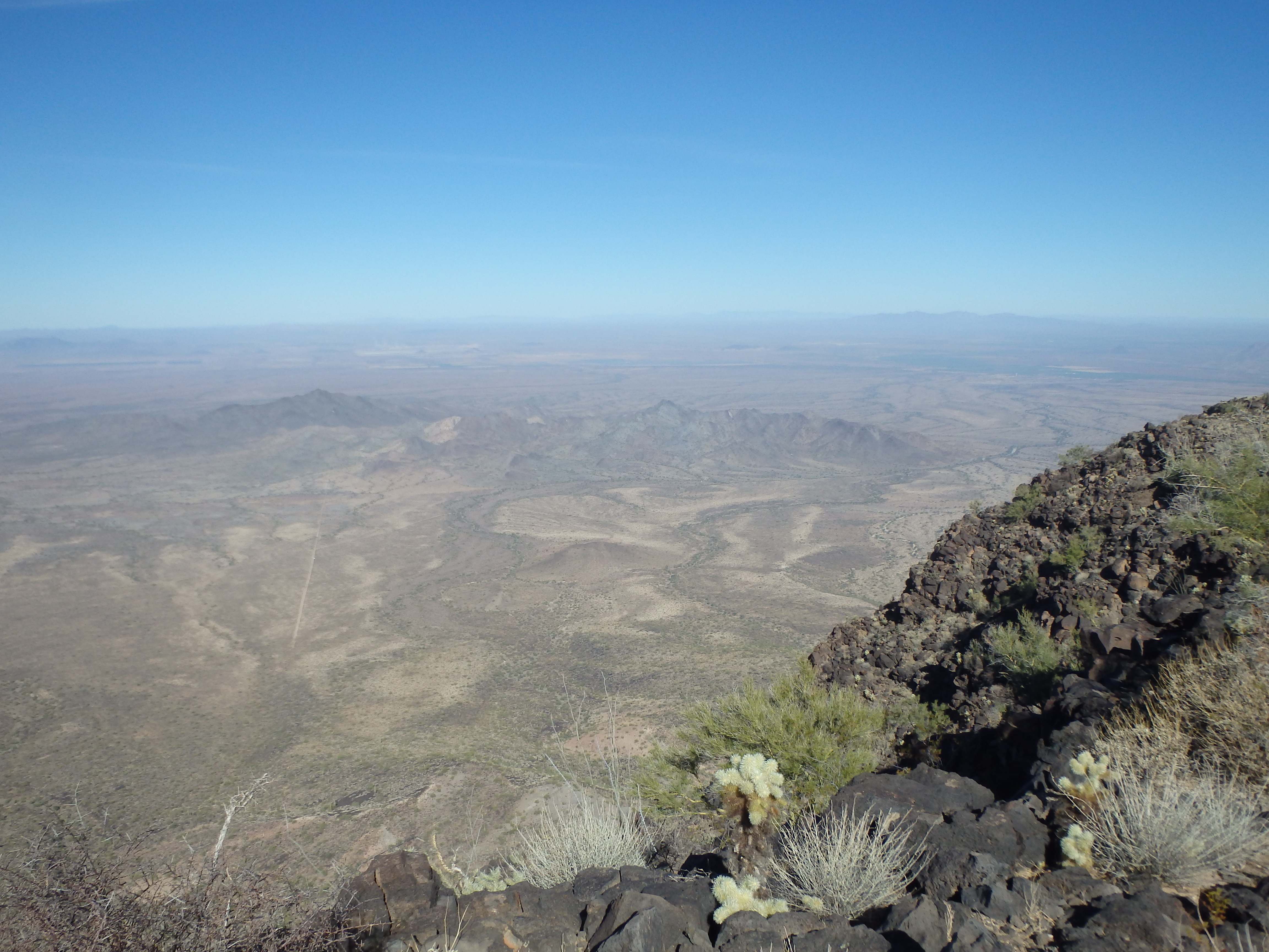
The summit plateau had an interesting rock lined pathway through a cholla cactus garden. I followed it first to the east to an overlook, then back west to a rock circle and summit benchmark. A register at the highest rocks near the summit rim only dated back one year, and I suspected there may be another register buried in the rubble near the BM, although I didn’t feel like digging through the packrat cholla spines to find it. I ate a small lunch on the summit and picked out the various other P2Ks in the distance including Hayes Peak in the Sierra Estrellas to the east, Castle Dome and Signal Peak to the west, and Barry Goldwater to the northeast. I could even just make out Four Peaks far in the distance.
Dropping off the summit back into the cliffed gullies, I initially kept to the class 3 lines providing better traction. When I switched to the loose class 2, I almost immediately fell, catching myself on a buckhorn cholla in typical Sonoran hiking fashion. After that I was a bit less cavalier in my descent, and didn’t relax until I reached the relative safety of the more solid black volcanic talus. From there it was an easy descent back to the old 4WD track to my car, and an uneventful ride out to safer pavement.