
Angora Mountain 10,193′, Peak 10,064′, Coyote Peaks East 10,894′ and Coyote Peaks West 10,716′
Sierra Nevada
Total Time: 16:00
Distance: 30.8 miles
Elevation Gain: 9,300′
Crux: Class 2
Trailhead: Lewis Camp- pit toilets


South of Mineral King, where the western High Sierra transitions to the lower Southern Sierra, there are a pair of Sierra Peak Section summits in contention for the worst summits on the entire list. The two can be combined into a long dayhike clocking in at a little over 30 miles, but in a section of the range that is hot, dry and decidedly less scenic. I usually like to time my 30+ miles outings for the end of summer when I was acclimated and in prime hiking shape, and had originally planned to tackle Brewer +/- North and South Guard. But much of the Sierra was blanketed in smoke from the Garnet Fire, with air quality the best to the south. I had gotten my butt kicked on some of the longer outings within the last year- Mount Kaweah, Mount Cotter and Mount Clarence King. However all of those trips had significant cross country travel, and looking at maps, it looked like I could bag both peaks spending the majority of the hike on trail, greatly increasing my speed and decreasing my suffering. It also looked like I could shave off about a mile in each direction starting from Lewis Camp over the more popular Lloyd Meadows with 300-400′ less overall elevation gain for the day. With those realizations, I somehow found myself in a place not fully dreading tackling both summits as a dayhike, and felt I should capitalize on that feeling before I changed my mind. I spent the night in Porterville, waking up at 3 AM and driving the windy road up Route 190 to the trailhead under a bright full moon. I hopped out of the car to use the pit toilet and hit the button on my headlamp- no response. I pulled it off and checked the batteries- empty. I had grabbed my wife’s headlamp instead of my own. For a 30+ mile outing this was far from ideal. Luckily, between the bright full moon overhead and two power banks I had with me for a phone flashlight, I felt like I could probably get by. Indeed, I only needed to use my phone flashlight for the first 5 minutes of the trail out of Lewis Camp before I entered a burn scar along the ridgeline, the full moon providing more than enough light for the well traveled trail.

Dawn was beginning to break as I reached Jerky Meadows and I continued along, descending another 1,000′ of trail to the bridge across the Little Kern River. I had traveled close to 4.5 miles in only about 1:15 and felt I was off to a good start despite the lighting difficulties.


I took a short break and then headed directly upslope from the trail, one of my few planned cross country sections for the day, bypassing a long unnecessary switchback to the east that was described in Bob Burd’s trip report, one of the few detailed ones I could find. I was still in the burn scar as I started upslope, although it was mostly knee high grasses and ashy dirt rather than any difficult bushwacking. But this grew progressively worse the higher I climbed, the grasses replaced first by scratchy sagebrush followed by buckthorn, wild rose and a number of other spiky plants. I used fallen logs where I could to get over the worst of it, and kept checking my GPS to try and refind the trail as soon as possible. It was a bit demoralizing when I did reach it- completely overgrown from the same thorny plants and almost completely erased by fire in spots. The trail had received little to no TLC since the Castle Fire in 2020 and clearly little traffic in the intervening years.


I struggled to follow it as I worked west towards Deep Creek. The forest immediately surrounding the creek had fared a bit better in the fire and I was able to find and keep on the trail, following it another half mile to where I expected to find a junction to a trail junction. Unfortunately, I reentered a severely burned pocket and the trail junction was completely lost in ash and thorny brush. Further demoralized, I set out north cross country, hoping to intersect the trail further up where it looked a bit less torched. After some bushwacking through buckthorn I found the trail and took it back to Deep Creek. Since the Creek had seemed to have provided a bit of a buffer to the Castle Fire, I hoped the worst of the day was behind me and that I would be able to stick to trail all the way to the summit ridgeline. Initially this was true, and I was able to follow the trail a solid 1.5 miles along the edge of Deep Creek, losing it at times in small pockets of burned area but refinding it easily enough. But I eventually hit a wall of thick buck thorn, this pocket some of the thickest of the day with some of the buckthorn nearly shoulder height and no obvious game trails through. I tried crossing to the other side of the creek, following the creek bed directly, but found little luck. Somehow my long day of almost all trail was turning into a day of almost exclusive painful bushwacking. I looked up towards the summit of Angora Mountain and my eyes followed a steep ridgeline that seemed to extend nearly to the summit. The trees along the ridge looked healthy and green, and I guessed that if that ridge had burned, it would be minimal brush. I decided that this was becoming the only tolerable option, certainly if I still wanted to tag both summits, and I dropped into Deep Creek to filter some water, not expecting to find any other sources along the ridgeline. Pulling out my Sawyer, I was surprised to find the O-Ring missing, with an incomplete seal between the filter and the unfiltered water bottle, causing a significant leak. It was almost laughable how many things were going wrong so early into such a long day, and it took me about 3x as long to filter a liter of water with the leak. With 2 liters finally filtered I cut across the brush in a shallow drainage to the ridgeline running off Angora Mountain. This worked about as well as I could have hoped, with portions of the ridge completely unburned along with some smaller burned out pockets that were easy enough to avoid or push through.

I hit a shallow saddle below Point 9208′ and traversed northeast directly towards the summit. The final few hundred feet to the top was a field of enjoyable boulder hopping, keeping me above the manzanita and offering a bit of solid scrambling, a nice break after the brutal bushwacking and steep cross country. I topped out at 11:15, my pace about 30 minutes slower than Bob Burd’s effort, although it was probably unfair to use that as a reference considering our routes were now almost completely different between the burned out trail and ridgeline ascent. I took a short break and perused the summit register dating back to 1969, most years seeing only a handful of ascents. I recognized the majority of the names from the past few years, all fellow SPS chasers, with no other reason anyone would force themselves to tag this mountain. I fully understood why this peak is considered one of the least enjoyable on the list.


After a short snack I dropped to the north, going up and over Peak 10,064′ before finding the trail at the saddle above Grasshopper Creek. I had been seriously debating whether it was worth continuing to Coyote Peaks or to call the sufferfest a day and head back after Angora. But the thought of ever having to return to bushwack through those thorns was enough for me to press on, continuing across the trail cross country along the ridgeline. It was brushy but straightforward travel for about a mile until I reintersected the trail, the landscape transforming dramatically from thinned partially burned pine forest and manzanita to open sandy ridgeline dotted with foxtail pines and large granite outcroppings.

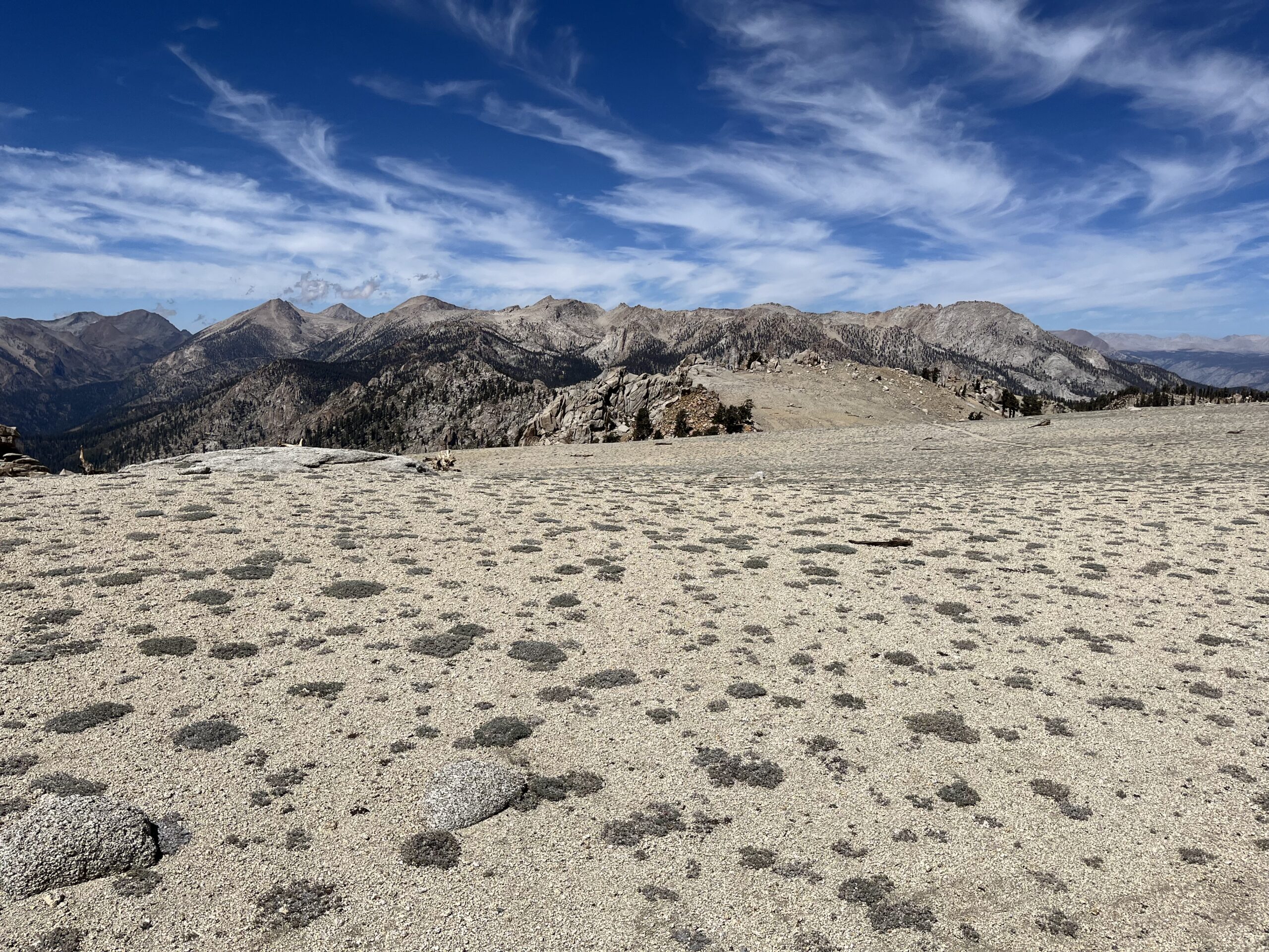
The trail here was well defined and the route was suddenly significantly more pleasant. I followed the trail, skirting the unnamed peak of 10,900′, which would actually be the high point for the day. I decided to skip the summit, with under 1,000′ of prominence, it would not be a peak I would need to return for.

The trail began a sandy descent down to the saddle with Coyote Peaks, the eastern summit being the higher of the two. Similar to Peak 10,900′, I decided to skip the bonus tag of Coyote Peaks West, skirting the south face across some cliff bands to the connecting saddle. From there it was straightforward class 3 scrambling to the summit, topping out at about 2:30 PM and taking about 3 hours from Angora.


The summit register for Coyote Peaks East was even older, dating back to 1964 with many of the same names in the final few pages. The views from the summit were much better than on Angora, with a close up look of Mineral King and Farewell Gap to the north and the Whitney region in better view to the northeast. I took a short break and polished off the rest of my lunch before starting the long descent back to the trailhead.


Dropping off Coyote Peaks East, I decided that going up and over the West summit would actually be a bit faster than the sandy traverse, so I went up and over the bonus summit, not breaking stride as I passed over the high point. After the summit break, I had a bit more energy to regain the trail around 10,900′, again passing on the bonus peak as I hoped to at least get back to the bridge over the Little Kern River by sunset, not wanting to bushwack in the dark with my cell phone flashlight as my only light source. The traverse back to the saddle above Grasshopper Creek was uneventful, with the biggest question of the day now ahead of me- how far could I follow the trail back to Deep Creek before it disappeared into burn scar and thicket. The answer was- not long. I was able to follow it intermittently for about 1 mile before losing it completely around 9,600′.

Without the trail, there was little reason to try and follow the topo, and I took a direct line downslope, aiming for the creek just above where I left it on the ascent. This actually worked out incredibly well, finding a line with minimal burn and great sand and pine duff to plunge step down. I hit Deep Creek at a small meadow and followed it a bit further to the worst section of the burned out area, intersecting my ascent route and stopping to filter water for the first time since that morning. I was now close to 13 hours into my day with about 8 miles to go to get back to the car, a little under half of that through cross country brush. With only about an hour to sunset, I picked up the pace, deciding to parallel Deep Creek as long as possible in hopes of finding a less burned and more direct line back to the Little Kern River Bridge. This worked fairly well, as the creek ran over granite slabs and small pools.

I trended above the creek to the east to pick up my ascent track above Point 6162′, and followed this as best I could just as I began to lose the last bits of light, the sun dipping into a layer of clouds to the west. I was almost back to the trail in faint light when a juvenile rattlesnake made itself known just a few feet from where I stepped, another reason to get back on the trail as quickly as possible.

From the bridge it was 4.5 miles and 1,800′ of gain to get back to me car, and although almost completely dark, the trail was sandy enough to not need to use my phone for the first half mile. After stumbling on a rock, I pulled out my phone for the rest of the hike out, the 35% remaining battery enough to get me back with juice to spare. I somehow found a second wind in the final stretch, and aside from scaring a lone cow (and in the process myself) in the pitch darkness, the hike out was fast and uneventful, hiking the final 4.5 miles and 1,800′ of gain in 1:45 and finishing the day in 16 hours even. Despite a good deal of suffering, I was pretty pleased with my time, with all my other 30 mile efforts taking several hours longer and this day requiring quite a bit more cross country travel then I had anticipated. I hopped in my car, stopping for In’N’Out in Tulare for a very late dinner before getting home shortly after midnight for work the following morning.
I’m dreading these two by far the most among my last dozen SPS summits. I was hoping to get around to them this year, but it looks like it’ll be next year instead. 30 miles with buckthorn-whacking, late in the year, for a couple of mediocre peaks… Nice job getting them done with nothing but a phone for light.
Thanks! It was somehow both a little better and significantly worse than I was expecting. Now knowing the conditions, if I were to do it again I would follow my descent track from the bridge to Deep Creek, then try and get cross country on the ridgeline up to Angora as quickly as possible. Descent I would keep the same. Definitely doable.