
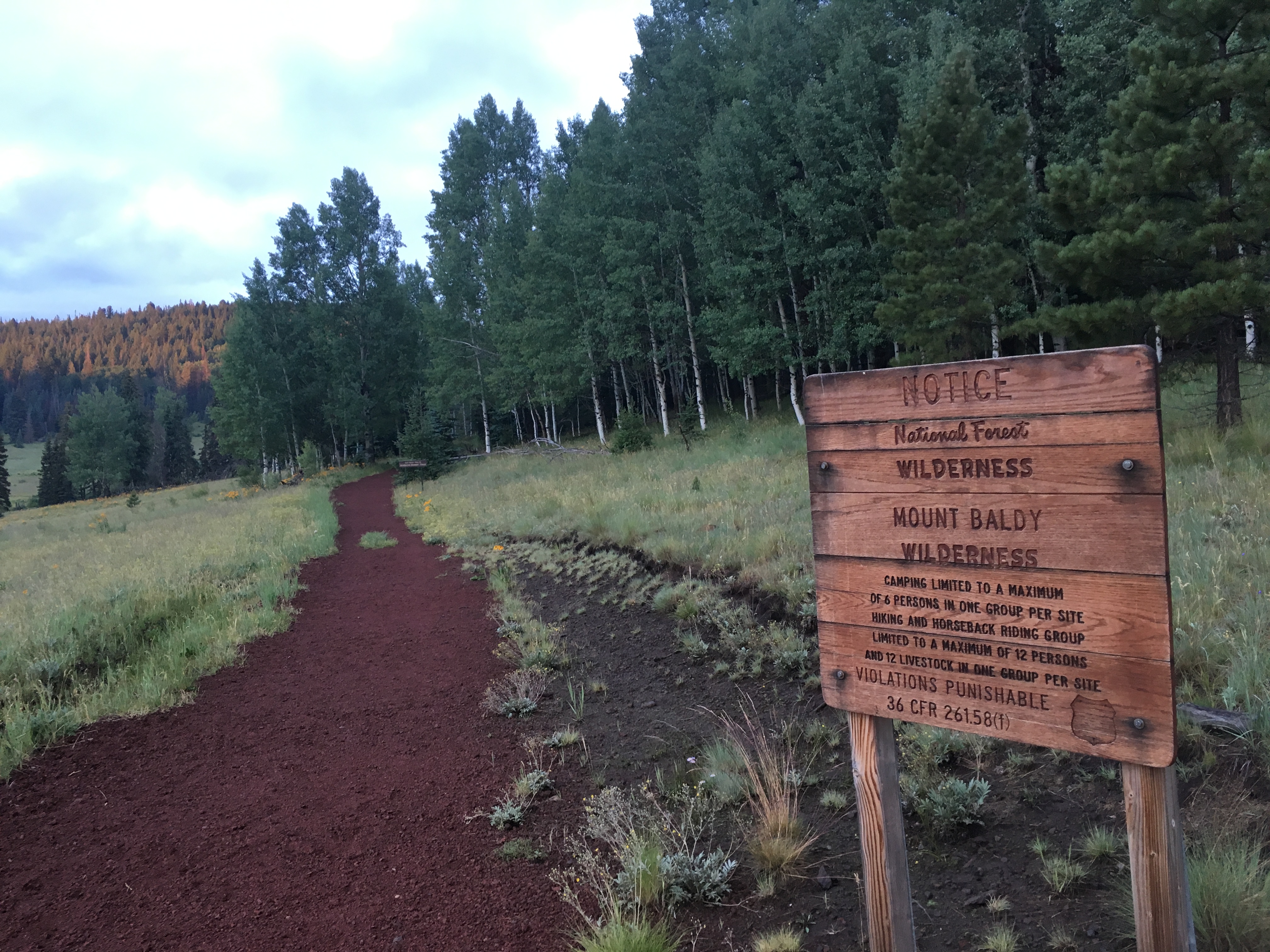
Mount Baldy 11,421′
Apache-Sitgreaves National Forest
Total Time: 8:20
Roundtrip Mileage: 16.5
Elevation Gain: 5200′
Crux: Class 1
Trailhead: East Baldy Trail, no services


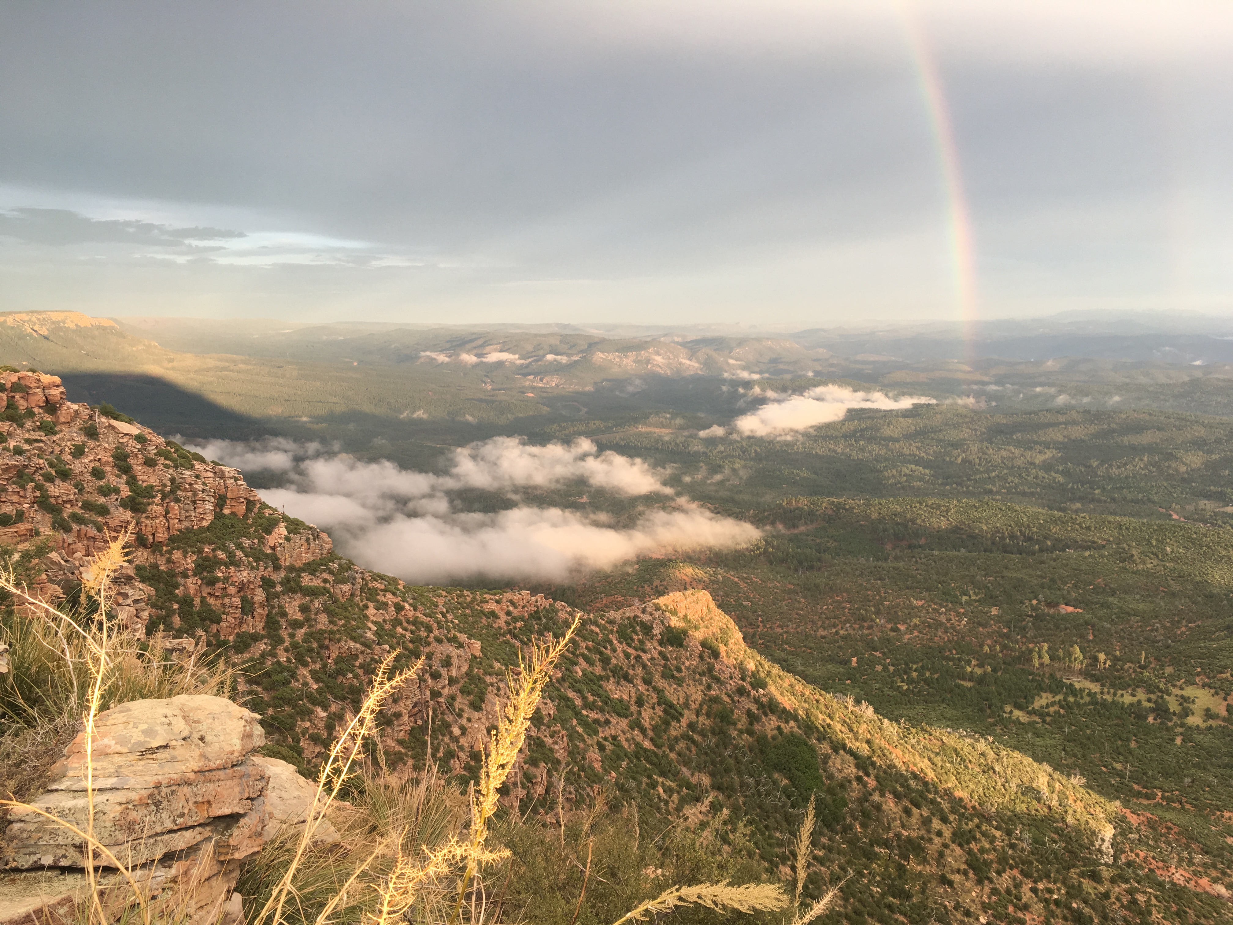
Arizona is a state better known for its desert, not its alpine. Even though the beautifully varied state has deep canyons, sky island mountains and raw Sonoran desert, not much terrain breaks above treeline. Humphreys Peak, Arizona’s highest summit, is by far the most well known, climbed by 1000s of people each year. It features a number of subpeaks, of which only Agassiz and Fremont break 11,000′, with a number of others over 10k. Outside of the San Francisco Peaks, the second highest mountain in the state of Arizona is Mount Baldy. Originally named Mount Thomas, Baldy sits in far eastern Arizona in a portion of the state that receives the highest amount of rainfall each year. Because of this, Baldy is the headwaters for many of the major rivers in Arizona, including the Little Colorado River which drains in to the Grand Canyon, and the Salt River which runs through Phoenix. The Apache hold the treeless summit sacred, and it lies entirely on tribal land. Hikers in Apache-Sitgreaves NF can follow a large loop up the eastern slopes to about 11,000′, with the higher southern summit only open to those with permission from the tribe. I had wanted to climb Baldy since moving to Arizona, but the combination of busy summer weekends and the 4+ hour drive from Phoenix meant I didn’t have an opportunity until the start of my third year in the Grand Canyon State. So on a weekend off, I drove up on a Friday after work towards Show Low and Pinetop with a plan to climb Mount Baldy, as well as Escudilla and the Greenlee County Highpoint in the Blue Mountains. I drove through afternoon monsoons up the 87, grabbed dinner at the Payson Pizza Factory (“We Toss ‘Em, They’re Awesome!”) and drove up to the Mogollon Rim to Myrtle Point, the highpoint of Gila County. It was nearly 20 miles of dirt road along the rim to reach the small spur to Myrtle Point, which I wound up driving too far down missing the highpoint. I eventually found the red canister and register (full, with no pen) and enjoyed the setting sun and rainshower before driving the rest of the way to the Baldy TH that night.
Baldy has two trails on it’s eastern slopes, curiously named the East and West Baldy Trails (they are oriented north and south of one another), and I decided to ascend via the East Baldy Trail as it looked like it followed a ridgeline that would have better views on the ascent. I started hiking at 5:30AM with the sun barely up, clouds still lingering from the rain the night before. The trail started at over 9,000′, so with only about 2300′ spaced out over 7 miles up, the grade wasn’t too steep as I followed the gentle trail across grassy subalpine meadows.


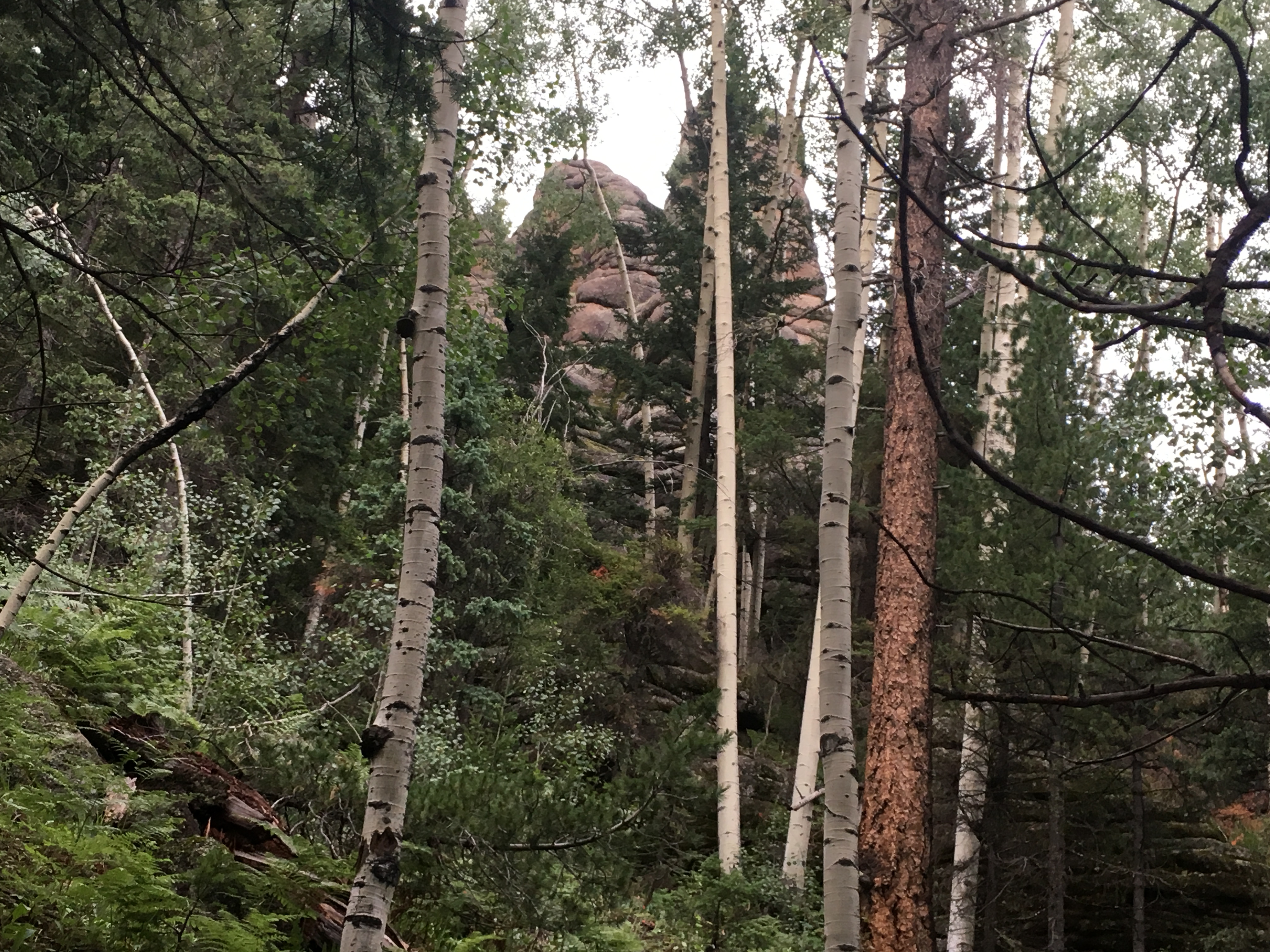
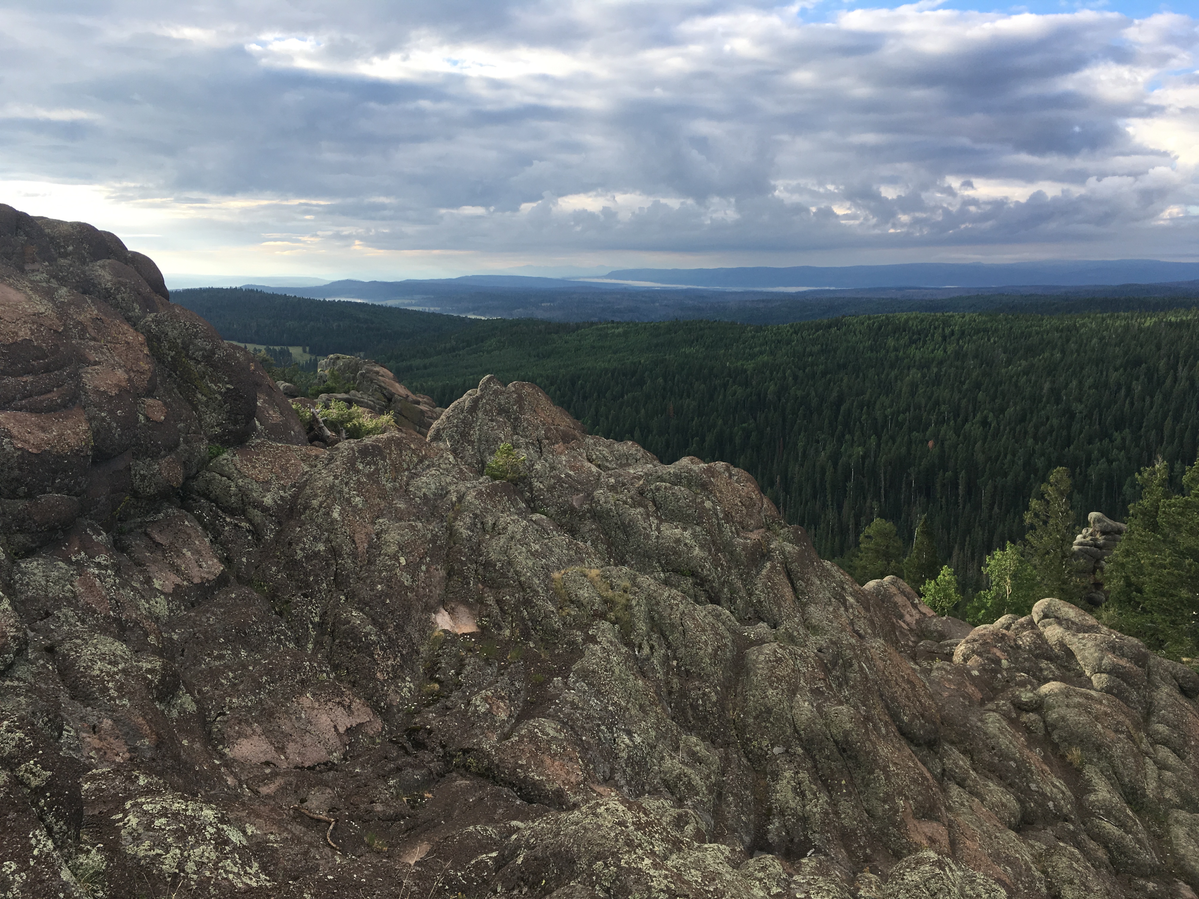
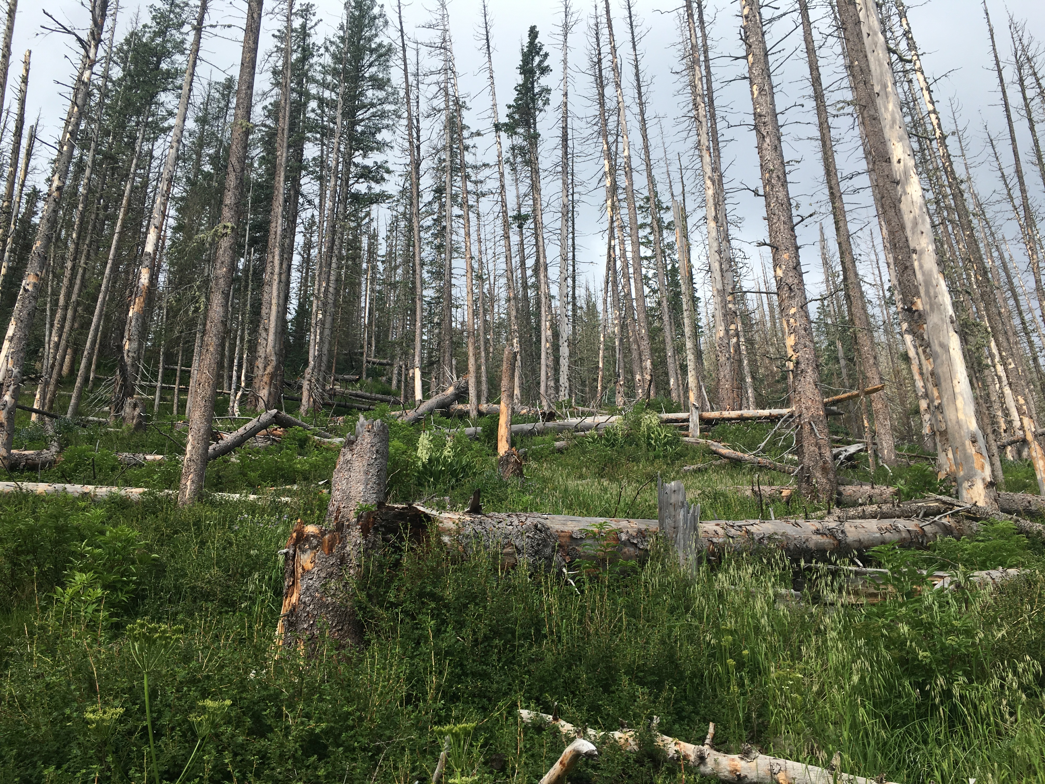
In viewing the topo map, it looked like Baldy’s east ridge was particularly rocky, but as a shield volcano, I was mostly expecting some volcanic scree. But as I drew closer to the ridgeline, I was surprised to find somewhat dramatic rock spires, some well over 100′ in height. As I hiked through the forest on the gentle ridgeline, the rock spires seemed to grow only higher, and I surmised it would be an excellent place to rock climb (I could find nothing on developed routes after a brief online search). The trail switchbacked under the largest formation and weaved through the volcanic spires to the apex of the ridgeline, giving me my first views of Mount Baldy for the day.


I took a short break here, the summit still looking far off, but the trail being fairly direct. The sub-summit along the eastern ridgeline just before the summit of Baldy was known as Mount Thomas, and I eyed the slopes, planning to tag it en route. Although the ridgeline was somewhat undulating, I reached the base of Mount Thomas fairly quickly, and started up the series of short switchbacks as it worked around the lesser summit. Near the last switchback, I left the trail heading steeply uphill through the pines and duff to the surprisingly open summit. The west end was tree covered, obscuring views of nearby Baldy, but it did offer nice views across to the West Baldy Trail and headwaters of the Little Colorado River below.

The weather was improving, but the clouds west of the summit weren’t quite burning off like I had hoped, so I clambered off the summit through the forest and down to the saddle near where the East and West Baldy Trails meet near 11,000′ and the Apache Tribal Boundary. The GPS map showed the tribal boundary cutting straight to the west, cutting between the north and south summits, the north summit being entirely on National Forest Land. In retrospect, this may have been a bit off, and I have since found a lot of variability in where the boundary is shown on the maps. From below, the north summit actually eyeballed higher, and I thought I could have my cake and eat it too- not trespass on tribal land and still tag the highpoint. I continued on the West Baldy trail as it contoured around the base of the north summit. My GPS did not show any use trails in the area, and the main trail entered an old burn area, with a good deal of downed logs and thick brush. I started to hike past the highpoint and the trail began to descend, so I abandoned hope of finding a use trail and started up through the brush.
Everything was still wet from the morning dew and I had trouble finding footing on the wet, steep ground. On top of that, the brush was almost all thorned, ripping at me with every step upward. I tried staying above the brush by tightrope walking from log to log. It reminded me of jumping across the furniture as a child playing ‘the floor is lava,’ but instead of lava, I was dealing with sopping wet thorns. Fun stuff. About halfway up from the trail, the burn area ended and the thorns along with it, and I found easier ground up steep pine forest and duff, topping out on the long broad ridgeline of the northern summit and huge summit cairn on top. Although the north summit had eyeballed higher from below, that was mostly due to the scattered trees along the summit ridge, and the southern summit was slightly higher, at most by a few feet. I decided to respect the tribal wishes and not hike to the south summit. This is by no means a high horse- I’ve done plenty of stupid things in the name of peakbagging, and with no one around, it would have been easy to quickly run up and back. But I figured I could count this summit without breaking any laws or treaties, just this once. Slow. Clap. Although, again in retrospect, the tribal boundary on my GPS and other maps doesn’t quite match, so I may have trespassed anyways without meaning too….


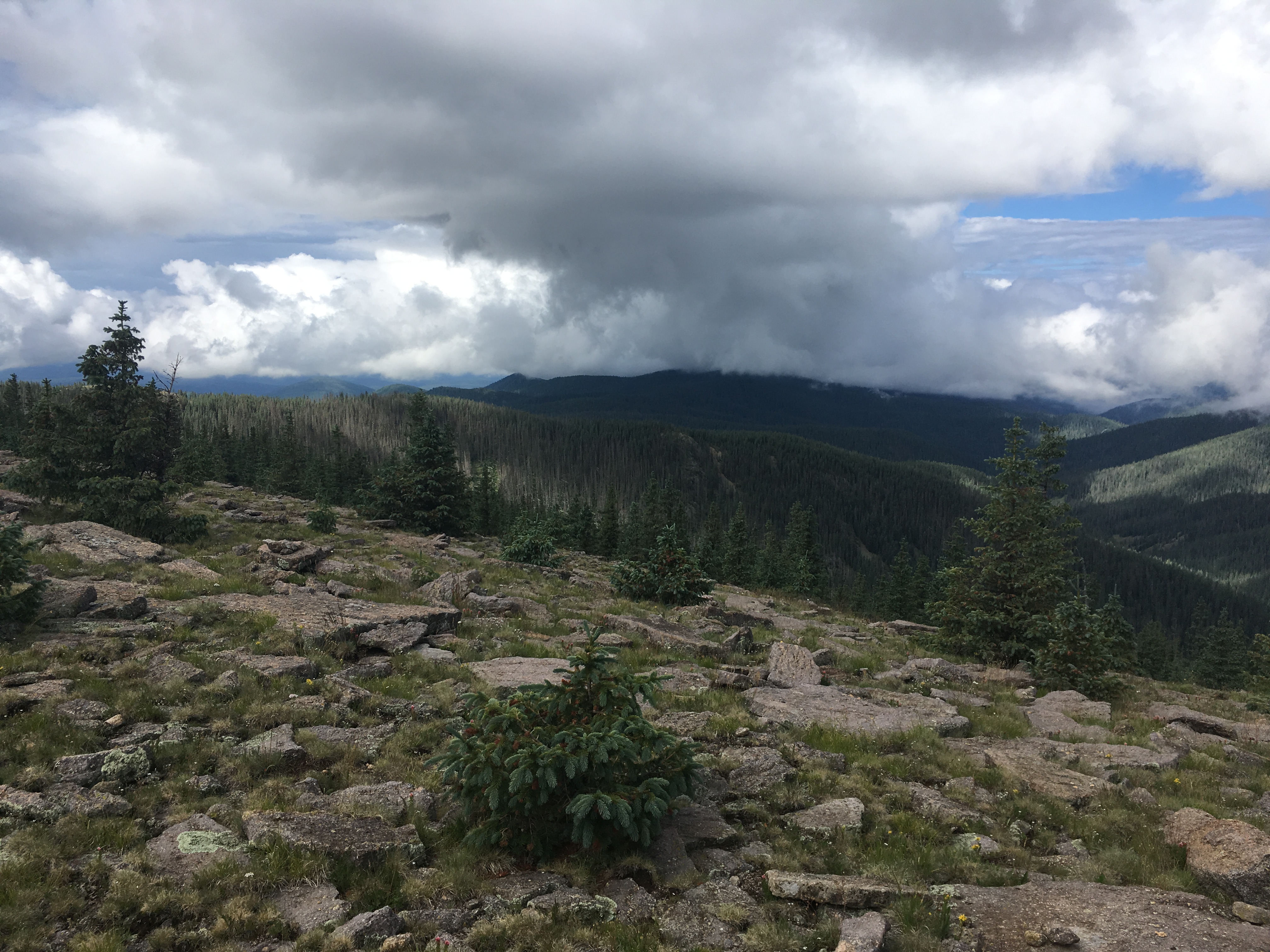
Surprisingly I heard the first rumble of thunder at the summit to the west on the Mogollon Rim, very early for the day at 9:30AM. So I headed north along the ridge, finding a nice use trail that I would have loved on the ascent. It looked like it was heading right for the trail at a saddle, and I charged down with the storm approaching, following flag and tape on branches as I went. I checked my GPS too late to find I had somehow shot past the trail despite the presence of the trail markings (I have no idea where they led) and I cut cross country back towards the trail, reentering the burn area resulting in another fun round of ‘the floor is wet thorns.’ This round was a bit faster and I emerged on the trail about 10 minutes later and decided I would finish the loop on the West Baldy Trail, which hugs the headwaters of the Little Colorado River, much safer from the lightning in the deep forested canyon than along the eastern ridgeline. I started to encounter my first hikers of the day shortly after regaining the trail, many with heavy packs likely camping somewhere near the trail apex for the night. I made it to about 10,000′ just as the rain started and I donned my jacket and pack cover. The rain would be on and off the rest of the day.


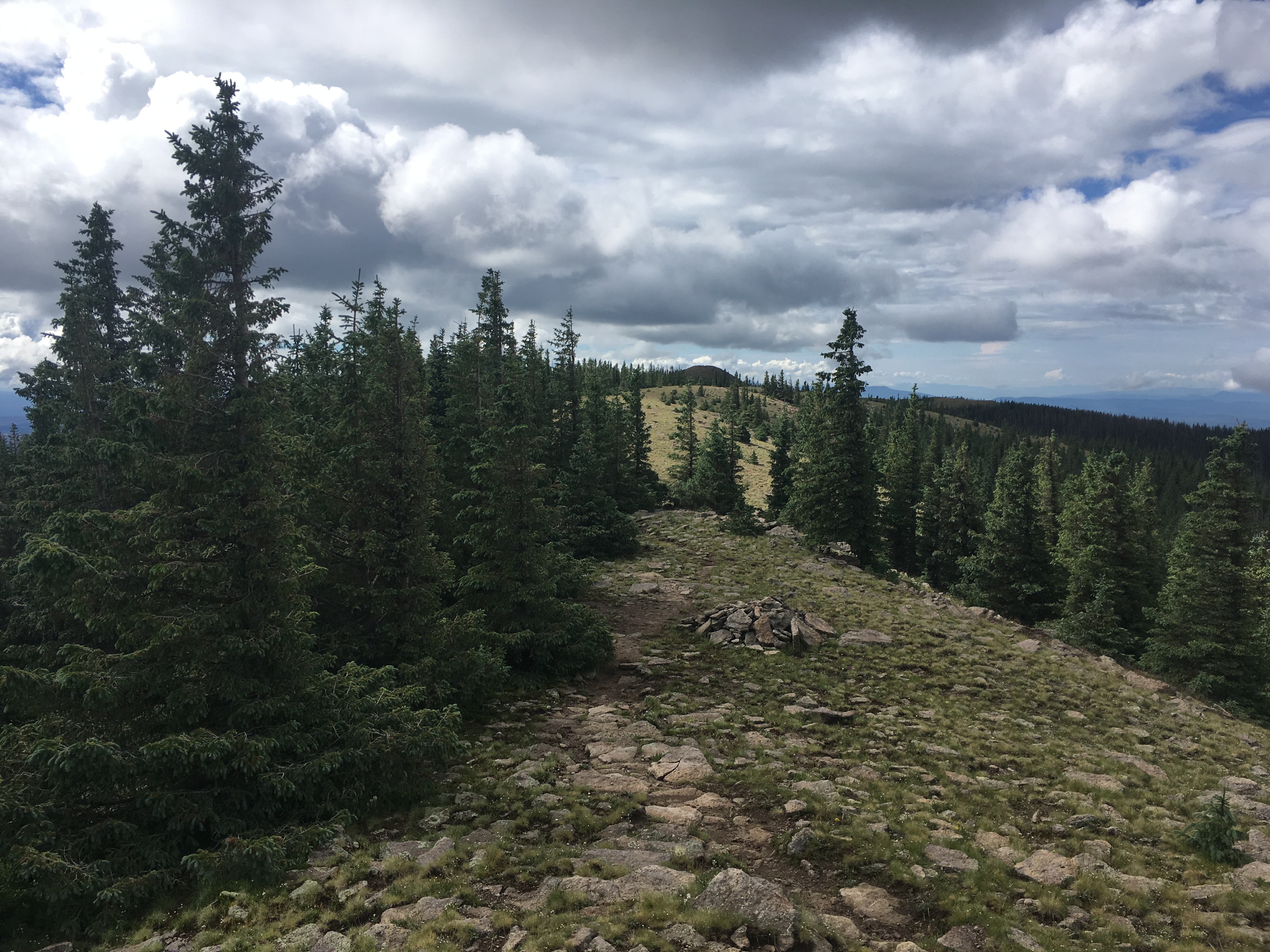
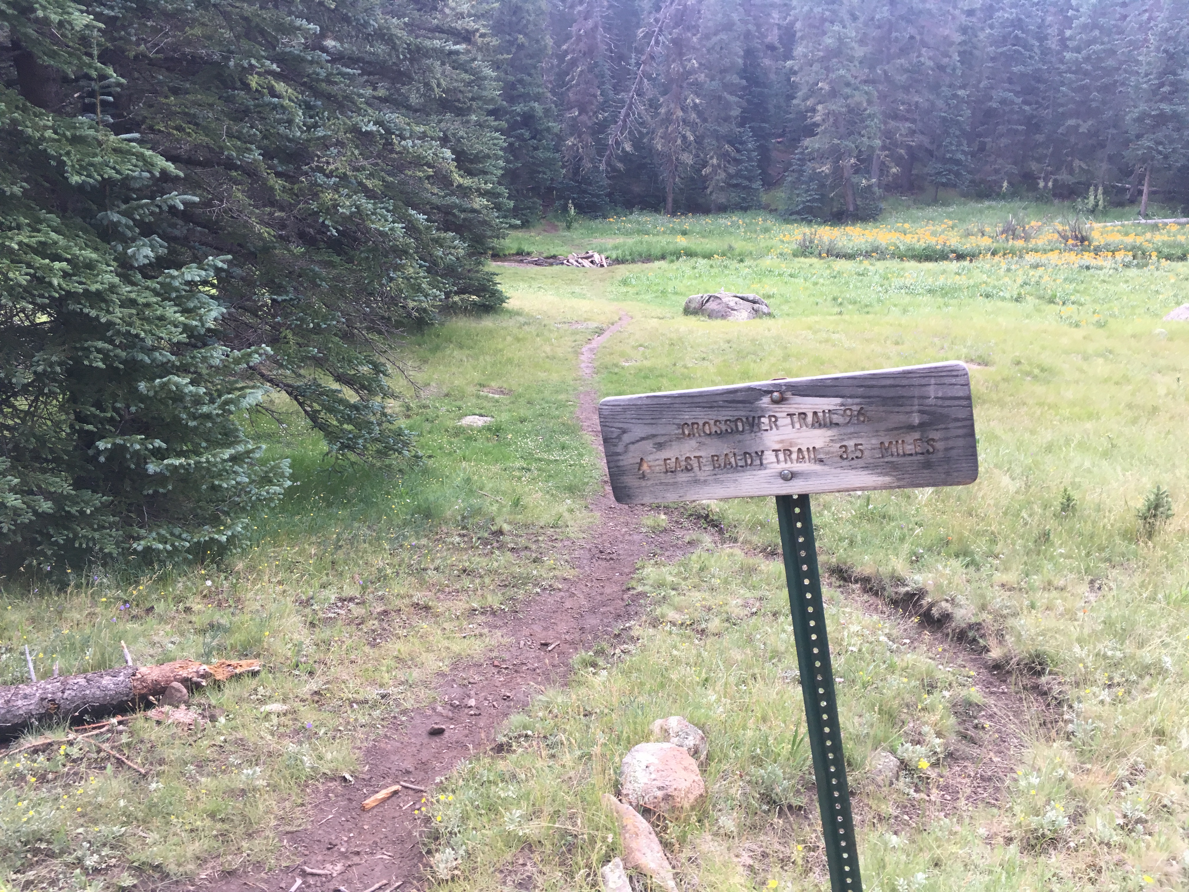
I followed the trail as it followed slopes above the Little Colorado River, reaching more exposed subalpine meadows at about 9,700′. I begin to pass more and more hikers, surprised by the number of people headed up in an active storm with very obvious thunder rolling. The West Baldy Trailhead and East Baldy Trailhead are separated by several miles of road, but have a convenient 3.5 miles connector trail to make a loop easy. On the map, it looked like I would cut over once beyond the steepest parts of the East Ridge.
I turned onto the trail and was immediately hiking uphill. I assumed this would be short and it would be all downhill once hitting the apex of the ridge. But a closer look at my GPS showed I had to cross over about 4 different subridges going up and down 100+’ each time, a tiring proposition 15 miles into the hike. I started to grow irritated with the seemingly pointless up and downs as it started raining harder and the lightning grew closer, having to cross multiple exposed meadows. It took me over an hour to reach the East Baldy Trail, and from the connection, it was a short 5 minute walk the remaining distance to the car. It was still fairly early in the day but a bit too rainy too do much else outside and still enjoy it, so I headed back to Pinetop to sample some local beers and have dinner before heading east for the night to climb Escudilla and Blue Peak in the morning.
Hi Christopher –
Nice Blog.
If you are chasing after obscure bumps like Gila County HP then you are no doubt aware of the “list” https://www.peakbagger.com/list.aspx?lid=13211
If you complete the project please let me know – fame (maybe) and fortune (not) await 🙂
See Ya – Andy Martin oldadit at gmail dot com
Thanks, hope to tick of the last 2 in AZ by spring next year!