
The Cockscomb 5009′
Total Time: 2 hours
Roundtrip Mileage: 2.9
Elevation Gain: 500′
Crux: Class 3
Trailhead: Aerie Trailhead, no amenities
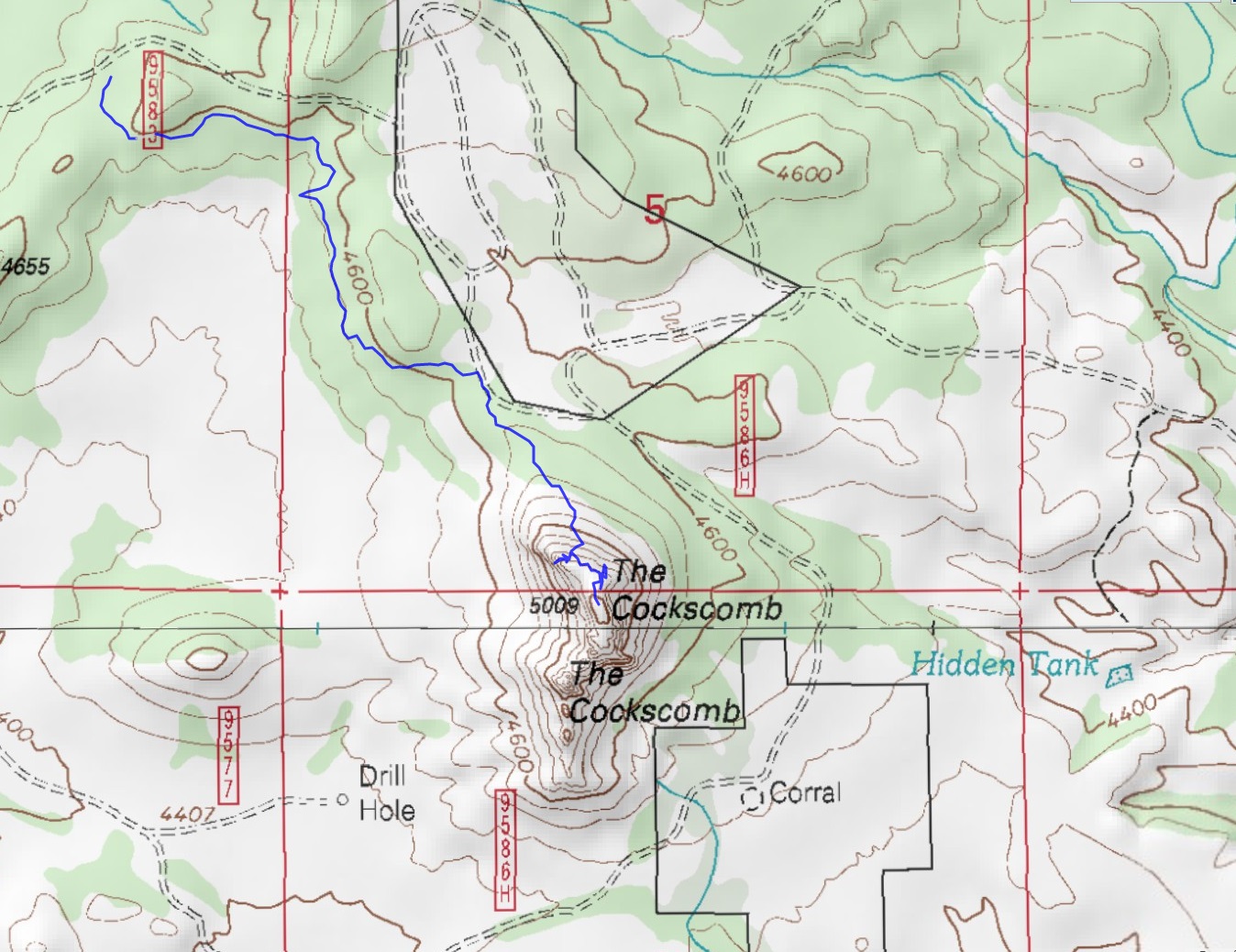
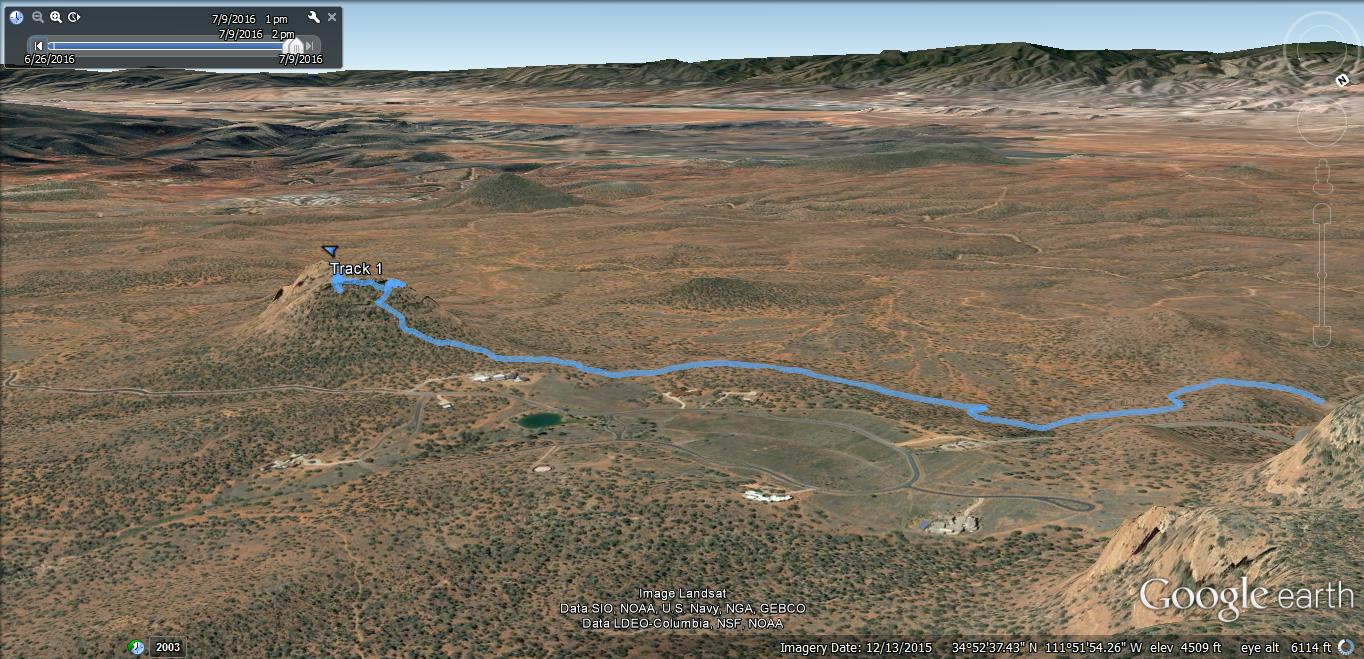
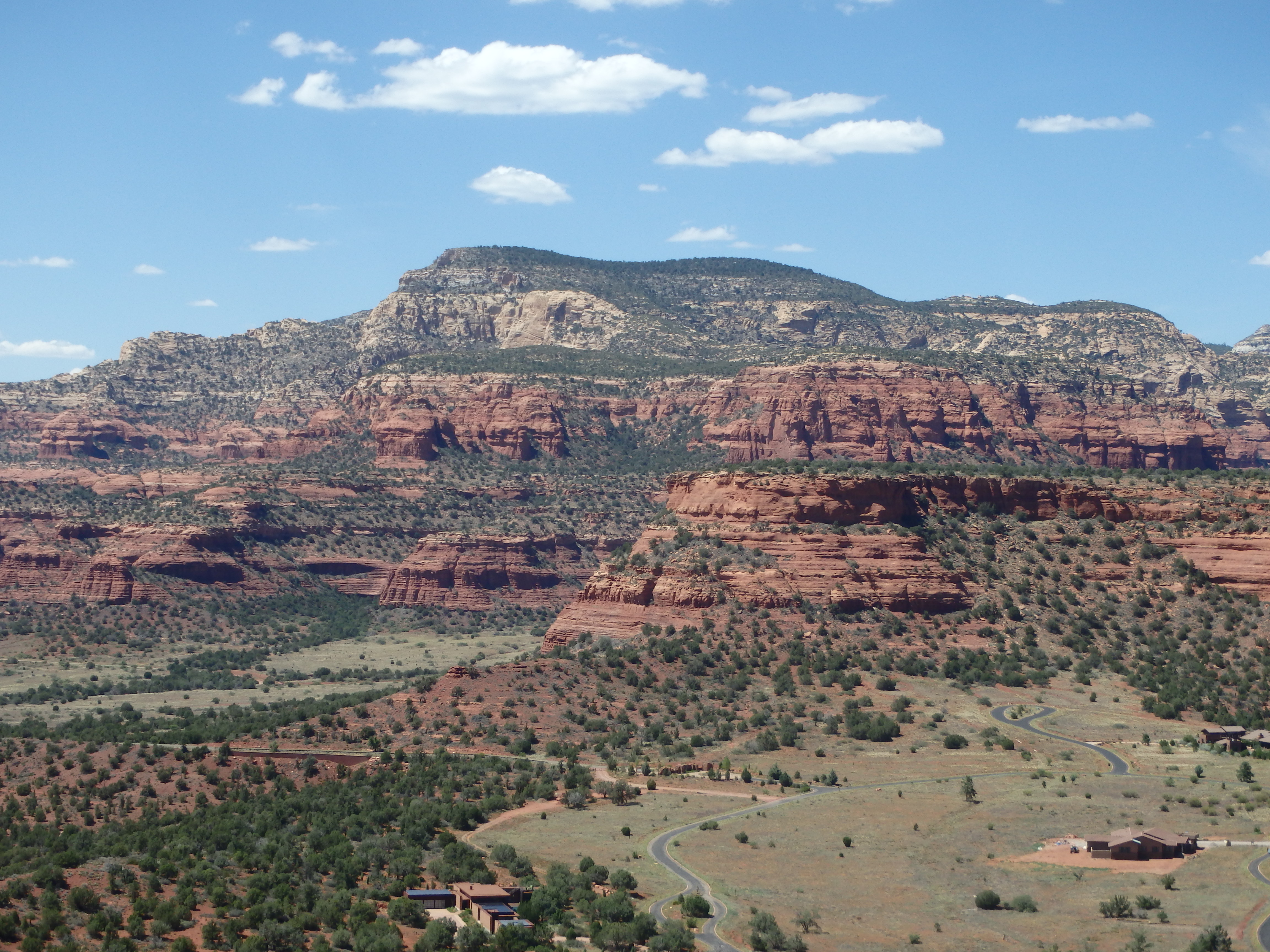
South of Sedona is a series of small buttes, all hovering around 5000′ in elevation, summits lined by sandstone cliffs. Doe Mountain is the most well known, with a trail leading to it’s broad summit. Nearby Mescal Mountain is a fun scramble, which I had climbed last fall. The southern most of these buttes, Cockscomb, has a namesake fractured ridge of sandstone spires along it’s south side, and offers great views looking back at the greater Sedona area. After a climb of Morning Glory Spire in the morning, I was looking for something fairly easy in the hundred degree heat. With only about 500′ of elevation gain and a bit of scrambling to keep things interesting, Cockscomb was a good fit. The trailhead for the Cockscomb was a bit hard to find due to conflicting information online and the new Aerie development, but I found the Aerie Trailhead shortly after lunch, the only car in the lot. The Aerie TH and Cockscomb area are less popular than the cooler canyons in Sedona proper, and I hiked on the deserted Cockscomb trail with my objective clearly in sight. The trail does not go to the mountain itself but skirts along the base, and shortly after passing a barbwire fence I left the trail and started heading upslope along the North-Northeast face.
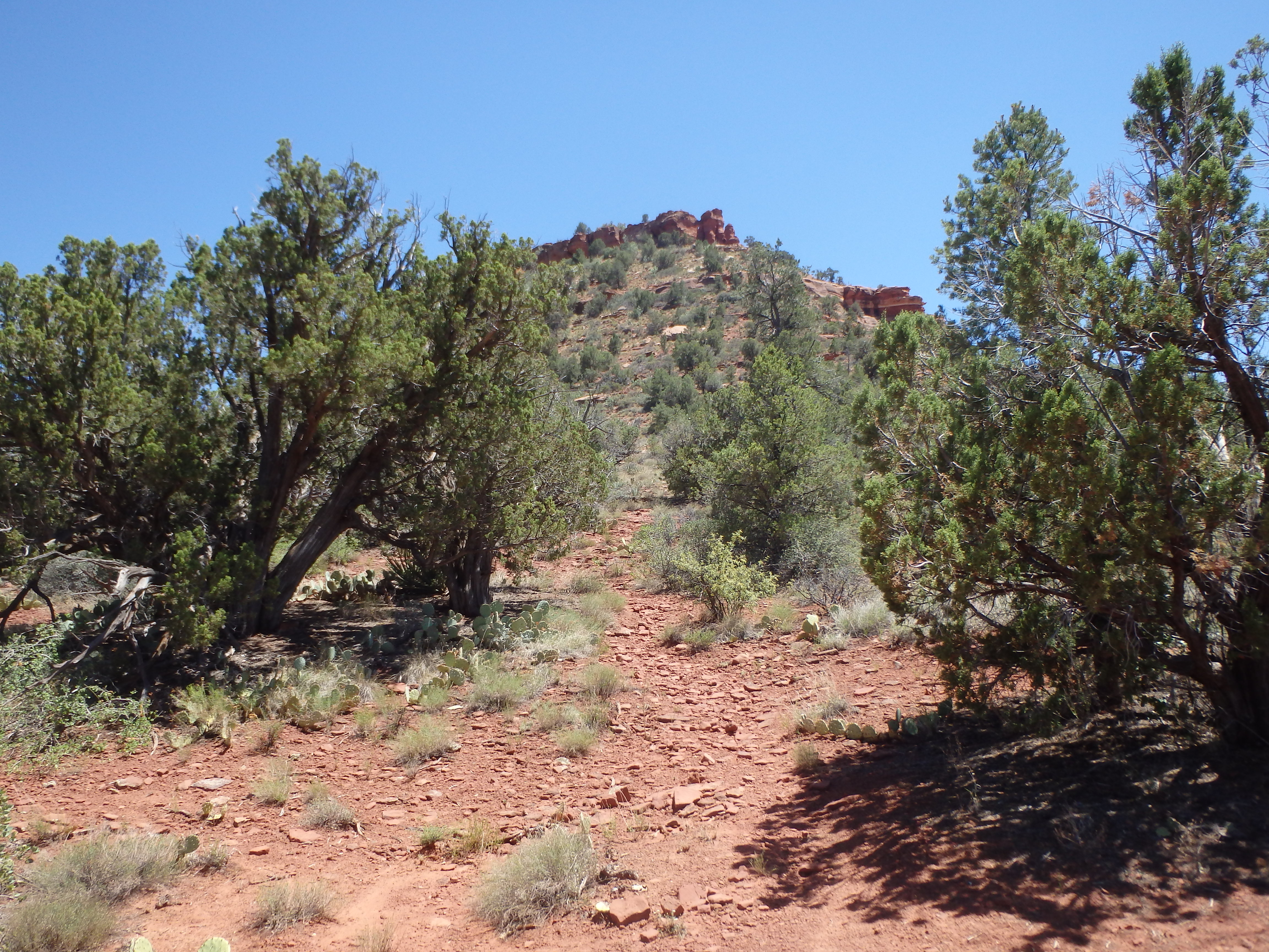
It wasn’t long before I found an excellent use trail, well worn and very easy to follow. Within a few minutes I was at the base of the summit cliff bands, with some well preserved Sinagua ruins tucked beneath the cliff bands.
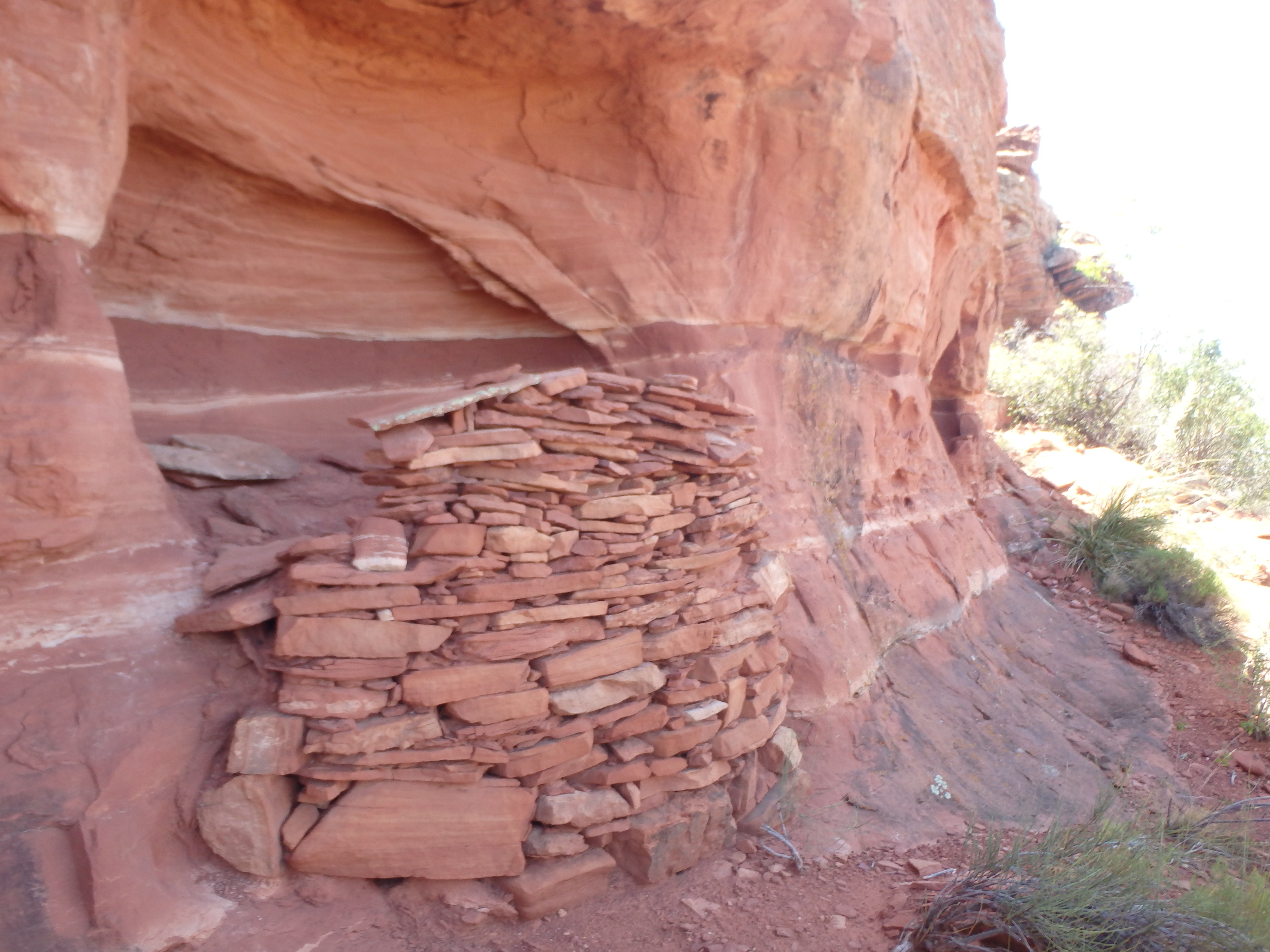
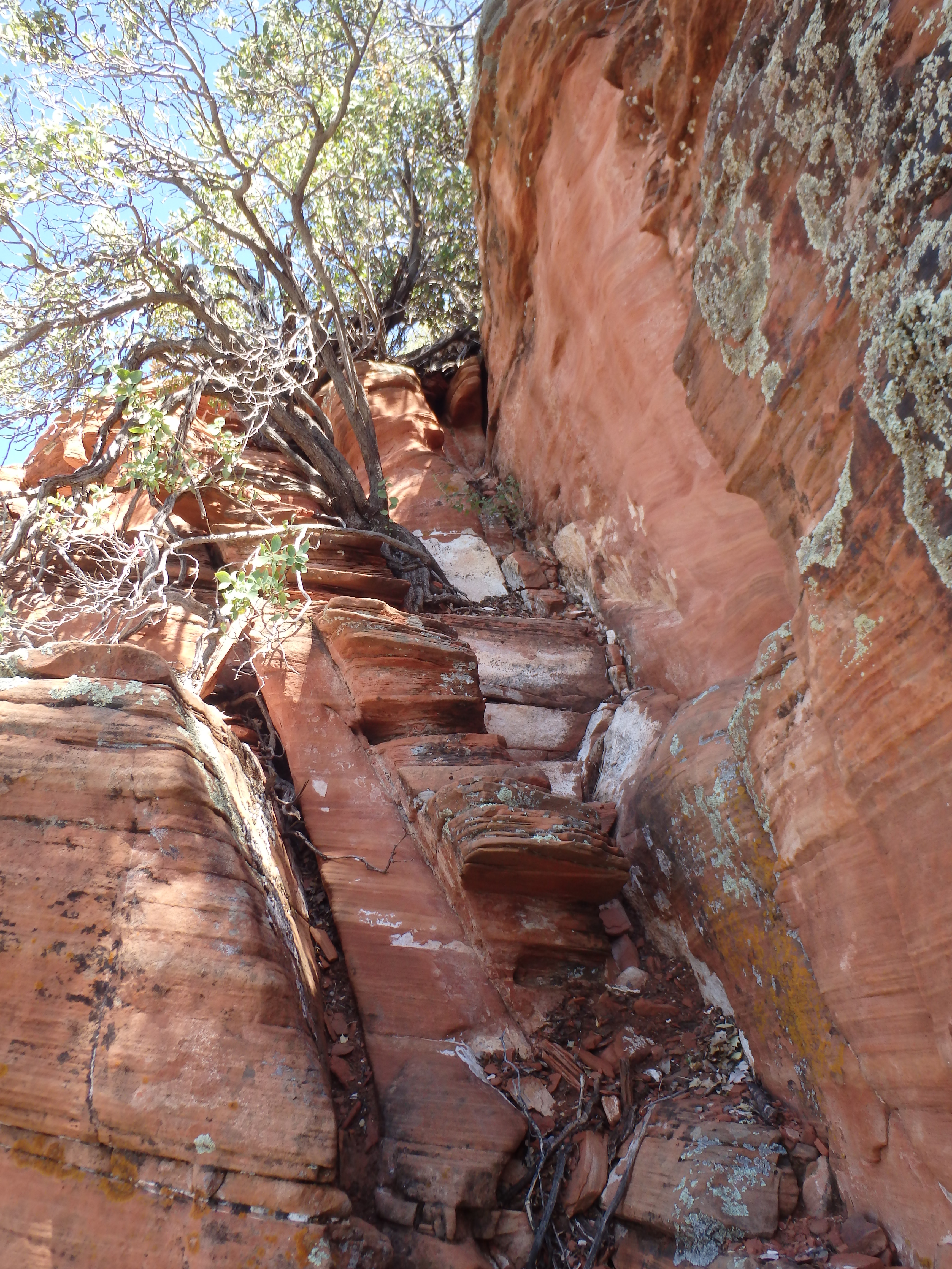
I wondered if the trail I took was a trail made by the original Sinagua inhabitants, or just from tourists hiking to these out of the way ruins. I started looking for the reported class III route to the summit. To the climbers right of the ruins, there was a pretty serious chimney that was at least class IV and very sandy. I started up it partways, but the sand made traction tenuous at best and I backed down looking for the reported easier option.

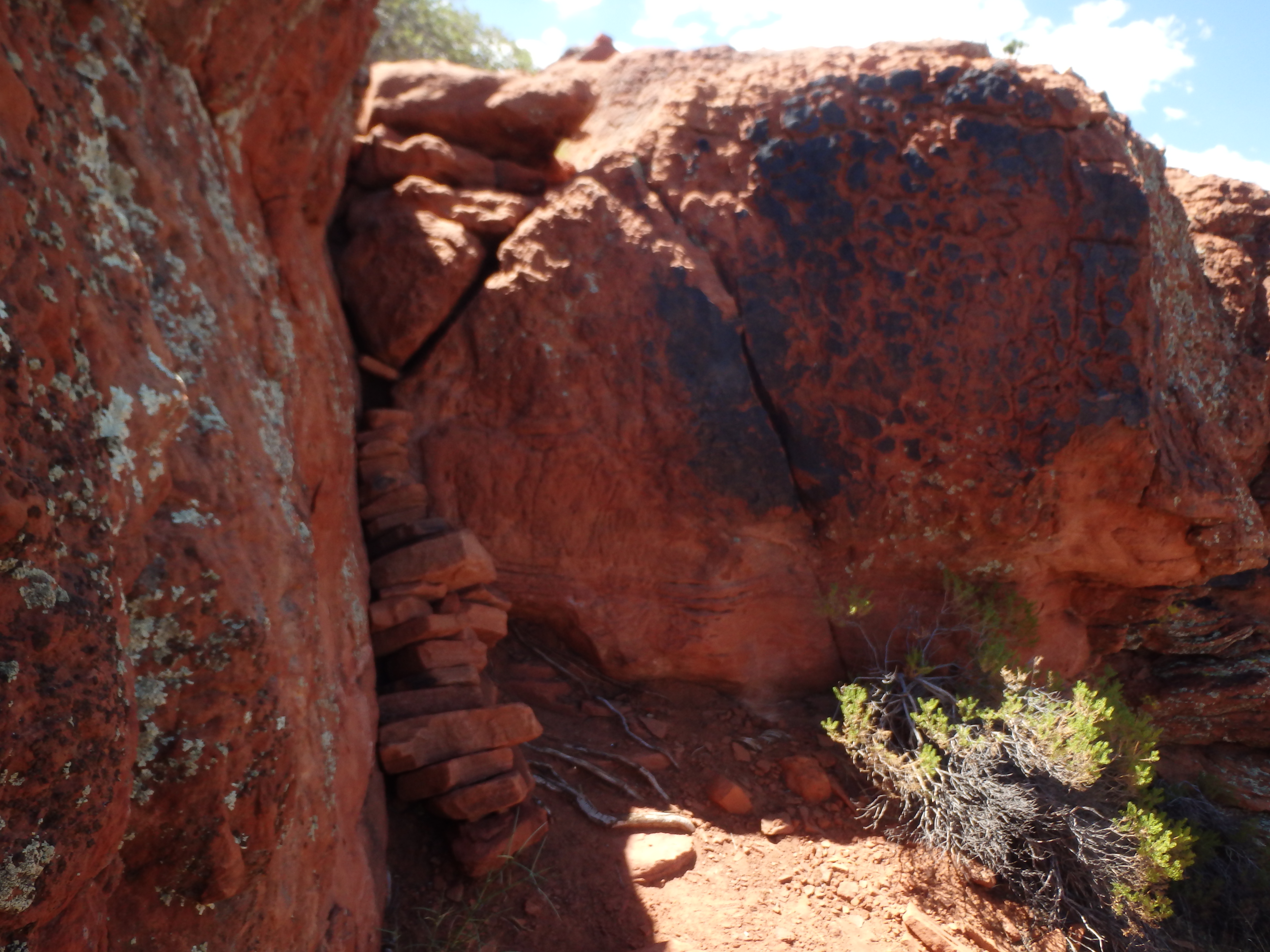
I kept looking and traversed south along the northeast face, passing through some less well preserved ruins. After ducking around some holly bushes near the rock faces, I found the series of easy to miss ledges with minimal class III, which seemed to be the ticket to the top. After working around some more thick holly bushes, I emerged on a large ledge just below the summit bands. A crack through the rock band brought me the rest of the way to the summit plateau, made easier by a group of rocks stacked near the base.
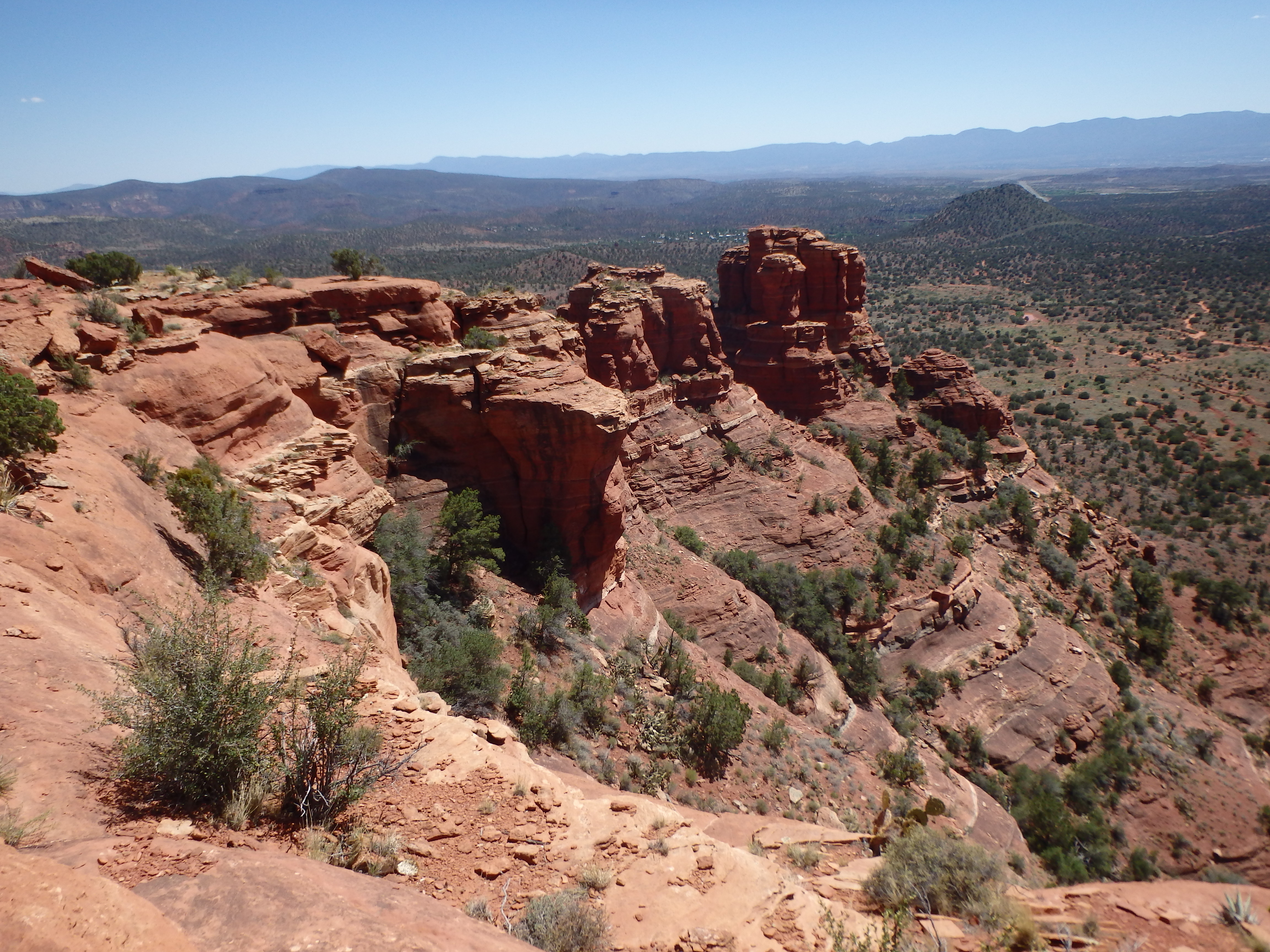
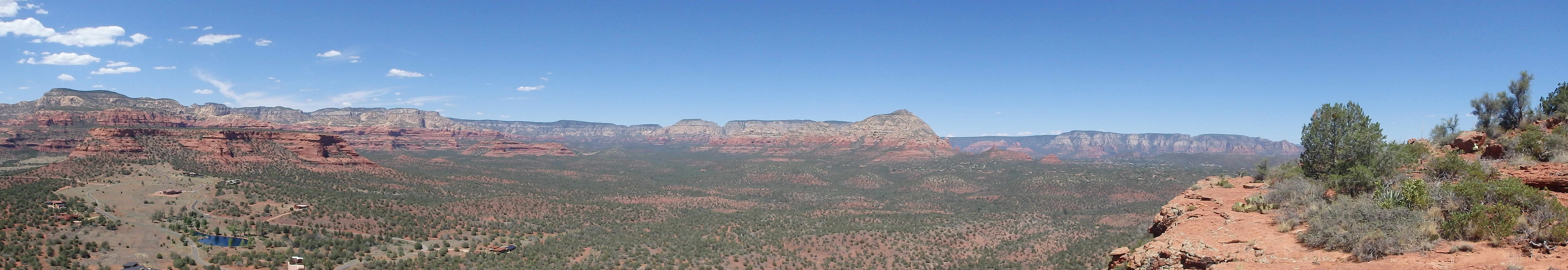
The summit plateau of the Cockscomb is much smaller then Doe or Mescal Mountain, and you have more of a 360 view with cliffs on every side. I placed a summit register near the highest point, and took a few photos of the namesake Cockscomb pinnacles to the south and the panoramic views of Sedona proper to the North.
With minimal shade at the top, I did not linger and scrambled back down to the ruins. The hike back out was uneventful and I quickly returned to my car to get back to Phoenix for dinner.