
Mount Conness 12589′
Total Time: 6 hours
Round trip Mileage: 9.0 miles
Elevation Gain: 3550′
Crux: Class 3 summit rocks
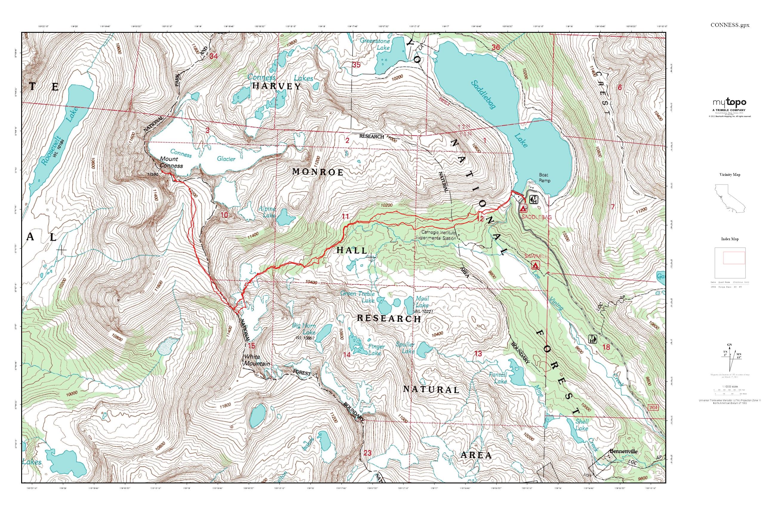
Trailhead: Saddlebag Lake
Companions: Justin Shelton
Day 3 I finally had some company. Justin, my best man, had flown into Vegas the night before and drove through the darkness to meet me at 5AM in Mammoth. Despite having hiked and climbed across the US, he had yet to experience the Sierras, and I was excited to show him this granite playground. Unfortunately, the unsettled weather that had started on my near epic on Banner continued to linger through the morning, with the threat of thunderstorms starting around noon. But we crossed our fingers and drove north from Mammoth to Saddlebag Lake for a climb of Mount Conness. Despite being just a bit over 12K, Mount Conness is one of the most prominent mountains in Yosemite National Park, and one of California’s 164 summits with over 2000′ of prominence. It is also the highest mountain in the Sierra Nevada north of Tioga Pass, not finding a taller mountain to the north until Mount Shasta hundred of miles away. The sun started to rise as we reached Saddlebag Lake, and gloomy skies and dark clouds hung low as we prepared our gear.
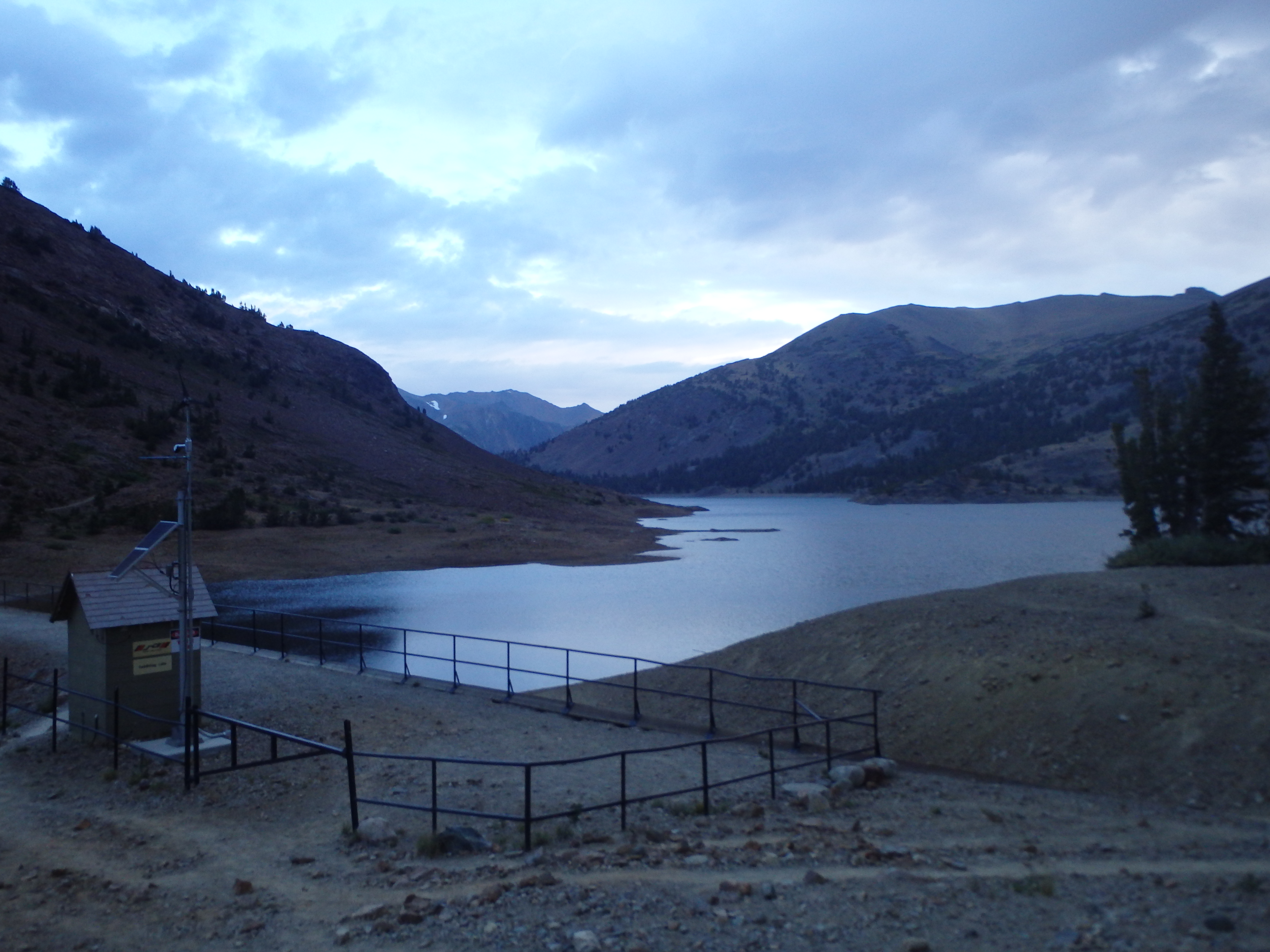
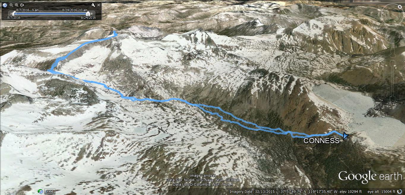
While we had initially planned on an ascent along the East Ridge, the threat of lightning made me want to stay below treeline as long as possible, and the idea of scrambling on exposed and wet class III days before my wedding seemed less than ideal. So instead, we settled on the standard ascent route up to Alpine Lake and on to the broad summit plateau to the top. We crossed the dam at the outlet of Saddlebag Lake and followed a thin use trail as it lost a bit of elevation, dropping into the broad valley south of Conness. We quickly lost the trail, but the cross country was fairly easy, and we cut beneath the East Ridge of Conness, trying not to lose too much elevation in the process. It wasn’t long before a cold rain started, and I began to doubt our chances of success quite early. But we pressed on, and stumbled on a well defined trail which, at the time, I assumed led to Alpine Lake. We gained a little bit of elevation along the trail, and as we reached an upper basin, the rain stopped, even giving us a few rays of sunshine.
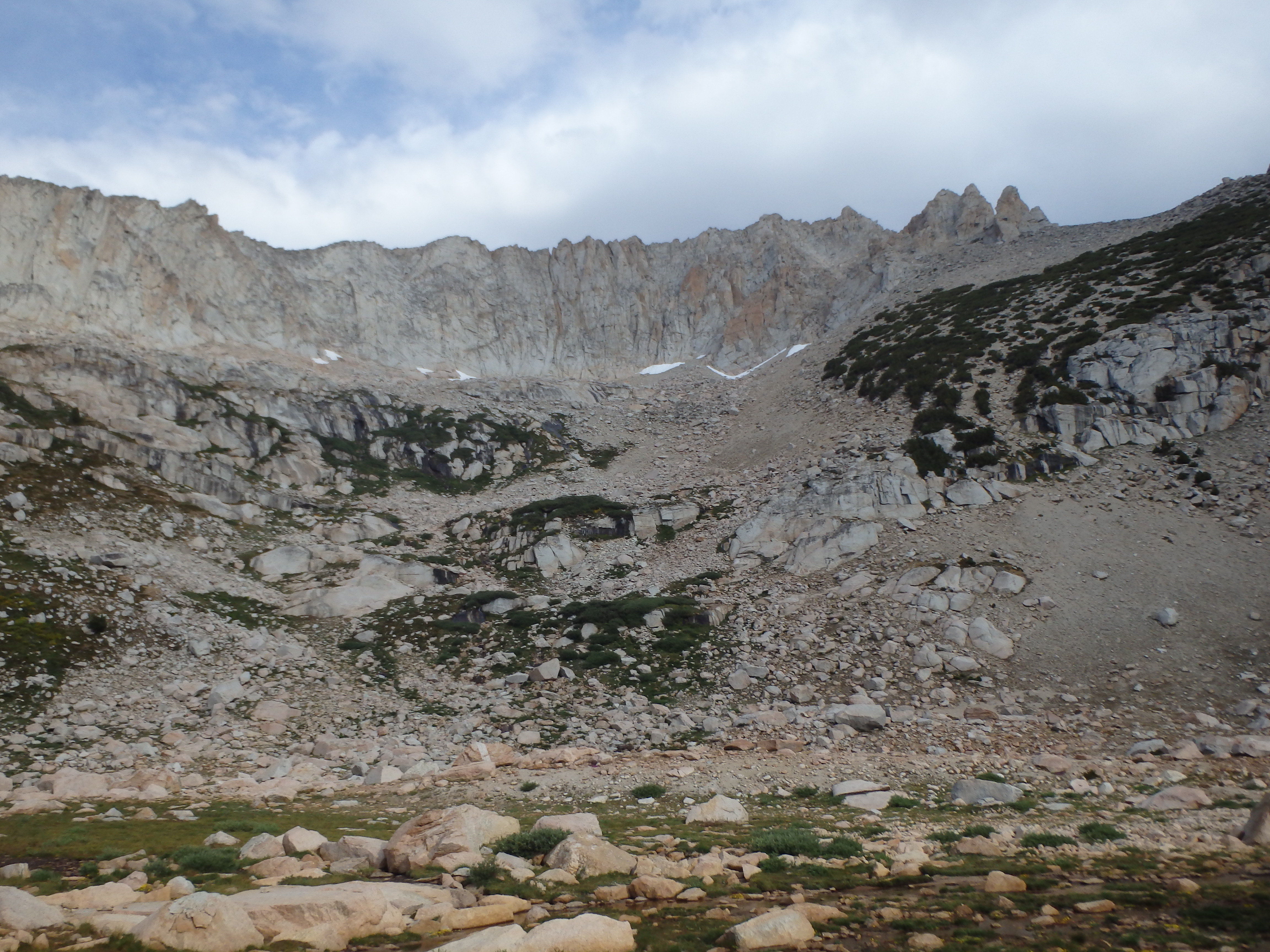
We took our first break here, and I checked my map to figure out the route. The lake in front of us was more like a dried up tarn, and the basin didn’t quite fit my map. I pulled out my GPS to figure out our position, and realized that we overshot the turnoff for Alpine Lake and were instead below the broad saddle between Conness and White Mountain. This route was technically easier anyways, and with the promise of sun to the west, our mistake almost seemed good fortune. After a short break, we began the first bit of off trail for the day, ascending low angle granite slabs and talus up to the saddle. The lower part of the route was marked with numerous cairns, but the terrain was forgiving enough that any number of lines would work.

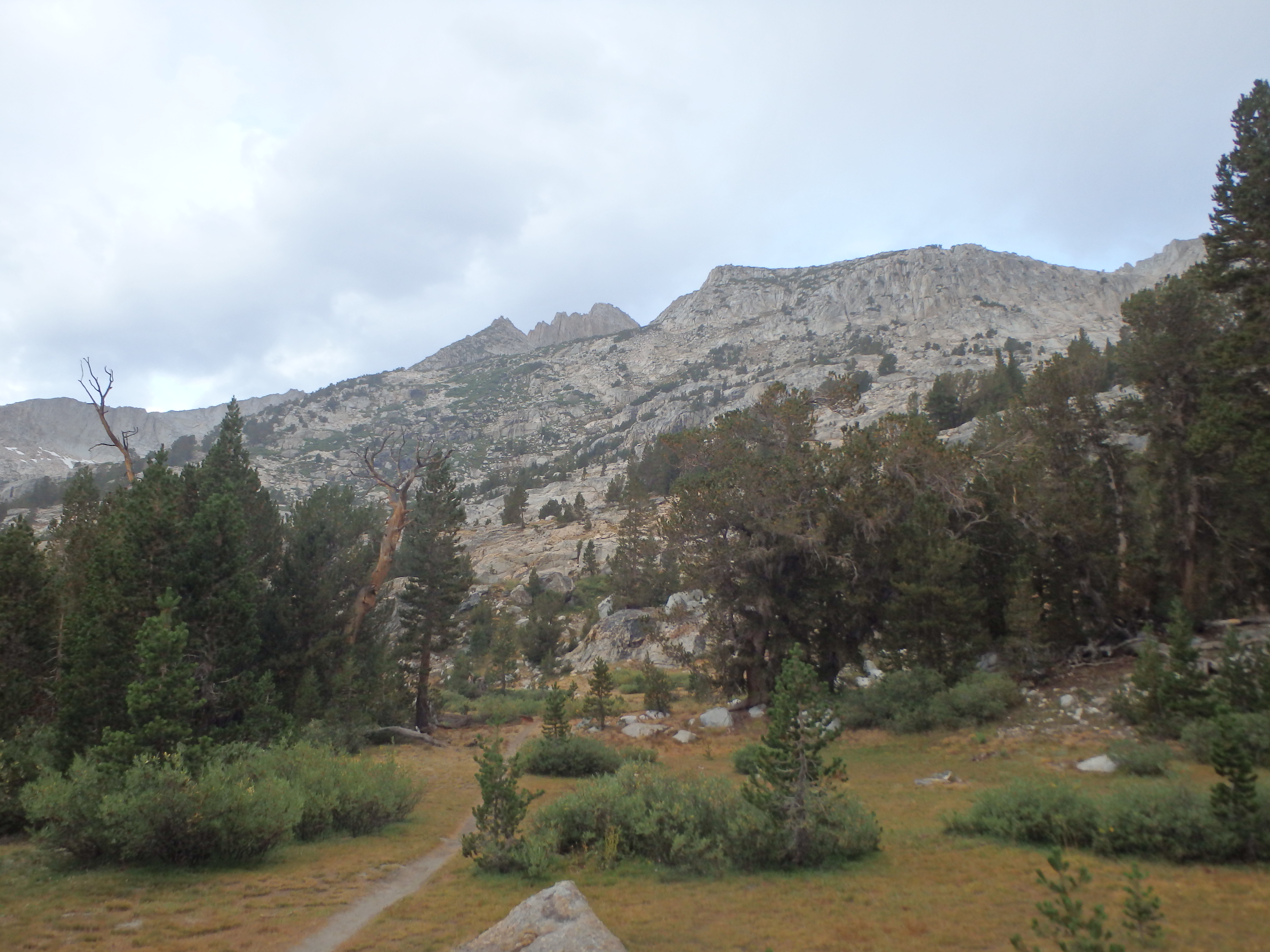
The only true difficulty came in the final 100′ through a narrow chute filled with loose sand. But with a few minutes of struggling, we popped out on the low saddle, officially entering Yosemite National Park. Being Justin’s first time in Yosemite (or all of the Sierras for that matter), I made sure this moment was not lost on him, and pointed out the various summits towering over Tuolumne Meadows to the SW. This again seemed like a natural place for a short break, and we took in the fantastic views and slowly improving weather across the park.

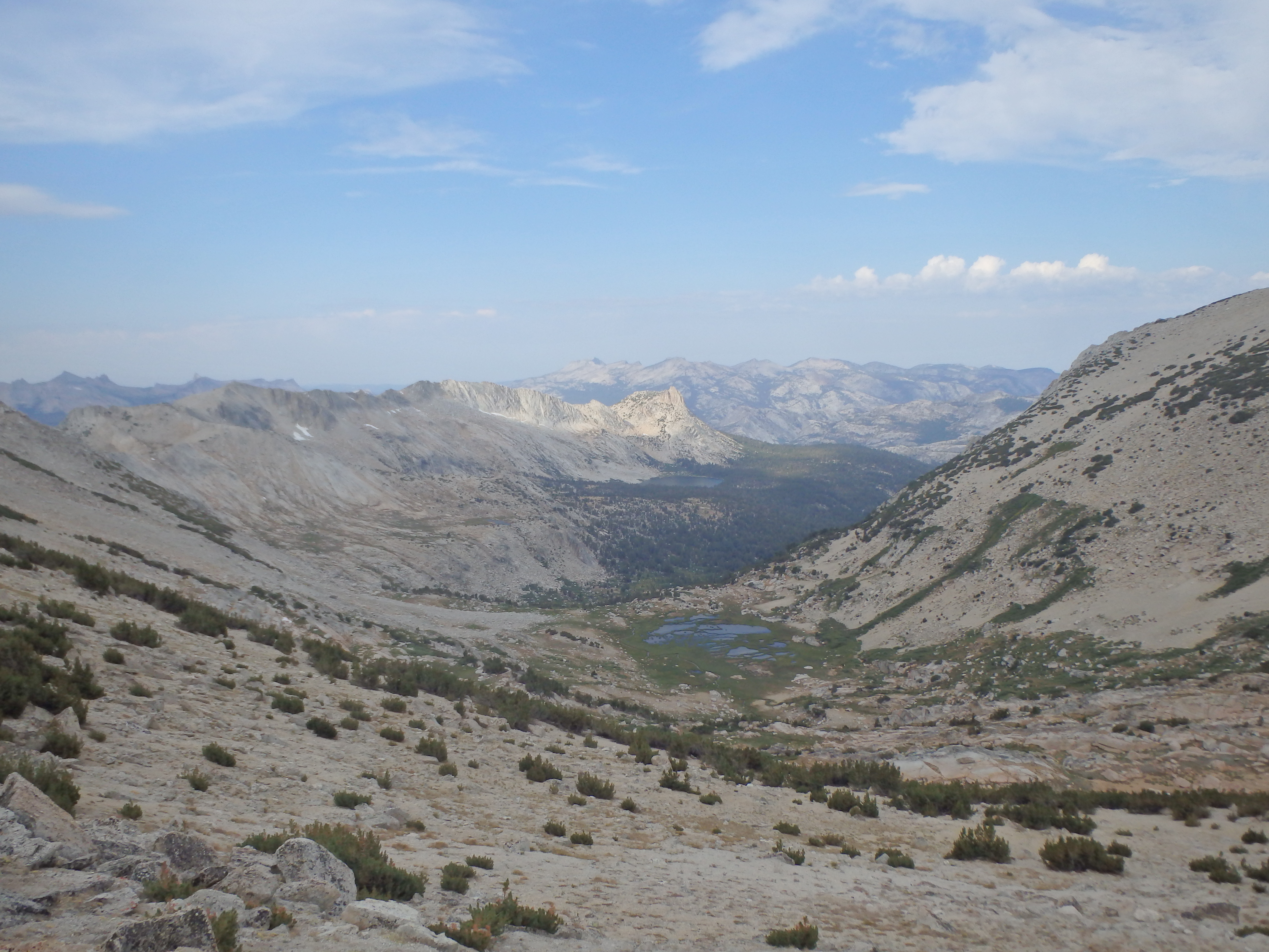
Looking north towards the summit, it was difficult to see the true high point above. But with nothing but sandy slopes between us it seemed we would have smooth sailing the rest of the climb. We headed up and over a false summit, following thin use trails as we found them. A prominent trail came up from the basin to the west, being the standard route for those starting in Yosemite. From there, the trail became better defined with the two routes merging, and we rounded the corner to see the true summit ahead, some lingering patches of snow near it’s flanks.

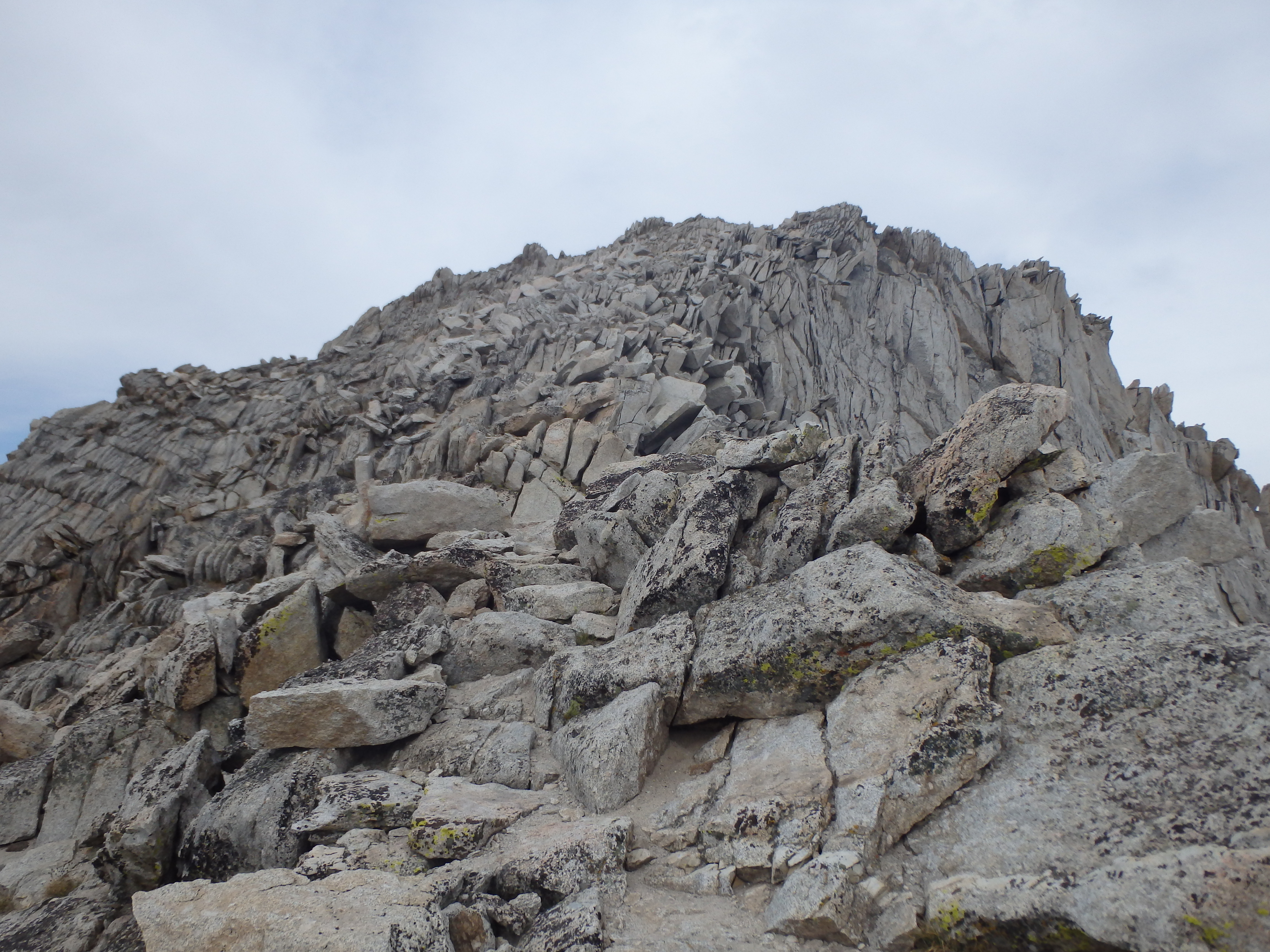
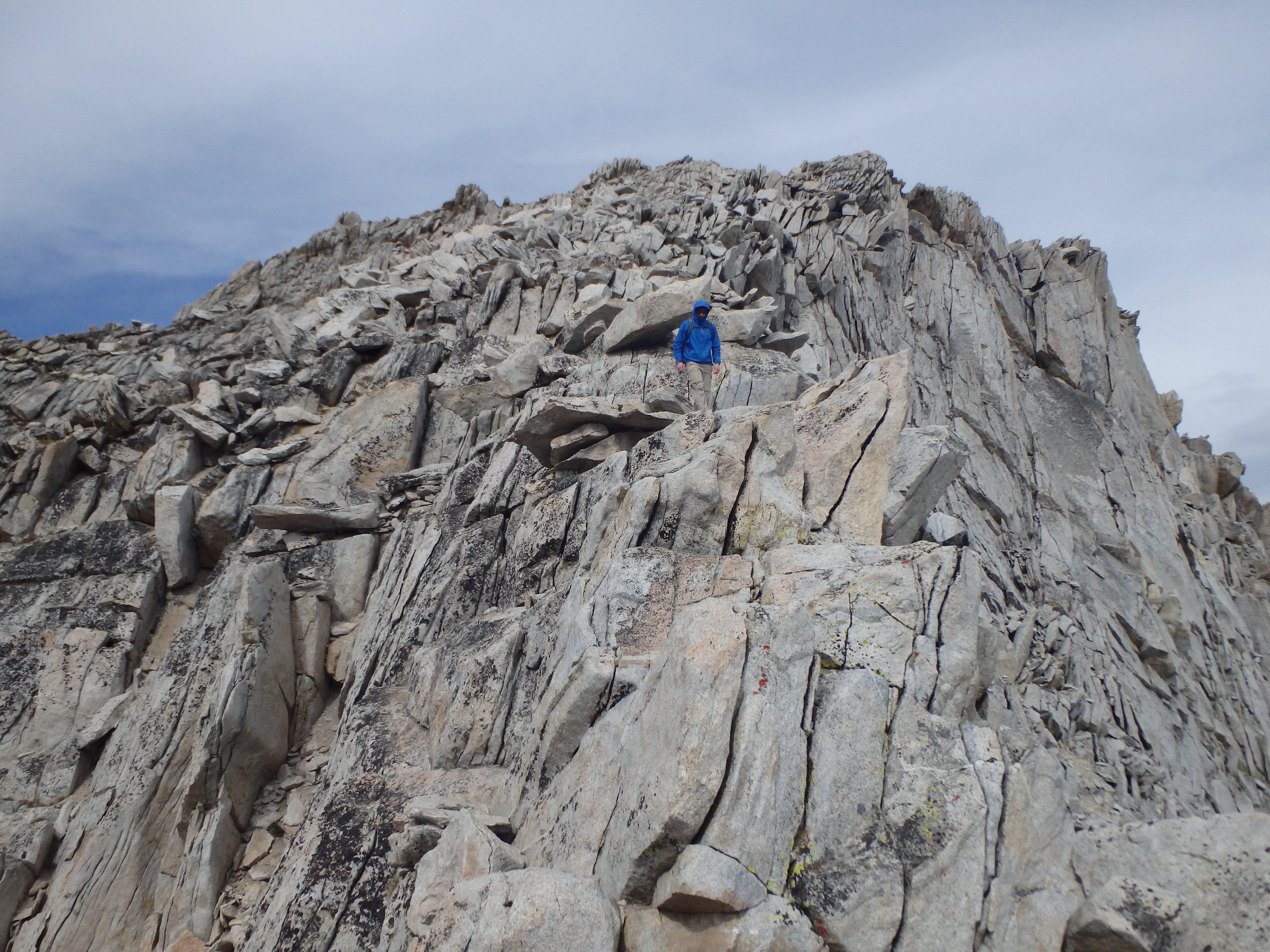
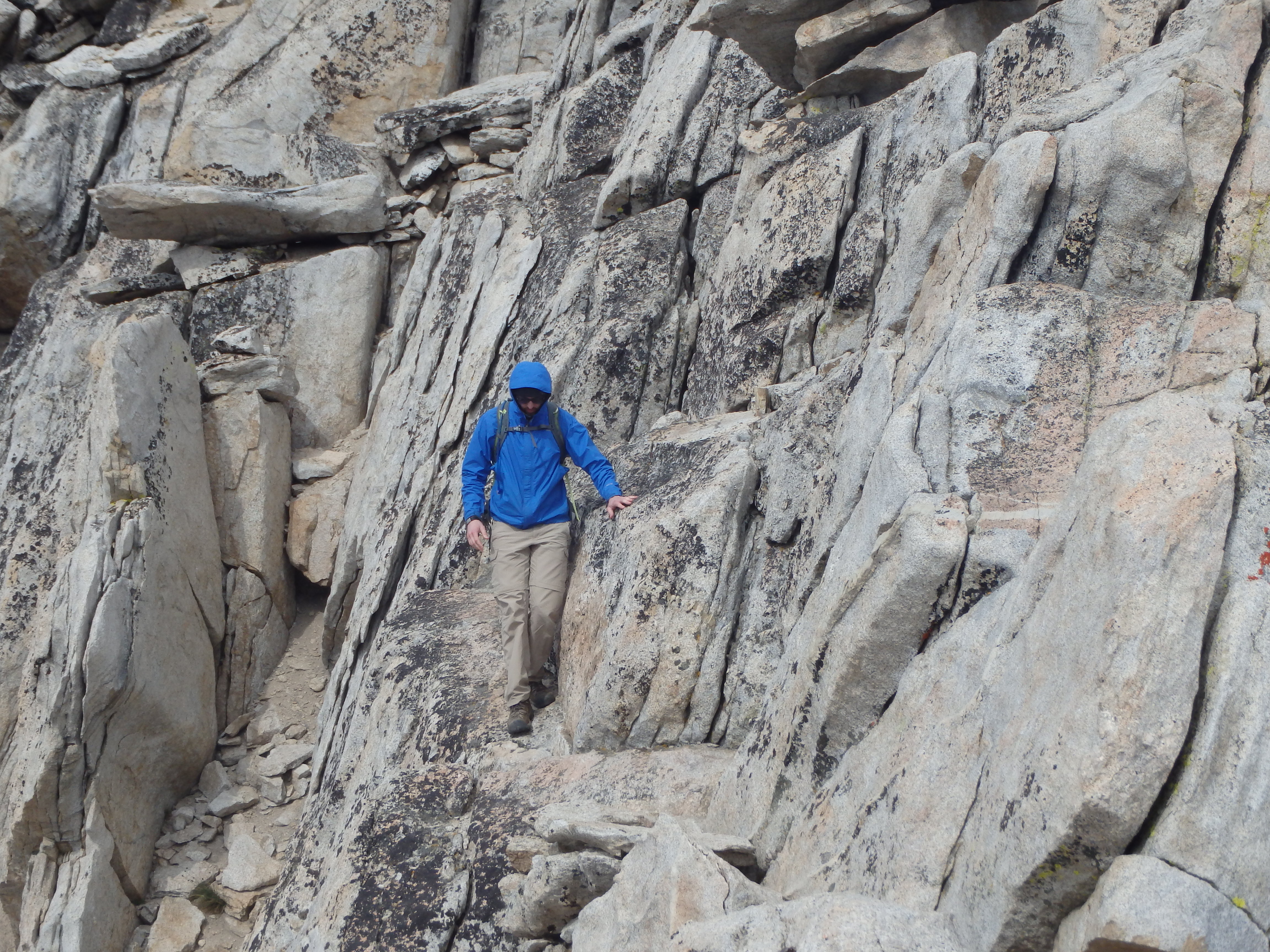
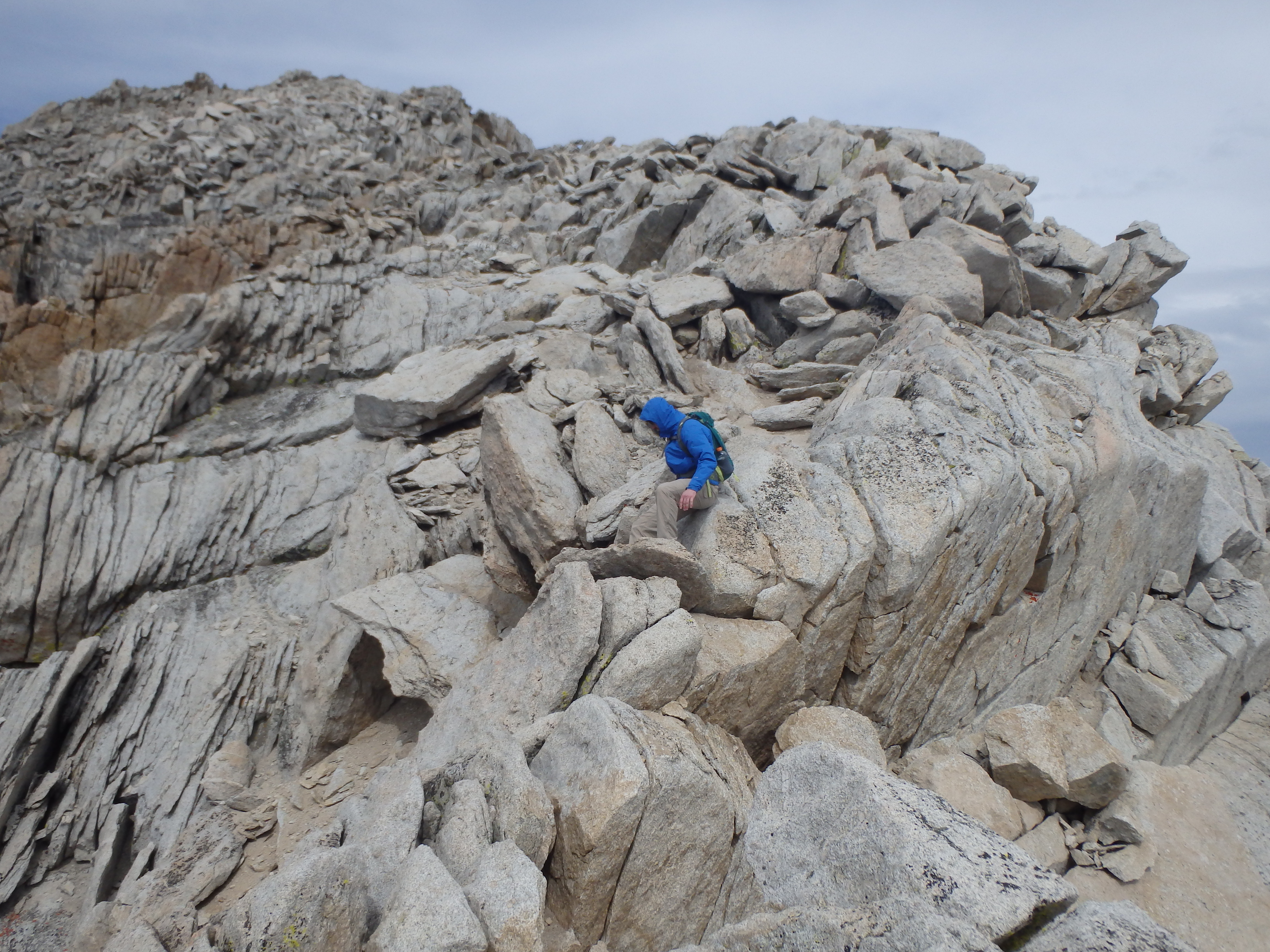
Although the terrain here was easy, Justin was definitely starting to feel the altitude, and the slog across the high elevation sand with minimal sleep was definitely starting to show. But as we reach the base of the summit rocks, both of us woke up for the class III finish. Compared to many Sierra summits, the class III was minimal, but there were some interesting mental cruxes, with some short narrow sections and a small exposed catwalk to keep things interesting. Closer to the top were some steps made of rocks, presumably by bored firetower workers, which had burned down long ago.

I paused just before the final summit rocks, and let Justin pass to bag his first Sierra summit. The views from the top did not disappoint. The higher elevation revealed not only the major summits of the Tuolumne Meadows area, but even Half Dome and Cloud’s Rest in the valley. There was almost a direct view down the Grand Canyon of the Tuolumne, and to the east, storms continued over Warren Peak and Mount Dana to the south.


After celebrating our summit with some Elk Cajun jerky, it was time to descend, and we reversed the catwalk and airy steps back to the sandy summit plateau. I stopped to take a few more pictures of some of the trickier spots as Justin made his way through, mostly to upset Angie (his wife) and his mother should they ever decide to read this.
Sandy descents are always enjoyable and we quickly plunged stepped our way down the broad slopes and back to the saddle. We took an alternate chute down, hoping to find more solid rock, but in the end it was probably a wash. A bit lower down closer to the tarn, I started to aim for patches of snow to glissade down. But after punching clear through one patch, I abandoned that idea and switched back to solid rock. Getting back to treeline, the sunny skies we had enjoyed to the east began to slowly disappear, and by the time we were almost to the car, dark thunderclouds hung low over Yosemite.

Wanting to get back to the car before the rain restarted, I picked up the pace, leaving Justin in a loose talus field. I rounded the corner and crossed the dam, reaching the car around 12:45. I looked back and was surprised to see Justin wasn’t behind me. He was probably only a minute back on the talus, and should have been at the dam by now. I slowly rolled my car down the road looking through the gaps in the trees, and saw him standing still, looking downslope. I would come to learn there was another hiker dressed like me in that direction, and he was yelling to him asking why he was headed the wrong way. I started beeping and he realized that hiker wasn’t me, and he finished across the dam to meet me at the car. From there we headed back into Yosemite (this time by car) for lunch in Tuolumne Meadows and a bit more touristy exploration of the High Sierra before heading back to Mammoth for dinner.