
Hinter-Grauspitz 2574 m, and Kamm 2123 m
Failed attempt of Vorder-Grauspitz
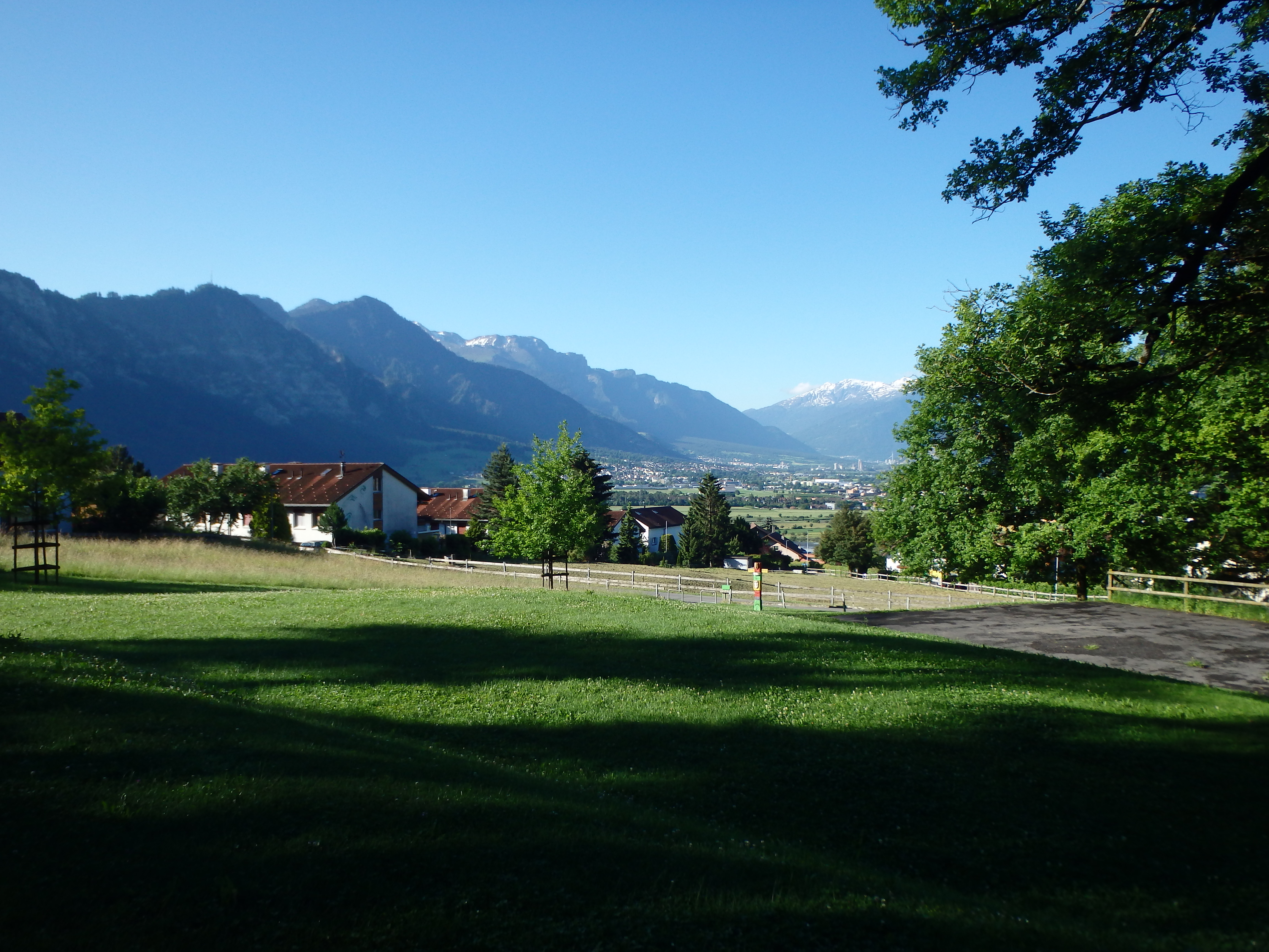
The Vorder-Grauspitz is the highest summit in the small country Lichtenstein, lying on the Swiss border in the small Ratikon subrange. While not particularly tall by Alpine standards, it does feature a challenging class IV, somewhat loose summit ridgeline that have turned back many even under optimal conditions. I had looked a various trip reports online, and it looked like mid-June would have snow free conditions on the south facing slopes. So my first day in Europe, being a starving peakbagger and nothing resembling a normal human being (that might go to museum or do something normal), I drove out from Zurich under sunny skies to the small town of Malans near the Swiss-Lichtenstein border.
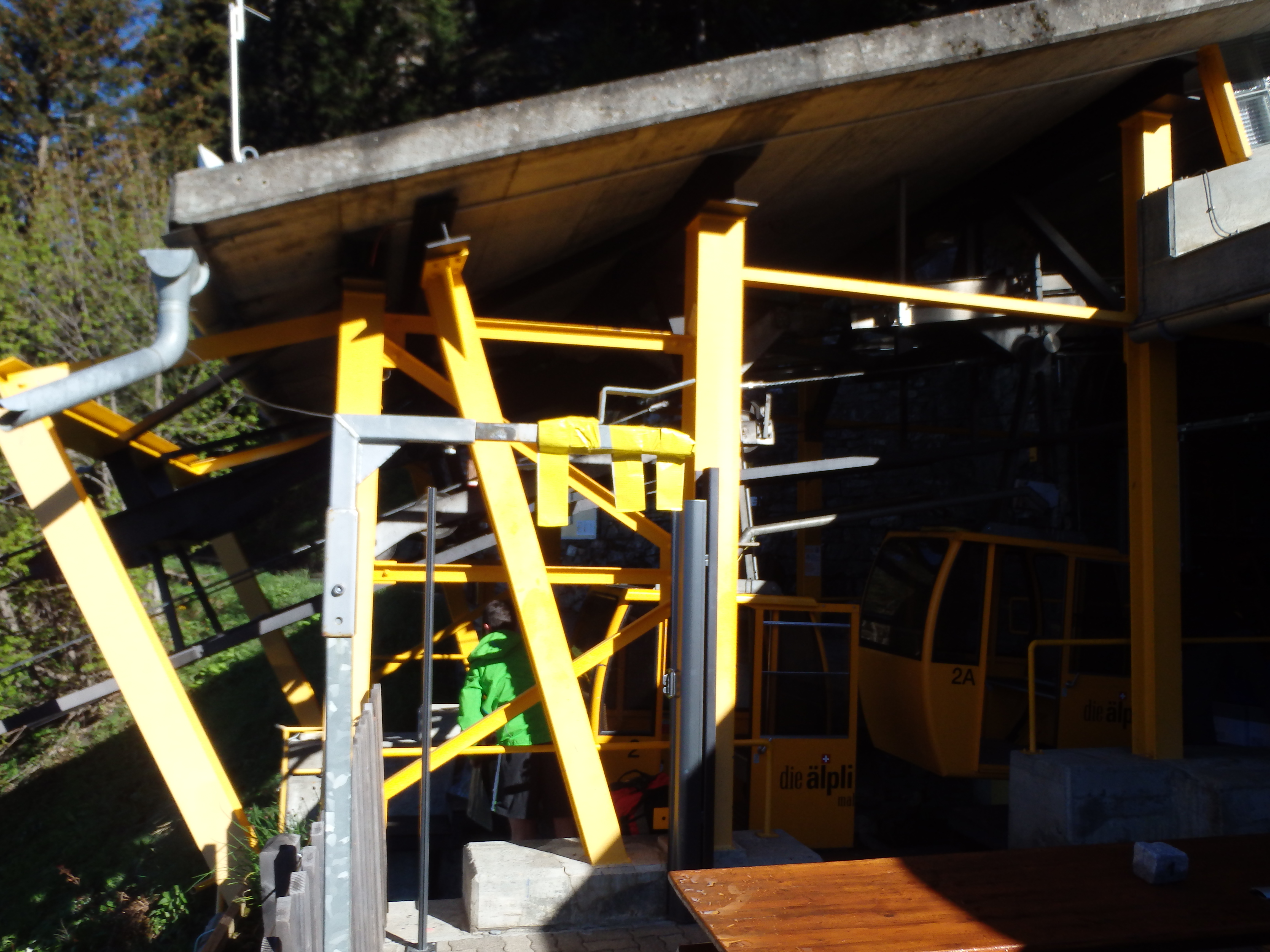
The small town is quite rural, but does feature a small cable car, the Alplibahn, which seats only 8 people and brings you up to about 1200 meters, halfway to the top. I pulled up just as the first cars were leaving for the top, and paid 18 CHF for my roundtrip ticket, reserving a spot on the 4:15 car back down. I shared my ride with an old man heading to Vilans, the summit just above the upper station where the majority people hike to. Once at the upper station, I took a quick picture of the map to reference (I had some google terrain photos as well) and followed the well signed paths north towards Kamm ridge.

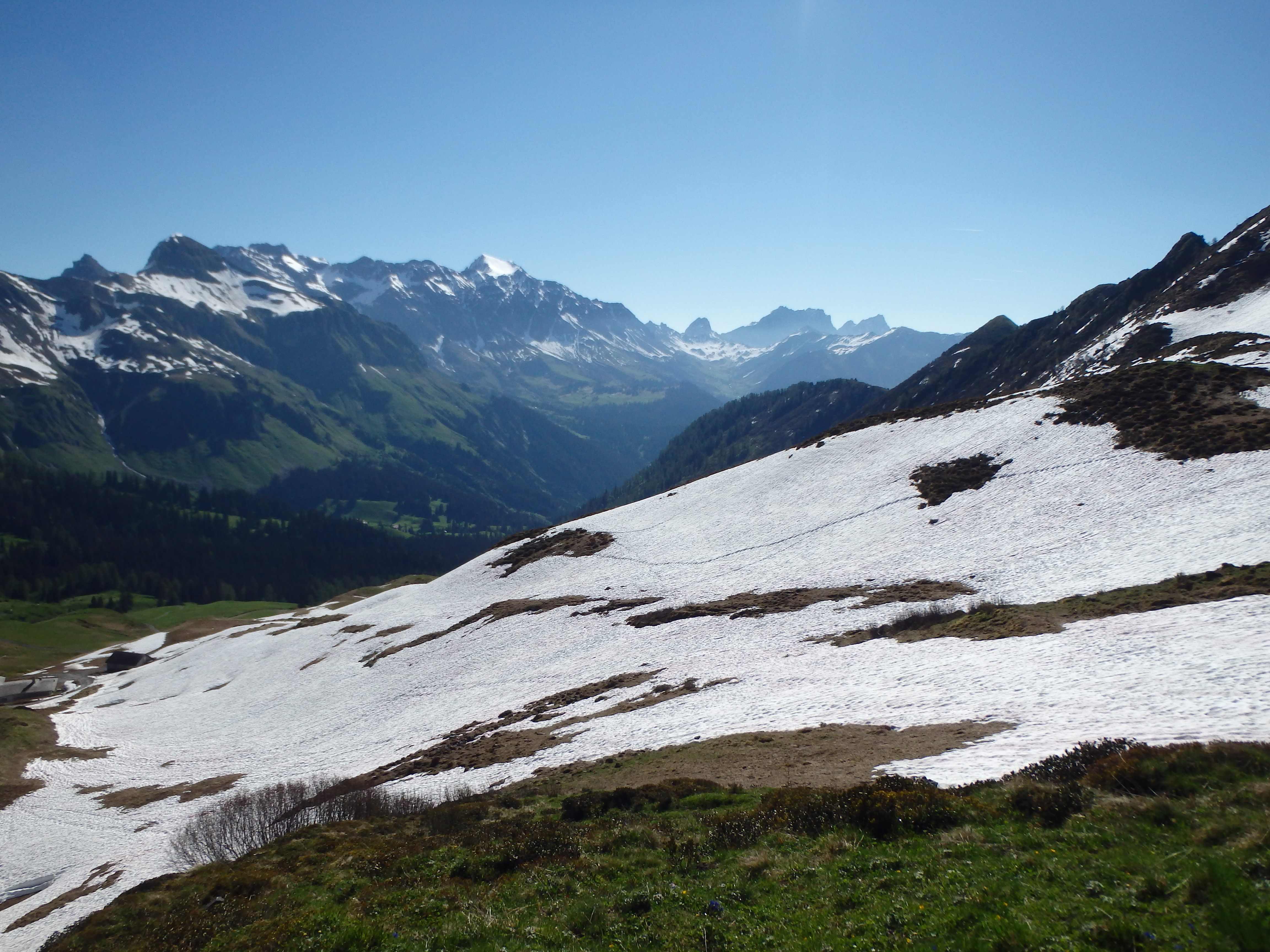
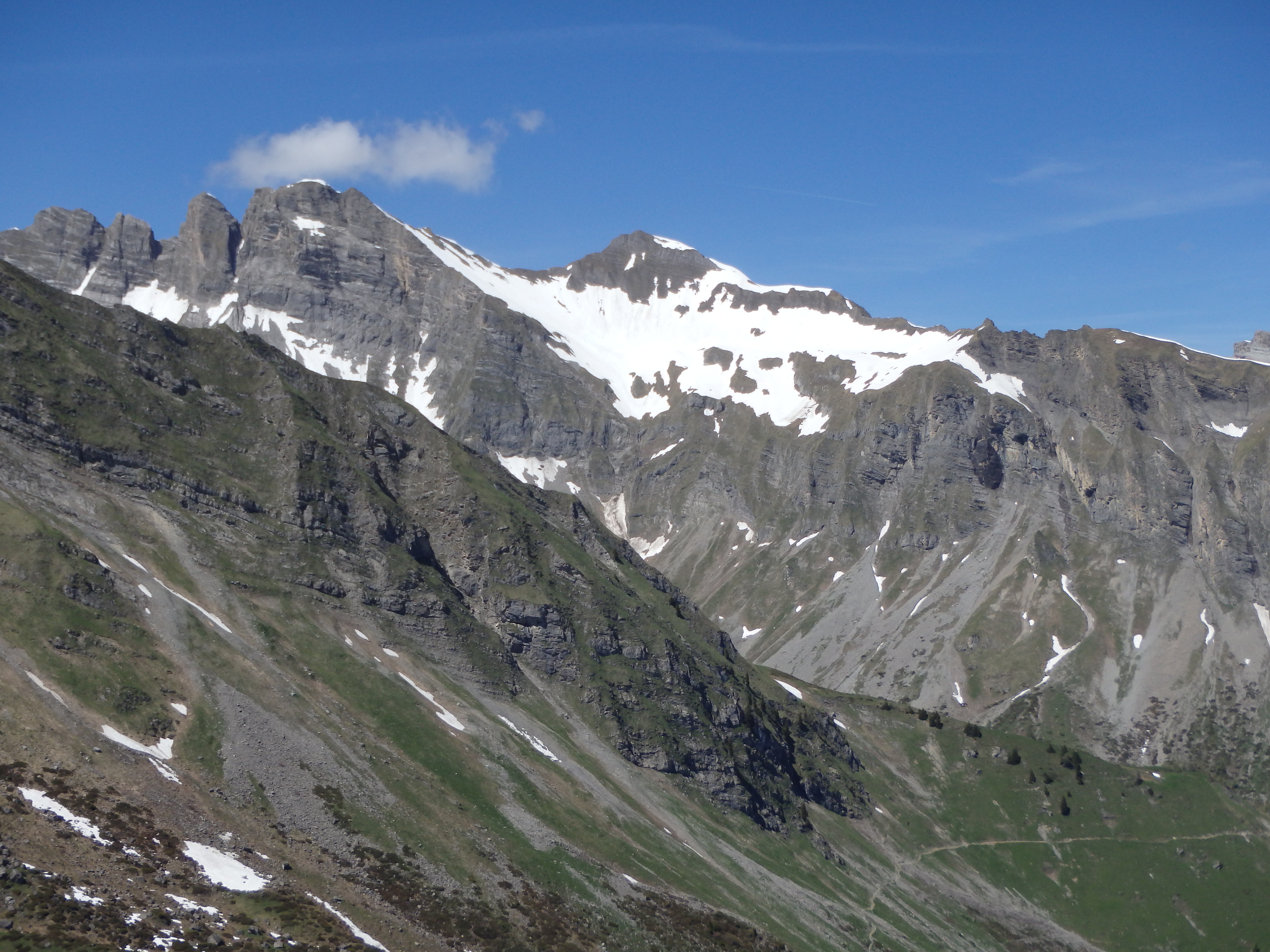
The signs did not indicate distance but rather estimated time, a nice way to gauge my speed throughout the day. While I could see plenty of snow on the surrounding summits in the distance, it was mostly north faces I was looking at, and couldn’t see beyond Kamm to judge route conditions. The route followed old farming roads, muddy in spots, to a high saddle on the intermediary ridge Kamm.
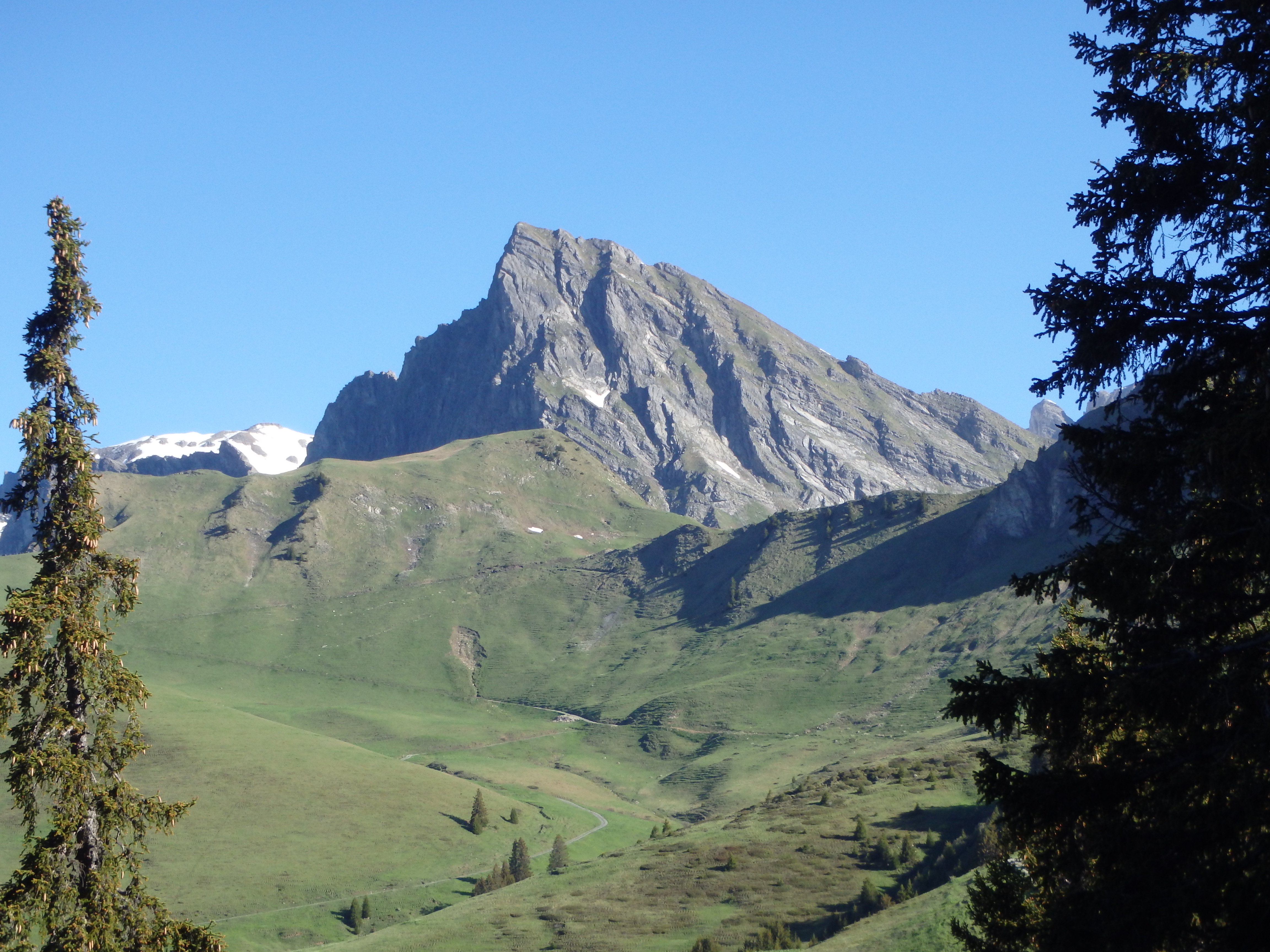
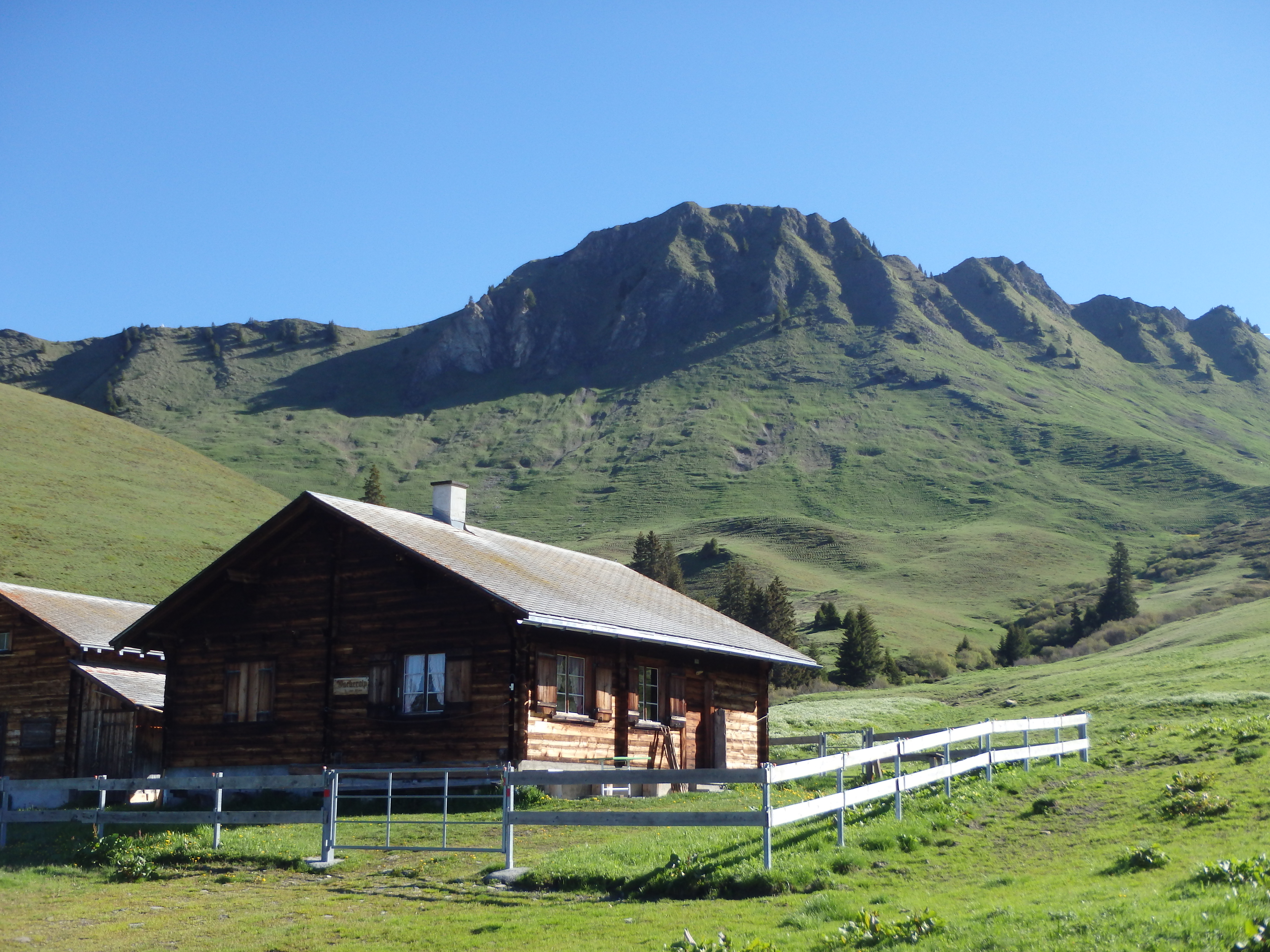
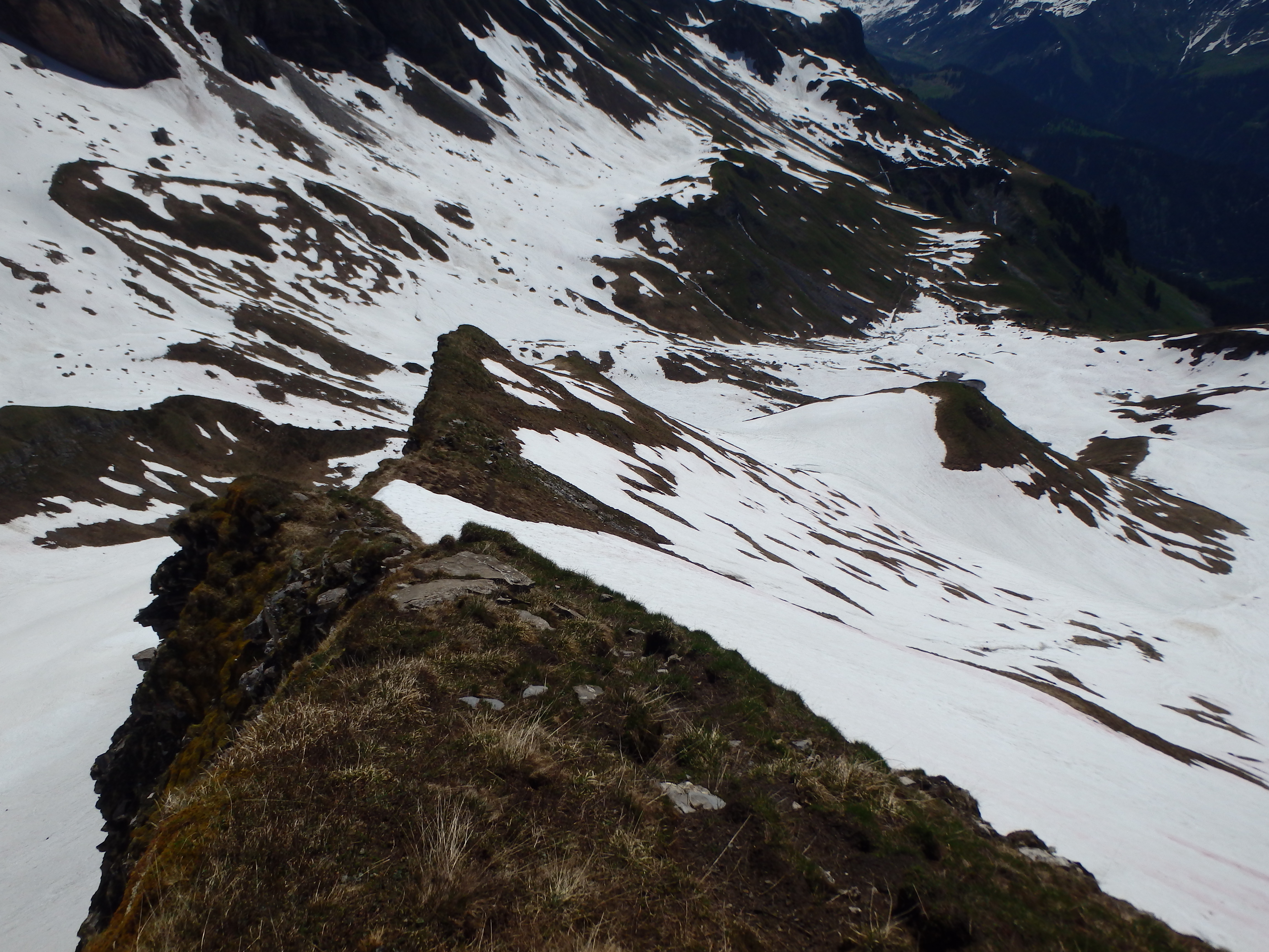
Topping out on Kamm, I encountered my first bit of snow, only at 2000 meters, and could see the cross with snow on top of Hinter-Grauspitz, the second highest mountain in Lichtenstein and neighbor of Vorder-Grauspitz. I marched on from Kamm, a bit more worried about the conditions (which would become the general theme of the entire trip quickly), and dropped a painful 200 meters to a junction above Ijes Milk Farm, passing a number of other closed farms along the way.
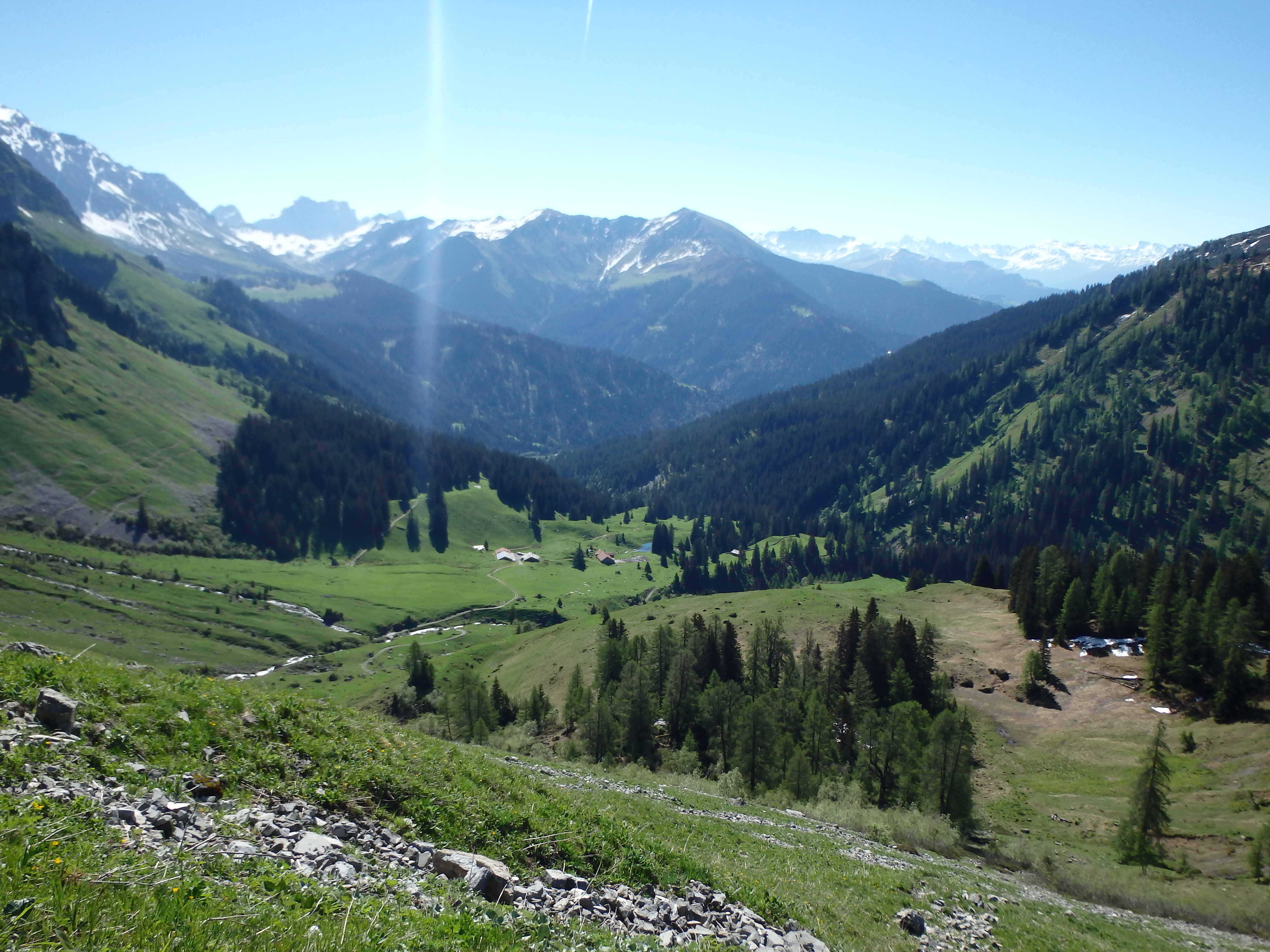
When I was nearly to Ijes, a man pulled up in an SUV asking where I was headed. I responded Grauspitz, and he took a long draw from his cigar before saying, “Very snowy, be careful,” then driving off. The blocky summit of Glegghorn was hiding the route to the southern slopes, and from what I had read, a road takes you directly to the lower basin to the south. But as I neared the bottom of the ridgeline, I couldn’t spot the road I should have been taking, and started looking for a scramble route through the cliff bands. As I rounded the bend, I was surprised to find a tunnel through the ridgeline, at least 1km in length, leading directly into the lower basin, completely buried in snow at only 2150 meters.


I could see a summit cross above me, and after orienting myself to the map, took a narrow subsidiary ridge connecting to the main southern ridge on Hinter-Grauspitz. The ridge was mostly snow free, and was steep but easy hiking up grassy slopes for the lower 3/4. About halfway up, I heard a loud crash behind me, and saw an active rockslide happening on the slopes of the mountain to the east. The seriousness of the climb in sub-optimal conditions was beginning to set it.
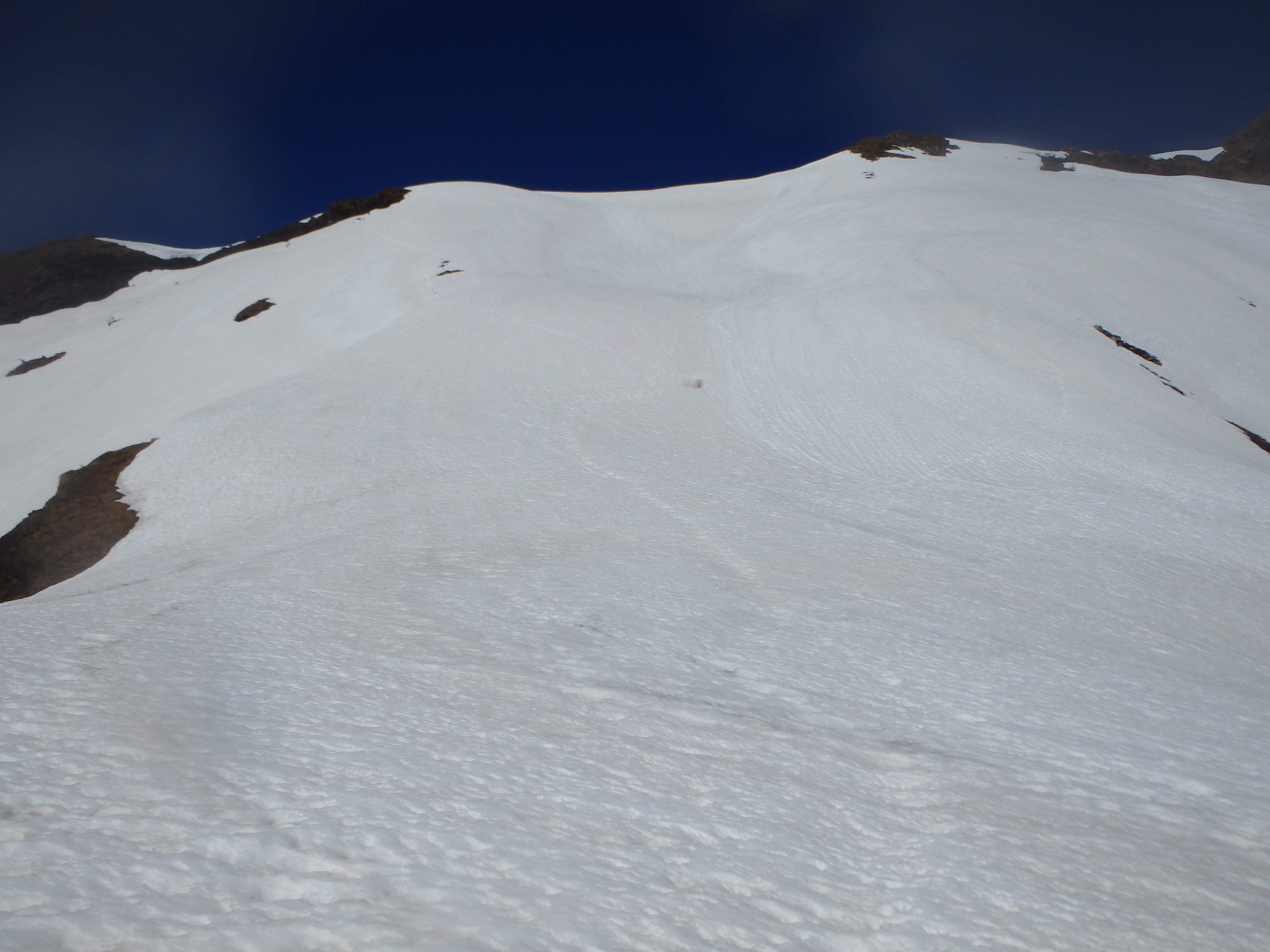
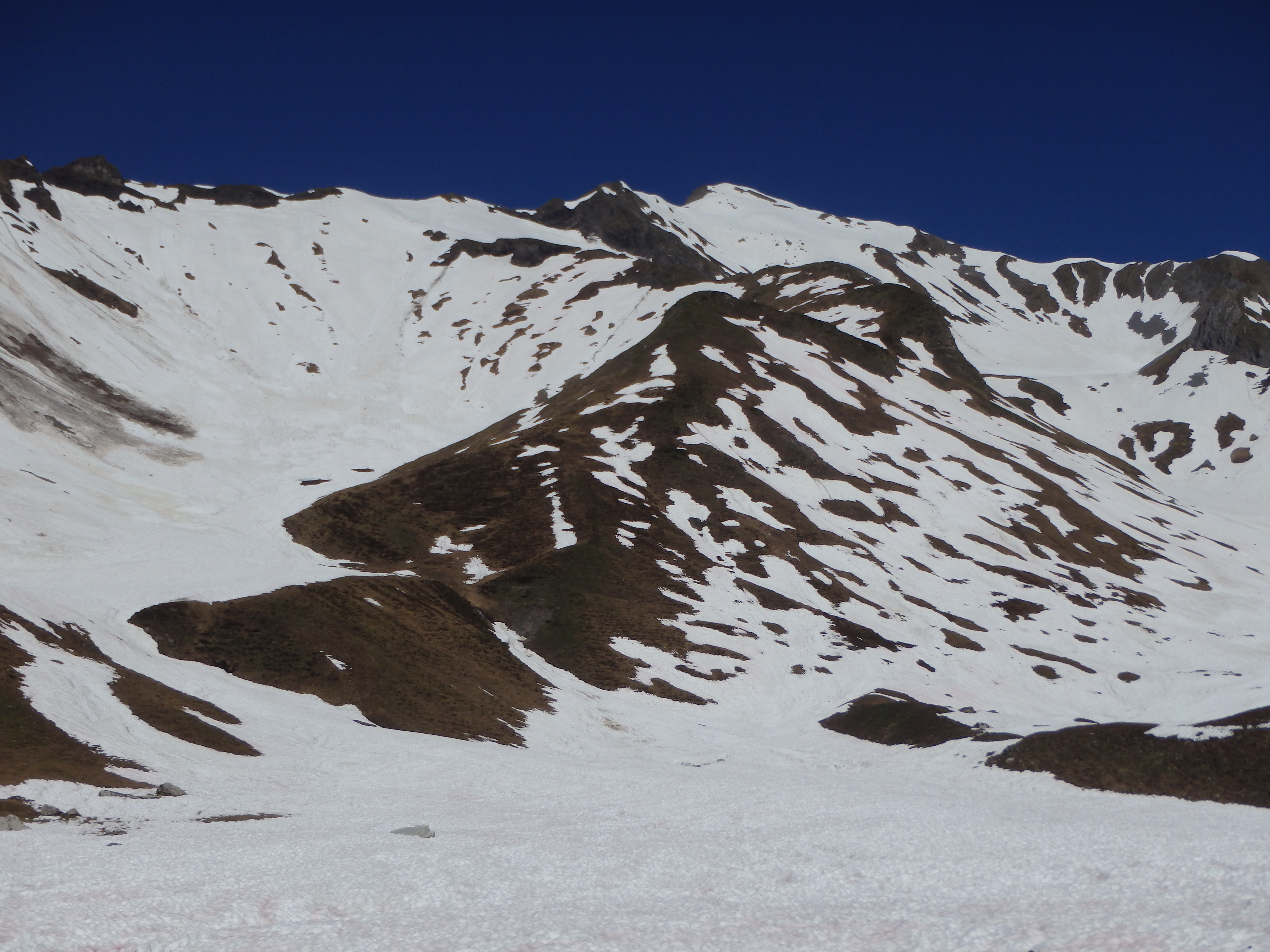
Nearing the main ridgeline, my snow free luck ran out, and I was faced with the decision to press on. I still couldn’t see Vorder-Grauspitz, blocked by the main ridgeline, so I was unsure of the conditions beyond this. But the section wasn’t steep and I did have my crampons, although I didn’t think I’d actually be using them when I left that morning, and did not bring my ice axe. I could see faint track in the snow which I found reassuring, and put my crampons on over my hiking boots and started upwards. The snow was already growing soft from the fairly intense sun, and I was mostly kicking steps up, my boot getting quickly saturated. I hit the main ridgeline, giving me my first look at the upper bowl and the remaining route to Vorder-Grauspitz, which, not surprisingly, was 100% snow covered. I had intended to drop into the upper bowl and climb the south face directly, avoiding the loose class IV ridge between Vorder and Hinter, where most parties have trouble. Unfortunately with the melting, loose snow, I doubted that the high angle ice near the top would be able to hold me, and I turned my attention to the traditional route up to Hinter with a traverse to Vorder-Grauspitz. I was surprised to see the route looked mostly snow free aside for some low angle snow patches, and thought I would climb Hinter Grauspitz, then reassess.
I headed up the ridge, taking my crampons off briefly for a very narrow section, and curved up some snow patches to the summit cross and my first Alpine summit.
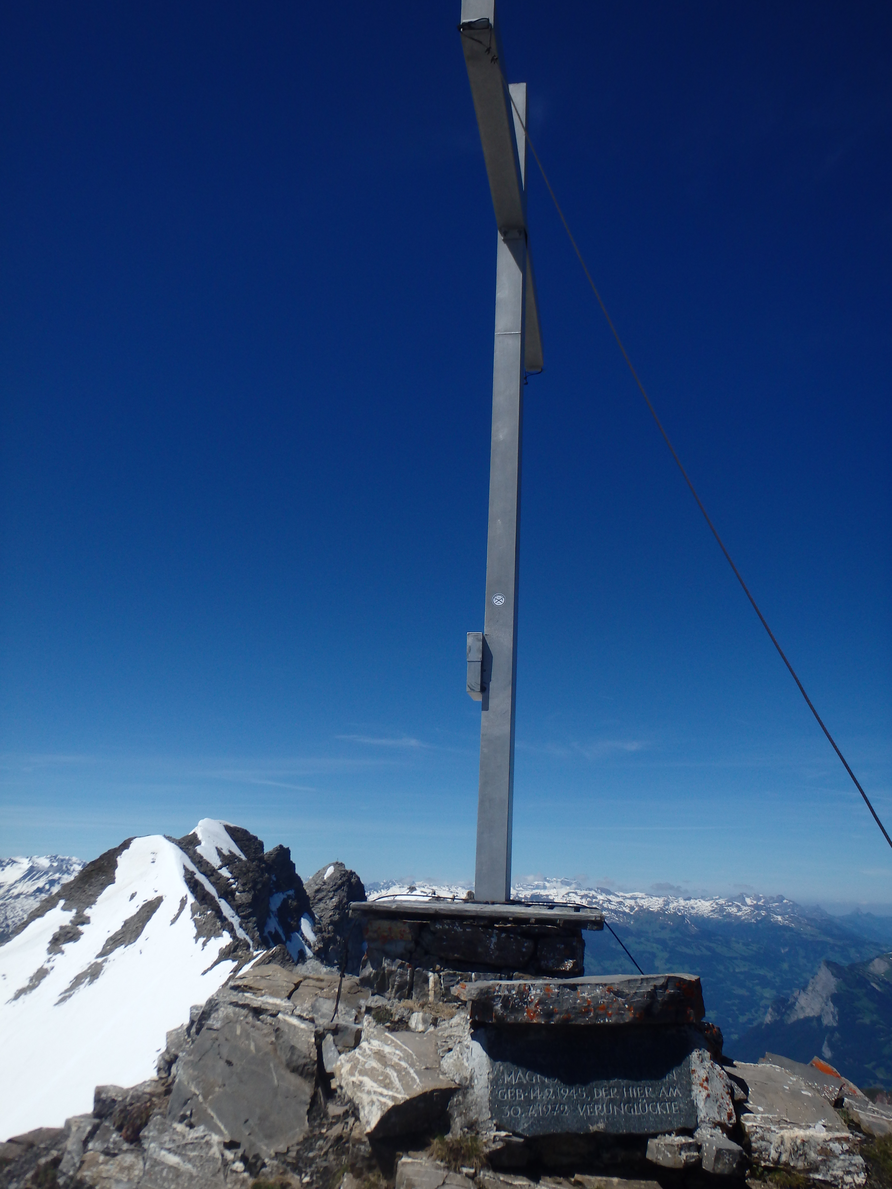

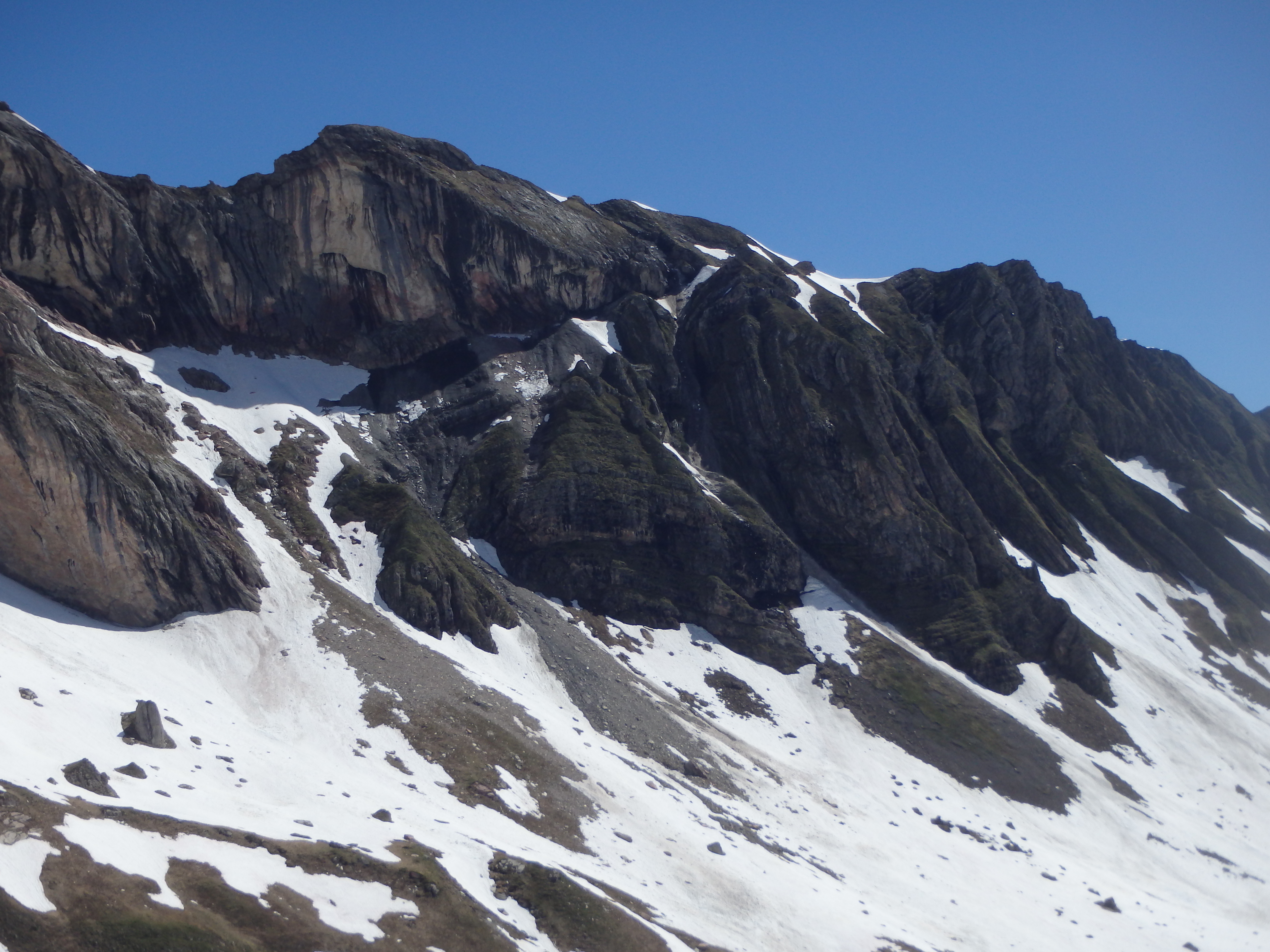
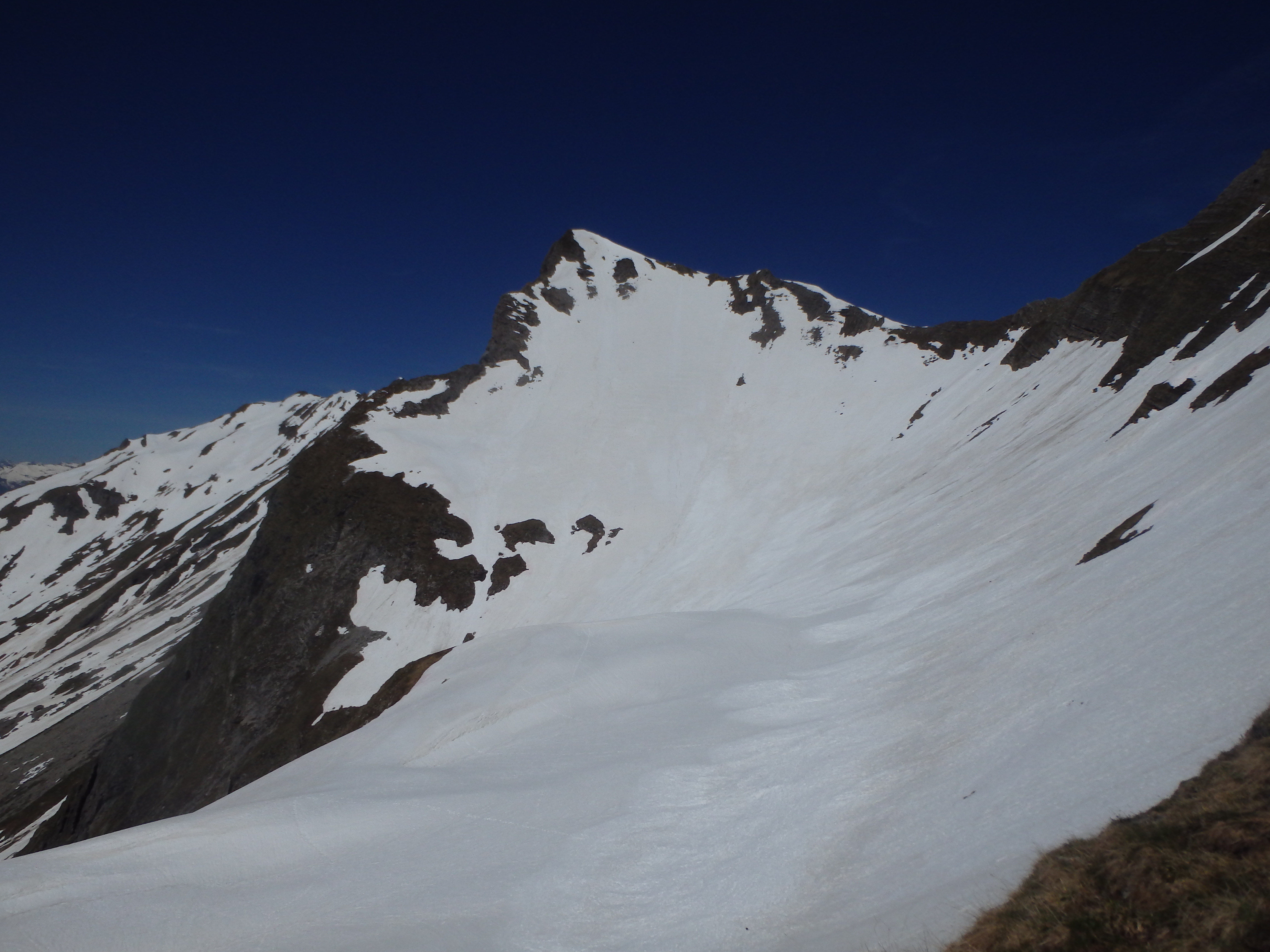
After signing into the summit register, my attention immediately turn to Vorder-Grauspitz. While the descent to the saddle between the two summit appeared to be snow free (and reportedly, the most difficult part), the narrow, class III ridgeline heading to the top of Vorder-Grauspitz had several areas of significant snow and ice. I studied the route carefully, and dropped down partways to better assess it. Immediately above the saddle, there was a narrow section with death exposure to the north, covered in loose and melting snow. A similar and longer section could be seen just above this, which was capped off by the steepest part just below the summit, where the angle probably approached 60 degrees, with death exposure to the north and 1000′ to the bowl to the south.
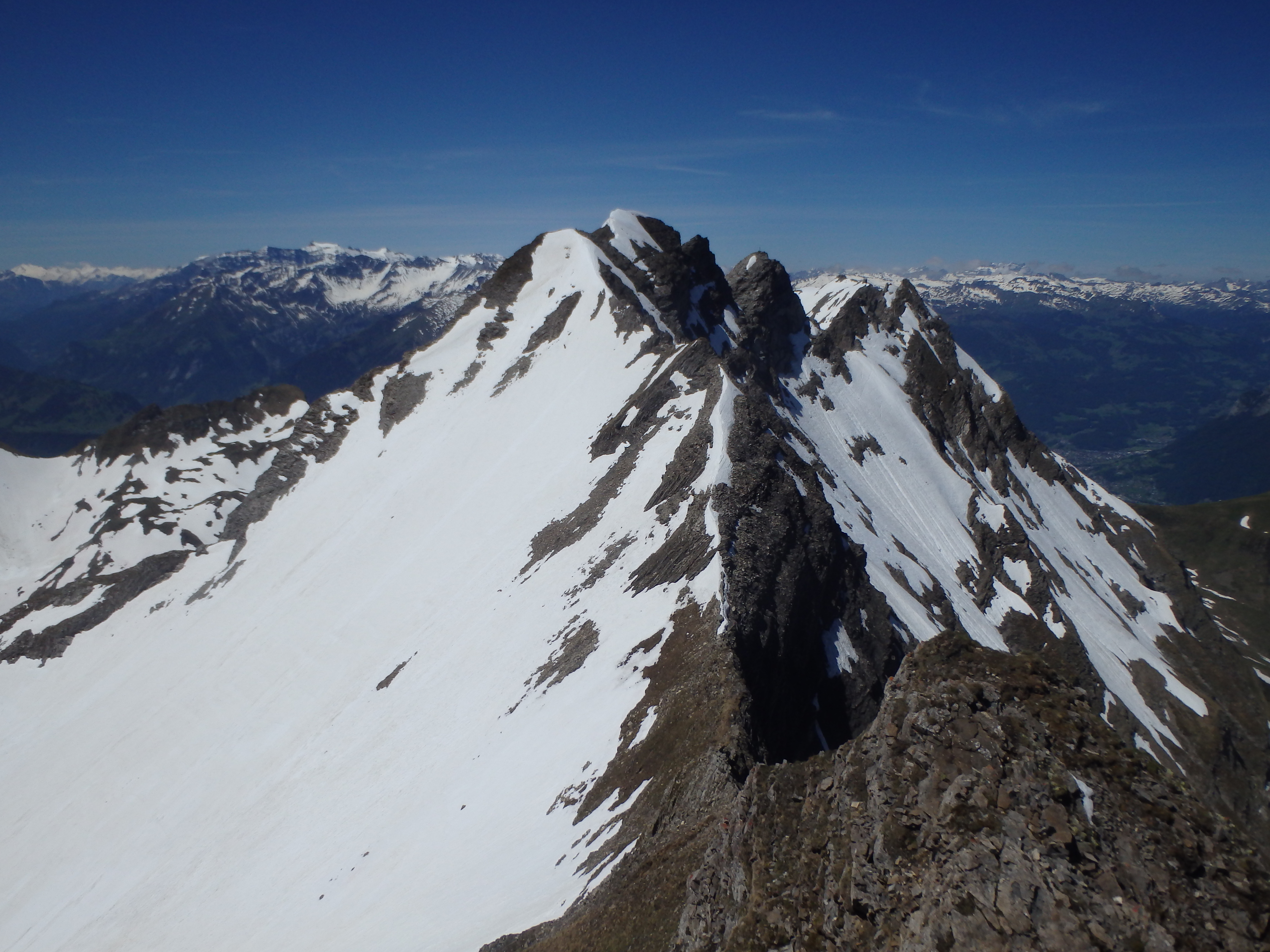
I looked for other options, possibly traversing the snow below the section. In fact, there were footprints that looked to do just that on the upper slopes. And as I looked down to the snowfield, I actually saw a bit of movement below, not another climber, but a mountain goat. I quickly realized that the vague tracks I had been following were not from other people, but goats, and should probably not be relied on for route choices. After staring at the route to Vorder-Grauspitz for a good 30 minutes, only 25 meters higher then Hinter-Grauspitz, I felt I couldn’t rationalize the risks on what was already a challenging route under optimal conditions. So i descended back down the ridgeline the way I came, trudging through the melting snow and suncups, and back to the road.

Disappointed that I couldn’t tag the highpoint, I started looking for other consolation peaks. It was early afternoon and I needed to be back to the top of the lift by 4:15, which didn’t give me much time to chase after anything too involving. Kamm seemed like the obvious choice, since I needed to cross the saddle just below the summit anyways. I picked up my speed and hiked back up the road to the saddle, passing a car full of tourists calling out for their lost dog.
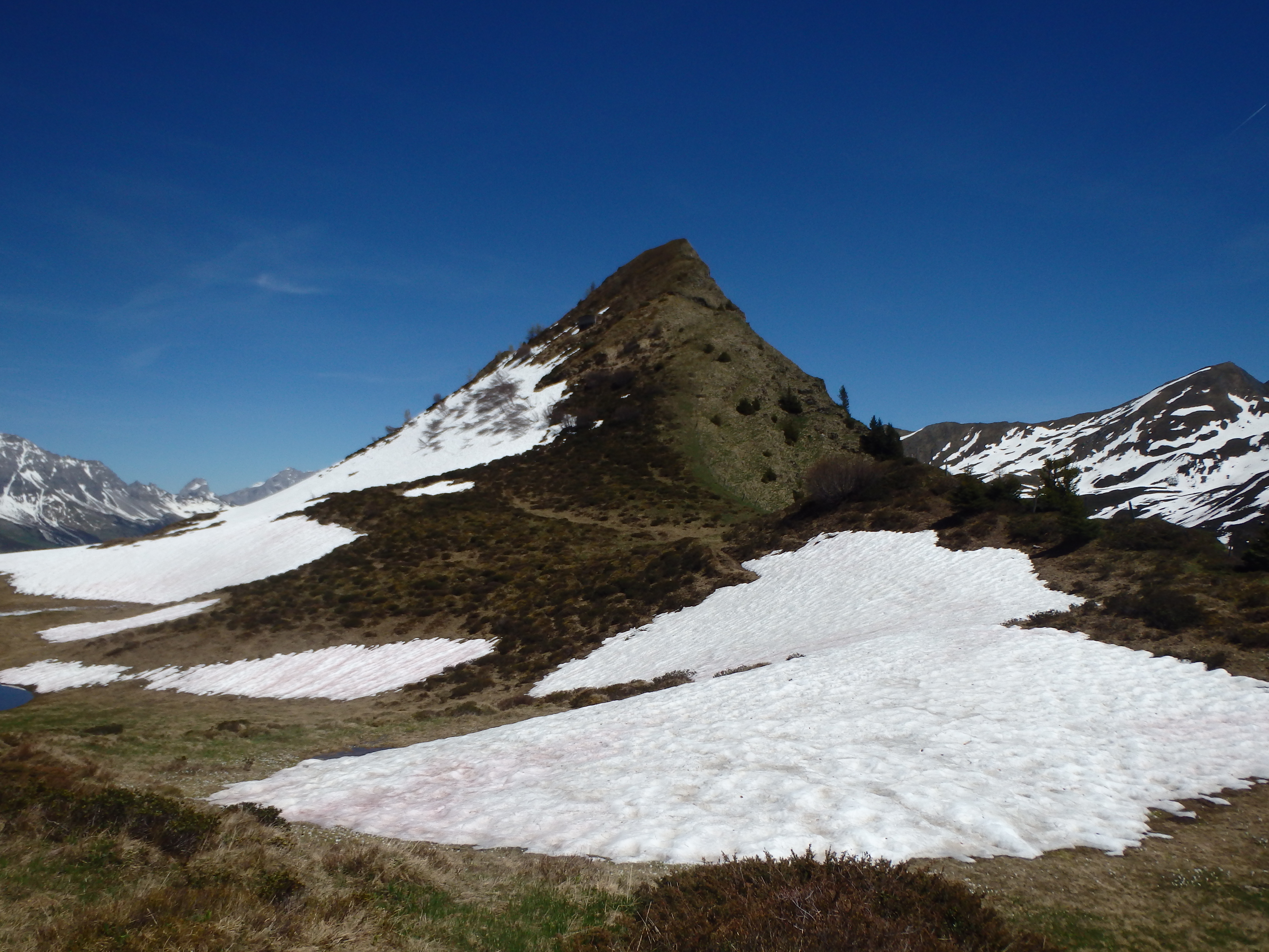
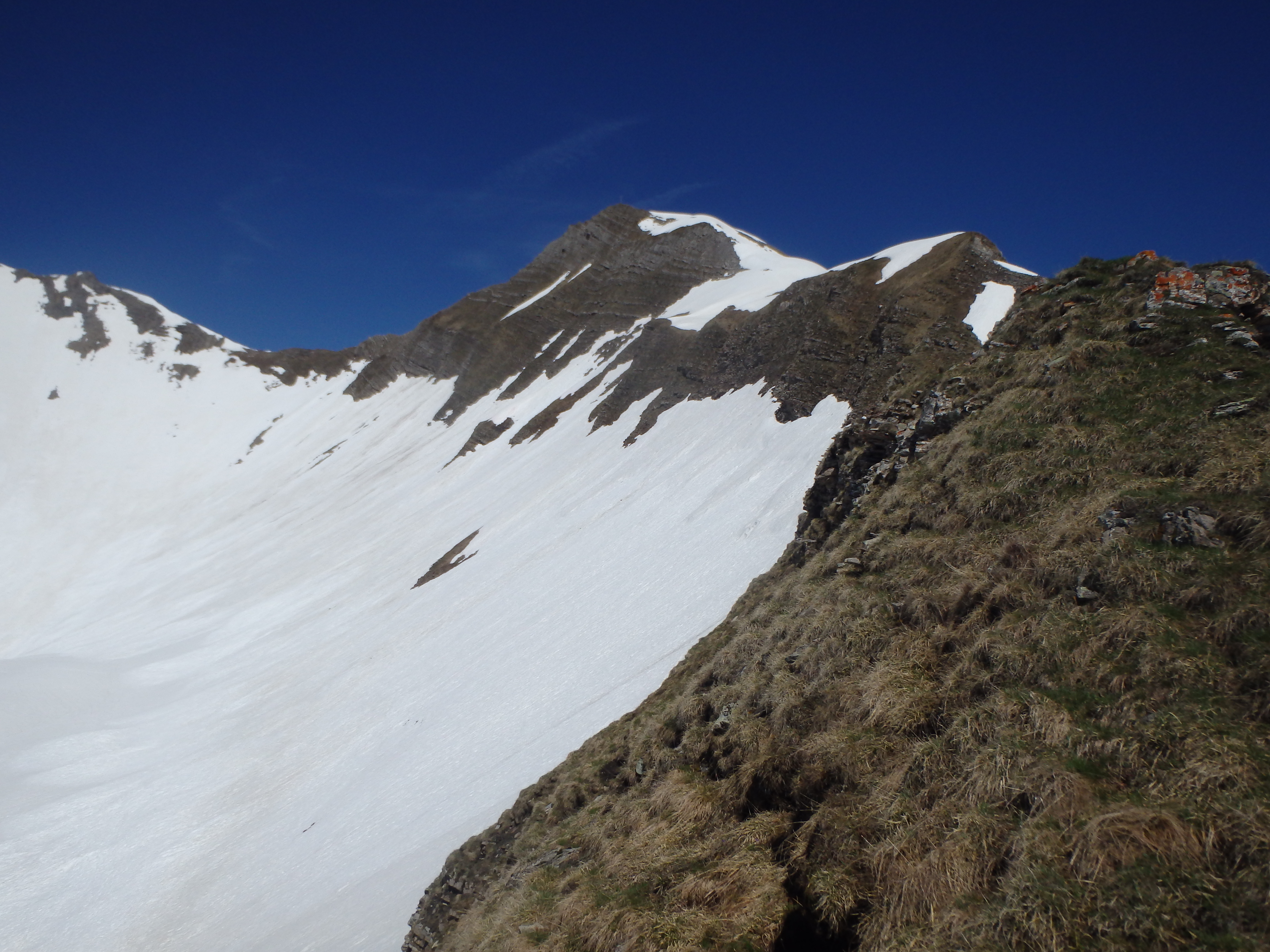
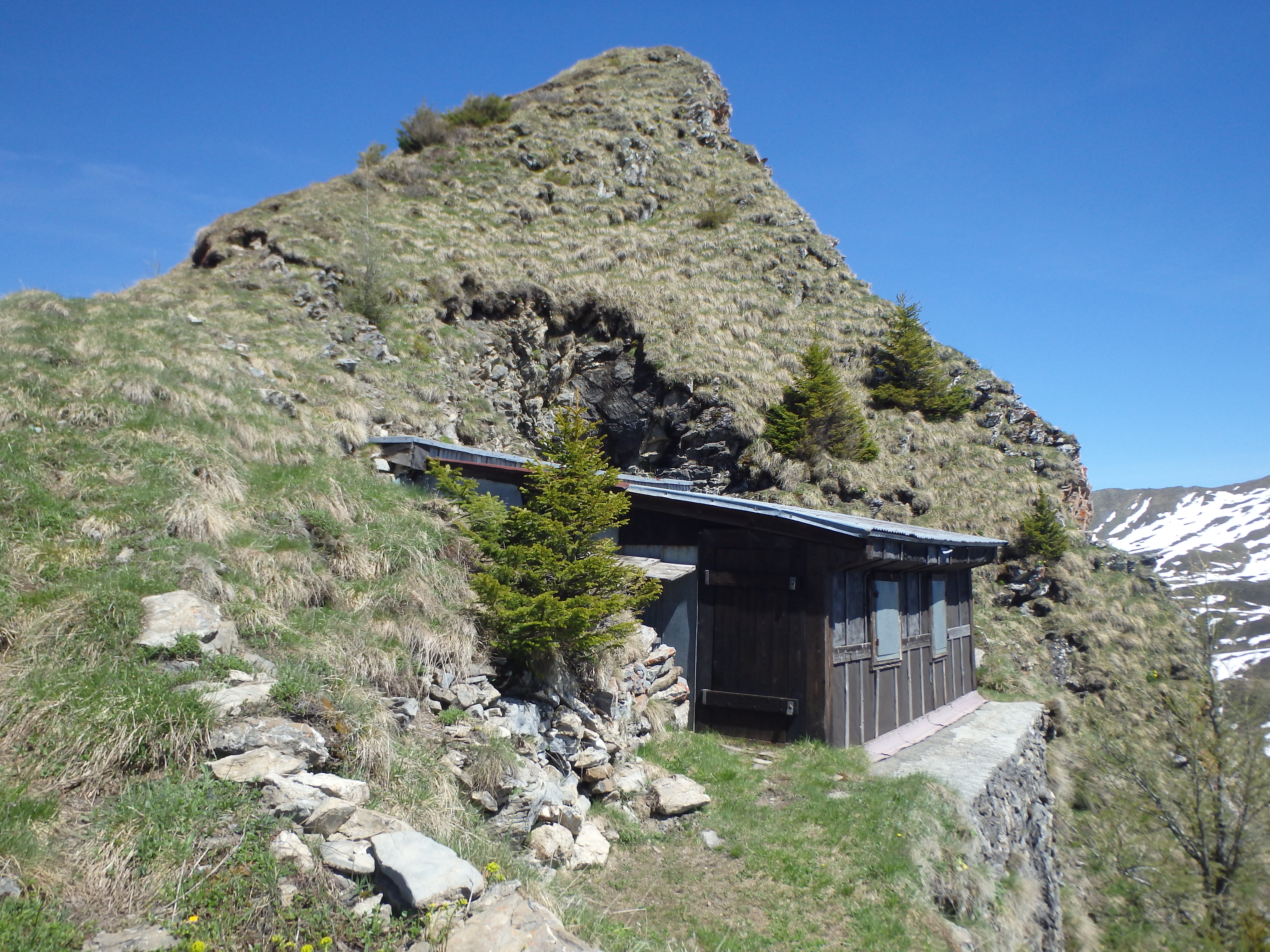
From there, it was straightforward cross country up the grassy ridge to the top. Just below the summit, there’s a small storage shed, presumably belonging to the farm below. The view from the top of Kamm was similar to the saddle, but did offer a nice look at the upper basin of Vorder and Hinter-Grauspitz.
It was nearly 4:15, so I dropped back to the saddle and headed cross country directly down slope, cutting some of the larger switchbacks along the road. I made it back to the the top of the lift shortly after 4, took the lift down, and drove back to Zurich for dinner and to dry my soaking wet shoes under the hotel hairdryer.