
Mount Meru 4562 m / 14,977′
International– Tanzania
Total Time: 3 days
Distance: 38.5 km/ 23.9 miles
Elevation Gain: 10,560’/ 3,220 meters
Crux: Class 2/3
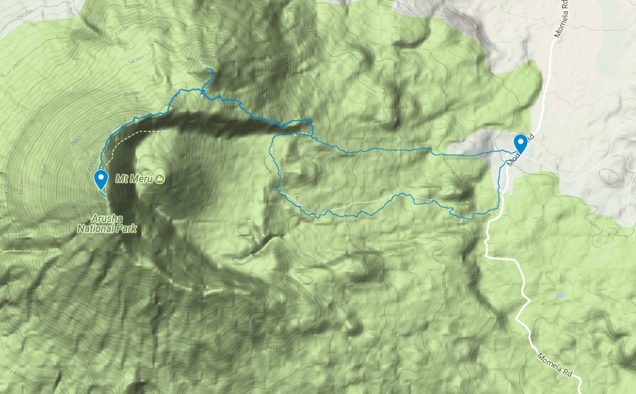
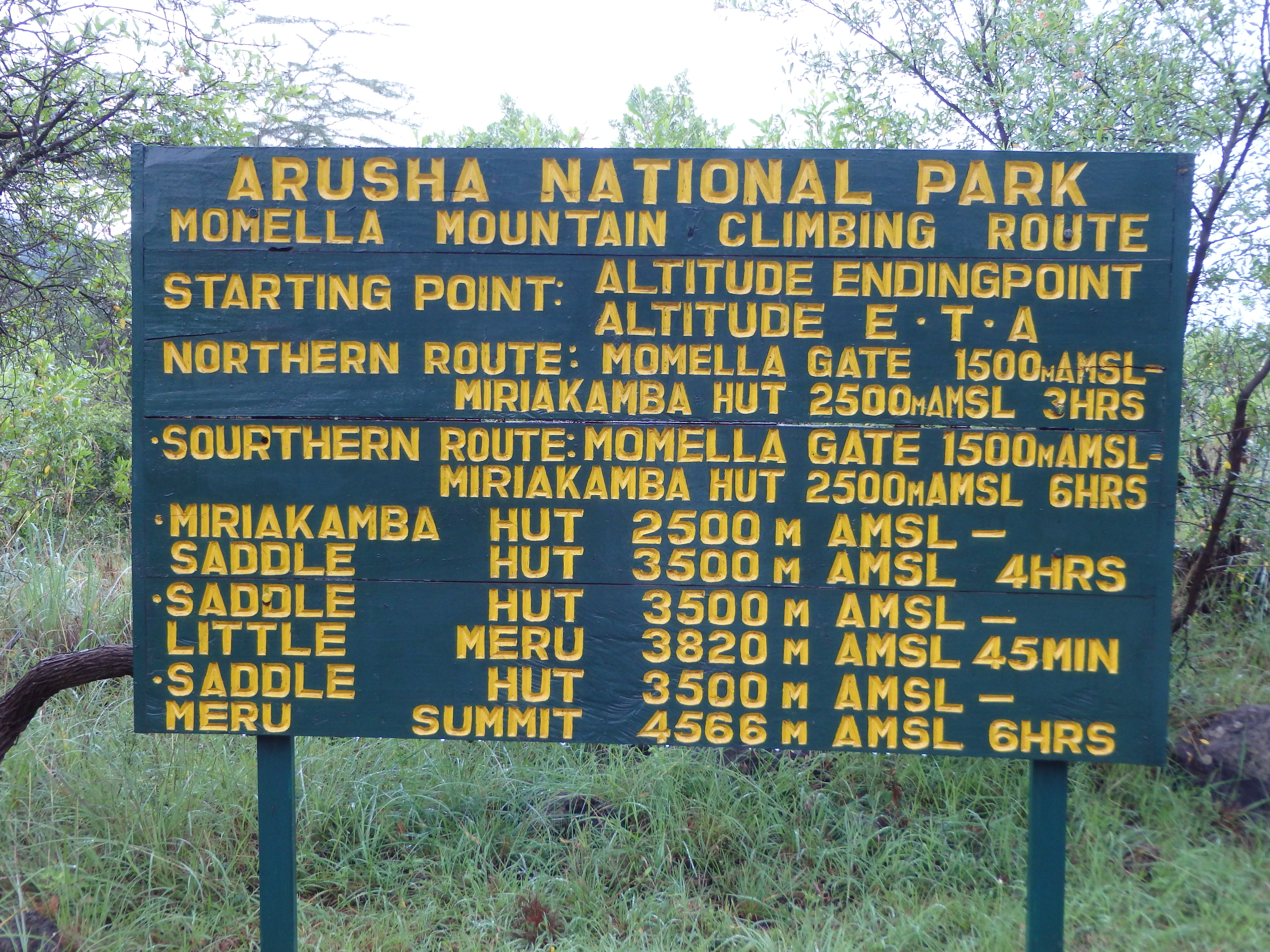
Trailhead: Momella Gate
Companions: Justin Shelton, Adnaan Sheriff, Rob Frings

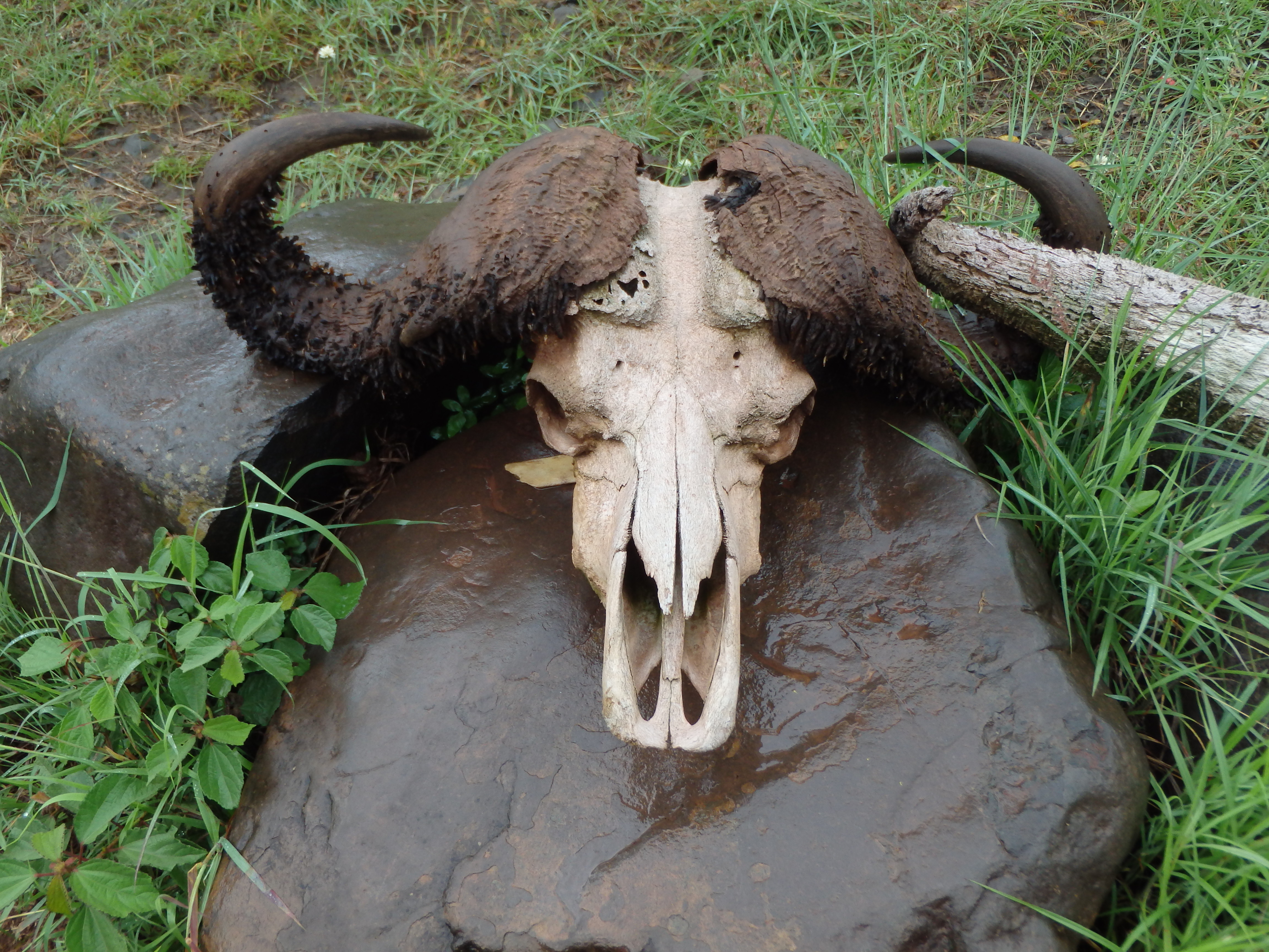
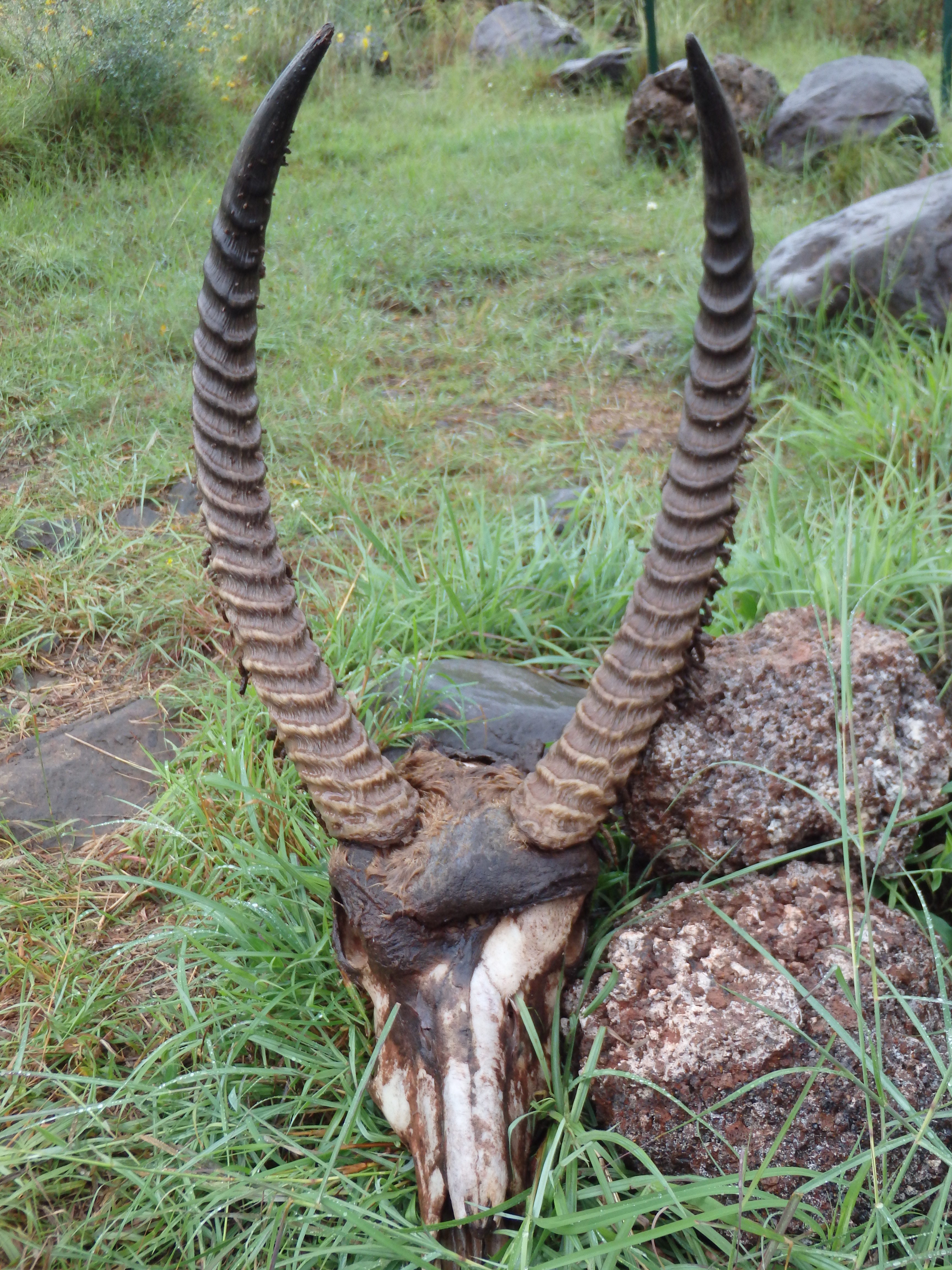
Mount Meru is the second highest mountain in Tanzania and the fifth highest in Africa. Certainly a worth objective in its’ own right, Meru is usually climbed by international hikers looking to acclimate before climbing Meru’s higher and more famous neighbor, Mount Kilimanjaro. Unlike Kilimanjaro, Mount Meru can be climbed unguided, although a park ranger needs to be hired for “climber protection” since the park has potential for large game encounters along the trail. But it’s the potential encounters with big game that makes this climb so interesting- while Kilimanjaro has it’s share of birds and monkeys, on Mount Meru you’re hiking on foot past herds of Buffalo, Zebra and Giraffe without the safety of a safari vehicle between you and the massive animals. For us, it served as the perfect mountain to acclimate for Mount Kilimanjaro, which we would be attempting several days after Meru.
Day 1
We woke up early in Arusha for Mount Meru and left by 7:30 AM in heavy rains. We reached the Momella Gate by 9 AM and paid our park fees (by credit card!) at the headquarters.
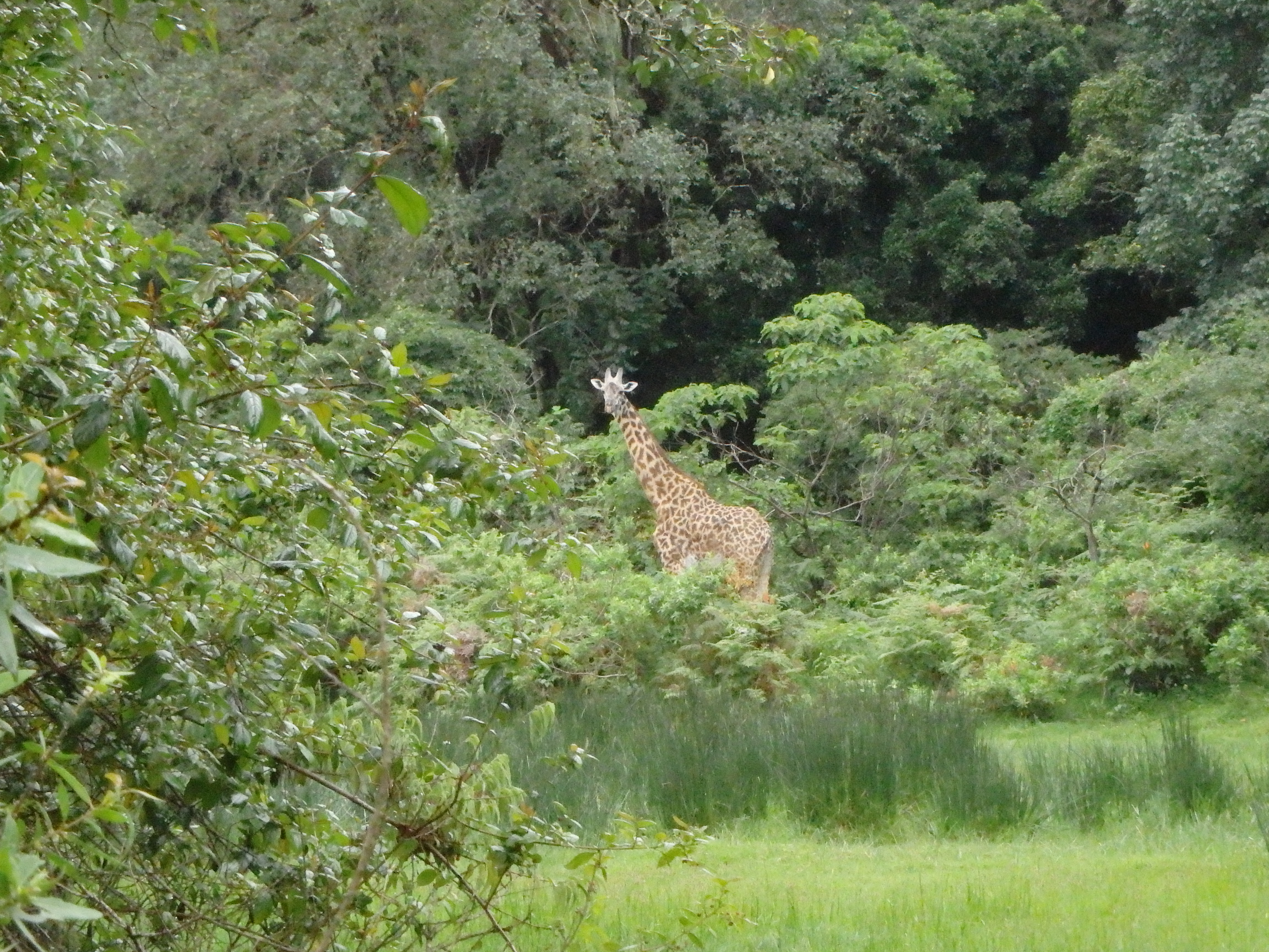
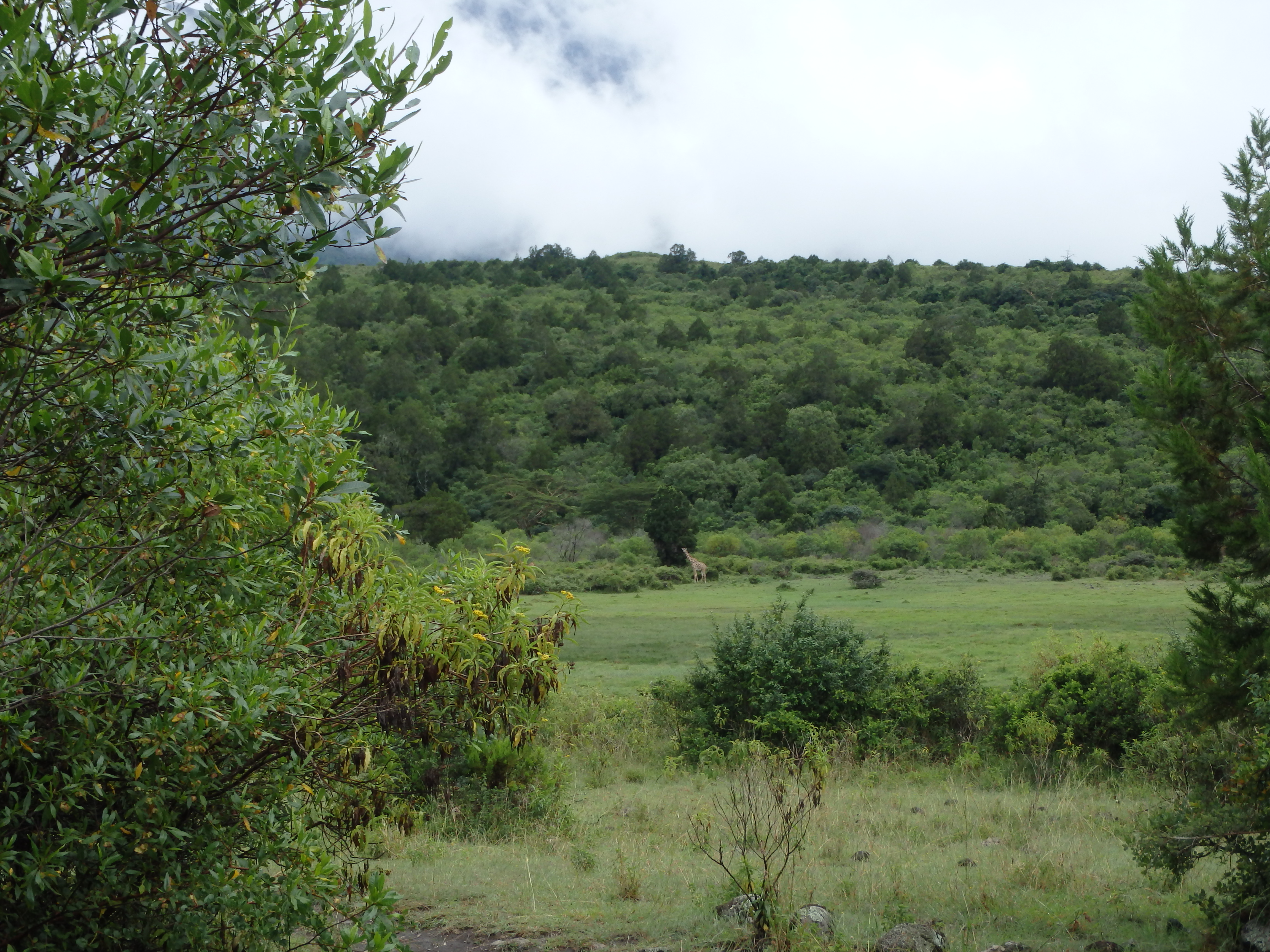
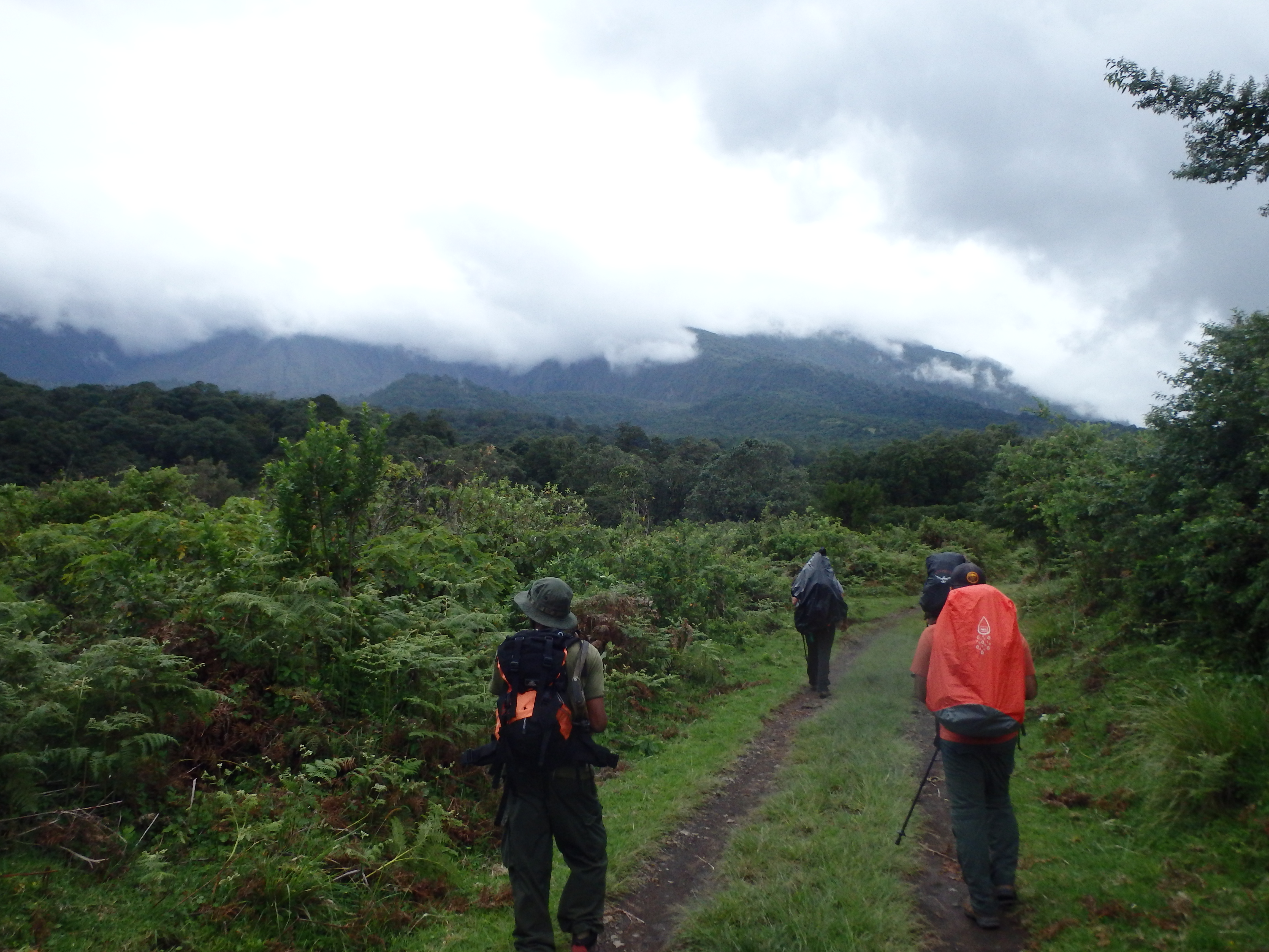
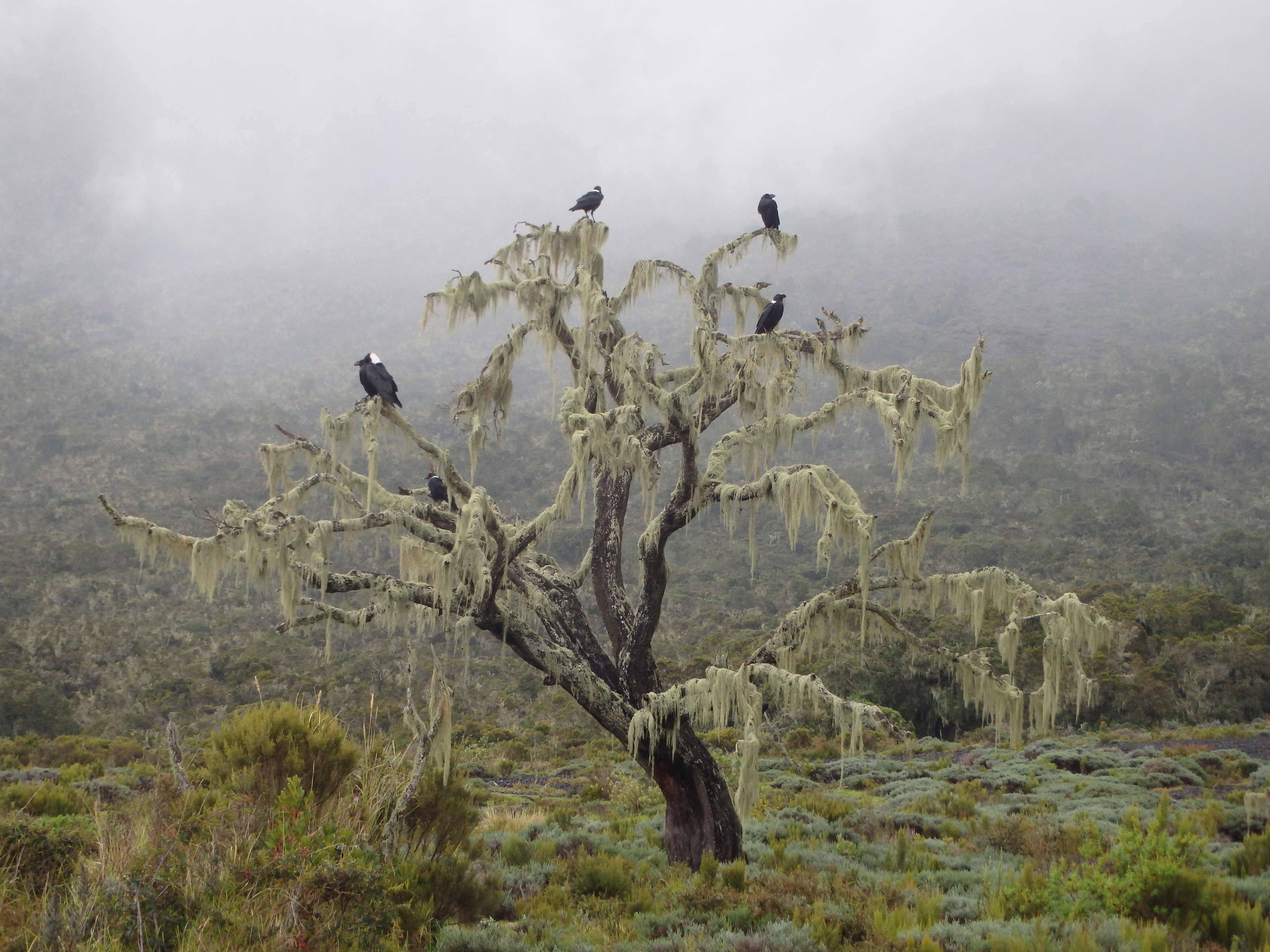
We learned that the ranger that leads the climbing groups wouldn’t arrive until 10. When he did show up an hour later, he took his time getting ready, possibly hoping for another group to show up that he could combine with us. It was after 11 AM when we set out, thankfully the heavy rains having stopped. Our ranger/pseudo-guide Raymond hiked with a rifle slung over his shoulder, mainly to scare off any potentially charging Buffalo. The trail passed through open grassland and entered thick jungle with Colobus Monkeys swinging in the trees above and birds waking up as the rains stopped. Reaching a stream crossing about one mile in, I was shocked to see a wild giraffe grazing about 20 yards off the trail. Certainly the largest animal I’ve ever seen in the wild while on foot.
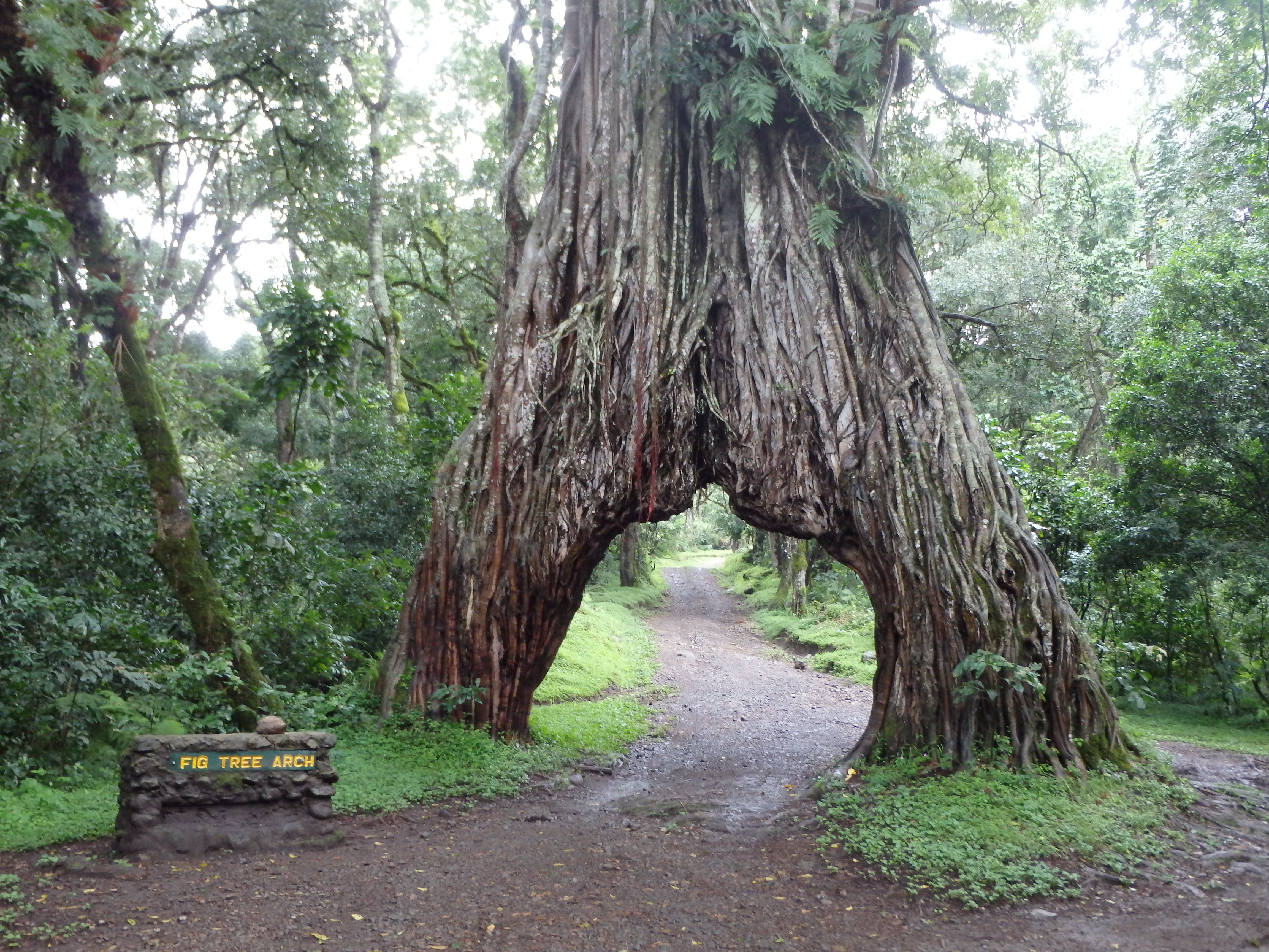
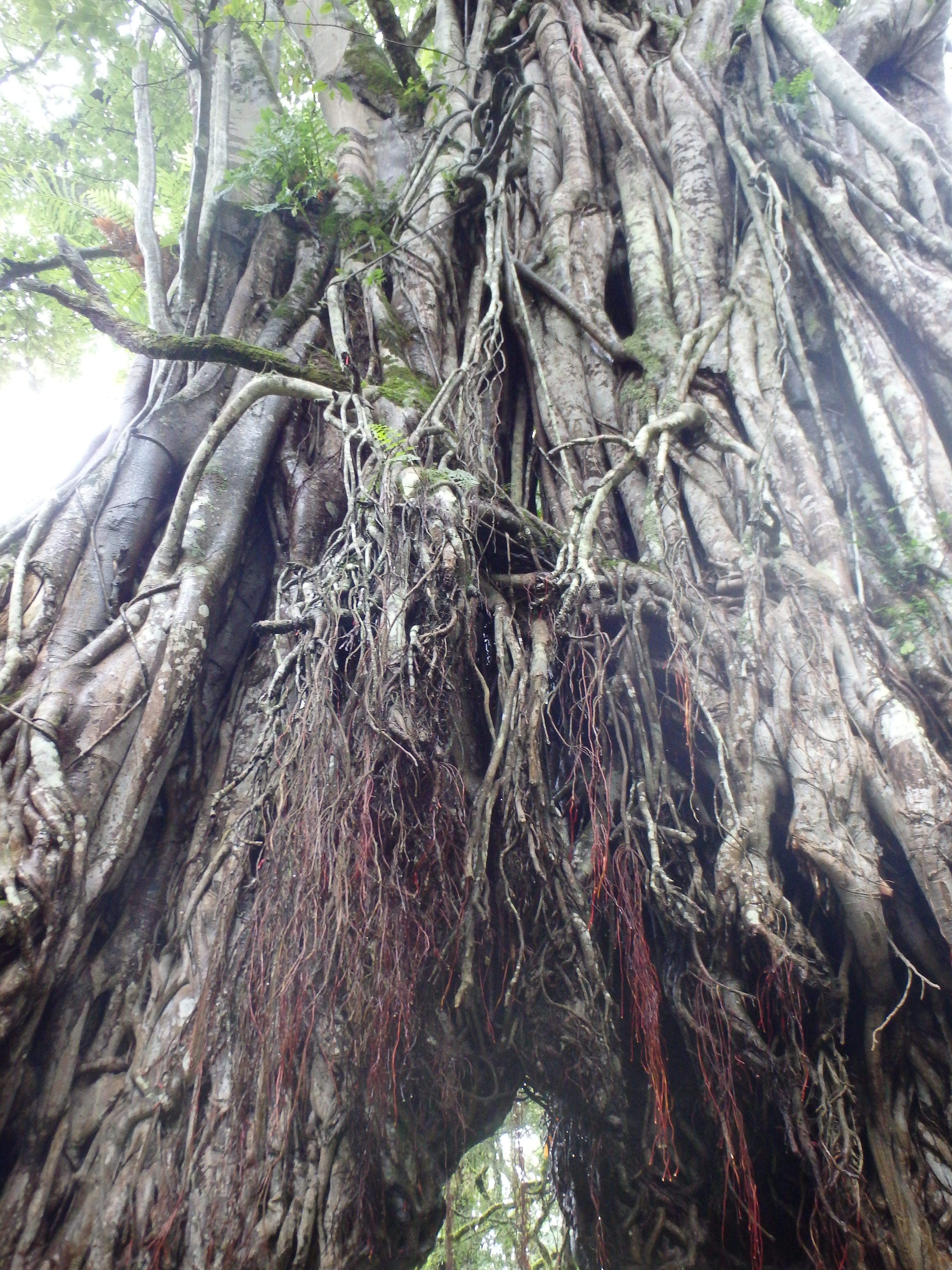
We choose to hike along the Southern, more scenic route in to Miriakamba Camp, which traversed east of the Cinder cone in the center of Meru’s blown out caldera. Before reaching the cinder cone, the trail passes through the famed “Tunnel Tree’ a massive fig tree with the trail going directly between the roots. I’m unsure if this tunnel was natural or not, but the tree seemed to be in good health and made for an interesting addition to the hike.
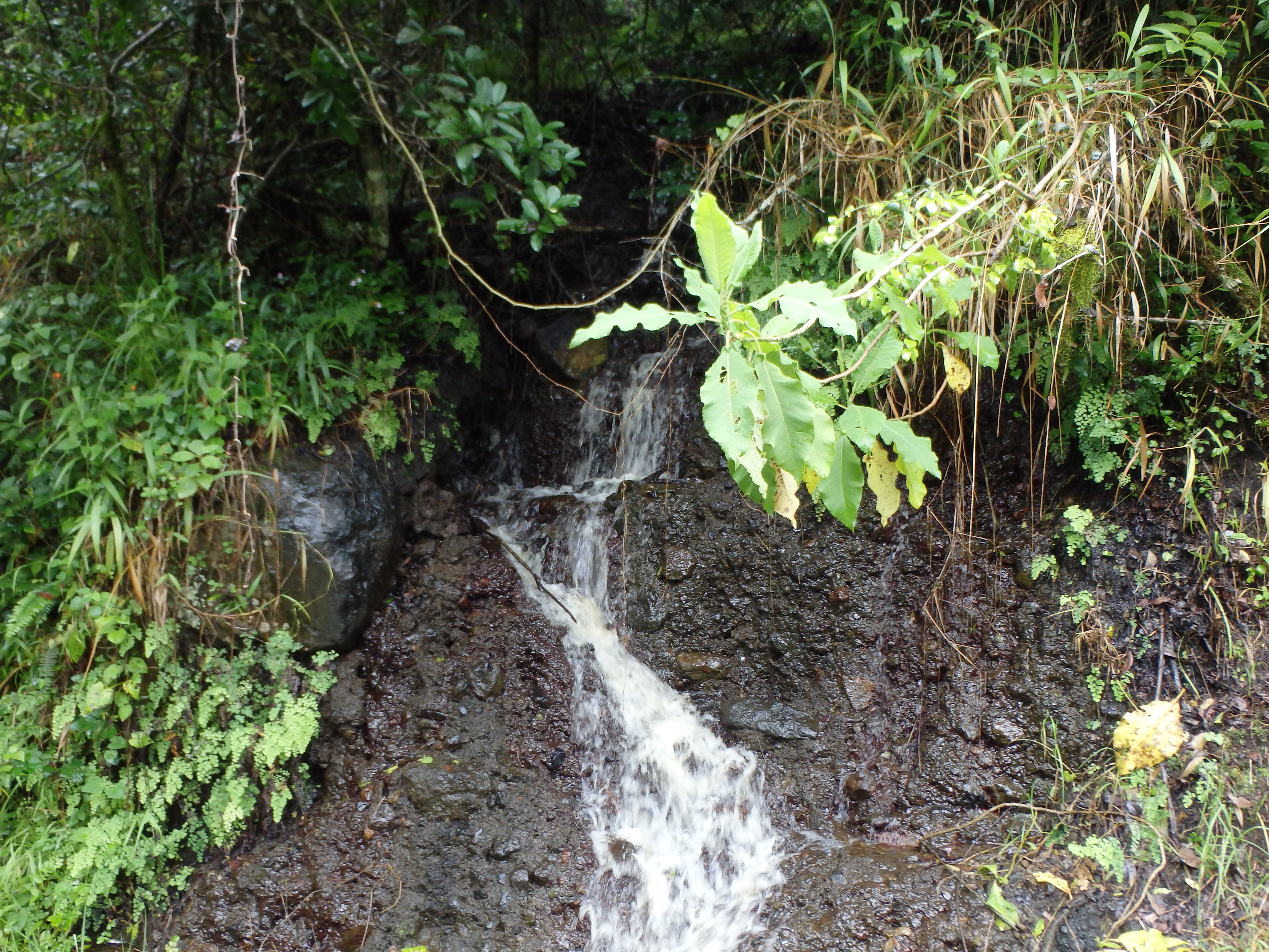
Leaving the tunnel tree, the trail slowly ascended out of the deep rainforest with more open ridgelines and grassland. As we neared the cinder cone, the trail became flooded from the recent rains, huge puddles and streams covering most of the trail. We tried to hop from rock to rock in an effort to keep our boots dry for the next two days of hiking. Adnaan learned the hard way that piles of Buffalo shit can look an awful lot like rocks.
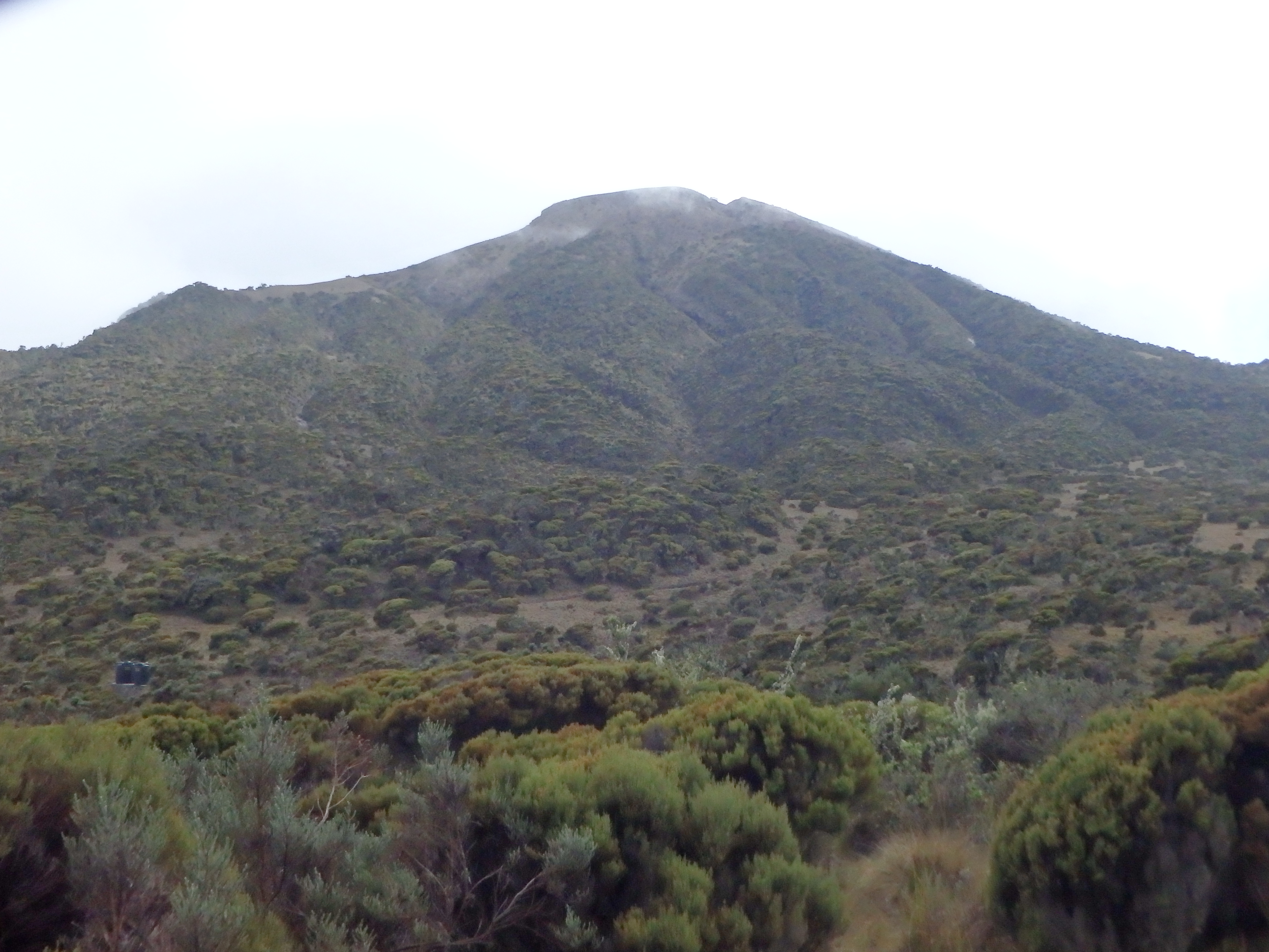
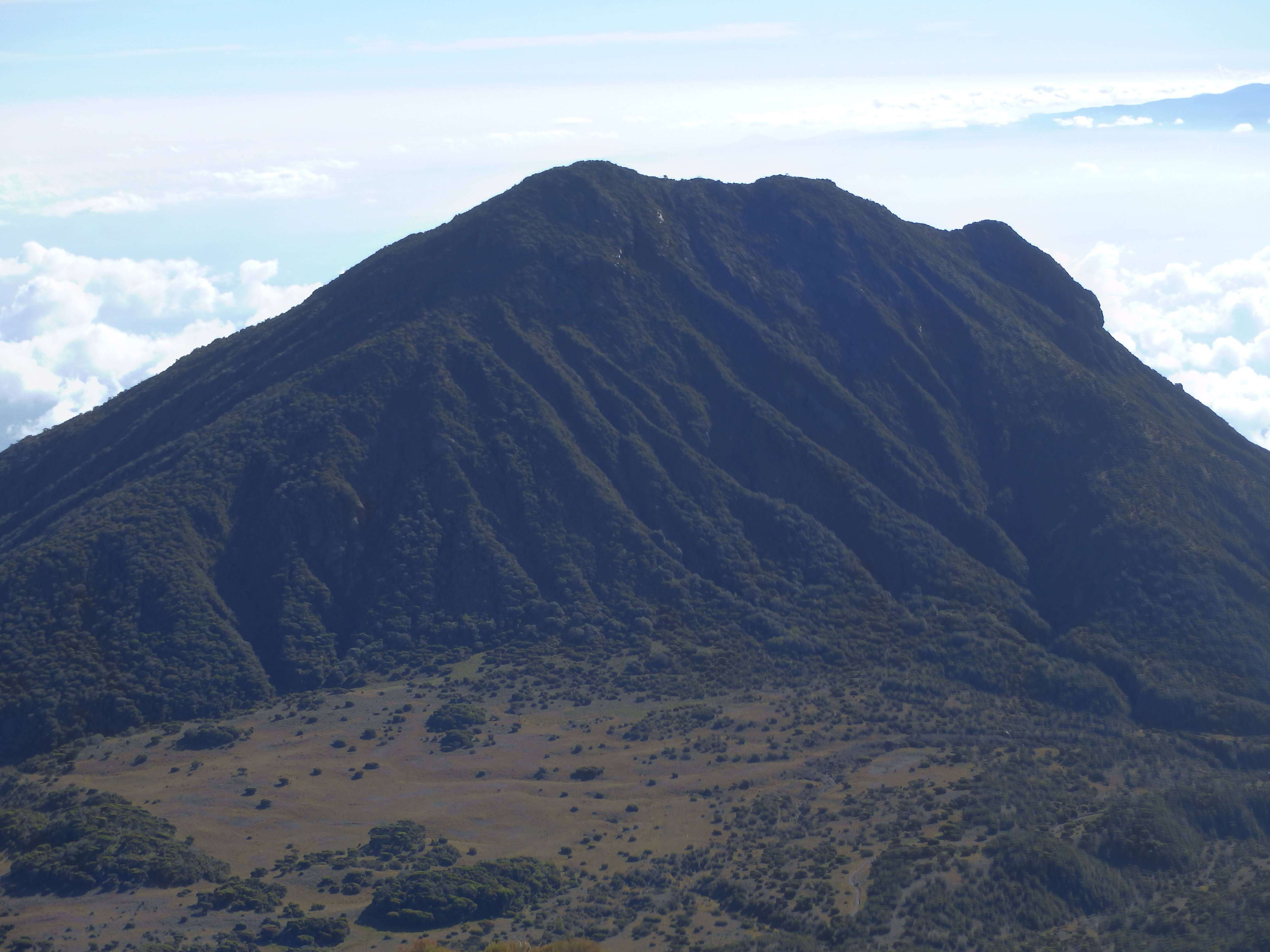
Just as the trail cuts north towards Mirikamba Camp, the views towards the cinder cone opened up and gave us our first look at the bizarre summit in the middle of Mount Meru. While there is a trail that leads to the cone, it is only open to researchers by a special permit. And considering we were with an armed ranger, it didn’t seem like a great time to go rouge….

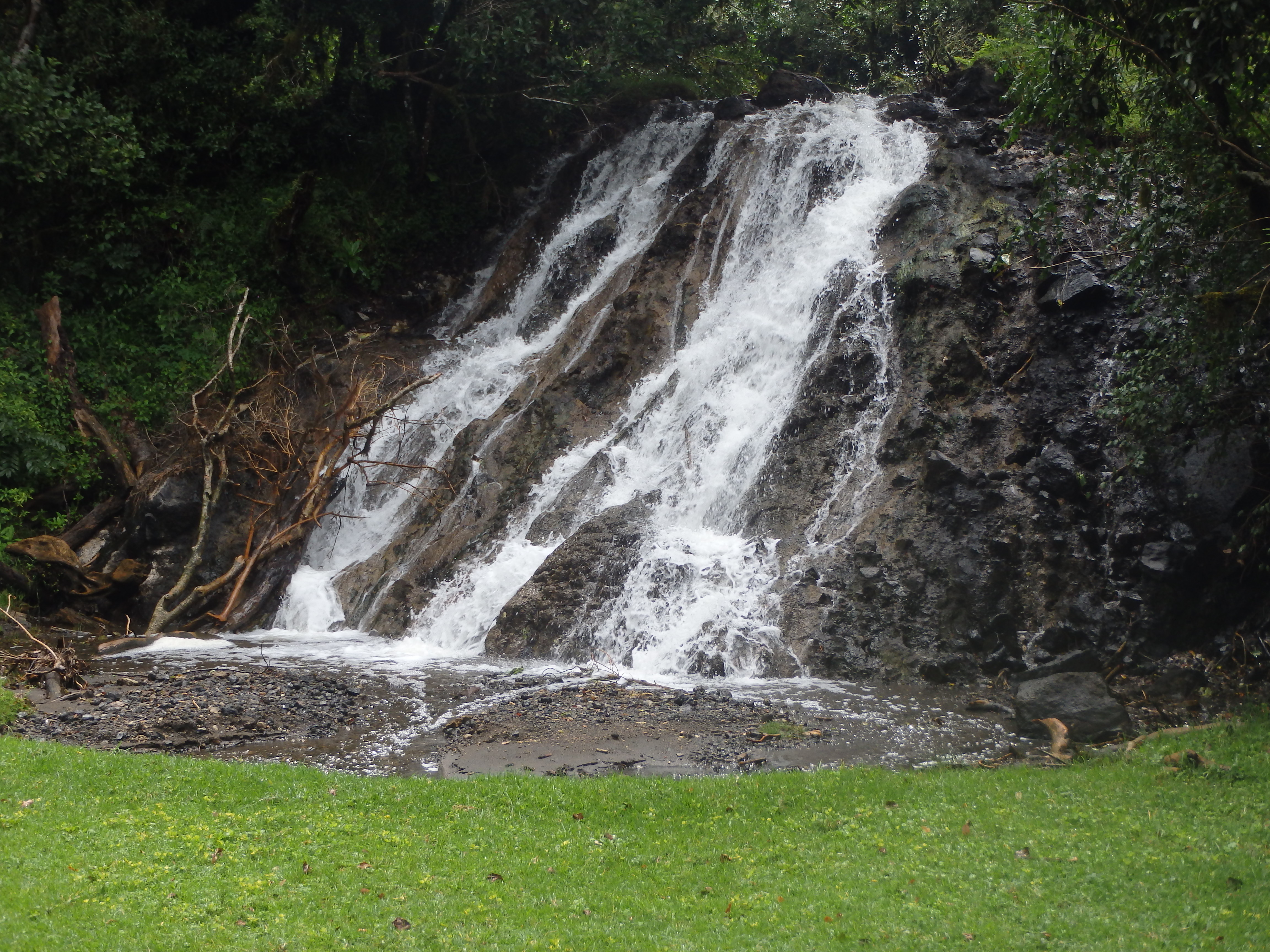
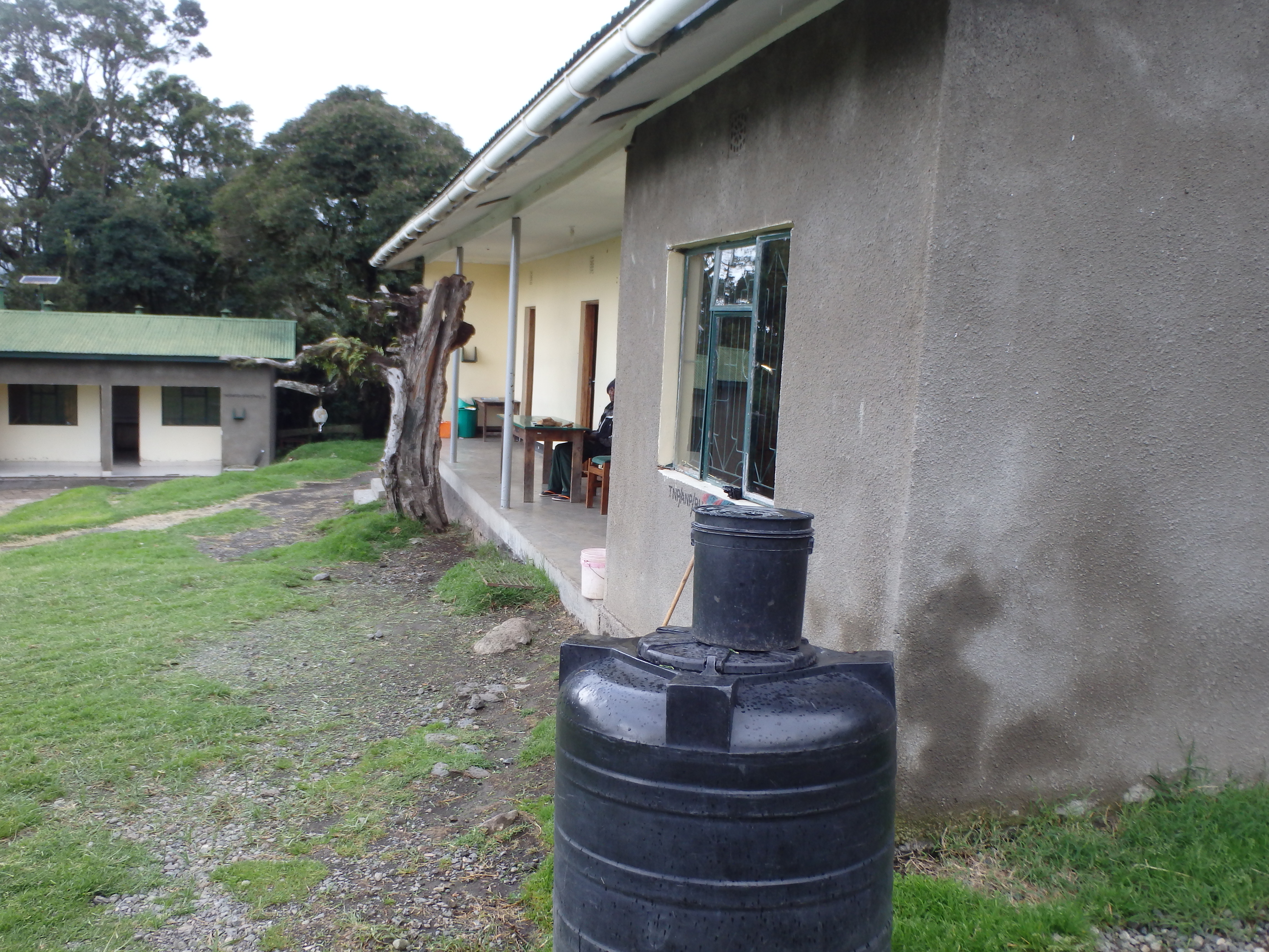
The rain was on and off for the several hours of hiking through the rainforest until we reached Miriakamba Camp at 2514 meters. Despite the distance from the trailhead, the camp was one of the most deluxe backcountry compounds I’ve ever seen with multiple bunkhouses complete with mattresses and pillows, bathrooms with running water, kitchens with a dining area, and even an observation deck.
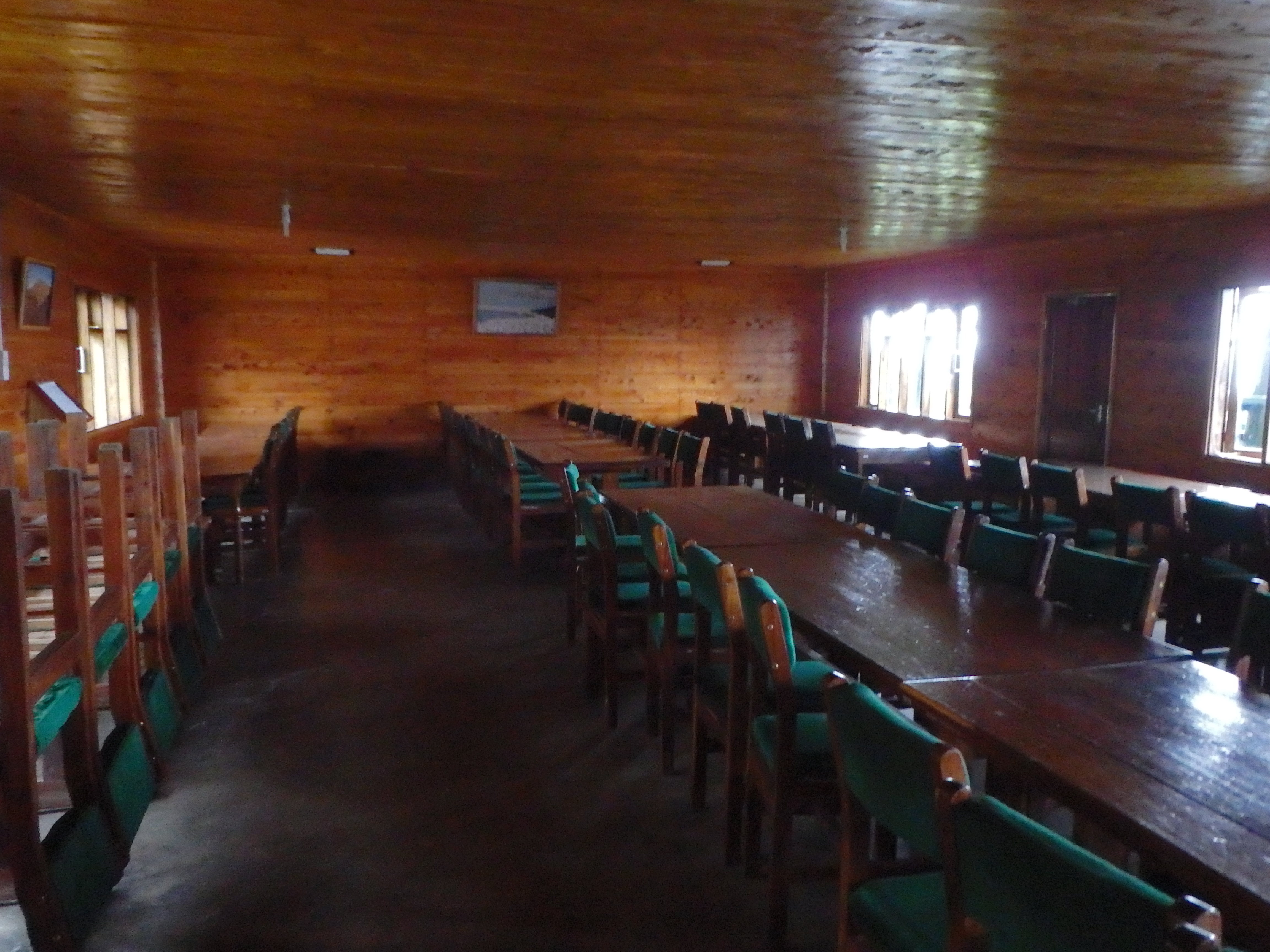
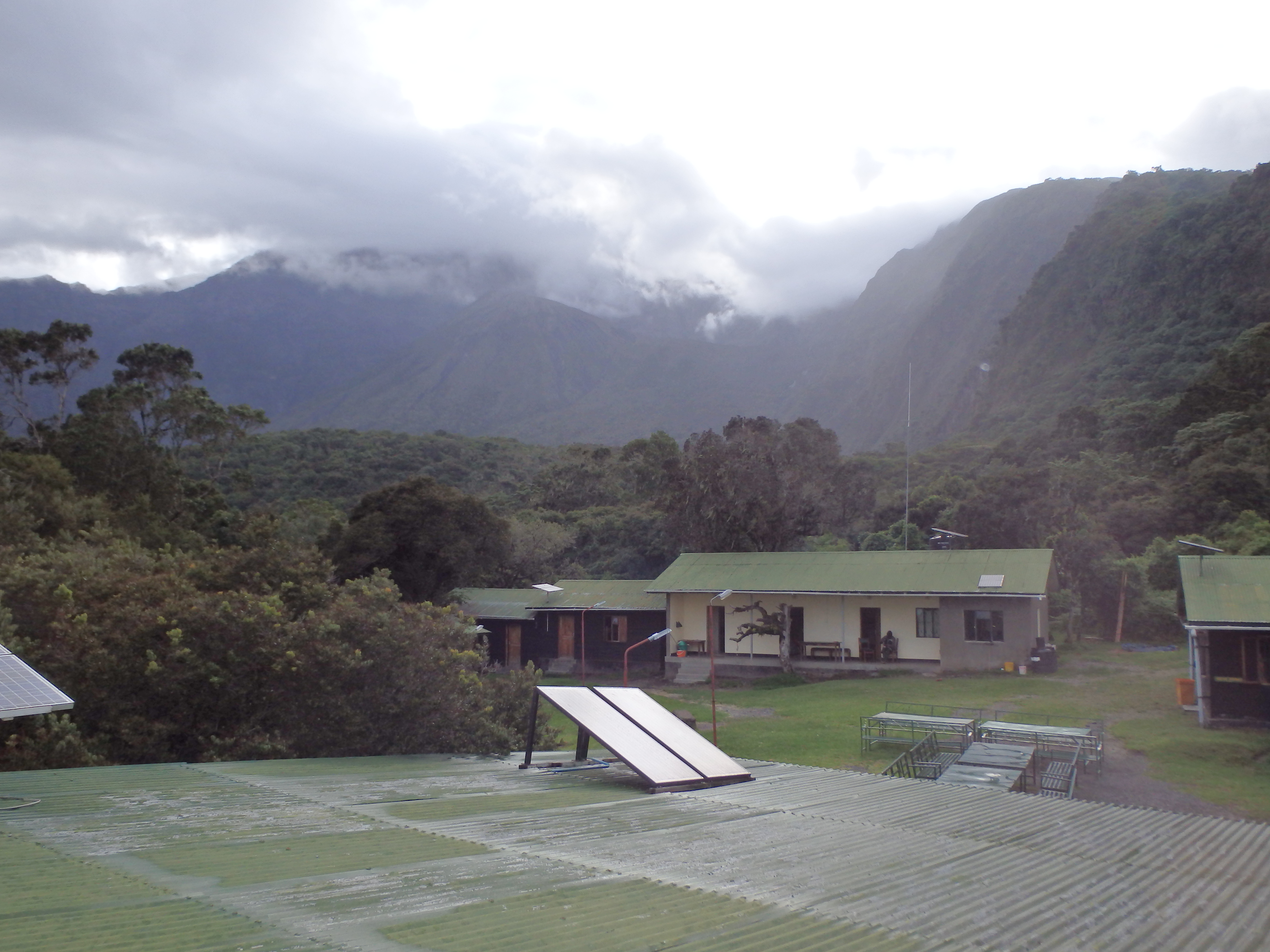
We killed time in the dining area playing cards and making our MREs before heading to bed, each of us with our own bunk room in the empty camp.
Day 2
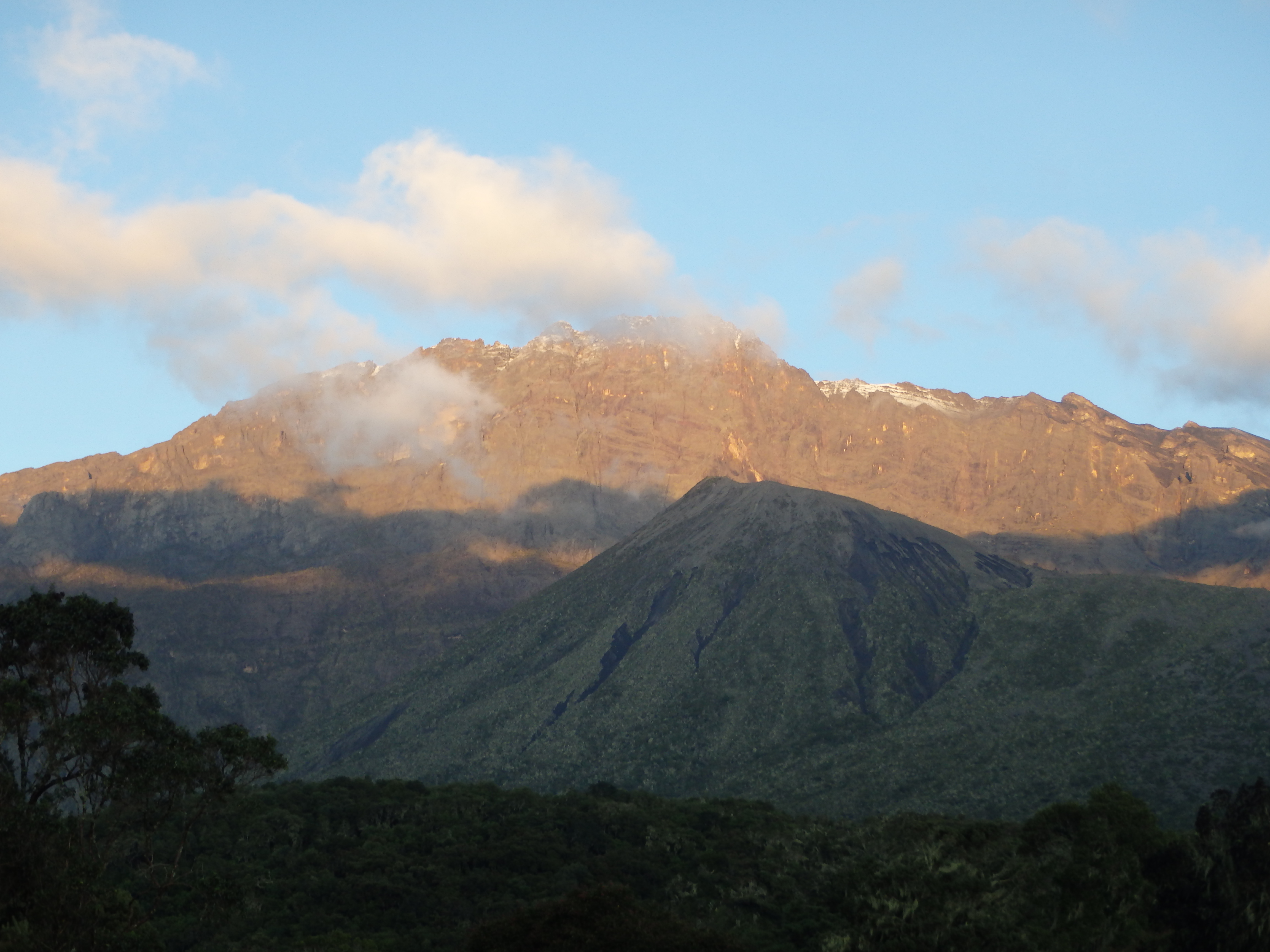
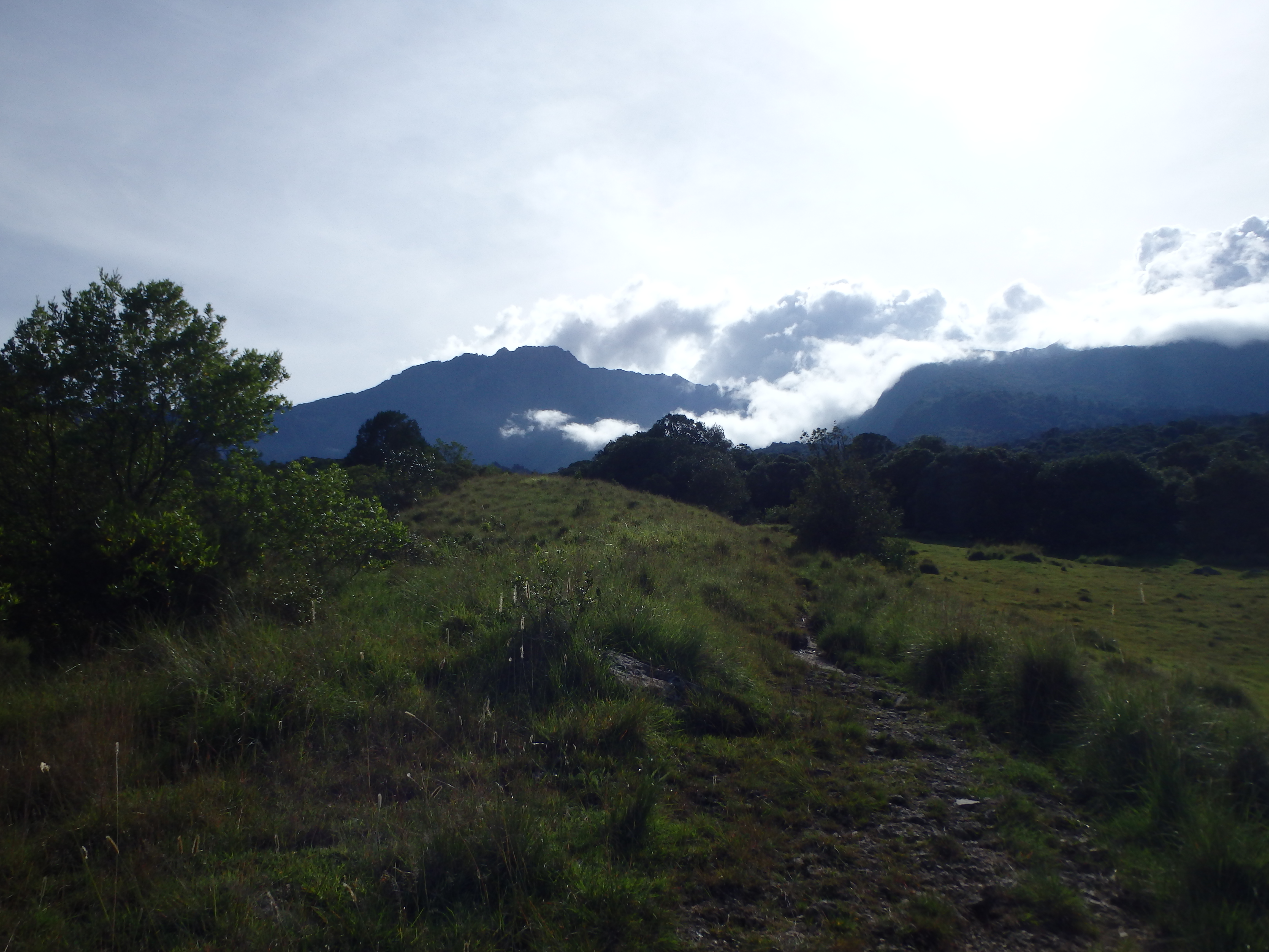
The next day we woke fairly early and left Miriakamba by 8:00 AM for Saddle Camp. The weather had improved considerably that morning, with the sun shining on the summit of Mount Meru and what looked like a light dusting of snow or ice on the highest slopes above.
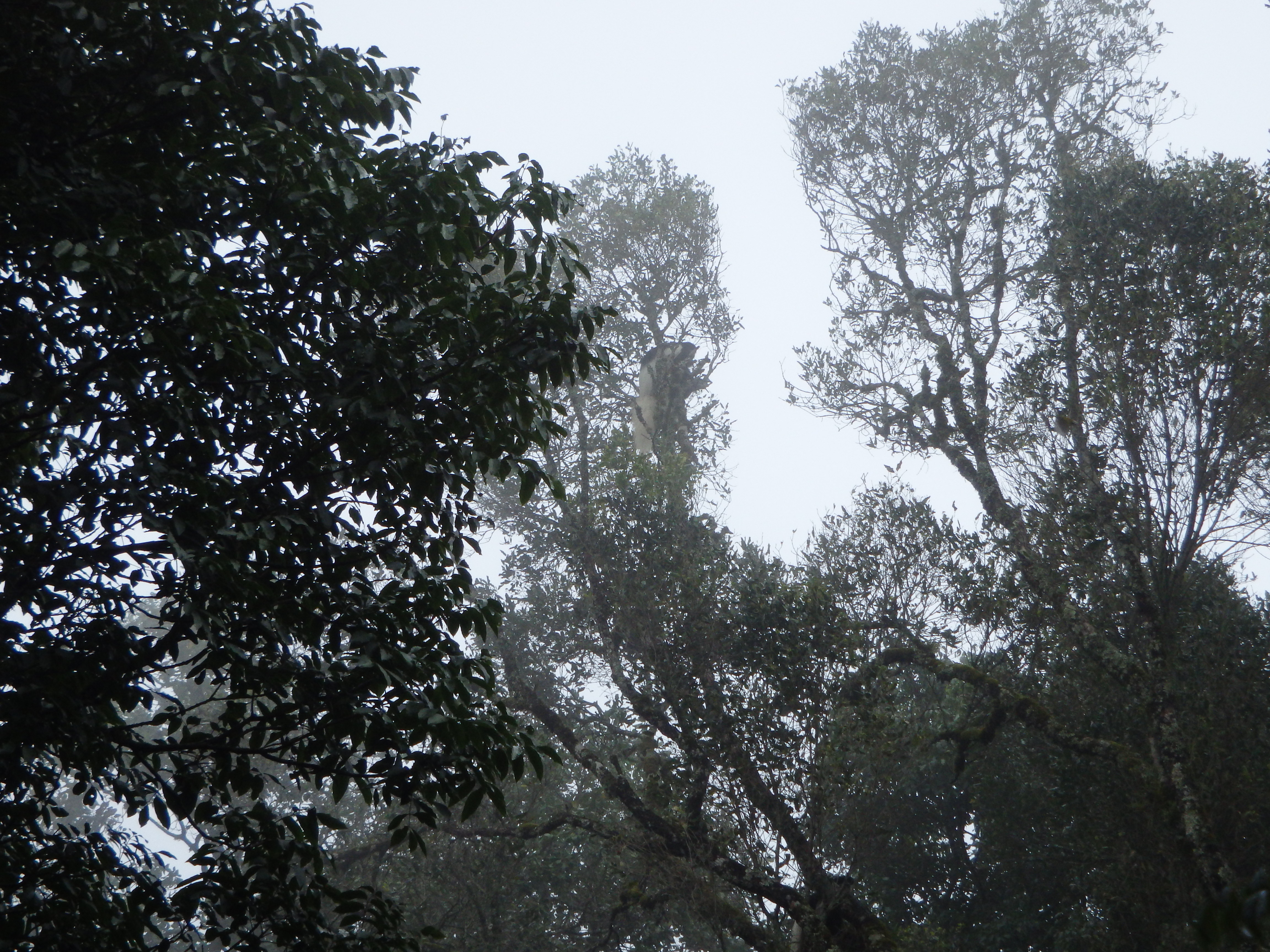
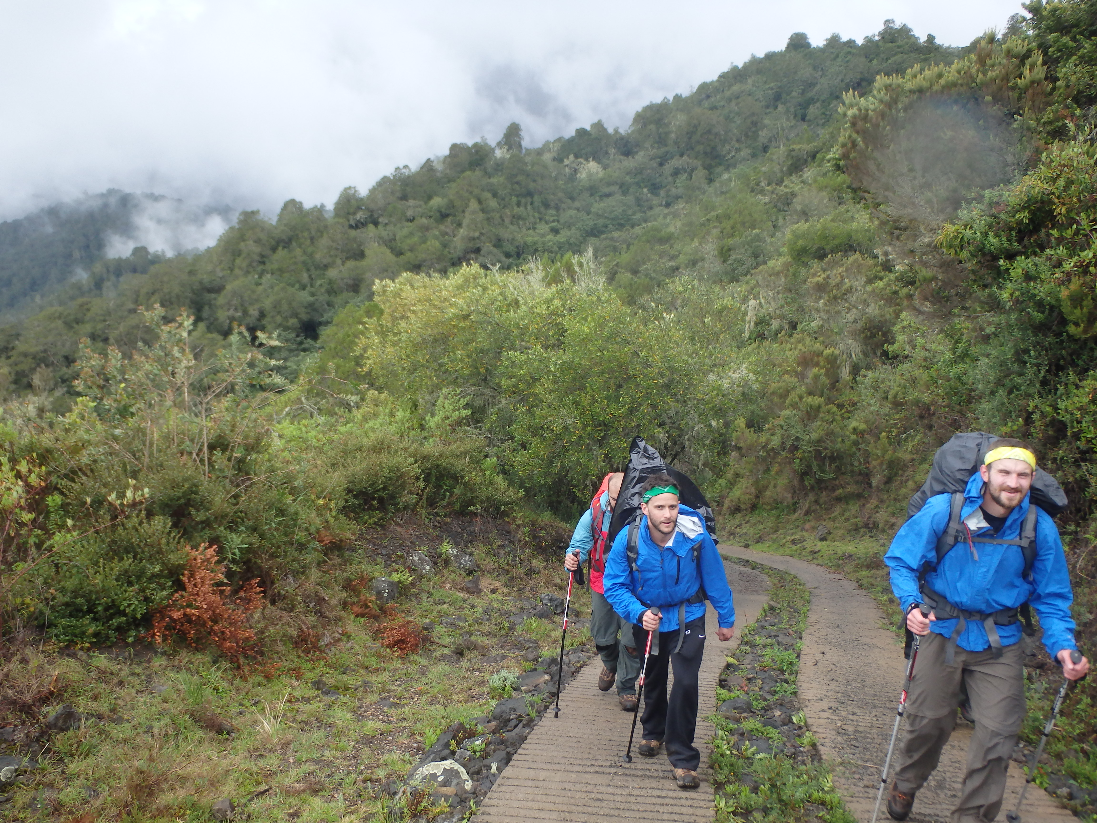
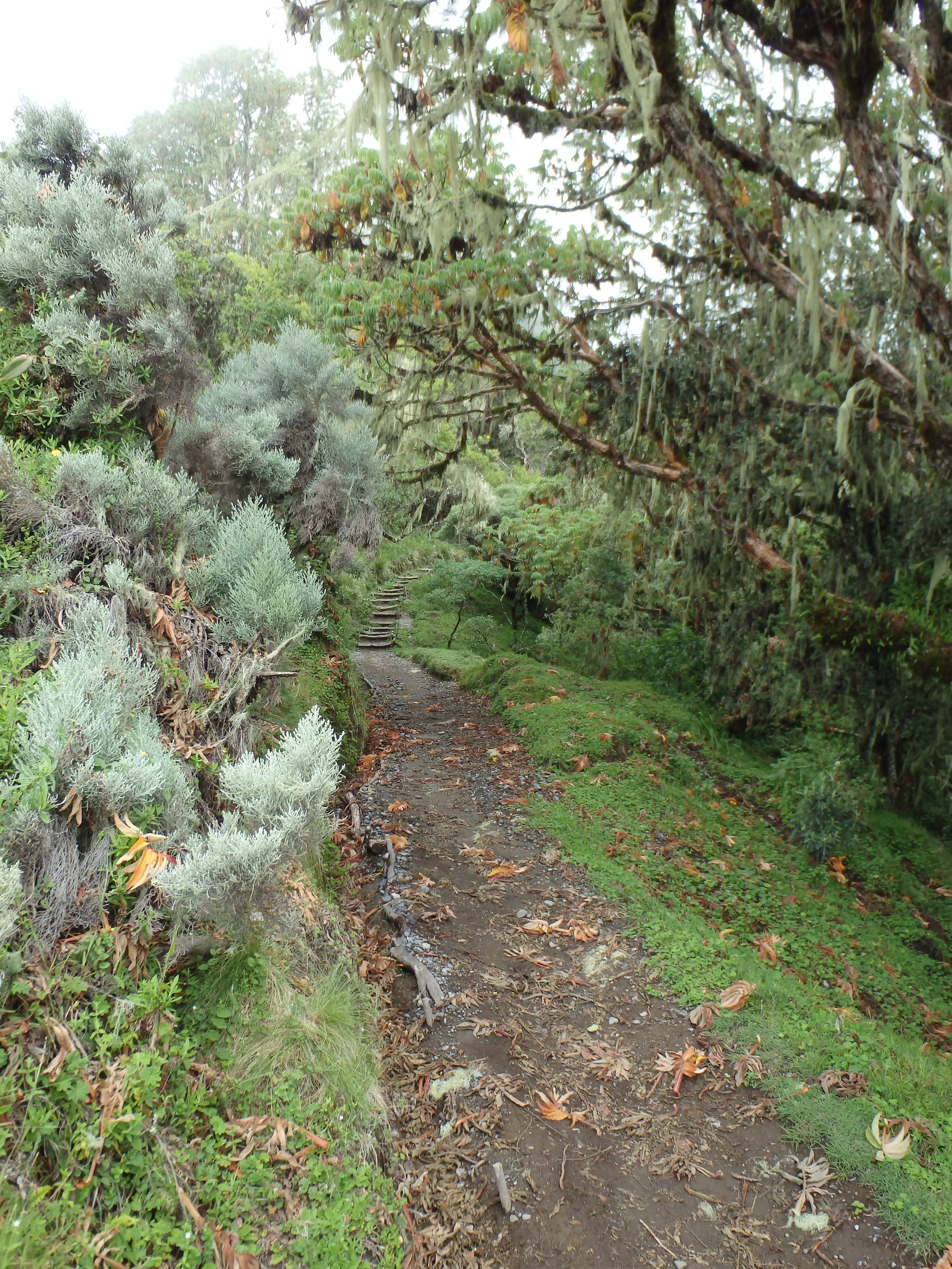
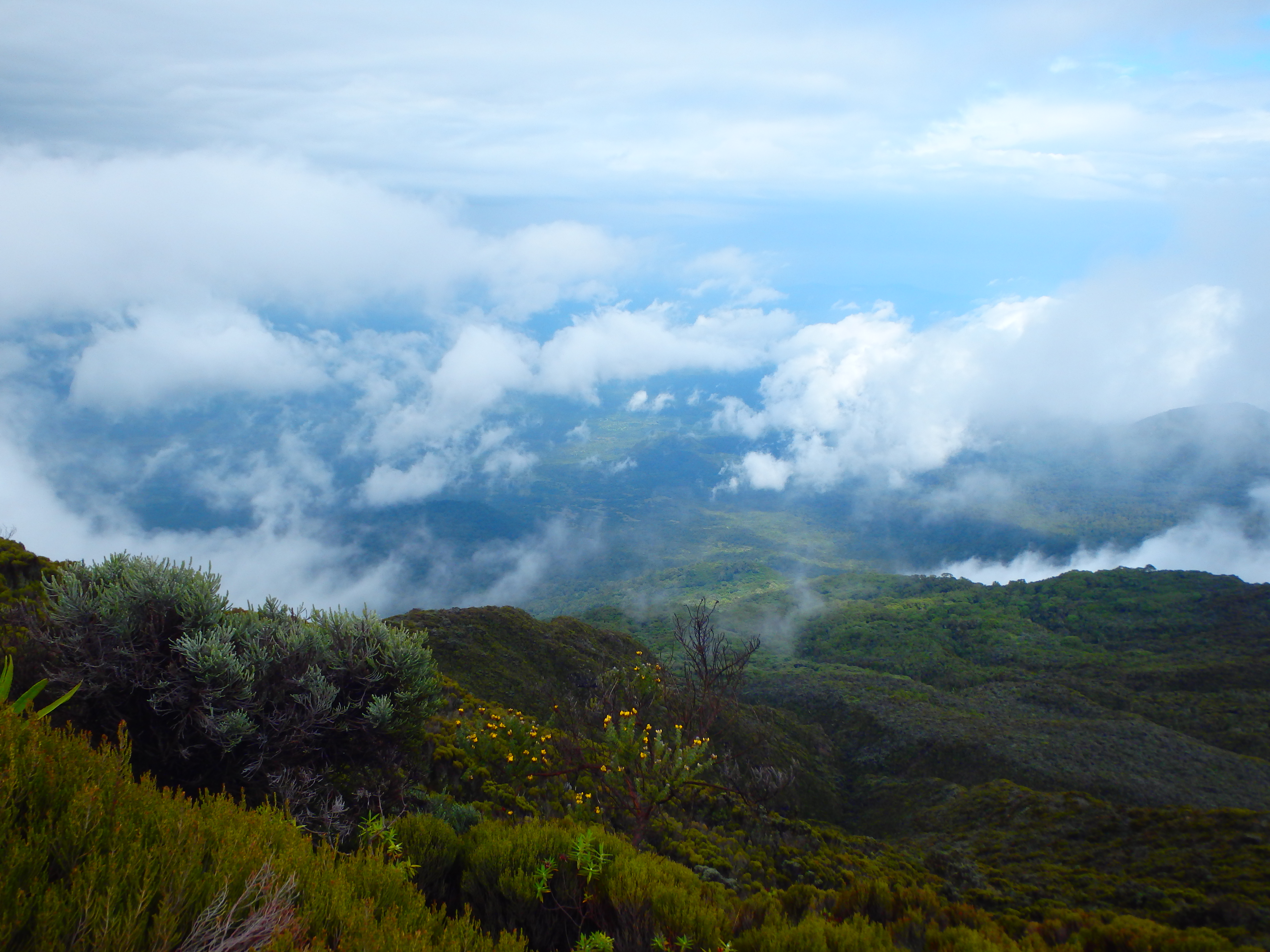
The trail the second day steepened considerably and ascended a narrow ridgeline off of Meru’s caldera rim. The forest thinned as we climbed higher, leaving the lush rainforest behind us for the scraggly trees of the Moorland. The trail switchbacked aggressively upwards, sometimes only for a few feet before working back on the narrow ridge.
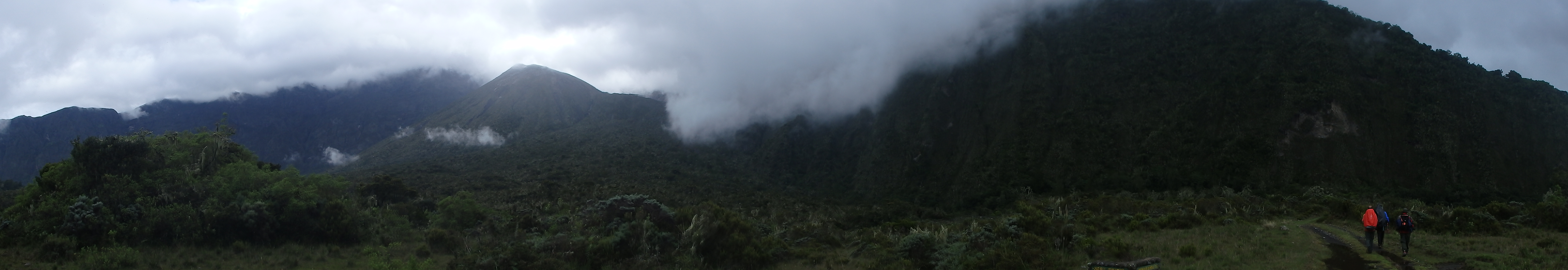
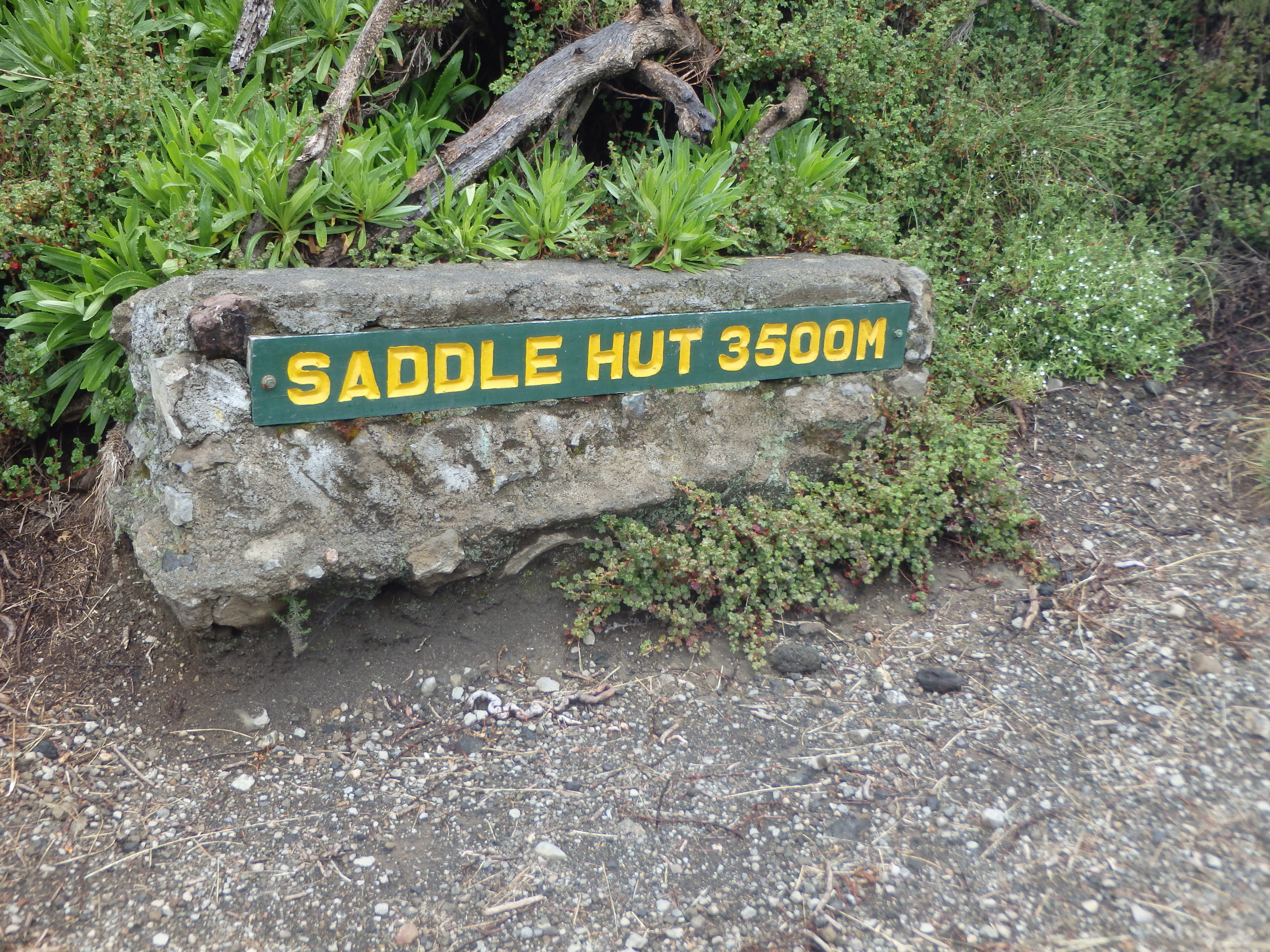
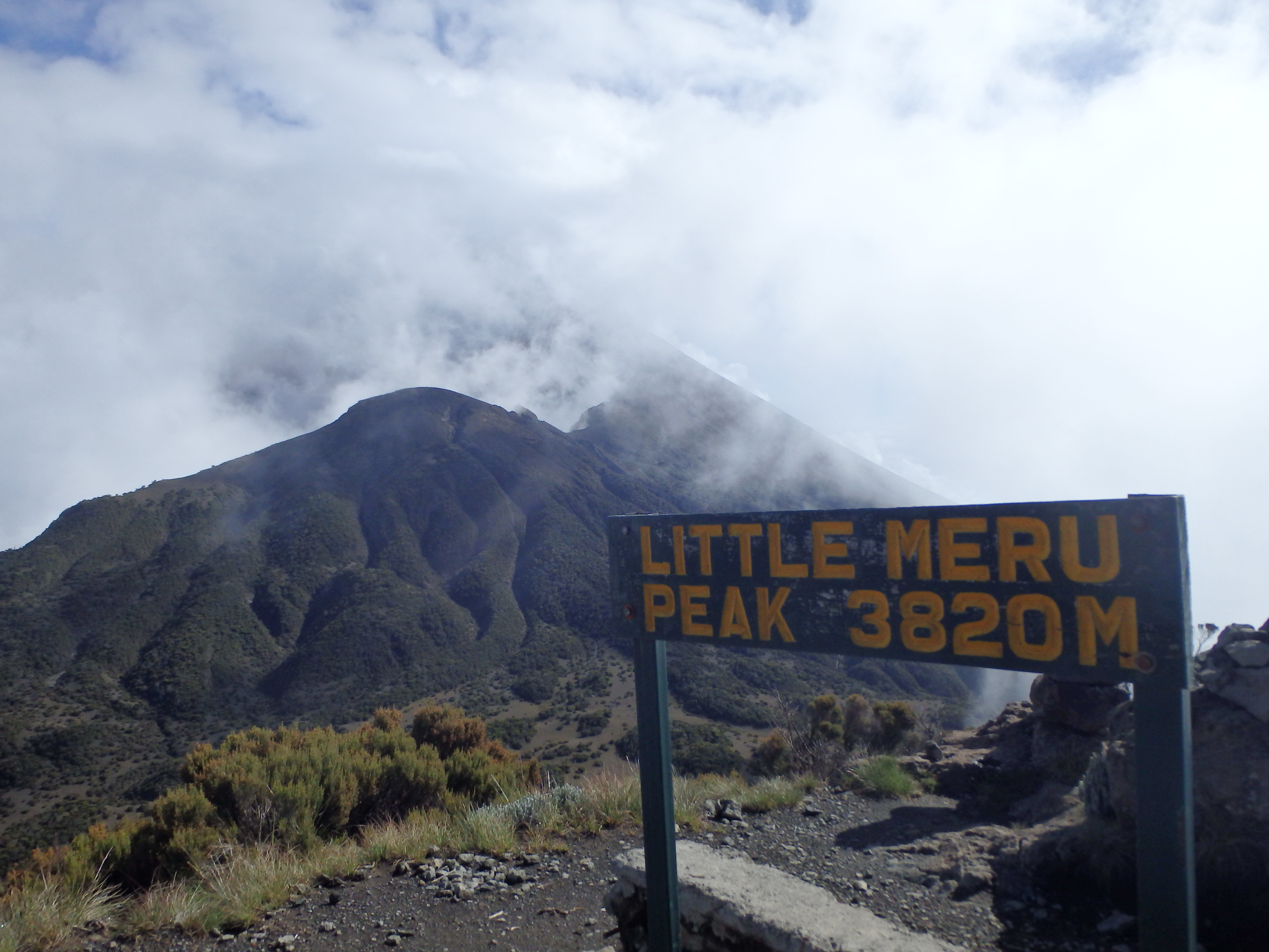
It wasn’t long before we were in cloud and rain again, our clothes never catching a break to dry. We reached Saddle Camp at 3570 meters and took a break while we let the weather clear and settled in to another empty camp with multiple empty bunk rooms. We hoped to hike Little Meru (3820 meters) as a way to acclimate for the summit push the following day, as well as bag a bonus peak on the hike.
The rain stopped in the midafternoon and we left for the small summit at 3 PM, the clouds breaking as we ascended. The trail was defined and well traveled, and a series of switchbacks quickly brought us up to the summit. Broken clouds surrounded the summit of Mount Meru hiding it from view, although we could spot parts of the rim through the clouds.
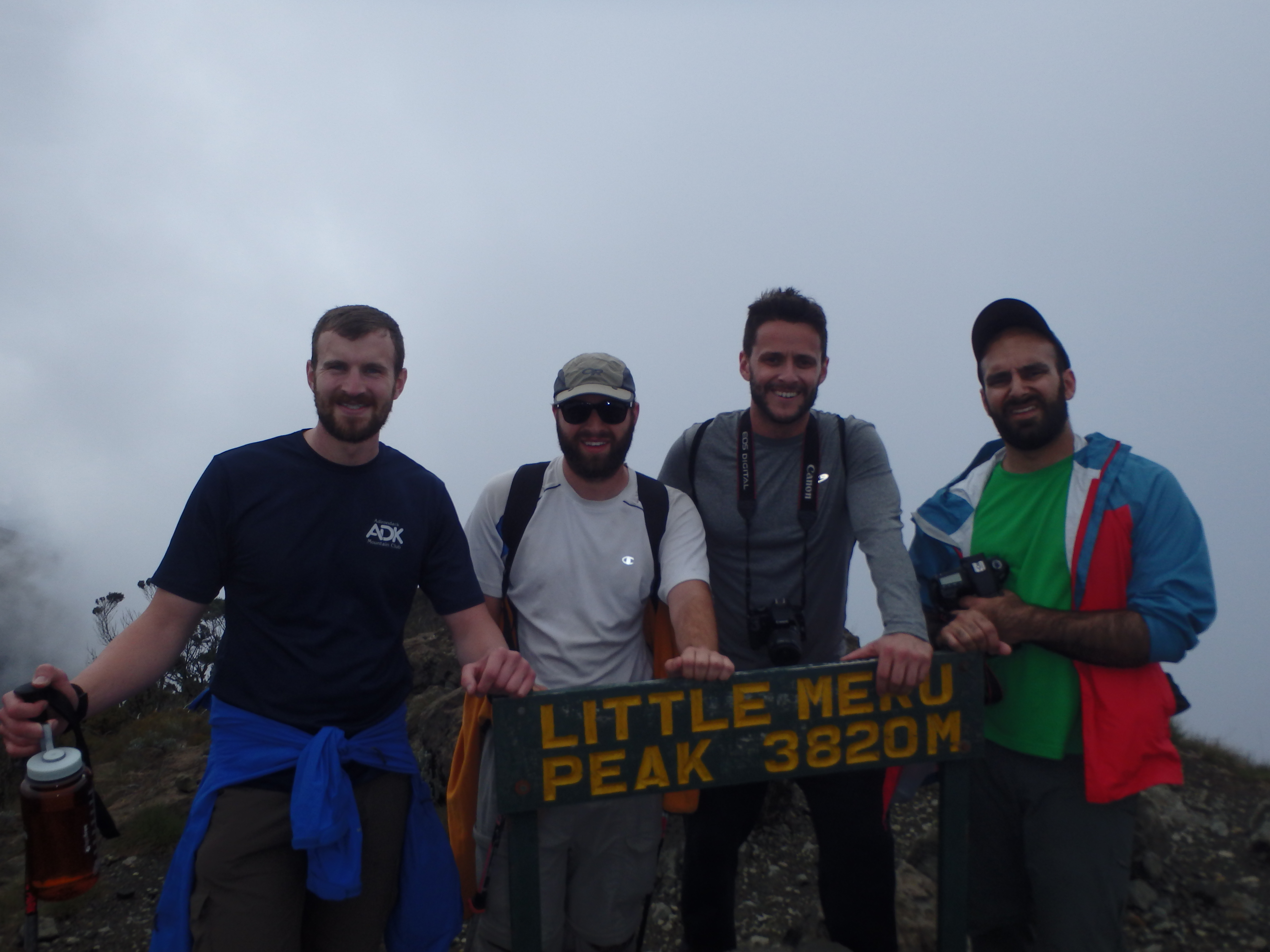
The side hike took less than two hours, and upon returning back to camp, we started on dinner and got our bags ready for the next day. We were in bed by 6 PM for summit day, with plans to wake up at 12 AM for our summit bid.
Day 3
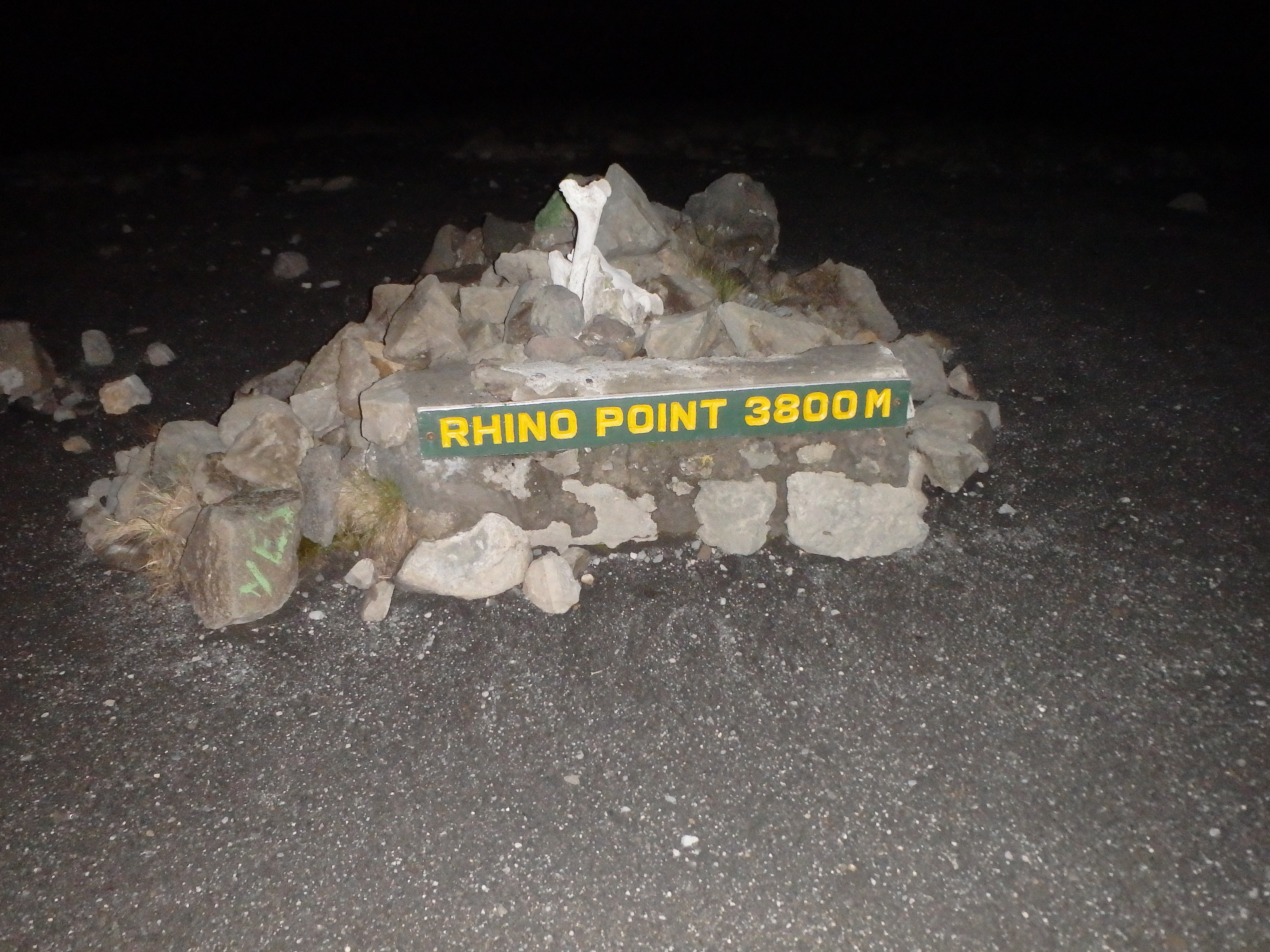
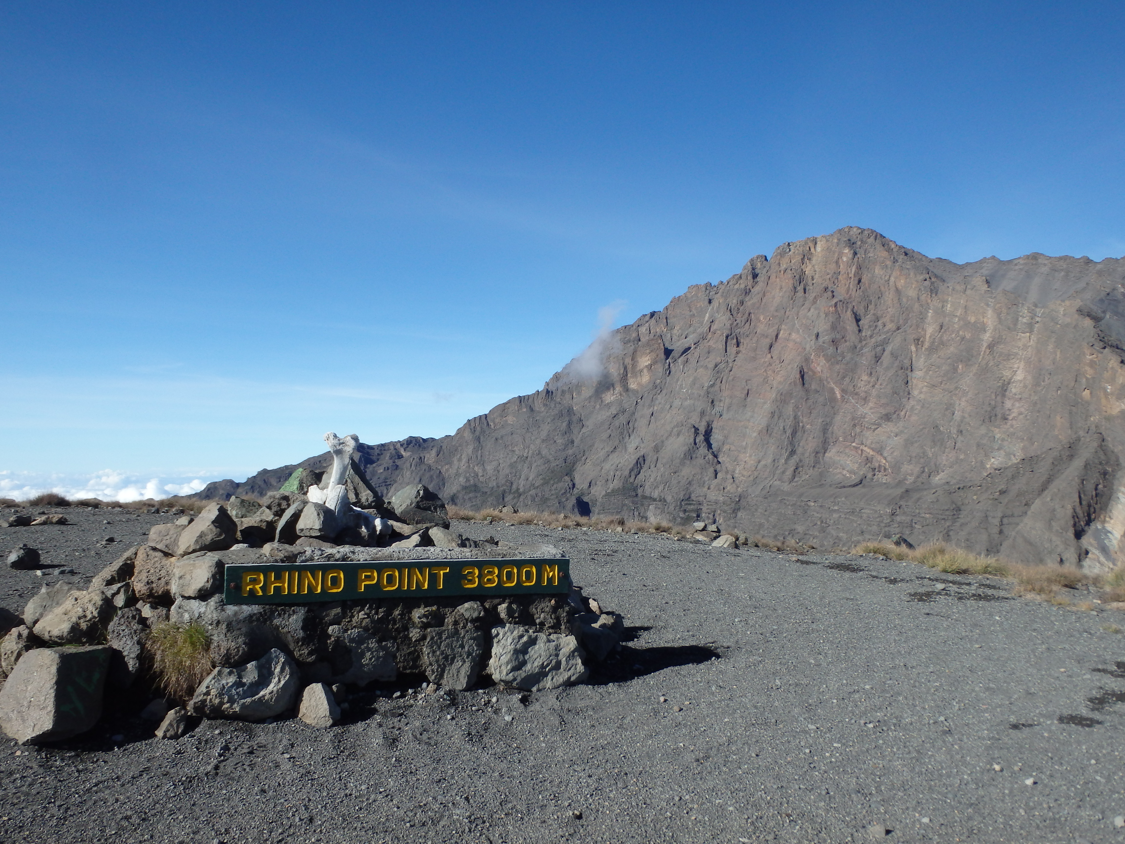
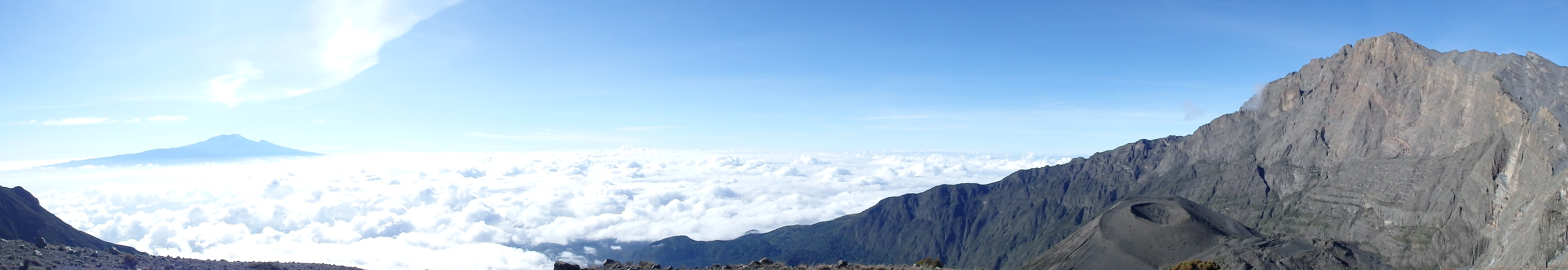
We woke up at midnight under crystal clear skies with the hazy outline of Kilimanjaro lit by moonlight in the far distance. I didn’t expect Raymond to join us since there was no risk of animal encounters above treeline, but he had has rifle slung over his shoulder ready to go at midnight. After a quick breakfast we were able to leave camp by 1 AM and quickly made it to Rhino Point in about one hour, sitting 300 meters above camp.
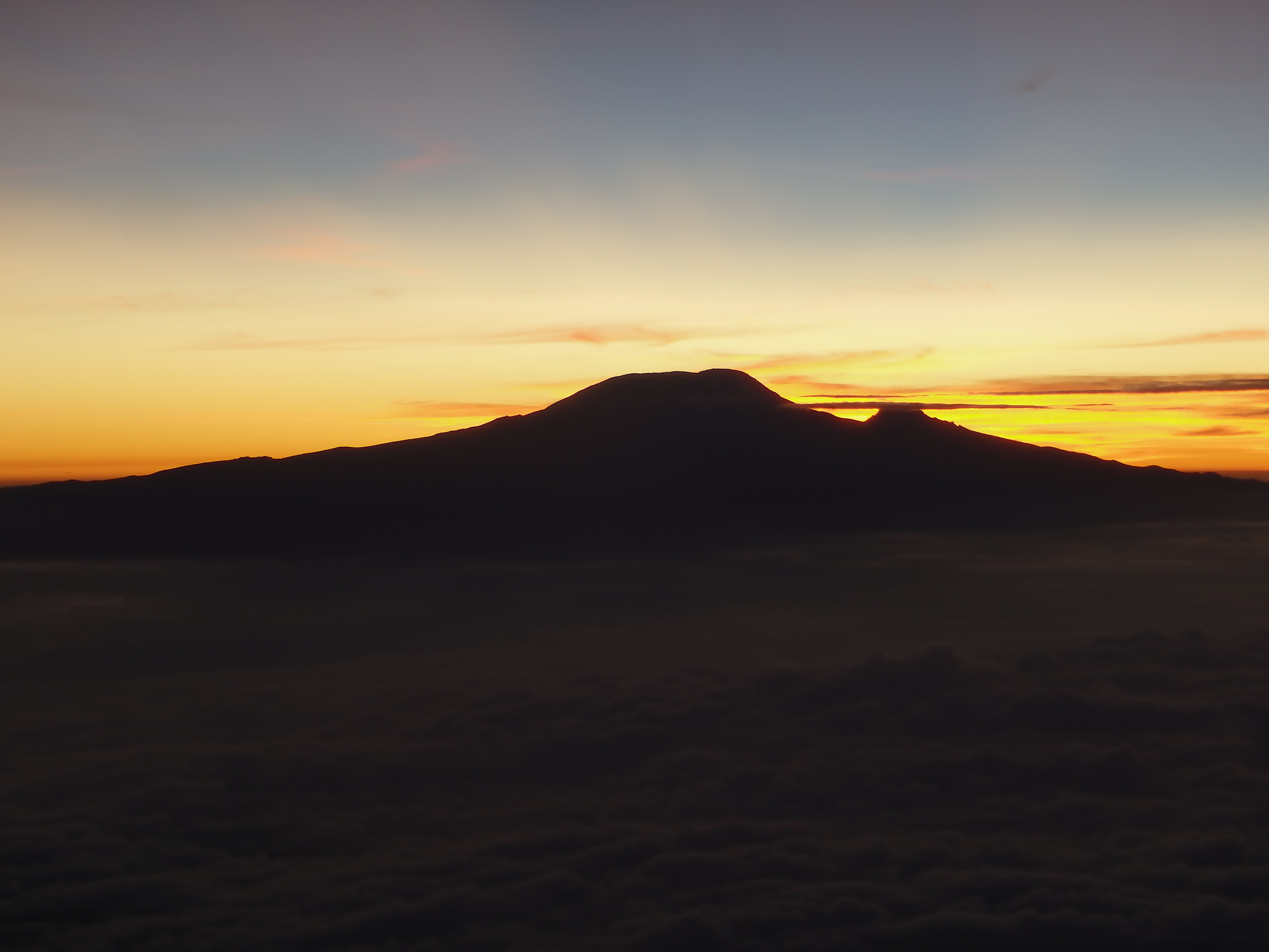
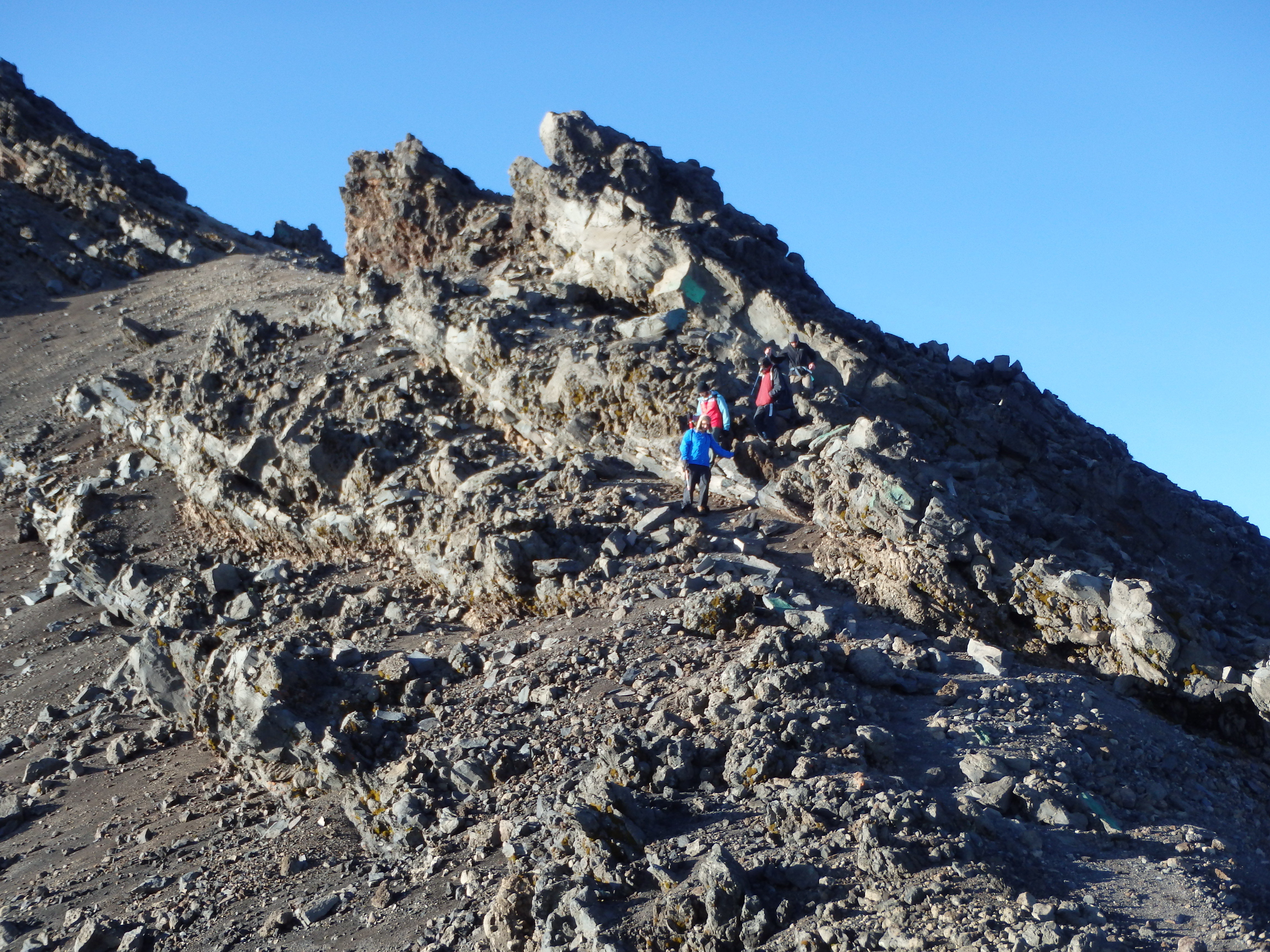
The trail we had been following gave way to more interesting class 2 slabs, unfortunately spray painted with arrows to mark the way. The route ascends and traverses some class 2/3 slabs beneath the caldera rim for the remainder of the route. Although the spray paint may have been helpful, the slabs were such that there were a number of variations possible and routefinding was part of the fun. The slabs and minor scrambling ended on the caldera rim, with a culmination of a fun class 3 scramble up the backside of the last several hundred feet to the high point. We hit the summit almost exactly at sunrise, and sat down to enjoy day breaking directly over Kilimanjaro on the horizon.
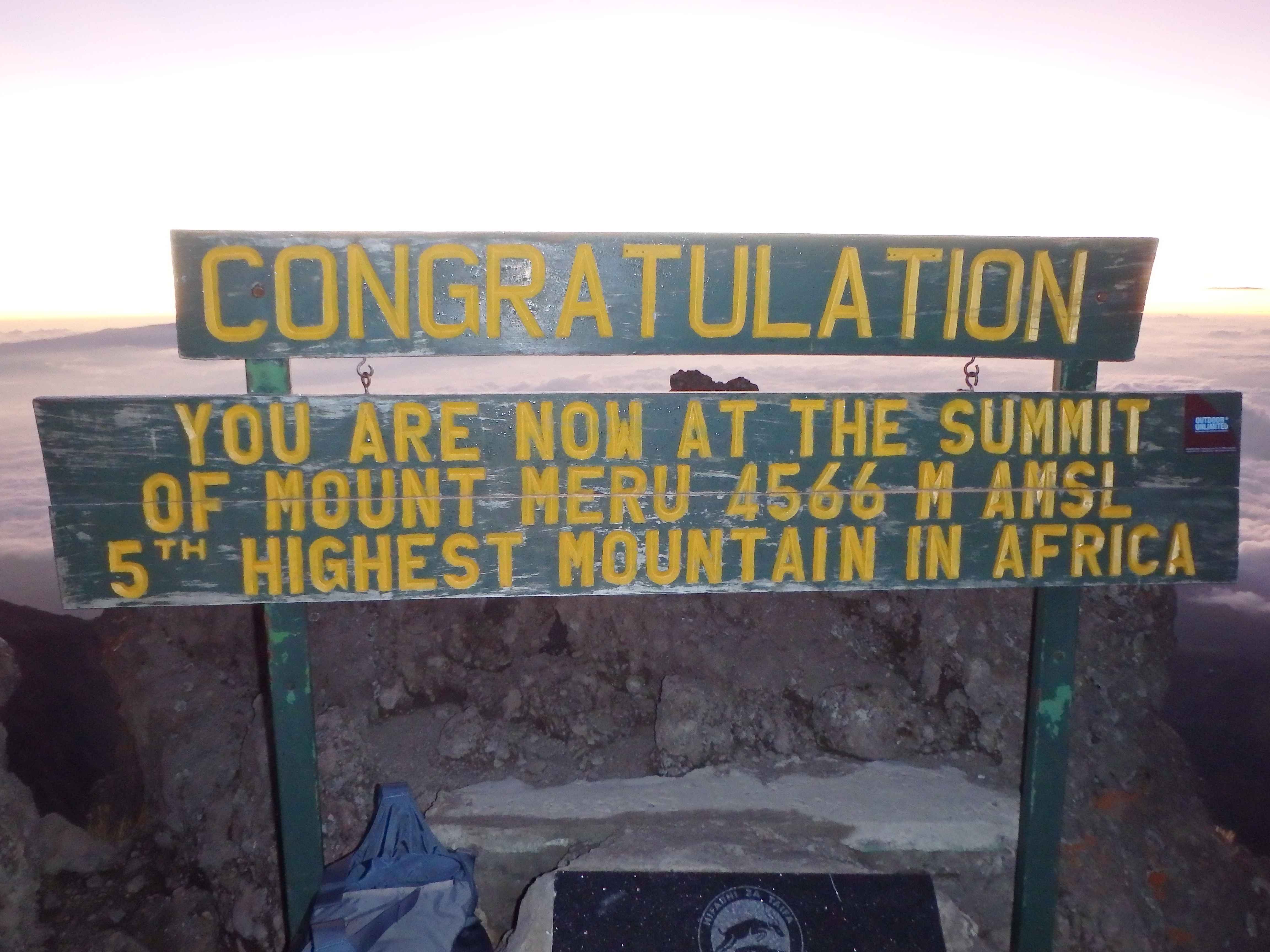
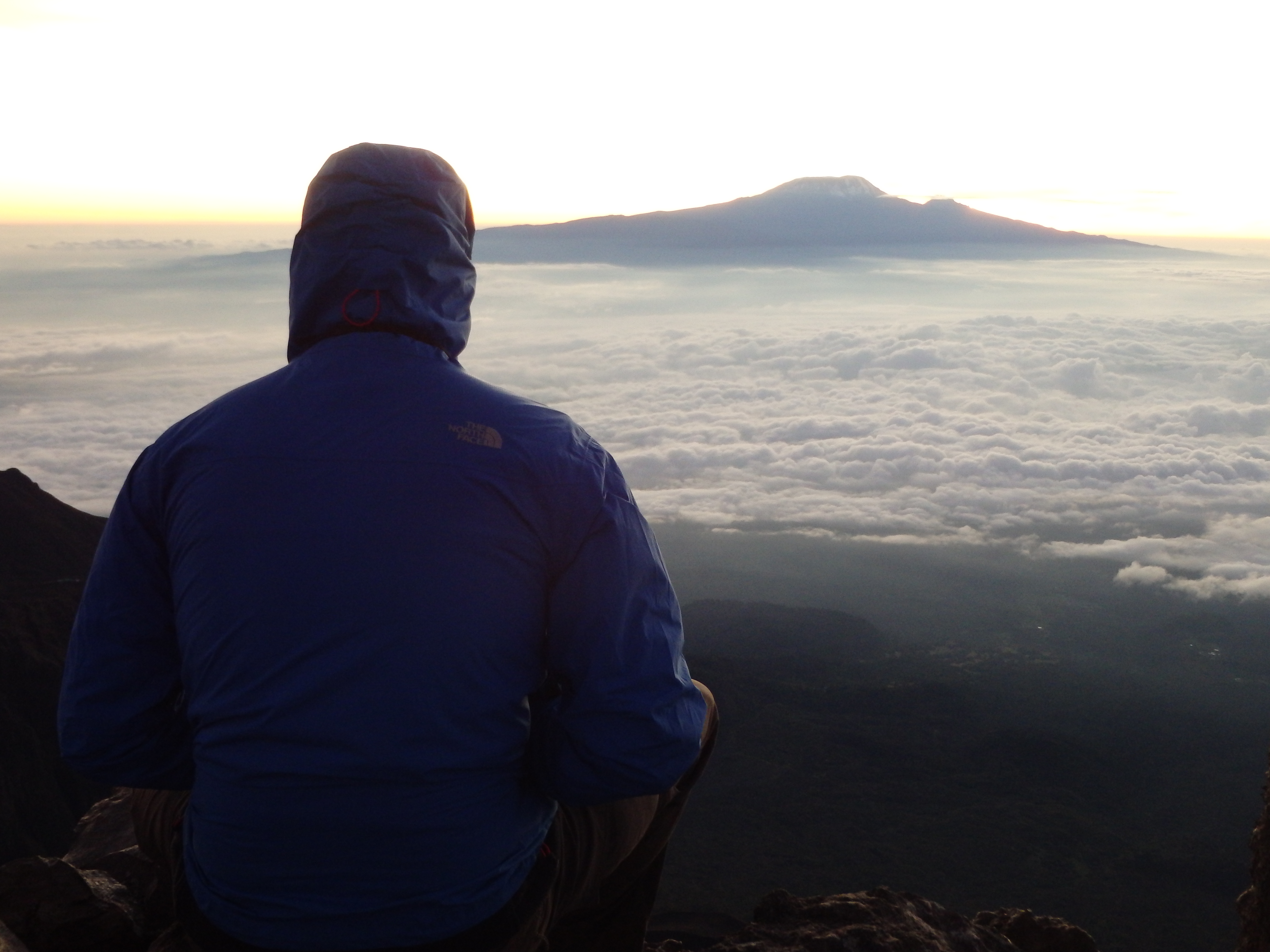
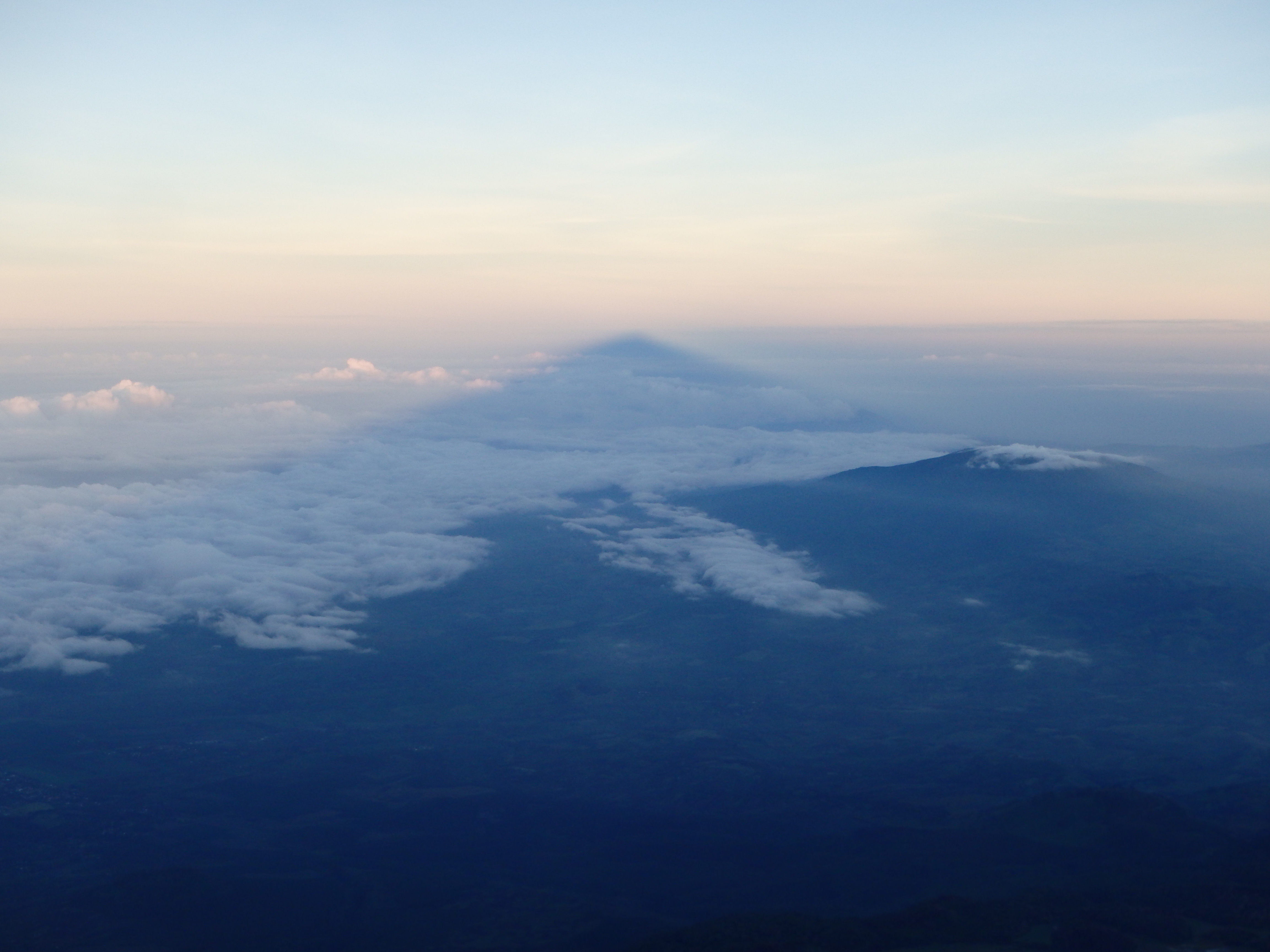
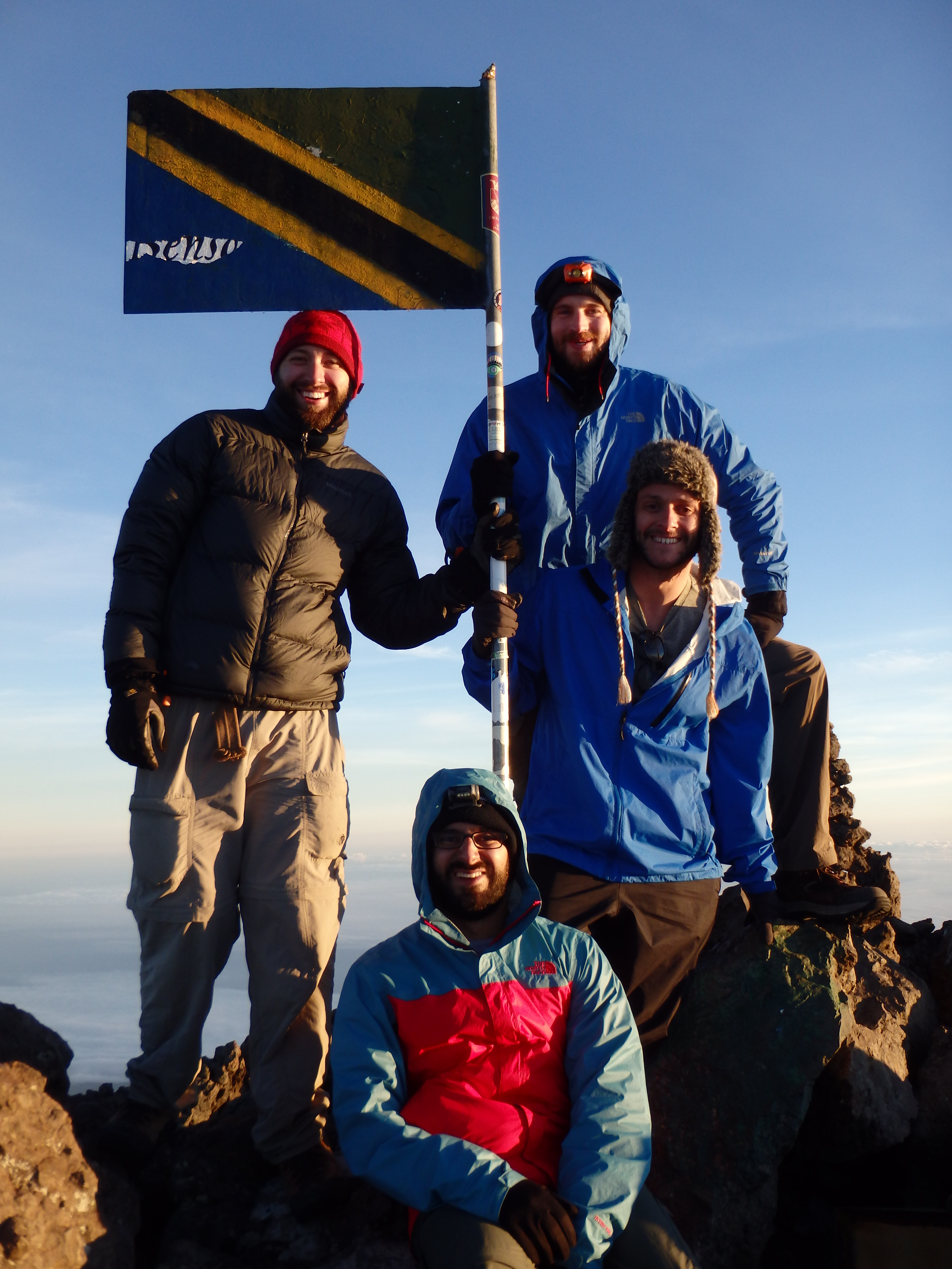
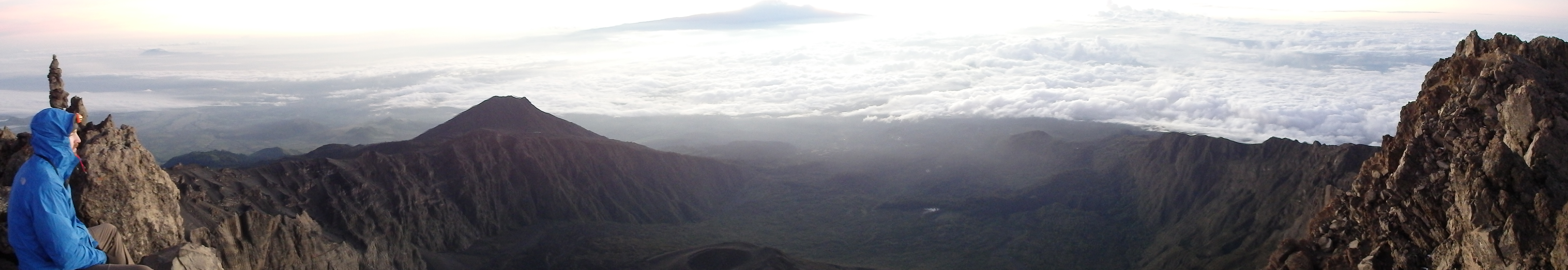
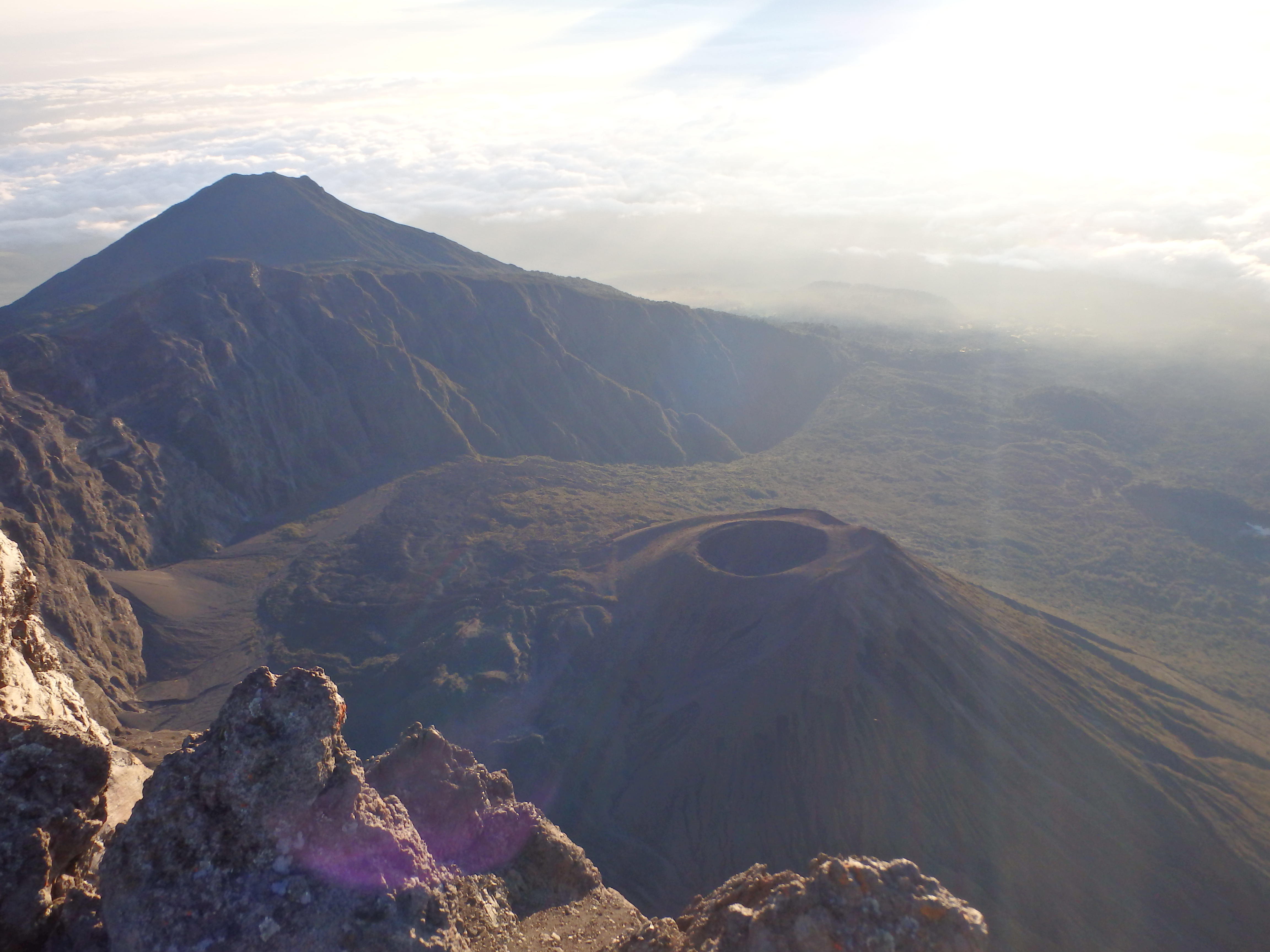
We spent a good 30 minutes at the summit, sharing champagne and taking pictures of the sunrise, Kilimanjaro, and Meru’s impressive summit crater and Cinder Cone. With the full mountain to descend that day, we left the summit down the class 2/3 slabs, the route being much more obvious in the daylight. With no risk of big game encounters at such high elevation, I broke off from the group on the descent giving me an opportunity to take more photos before the clouds rolled in.
Rob’s feet were taking a beating on the descent, and when he did make it to camp, it took another hour to organize our gear before we could continue our descent. We made it back down to Miriakamba Hut by 2:30 PM already tired and sore, still with another 3 hours of hiking and 1000 meters of descent to go! After one last short break, we descended by the shorter but less scenic northern route, which was much more exposed along a rocky ridgeline.
Despite the exposure, we saw no animals on the hike out aside from a small herd of Cape Buffalo near the very end of the trail. We reached Momella Gate at 5:30 PM after over 10,000′ of descent in a single day! We quickly got our summit certificates then headed back into Arusha proper for steak skewers and an early bedtime. Although it would take our feet a few days to recover, the ascent of Mount Meru no doubt helped on our climb of Mount Kilimanjaro a few days later….
this article is very useful, thank you for making a good article