
Mount Princeton 14,197′
Total Time: 4 hours
Roundtrip Mileage: 5.0 miles
Elevation Gain: 2650′
Crux: Class 2
Trailhead: Mount Princeton FR, parked at about 11,500′
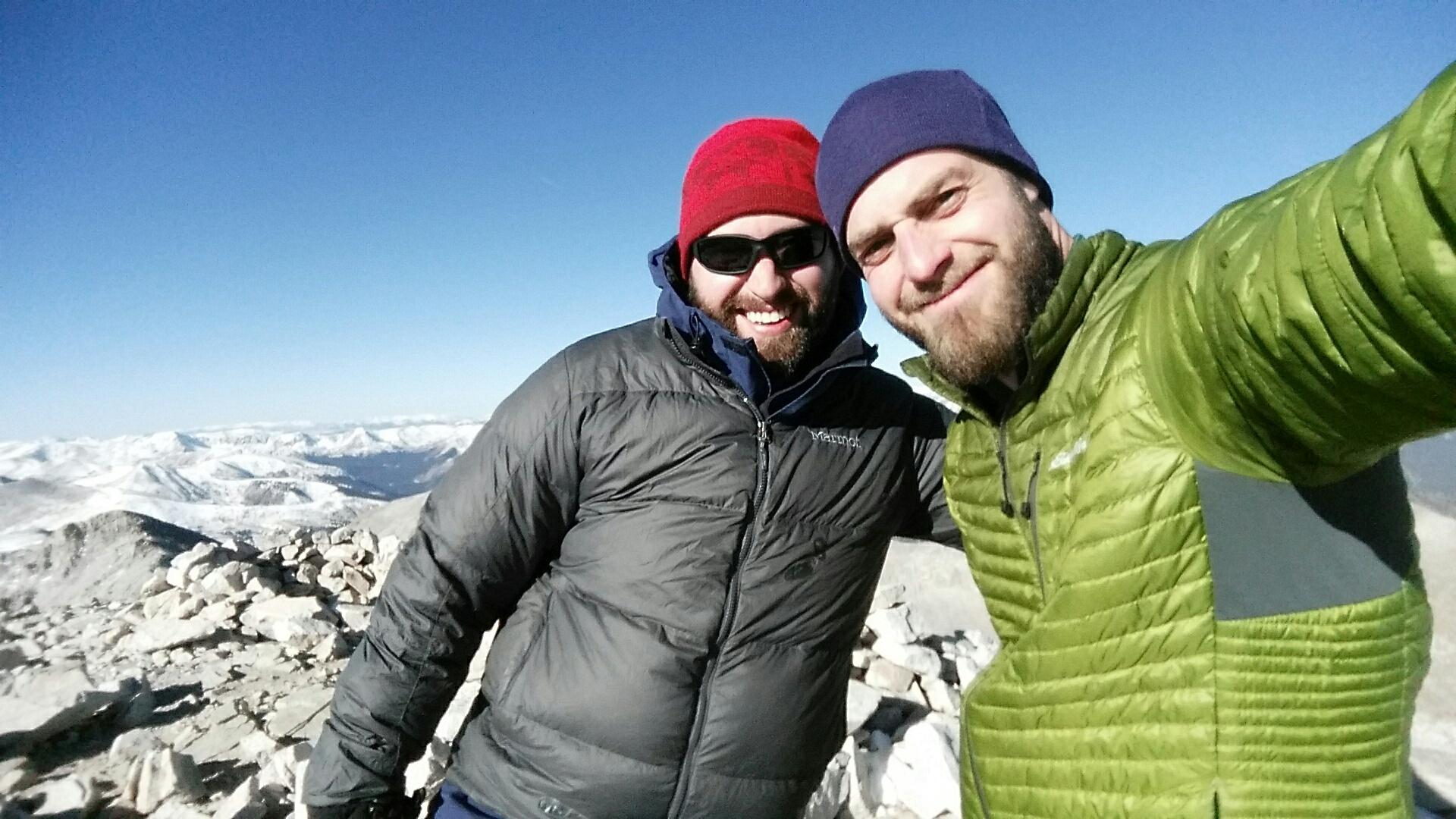
Companions: Jacob Hyde
Earlier this year, I was able to tag 6 Colorado 14ers in a 4 day sprint- Wilson Peak, Handies, Uncompahgre and Wetterhorn, and Redcloud and Sunshine. With a round or two of winter snow across Colorado, I thought bagging any more 14ers would have to wait until 2017. Even with a trip to Denver planned for Thanksgiving, I had low expectations that I would be able to tick one off the list. While many of the easier peaks would be accessible, I had climbed most of these, leaving the most likely candidates in the Sawatch a good 2+ hours away. But after weather forecasters were off on a couple pre-Thanksgiving Day storms, I sight my sights on Mount Princeton towards the southern third of the Sawatch Range. A trip report the night before reported the amount of snow was “pathetic,” which sounded promising for a high chance of summit success. So the Saturday after Thanksgiving, Jacob and I woke up in Denver at 4AM and left the house by 4:30 for the long drive to Buena Vista. We drove over 2 hours in darkness, the sun rising just as we reached Buena Vista with our first views of Princeton.

Jacob had a solid 4WD Jeep with some extra bells and whistles, and after cutting through town, we started up the rough switchbacks to reach the upper trailhead parking at a little over 11,000′. While the road was narrow and rutted, my Subaru could have made it to the antenna at 11K where most people park. But Jacob wasn’t satisfied. We continued along the road even higher, the road getting noticeably worse with large rocks jutting out from the road. He pushed on up several more switchbacks, ultimately parking at about 11,550′. We could have gone further, but had we gotten stuck, turning around would be difficult on the narrow road. Besides, we were definitely sick of sitting in the car and were ready to start hiking.


From our parking spot, Princeton loomed above with little snow as promised. There was little wind and things were shaping to be a good day. We walked the road about a quarter mile, breaking treeline and finding a some man-made steps just off the road to start us up the ridgeline. While winter conditions would usual keep climbers true to the ridgeline to avoid steep snow on the north facing slopes. The small dusting allowed us to utilize the summer trail, which slowly cut across the north facing slope of the SE ridgeline. The trail at this point was rocky and uneven, but fairly consistent in grade, and we were surprised to find we had burned through 1,200′ in about 40 minutes. A number of use trails braided the north slopes but the most defined seemed to be a series of steep switchbacks that would have us regain the ridgeline at around 13,000′. Reaching the ridgeline put us in the sun for the rest of the climb up, and although slightly more exposed to the wind, the weather was as much as you could hope for in late November.


After a short break we continued along the ridgeline, and after a few small false summits the route steepened considerably. While much of the class II routes I had been in Colorado barely qualified as class II with easy use trails cutting through, this was quite true to rating, and we cautiously moved up the shifting rock to a small plaque below the summit, dedicated to a young climber who lost her life years ago. From the plaque, the summit was a chip shot away and we topped out around 1030AM. With many of the surrounding mountains covered in fresh snow (I’m still not sure how Princeton had almost none), the views were some of the best I’ve had in recent memory. Antero loomed large to the south, with Yale and Harvard towering to the north. To the NE, you could see the 14ers clustered around Aspen, although I couldn’t tease them apart well from this distance. The Sangre de Cristos could be seen in the distance to the south, with the Crestones jutting out from the ridgeline. To the far southwest, I could even see Uncompahgre and Wetterhorn, which I had climbed that summer.


We found relief from the wind behind some summit rocks and ate an early lunch while trying to keep our hands warm (independently of course). When we started to reached the point of “uncomfortably cold” we decided it was time to descend, and dropped down the steep class II rock along the ridgeline. The ridge was packed in places, nice traction for going up, but a bit sketchy going down and we aimed for small rocks jutting up from the dirt. Halfway down we ditched our down layers and I had the bright idea of dropping off the ridge early and heading more directly towards the trail, avoiding some of the random false summits. This is a mistake. Random use trails would quickly peter out among the talus, and we side-hilled along loose rock, our progress slowed considerably. After a good 30 minutes we finally made it back to the trail, taking a quick break before restarting at a quick pace back to the car. With a long drive ahead of us and several miles of painful dirt road, we didn’t want to waste much more time. So we picked up our pace and hiked the rough trail across the north slopes back to the road. Both of us we relieved to see the car hadn’t tumbled off the cliff while we were hiking. With the day’s exercise behind us, it was another hour of patient driving down the rough road to make it back to Buena Vista, followed by another 2 hours of driving back to Denver. It was nice to sneak in a 7th 14er for the year (a decent number considering I don’t live in Colorado) and the first time to have company on one since 2013…