
Mount Tipton 7148′
Total Time: ~5:30
Distance: 8.8 miles
Elevation Gain: 3500′
Crux: Class 2-3
Trailhead: Dirt road to Mount Tipton Wilderness Boundary, 4WD, no services


Mount Tipton is one of 9 Sierra Club DPS peaks in Arizona, and was one of two (the other Baboquivari) I had left to climb. It’s inclusion by the DPS has always puzzled me. Not to say that it isn’t a worthy summit; with over 2000′ of prominence, it dominates the skyline over US 93. But with only 9 peaks chosen in the entire state, it seems odd that it was picked over nearby Hualapai Peak, Four Peaks, or a dozen other big name summits across Arizona. It was also notoriously brushy for a DPS summit, a blend of the dry Mojave and more lush Sonoran Desert that I had become accustomed to. The drive from Peacock Peak to the start of Tipton took a little longer than I expected. The dirt road to a closed fence was in pretty decent shape, but it deteriorated pretty quickly beyond that. I tried to make it past the main trailhead a bit further up the road, but some good sized rocks blocked progress and I pulled off into the brush to start the climb in the early afternoon.

The road continued east towards Upper Indian Spring, which I followed to the dried up and fenced in Lower Indian Spring, the fence strangely once meant to keep out the wildlife in this federally protected wilderness. A series of pipes seemed to drain out whatever water might surface, with small trees sopping up the remainder.

The road/trail became a bit rougher beyond the lower spring, and I left the trail shortly after going over a small rise, aiming for the broad drainage between Mount Tipton and Peak 5534′. I did a truly horrible job of finding the path of least resistance, being tempted by various game trails only to have them dead end in thick brush. Despite having read many trip reports encouraging me to stick to the wash, I often would cut up onto the adjacent slopes and would pay for it each and every time. One saving grace was that drainage provided a good deal of shade in the late May Arizona heat, and there were pockets of large and healthy pine trees growing along the drainage. It took over an hour to reach the saddle between Tipton and 5534′, and I took a break in the shade of a large pine tree and cached a liter of water for my descent.


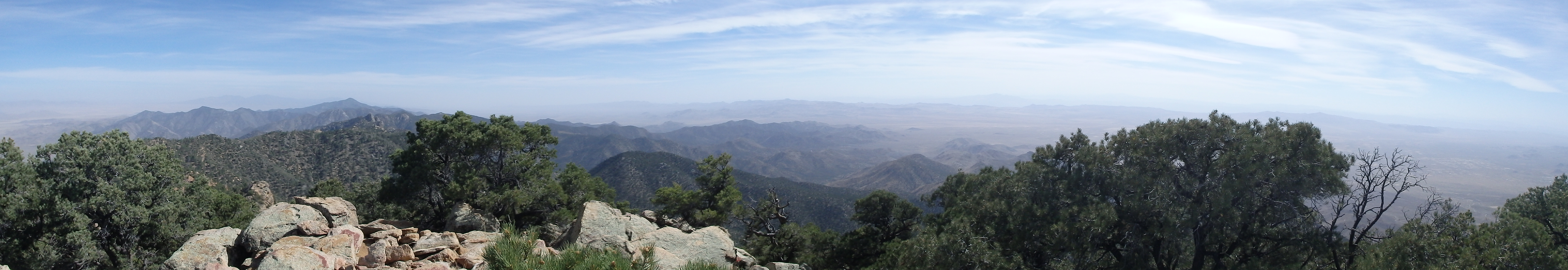
The ridgeline up towards the summit appeared quite steep, but it looked like it may provide some scrambling opportunities to avoid the brush. I headed up, not really finding much in the way of a use trail but fairly open terrain between the pines. Some rocky slabs ran on the left side of the ridgeline and I aimed for those, giving me brief sections of solid rock above the brush and yucca. Some huge boulders and rocky features dotted the ridgeline, and I began to see why the DPS selected this peak. I hadn’t appreciated how much further the summit was from the saddle, nearly 2000 trailless feet, and the brush seemed to get worse before it got better. At about 300′ below the summit, the worst brush on ridgeline was replaced by larger and larger pines, and some huge rocky gendarmes blocked the way, with easy passages around the obstacles on either side.

I was fairly exhausted by the time I reached the main north-south ridgeline of the range, with the summit still about 0.25 miles to the south. I traversed east over a few more false summits, the soil thick with duff and decades of pine needles. A few easy class 3 moves (which could have easily been avoided) put me on the last short ramp to the highpoint. Despite it being the afternoon in late May, a light breeze and the higher elevation made it cold enough to require a light jacket, and I sat down to go through the summit register and take in the views. Although it had only taken about 2.5 hours on the ascent, it was unrealistic to think I could make it to Perkins before sunset, and I enjoyed the high point with less urgency to descend. I recognized a number of Sierra Club climbers in the register, although the summit still only saw a few parties per year. I couldn’t help but laugh at the entries that complained about the brush, one person even saying it was the worst DPS summit on the entire list! In my opinion, it was a cakewalk compared to the mid elevation summits further south in the Sonoran Desert…


After a brief snack, I started down the summit ridgeline, using the loose pine needles to my advantage as I descended. My line of descent was much cleaner, able to see clear patches and exposed rock from above and use them to my advantage. I briefly picked up a cairned trail just above the saddle between Tipton and 5534′ but I quickly lost it in a drainage. It didn’t seem all that helpful anyways. Further down on the descent, I stuck to the gully far more judiciously, largely avoiding the worst of the brush on the ascent.

It was hard to tell where to cut away from the gully (my GPS had died) and I left it a bit too early, resulting in a final bit of bushwacking to get back to the old road. From there it was an easy trek back to the car, the temperatures still in the 90s at the low elevation. I had left a sunshower in the dashboard to rinse off once I got back to the car and nearly scalded myself from the hot water, heating all day on the dashboard. Once I was cleaned up, I headed into the small town of Dolan Springs for an early dinner before heading north to tag Mount Wilson first thing in the morning.
