
Wetterhorn Peak 14016′ and Uncompahgre Peak 14308′
Total Time: 10.5 hours
Roundtrip Mileage: 13.9 miles
Elevation Gain: 6450′
Crux: Class 3
Trailhead: Matterhorn Creek (lower 4WD TH)


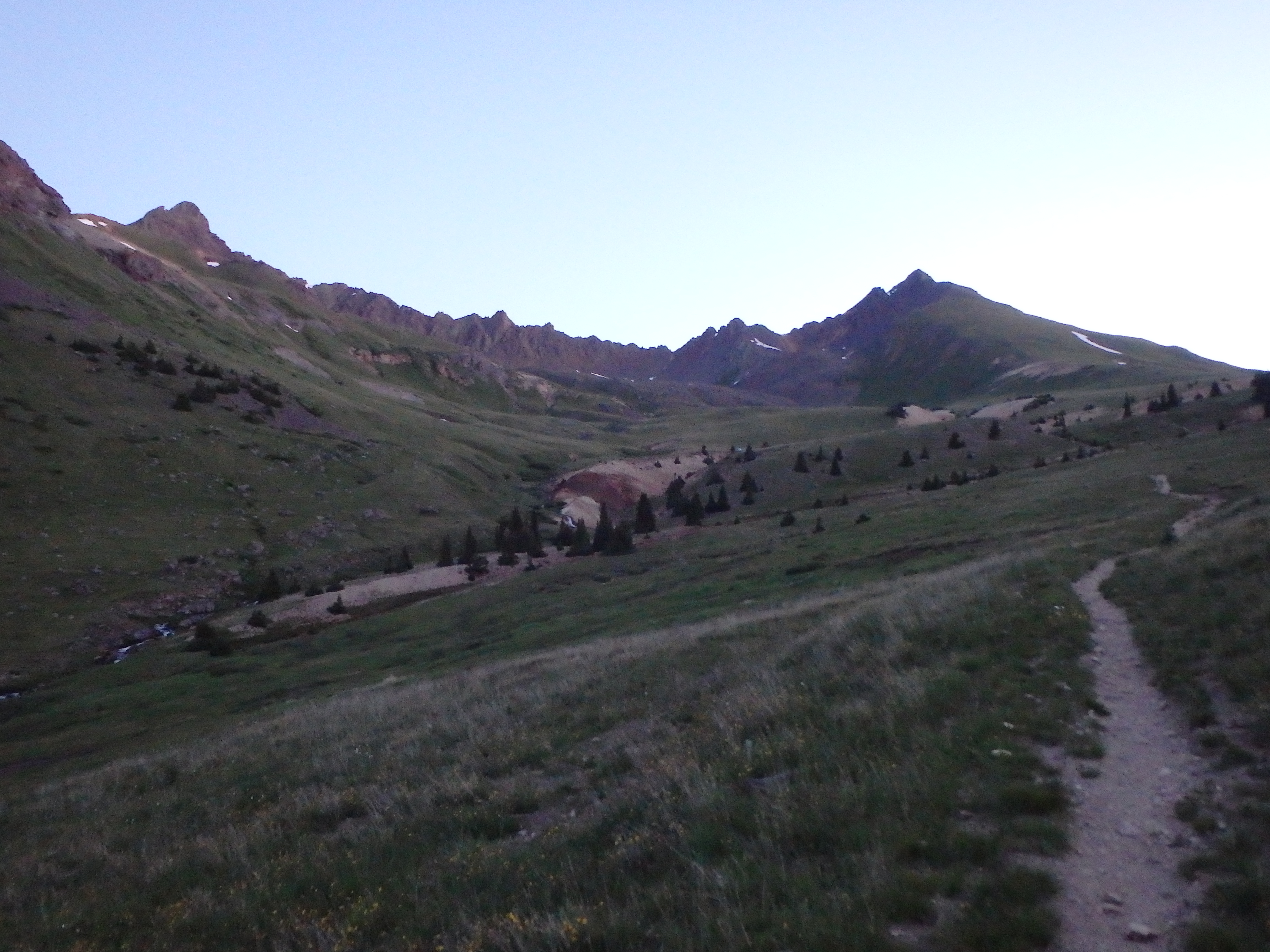
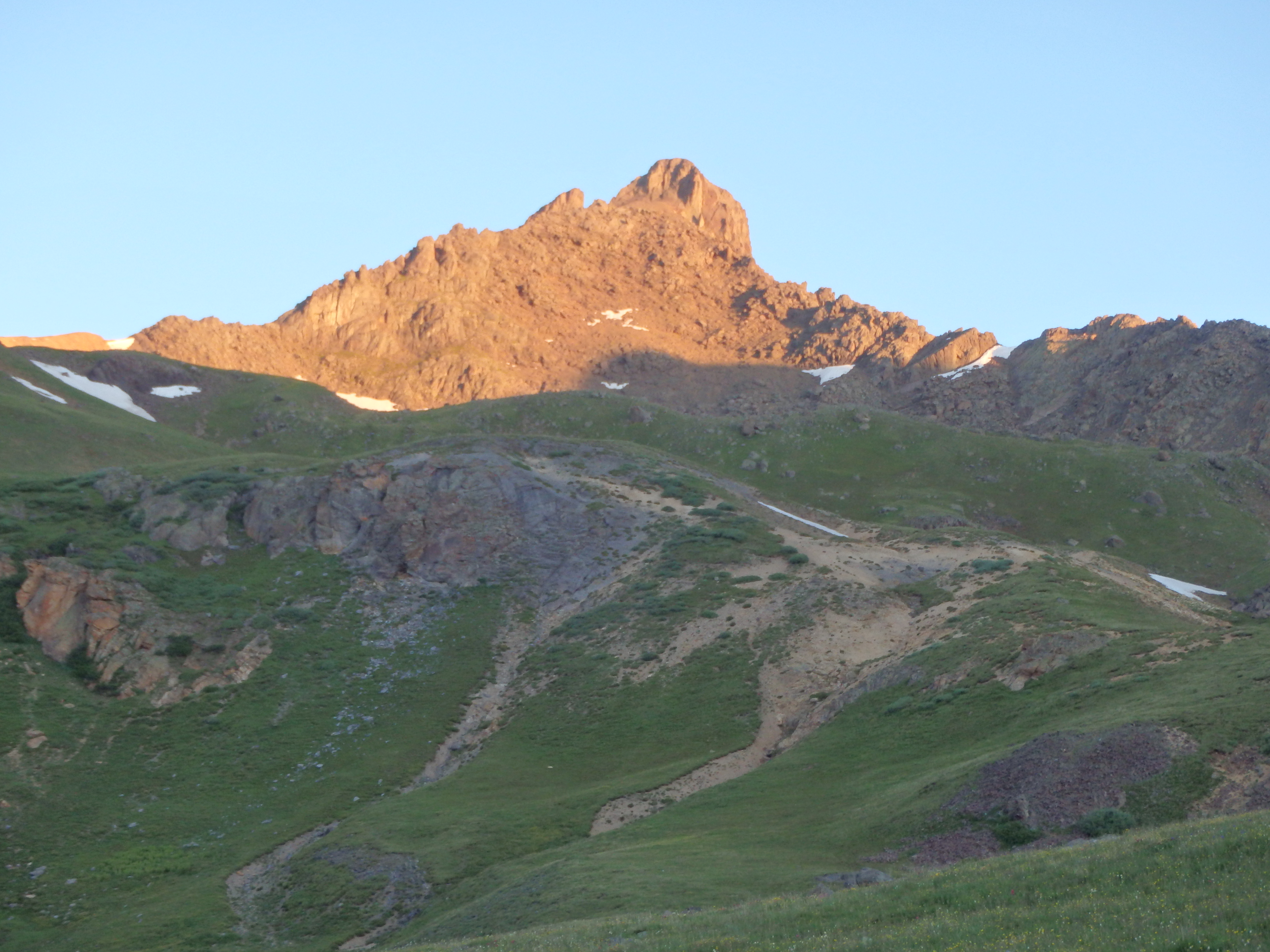
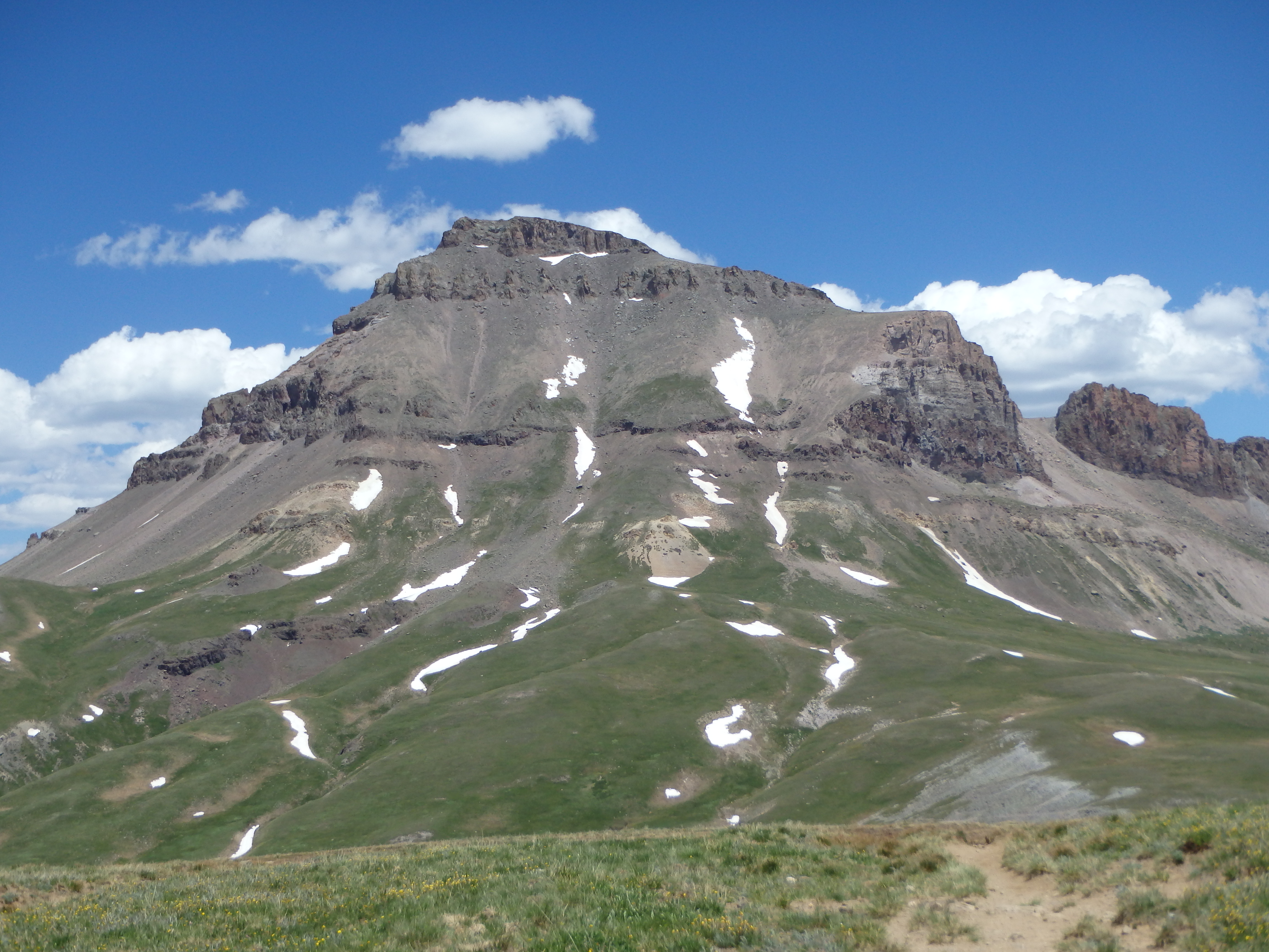
Uncompahgre is the highest mountain in the San Juans, and 6th highest in all of Colorado. It’s north face is a wall of dramatic cliffs, but the east and south slopes are more gentle with tiers of rock, likened to a melting layer cake. The easiest route to the summit is rated class II, but is virtually class I, following a trail all the way to the summit. Wetterhorn, a shorter nearby 14er to the west, is genuine class III by it’s easiest route. Despite their proximity, they are typically climbed separately given the 2,000’+ drop and miles of high plateau in between. But with a bit of stamina and a blessing from the weather gods, both can be done (+/- the Matterhorn) in a long day. Thanks to the “Heat Dome” sitting over Colorado, it seemed as if the weather wouldn’t be an issue. But with a bad ankle, stamina would be the true test for the day. I made it up the not too horrible 4WD road to Matterhorn Creek Trailhead, stopping 0.7 miles from the official start where the road gets significantly worse. I slept at a pulloff on the dirt road, and woke up at 4AM to give myself time for the long day. I left camp around 4:30 and hiked the 0.7 miles to the main trailhead in about 15 minutes. I hiked in darkness along the well traveled trail, and with my head down, blew past the first signed junction where I needed to turn right. The trail I was following along Matterhorn Creek petered out and I checked my GPS, quickly realizing my mistake. So I set off cross country straight up slope to regain the trail- not the best start to what was promising to be a long day. Back on the trail, things went a bit smoother, and as the sun rose over Wetterhorn and Matterhorn, I had my first views of the peaks for the day.
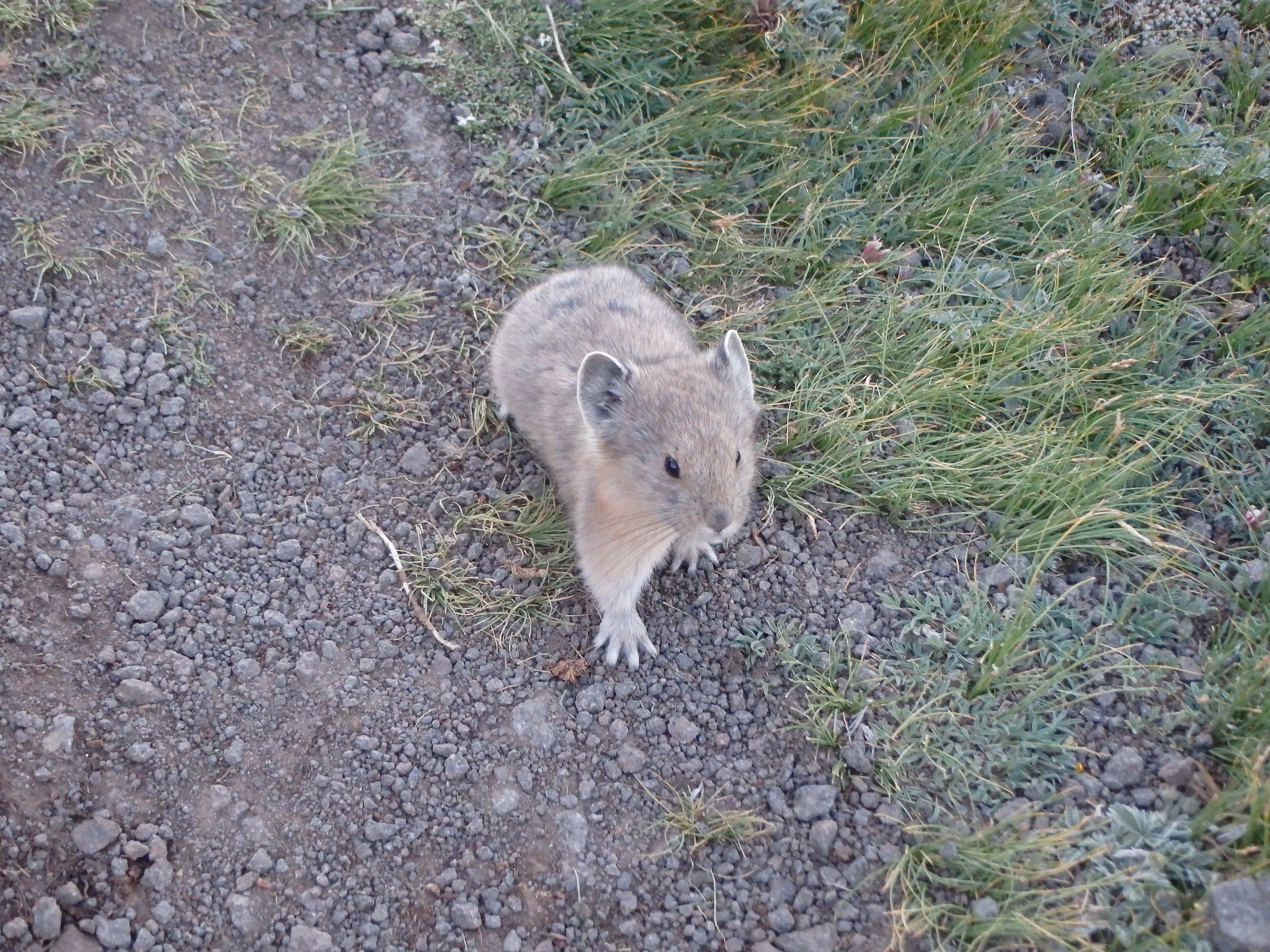
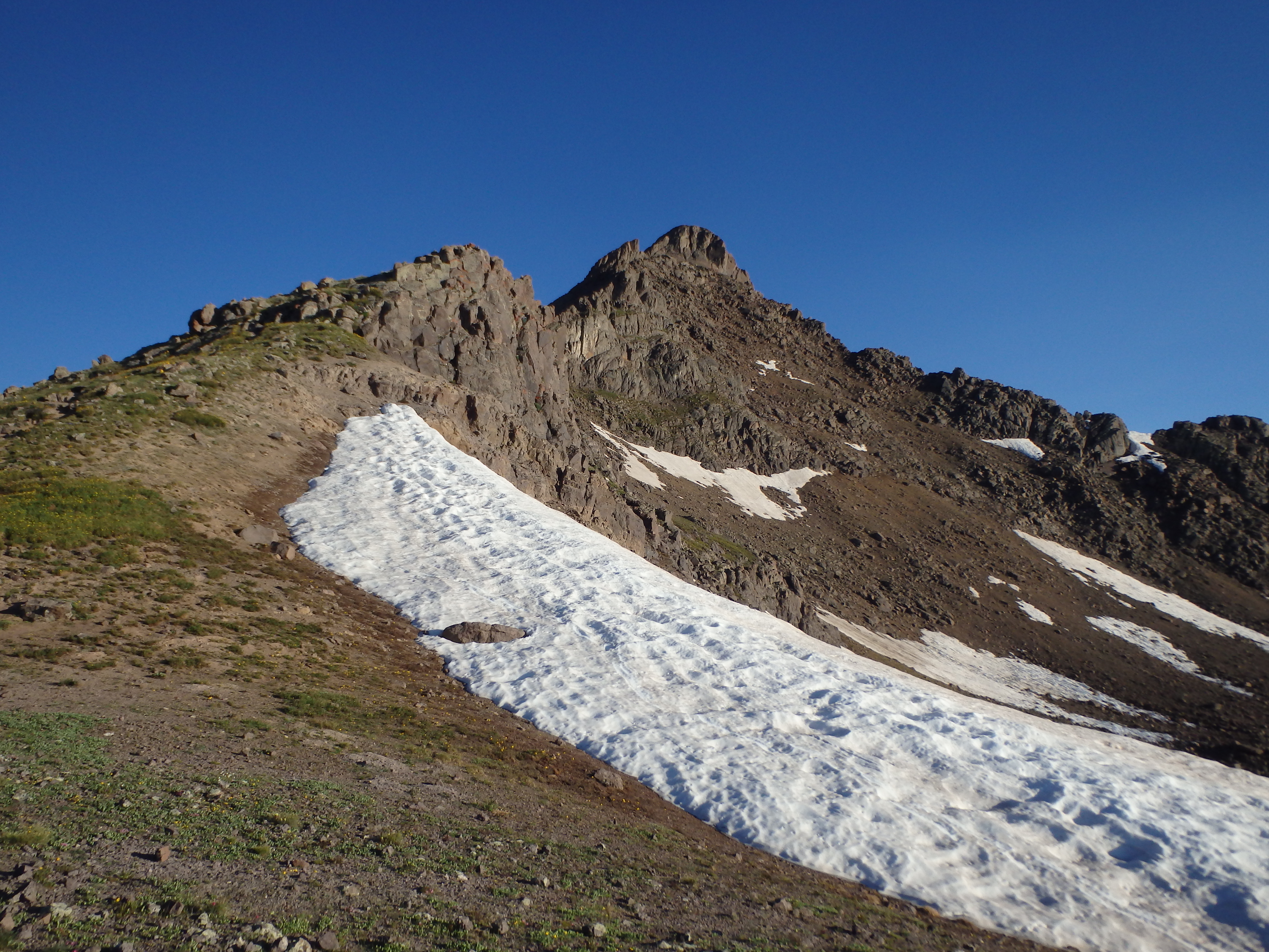
I passed another signed junction leading over the shallow pass towards Uncompahgre (which I would be taking on the return), and continued through the meadow to the start of a rocky moraine at the base of the Wetterhorn, my first stop for the day. A well worn trail headed up through the boulders, and there was no scrambling required despite the rough appearance from below. Through this section I saw more Pika in one mile then all my years of hiking combined, some bold enough to walk right up to me despite their normally skittish nature.
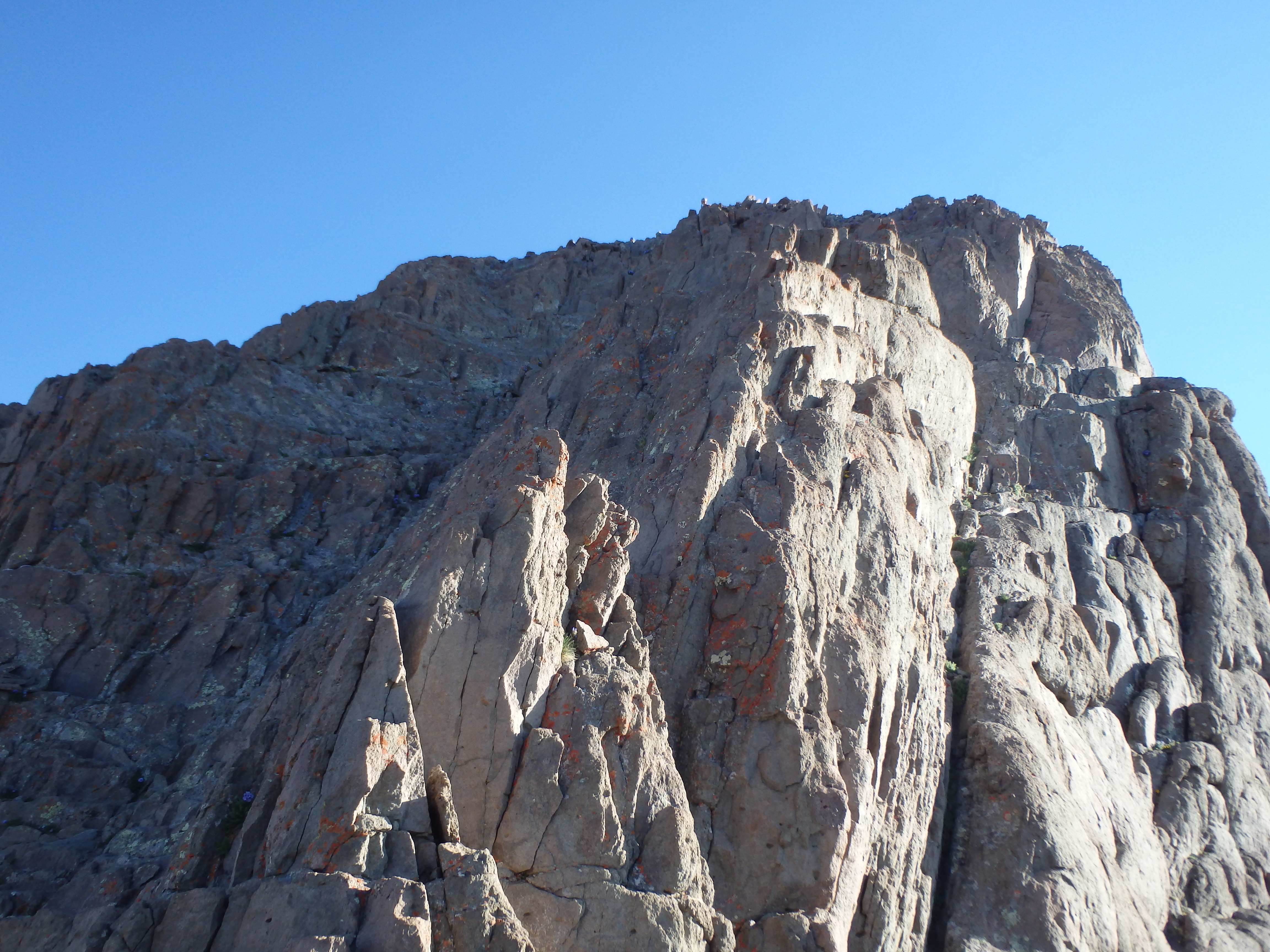
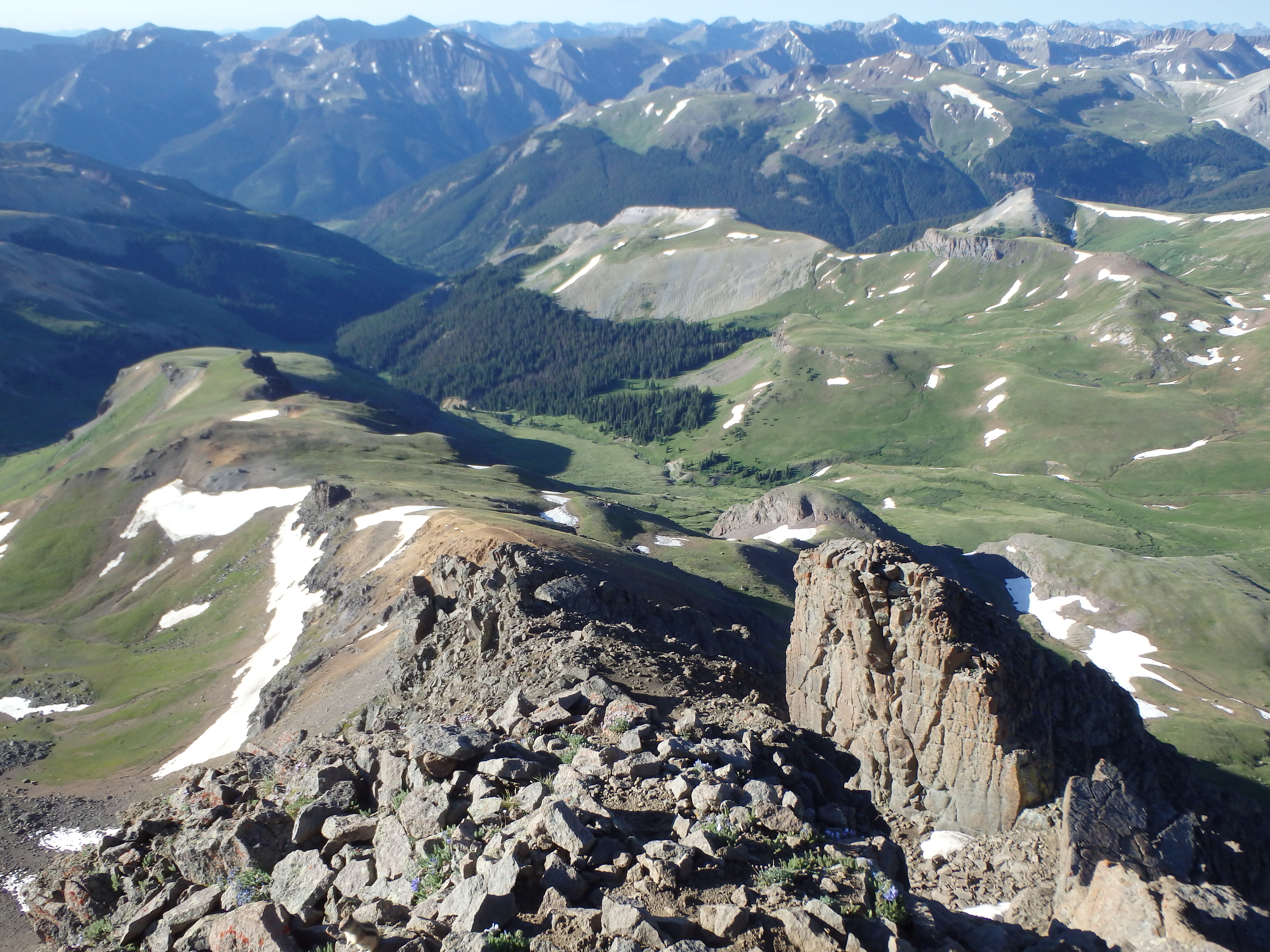
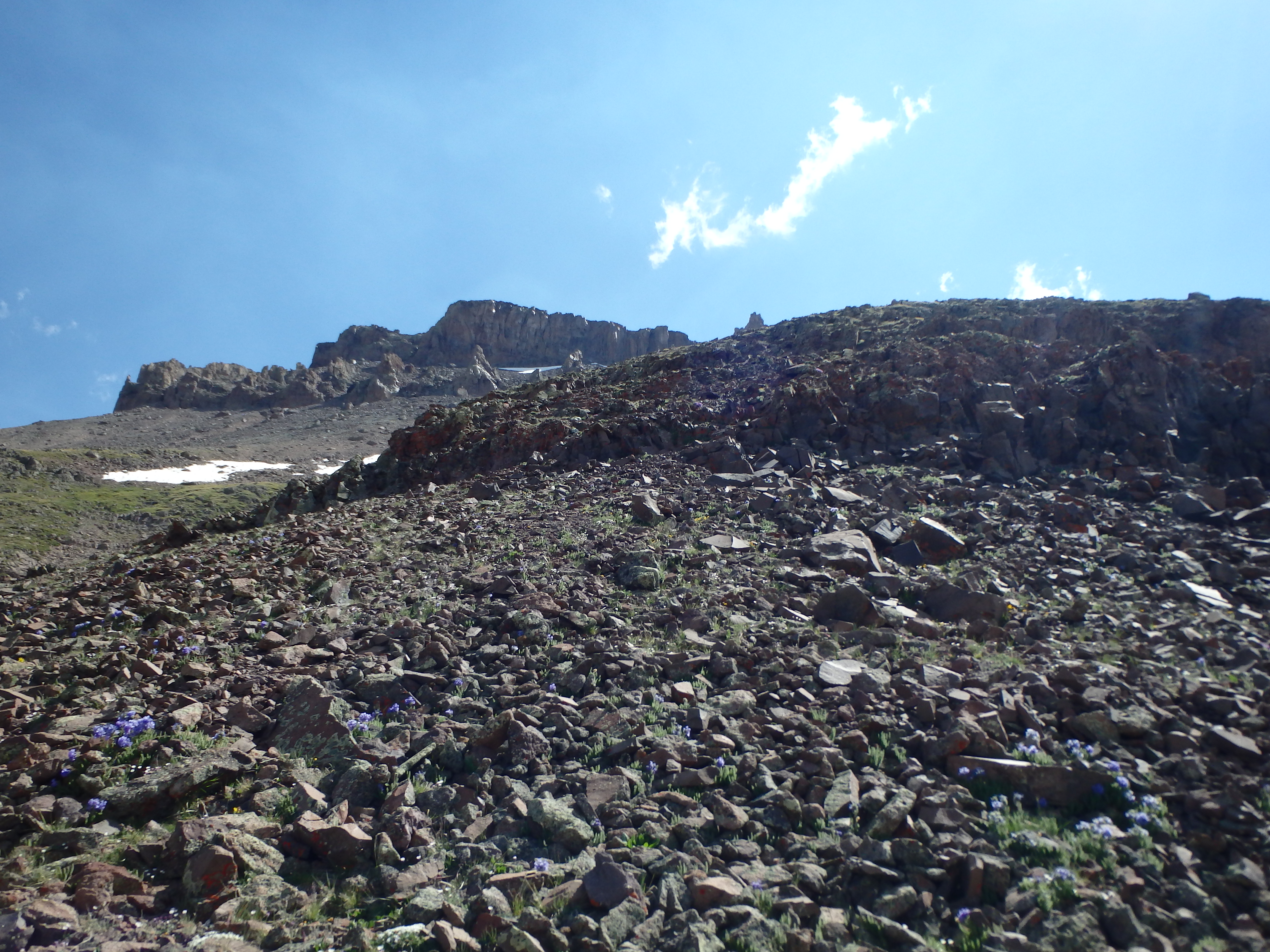
I continued along the trail up and over a small snow patch to the ridgeline and the start of the route up the SE. The summit was less than 1000′ above but the route at this point was difficult to see beyond the lower slopes. I continued along the well worn trail directly up the ridgeline, weaving around some of the smaller boulders before finally getting to the fun stuff another 200′ higher. The route here transitioned to bonafide class II ledges, some gritty and loose, as I worked my way slowly up the ridge towards a steep ridge dropping off to the left.
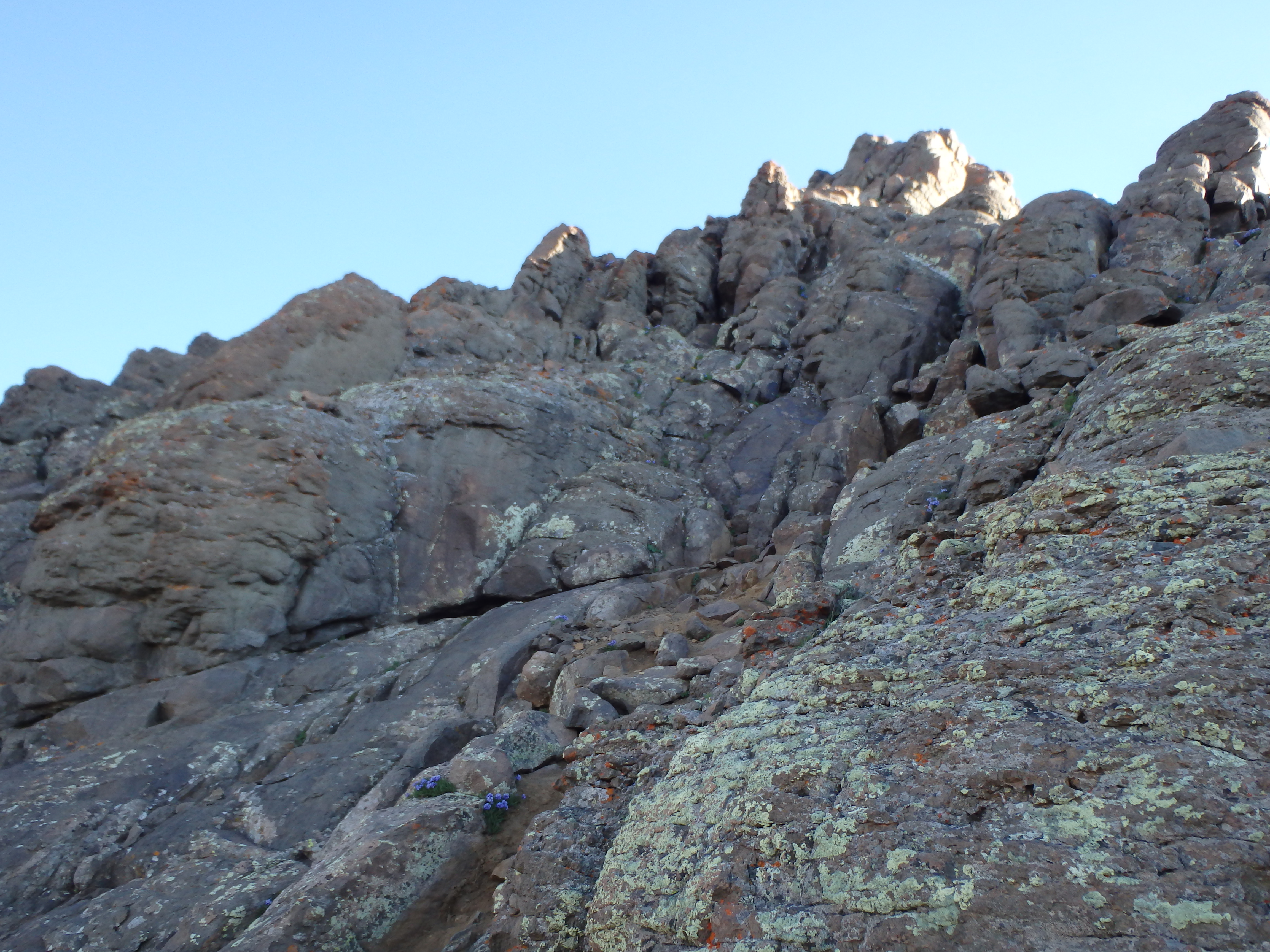
There were a number of options to work with at this point, but the only real goal was to make it to the the large rock rib and head up to a cleaved boulder from there. While most of this was class II, I made no effort to avoid class III, and would climb occasional cracks and ledges to keep it sporting. From the cleaved boulder I turned left into a notch leading to more class II ledges below the prow, the prominent false summit along the ridgeline. The climbing here was actually quite easy, and I worked across the ledges to find a surprisingly well defined use trail skirting the base of the prow to the climbers right.
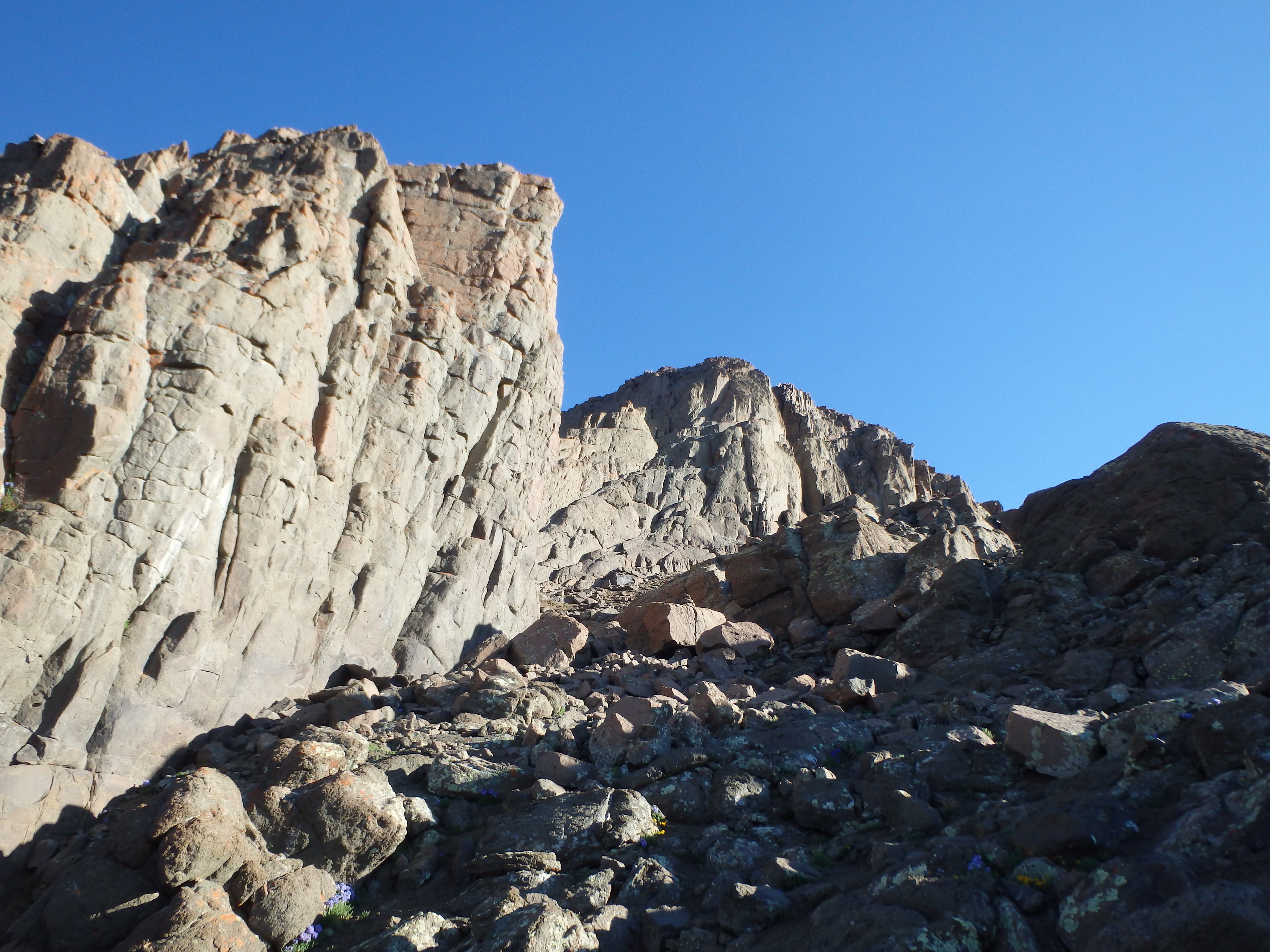
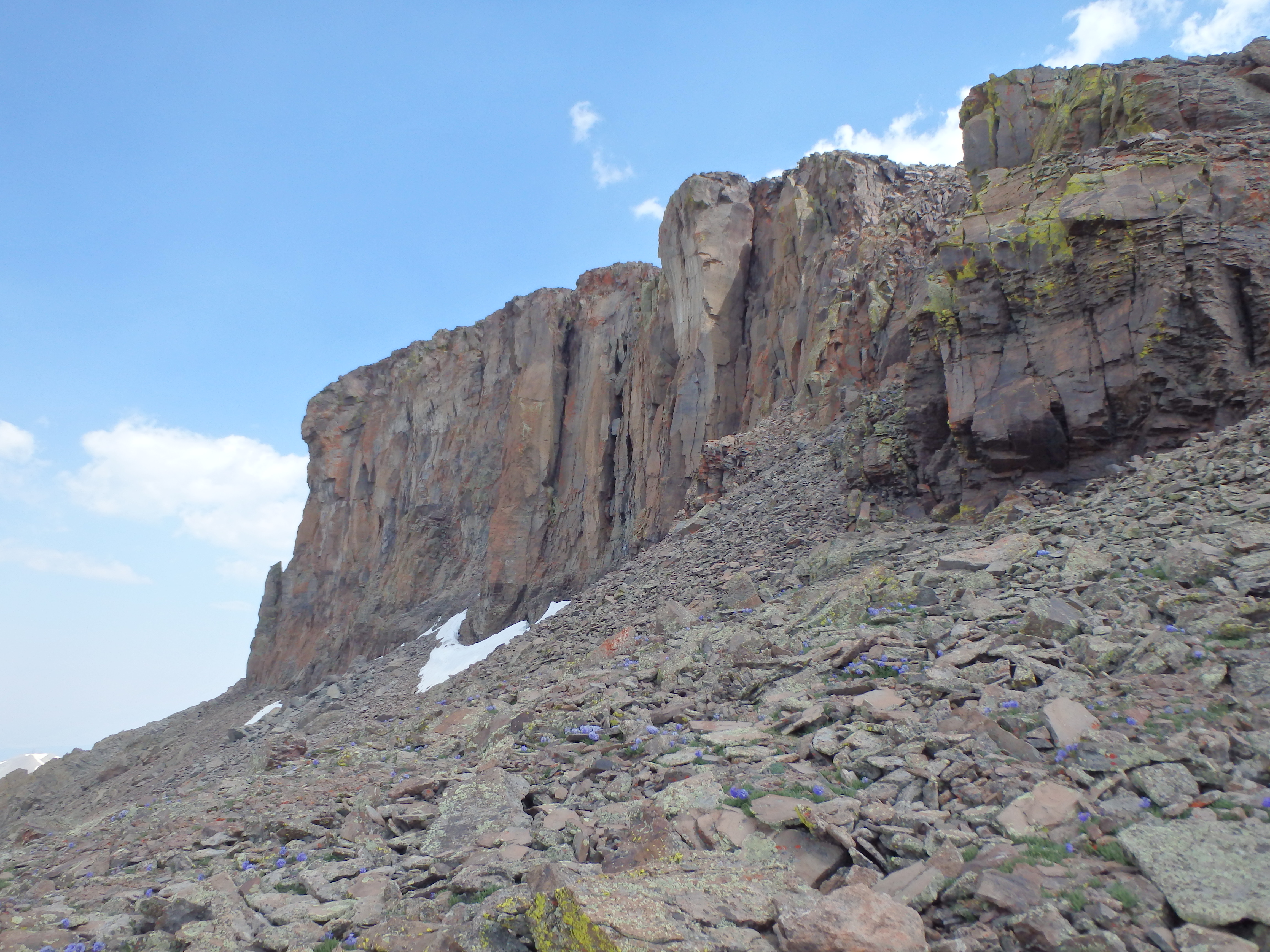
Working around the prow, I found the key notch between the prow and false summit, leading for the first bit of mandatory class III climbing for the day. At the notch, I popped out on some surprisingly smooth slabs and dropped right around a corner to the crux- a class III gully that leads directly to the summit.
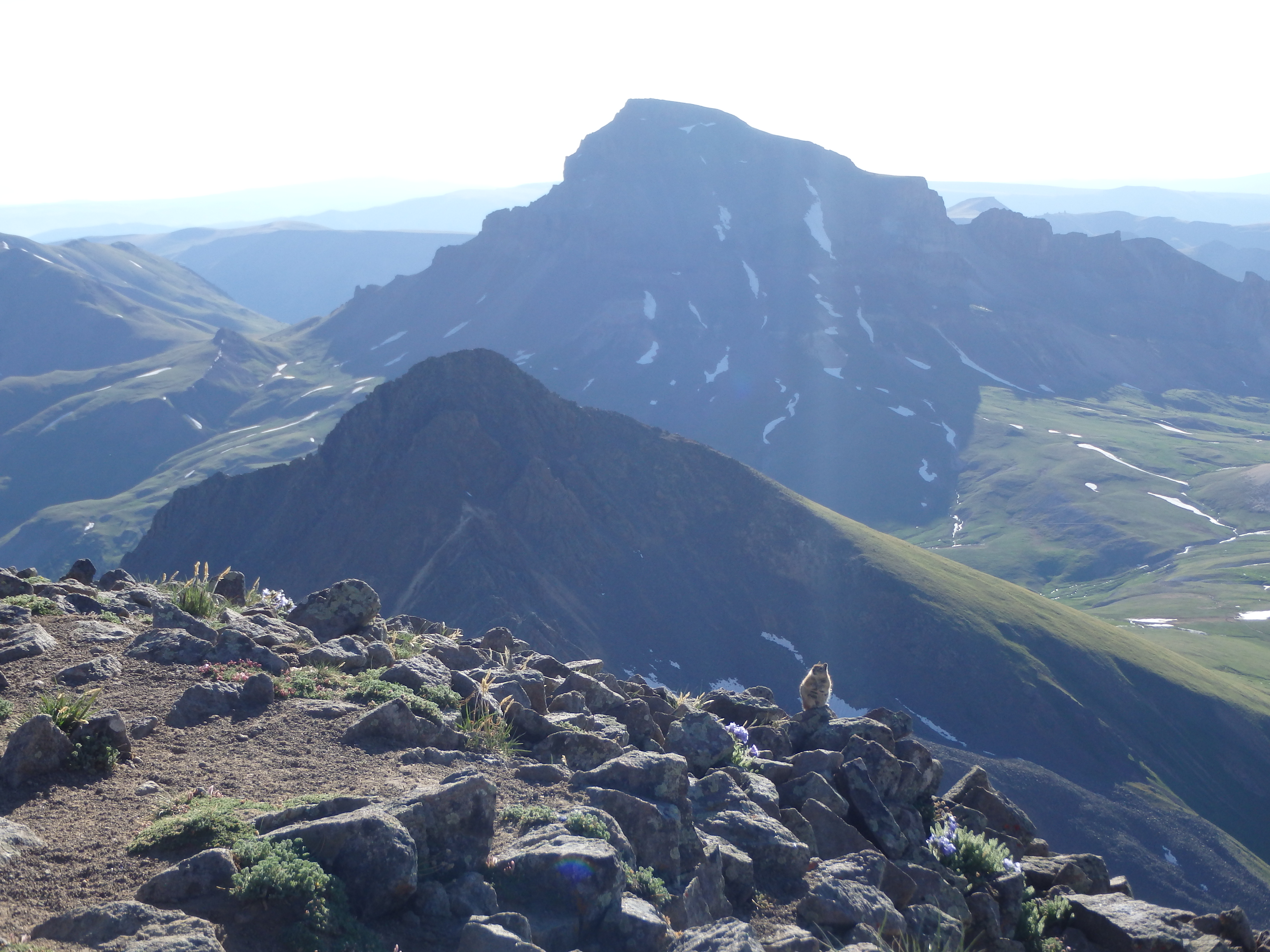
There were two climbers descending from the summit, and I let them drop about halfway down to avoid any rockfall they might accidentally send my way. The lower parts of the gully were pretty tame class III, with a series of ledges and not too much exposure. The hardest spot was near the very top of the gully, where the ledges got smaller with about 10′ of borderline face climbing with excellent holds. Past the crux, a few more ledges brought me to the small rounded summit, and I took my first break of the day. The sun was still low, so the views were best to the east and south, Uncompahgre backlit by the low sun. I tried not to think about how far away Uncompahgre looked from Wetterhorn, running with the assumption that it would look much, much closer after descending.

I dropped off the summit and started passing a number of groups on their way up Wetterhorn, nearly every one asking for beta on the route above. I assured them that there were many possibilities through the class II, the class III was short, and they should have no trouble. Hiking quickly down through the moraine, I started working cross country on a very faint track through the meadow to the west once clearing the boulders.
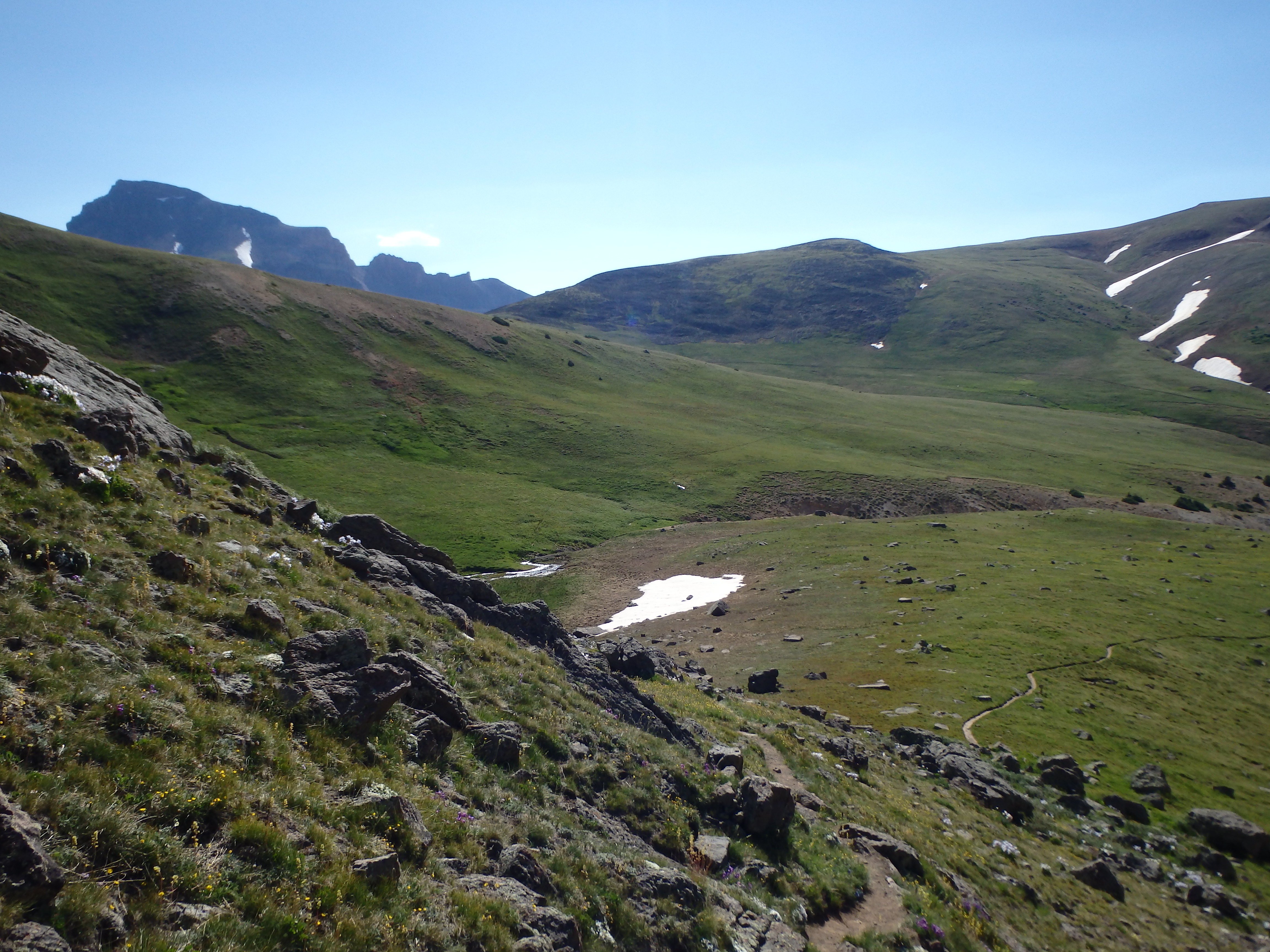
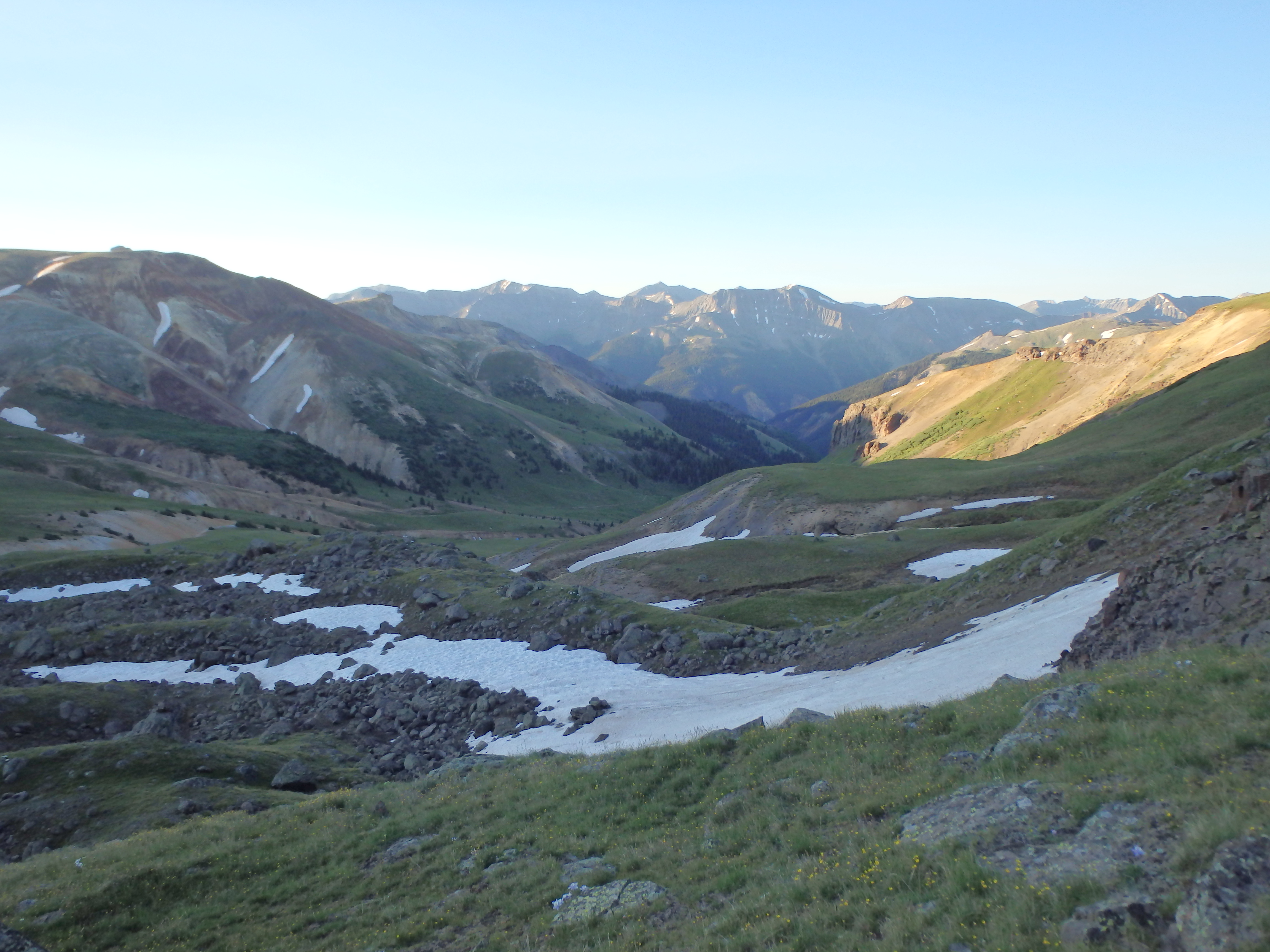
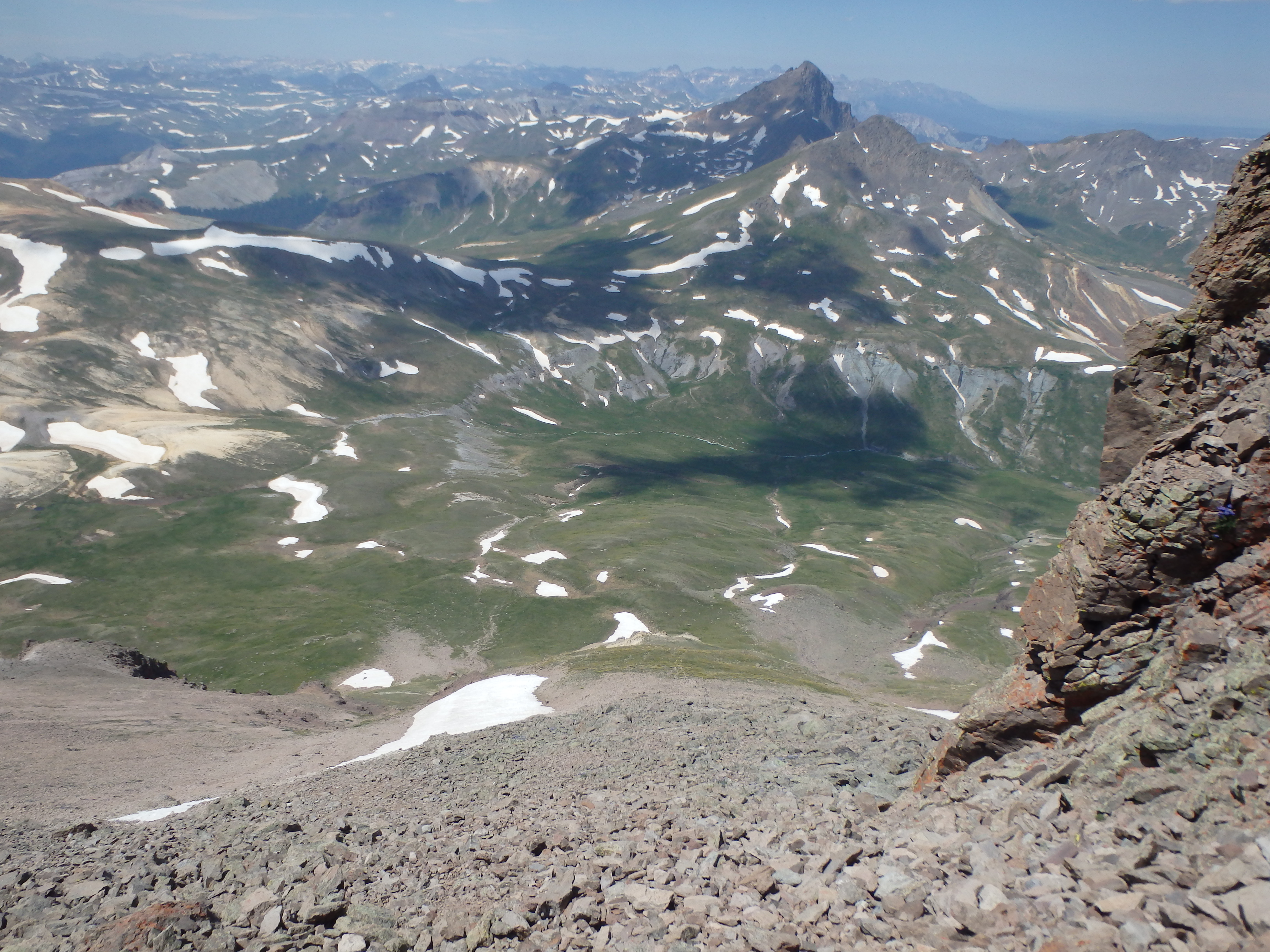
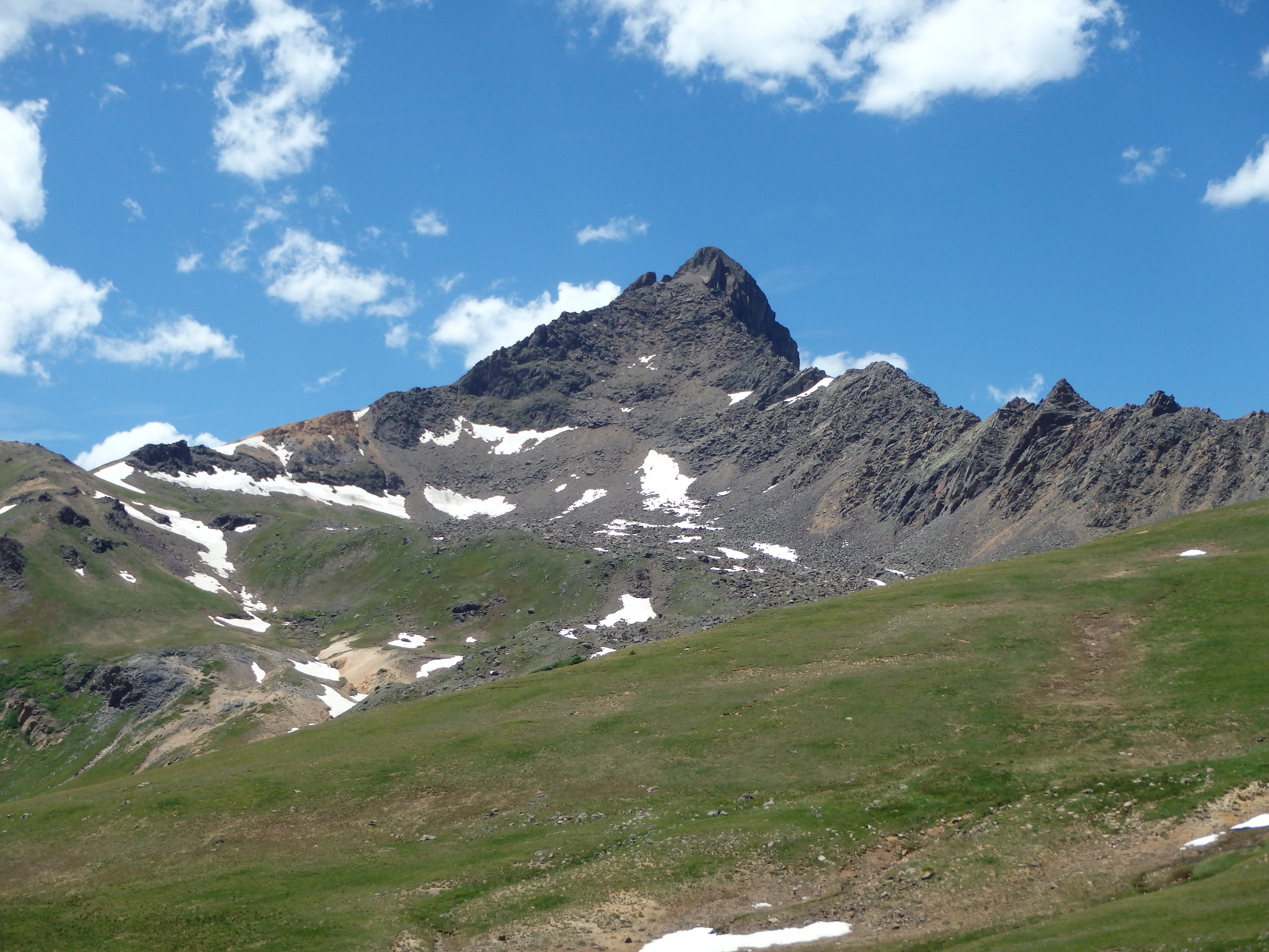
The broad, gentle southern ridge of Matterhorn was still blocking Uncompahgre, so I couldn’t see just how far it actually still was until I crested over the grassy slopes to find it towering in the distance. What made matters somewhat worse was the dire warning I had read online to not attempt the West Face directly without snow cover. Climbers cried “loose rock!” all over the message boards, and with a bad ankle already, I felt I had no choice but to end-around to the normal route, adding on many miles each way. But as I reached the pass, I encountered a group of climber doing the reverse of my day- Uncompahgre in the morning, Wetterhorn in the afternoon.They told me they had climbed the West Face, and didn’t find it bad at all. Sensing my skepticism, they pointed out the swath of grass that reached nearly to the summit cliffs. How could it be that loose if there’s grass growing nearly to the top, they pointed out. That was enough to sell me. I continued along the grassy path towards Uncompahgre, cutting cross country at a stream, and aiming for the shallow rib that would take me up the center gully of the West Face.
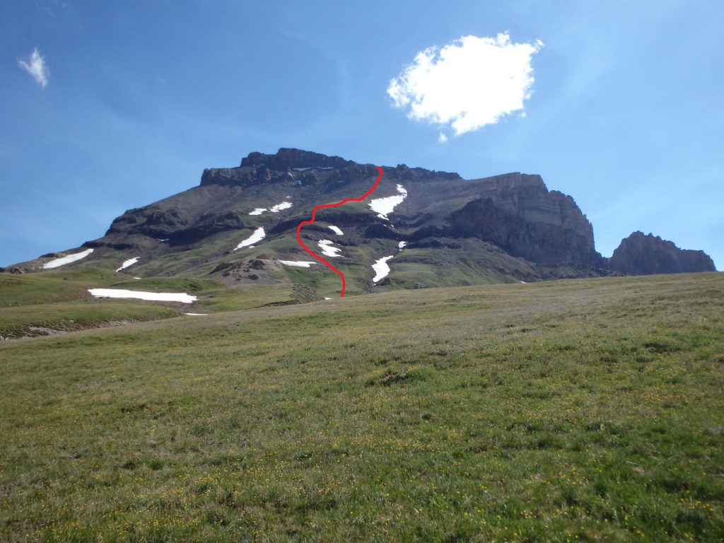
From below, it looked like I might have to figure out a way through some cliff bands about 1/3 of the way up. But as I drew closer, it became a non-issue, as there were a number of class II options to work up and over the small tiered cliffs and into the broad, grassy gully. Despite the grass, spots were still a bit loose, and I started aiming for some of the larger, more stable rocks. Higher up, as the grass gave way to looser rock and sand, I cheated to the far left side of the gully beneath some rock ribs, using the more solid rock (and class III climbing) to ultimately reach a notch on the comparatively flat ridgeline.
From there, it was a short walk on a well defined trail to the broad summit. It had taken 3.5 hours from the summit of Wetterhorn, faster than I expected, made possible by climbing the West Face directly. I talked to a few people milling around at the summit, took a few pictures, and admired the dramatic cliffs to the north.


At that point, the weather was looking a little iffy, with most of the clouds still looking innocent, but one or two hanging above looking a bit less friendly. I didn’t want to be caught in the broad, exposed plateau between the two summits if things went south, so I headed back down the trail and to the notch in the ridgeline to drop back down the West Face. I was a little nervous about the descent down the loose rock, thinking that would be a little tougher on my ankle. But moving off the more “solid” rock, I found some nice runs of sand and loose pebbles that I could boot ski down past the steepest sections.
From there I switched back to the larger boulders and talus to the north side of the gully until I reached the grass, with smooth sailing from there. As I hit the meadows again, the weather and haze actually improved, and as I hiked across the grassy, wildflower covered saddle between the two 14ers, I felt pretty accomplished. I rejoined the trail near Matterhorn Creek and followed the trail, hitting the junction I missed in the dark, and down the dry and dusty trail back to the trailhead. From there, I drove back to Lake City for a well earned beer and giant plate of ribs at Southern Vittles.
Continued…