
Bridge Mountain 6,940′
Red Rocks NRA
Total Time: 7:00
Round trip Mileage: 9.8 miles
Elevation Gain: 4750′
Class 3
Trailhead: Rocky Gap Road (4WD required)


West of Las Vegas, serving as a stunning backdrop to the Vegas Strip, is Red Rocks NRA, a playground for hikers, climbers, and tourists that have lost too much money to continue gambling. I had hiked in Red Rocks a few years prior, a fun little scramble up Turtlehead Jr, but hadn’t tackled any major summits off the main crest. The summit that had been on my Vegas short list for a long time (along with Charleston, which I have yet to do) is Bridge Mountain. Named for a prominent natural rock bridge just below the summit, Bridge Mountain is a demanding route over rugged sandstone with significant sustained class III. Looking technical from almost every angle, there’s an exciting and exposed route that brings you improbably to the summit. I was headed to Vegas for the weekend with a couple friends, and instead of losing too much money too quickly, I decided to dedicate a day to hiking in Red Rocks. I impressed myself by waking up at 7:30 despite being slightly hung over, but then immediately wasted that time taking the wrong route towards Red Rock Summit, with Google Maps directing me around to the south route to Red Rock Summit, by most reports, an impassable road. Back on track and in Red Rocks proper at around 9AM, I turned off towards Rocky Gap Road, and was hopeful that the summitpost comment I had read about the road being reworked in 2014 held true. Unfortunately, immediately after crossing a rocky wash, I was faced with a rutted section of road with a recent rockfall, and pulled over next to a group of cars that also felt they could go no further. I walked shortly up the road and found that it quickly improved, and headed back to my car, throwing some larger rocks off the road along the way. The Subaru made it through in one push, and I was on my way. As I rounded into the canyon, I hit another rough section that was arguably more difficult then the first, but made it through without major damage to my oil pan. By now I was considering alternative approaches given the road, and noticed a trail that headed up from the road down canyon, heading towards North Peak. Since I had already planned to climb North Peak as well that day, it actually wouldn’t add any mileage, only a little extra elevation gain. I decided to save my car the trouble to go the extra few miles to Red Rock Summit and try this route instead. Less then 0.5 miles from the North Peak Trail turnoff, I came upon another rutted section and decided not to force it, pulling over here.

By now it was already 10, and I headed out under sunny skies along Rocky Gap Road towards the North Peak Trail. I had my GPS running and came upon the turnoff for the North Peak Trail, marked unceremoniously with a black metal stake.


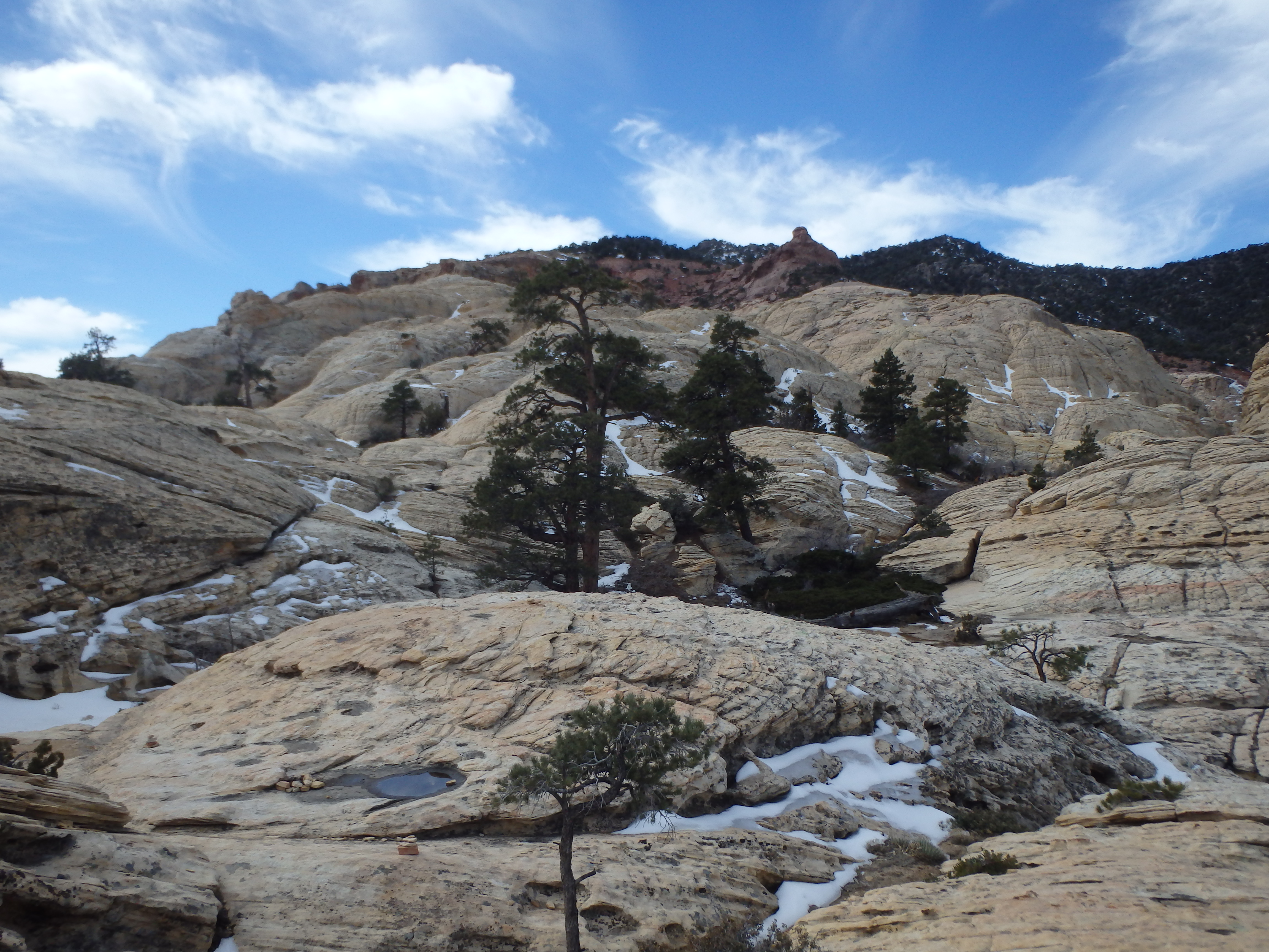
I dropped off the road and headed up the steep trail, briefly losing it near a campsite, then finding it once more along the ridge. Feeling like I was behind schedule, I tried to maintain a fast pace up the ridge, not wanting to take a break until I hit the ridgeline. Higher up, the trail became less distinct over sandstone slabs with small patches of snow along the north facing slopes.

As I neared the ridge, I could see North Peak close by, to be tagged on the way back. I wanted to maximize my time and energy for Bridge. Finally hitting the crest, I was a bit disappointed to see how far away Bridge Mountain actually looked, with an undulating ridge and multiple canyons to bypass just to get to main turn off.


I skipped my planned break and set out on the ridgeline, heading mostly uphill and drawing slowly closer to Bridge Mountain. After 20-30 minutes I hit the junction with the trail from Red Rock Summit, and a second sign shortly thereafter for Bridge Mountain.

The trail wove around a bump on the ridgeline before steeply dropping down the ridge to the low saddle with Bridge Mountain. While the upper reaches were mostly trail, this gave way to fun, sandstone slabs running in parallel tracks. Closer to the saddle the ridge steepened requiring a bit of scrambling, and I took my first break. Even this close, it didn’t seem like there was a nontechnical route to be found. All the way to the saddle, I still couldn’t see the line I was supposed to take. It wasn’t until I was nearly at the base of the cliffs that I could see the class III route up.

The climbing during this section was very enjoyable, with plenty of solid holds along the way. Higher up, the exposure increased a bit, and I was forced out of the crack and onto a rocky bench to the left. I continued hiking upwards along the slabs, crossing above a frozen tank with some large Ponderosa Pines at the base.
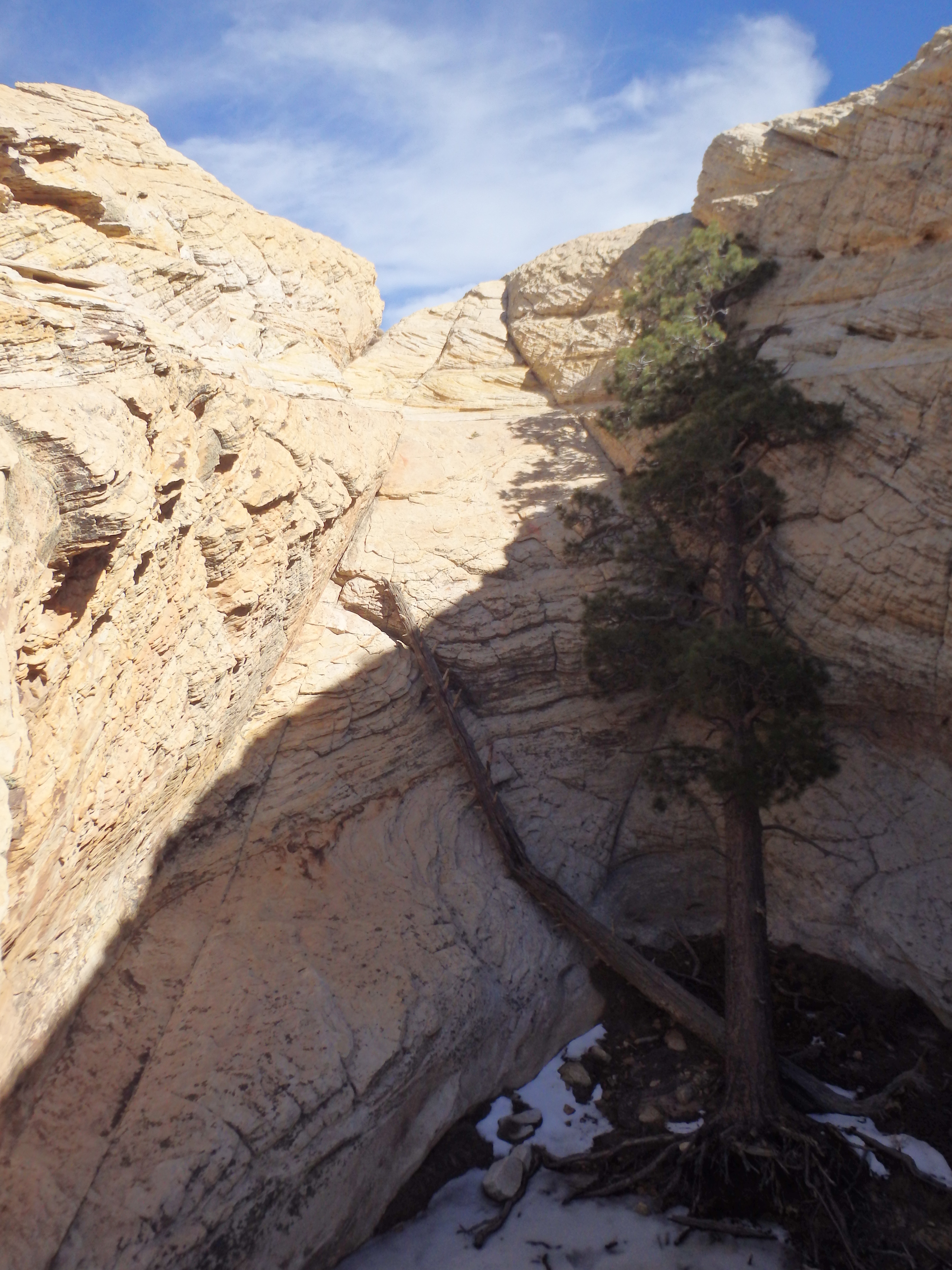
A bit more class III skirted the tank to the west, and I hit the famous “hidden forest,” a small grove of maybe 30 large Ponderosa Pines just below the summit.

From there it was another 200′ of class II-III scrambling to the summit blocks. The views were more impressive than I expected, with major Red Rock formations to the south, Charleston to the NW, and the Vegas Strip to the east.


I wandered down the east side of the summit a bit, considering tagging some of the unofficially named summits in the Bridge Mountain group along it’s eastern ridgeline. I descended about 100′ before seeing that getting to them would not be quite as straightforward as I had hoped with a steep drop off in between, and ultimately, not worth it for today’s adventure. I scrambled back down to the hidden forest and traversed around a deep tank to find the namesake natural Bridge, which I had completely missed on the way in having crossed right over it.


I dropped back down to the class III crack, trying not to look at the nearly 1000′ I would need to reascend back to the crest. The descent back to the saddle was uneventful, as was the climb back up to the crest. I felt like I definitely had enough time to pay a visit to North Peak before running out of daylight, and followed the trail north, thankfully with more downhill on the way back. A sign at the junction from Red Rock Summit suggested that North Peak was only 0.3 miles away; in reality, it was referencing Crest Peak, a high point on the ridge line (higher than North Peak in fact), which I made a quick stop at as well. I passed by the turnoff for my descent back to Rocky Gap Road, and hiked through sand and scrub to the blocky summit.


From this angle (or I suppose really any angle), Bridge looked impressive, and I took a final short break before the descent. I half jogged down the steep trail back to the car, and made it through the rough spots along Rocky Gap Rd without incident. I headed back to the Vegas to join the rest for a dinner and a night out on the Strip.