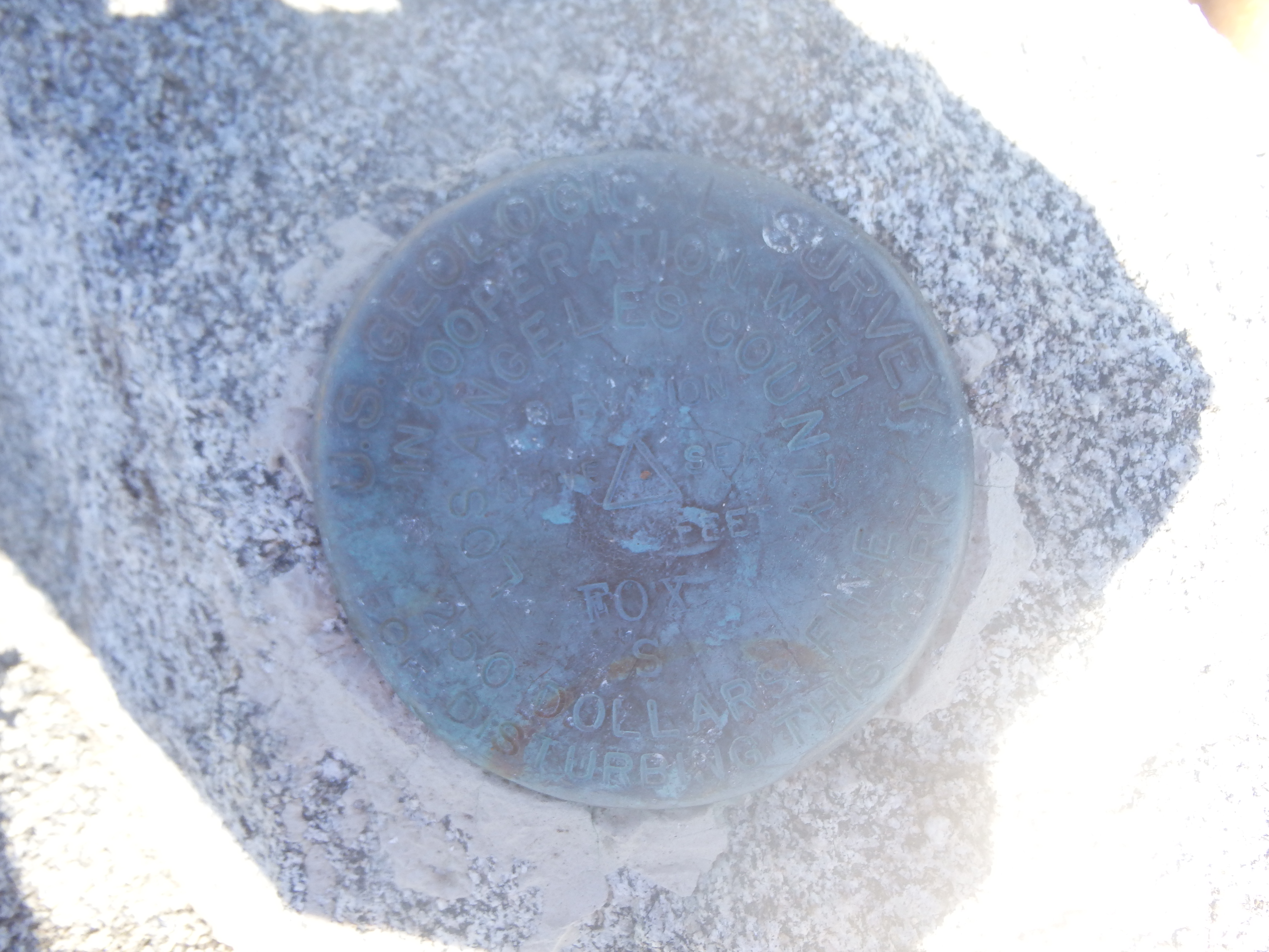
Fox BM 5036′, Condor Peak 5456′ and Iron Mountain 5636′
San Gabriel Mountains, Southern California
Total Time: 9:30
Distance: 19.5 miles
Elevation Gain: 6680′
Trailhead: Condor Peak Trail, no services


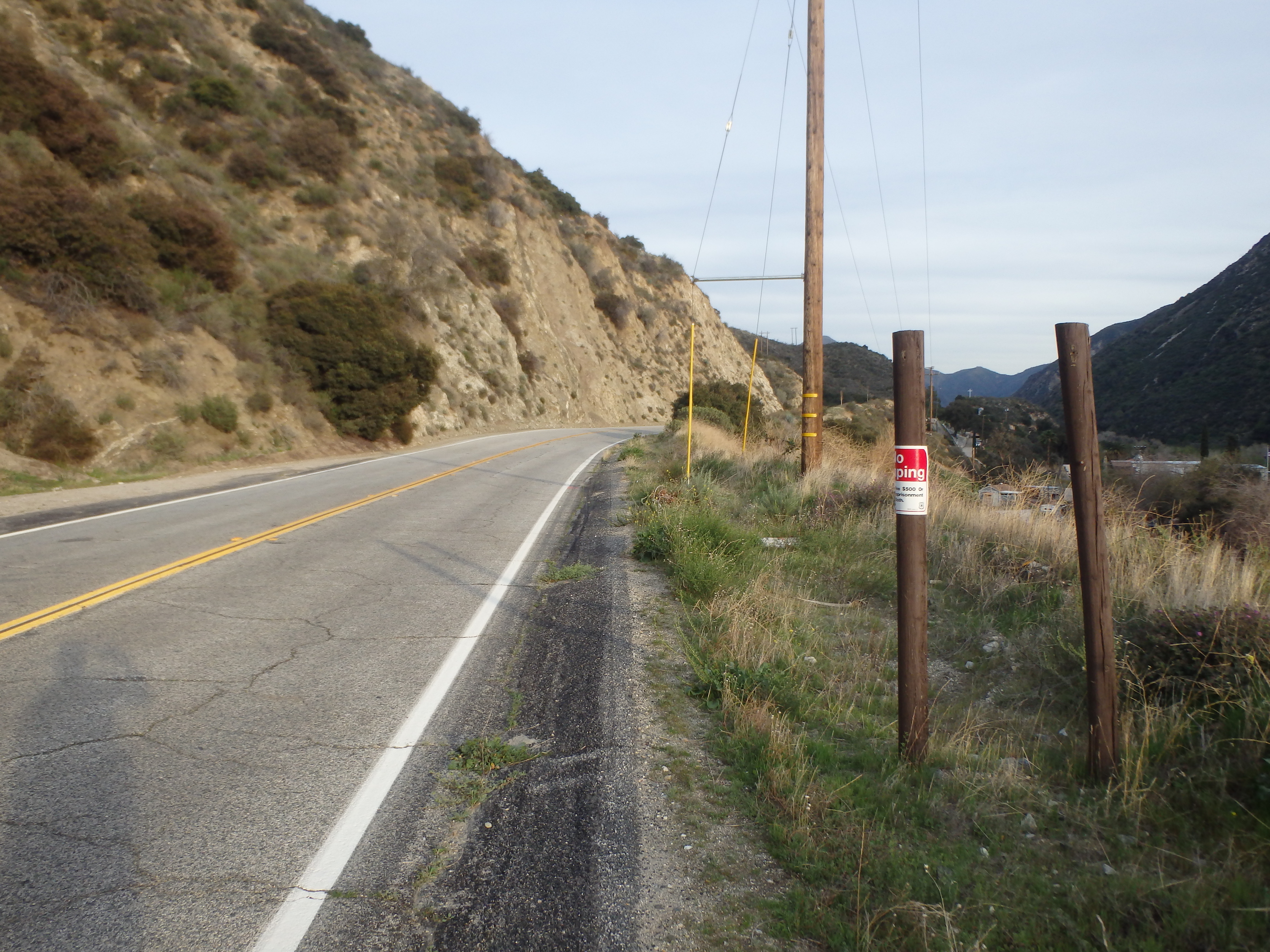
Fox, Condor and Iron are three of the western-most Hundred Peak Section (HPS) summits in Angeles National Forest. While they were some of the closest to home back when I lived in Los Feliz, they were off limits my entire time in Los Angeles due to the Station Fire in 2009, with large sections of the forest closed to recreation for recovery. Coming back to the range almost ten years later, the peaks were again fair game and I could at last tick these three off the list. My plan was to start at the Condor Peak Trailhead and loop down through Trail Canyon, with about 3 miles of road walking between the two THs, basically mirroring Bob Burd’s pre-Station Fire trip report. It looked like I could park at a pull off a bit further west on the highway to bushwack up and cut off the first long switchback, which would save me about a half mile of hiking on each end of the loop. I didn’t get started until about 9:30 AM thanks to some work things I needed to take care of in the morning, and I found the rough pull out I was looking for. The highway was mostly cliffs or impossibly steep brush, but I found a rocky gully that I could take up the first 40′ until bushwacking through brush became at least feasible. It only took me about 5-10 minutes to gain the trail and cut the entire first switchback, and I started up the long grind towards Fox BM, my first stop of the day.
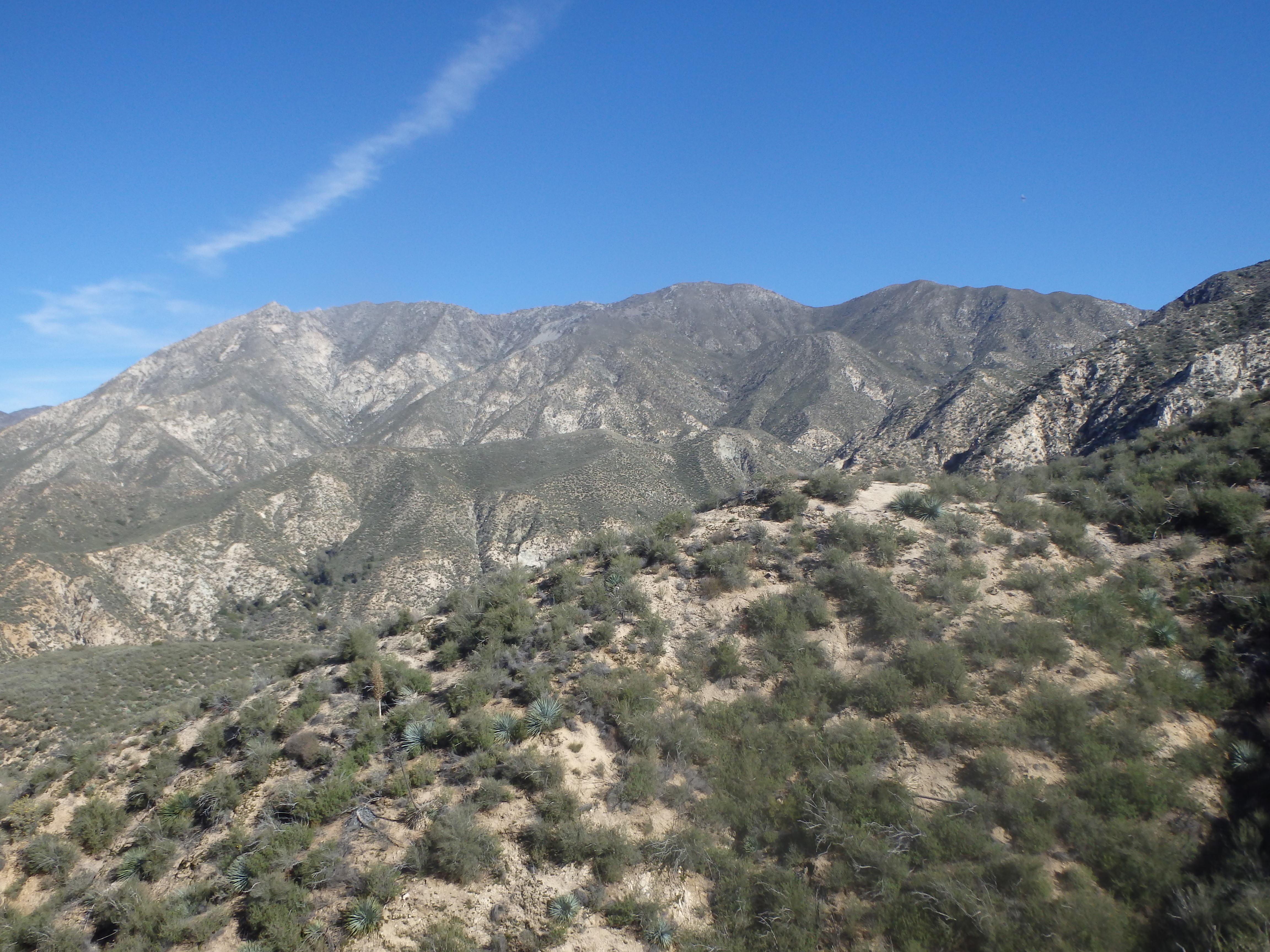
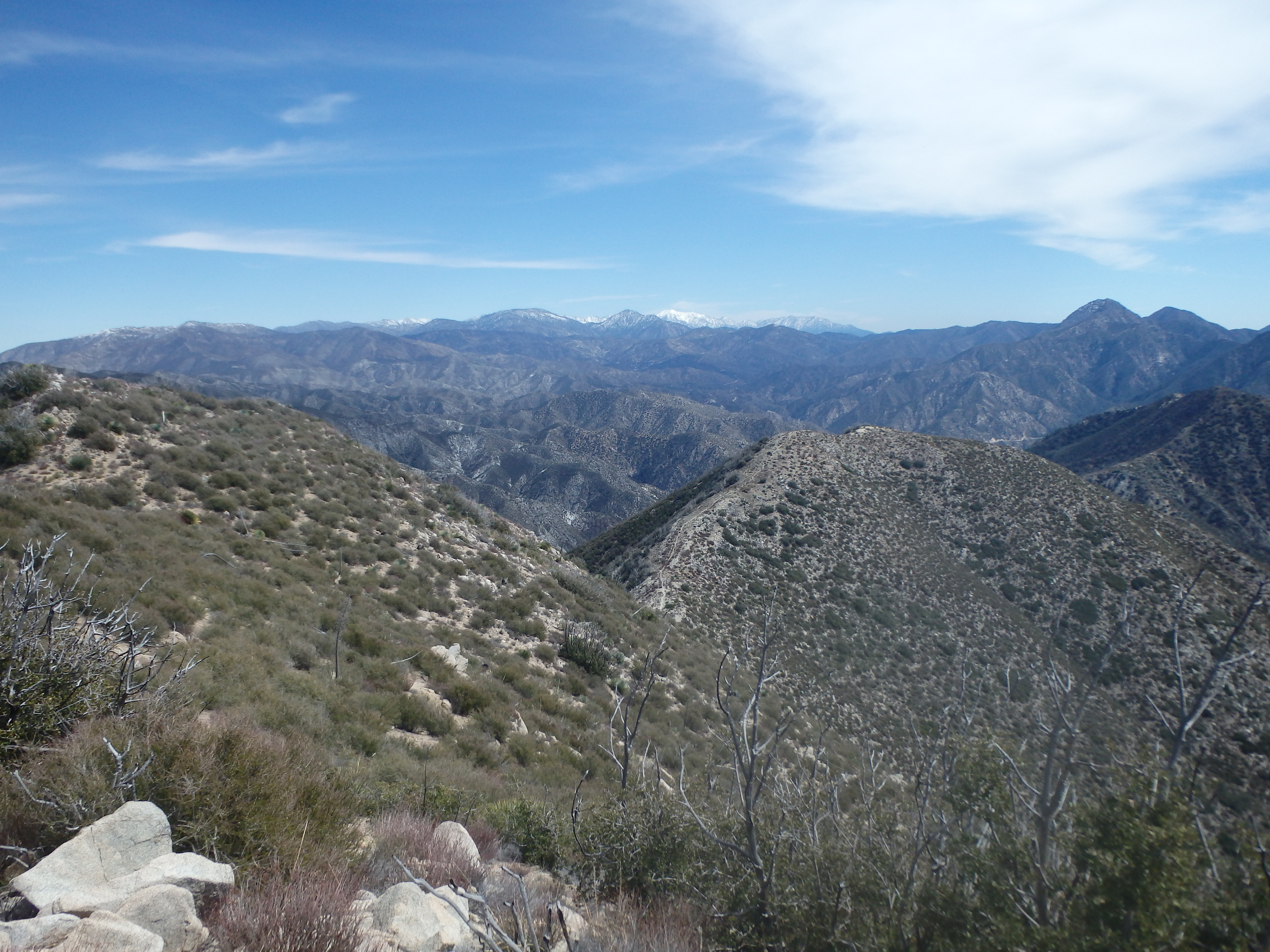
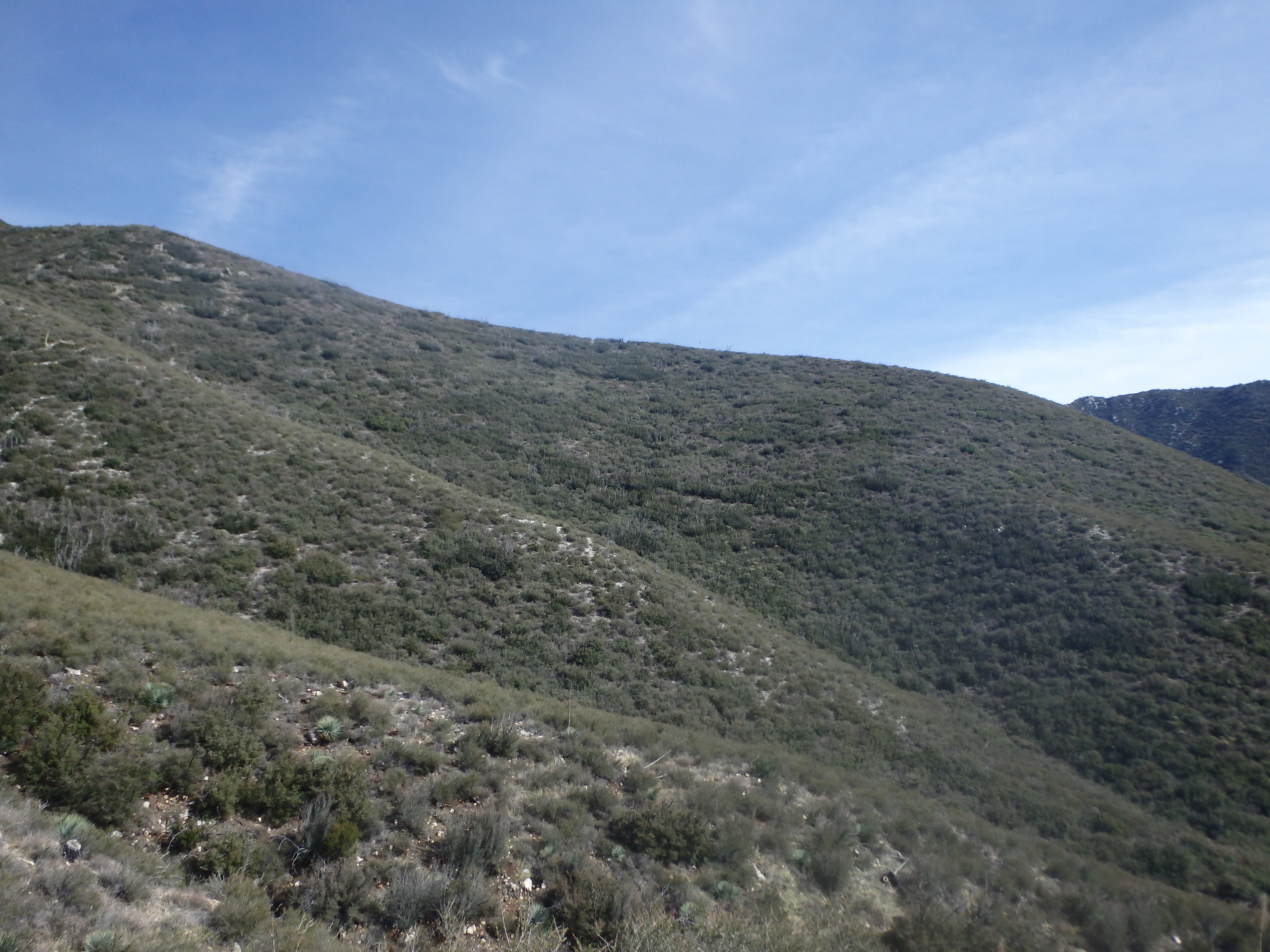
It was almost 3000′ of elevation gain to reach this first peak, but the approach trail was in excellent shape after the fire, with virtually no overgrown brush or washed out trail. Plodding along, the trail was fairly exposed and only took short breaks in the small scraps of shade I found in some of the deeper side canyons with thin flows of water and more lush vegetation. Climbing higher, the views opened up to Mount Lukens to the south, the snowy summits near Mount Waterman and Mount Baldy, and Big Tujunga Reservoir in the canyon below.
After about 2 hours I was finally nearing the base of the summit of Fox BM. My map indicated a use trail on the north side, but the brush was quite tolerable at the higher elevation for a bit of cross country. So instead, I headed up slope south of the summit using braided game trails the remaining distance to the top, startling a trio of hikers and their dogs enjoying their lunch and the views. The dogs, initially very protective of their masters, seemed to warm up to me quickly after I broke out my sandwich and started sprinkling crumbs around the summit for them to find. We exchanged pictures with a great backdrop of Mount Baldy to the west as I struggled to remember the names of all the peaks I had bagged 5+ years ago.

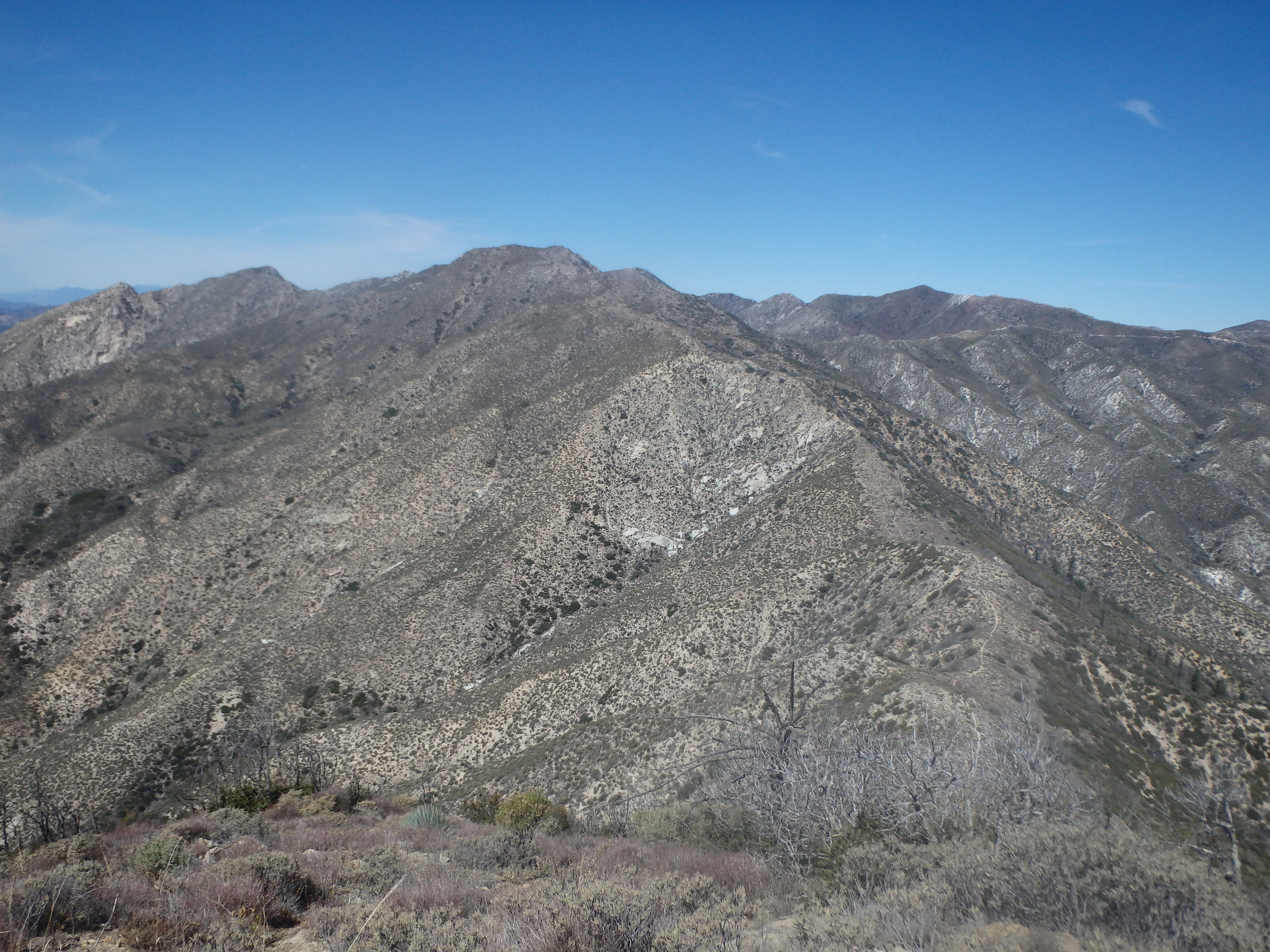

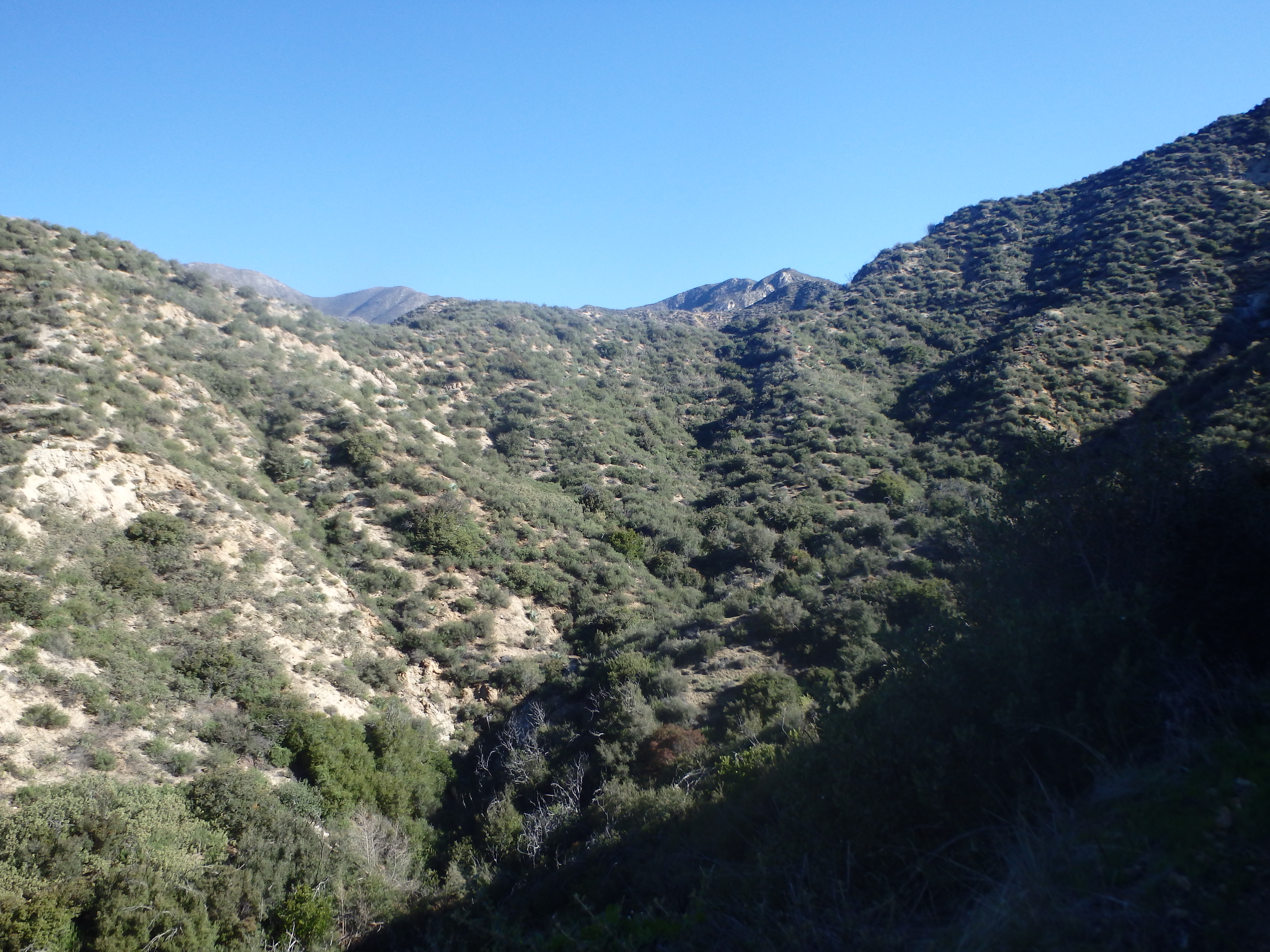
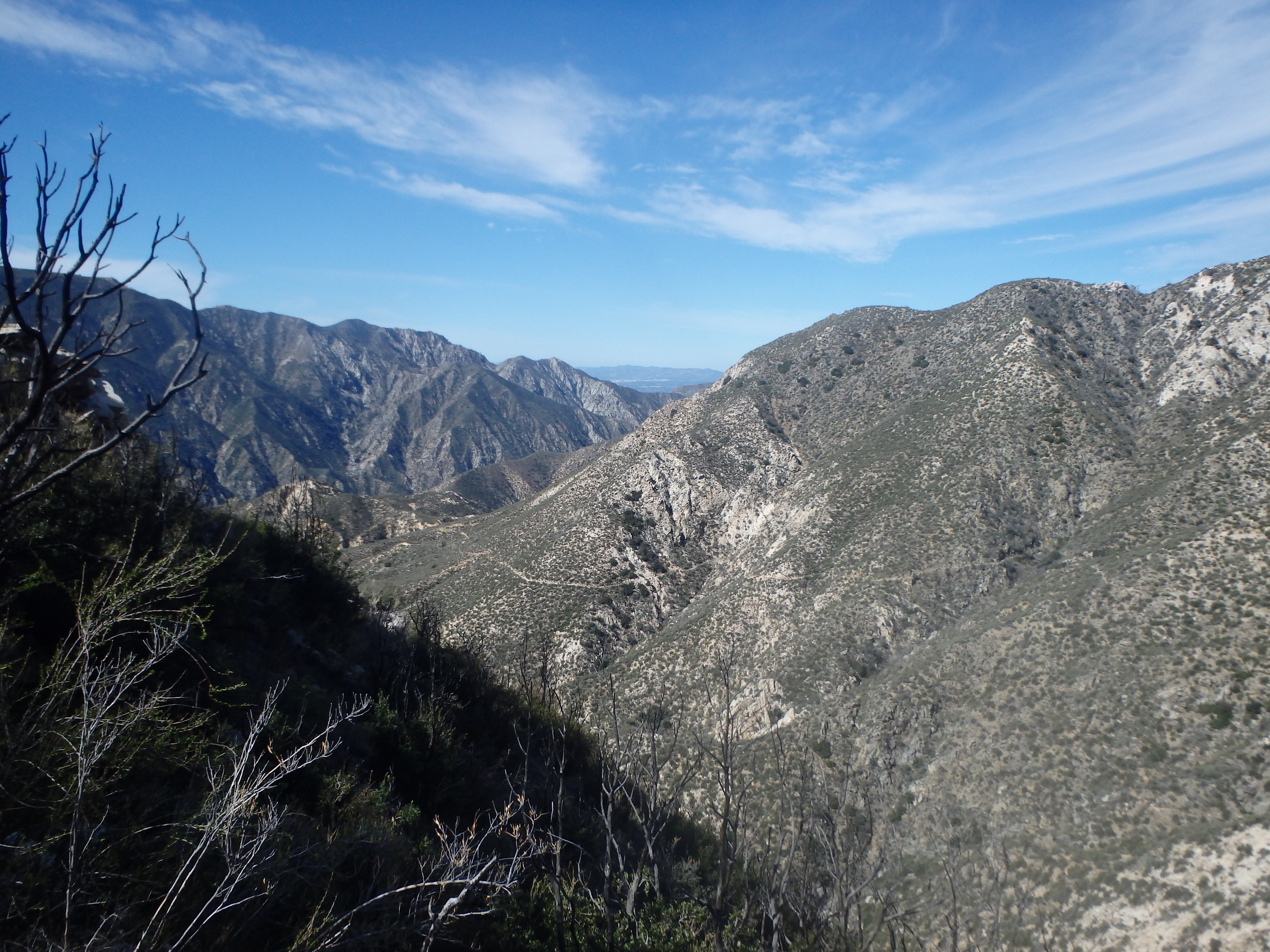
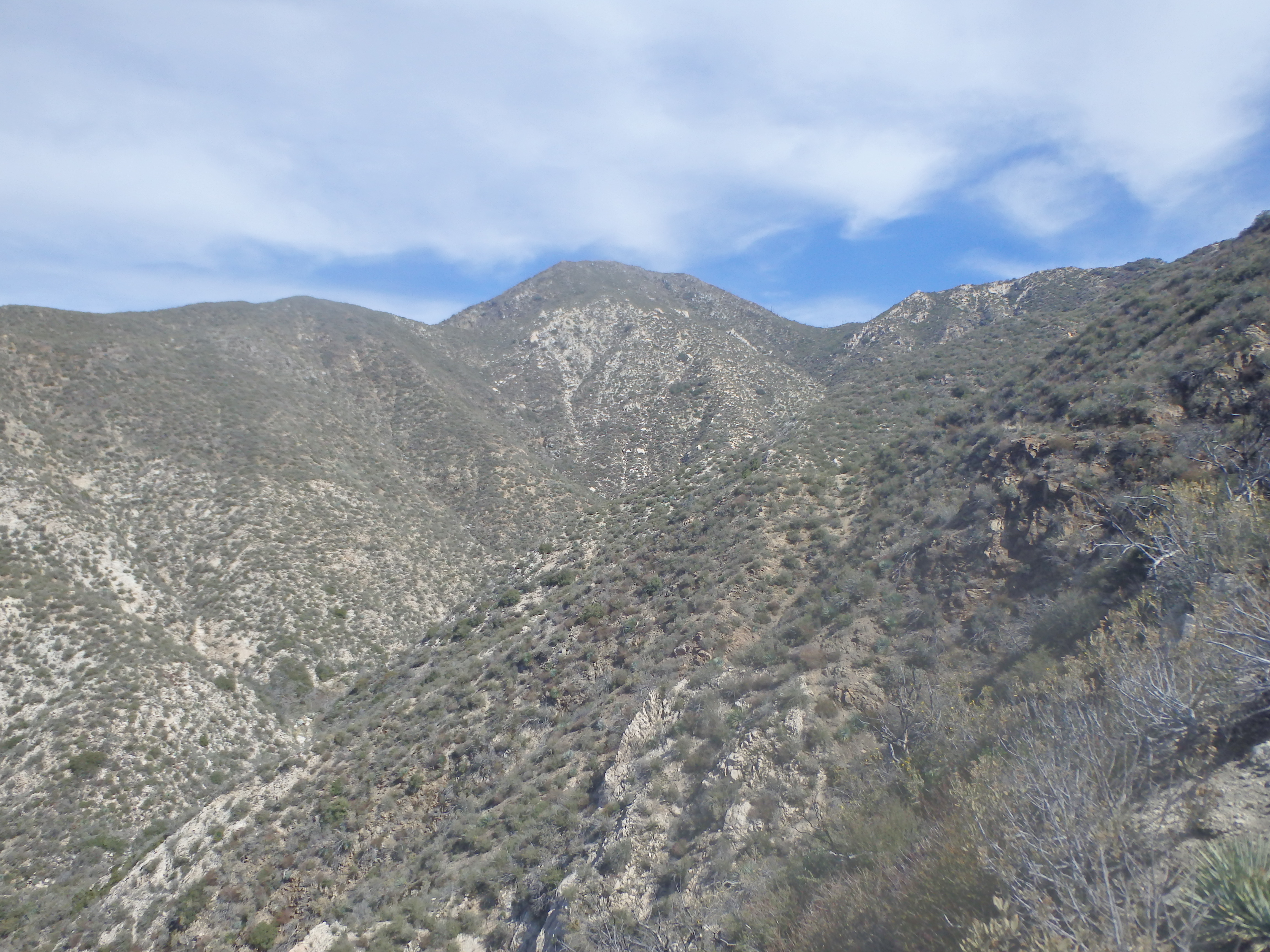
I headed down the use trail to the north, finding it was actually steeper than the southern game trail I used. The first summit plus lunch had taken me a little under three hours, but I was now in the meat of my day, traversing the high ridgelines peak to peak. Reaching the saddle between Fox BM and Condor Peak, the next summit seemed fairly close, basically a straight shot up the ridgeline. The trail remained in decent shape, traversing north around a few intermediate bumps on the ridgeline before shooting up and over one final false summit to a deeper notch about 200′ below the summit.
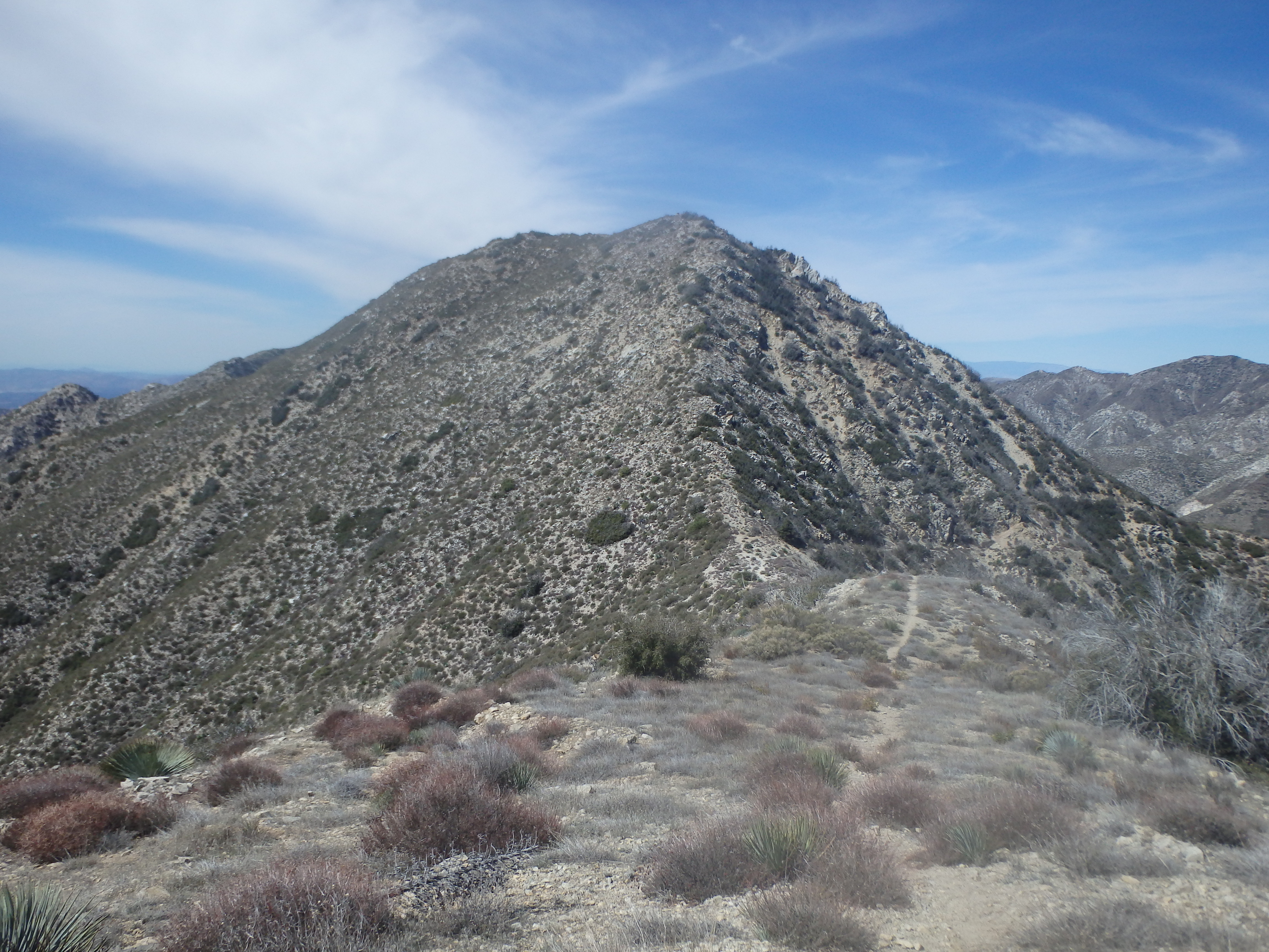
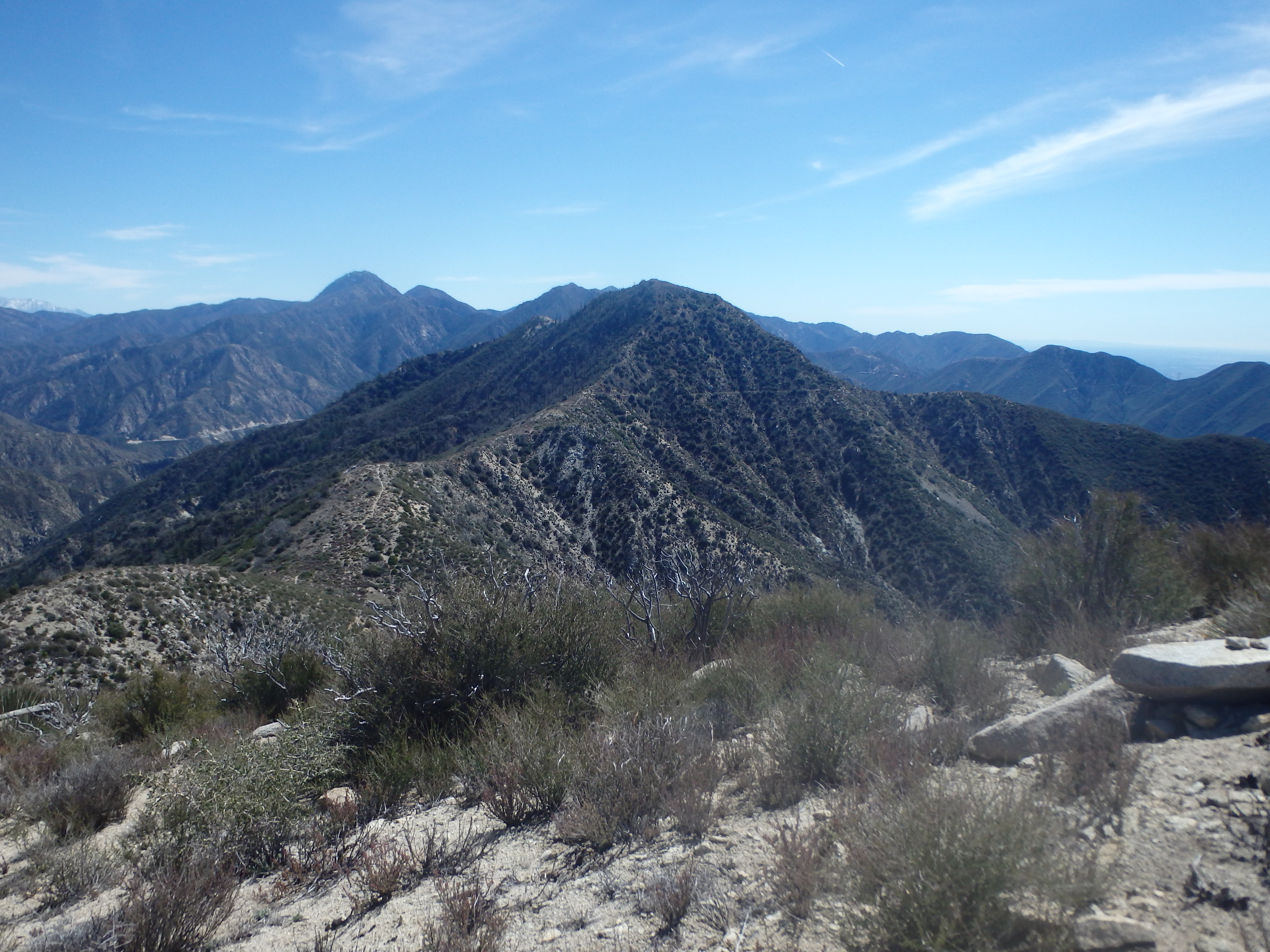
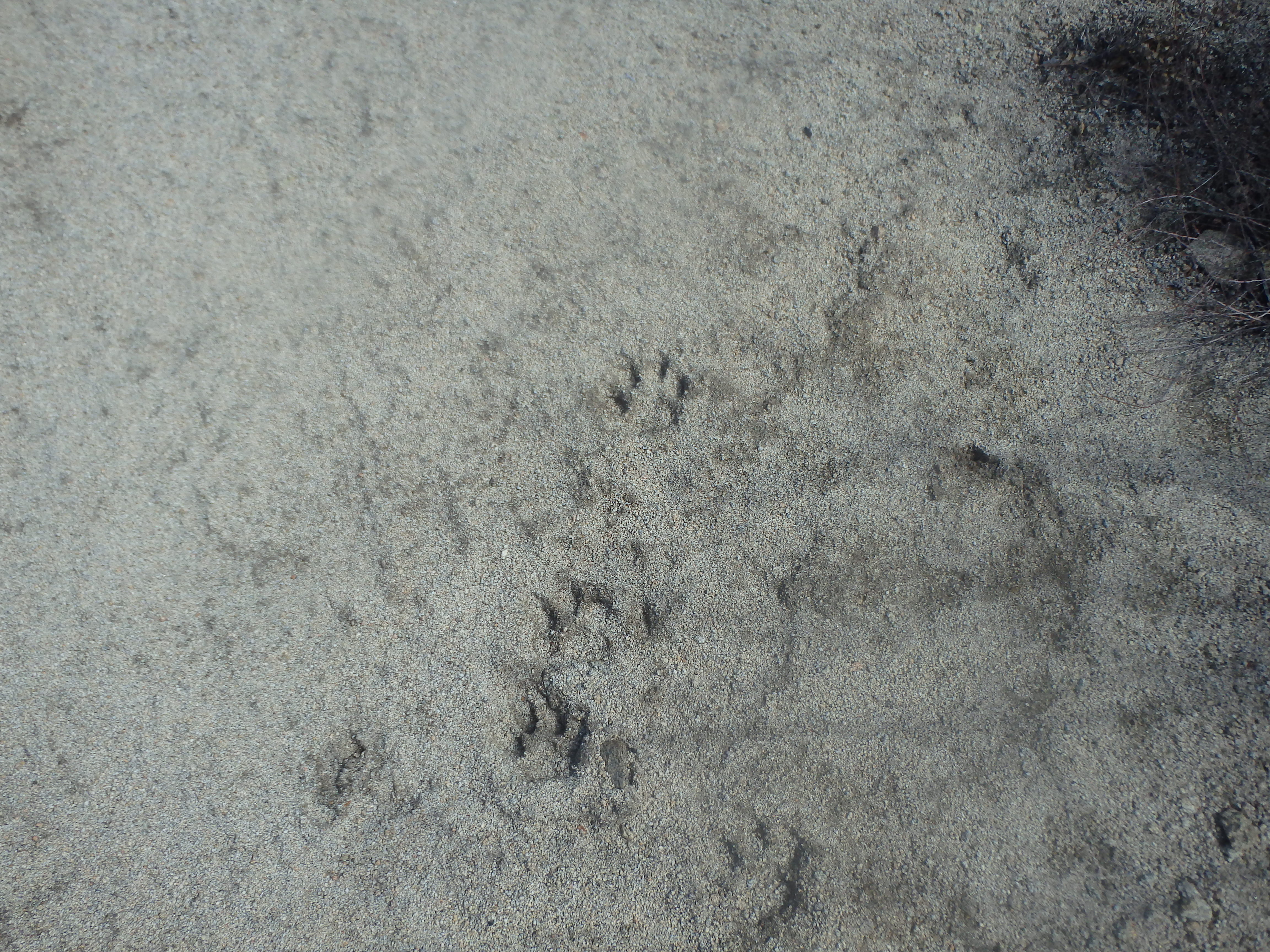
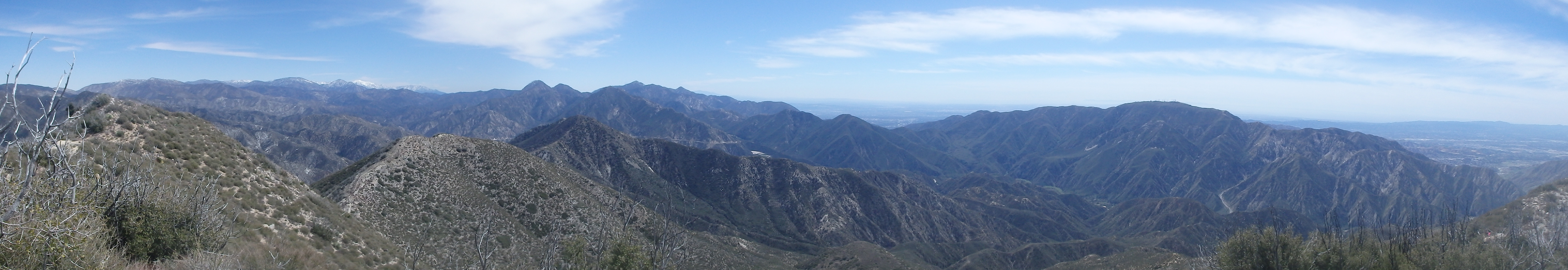
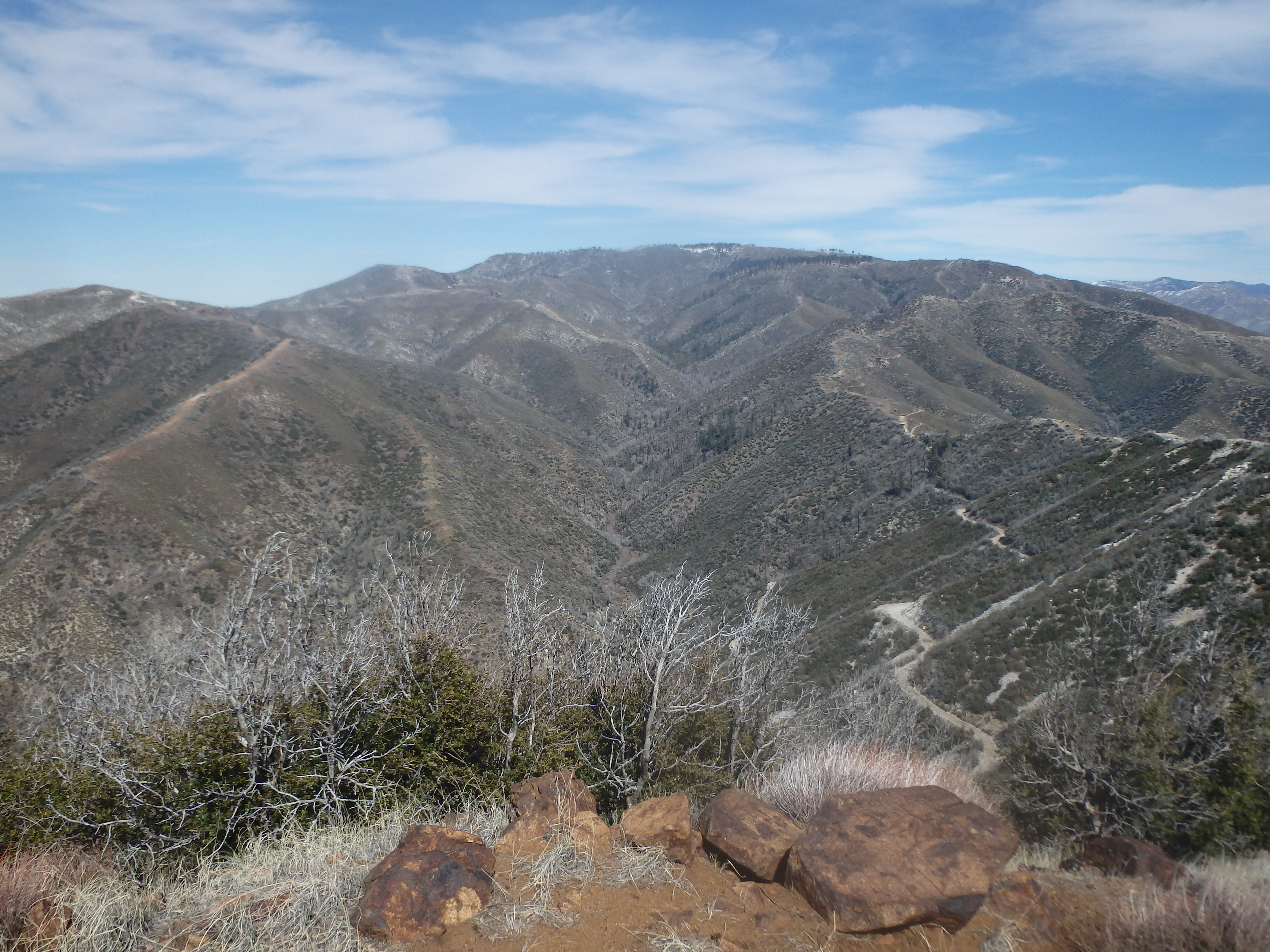
The final summit push had a less developed trail, loose class 2 and ill defined in places, but still quite reasonable. Just below the summit rocks I found a set of Mountain Lion prints that looked quite fresh, at most 48 hours old after the rains two days prior. But the summit views were unobstructed and I wasn’t too worried about a big cat encounter as I sat down to enjoy the second half of my lunch, taking just over an hour from Fox to traverse to Condor. From the second summit of the day, I had the entire loop laid out before me, with Fox BM looking surprisingly small to the southeast, Iron Mountain looking painfully far to the north, and the less brushy snowy mountains calling to the far east.
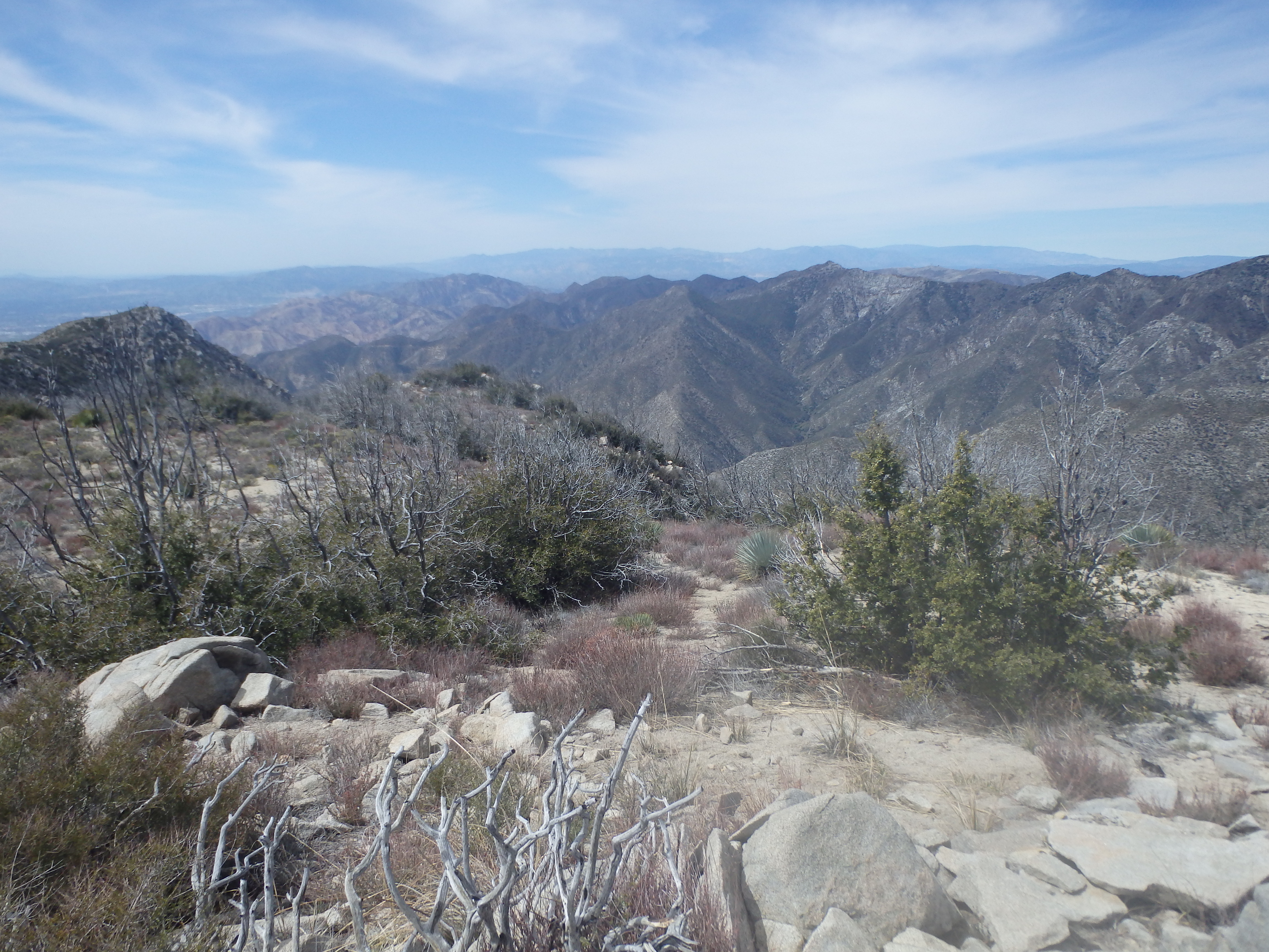
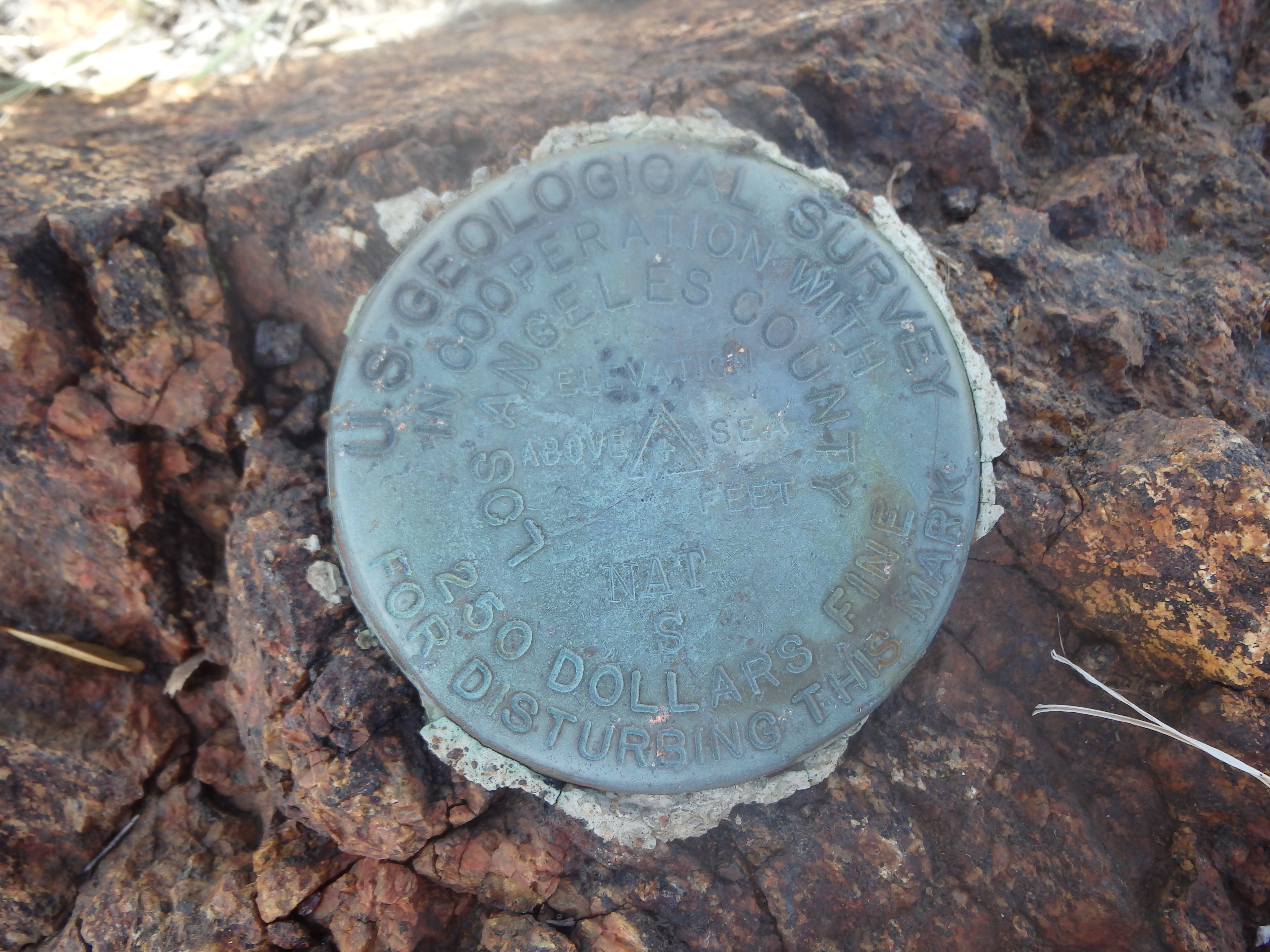
Mount McKinley, a 4000′ summit on the Lower Peak Committee List, was directly across Trail Canyon to the west and shared a ridgeline with Iron Mountain. I had debated possibly tacking that on to the loop, but it was difficult to gauge exactly how much that would add to my day. A decision to be made later. After signing into the register (shockingly pre-2009 fire) , I left Condor Peak, dropping back to the high notch to the east to a trail that began a descending traverse around the north side of Condor to the connecting ridgeline with Iron Mountain. This was the first time all day the trail started to become a bit overgrown, nothing too bad, but enough to make me glad for long pants as I pushed through buckthorn hanging over the trail. I continued straight along the trail a bit too far and didn’t realize my mistake until I spotted the trail about 100′ below me. But I was on a nice sandy slope and was able to quickly plunge step down the loose sand back to the trail to correct my mistake. It seems that far less people have made the trek to Iron Mountain after the Station Fire….
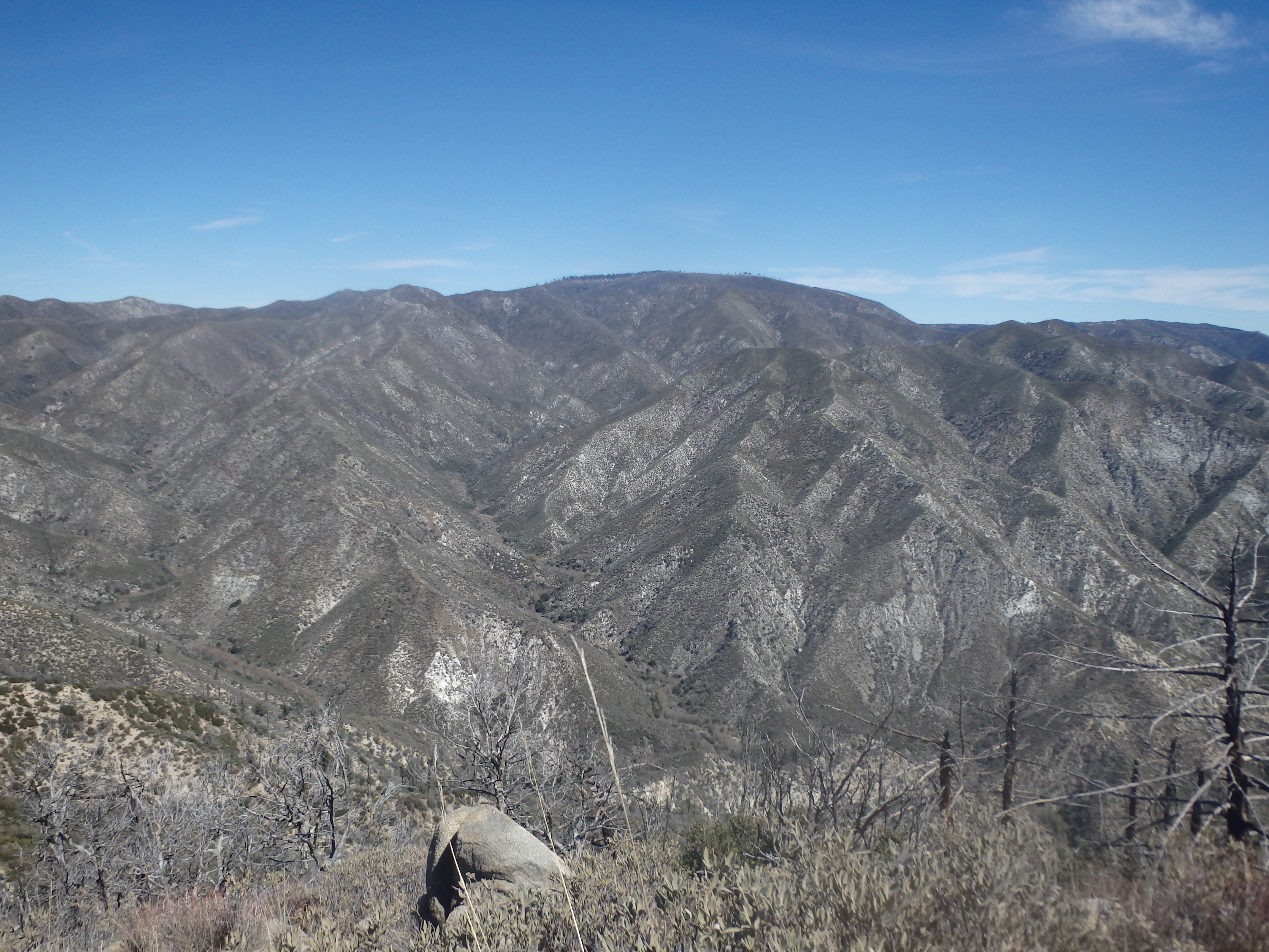
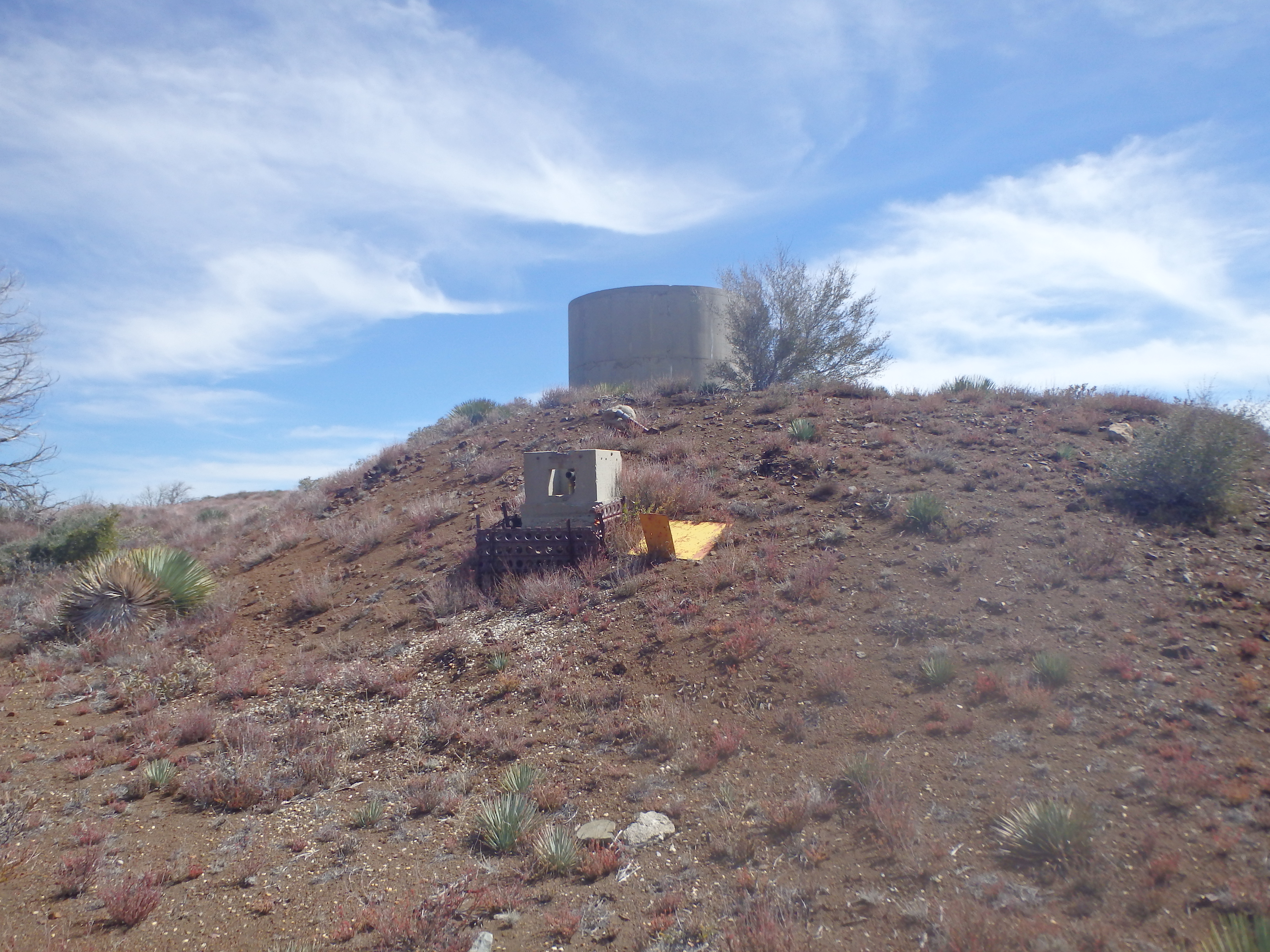
The ridgeline undulated up and over a series of small bumps en route to Iron before reaching a large clearing just south of the summit, the terminus of a fire road leading to the remains of a water tower and spring.
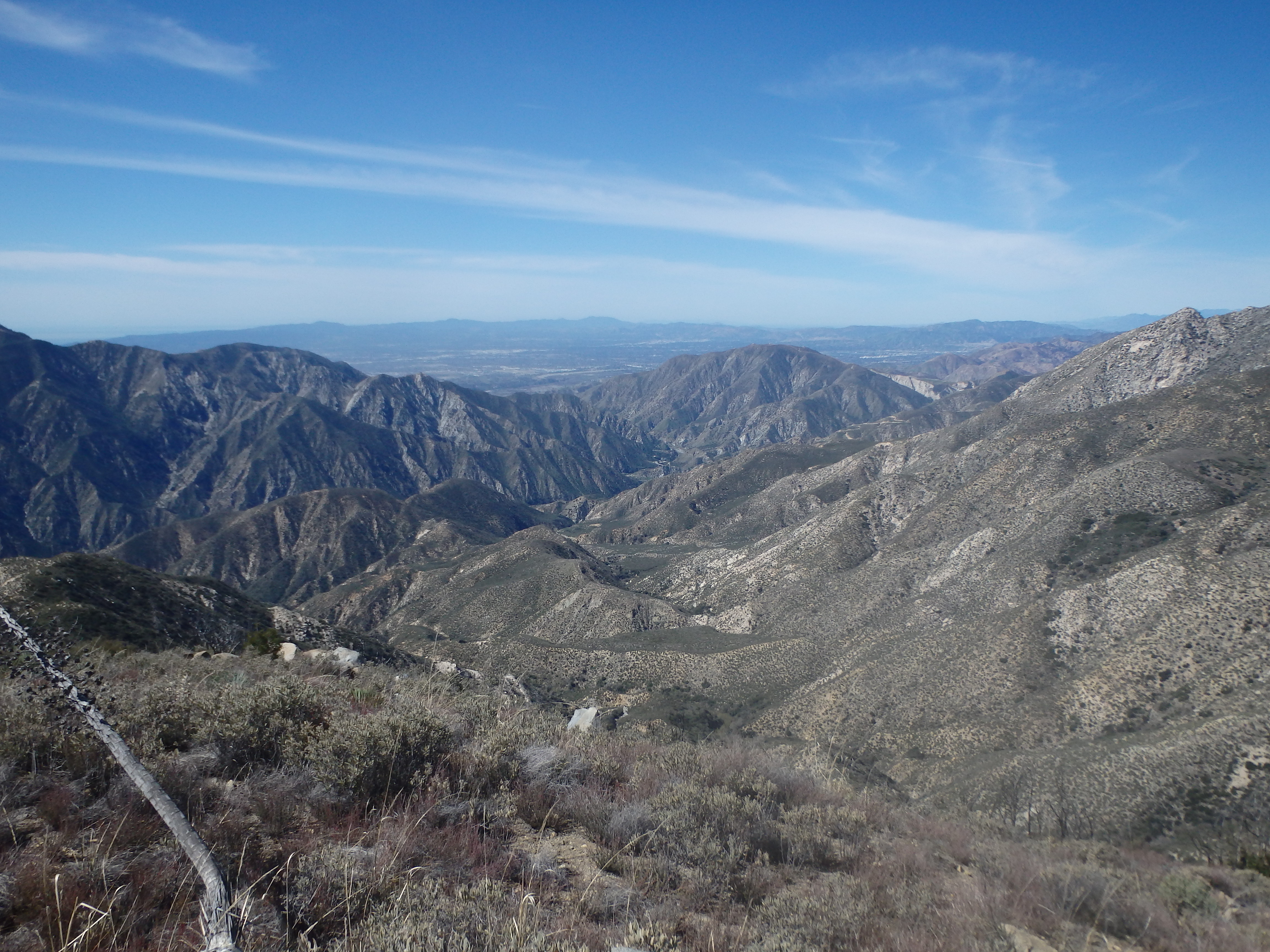
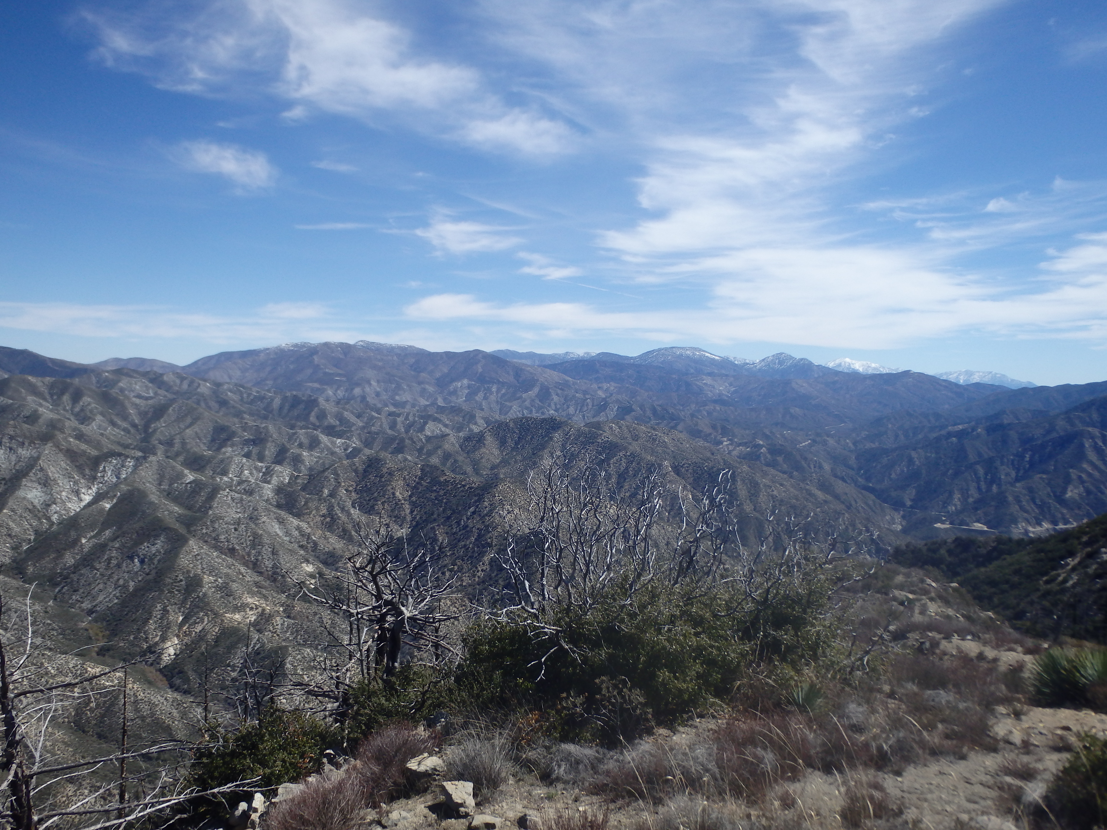
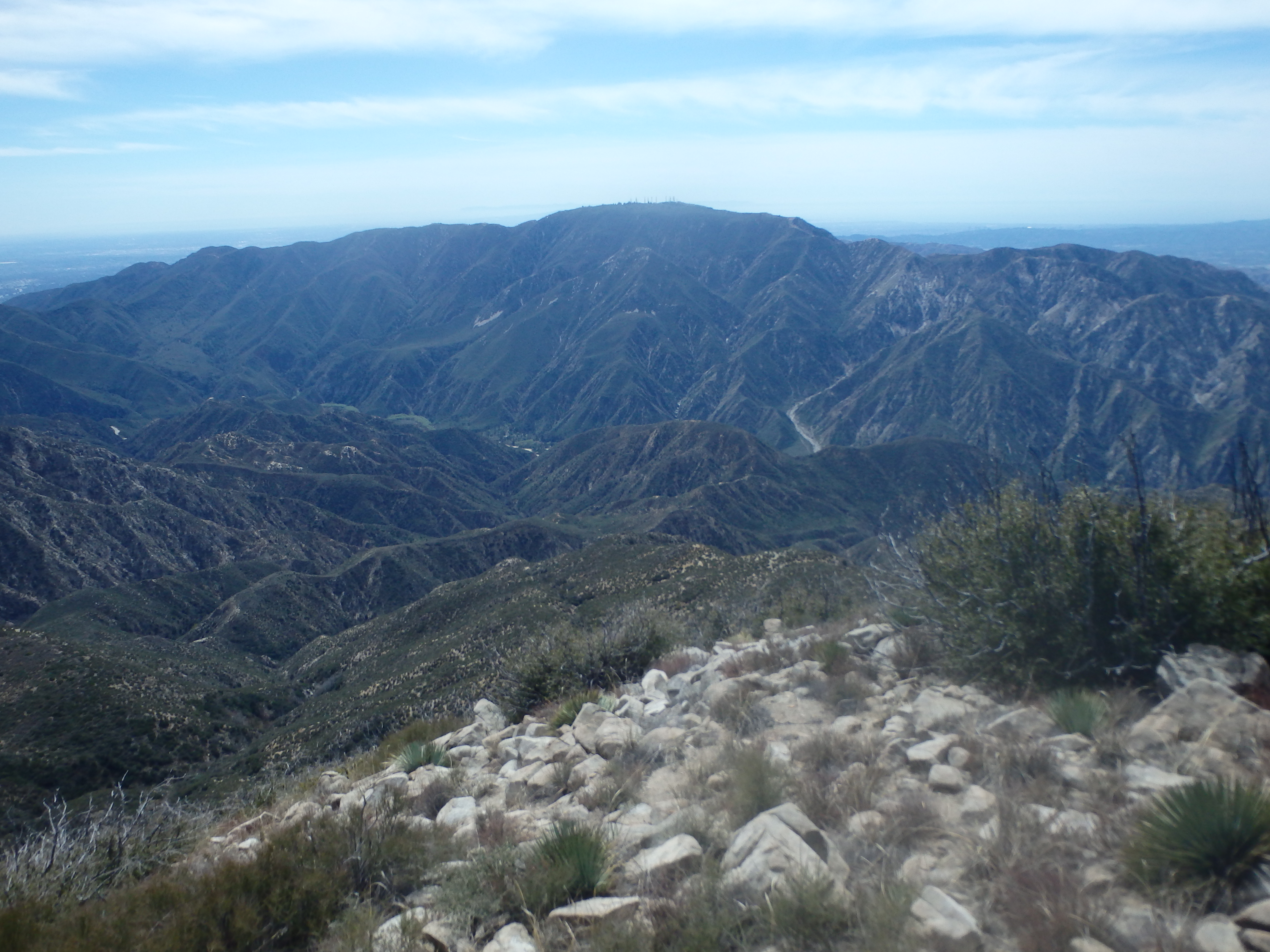
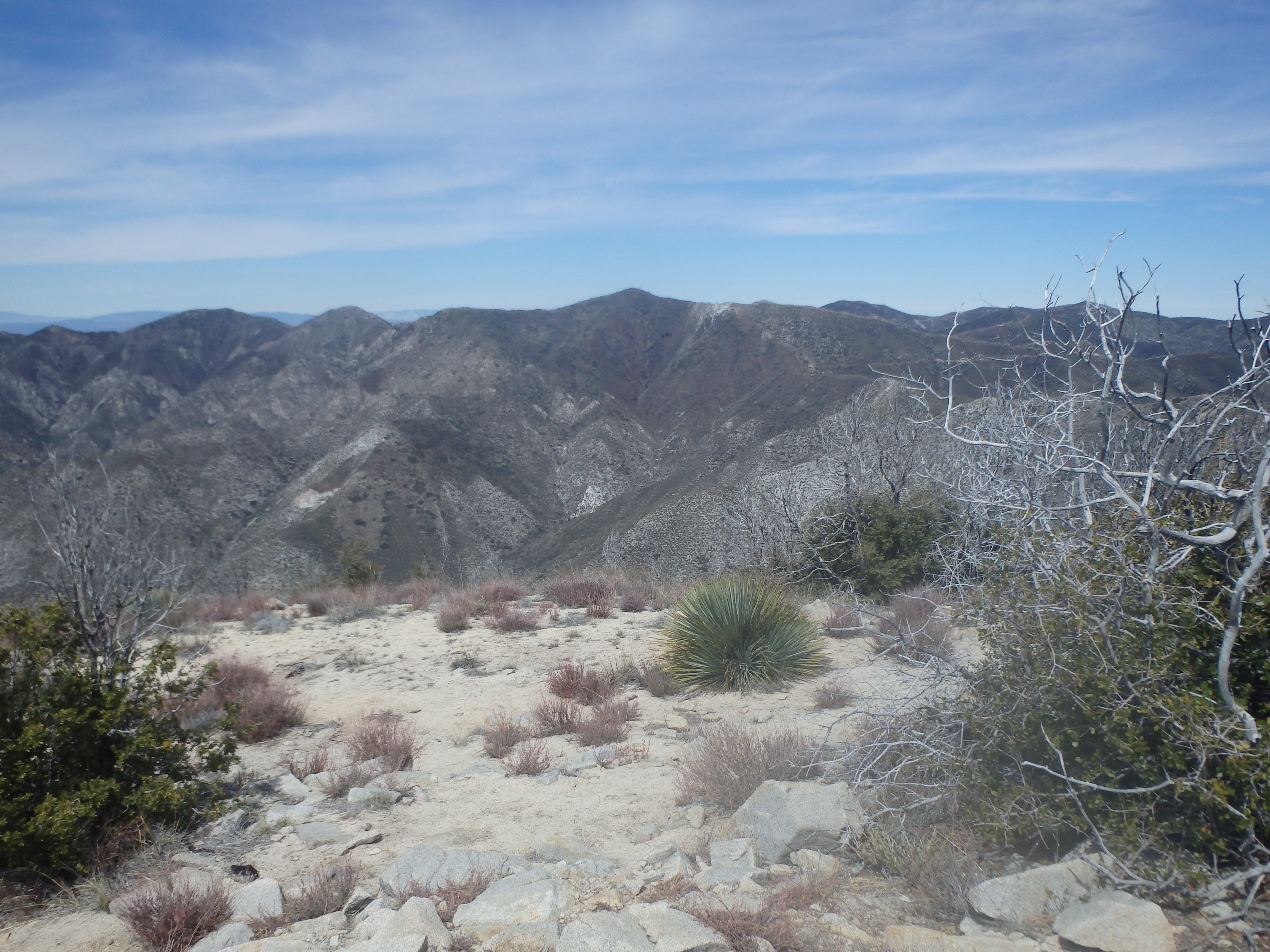
The road cut east at a gentle grade to reach the main east-west ridgeline of Iron, but a cairned use trail left the road near the clearing and headed directly upslope. The slope was a bit loose and charred, having more of a scorched earth feel after the fire than others areas I had visited that day. The soil seemed a bit more red (presumably iron), and the use trail reached the ridgeline just east of a series of prominent silver cliffs along the ridge. The grade eased considerably here, and in a few minutes I hit my third summit of the day. I thought Gleason would be blocking any real views to the north, but with the recent rains I could see clear to the Tehachapis and possibly even the Southern Sierras far in the distance. Condor was directly to the south, and I couldn’t help but hope that the HPS didn’t add the unofficially named Condor Point to the list sitting just east of Condor Peak, which would necessitate another climb up this way.


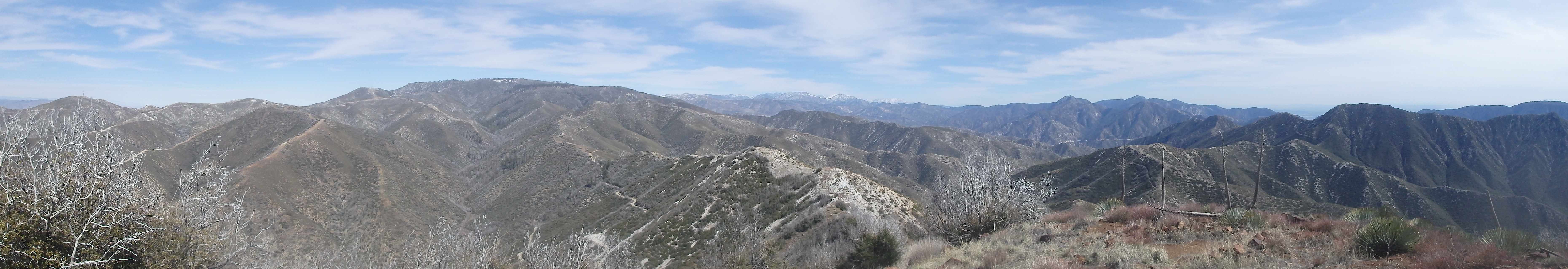
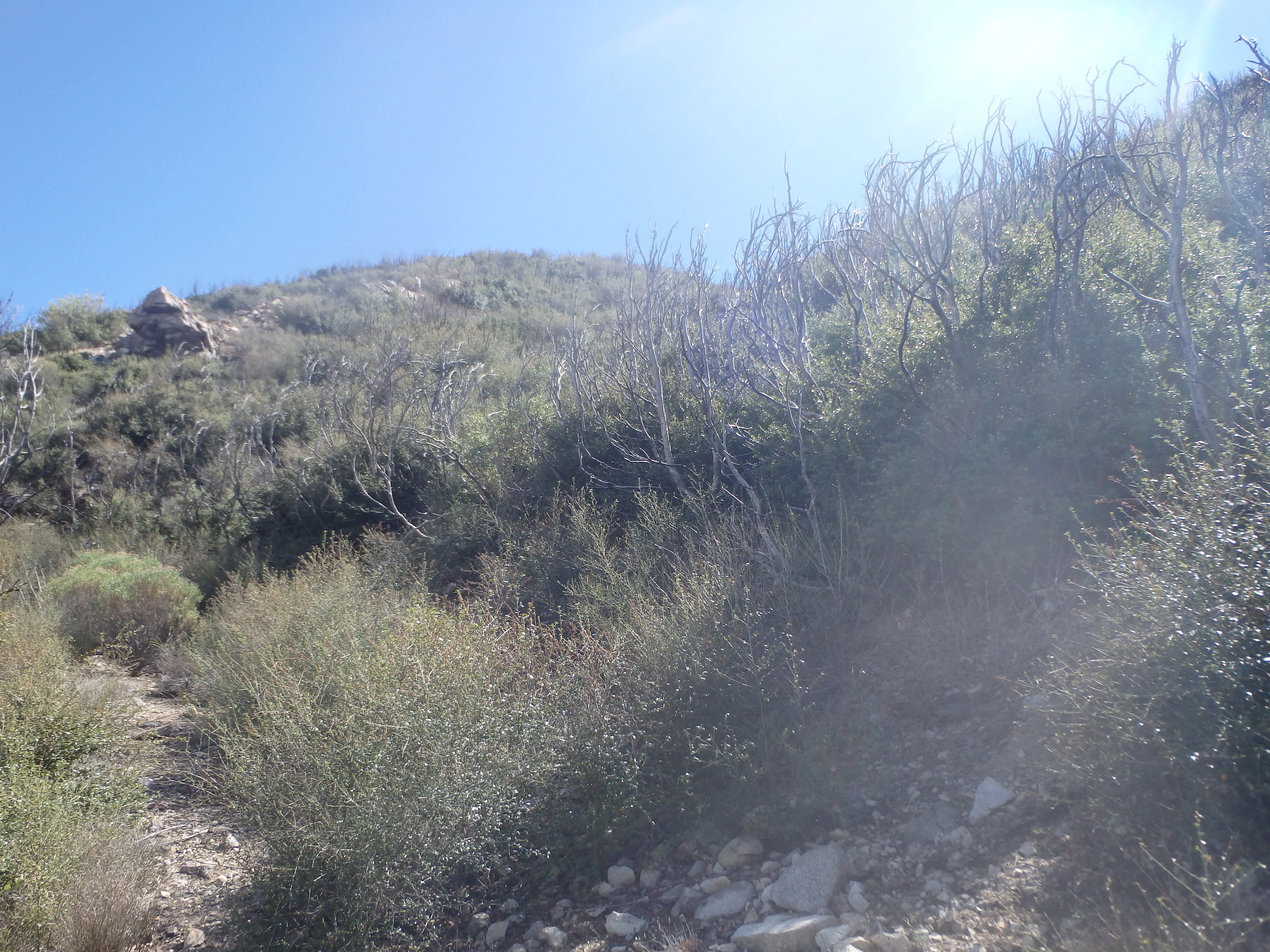
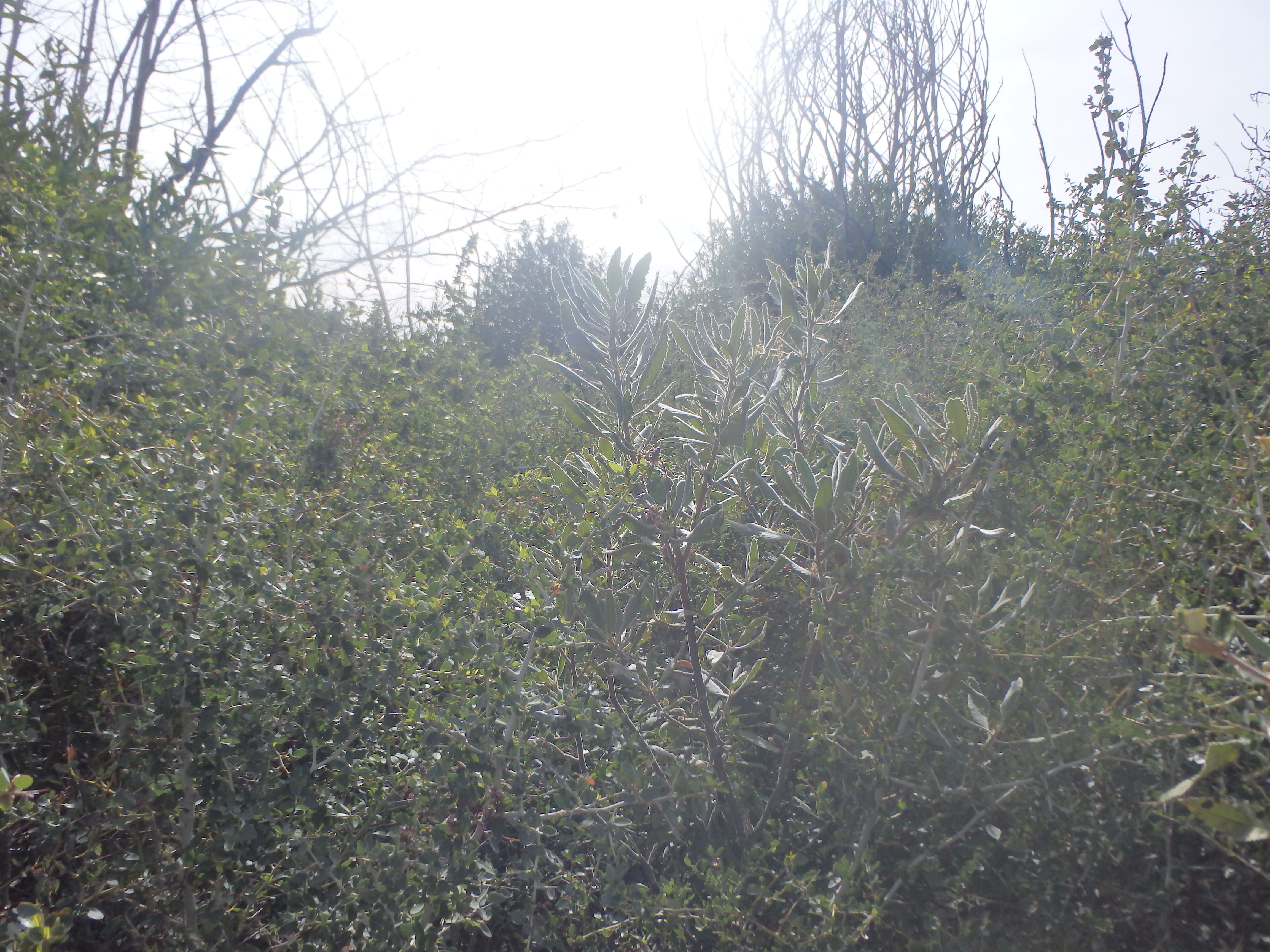
I had hoped McKinley would be a bit closer but it still looked pretty far from Iron, and my GPS confirmed about 3 miles of hiking between. It was about 2:45 PM with sunset at 7. If I looped through Trail Canyon, I had about 8 miles of trail and three-ish miles of road to get back to my car. If I returned the way I came I also had about 11 miles, but far more elevation gain along the ridgeline. McKinley seemed too far to tack on with at least 9 miles of trail with alot of up and down, followed by a lot of ridge hiking. So I decided to follow my original plan and descend via the Trail Canyon Trail with some road hiking to finish the day. I found the burnt sign post indicating the turn off and initially found the trail to be in reasonable shape. As I descended towards the first switchback, the trail became more and more overgrown with buckthorn, and soon I was thrashing through the brush on a nonexistent trail.
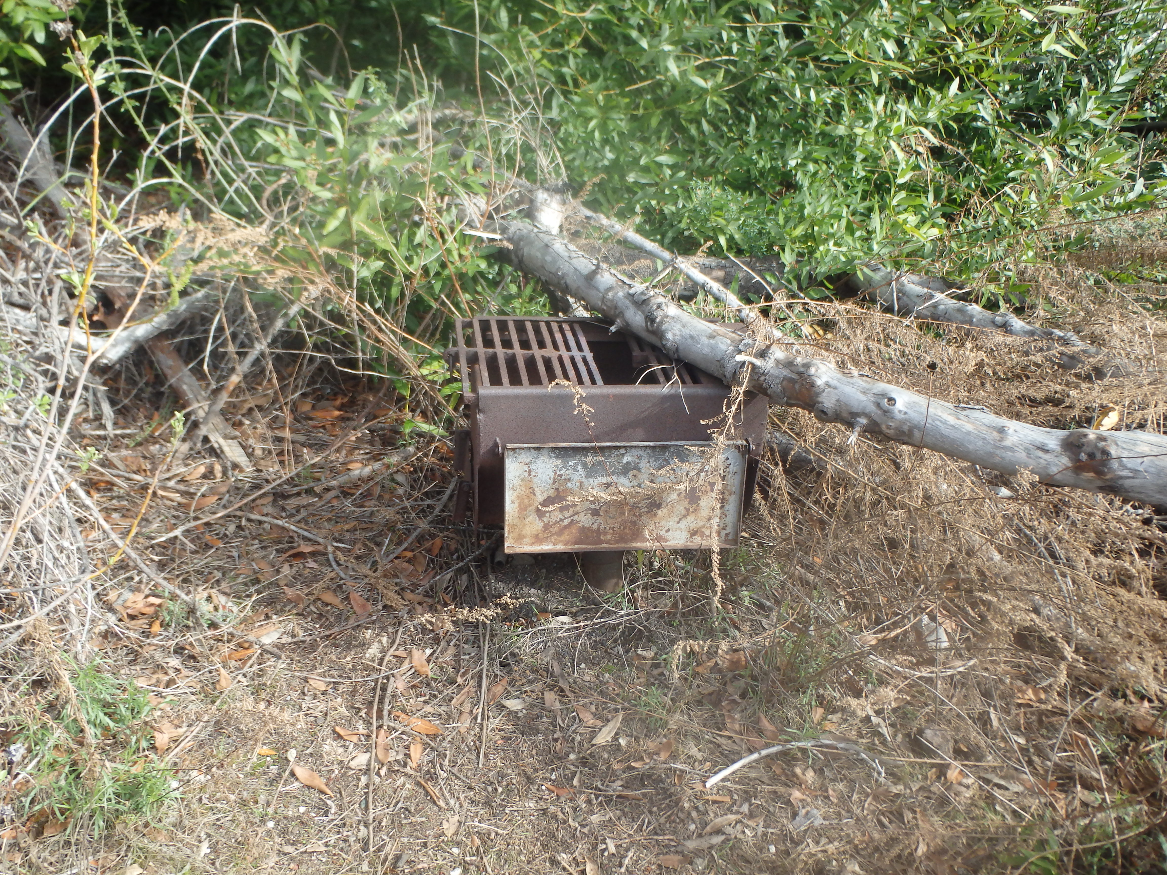
I could see the vague overgrown trail below me, so rather than fight through the brush to a nonexistent overgrown switchback, I dropped down slope to the faint trail and worked north as it became more well defined. I was hoping the worst brush was behind me, and things were looking promising as the trail dropped into the deepest portion of the canyon, about 20′ above and south of the dry wash below. But I soon encountered pretty horrible brush with buckthorn towering over my head. While it was initially small patches, the wall of thorns soon became continuous and I lost anything that resembled a trail. My map indicated that Tom Lucas Backcountry Campground was in another quarter mile, and I more or less aimed for this directly, at times crawling through overgrown tunnels of brush, and fighting through the thorns. As I reached the expected location of the campground, I found a more complex network of use trails, but nothing that looked like a campground or main trail out. My heart sank when I spotted one of the backcountry stoves and campfire rings completely overgrown and reclaimed by nature, confirming I was in the right place with nothing looking like a trail to help me out.

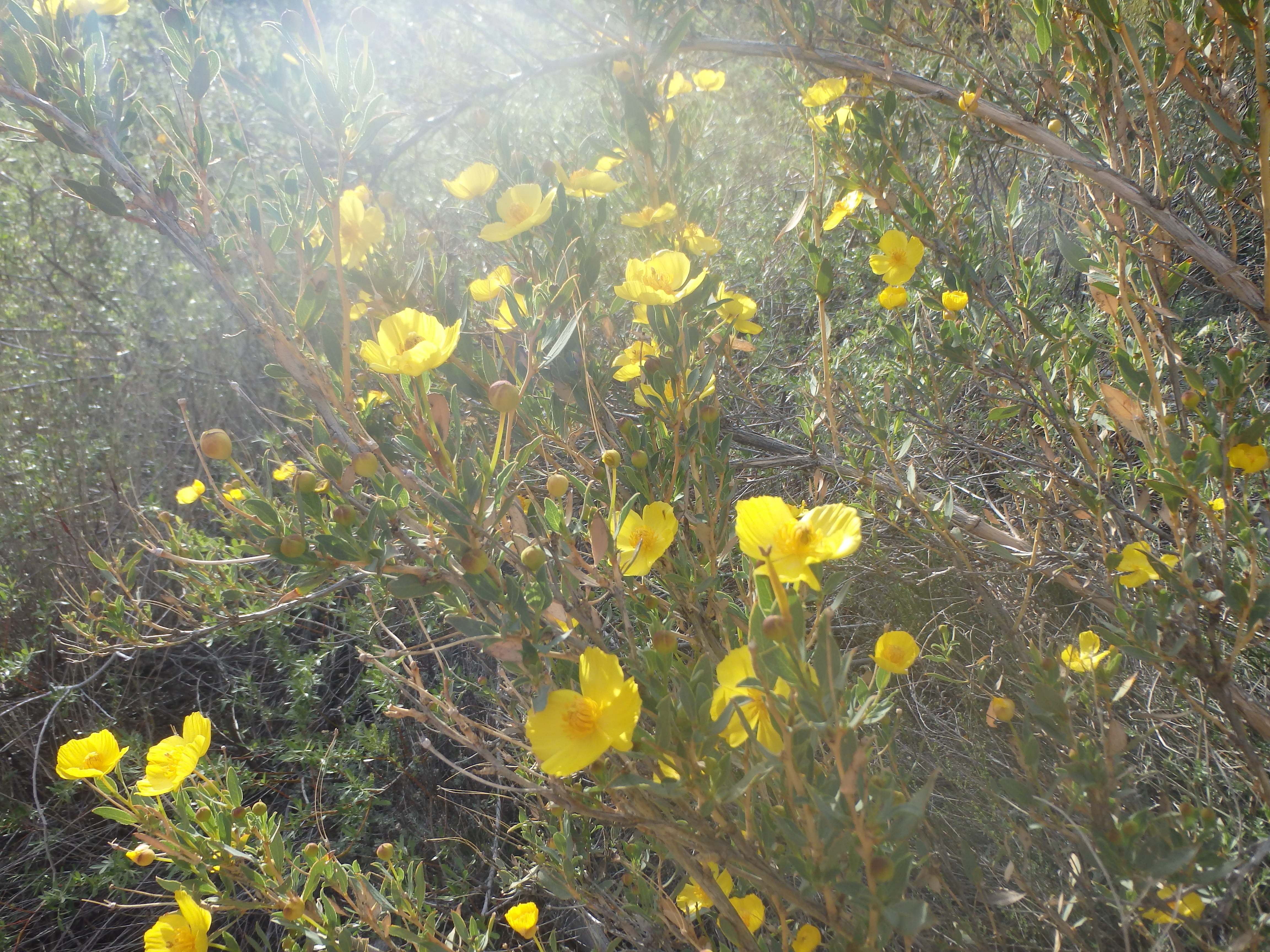
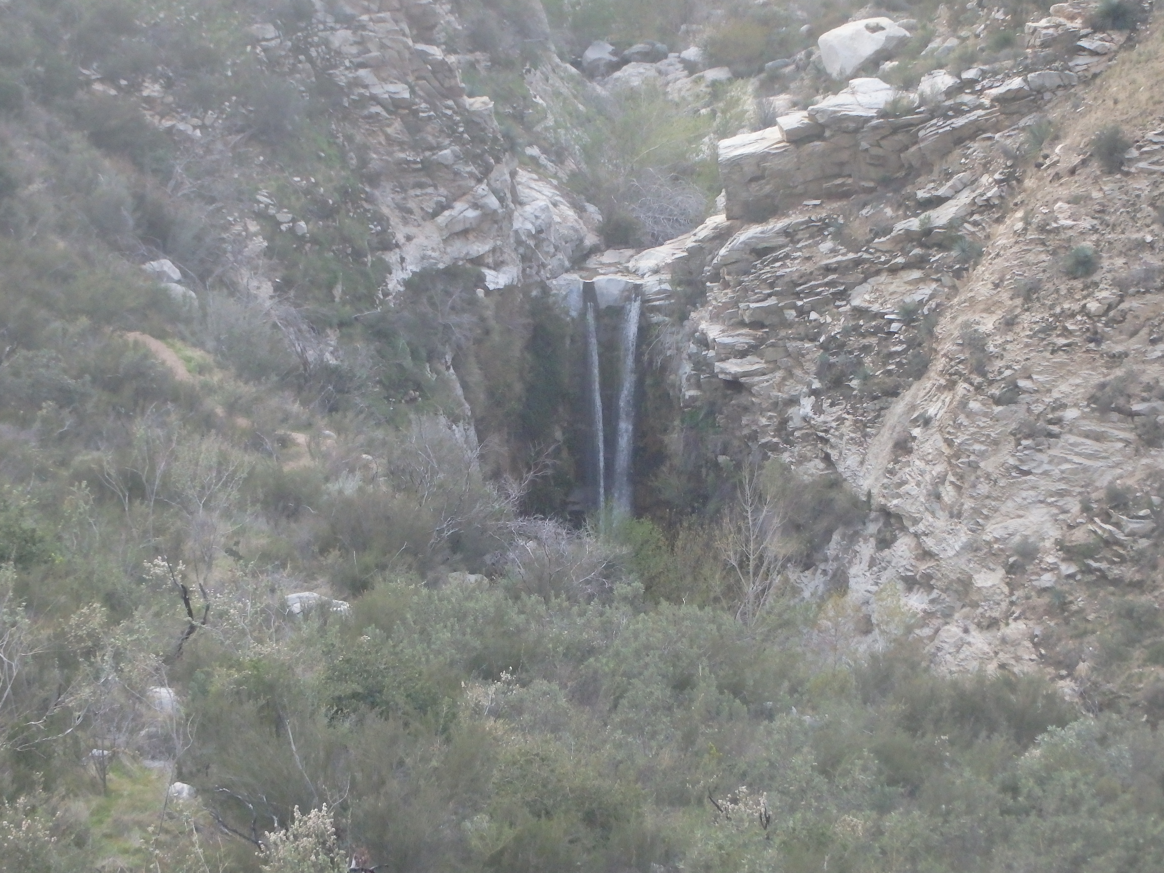
I continued downstream and finally stumbled on a flagged loose route that became more and more well defined as I continued along. It seemed the worst of the brush was finally behind me at Tom Lucas. It was around 4:30, and I had no real idea of how much trail I had to hike and how much time I had wasted fighting through the brush. I passed a trio of backpackers on the descent, and the trail improved with every step, running with an ever growing stream with small waterfalls and pools. After the bushwacking, it was a nice bit of redemption. The trail stayed high near Trail Canyon Falls and I began to pass a number of day hikers signaling that my trail time was nearing an end.

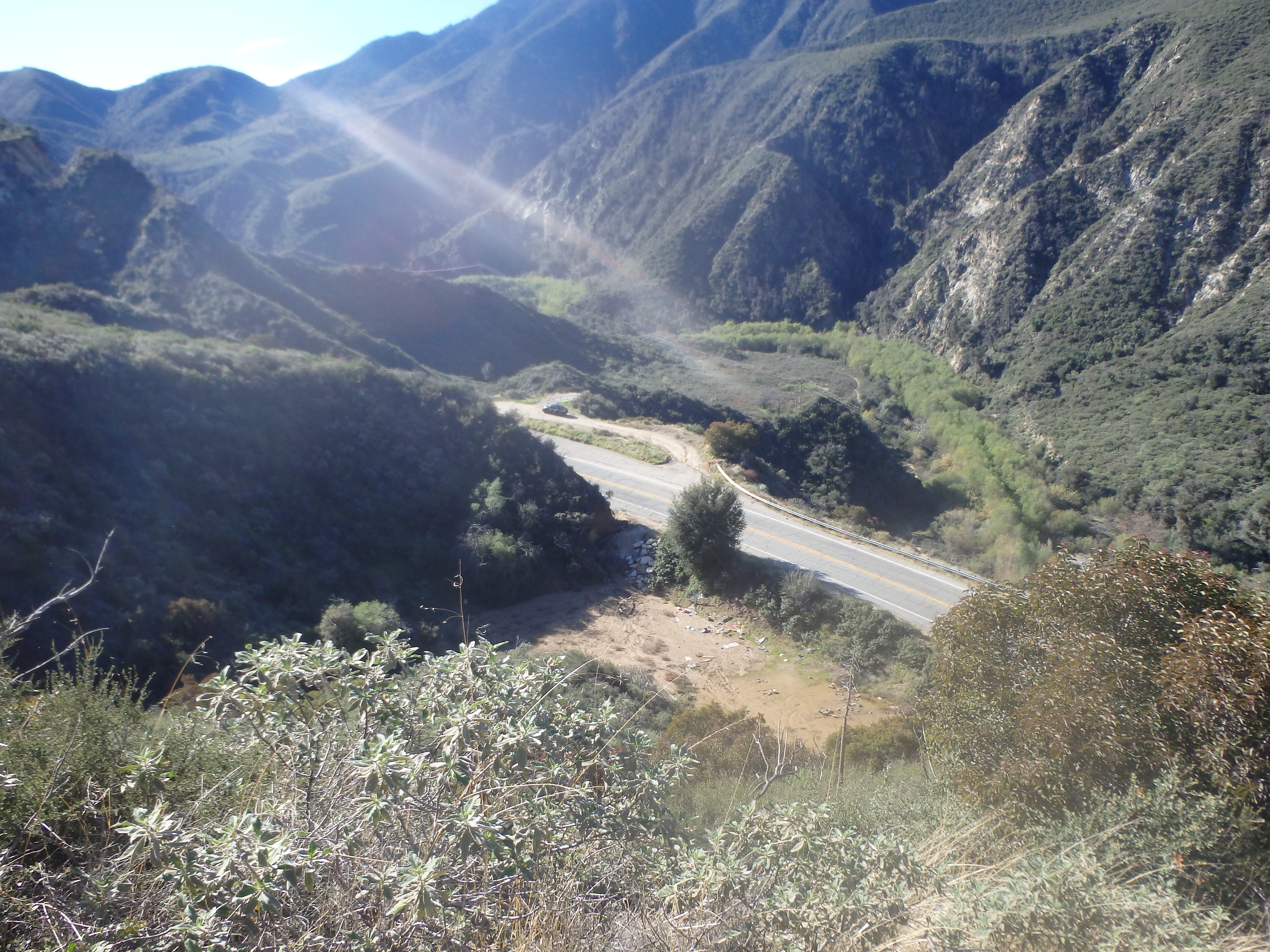
Shortly past the falls and a handful of switchbacks, the trail dropped back towards the water near some full grown oak trees that had somehow survived the fire. The final section of the canyon was dramatic and deep, and I could only imagine what it looked like before 2009. Nearing the end, the trail headed through a number of small cabins before a final stretch of fire road brought me back to the highway. I was hopeful that the pullout I had parked at had shaved at least a mile from my road hiking. In reality, it saved me less than half a mile and I reached my car in fading light just before 7 PM. Famished, I high tailed it back into LA for dinner then checked into my hotel downtown.