
Queen Mountain 5680′
Joshua Tree National Park
Total Time: 4:30
Distance: 7.4 miles
Elevation Gain: 1600′
Crux: Class 3
Companions: Holly, Colin Pickles and Alex Wallace
Trailhead: Park Boulevard


It seems like my pursuit of Sierra Club Hundred Peak Section Peaks has taken a back seat to rock climbing adventures. Although I have only tagged about half the HPS Peaks in Joshua Tree NP (and the entire list for that matter), my recent visits have revolved around climbing the various formations, most recently Headstone Rock and Cyclops Rock. On a final pre-COVID trip to Joshua Tree, our first day in the park was looking like cold and wet weather, not ideal for climbing rock. So I convinced the group to hike instead, with a plan to head up Queen Mountain near the center of the park. Driving from Phoenix that morning, low clouds hung across the desert with small pockets of rain overhead. The skies cleared as we crossed into California, and it seemed like we might have favorable weather after all. Pinto Basin Road was closed due to flooding, so we entered the park from the north in Twenty-Nine Palms. The unofficial route up Queen Mountain starts at the end of the dirt O’Dell Road off Park Boulevard. But the park had closed all dirt roads in the park, and we were forced to park at a pull off on Park Boulevard directly, adding an extra 2 flat miles to the hike. We cut through the desert and rejoined the closed road, finding a few puddles but nothing that any car would have trouble with.

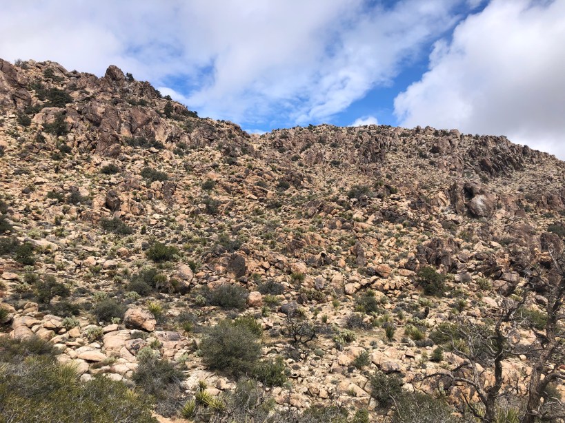
Queen Mountain rose up directly overhead, and jack rabbits scurried between the Joshua Trees as we hiked closer. The road ended at some old mining equipment at a round-about, and we continued past on an old mining trail, skirting a small hill to the west. The road more or less ended at the base of the mountain, but a very easy to follow use trail continued east, slowly gaining elevation.


We passed a large boulder with some chalk ticks, a bit far off the beaten path for most boulderers, but presenting a few interesting problems for sure. As we continued east the grade increased, although it really wasn’t as bad as I expected when looking at it from below. The trail cut up a gully and after a few hundred feet of ascent, we crested up and over a ridge running south directly off the summit.

We dropped into a wide basin leading to a different gully which brought us up to a saddle between the east and west summits. I knew from prior trip reports that the west summit was the high point, with the east, shorter summit having the benchmark. Both apparently had registers, although the maps I had and my GPS confirmed the western summit to be higher. Clouds moved in as we followed the trail up the western summit, having a short section of exposed slab scrambling to reach the true high point.


The thick clouds that had rolled in brought cold winds, and we hunkered down in the rocks with some summit beers and snacks out of the cold. With the weather turning, it seemed unlikely the rocks would dry enough for any climbing, and we did not rush to head back down.


Once the beer and snacks were finished, we worked back down the damp slabs to the saddle below. The winds had increased as we dropped back in to the basin, and did not relent until we reached the southern ridgeline and into the second gully.


We made short work of the use trail on the return, cutting across country in a broad wash to reach the road a bit faster with a few scattered rain drops falling. Back on the road we aimed for my car, eventually making a beeline through the desert once it was in sight. Even with the extra mileage the entire hike was quick, no one angry at me for my usual death marches.

Back in the car we left the park and headed in to town, grabbing food at the saloon and getting what groceries we could find in Yucca Valley before heading to an Airbnb for the night. The rest of the trip was spent on single pitch climbing, where all of us got our first outdoor 5.11, one of the highlights of the weekend!


