
Gran Paradiso 4061m/ 13,323′
International– Italy
Total Time: 2 days
Distance: 23.8 km/ 14.8 miles
Elevation Gain: 2340m/ 7680′
Crux: F+-PD/ French Grade II-III
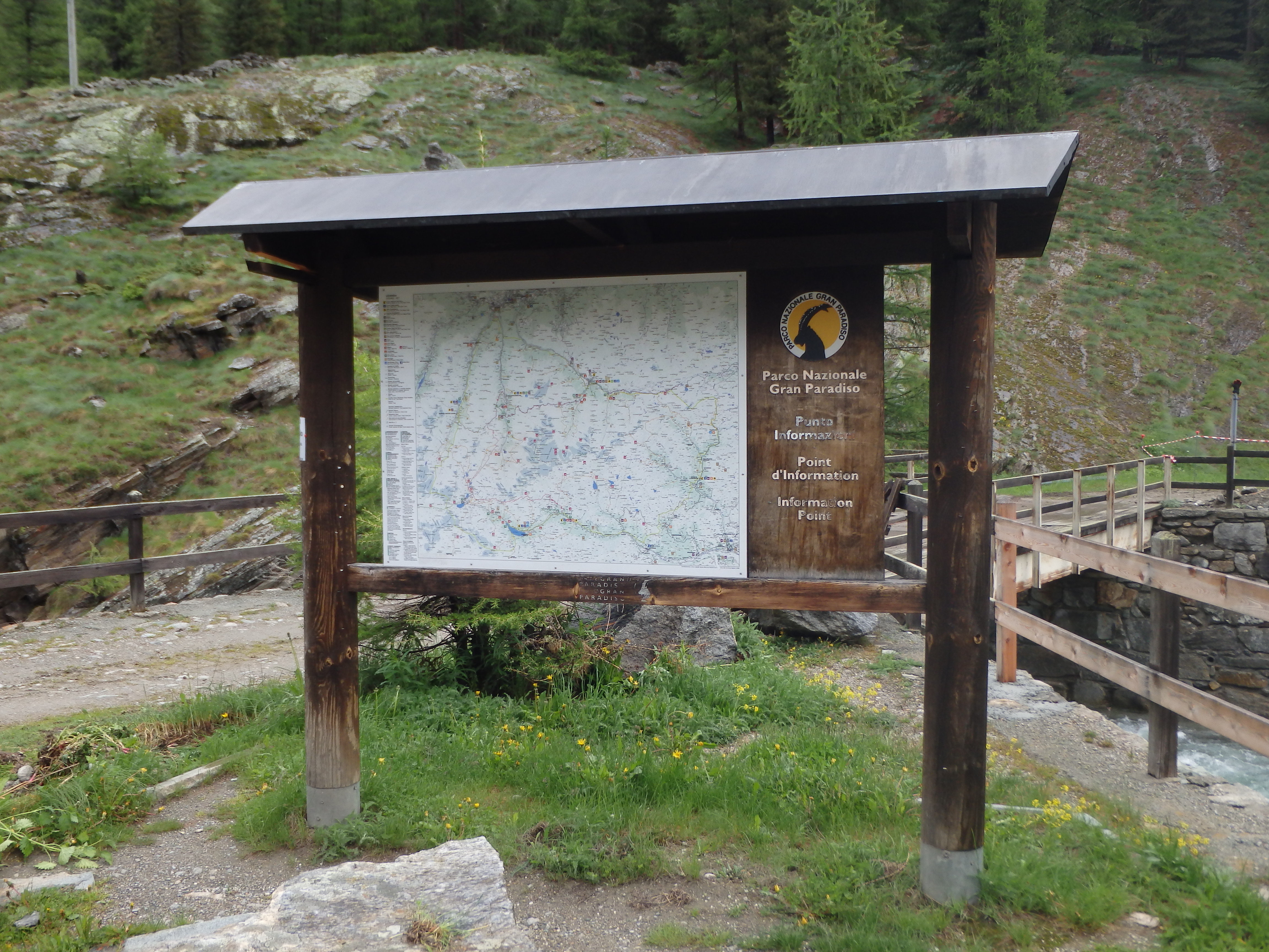
Trailhead: Valsavaranche, to Chabod hut
Companions: Holly


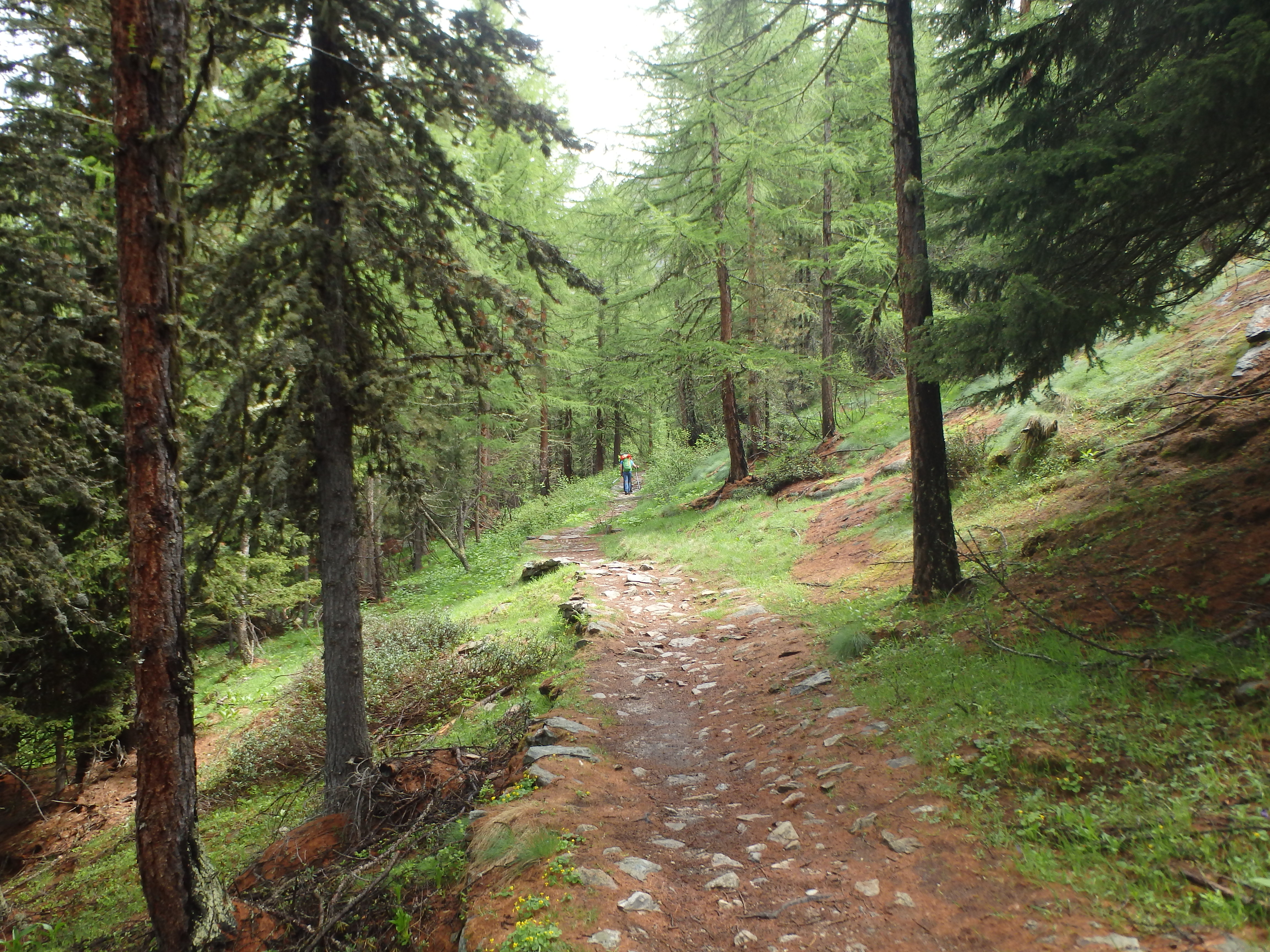
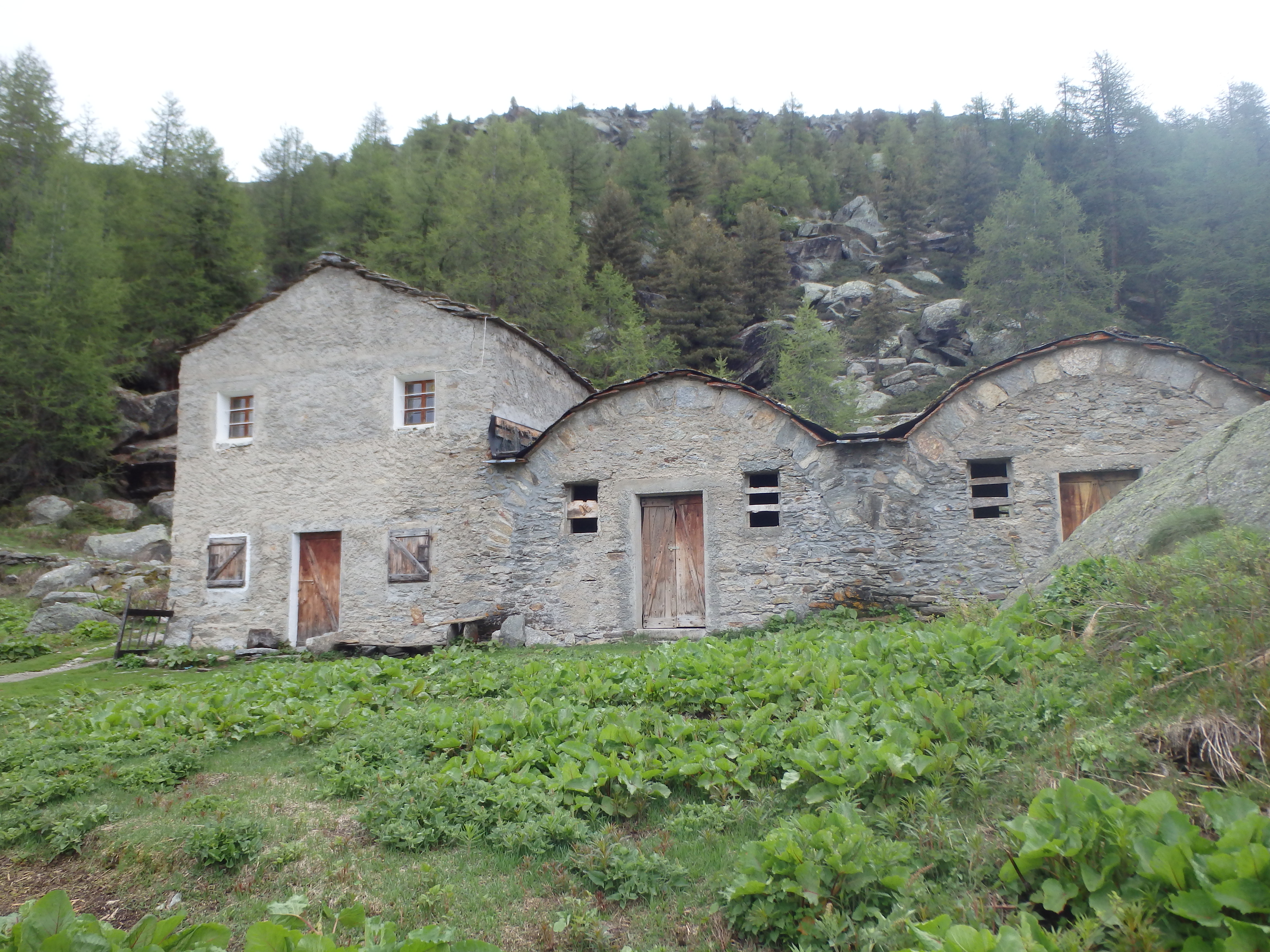
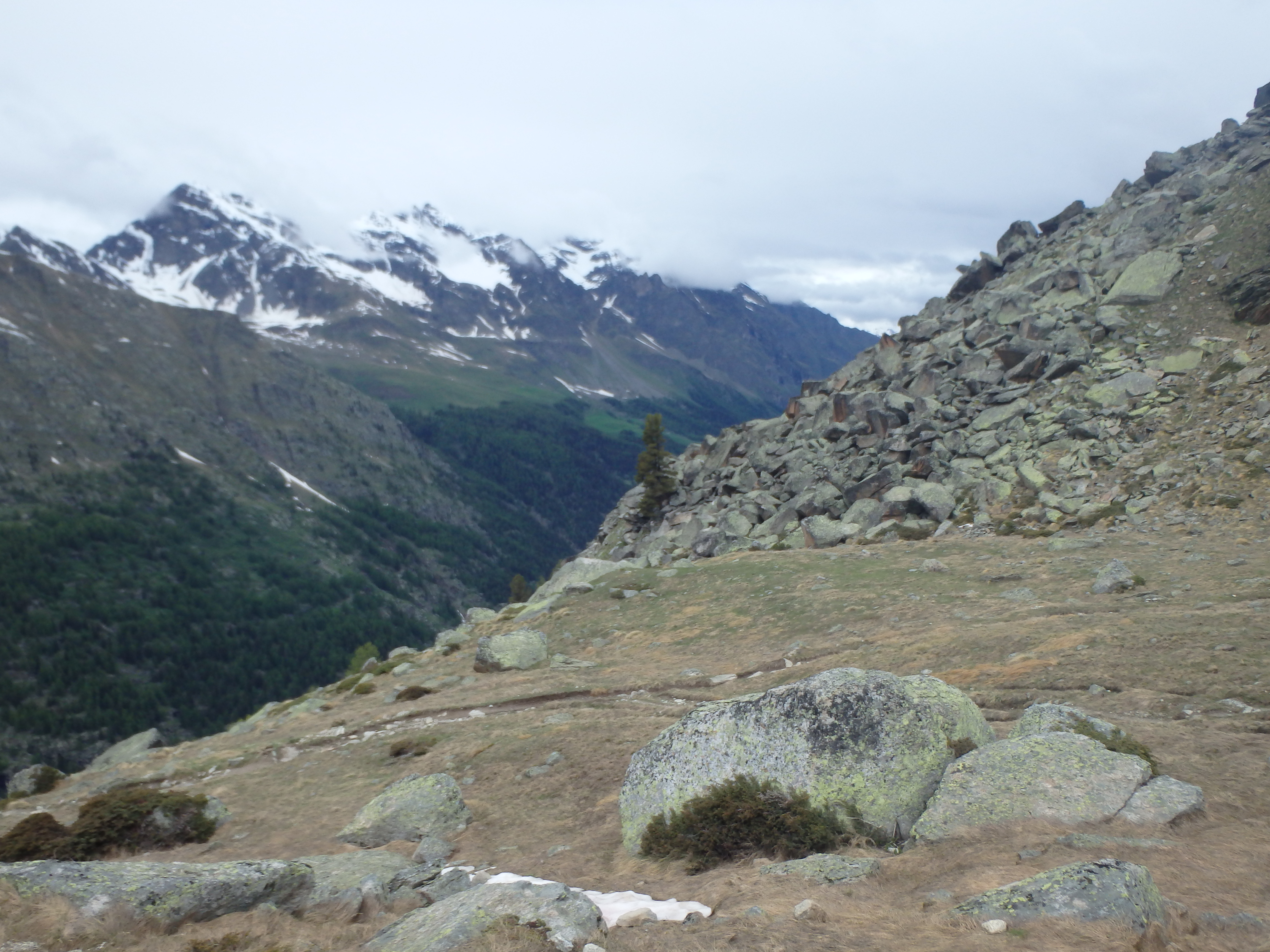
Gran Paradiso is the centerpiece of Gran Paradiso National Park, the oldest National Park in Italy and among the oldest in Europe. Standing at over 4,000m, Gran Paradiso is among the 82 official UIAA 4000 meter peaks in the Alps, and is one of the few Ultra-prominent peaks (1500 meters of prominence) in the range. Additionally, Gran Paradiso is the highest mountain entirely within Italy’s borders, with all other higher summits in the country shared with France or Switzerland. The peak is known as a good beginner alpine peak, with favorable conditions most of the year and comparatively less objective hazards than similar sized summits, having only small sections with crevasses and an exciting but protected ridgeline finish. That being said, it still requires a good deal of stamina, with nearly 2300 meters of elevation gain, not serviced by lifts like so many other big peaks in the Alps. My trip to the Alps was once again just too early for an attempt on Mont Blanc, so we instead decided to try for Gran Paradiso. The weather seemed to be improving the day after our misty hike up Le Brevent, and we left overcast Chamonix at around 8:30AM to meet our guide Marco from OnTop Mountaineering on the other side of the Mont Blanc tunnel. The tunnel itself was quite incredible, 11.6 km in length! The weather was better on the Italian side of the mountain, and we followed our guide Marco another 1.5 hours to the trailhead high in the valley of Valsavaranche. The trailhead was nearly empty, and Marco happened to know a pair of climbers headed up at the same time as us. We loaded our packs, mine heavy with big Scarpa Inverno boots, and started up the trail. After crossing a bridge and passing near a shepard’s home, the trail begins to aggressively switchback up through the forest.
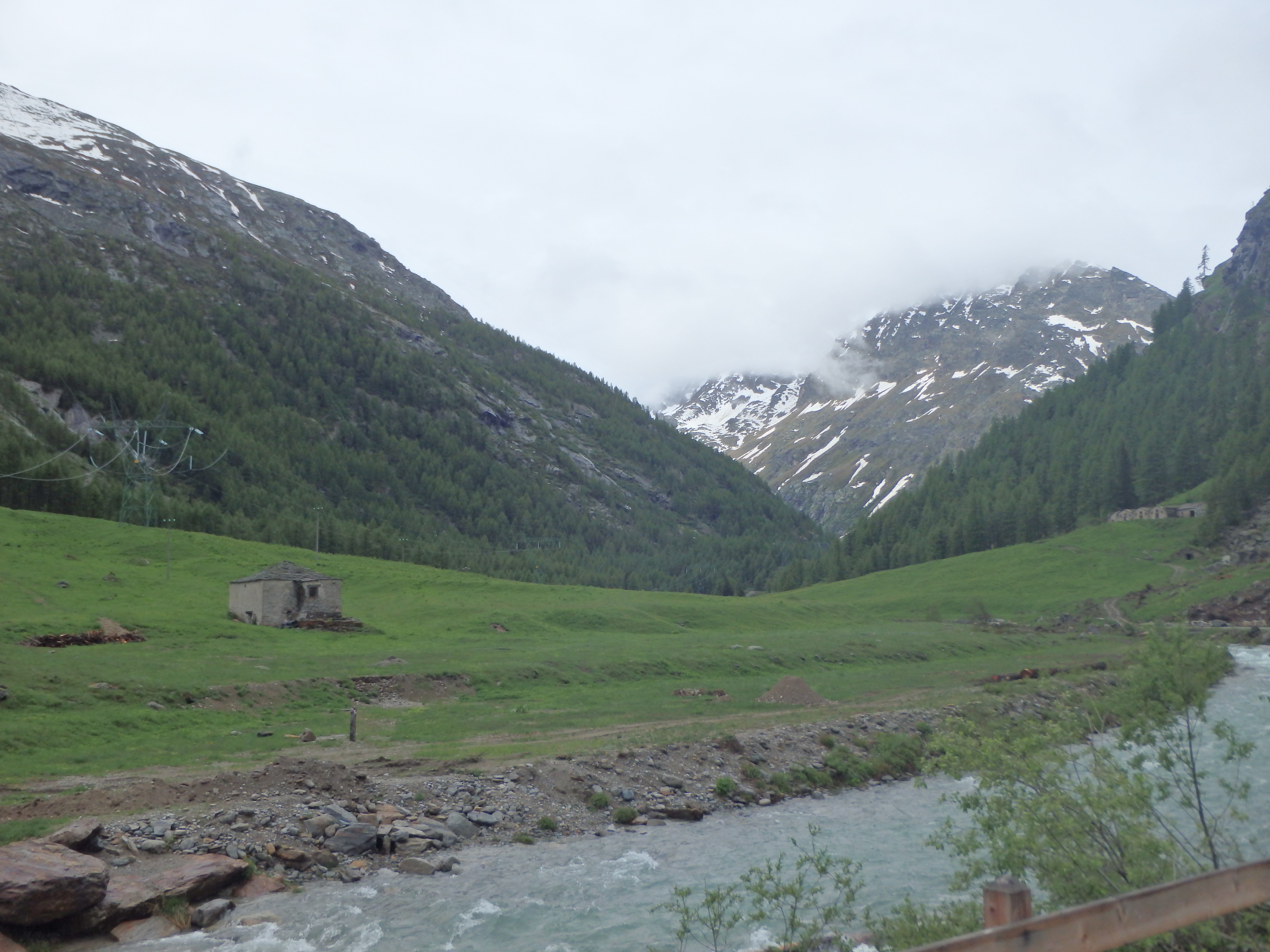
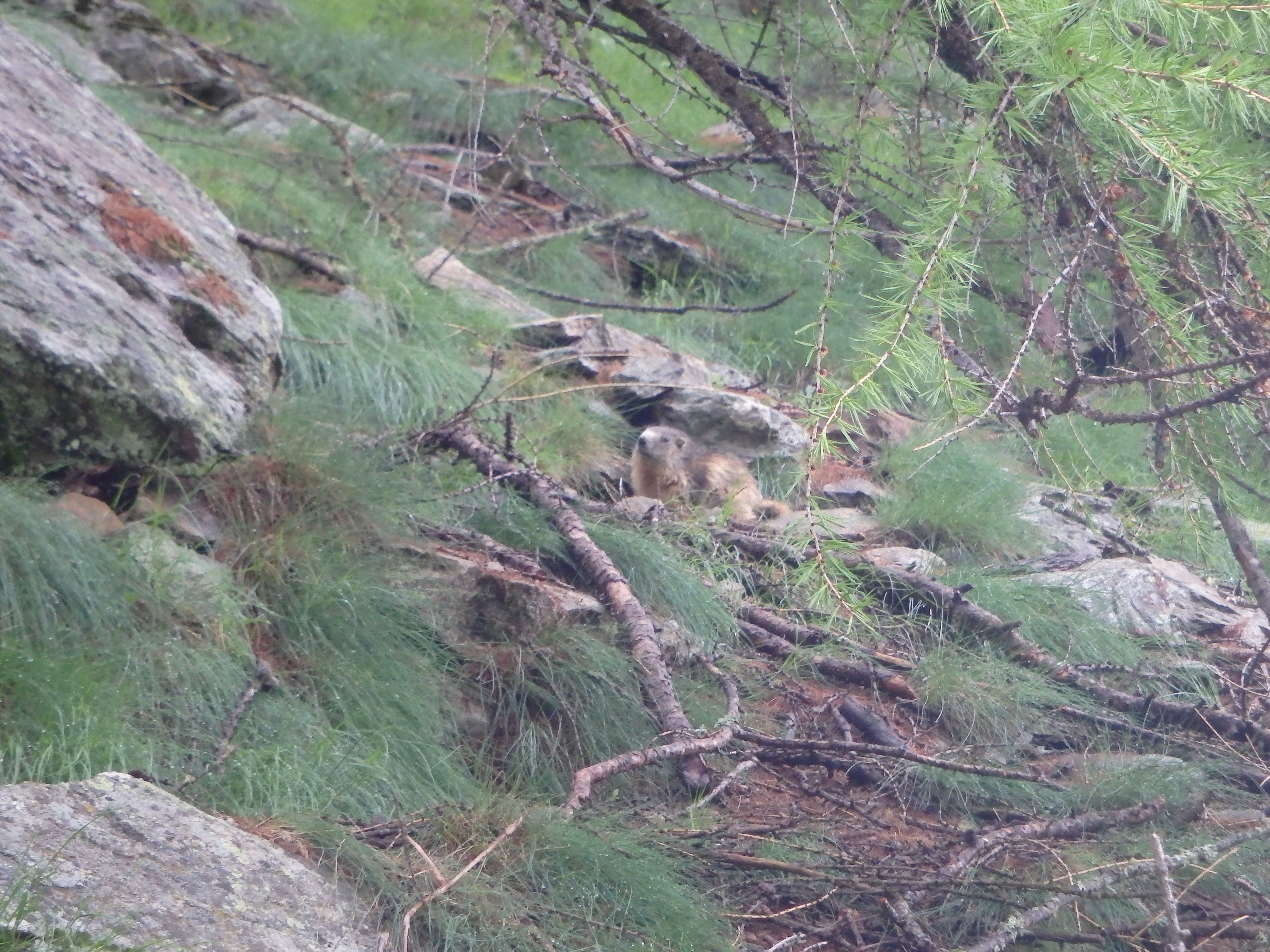
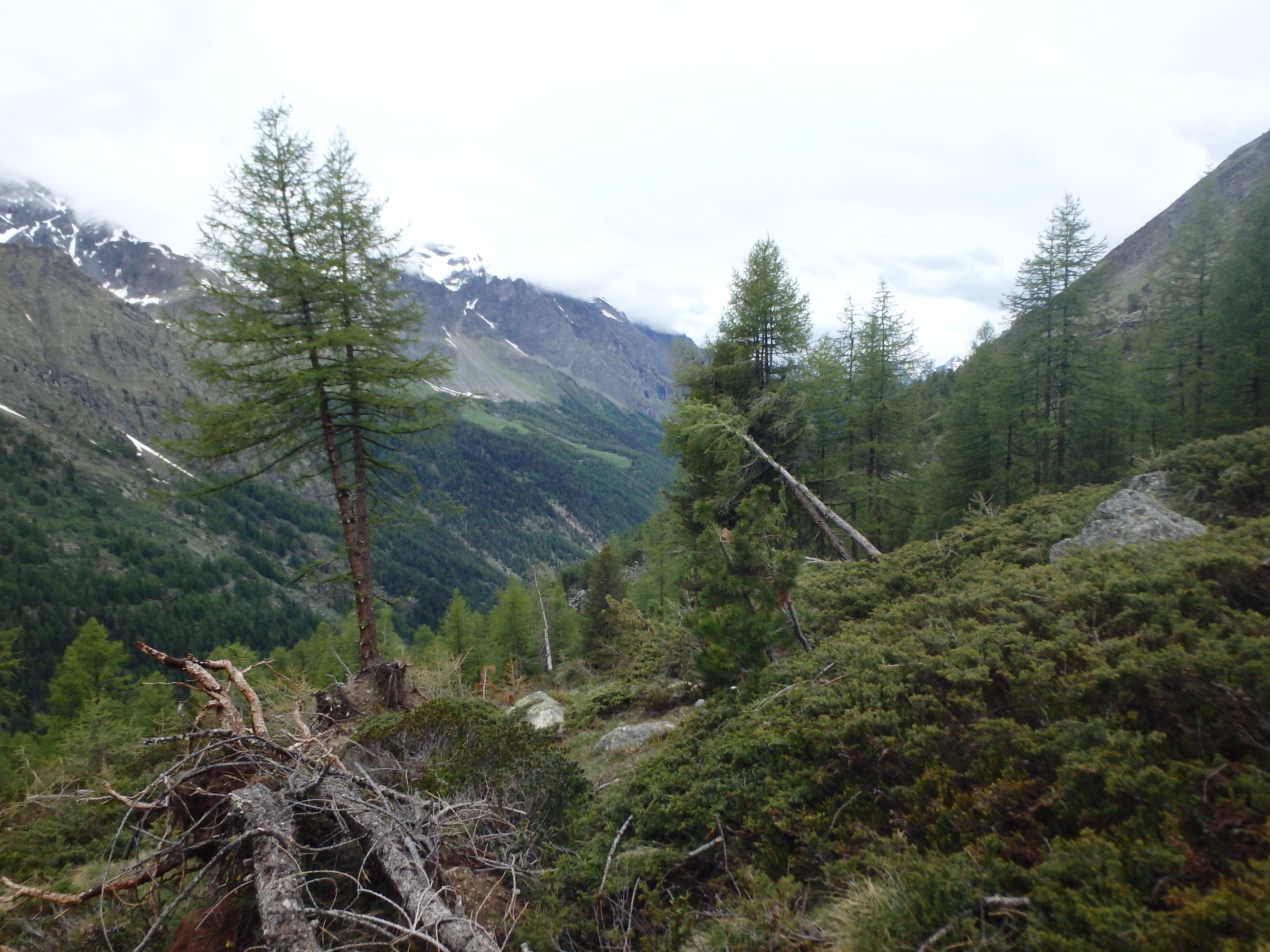
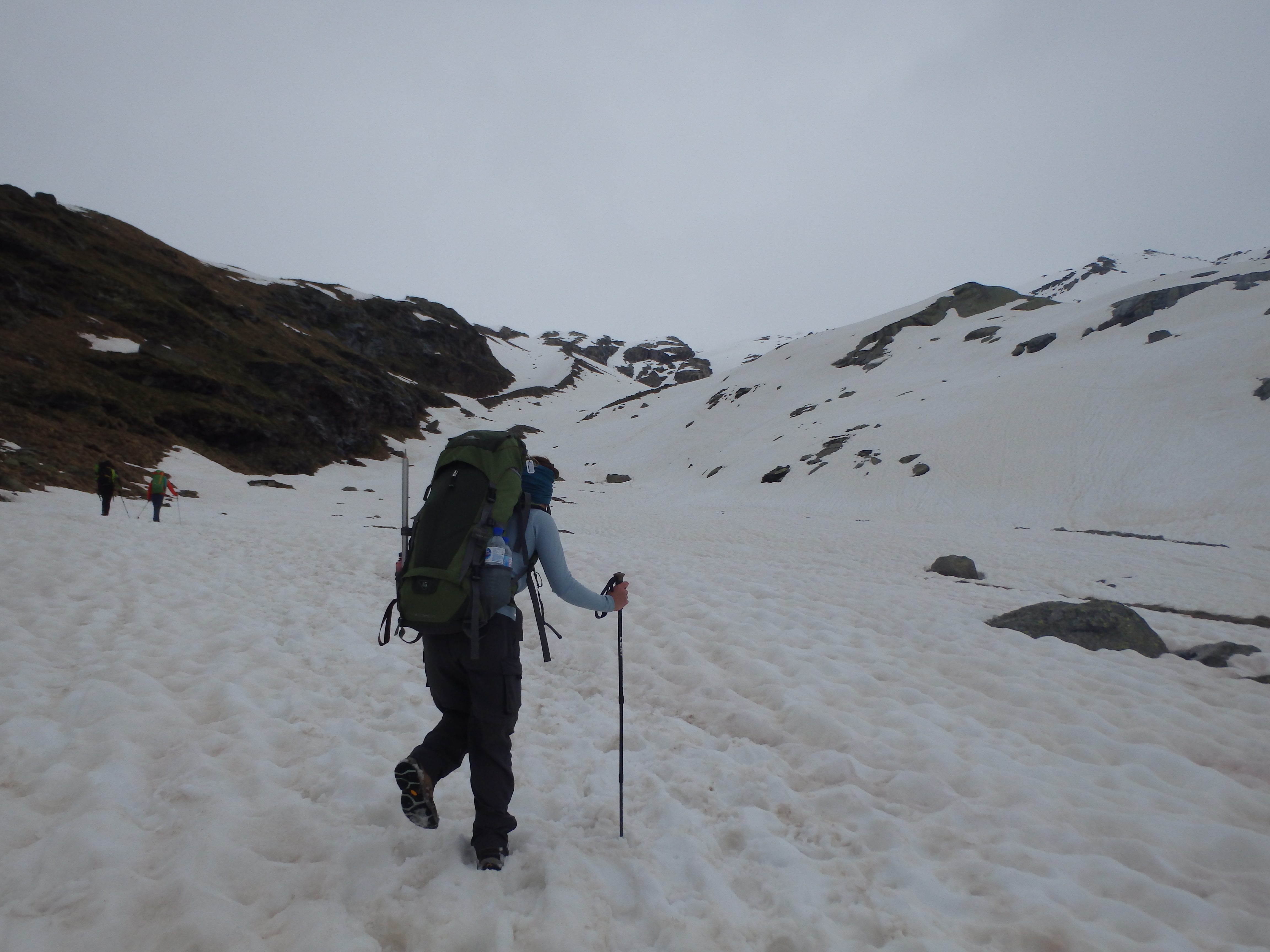
The trail was muddy from the recent rains, and fat marmots scurried around the rocks looking for food at the lower, thawed elevations. We took our first break at a bench overlooking the valley, crude roads cutting across the slopes of summits across the way. Shortly after, we reached the only trail junction of the climb near an alpine shepard’s home and a potable water fountain. We headed right and continued up switchbacks as the trees grew smaller and more sparse.
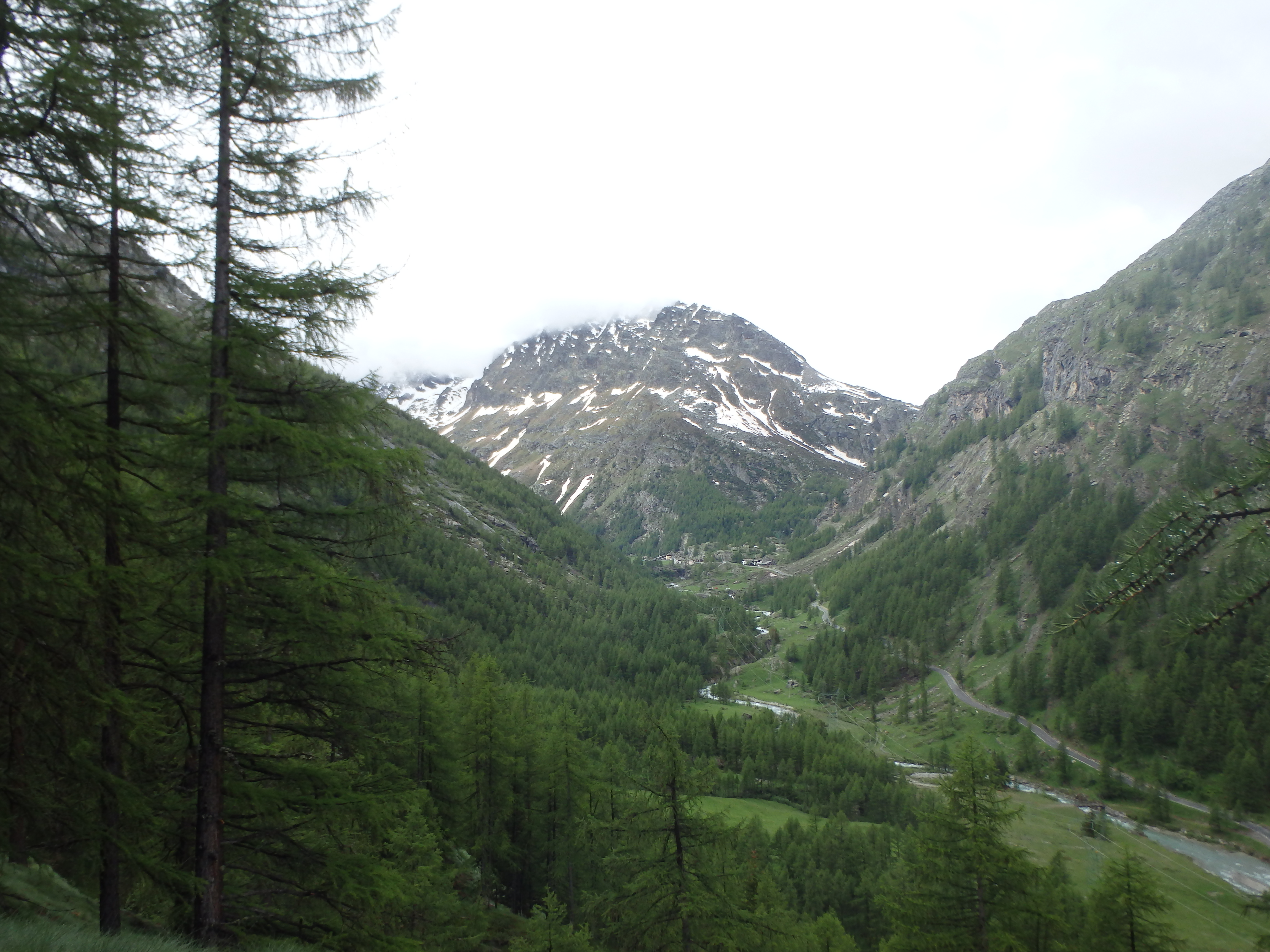
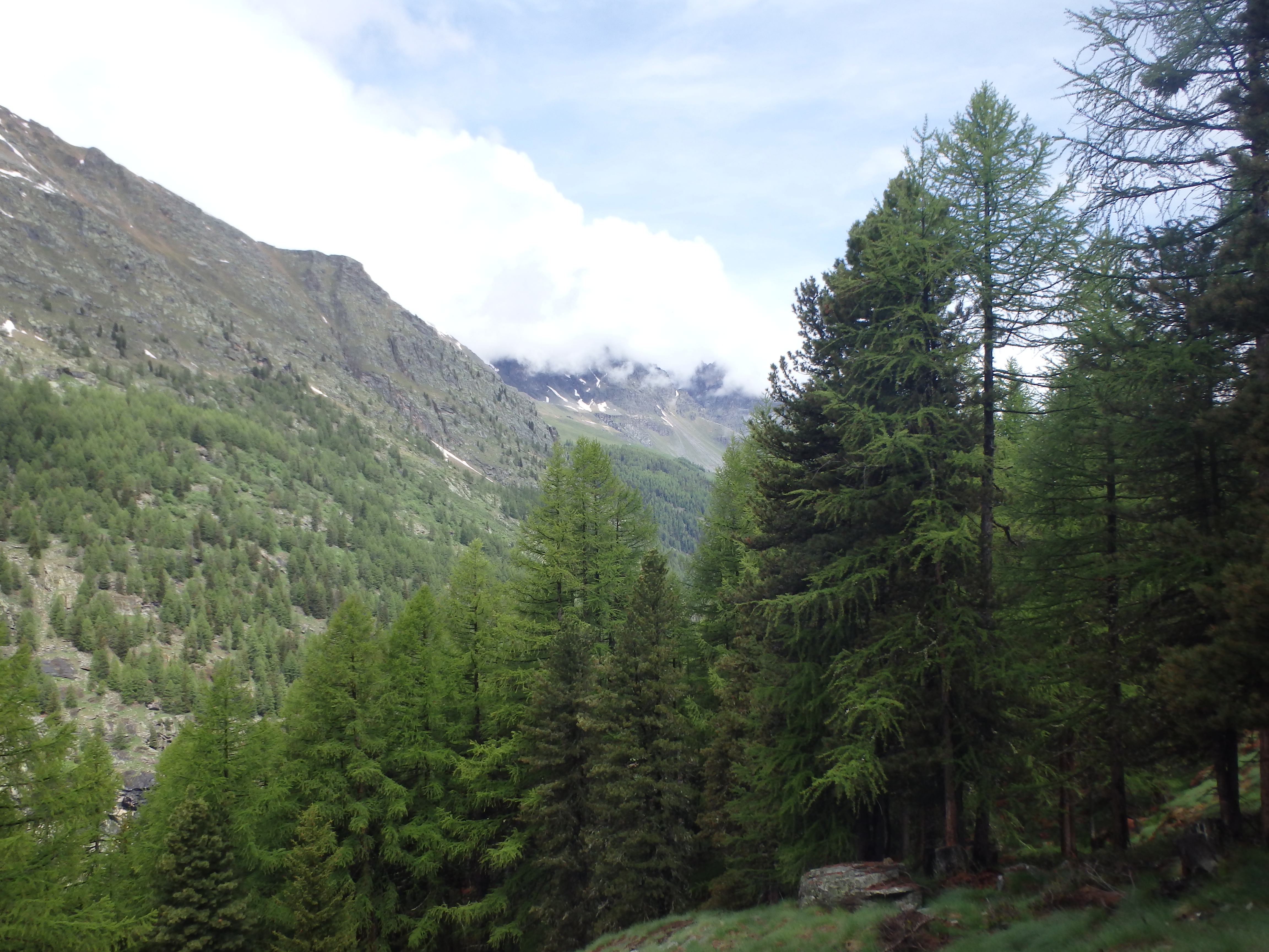
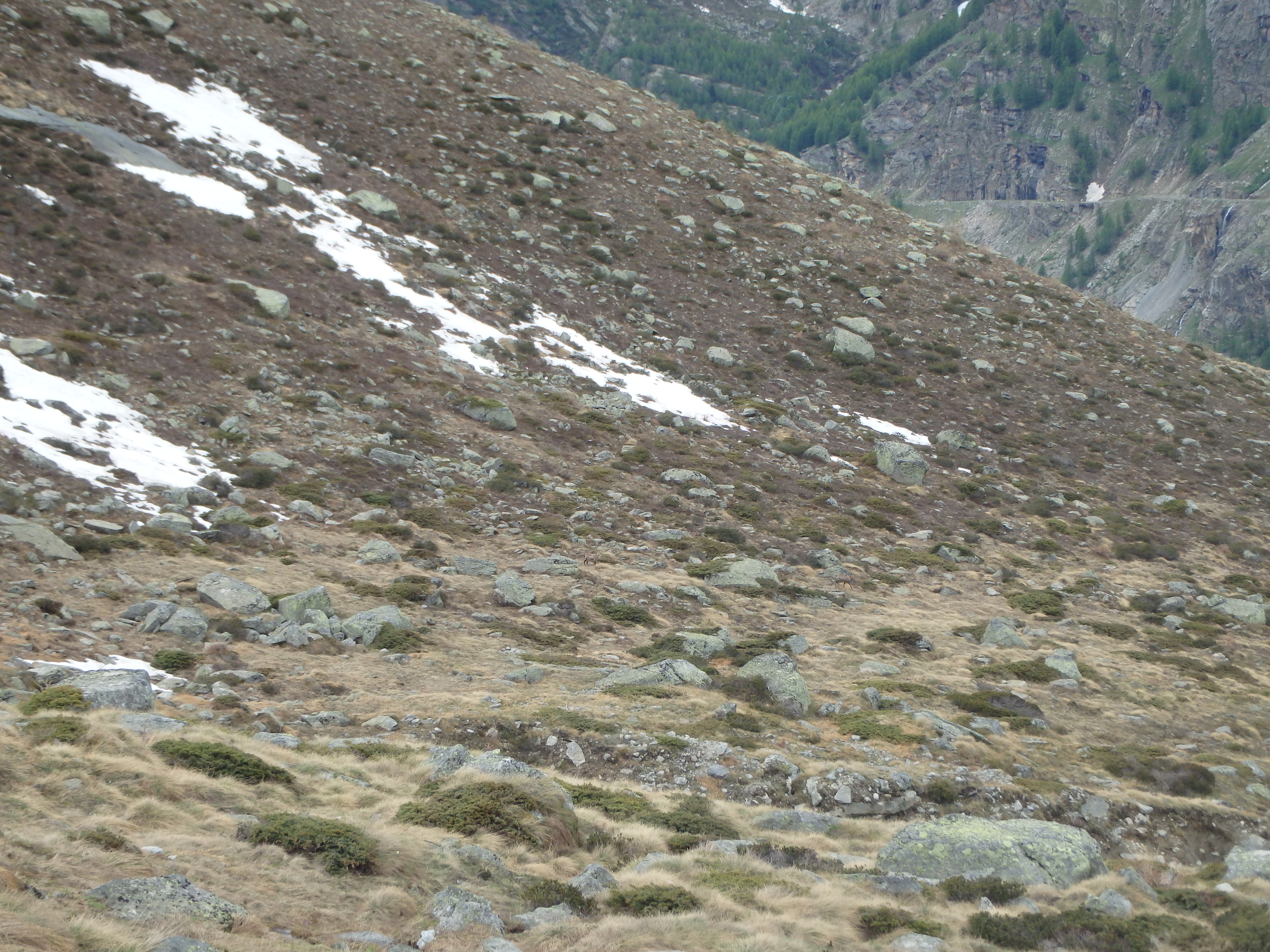
Not surprisingly, we were moving quite a bit slower than our guide or his two acclimated friends, and our pace slowed as we neared treeline, with afternoon rain beginning to threaten just as we were becoming exposed. I spotted two small goats working down the slopes, a pair of Chamois, and we stopped to watch them before continuing along.
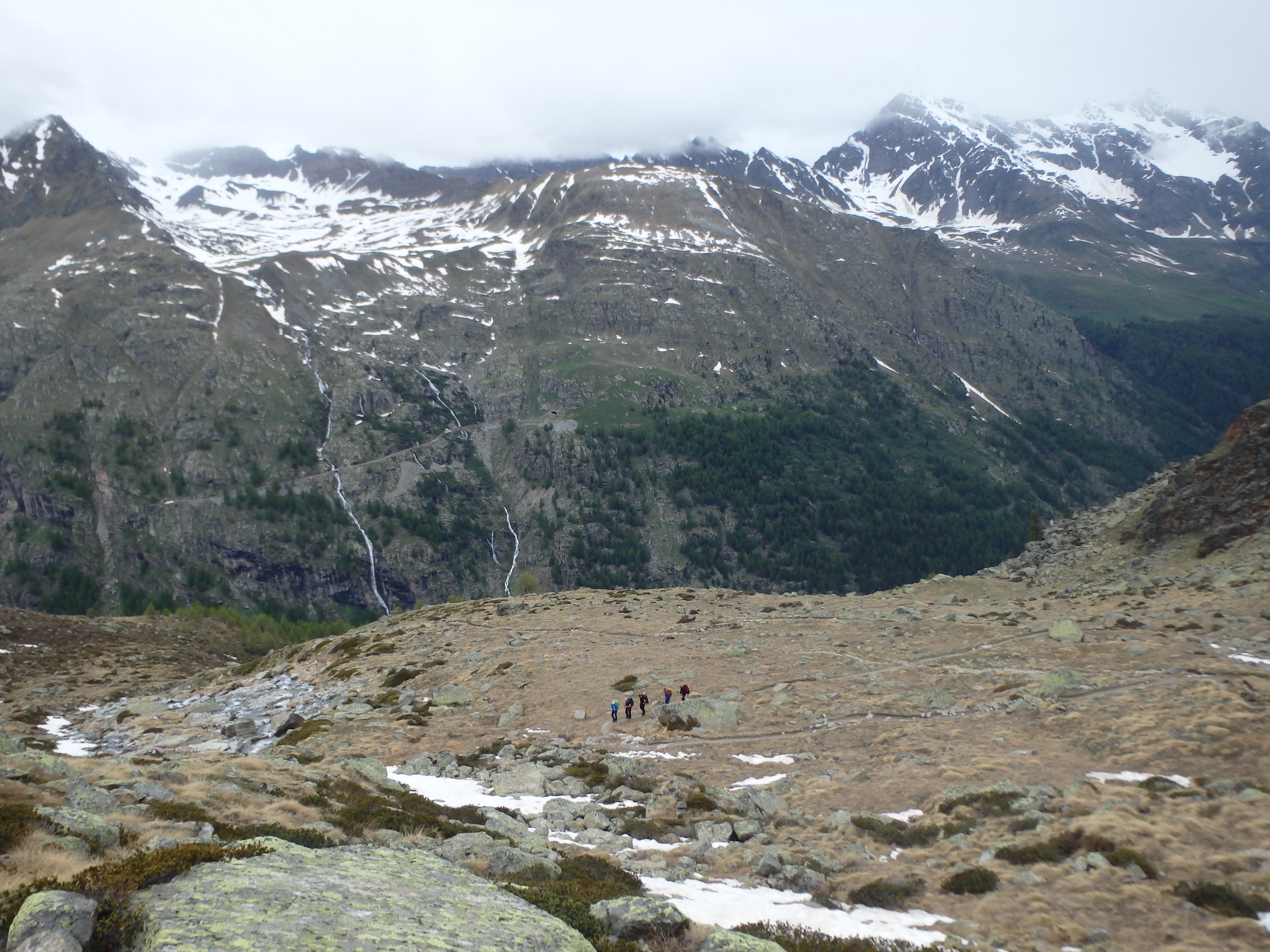
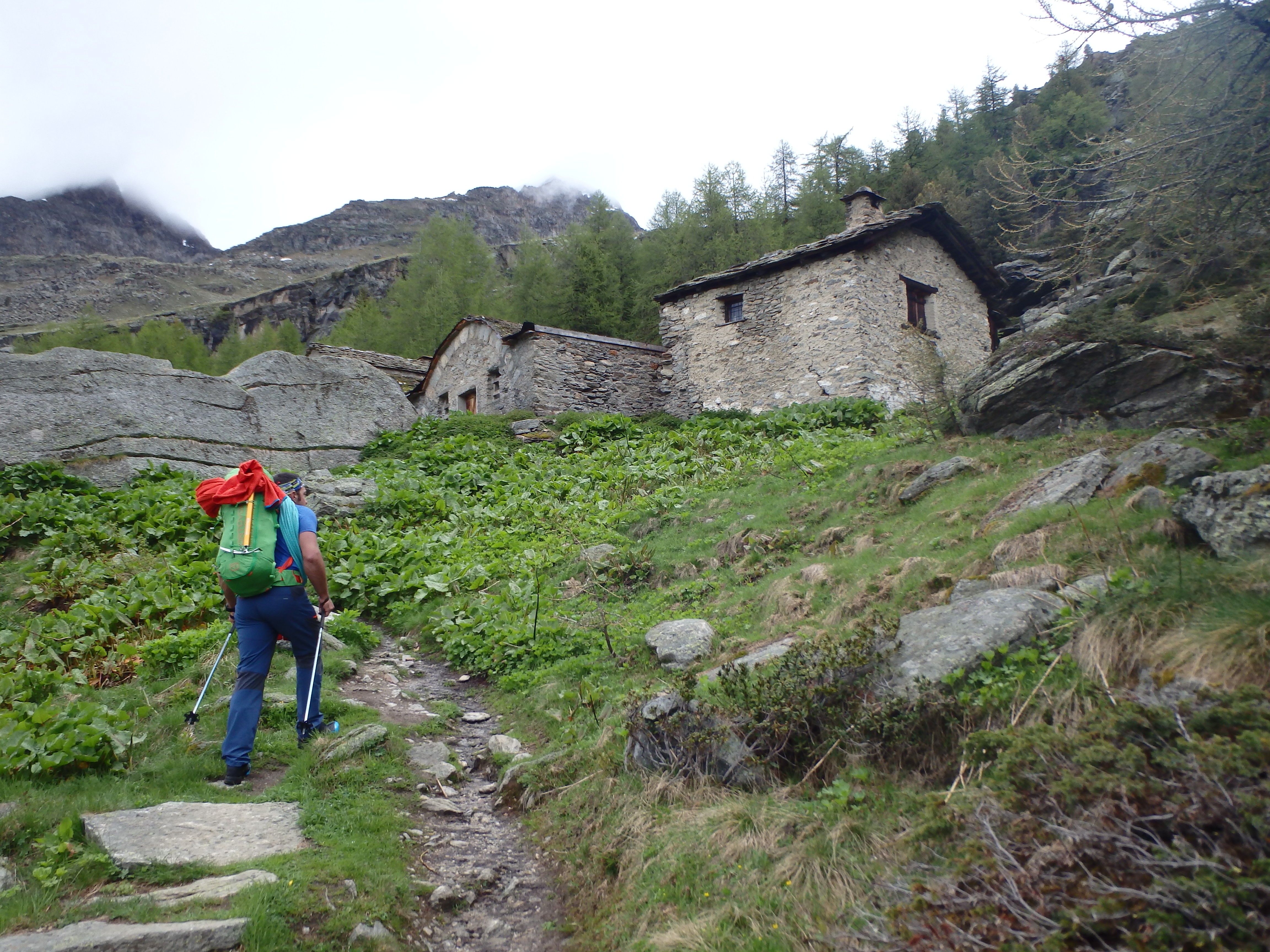
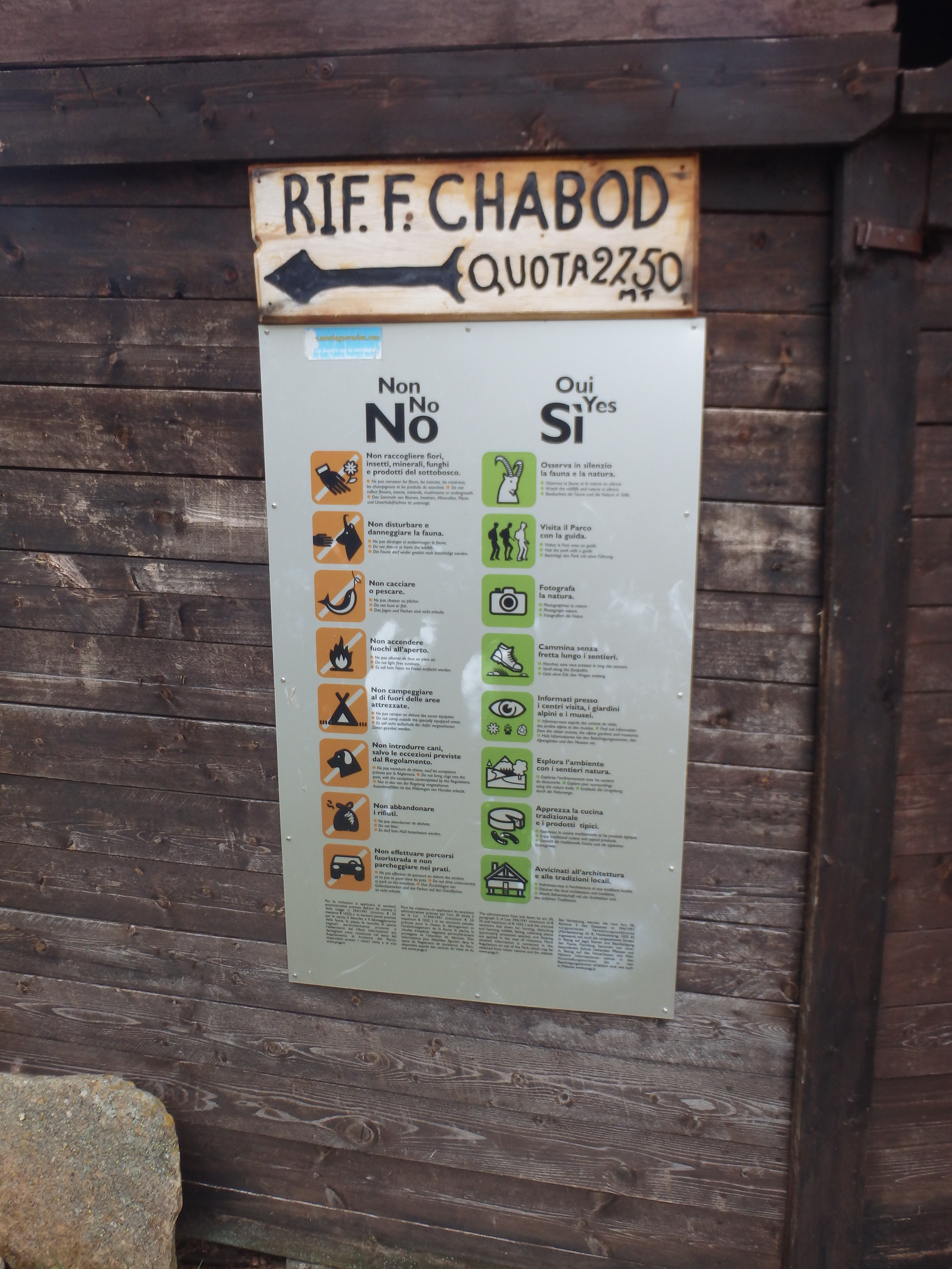
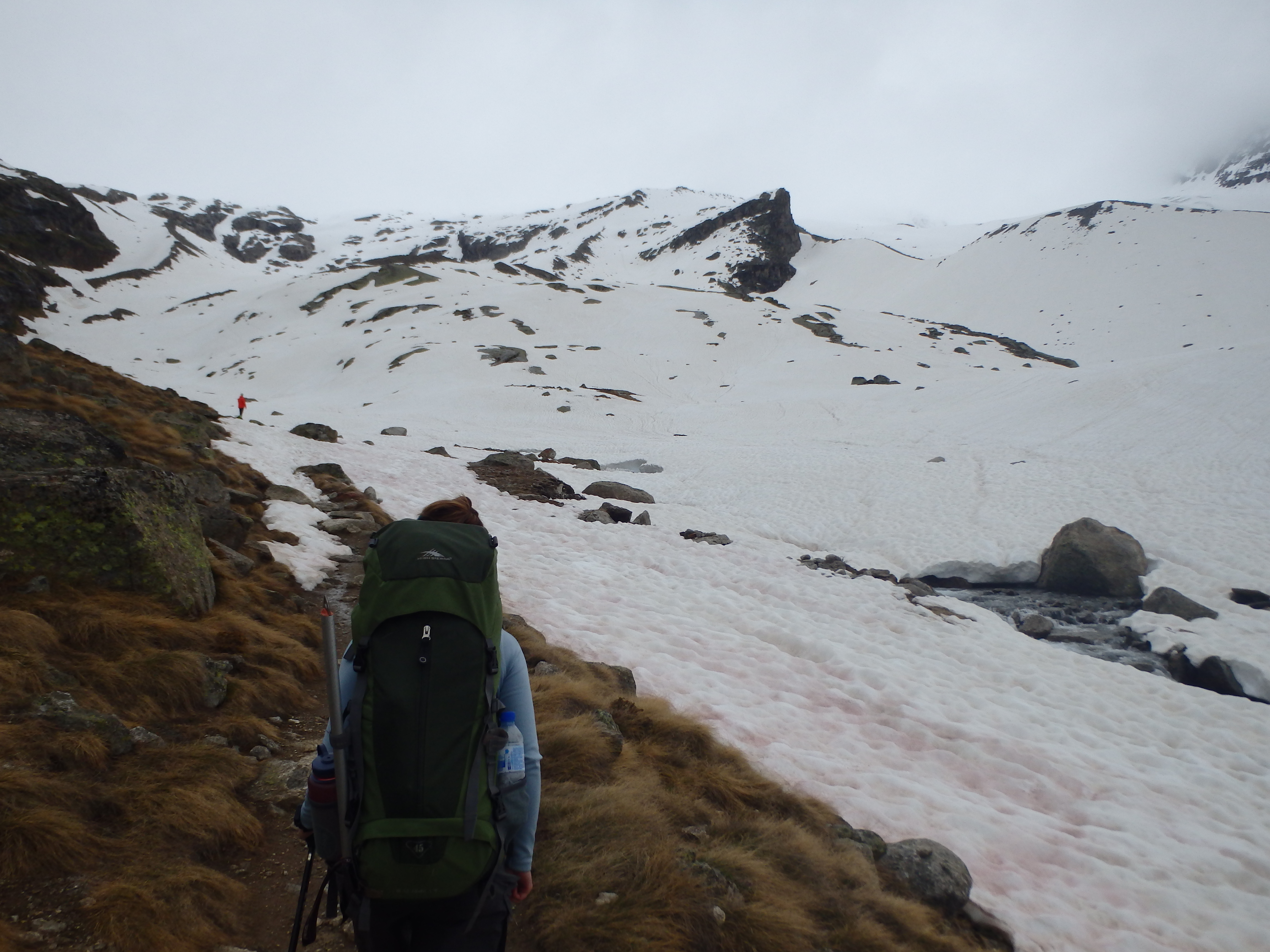
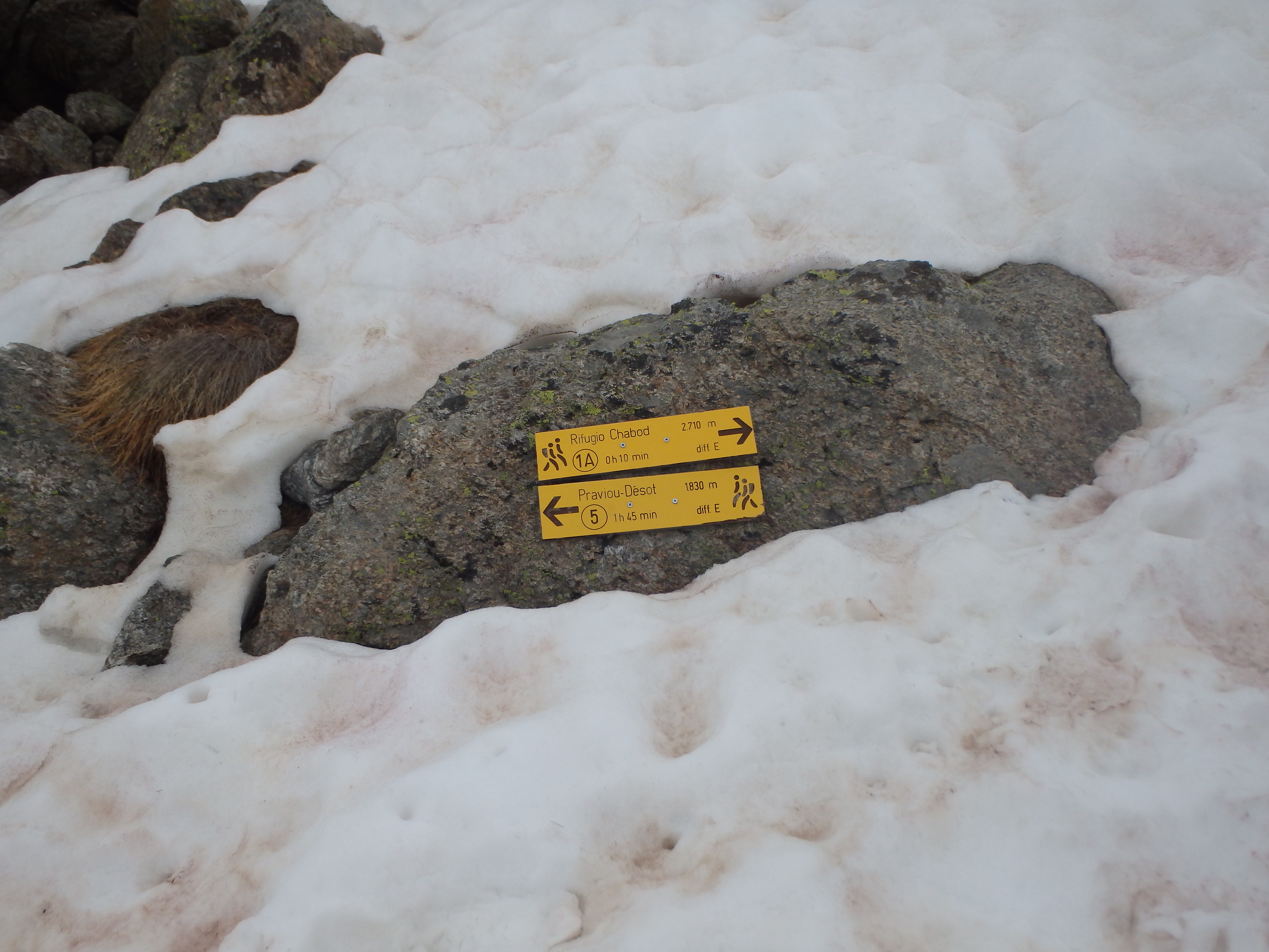
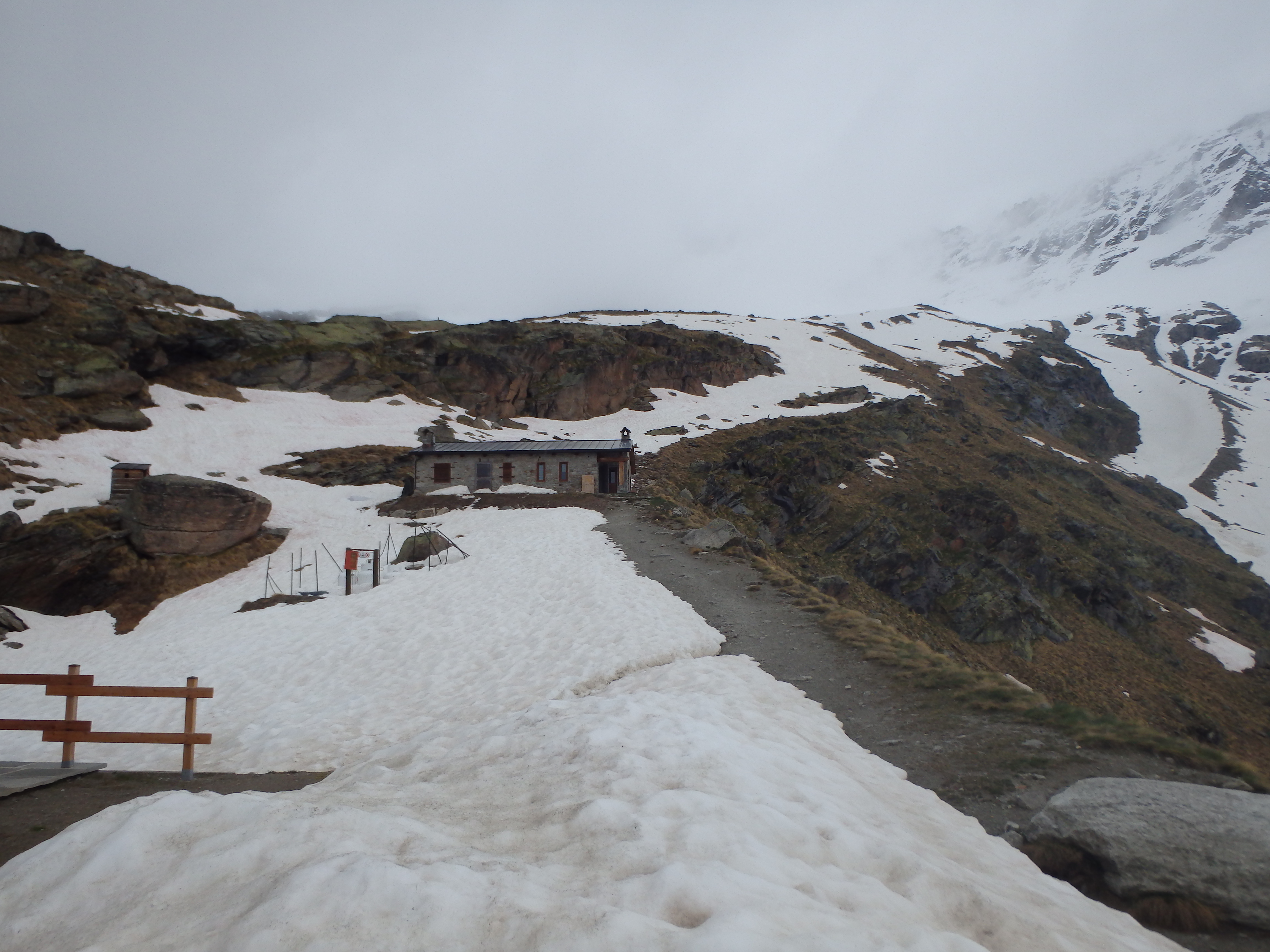
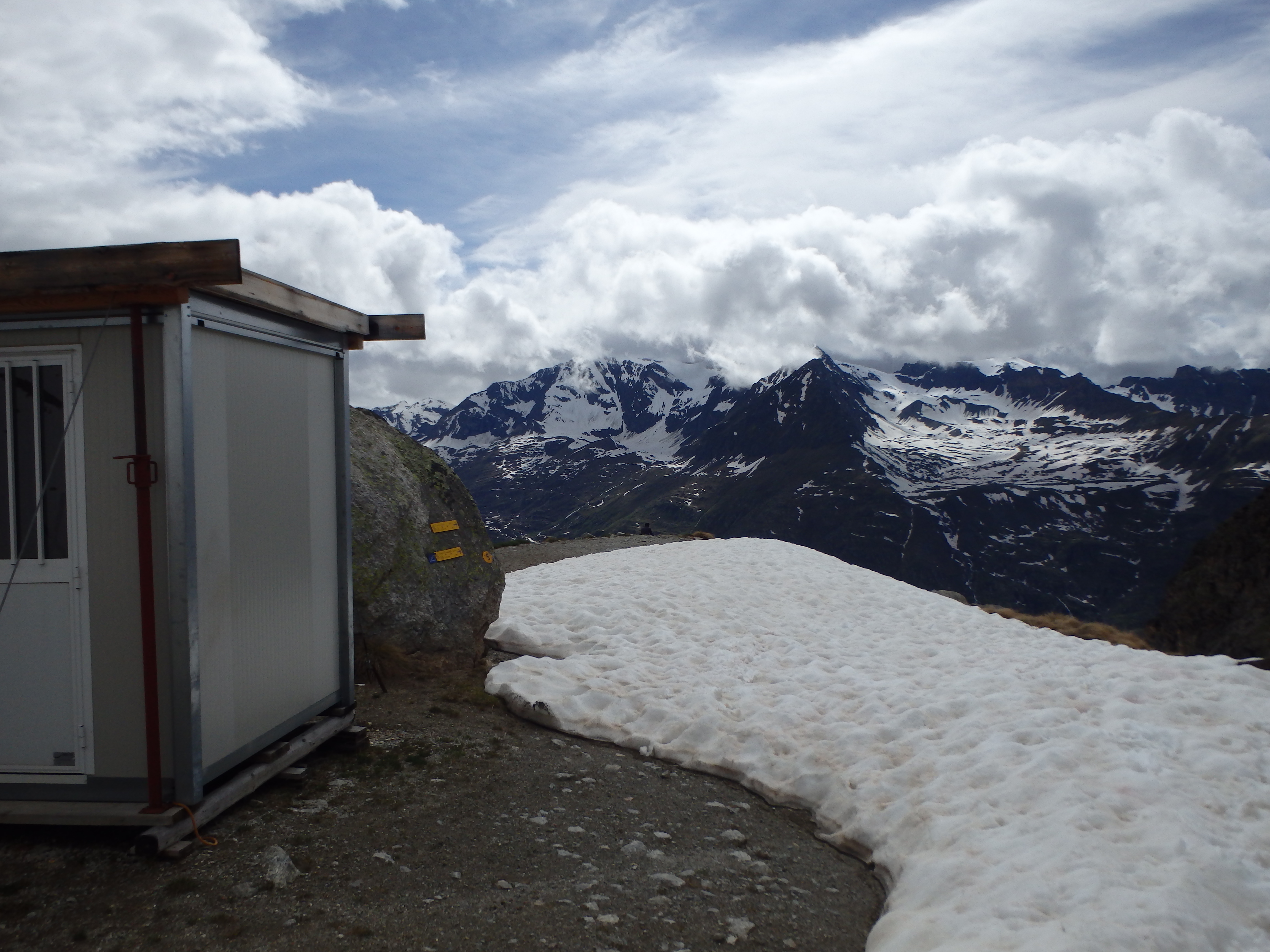
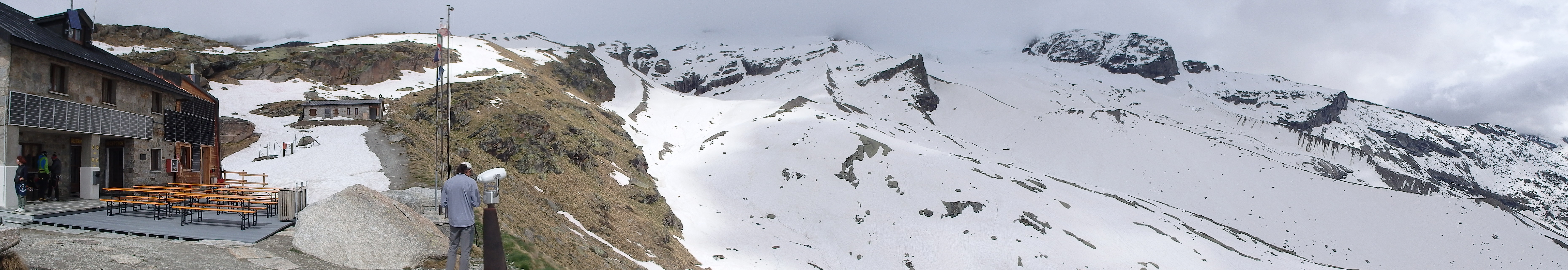
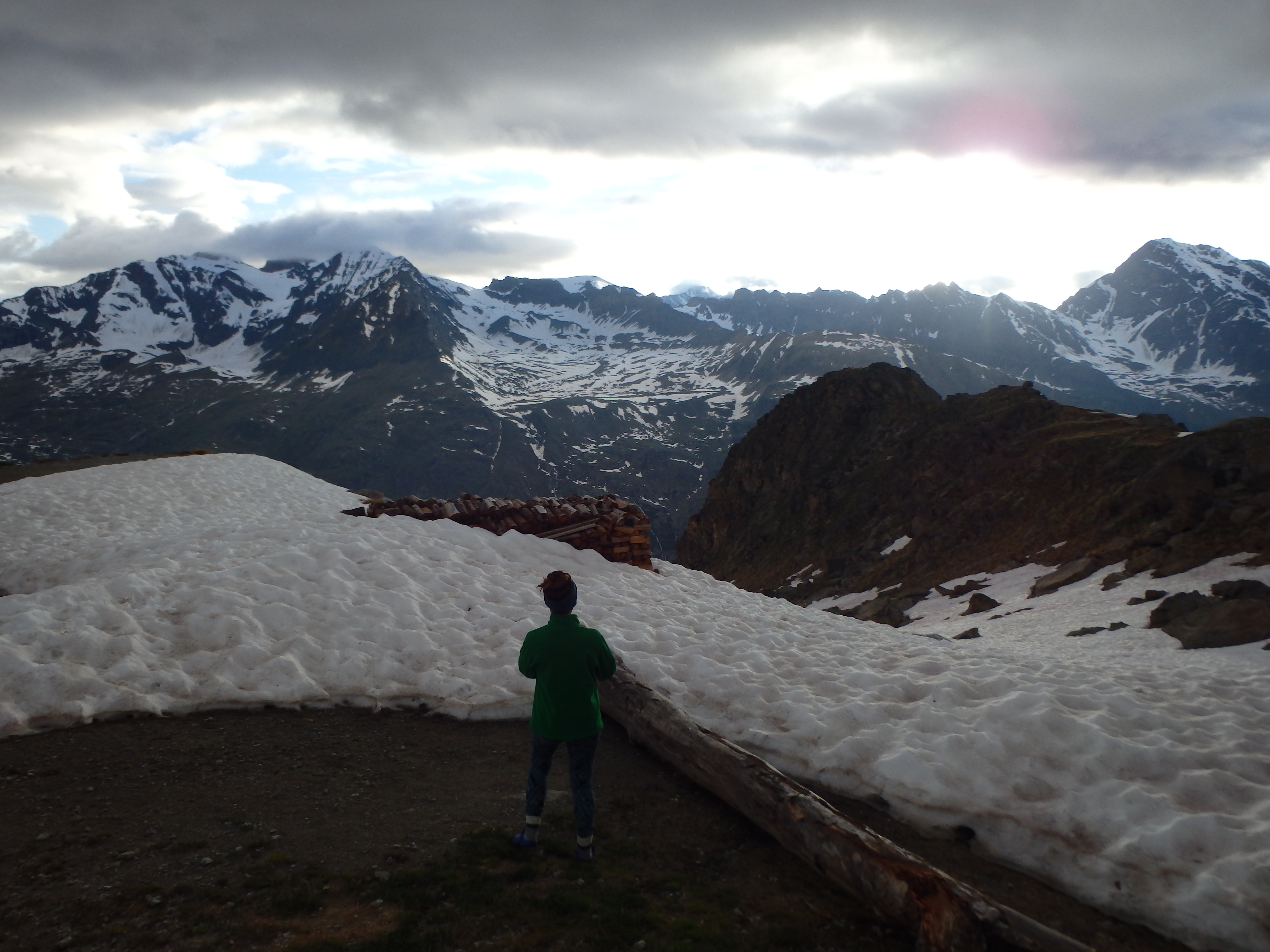
It seemed like this stretch of trail seemed to go on and on, expecting each switchback to bring us to the hut, yet it remained out of sight. After about 3 hours of hiking the trail began to flatten out and we entered a basin with patchy snow cover. I spotted a building half buried in the snow and assumed for it to be our accommodations for the night. In reality, that was basically a shed that housed some of the electrical and water equipment for the actual hut, with the Chabod Refuge just a few more switchbacks upslope on an open ridgeline.
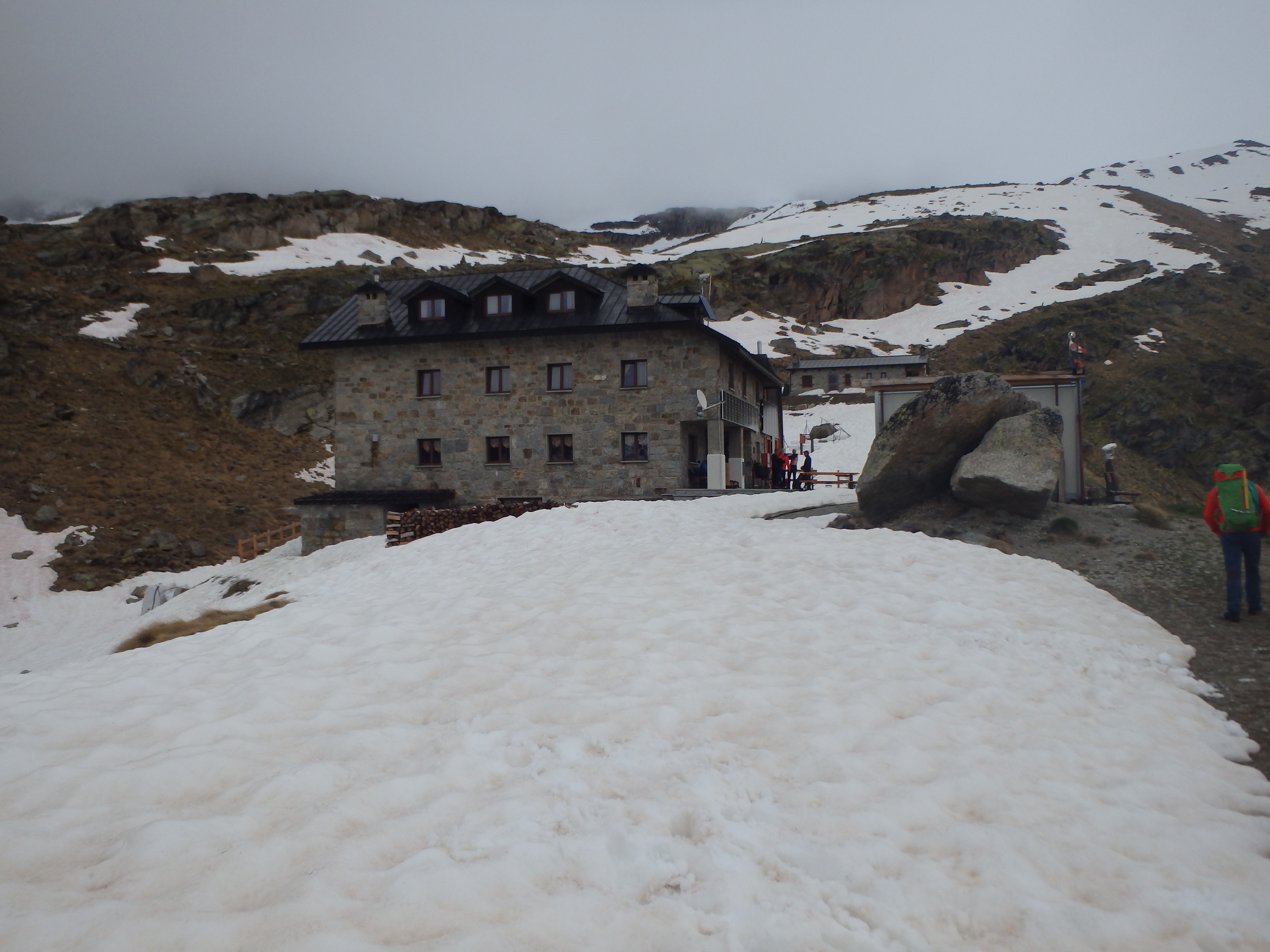
The refuge was far nicer than I had expected, four stories tall with heat, flush toilets, warm beds and a full service bar with beer on tap and a selection of bottled wine. We had brought lunch with us and pulled out our cold sandwich like suckers while our guide and the other climbers ordered fresh lasagna and pasta in the dining area.
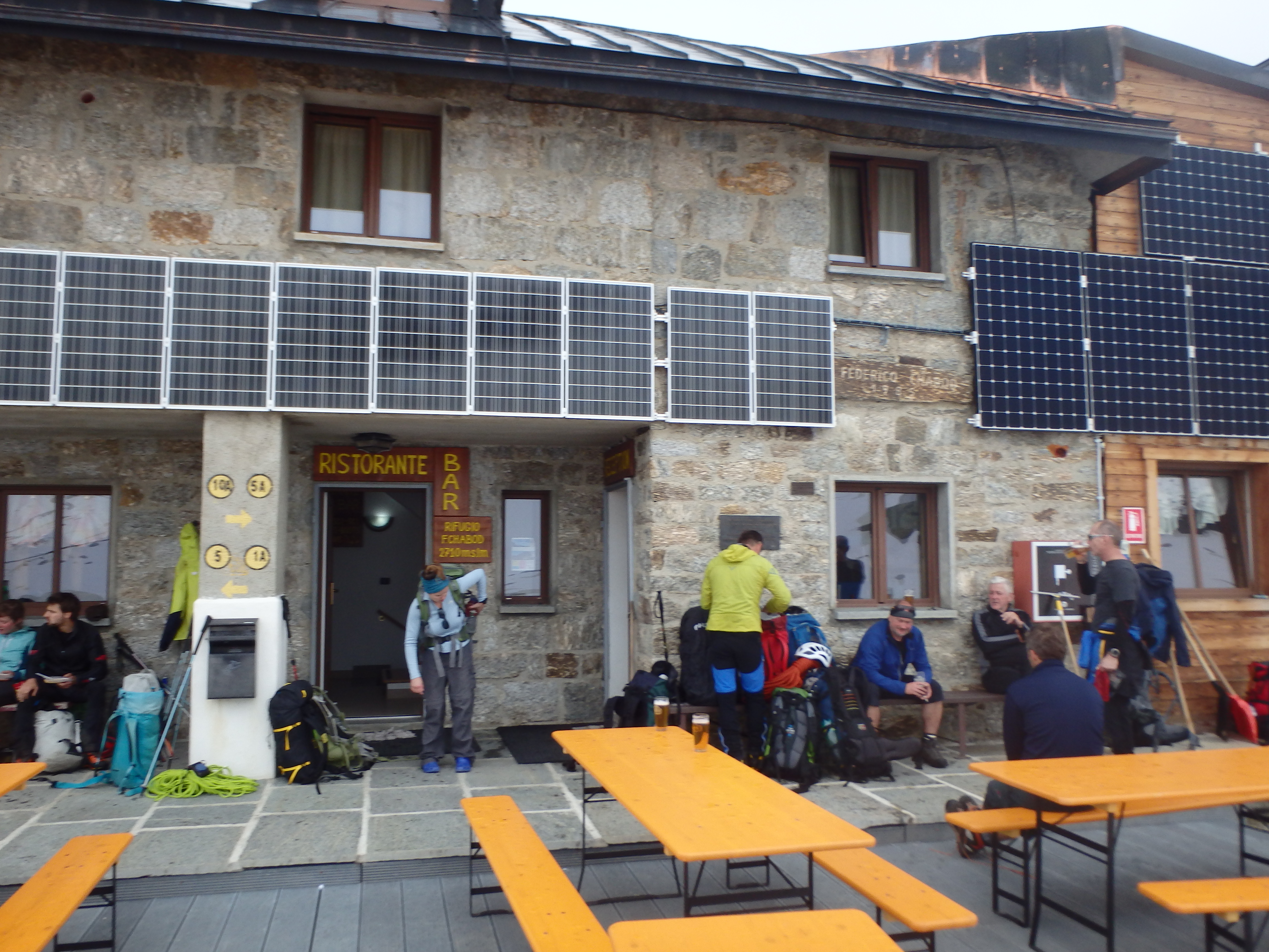
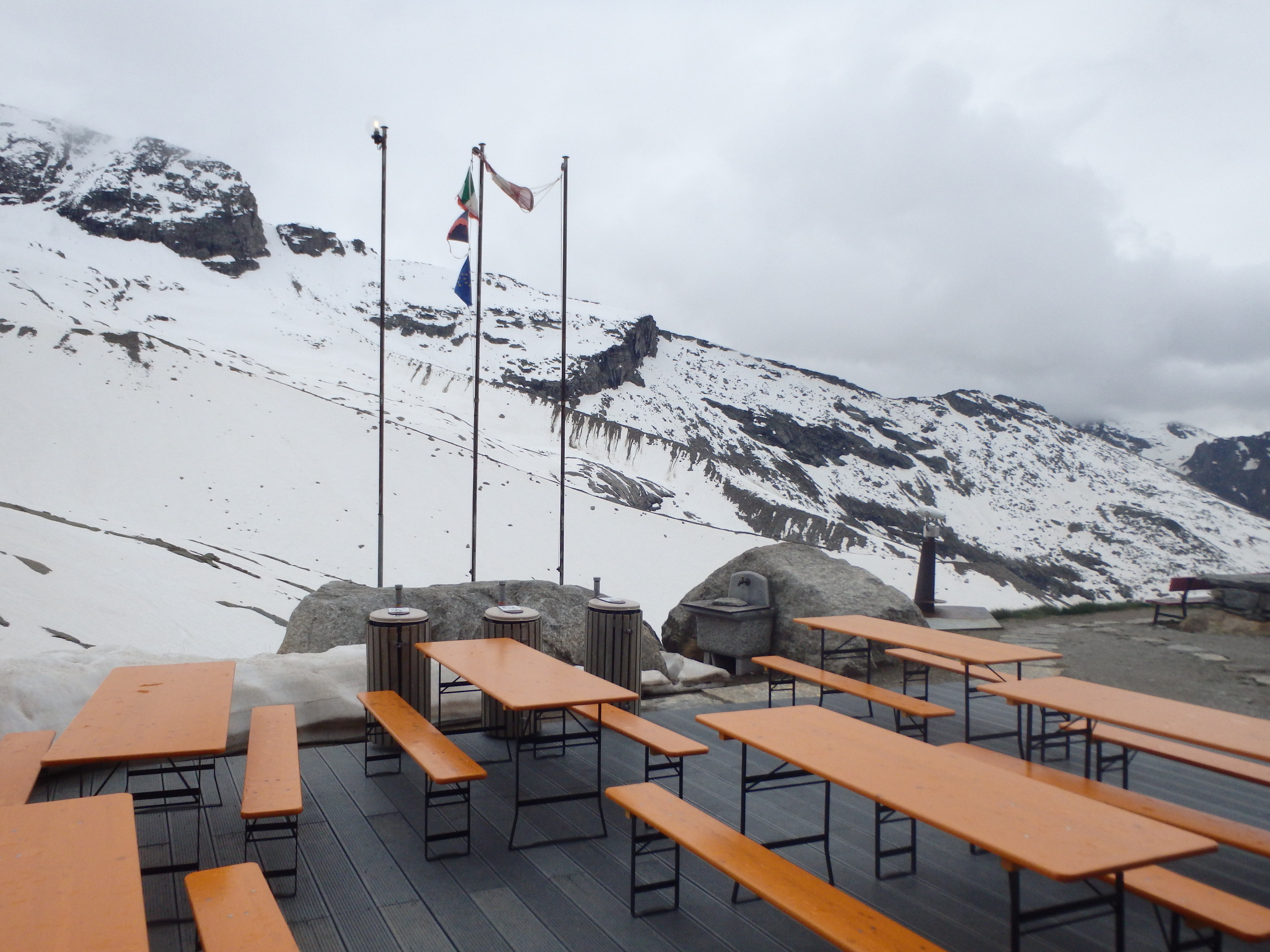
We relaxed with a beer and had plenty of time to kill in the afternoon, writing in our journals and playing cards while we waited for dinner. Being Italy, dinner was pasta, and we were surprised to learn that was only the first of three courses, with meat and vegetables and chocolate custard desert to follow. The Europeans definitely have this hut thing down…. After dinner we organized our packs for the next day and headed to bed to try and get some sleep before the 3:45 AM wake up.
I slept worse than I expected at 2750m, in part because the room with 4 other climbers was hot and stuffy. After getting dressed we headed down for breakfast, a self serve selection of breads with jams and nutella or cereal. We chugged our coffee and went to the staging area to finish putting on our gear- mountaineering boots, gaiters, headlamps etc. I hadn’t worn my Scarpa Invernos since the last time I was in Europe and climbed the far easier Breithorn, and I struggled with the straps in the low light before exiting the hut. We had barely gone a half kilometer before we stopped to put on our crampons. I had decided to use the crampons provided by Marco in order to save on weight for the flight out. As I put them on, I was somewhat horrified to find one of the straps had been cut too short, and it was barely long enough to hook in. With a combination of me pulling all the slack out of the system and Marco using his teeth to tighten it (talk about dedication) we had about 1 cm of tail to work with, just enough to hold for the day. Crisis averted, we crossed a basin of snow and started up a snow covered ridgeline up the central moraine, groups beginning to spread out at the first steep spots of the day.
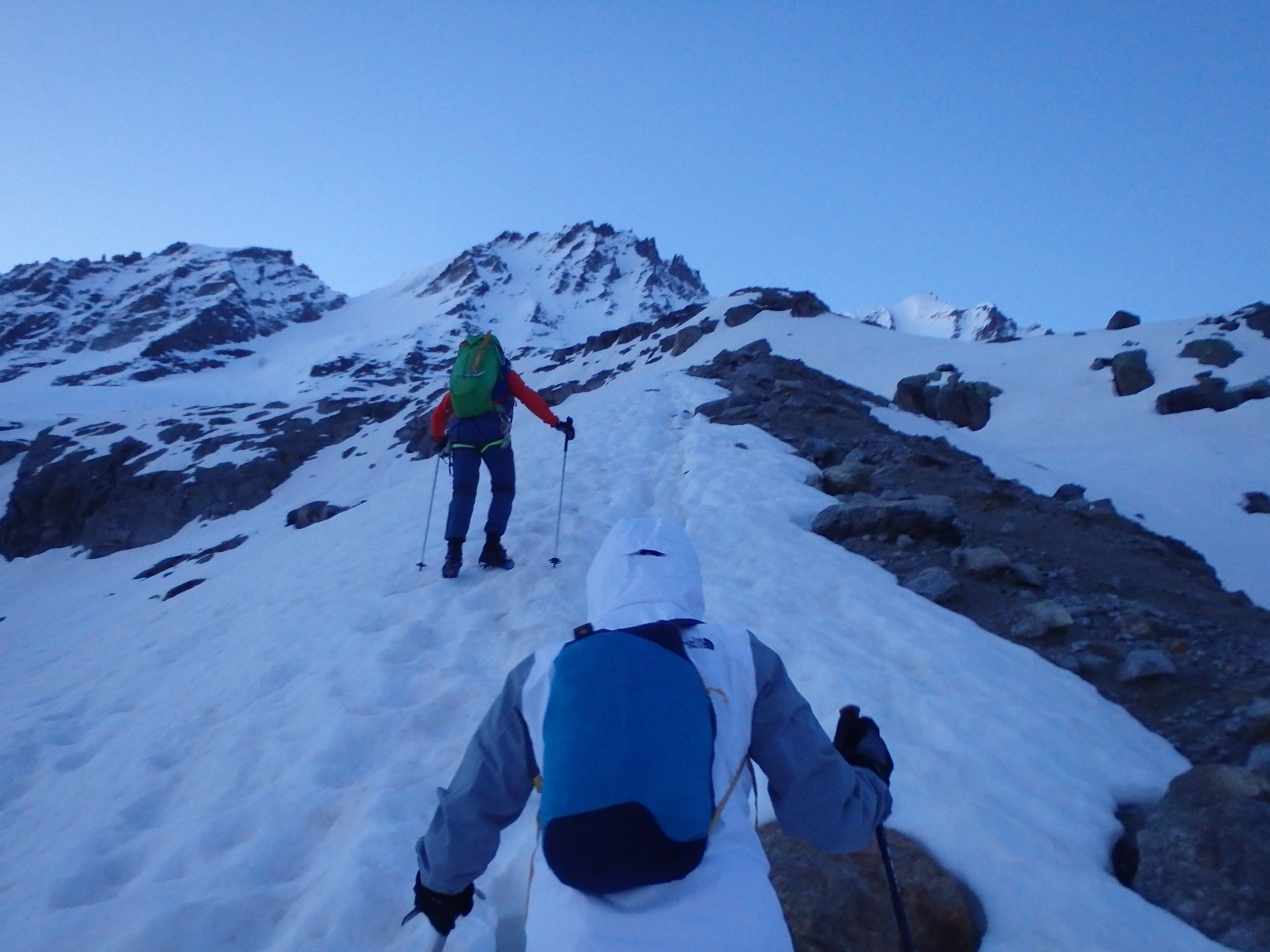
We were able to kill the headlamps quite early, but would remain in the cold shade of the north face all morning. Moving up the moraine, we dropped on to the glacier well above many of the fractured crevasses lower down, and roped up for the day, a thin 8mm ~40 meter Beal rope, with Marco leading, Holly tied into the middle on a clove hitch, and me at the anchor. The crevasses halfway up the glacier were basically completely buried this early in the season, out of sight and out of mind for Holly, who was the most worried about them. The track through the snow headed straight up the center of the glacier skirting some of the larger, less hidden crevasses when necessary.
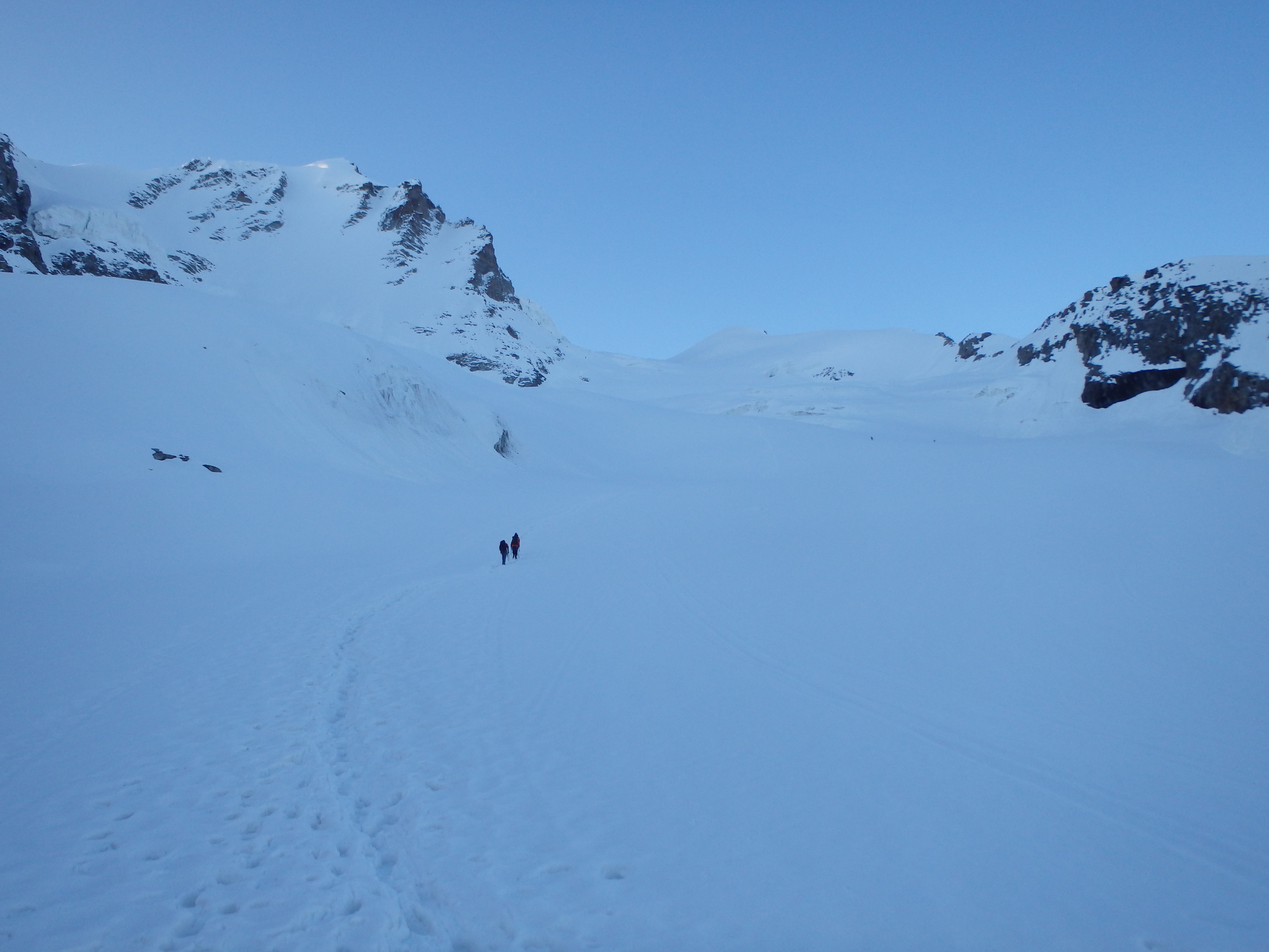
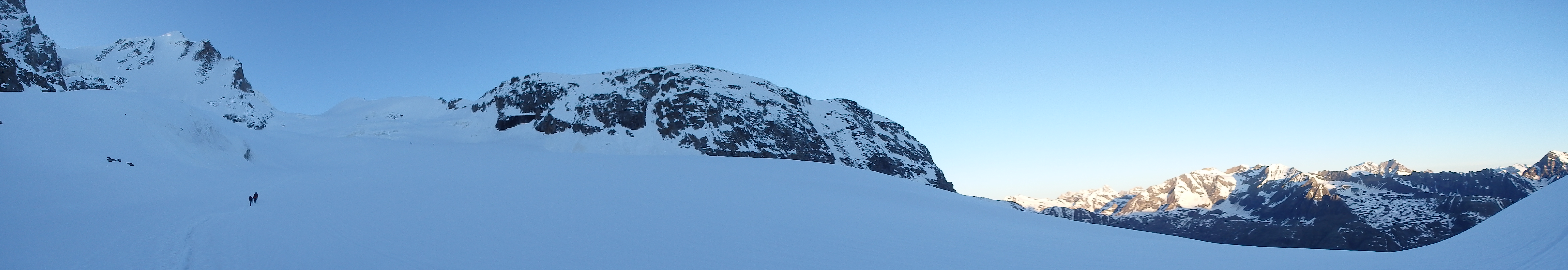
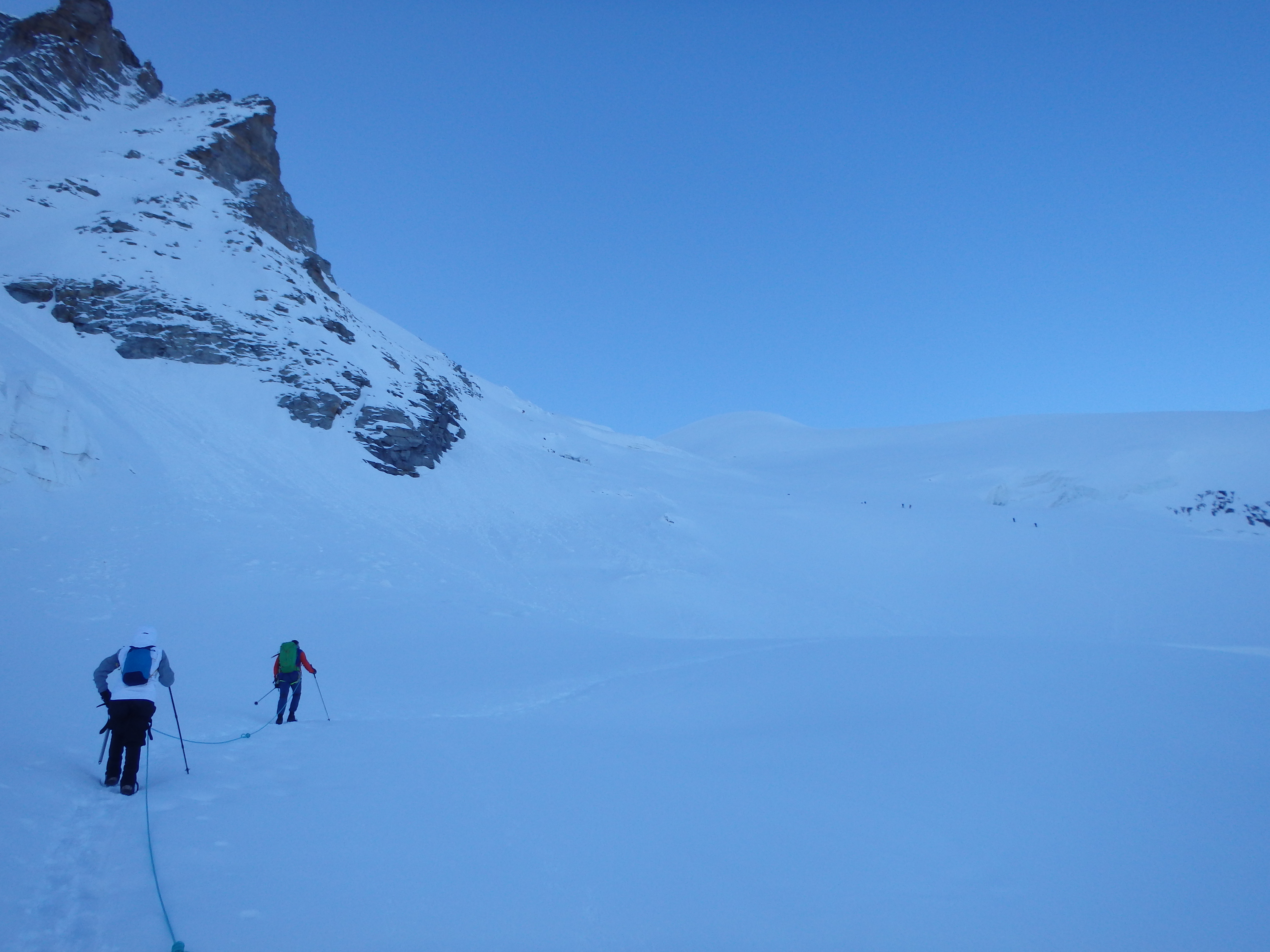
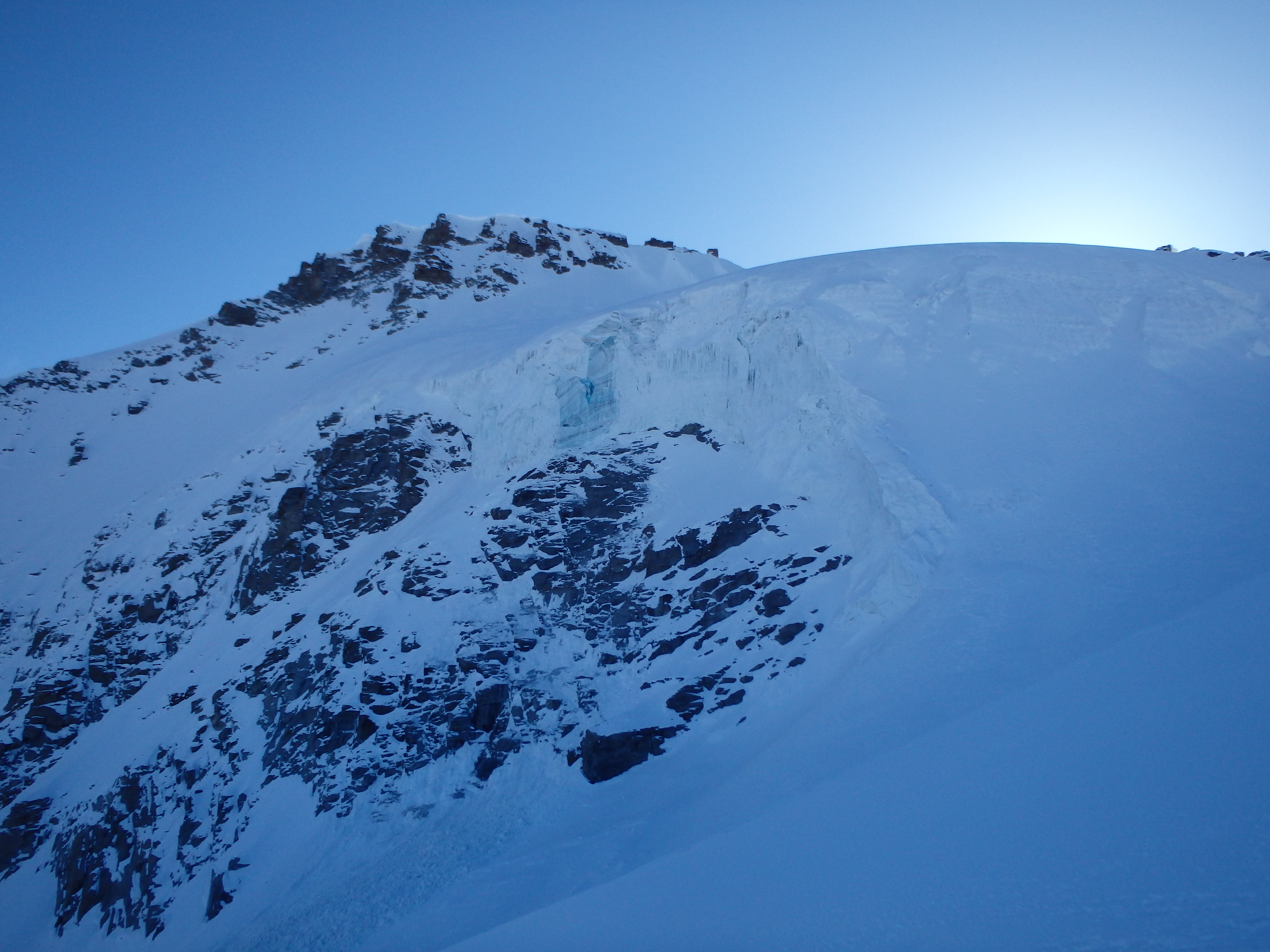
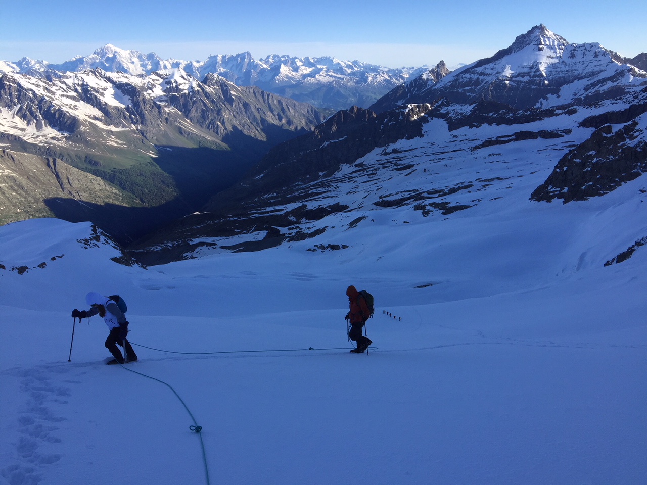
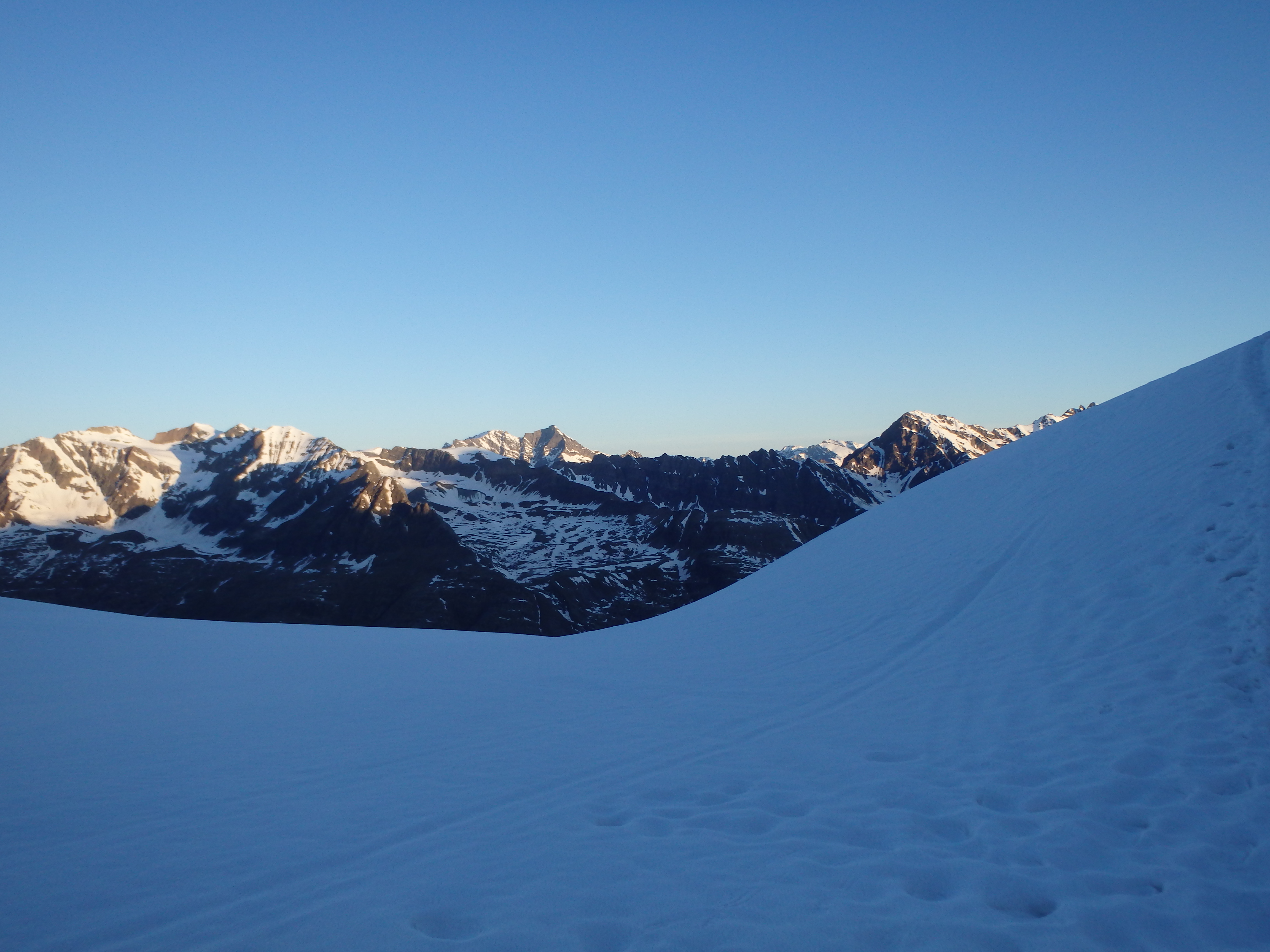
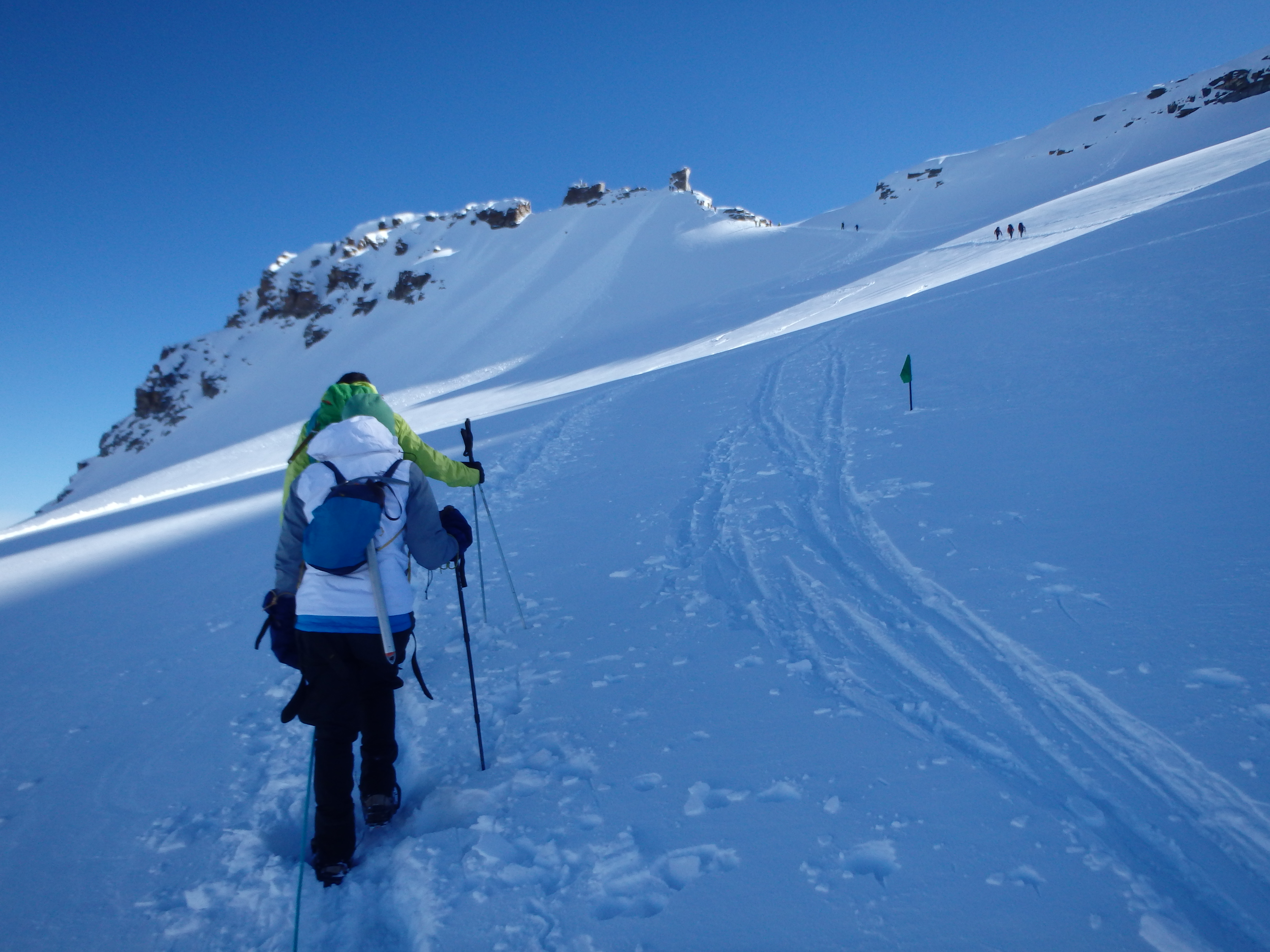
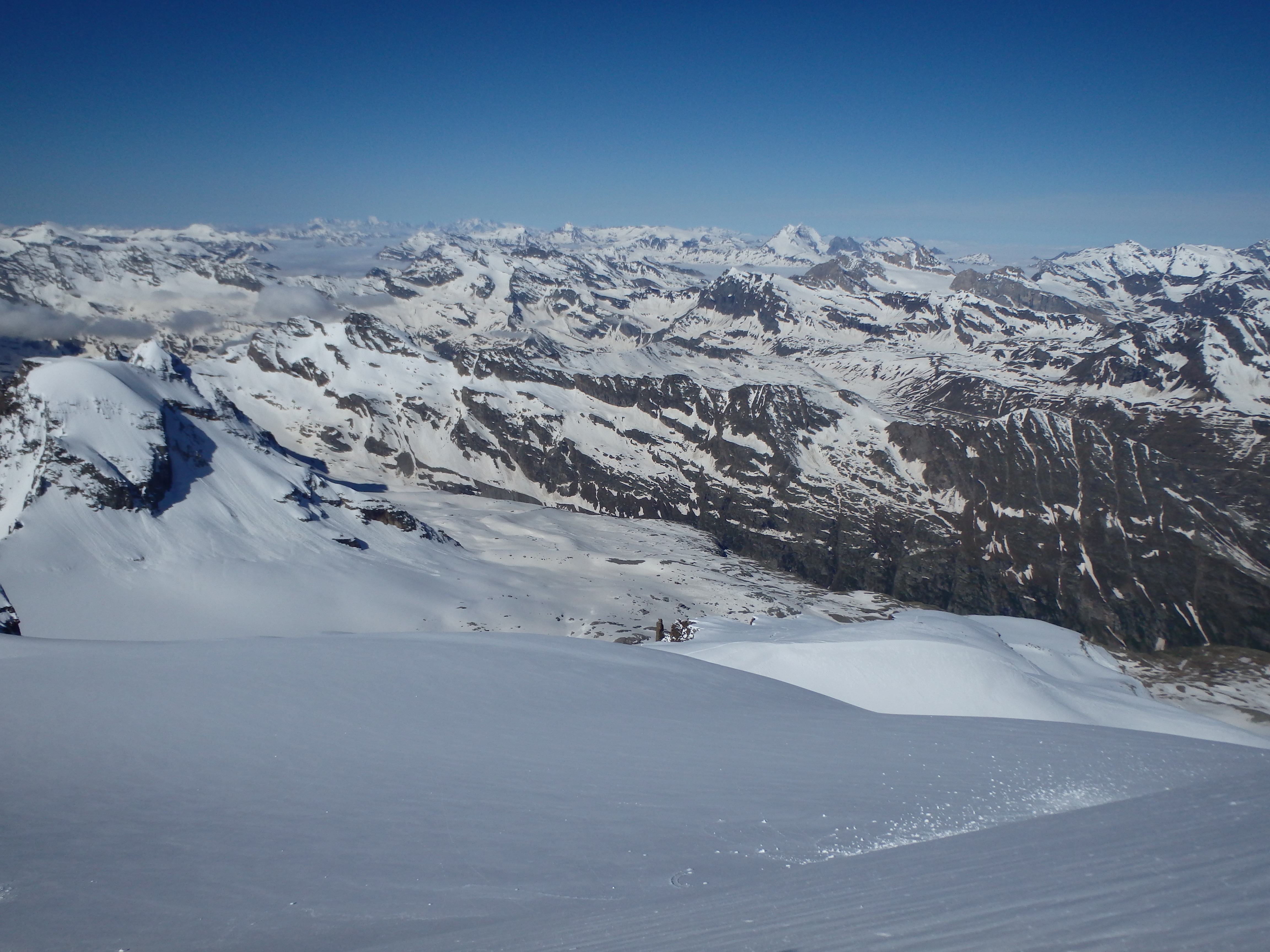
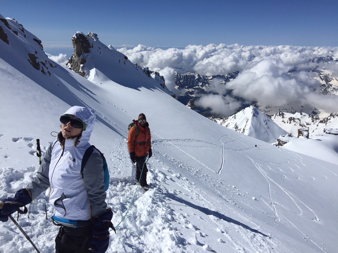
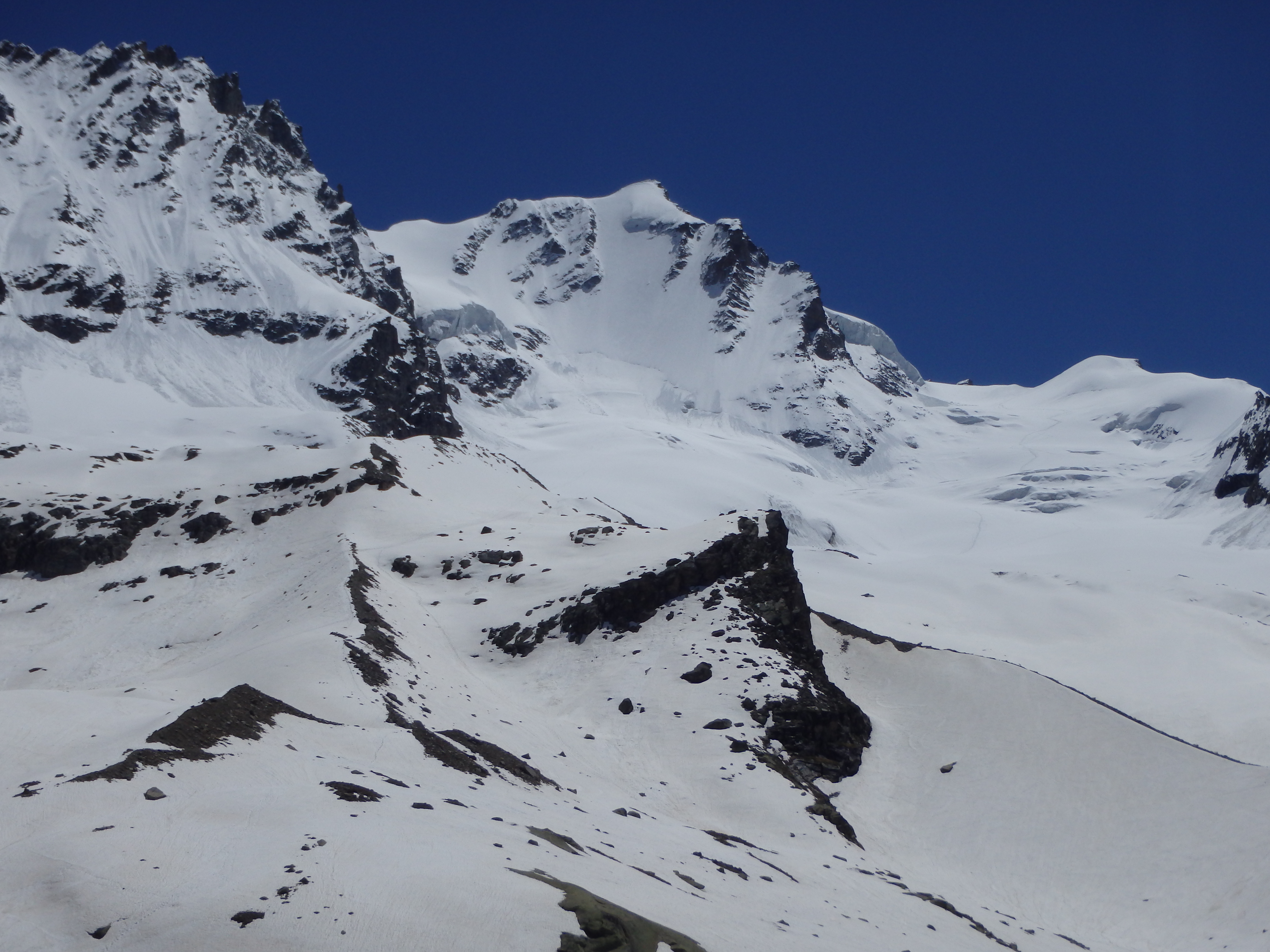
The pitch steepened considerably after the first ~1km on the glacier, and Marco set a pretty fast pace up for two unacclimated rookies. About halfway up, Holly called for a stop, her hands numb from the cold. She took off her gloves to find both hands mottled and numb, her light ski gloves with liners not cutting it in the cold. Marco thankfully had some heavy duty alpine mits for her to wear, and he graciously gave them to her, her hands warming up almost immediately. The mits would make holding an ice axe much more difficult, but we were soon above some of the steepest terrain and hit the warming sunlight for the first time that morning about 1 hour below the summit. From there, we could see a line already forming along the summit ridgeline scramble, which can be a bit of a bottleneck for the many groups climbing. We cut across a shallow col to a slope below the summit ridge, which while not quite as steep, had a significant amount of fresh and loose snow, slowing out progress and draining our energy quickly.
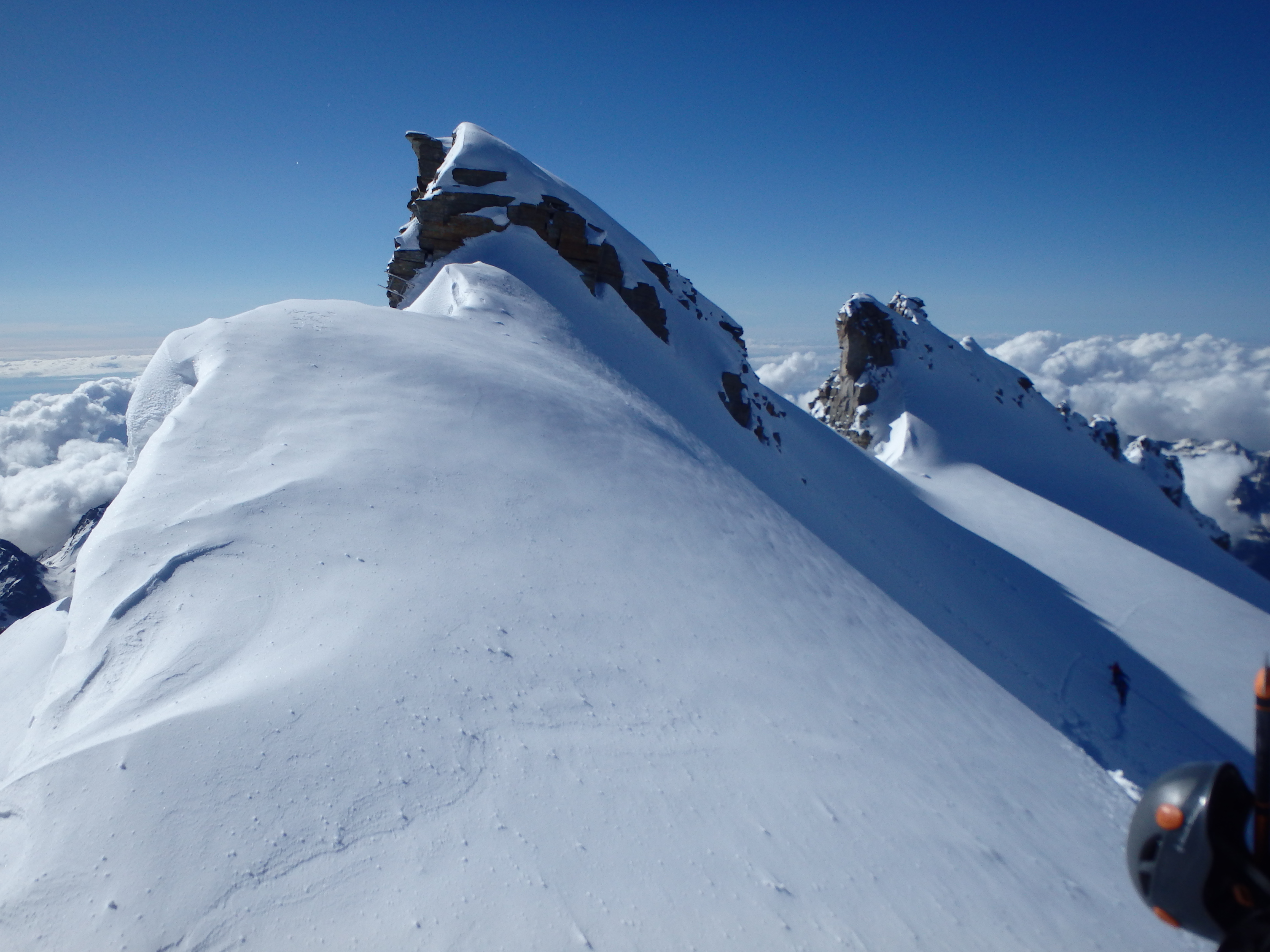
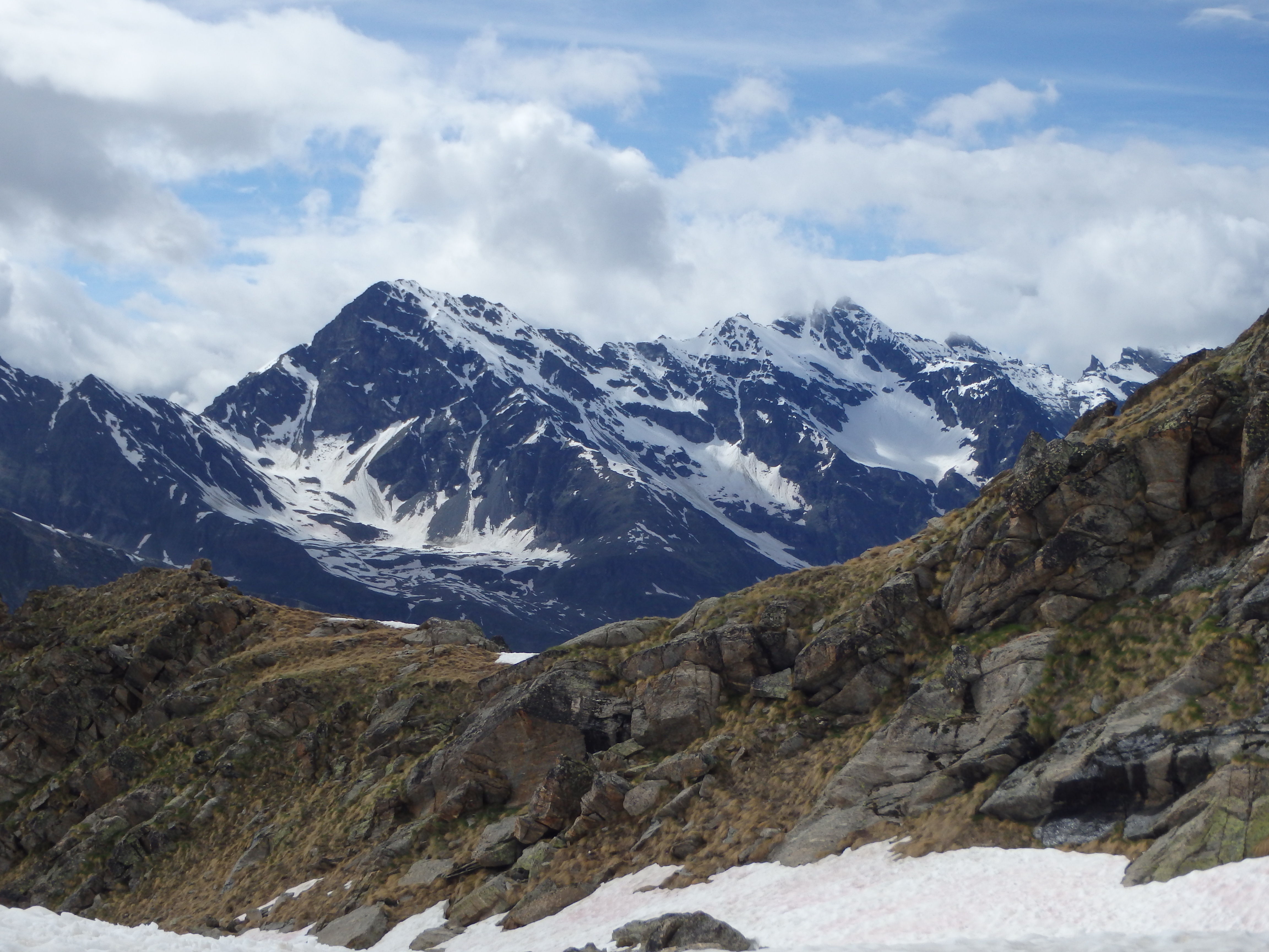
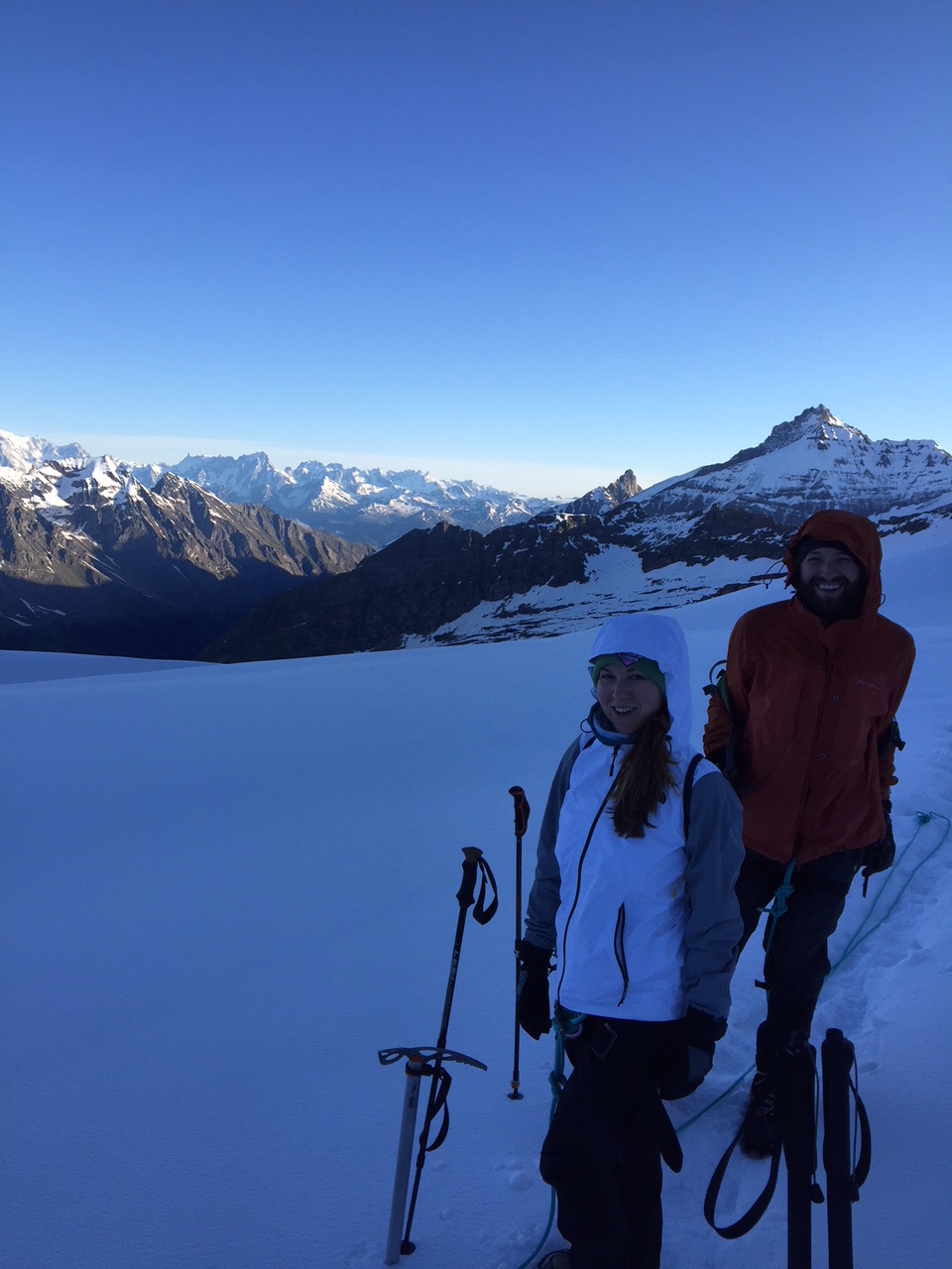
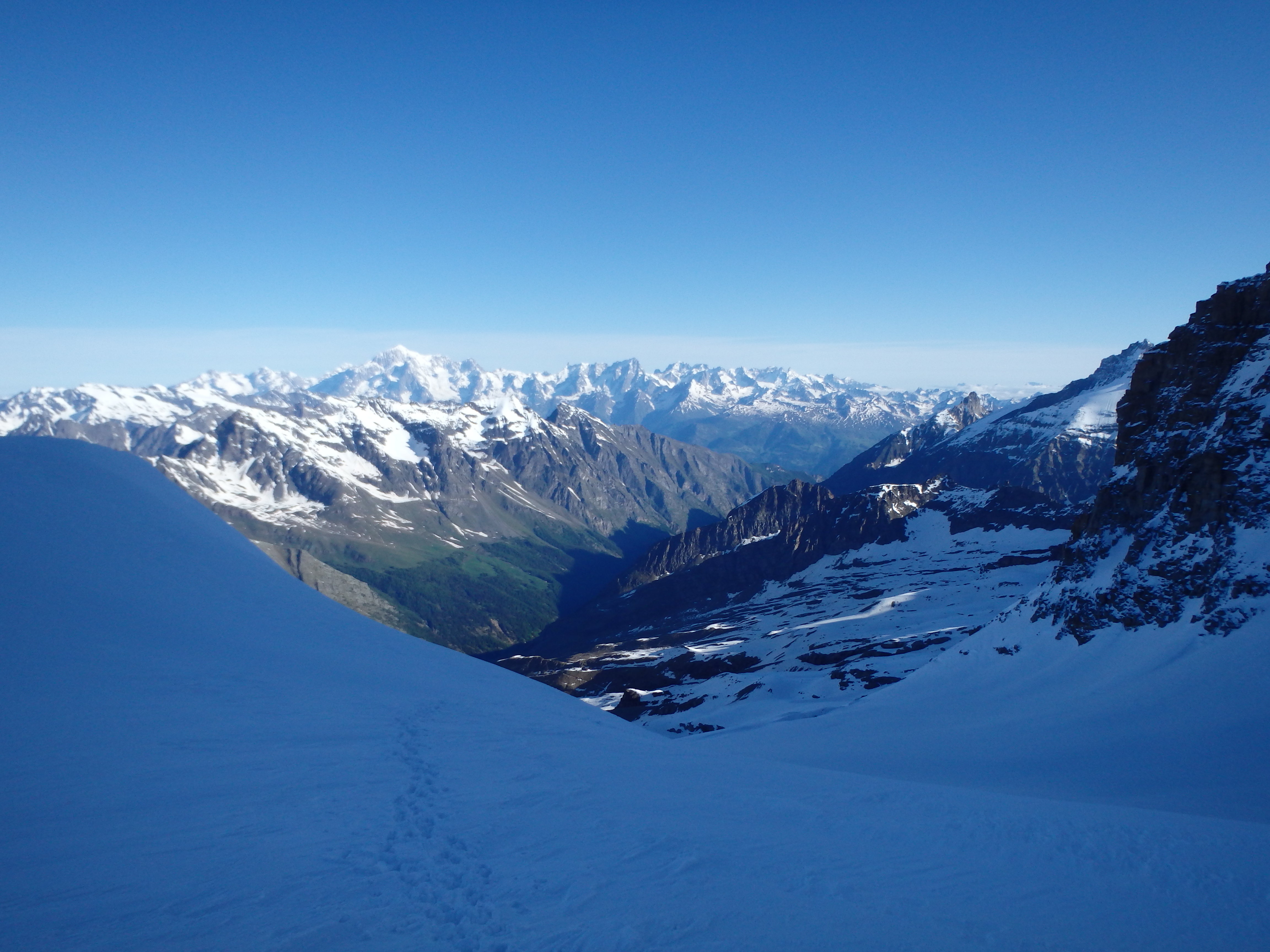
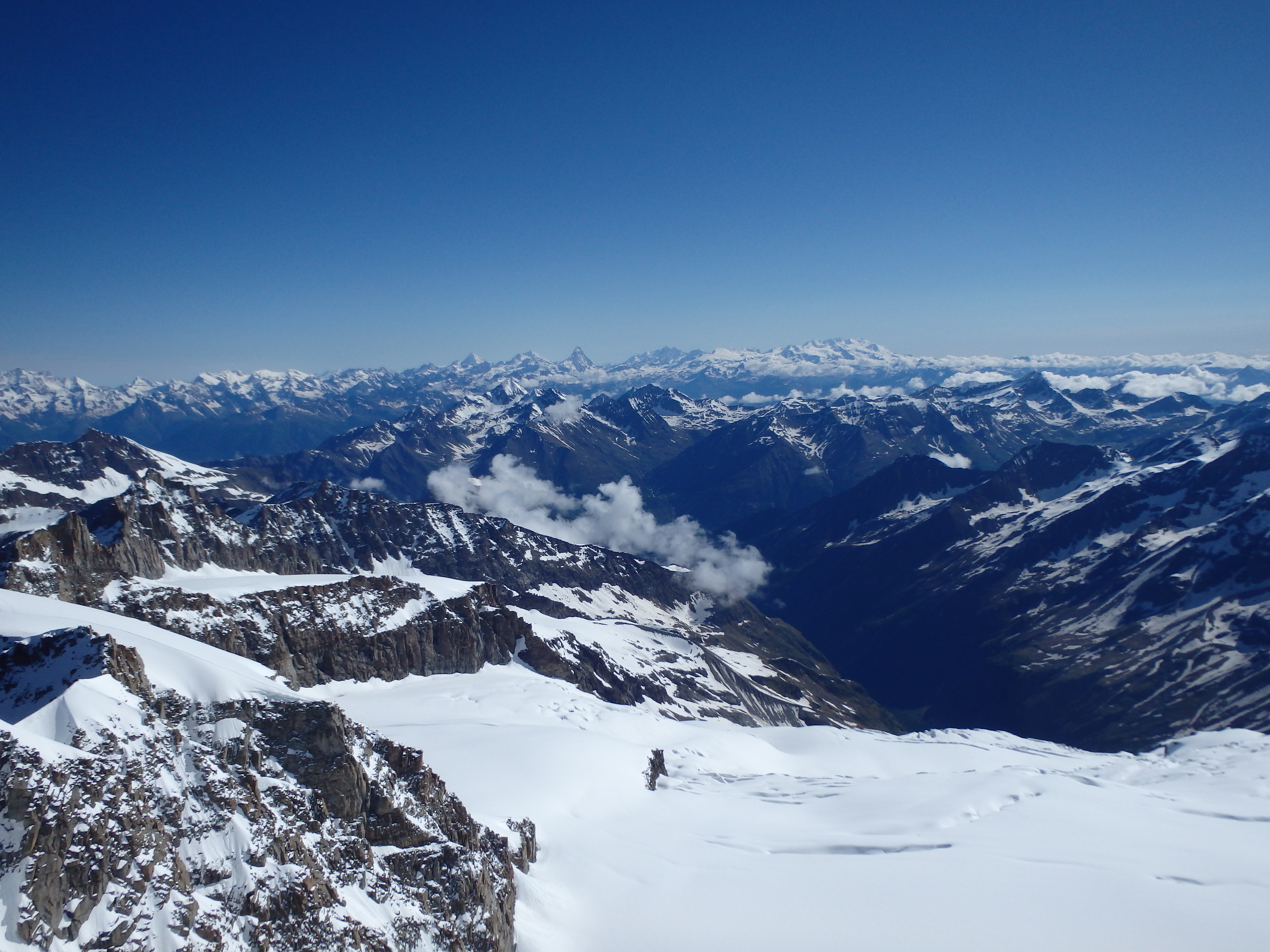
We trudged through the deepest snow only 15 minutes below the summit, and stopped to drop our packs and poles at a final shallow saddle before the scrambling began. This spot had some of the best views of the day, with Mont Blanc, the Matterhorn, Breithorn and Monta Rosa all visible from the highly corniced saddle.
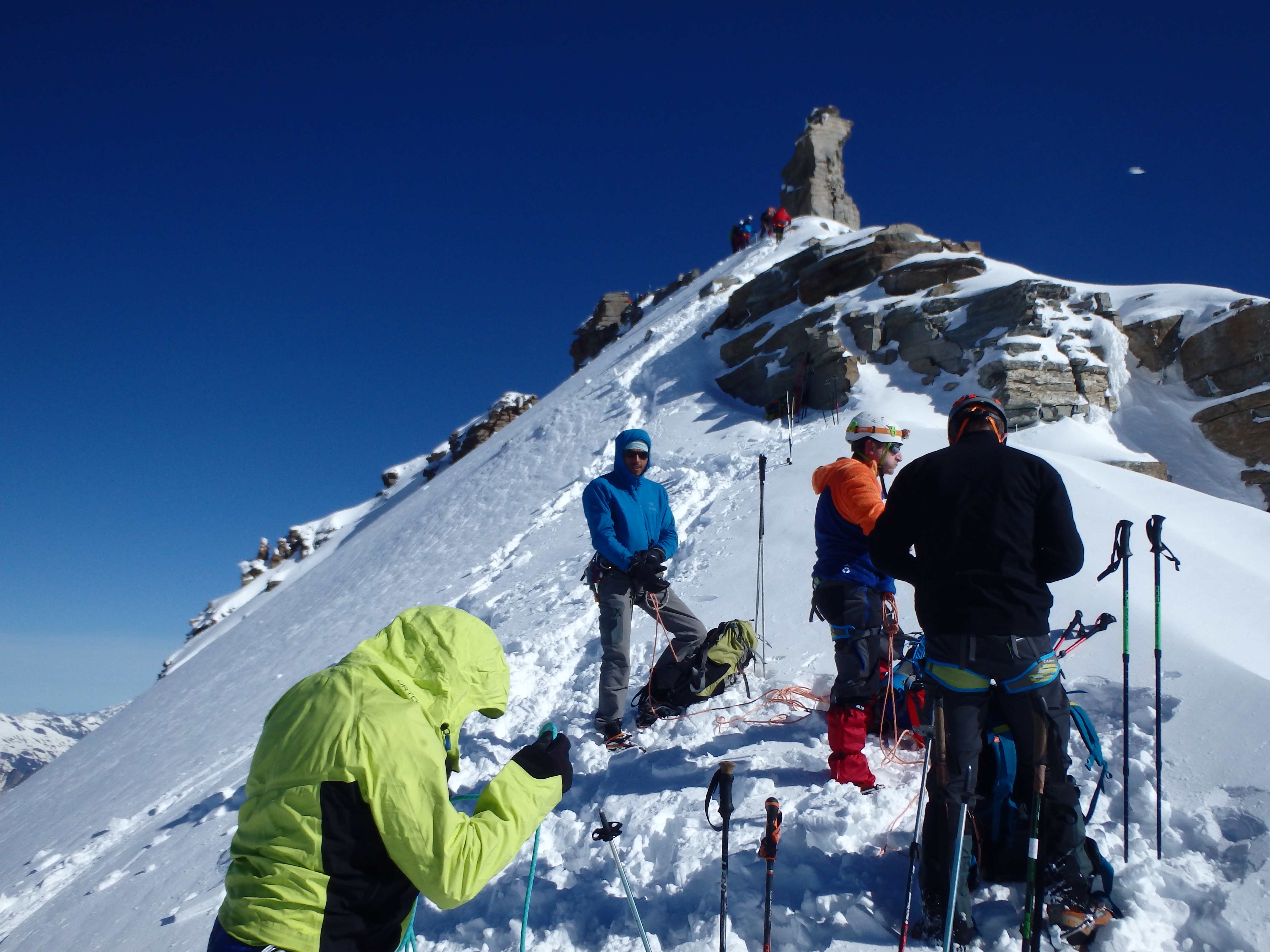
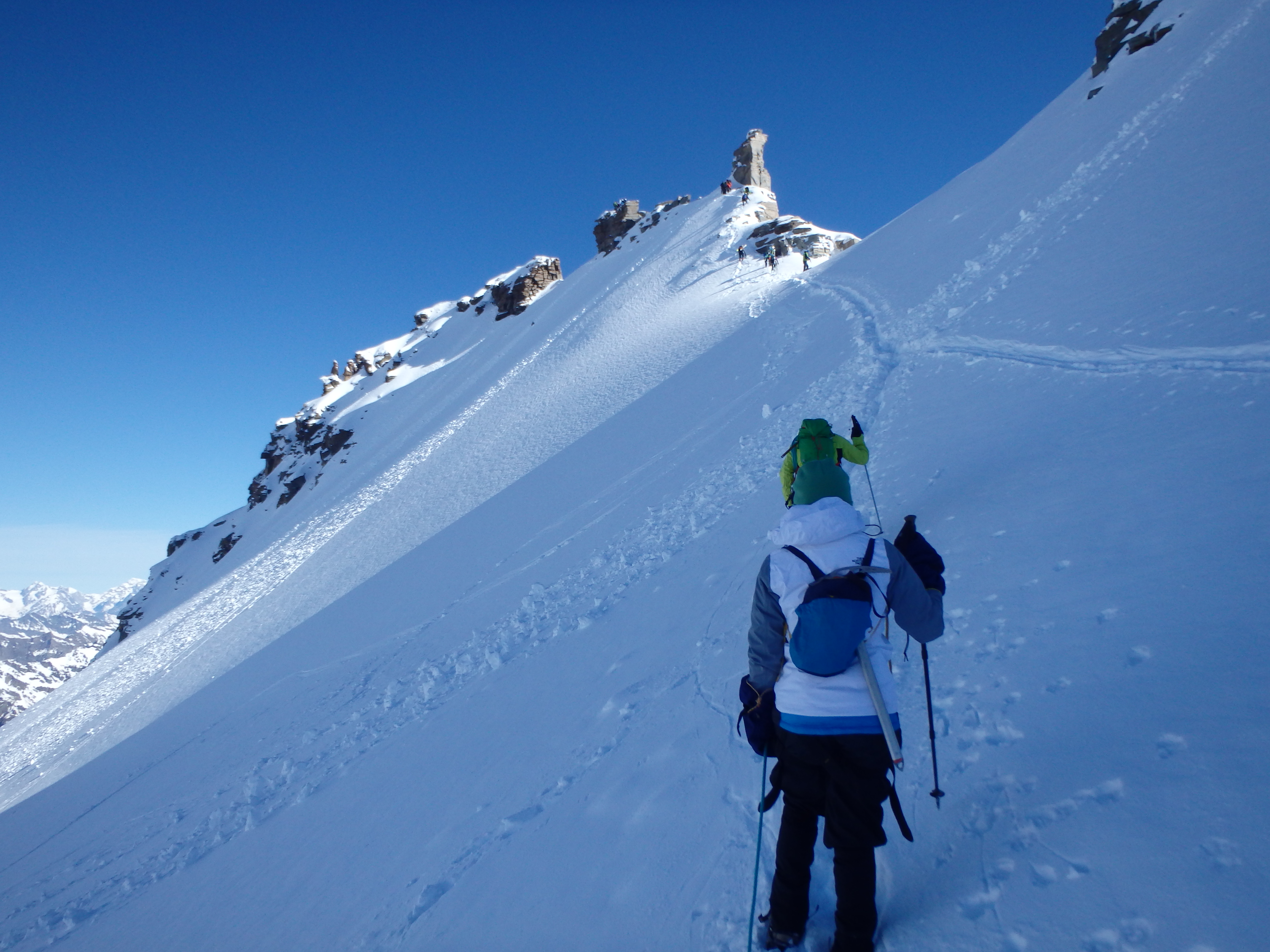
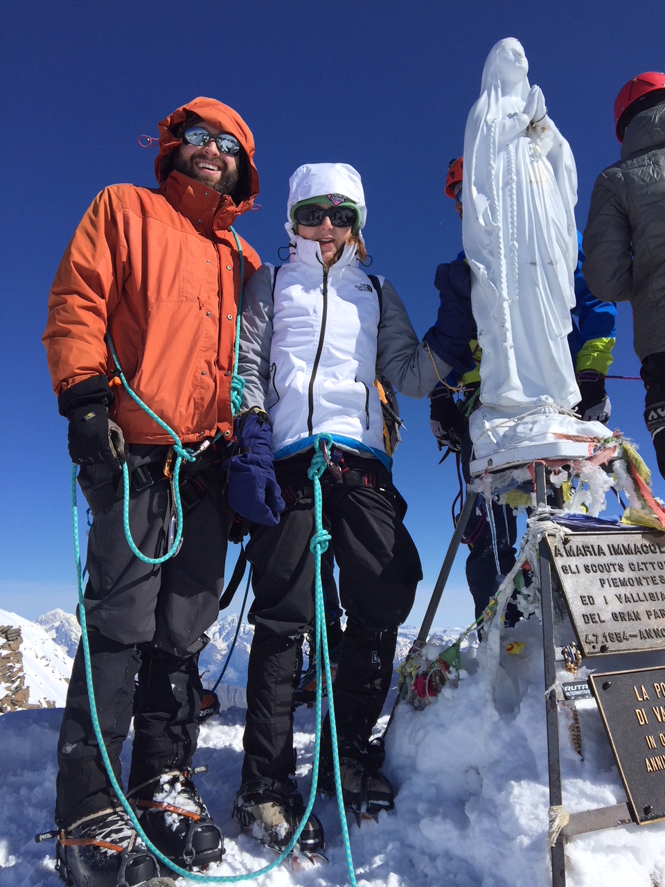
Ditching our gear, we started up the final arete, made more challenging by the soft loose snow and the various groups passing us, often at inopportune times. The snow arete topped out near some exposed rocks, the Madonna Statue at the summit looking close enough to touch. All that stood between us and her was an exposed, French Grade II-III (low YDS fifth class) traverse of only a few meters around a bulky rocky gendarme. Holly was pretty freaked out by the exposure, with the ice, crampons and heavy duty mittens making the straightforward 5 meters of traversing significantly more difficult. This section was protected with three bolts, which required some clipping and unclipping as Holly worked past so I could follow.
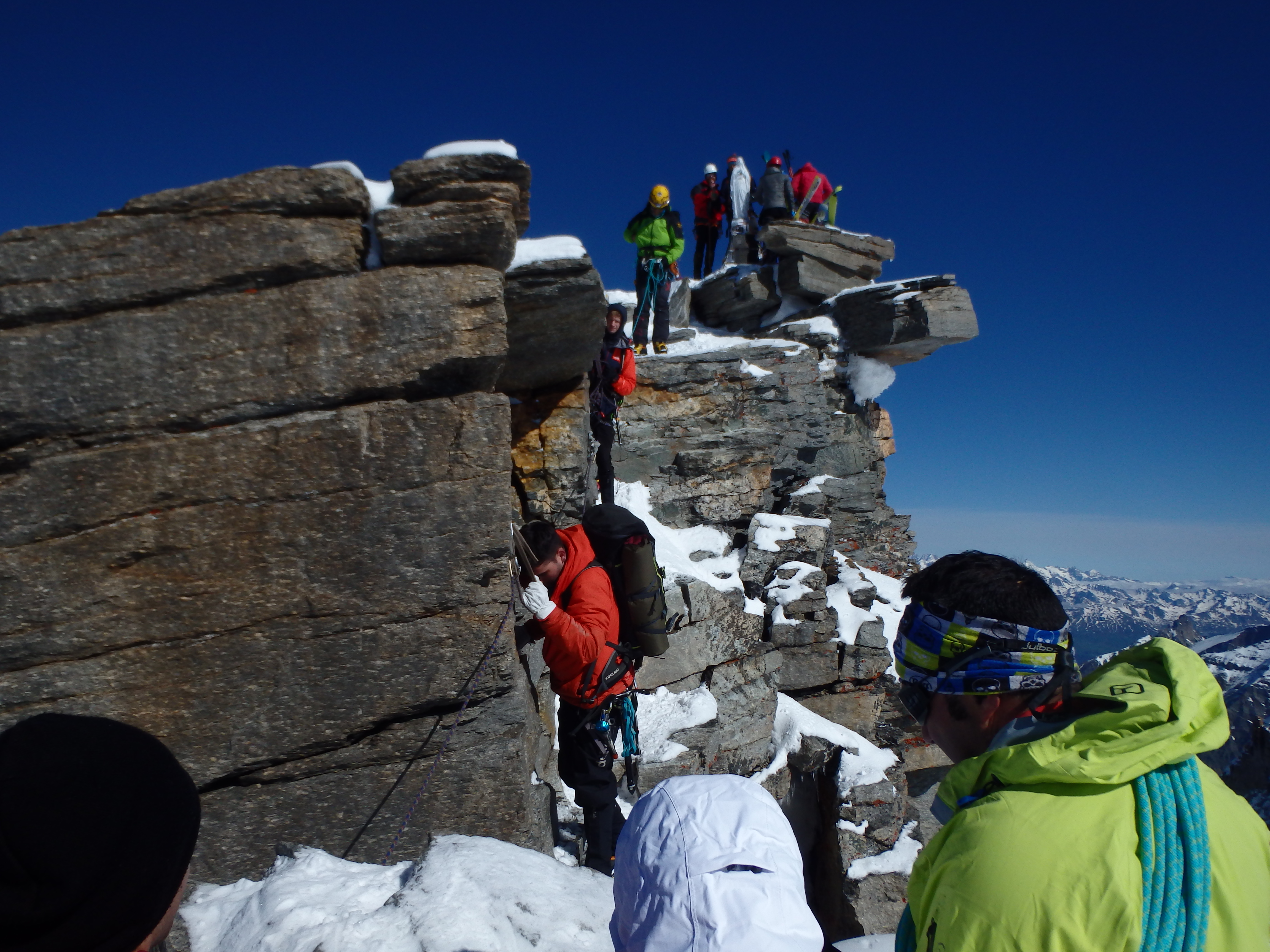
Just past this short crux was a quick ramp, and just like that, we had reached the summit. The Madonna statue took up half the summit space, and with another group on top we barely had enough room to take a victory photo and shoot a few pictures before heading back down the summit ridge.


The soft snow became an ally for the descent, and we quickly plunge stepped back down to our gear and continued down through the powder. There was no longer a need to switchback across the slope, and I led us down in a straight line with easy steps in the snow.


We remained roped together through the glacier given the crevasses, and the lower portions of the glacier were a bit too soft, with plenty of post holing near the end of the descent. We unroped once back at the moraine and removed our crampons at the final snow basin.

I glissaded down into the basin, dropping the last 100′ in less than a minute. Holly was a bit too afraid having never glissaded before, and opted to hike it down, taking quite a bit longer. From there it was an easy hike back to the hut, finally out of snow for the first time since leaving that morning.

After ripping off my heavy mountaineering boots, I headed straight for the bar for a pair of beers and home made pie to enjoy on the picnic tables outside the hut. We took our time with the drinks, enjoying the views of the summit from the hut (which had been obscured by clouds the day before) as well as the victory beer. But the descent was only a bit over half completed, and we didn’t linger too much longer before packing our things and continuing down the trail. While we were happy to be done with the snow, Marco insisted we continue down the various soft patches in the interest in saving our knees, and we didn’t completely finish with the white stuff until we left the upper basin.


Although still quite a ways to go, the remaining descent down the trail wasn’t too bad, particularly once we were back in the shade below treeline. We parted ways with Marco at the trail junction; he would wait there for another set of clients to climb the mountain the very next day. As with any hike, the last 500 meters of descent seemed to go on forever, and we passed many groups just starting up for an ascent that weekend. The lot was overflowing with cars by the time we reached the trailhead, and it seemed we had hit the mountain just before a busy weekend of good weather. From there we drove out of the valley and checked into a nice hotel outside of town, then headed into Aosta proper for a celebration of our success with pizza and pasta.
Beautiful pics. Looks like an awesome,adventurous trip!