
Mount Hoffmann 10856′
Total Time: 3 hours
Roundtrip Mileage: 6.3 miles
Elevation Gain: 2200′
Crux: Class 1
Companions: Justin Shelton
Trailhead: May Lake- trash, pit toilets


Day 4 was supposed to be the big dayhike of Split Mountain, allowing Justin a chance to acclimate before the monster dayhike, and not killing ourselves right before the wedding. But with lingering rain over the past two days, we thought it would be best to direct our efforts on a more reasonable summit rather than find ourselves 3000′ above treeline in the middle of a thunderstorm. The question quickly became, what would that reasonable summit be? With the unstable weather, anything too tall would leave us exposed above treeline for too long. So after much debate, we settled on an easy day on Mount Hoffmann. Sitting over Yosemite’s May Lake, Mount Hoffmann is one of the few alpine/ subalpine summits in the park that offer views into Yosemite Valley. It also sits in roughly the geographic center of the park, offering 360 views in all directions. Furthermore, it was another California 2000′ prominence peak, our second in two days.
We left Mammoth after breaking camp shortly after sunrise and stopped into Whoa Nellie Deli at the intersection of the 395 and Tioga Pass for a packed lunch for the summit. There were some small lingering clouds to the south as we rolled through Tuolumne Meadows, but for the most part the skies were clear. The parking lot at May Lake was only half full, and after taking a few steps down the wrong trail at the end of the road, we set out on the well traveled trail to May Lake.

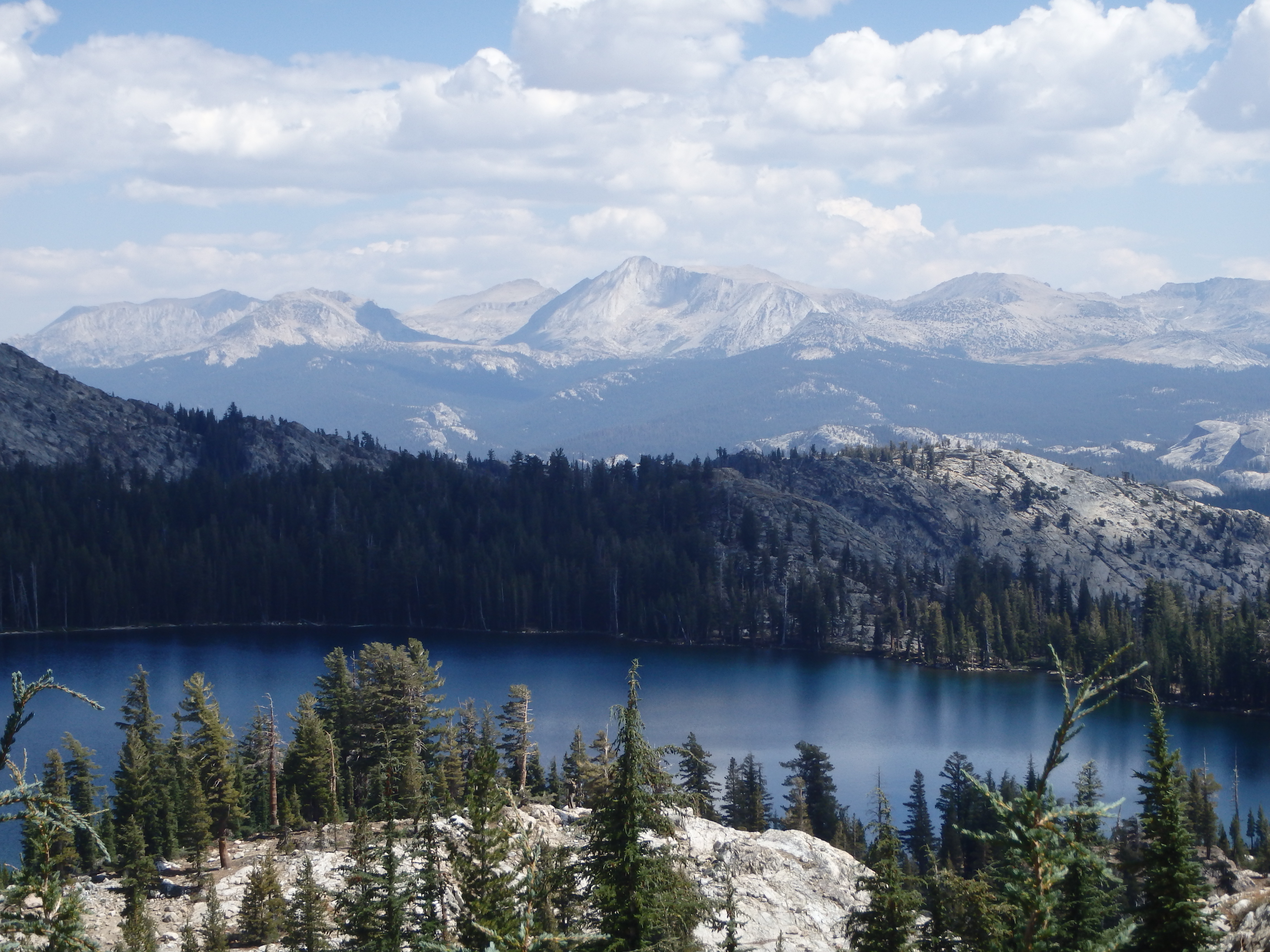
This was yet another new trail for me, and with only 1.1 miles between the trailhead and May Lake High Sierra Camp, we found ourselves at the lake in less than 30 minutes. There were a number of campers scattered around the lake, and we stopped along the shores to size up Mount Hoffmann, reflecting perfectly off the calm lake. From the lakeshore, the trail up Hoffmann continues along the south shore into a small depression between the summit flanks and a rock outcropping. We remained in trees and started switching up the broad south face, views of Yosemite Valley beginning to open up to the south.

As we left the trees and started up the granite slabs and benches, we would intermittently lose the trail, ultimately picking up another shortly there after. Although the trails to the top were not maintained, the hike is so popular that there were a number of use trails that braided the southern slopes from decades of hikers. We could see two other hikers on the slopes above us and disappear out of sight as the trail breaches a broad sandy plateau between the lower east and higher west summits. As we reached the plateau, we could see the true summit with a small antennae at the top.


The trail took a more direct course to the summit rocks, and I talked Justin into scrambling up the remaining bit of rock along a more direct course along the north face to keep things a little more interesting. The exposure to the north was actually quite impressive, but the scrambling was straightforward and shortlived, and we topped out after a little over 2 hours of hiking.

We cracked open some 395 IPAs and sat back to enjoy the views. The views south to Yosemite were particularly impressive, with the North Face of Half Dome and much of western Yosemite Valley in plain view. To the east, we could see Mount Conness, our climb from the day before. To the north was 10 Lakes Basin and Tower Peak further in the distance. The clouds were already building quickly at the early hour, vindicating our choice to skip an attempt on Split Mountain.


After finishing our beers and sandwiches from Whoa Nellie Deli, we scrambled the ridge south to get a closer look of Hoffmann’s Thumb, a prominent rock spire just to the south of the true summit. I decided I would need to come back with some gear to climb it someday. After lingering as long as reasonable, we headed back across the sandy plateau back to May Lake, passing dozens of groups on their way up.
The clouds were building quickly across the high peaks, and we decided to join our friends back in Mammoth to explore some of the hot springs along the Eastern Sierras while the lightning raged in the mountains above.