
Mount Morrison 12,241′
Total Time: 7 hours
Roundtrip Mileage: 7.8 miles
Elevation Gain: 4600′
Crux: Class 2-3
Companions: Justin Shelton
Trailhead: Convict Lake- trash, water, toilets, general store


My final day of peakbagging in the Sierras was a summit I had been eyeing for a very long time. Mount Morrison is a prominent summit of the Eastern Sierras, its North Face striking from the 395 on the drive up to Mammoth. Perched over the famed Convict Lake, Mount Morrison is named in honor of Robert Morrison, a member of a posse pursing a band of escaped convicts from Carson City that holed up in the canyon. With Convict Lake a year round resort, Mount Morrison is easily accessible any time of the year, and can be done in only about half a day under optimal conditions. We camped at Convict Lake campground the night before, and woke up shortly after sunrise for our ascent. After breaking camp, I drove along the access road alongside the lake to look for a use trail to start up the brushy slopes to bring us to the east face. Finding no such trail, I parked in a random spot and we immediately started bushwacking our way up several hundred feet to ultimately make our way into the shallow drainage next to Mono Jim Peak.
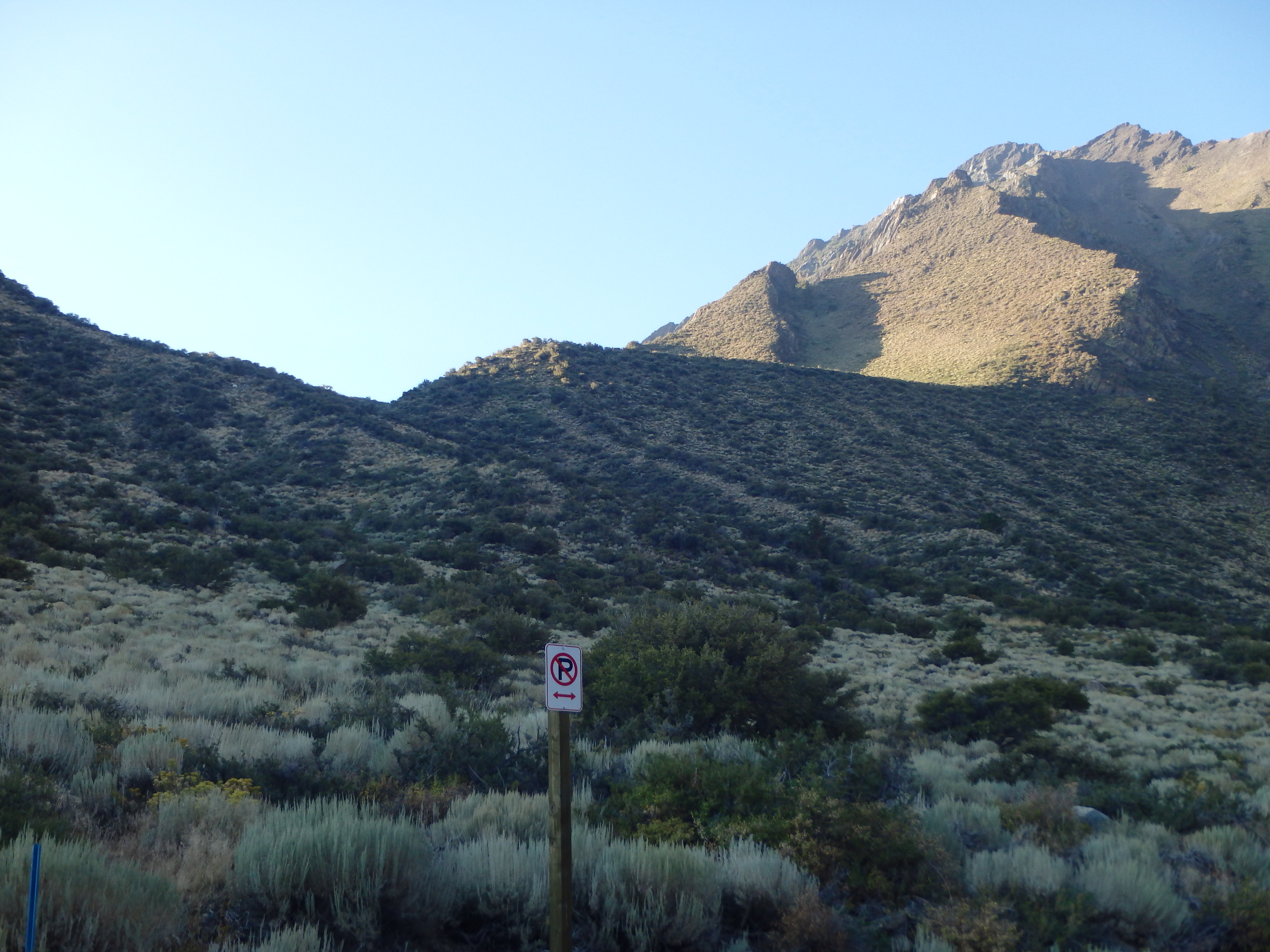
We tried to use faint deer trails among the brush but would quickly find ourselves knee deep in sage and desert scrub with nothing resembling a trail to follow. We were about halfway up the initial steep section when we found a more reasonable trail that brought us the remaining distance to the start of the hanging valley and an old road that dead ended at that spot. The parts of the road I could see were in good shape with recent tracks, leading me to believe we could have saved ourselves 30 minutes of shredding our legs with a bit of extra driving the night before. Once on the road, things got much easier. A use trail continued from the road and cut into the rocky drainage along the base of Mono Jim Peak.


This section was very pleasant and we remained in the shade as we slowly climbed higher along the bottom of the brush free drainage, the rock being mostly smooth slate. At about 9,200′, the drainage opened up into a higher plateau, and we continued upward to a small, dirty pond just below 10,000′. This was the only potential water source for the day, but was not the typical clear Sierra Lakes I was used to, and looked like animals had bathed in it somewhat recently, with prints along the muddy banks. We took a break here and surveyed the route above us. The summit was barely in sight, and we had steep talus slopes and what looked like a lot of loose class II to deal with.
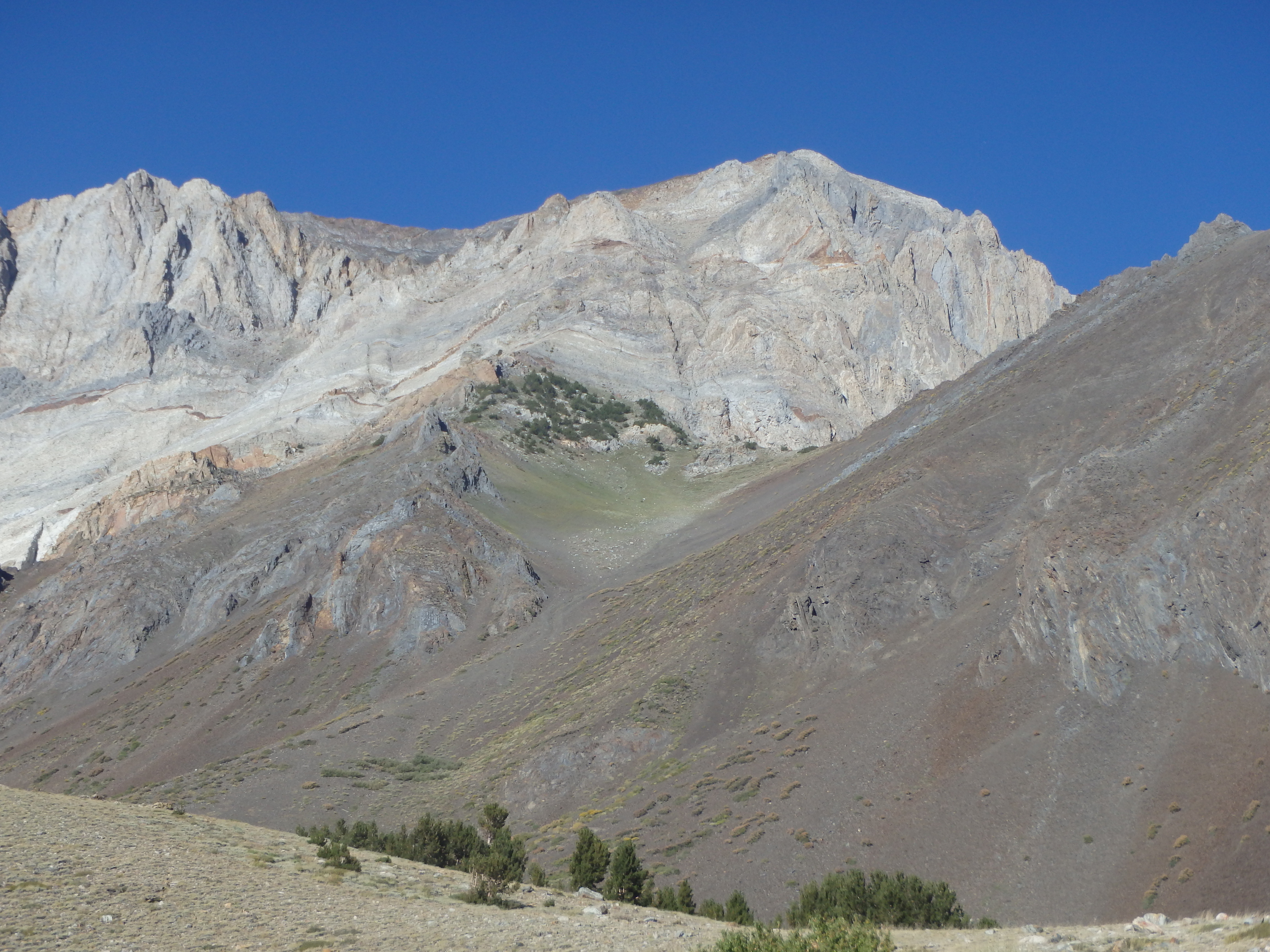

With our work cut out for us, we started up the initially grassy slopes, picking up a decent use trail that more or less headed to some scrubby trees just below the high saddle between Mono Jim Peak and Mount Morrison. Justin started to drop back for the first time all week; this was definitely the steepest sustained hiking we had been on in three days. I paused for him at the trees, and once he caught up, continued along the use trail up another 200′ to the start of the talus.
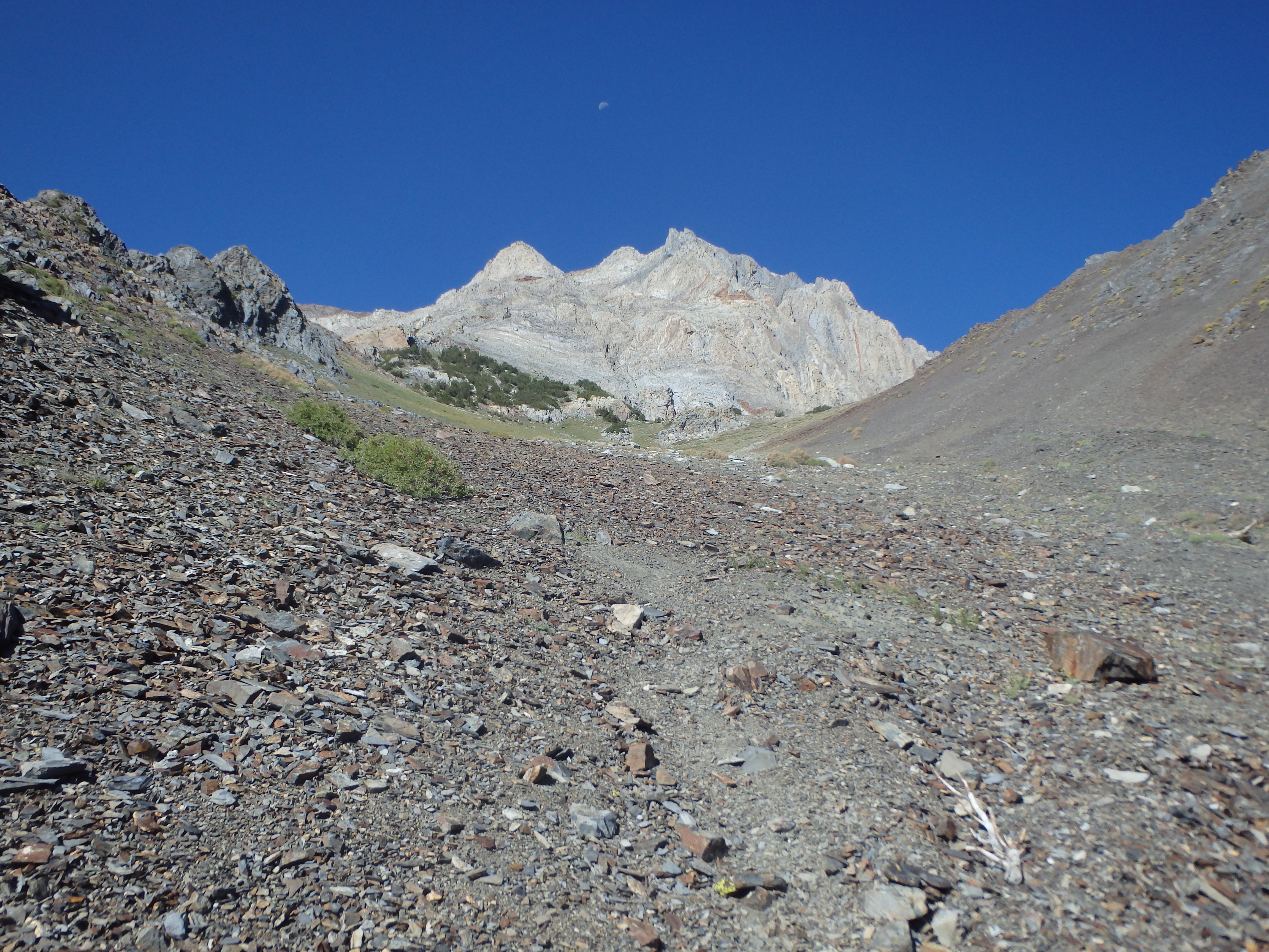

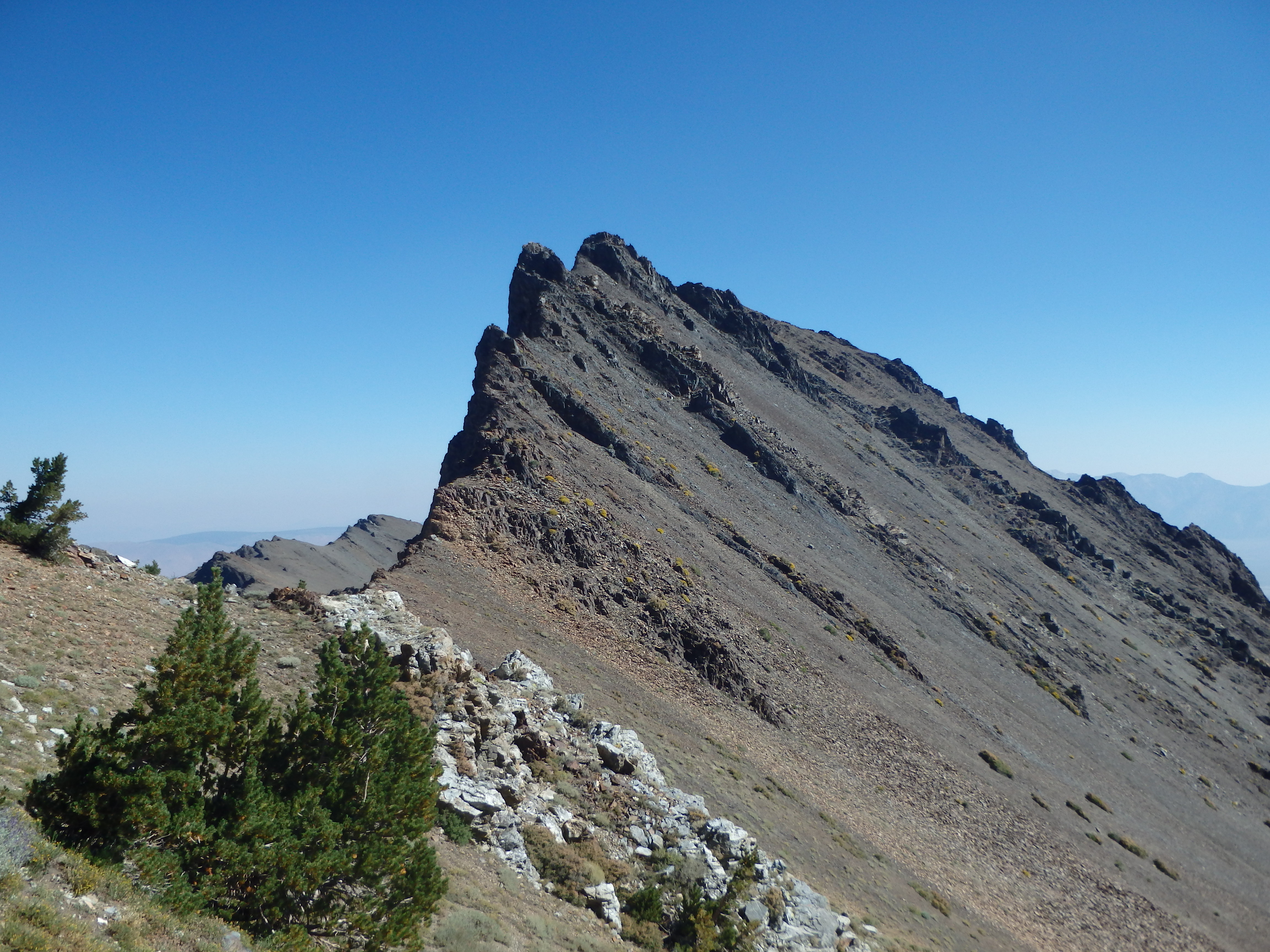
This was where route finding would become a bit more critical, and the route heads directly upslope to a small gendarme and cuts right, entering a broad gully that gently curves to the right nearly to the summit. Sounds easy on paper, but the fractured, loose terrain was a bit disorienting as we continued upwards.

Justin was not far behind as I started up the talus and I paused once more at the base of the gendarme waiting for him to get to the edge of the talus to join me. Once he reached that spot I climbed past the gendarme and traversed right into the broad and loose gully. Justin was now completely out of sight, but given the loose scree, I wanted to maintain some distance so as to not send rocks down on him. So I slowly continued on, and reached a small notch at the top of the gully, the right continuing on to the summit, and the left dropping into a steeper gully back to the base. At this point, I had been out of contact with Justin for at least 45 minutes, and it seemed odd that he hadn’t rounded the bend into the gully yet. Around this time I felt a rumbling in my pocket and found Justin was calling. It seems at the base of the talus he had an emergency bathroom session, and having not seen me climb right of the gendarme mid squat, he had instead climbed to the left, and found himself in some loose class III-IV terrain. The gully he was in would ultimately meet up with the notch I was currently just above, and I told him to continue on, or if it was looking dicey, traverse right and into the easier broad gully I was in. Realizing he would be a while to catch up, and with the summit only ~300′ above, I figured if I was to wait, I might as well wait on the summit. I climbed the remaining distance, sticking to solid ledges left of the gully to bring me to the top. The views were some of the best of the week. To the southwest was an intimidating look of the connecting ridgeline to White Fang and Baldwin, with Red Slate looming in the near distance. To the northwest were a number of backcountry lakes near Mammoth, with Ritter and Banner on the distant skyline, Yosemite a bit beyond. Far to the south, I could see Mount Humphreys and peaks in the Evolution region. To the east, was Convict Lake and the White Mountains beyond.


I spotted Justin below, who had traversed into the proper gully but was still a good 30 minutes away. So I sat back and took my pictures waiting for him to join me, and we cracked a pair of Epic IPAs once he reached the top. I suspected he enjoyed the solid Yosemite granite over the loose volcanic talus in this section of the Sierras. But the views were hard to argue with, and we spent a long time at the top, over an hour for me, probably the longest I had spent at any summit, ever. To avoid any issues, we decided to stay close on the descent, or at the very least within eye sight at all times, and we dropped down the sandy ledges back into the talus heap below.

He seemed surprised at how much easier it was on the actual route, and we were back to the scrubby trees in about 30 minutes. From there it was a steep but straight-forward descent down the use trail back to the dirty lake, utilizing loose spots to plunge step down and save my knees. We took another short break to empty our shoes and trudged back down the drainage all the way back to the lake, no longer with the benefit of early morning shade. Hot and dusty, we of course wanted to rinse off in Convict, and having been up an down Morrison without incident, it only makes sense that Justin would eat it on the lakeshore in his flip flops. We rinsed off the grit and grime and headed back to Mammoth for some happy hour at Robertos (all day half off Margs on Wednesdays!) and the end to some solid days of peakbagging.