
The Obelisk 9704′ and Spanish Mountain 10,056′
Rock Climbing– California
Total Time: 3 day backpack (20:35 moving time)
Distance: 23.0 miles
Elevation Gain: 6700′
Crux: 5.7
Pitches: 5
Protection: 70 m rope x 2, doubles to #2
Companions: Holly, Jason and Laura Meade
Trailhead: Old Spanish trailhead, no services


The Obelisk is a subalpine granite dome on the boundary of Kings Canyon National Park. Overlooking Tehipite Valley and the Middle Fork of the Kings River, the summit has no easy route to the top, requiring technical climbing skills and a long backcountry approach. But with huge knobs and chickenheads studding the face, it is considered one of the premier backcountry adventure climbs in the Sierra. I had initially considered attempting it as a long single day strike, but could never find the right partner up for a 20+ mile day on bad trail for 6 pitches of technical climbing. But a weekend of childcare provided an opportunity to turn it into a backpack, and I had a few willing participants in Jason, Laura and Holly open to turn a single day sufferfest into an enjoyable 3 day backpack. I unfortunately couldn’t get Friday off, so the three of them got an earlier start on Friday while I snuck away as early as possible after lunch. While the three started at the Rancheria Trailhead to the north, I planned to utilize the old Statham/ Spanish OHV to the south. Although the road was still gated shut, I hoped to use my E-bike to burn through the first five miles quickly, getting to camp by dinner. It was shortly after 2 PM when I started out, biking the road easily enough with a little e-assist. I crossed a shallow stream at 0.7 miles, and the road very quickly deteriorated from there. The road was far steeper and rougher than I expected.


Between a 50-pound pack, a 70-pound bike, and my own weight, the bike’s battery never stood a chance, and I was soon pushing the bike uphill in full sun. I hadn’t realized that I would be climbing over 3,000′ in the 5 miles of dirt road. I almost considered ditching the bike, realistically not moving any faster than if I were just hiking on foot. But I got a break about 2 miles in, the road mercifully leveling off and allowing me to pedal for a little over a mile before the grade kicked up again. I was about 4 miles in when the road steepened and worsened again, and I found a spot in the woods to cache my bike for the rest of the weekend, locking it to a tree out of sight.


I hiked along the road, reaching a small camping area 5 miles in. It had taken me almost exactly 2 hours, marginally faster than on foot. There was a very faint trail leaving the campground along the ridge and I continued along, finding it a pleasant change from the hot and exposed road, with the views opening up to the south across Kings Canyon, as well as to the northeast as far as Mount Goddard. I followed the ridge for a little over a mile before trending right towards a high saddle north of Spanish Mountain just above Geraldine Lakes where I would be meeting the others for camp.


I dropped into the basin on easy granite slabs and flicked on my walkie talkie to radio the others. They were just reaching Lower Geraldine Lake, some car trouble and bad trail conditions slowing them down considerably. Although Lower Geraldine would be a little better base camp for the Obelisk, we hoped for less mosquitos at the higher Upper Lake and I dropped to the lakeshore, finding a nice campsite on the northwest side and beating the others by about 20-30 minutes. We had dinner, made camp, and game planned by the fire for an early start the next morning.

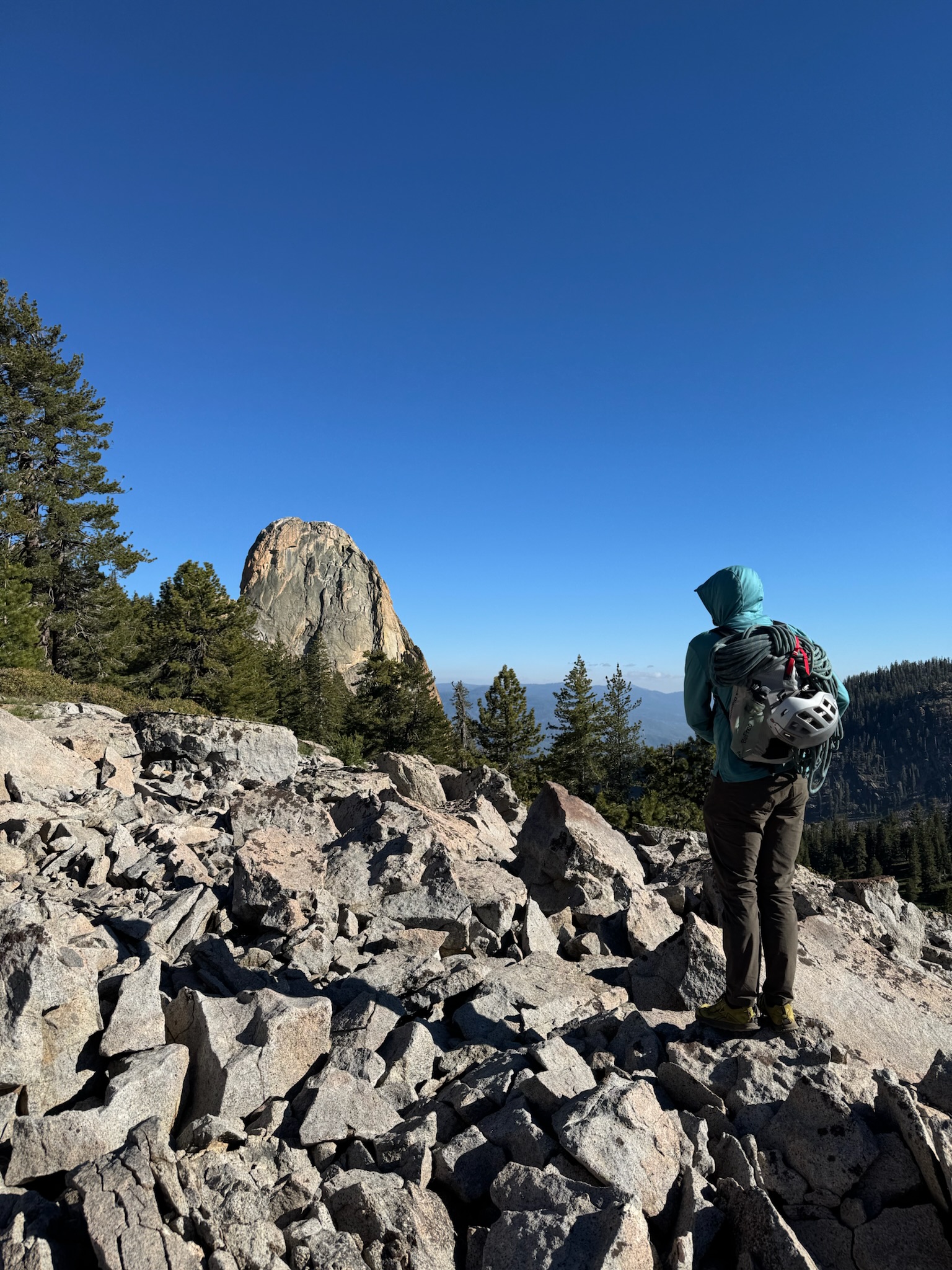
The birds woke us up before our alarms. A day before the summer solstice, the sun rose very early and I was up and out of the tent at 6 AM sharp. After eating breakfast, filtering water and organizing gear, it was 7:45 when we left camp. Our goal was to gain the shallow saddle between 9592′ and 9553′, requiring a trail less traverse that although looked like a gentle rise on the map, required a good deal of up and down across granite slabs and shallow water grooves. It took a little under an hour to reach the saddle, the Obelisk in view to the southeast for the first time.


I was unsure of what line to take to reach the base of the mountain, and elected to stay high above the brush, requiring some easy cross country through meadow mixed with boulder hopping across volcanic talus. Near the base, we needed to cross Tombstone Creek, still flowing with water despite the lack of lingering snow on the slopes above. Jason filtered a bit more water while I continued to the base, finding the last stretch to be painfully brushy with shoulder high aspens and bushes. I found a faint way through and worked my way along the base of the Obelisk to the West Face, finding the start at a deep chimney. I was surprised to find a rope hanging down the first pitch, someone seemingly needing to bail on the route. Jason would later pull it down and find it core-shot, suggesting someone took a tough fall and couldn’t complete the route. It was now 10 AM as I racked up for the first pitch, a bit behind schedule.

Holly belayed me as I started up on lead, looking for a quick exit out of the chimney on to the more featured face to my left. I found a series of horizontal cracks that offered both protection and good holds as I pulled around on to the face, immediately greeted by a sea of knobs and chickenheads. From there it was quite easy climbing, and I went as high as my 70 meter rope would allow to a ledge system between two opposing dihedrals.

I fixed my line and Jason started up behind me, towing a rope connected to Laura. We would then both be able to top belay Holly and Laura simultaneously, a system that allowed us to have multiple climbers moving throughout the day and allowed us to be rather efficient. It also gave me some excellent breaks after each lead as Jason climbed up to join me at the first anchor. Looking up, the second and third pitches seemed to be the route finding cruxes, and I could understand why. There was competing information on whether to exit the face between the two dihedrals right or left, as well as where to specifically do it.

I started up off the belay, finding the terrain a bit steeper than expected but still 5.7. I quickly encountered one of the bail anchors from the hanging rope, a single cam equalized with a nut. Other trip reports describe a large knob referred to affectionately as the “dongle” out right marking the escape, but I saw no obvious option. Continuing upwards, I climbed the face to just below a series of roofs, following a series of cracks around to the left with a broken and sloped ledge for a second belay. There was a perched boulder below the belay, and I set a redirect around it as Jason climbed up to join me on the fixed rope, the girls headed up shortly after. By now we had settled into a rhythm—I’d lead a pitch, Jason jug the fixed line, then we’d bring up Holly and Laura together.


This belay stance, although roomy for two, was quite cramped for 3+ and a pile of tangled ropes, and I started up the third pitch as soon as Holly hit the anchor. Very easy climbing off the ledge to the right allowed me to gain the main upper face, completely studded in knobs, patina plates. chickenheads and endless protection opportunities.


The climbing was likely never more difficult than 5.4, and I slung knobs for protection until hitting a larger ledge just below the final headwall. I realized I had probably combined the pitches 2, 3 and 4 into 2 long pitches, making up for some lost time at the start.

I knew this next pitch would have the only remaining fifth class climbing, with the final summit pitch rated fourth class. Traditionally, the route followed an angling crack and ramp out to the right around the headwall. But from below, it looked easy enough to climb the headwall directly, steep but just as featured as the pitch before. I started up, indeed finding it steep but manageable with one move that felt a touch overhanging, probably closer to 5.8. Above the headwall the terrain became more broken as you enter the summit rocks, and I needed to work around boulders and around grooves to a final pitch of low angled chicken heads. I tried to run it out to the summit, but came up about 30′ short with the 70 meter rope.


I made an anchor with slung chickenheads and quickly brought up the others, splitting into two formal rope teams for the final easy pitch. I placed a single cam in the final stretch before hitting the south summit, working across a notch and up a final short face to the higher north summit. I brought up Holly behind me and the two of us had a few moments to enjoy the summit together before Jason popped up not far behind.

It was just after 3 PM when Laura topped out, the four of us cruising the route in about 5 hours, almost half the time I had budgeted for the day. I opened the summit register and was disappointed to find it completely waterlogged and pen dried up, the last entry in 2024.


We took a long break at the summit before looking for the first rappel station off the north side, requiring a short slabby class 3 downclimb that we stayed on belay for. I added some fresh webbing to the first rappel station, a single bolt with multiple large slung knobs.

I rappelled first, bringing our second rope with me. Just before the lip of the overhang I found the new two-bolt station. There was a small stance to set up the second rappel while the others made their way down, rappeling first to me and immediately transferring to the second rope to a larger notch below.


I cleaned the two ropes and joined them, with one final rappel down a fourth class gully to reach the base of the mountain and scree slopes below.
For the hike back to camp, we took a slightly different line back, this time going up and over the saddle between 9628′ and 9553′ to the east of our approach line. While this initially seemed to work well, the constant ups and downs across the slabs meant it took a bit longer than had we stuck to the initial path. It was about 7 PM when we made it back to camp, on the move for 11 hours since that morning. That night we celebrated with a bottle of champagne I had hauled in beside a roaring fire.

For our hike out on the final day, the four of us would be hiking out together via the Statham/ Spanish OHV route, allowing me to get back my bike and shuttle them to their car at the Rancheria Trailhead. Although it would be possible to take a long switchback through the forest to gain the saddle just north of Spanish Mountain, everyone was in agreement to take the direct line up the granite slabs that I had descended on the way in. Even with the full packs this went quite well, climbing the ~600′ to the saddle and final water source in about an hour from camp.


I had visited Spanish Mountain 12 years prior in 2014, but with the summit only 0.3 miles away, it would be an easy add-on. The girls were firmly not interested in any extra walking for the day, so Jason and I set up towards the high point, taking only 11 minutes to reach the summit. I was unable to find my summit entry from 2014 and after snapping a few pictures, headed back down to the saddle to join the girls.


From the saddle north of Spanish Mountain, we needed to cheat to the north to regain the ridgeline. I did not take the best line on the return trip, requiring a little extra climbing and bushwhacking to regain the ridge. But from there it was smooth sailing, with easy hiking on the open grassy ridgeline to the Spanish OHV camp where we took a final break as a group. Continuing down the road, I stayed with the others for another mile before finding my bike in the forest. I zipped past the group as the road entered the exposed beetle kill area. Even going downhill, I needed to hop off my bike at multiple points, amazed that I was able to push the heavy bike as far uphill as I had on the way in. From the stream crossing 0.7 miles from the trailhead, I was able to stay mounted the entire way back to the car, the 4.5 miles of bike riding on rough road taking about an hour. Knowing I had plenty of time before the others hiked out, I hopped in the car and drove to the store near Wishon Reservoir, grabbing some Gatorade and a cold six pack to surprise everyone at the trailhead when they emerged hot and dusty an hour later.
What a great read ! One of your best posts ever !
Thank you! Very kind of you to say 😊