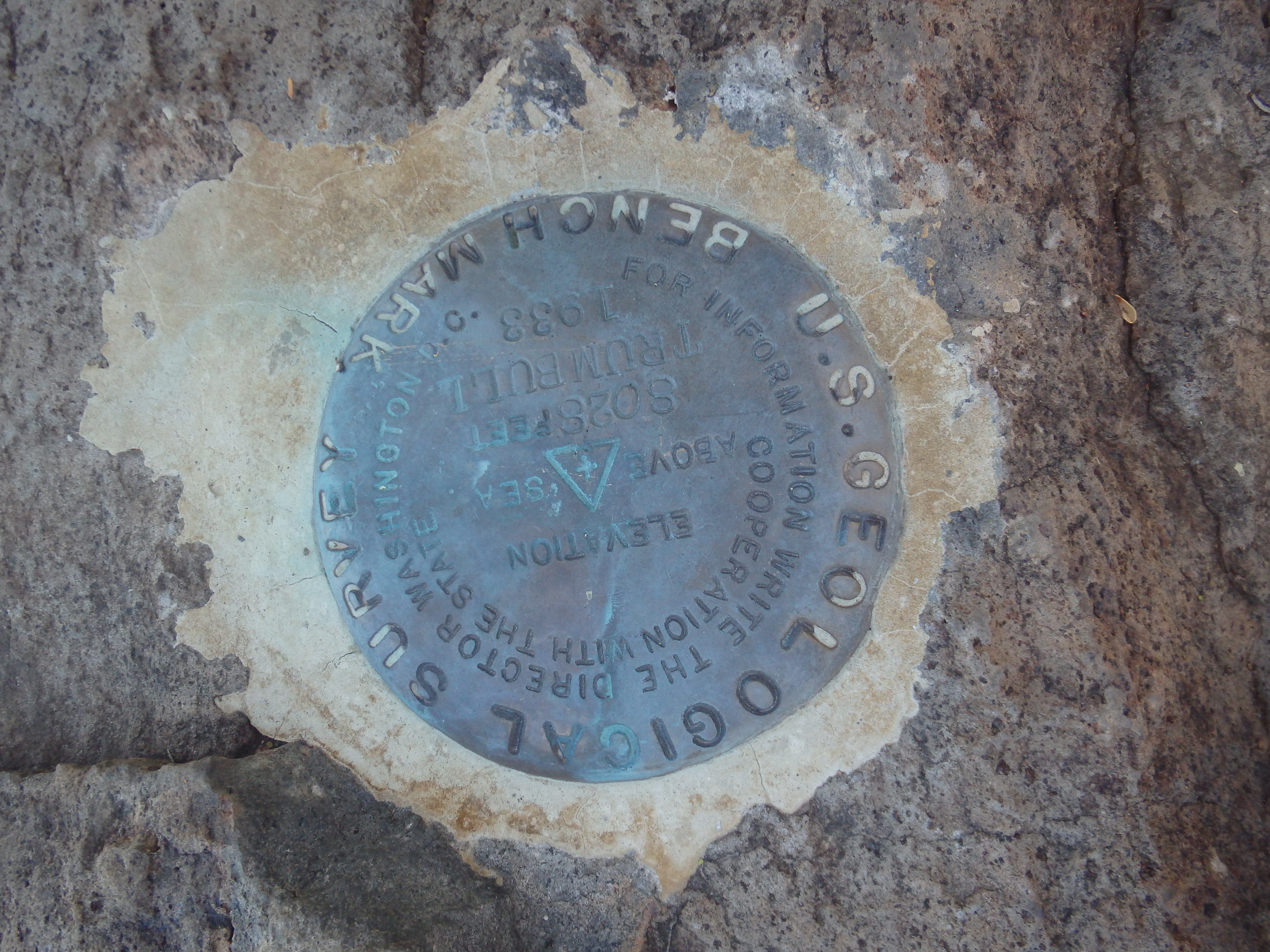
Mount Trumbull 8029′ and Mount Logan 7886′
Total Time: 2:45
Distance: 5.2 miles
Elevation Gain: 2000′
Crux: Class 1
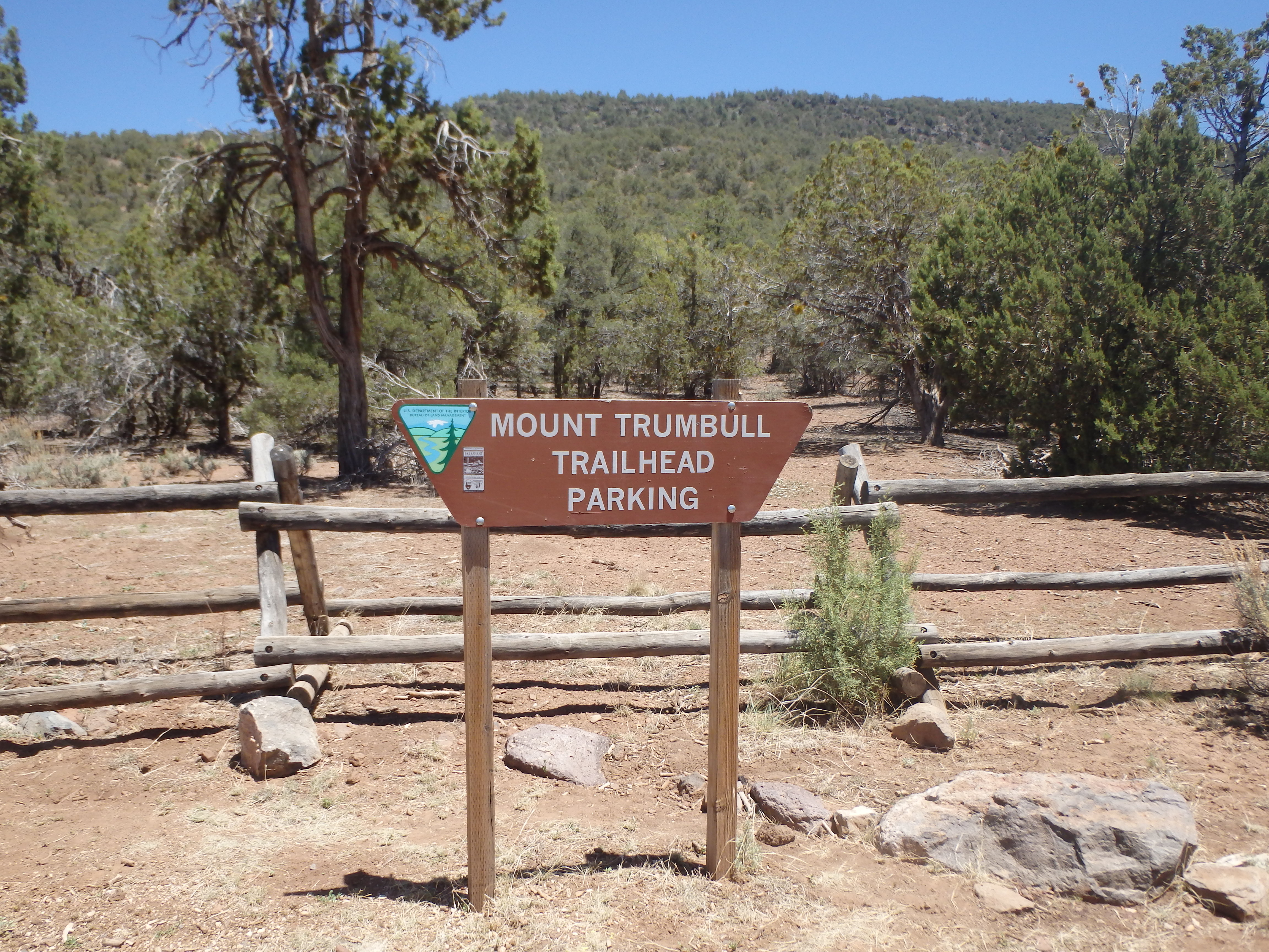
Trailhead: Mount Trumbull Trail
Companions: Holly, Steve and Cara Whittingham


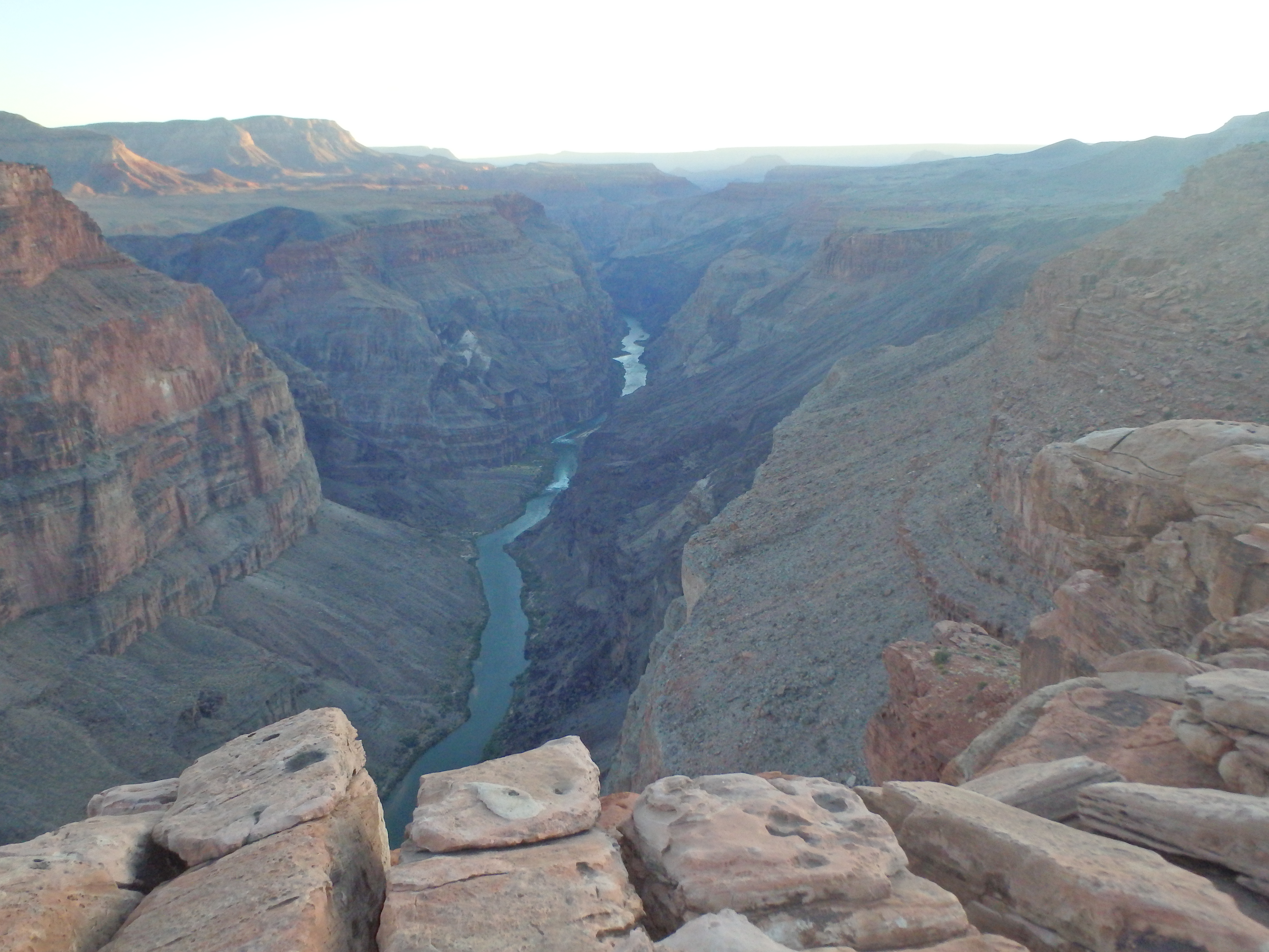
Mount Trumbull is one of the most remote Arizona P2Ks. Located on the remote Arizona strip, it takes miles of dirt road through sage brush desolation to reach, and is usually tagged on a trip to Toroweap, a dramatic Grand Canyon overlook where the rim drops 3000′ directly to the river. Additionally, it, along with nearby Mount Logan, was on the Las Vegas Mountaineering Club 50 Peaks list that I was slowly picking away at, and a trip to Toroweap over Memorial Day weekend was the perfect time to tag them both. We shaved part of the long drive from Phoenix by staying the night in Jacob Lake, and after a breakfast at the inn, headed out towards Fredonia, hooking south onto the dirt road towards Toroweap a few miles outside of town. The road was actually in better shape than I expected, and a passenger could handle basically everything up to the trailhead with a little patience, taking a few hours and over 50 miles of dirt and open range from the turn off. The trailhead was well marked and almost directly across from the Nixon Ranger Station.
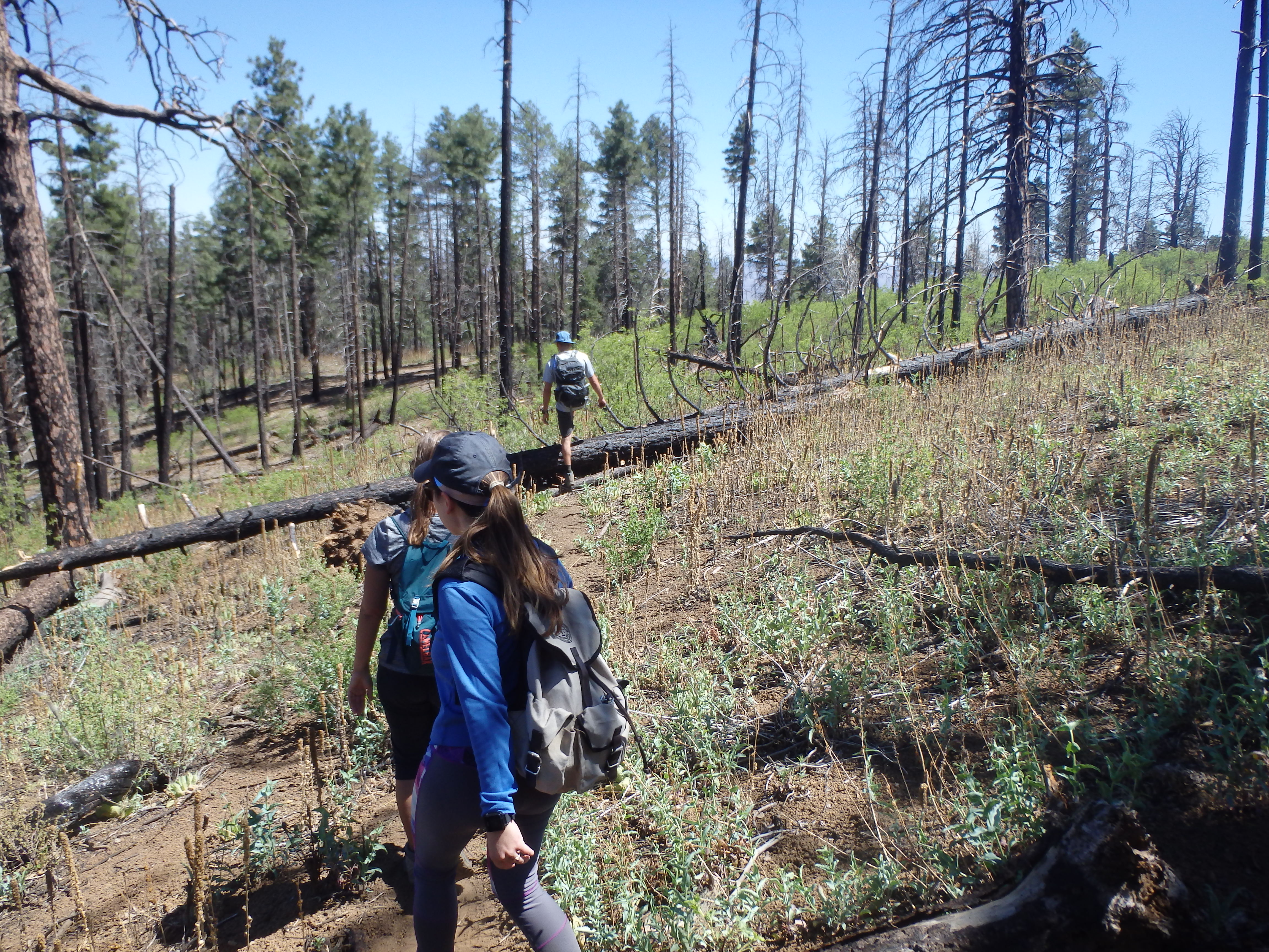
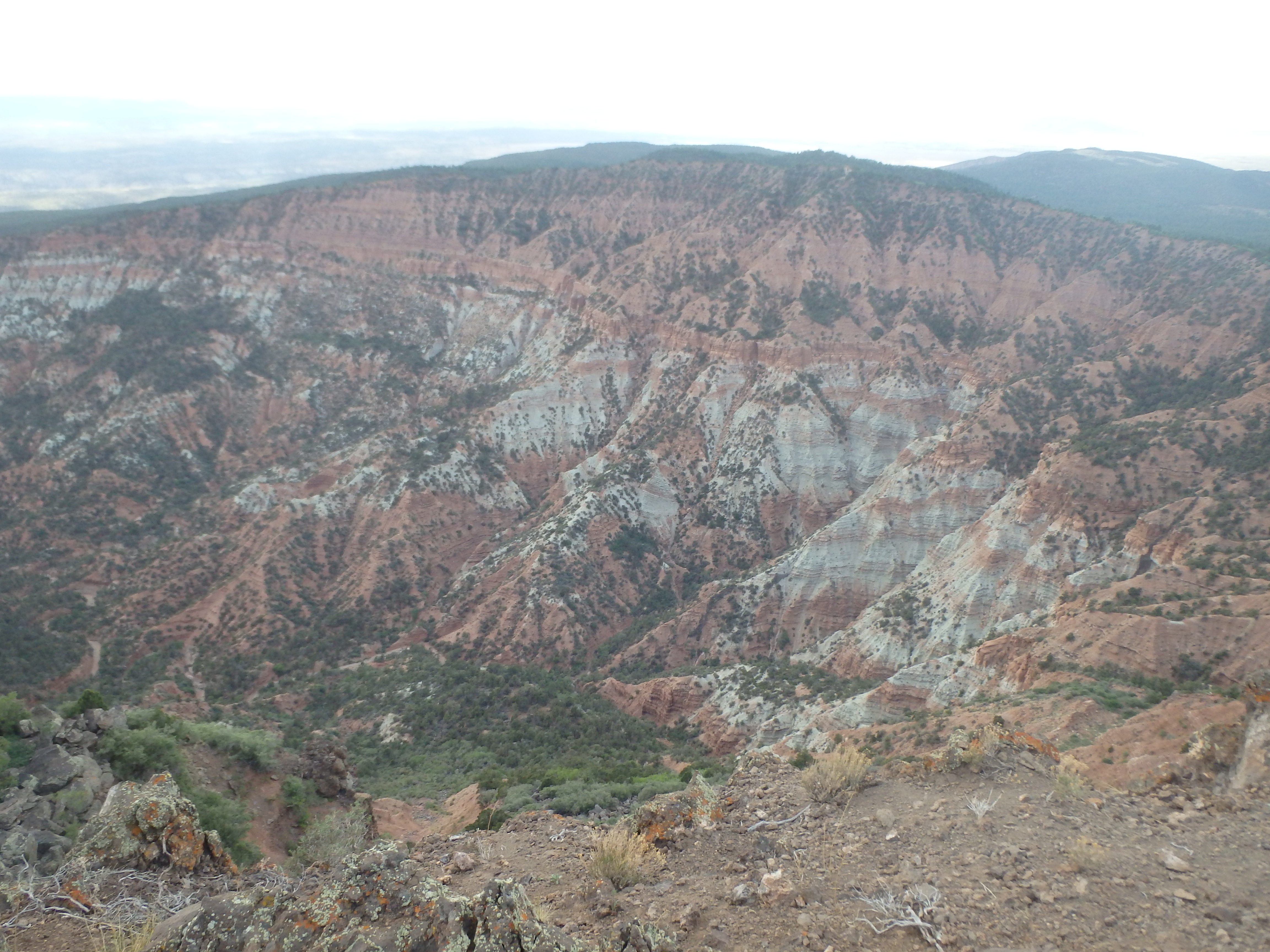
After dusting off our packs from the dirt road and signing into the trail register (with an obnoxious rant about the “lazy” USFS ranger for not clearing the trail) we started up the trail. I had assured everyone that the grade of the climb was reasonable, only about 1300′ over 2.5 miles. We would quickly find that most of that elevation was in the first mile, and combined with the altitude and lack of acclimatization, the majority of the group was cursing me as we climbed up through the forest with expanding views across the valley towards Mount Logan and the San Francisco Peaks hazy in the distance.
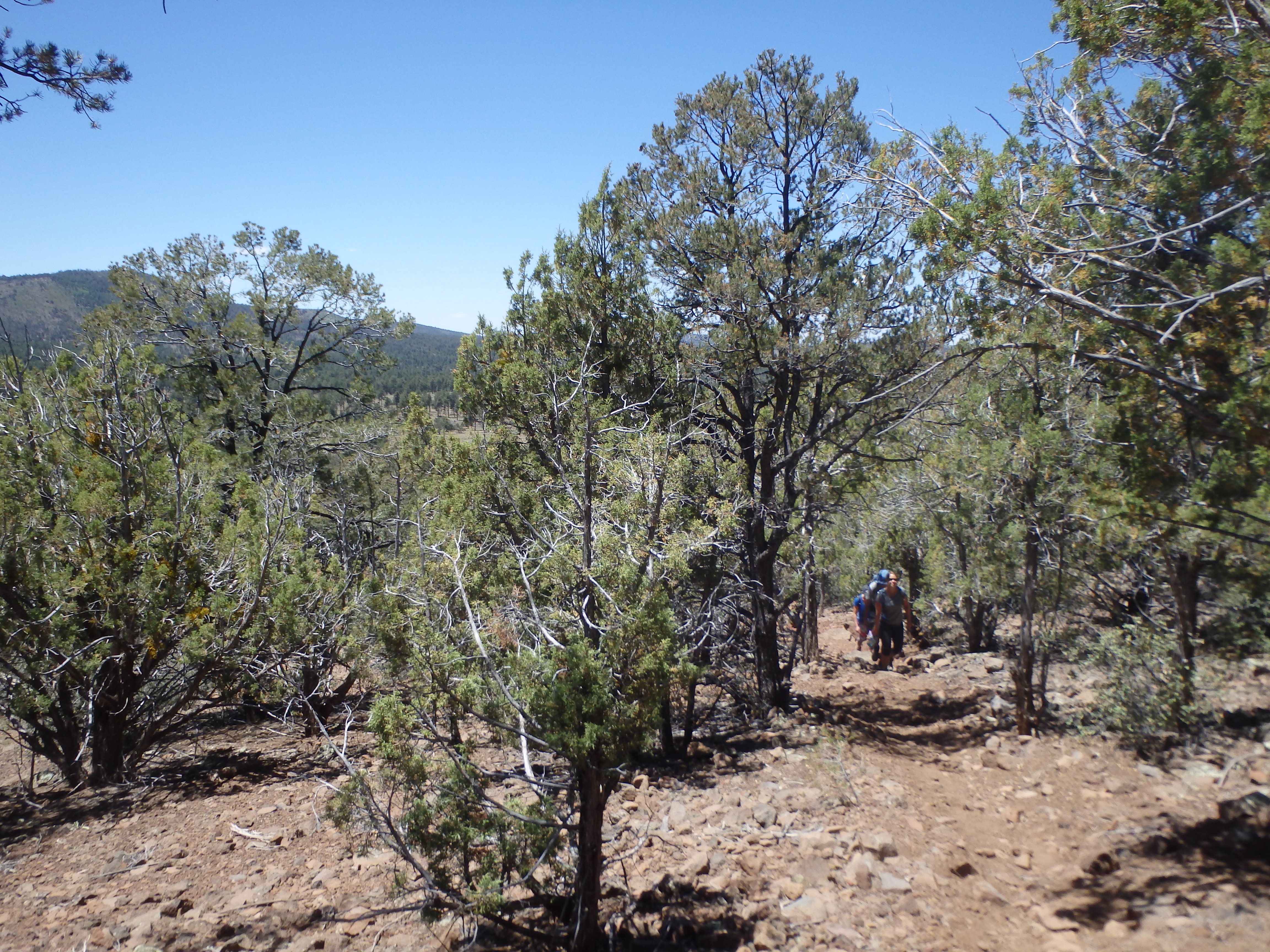
The grade started to ease about 1.5 miles in as we entered a burn area and had to scramble over a handleful of down trees that had drawn the ire of the trail register signee, making passage more difficult for his horses (insert eye roll).
The burn area was short, and we were soon back into a healthy pine tree forest on a much more forgiveable grade. The trail became less and less distinct as we continued along, a smattering of cairns leading the way up the indistinct high point, with multiple path converging to the same place.
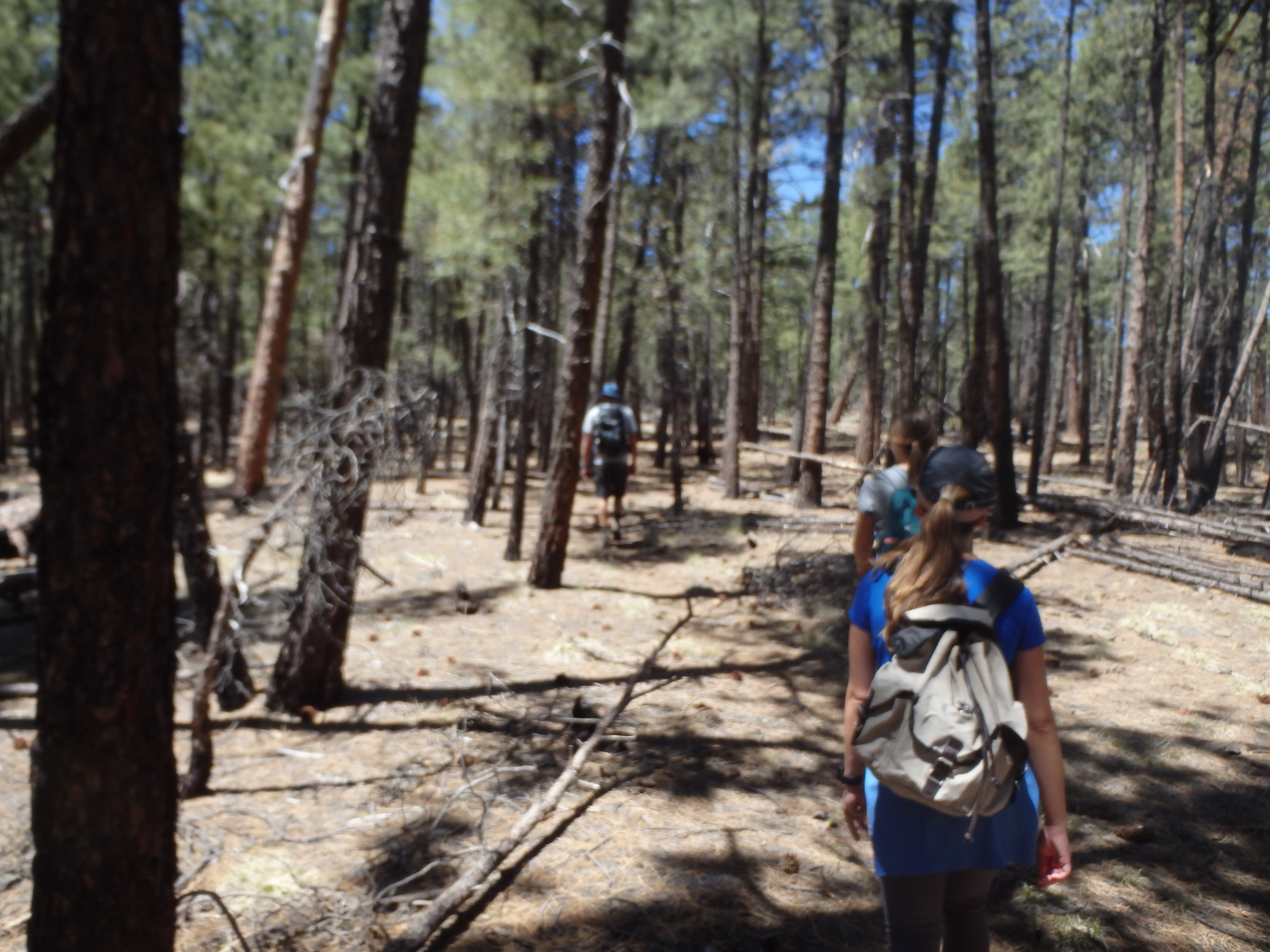
Aside from a rocky outcrop just below the summit and some occasional brush and aspen to push through the route was basically pure trail, and we reached the BM and high point less than 2 hours from starting out. The views were obscured by trees, but the journey was pleasant, traveling through pines to one of my few peaks over 8k so far on the year.
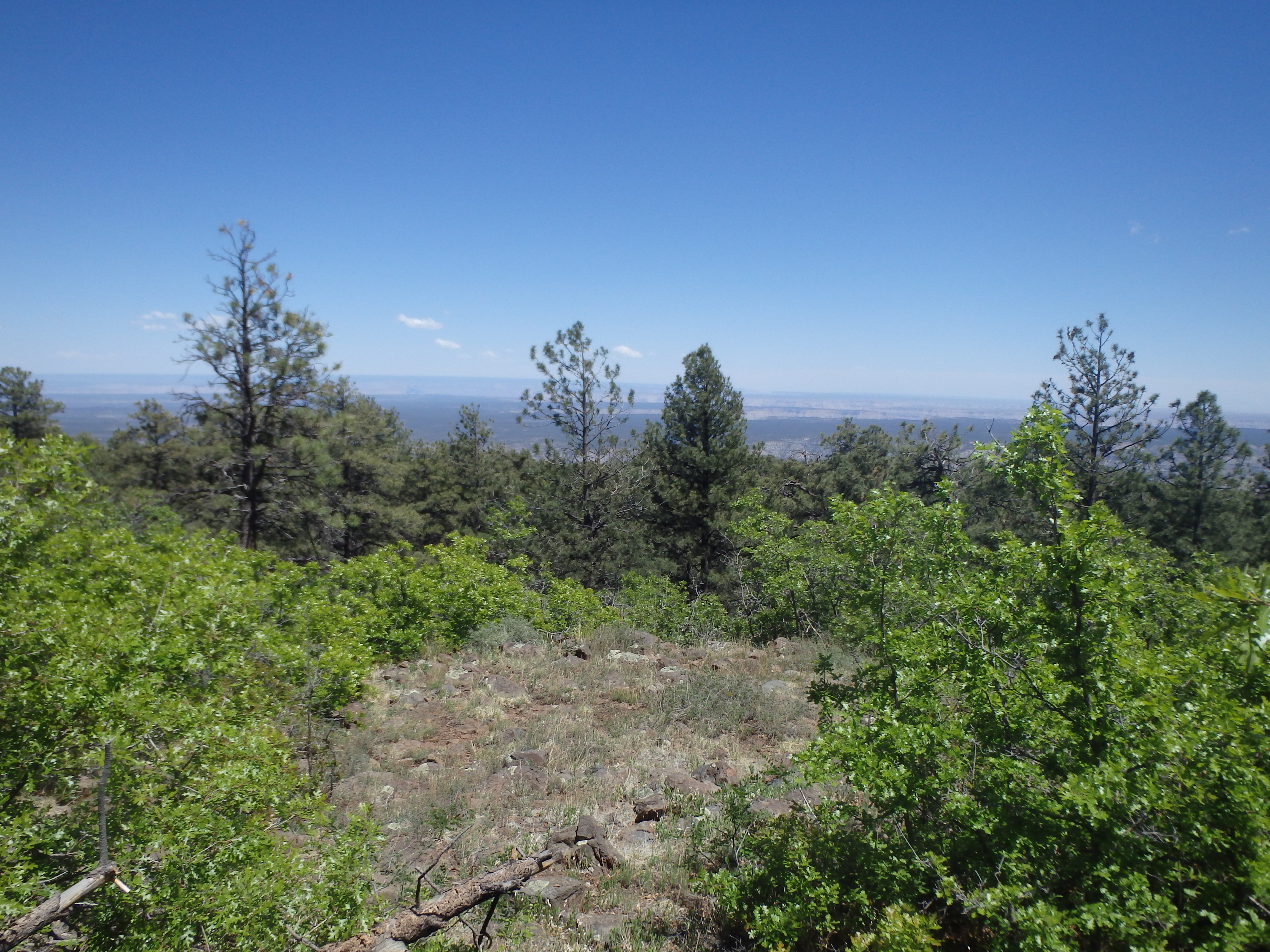
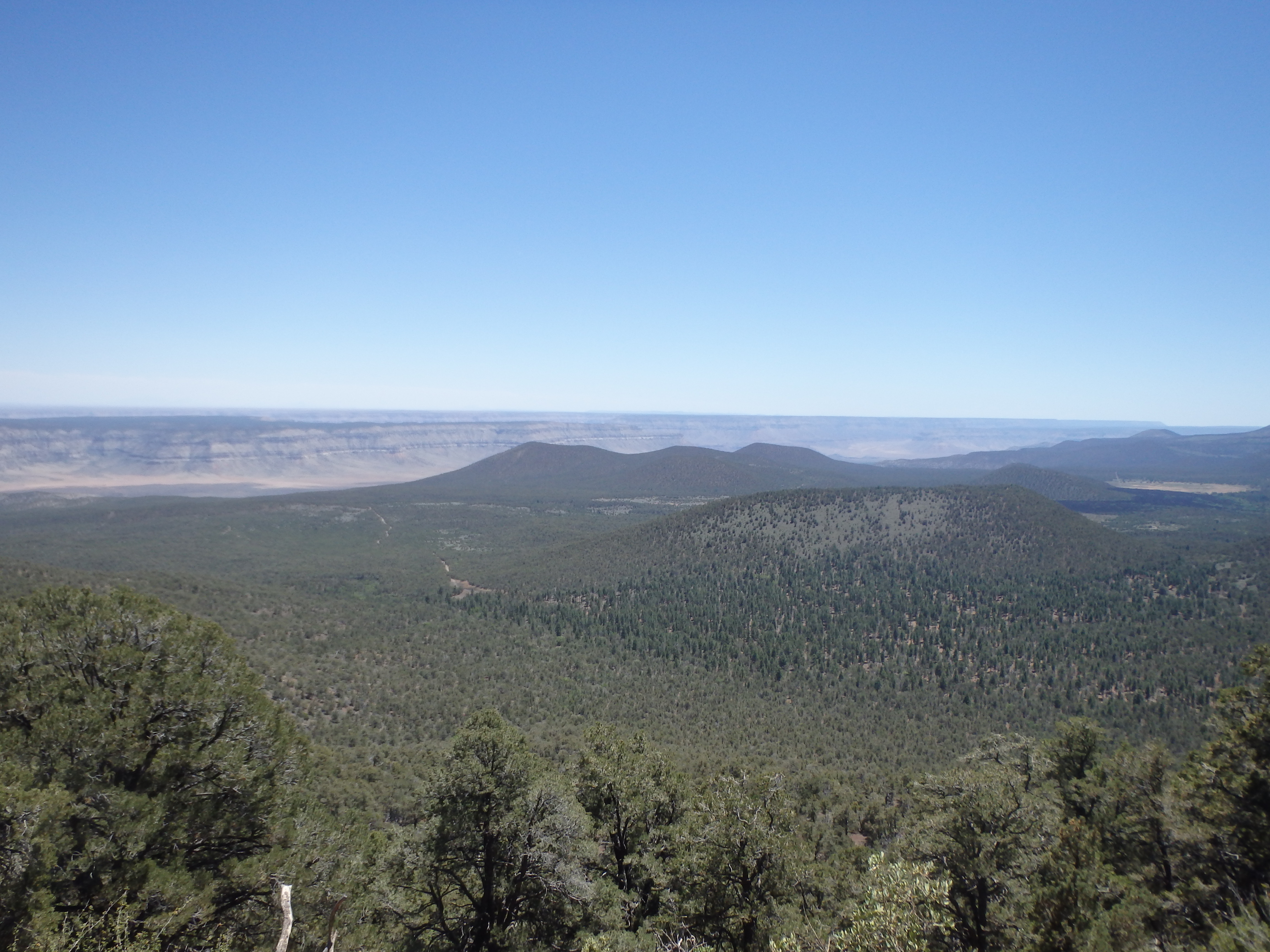
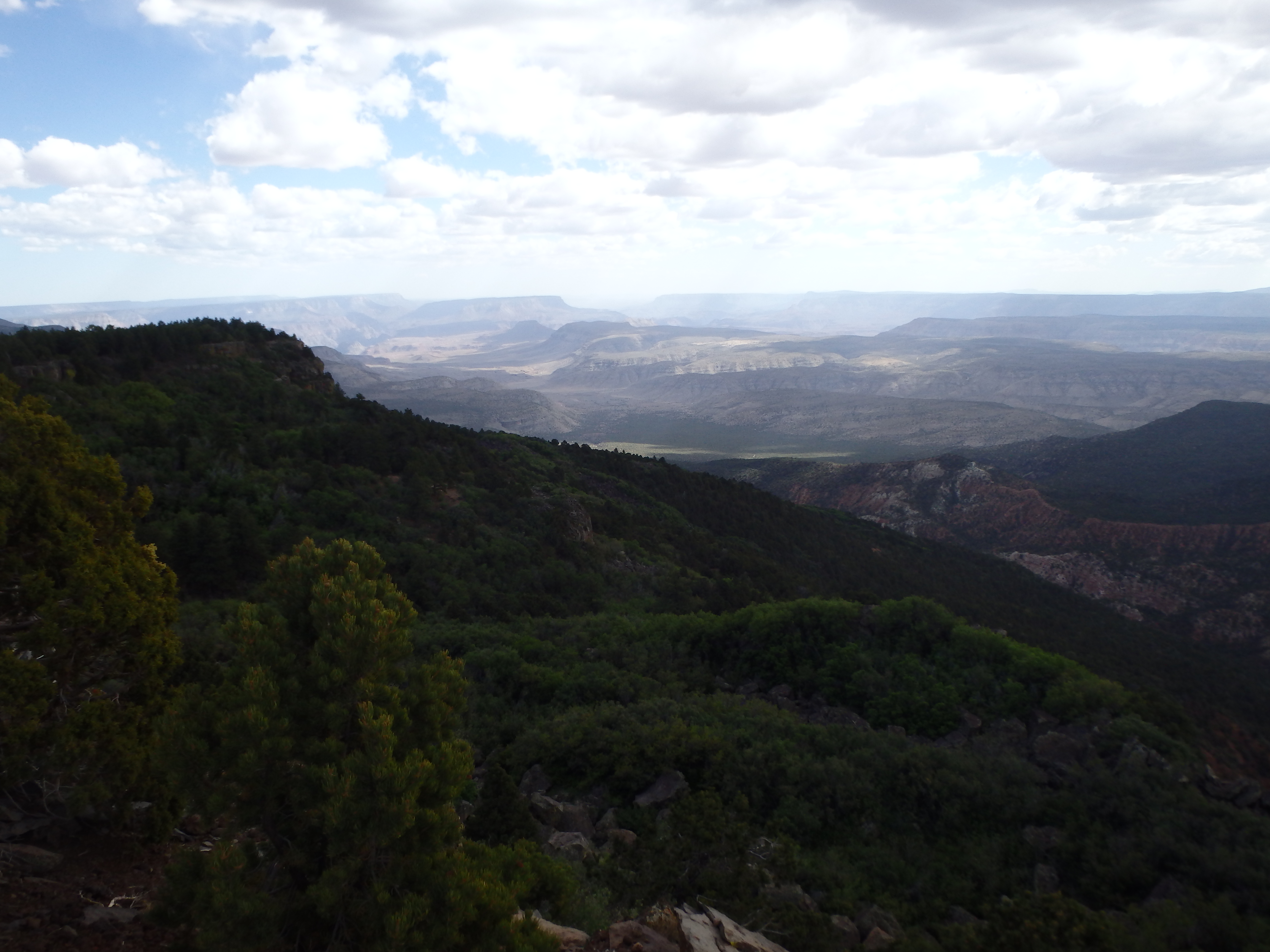
With mixed views (and no register) there wasn’t a big reason to linger, and we followed the loose network of cairns back to the burn area where the trail became more well defined. Once back on the trail, I needed to water the already planted seed for Mount Logan, citing the much better views, shorter hike, and I mean, if we got to camp too early, what would we do all day? Unfortunately some early monsoon looking clouds were looking to spoil my plans, building over the south rim and a little too close for comfort. I convinced the group to give Logan a go, and we started down the 7 mile, also decent dirt road winding up the mountain to the unofficial trailhead. A missed turn from a knocked over sign was quickly corrected thanks to my GPS, and we were soon at the highest point in the road only a few hundred feet below the summit. It was a quick and easy use trail through the forest to the high point, offering incredible views of Hells Hole directly below, and the Grand Canyon, Toroweap and Vulcans Throne nearby.
The clouds continued to threaten rain and the wind was too strong to find a comfortable spot to enjoy the view, so we headed back down the trail the remaining distance to the car and drove the 40+ remaining miles to Toroweap for camp for the next few days. We enjoyed sunset at the overlook before a steak fajita dinner and rest before an attempt on Vulcans Throne the next day.