
Bear Mountain 6506′
Total Time: 3.5 hours
Roundtrip Mileage: 5.0 miles
Elevation Gain: 1800′
Crux: Class 1
Trailhead: Bear and Doe Mountain THs- trash, pit toilets, $5 RR pass required
Companions: Holly

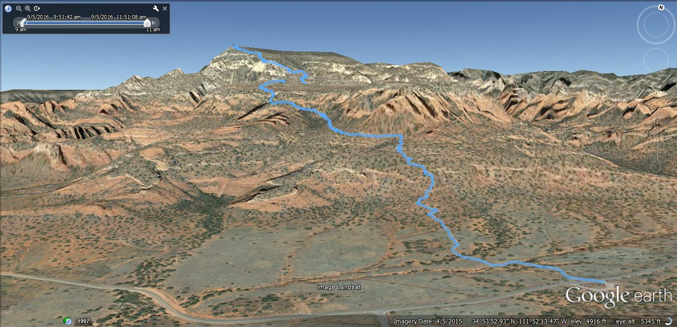
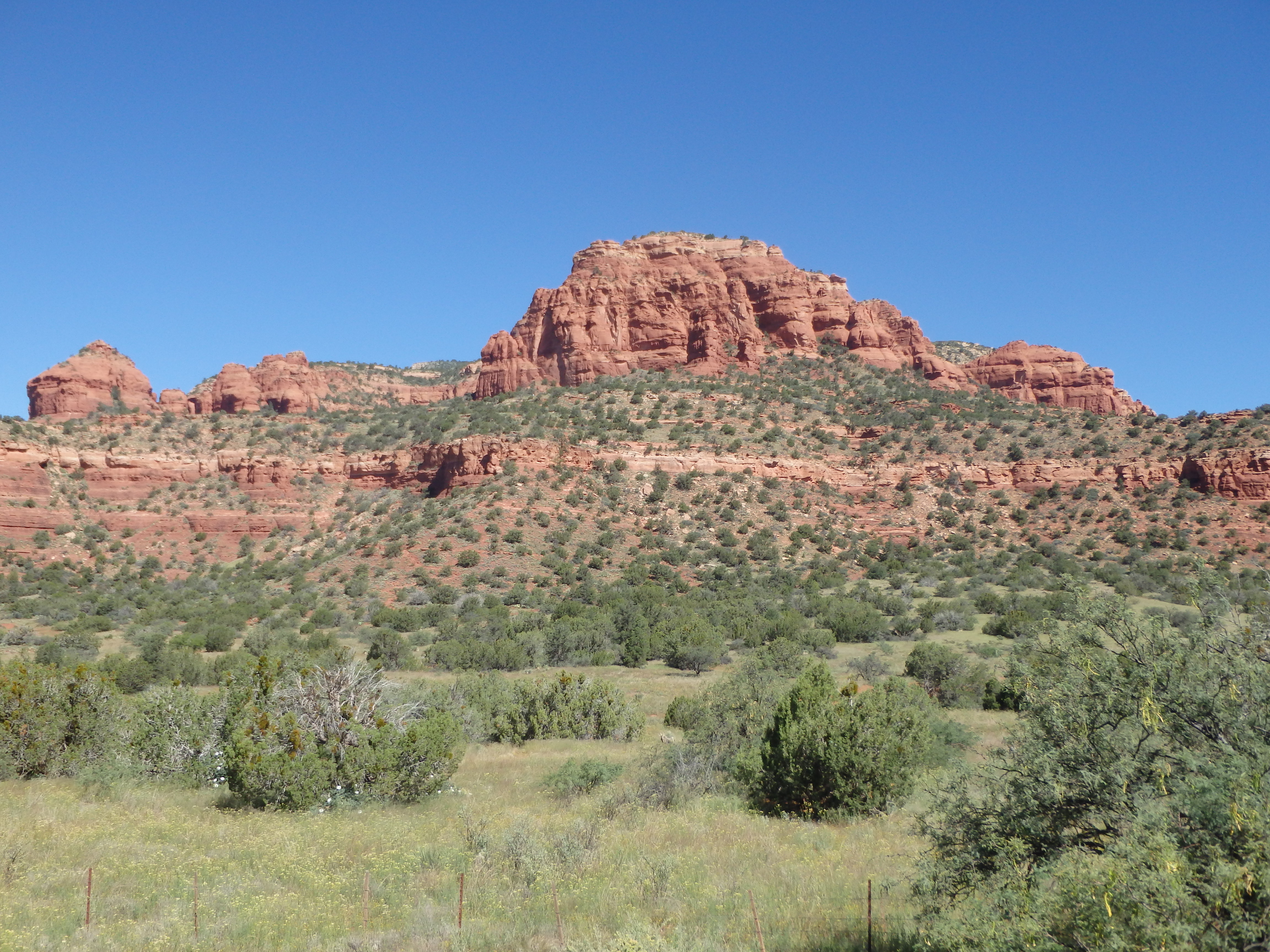
Bear Mountain is one of the most popular hikes in Sedona, and one of the easier hikes to bring you up to the Mogollon Rim. Located west of town and Capitol Butte, the short hike ascends several layers of sandstone to its somewhat brushy summit, with views down into Enchantment and Palatki ruins. I had been saving Bear Mountain to do with Holly as a nice half day hike, finally to be hiked over Labor Day weekend while in the area. The trailhead parking area is shared with Doe Mountain, one of my first hikes in the area over a year ago.
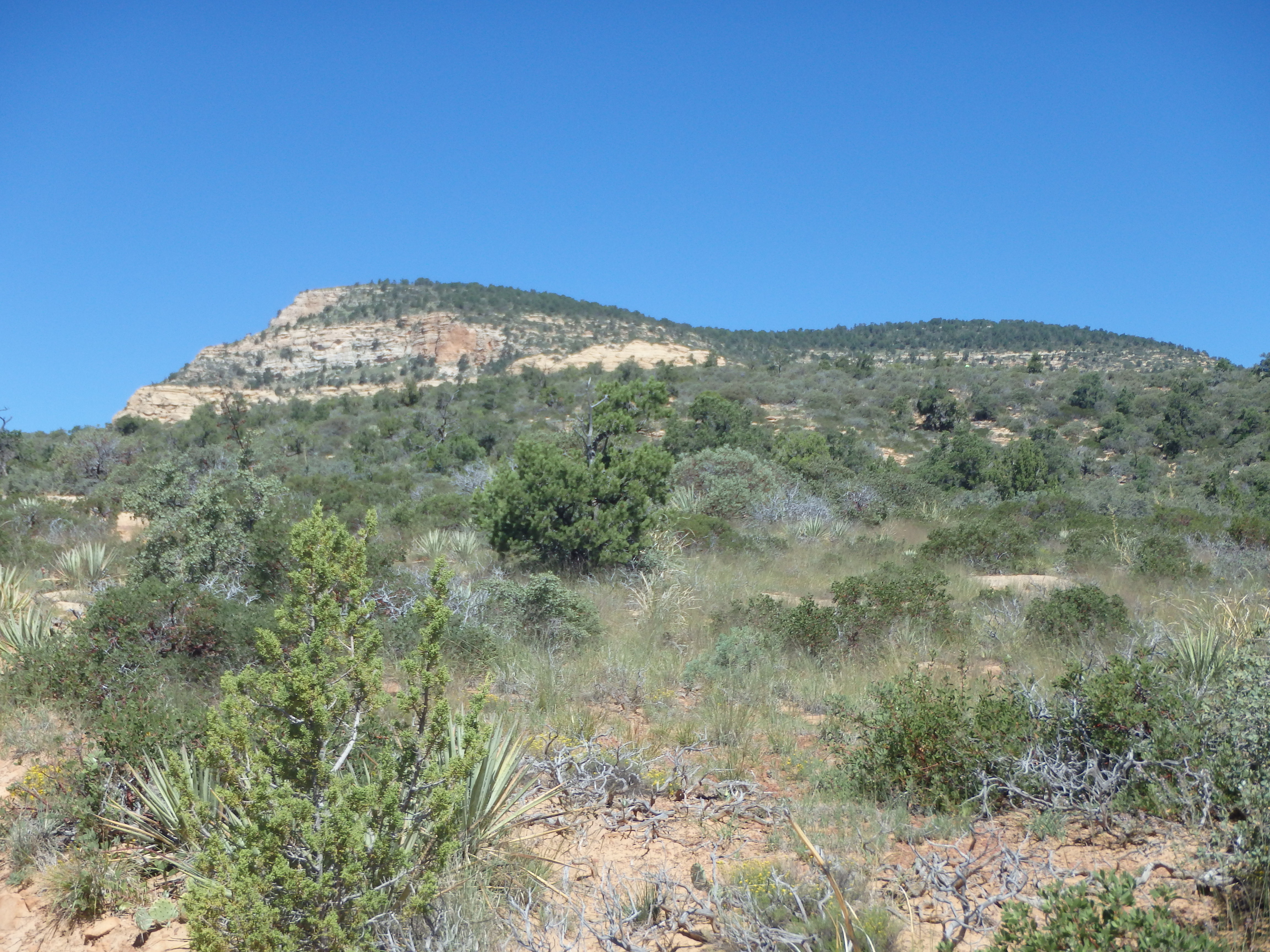
Crossing the road towards Bear Mountain, the trail initially traverses several shallow washes with vertical sandstone cliffs looming directly ahead. The relatively flat start quickly shifted to steep switchbacks through a break in the first layer of sandstone, passing some shallow sandstone caves en route.
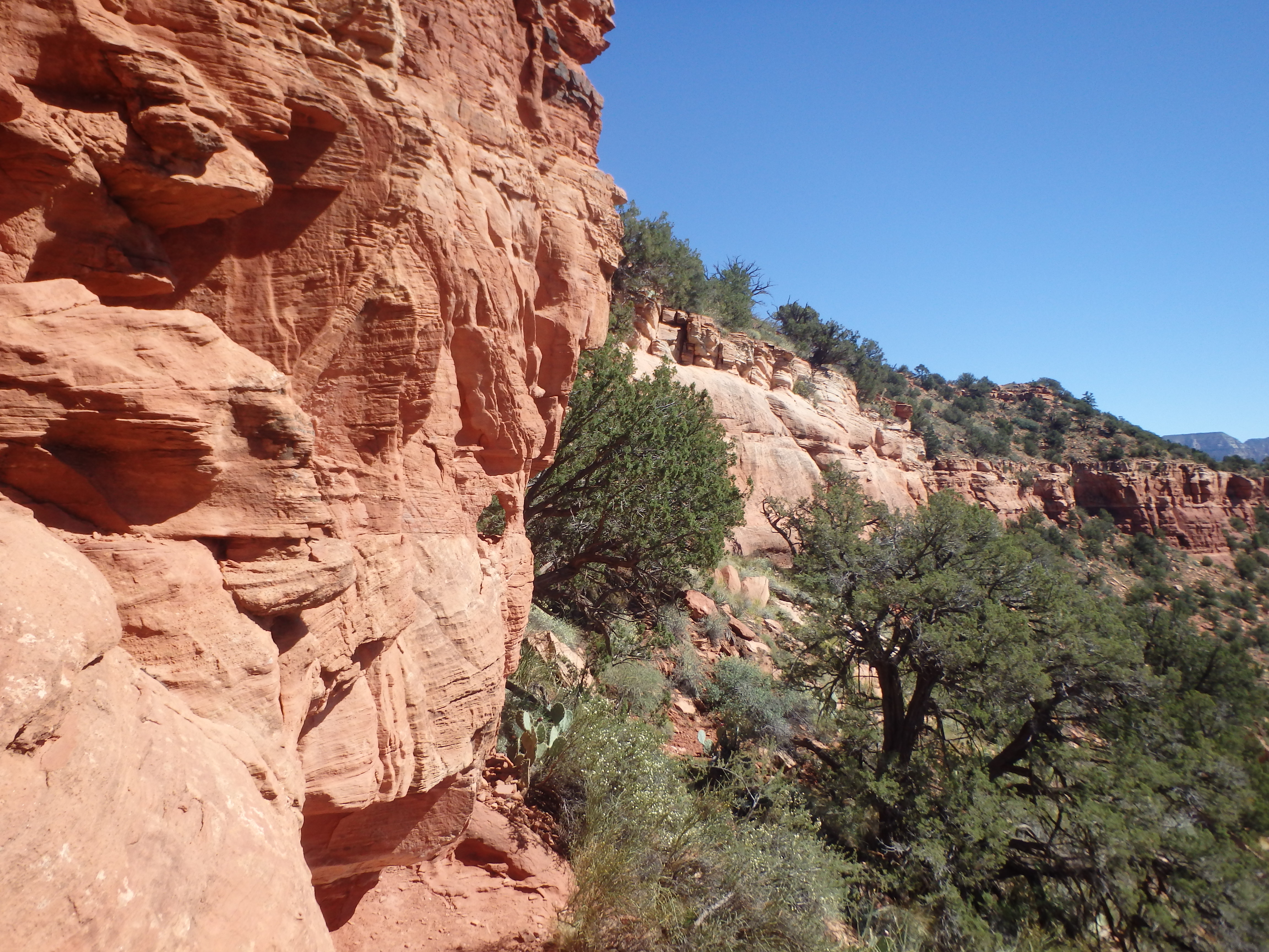
Once atop the first cliff band, we paused for a break in the shade under one of the small pinyon pines along the trail. At this point, a non technical route seems improbable with 500′ cliffs straight ahead. But the trail snaked to the west and makes it’s way up a weakness in the sandstone wall, leading to a broad, brushy plateau above.
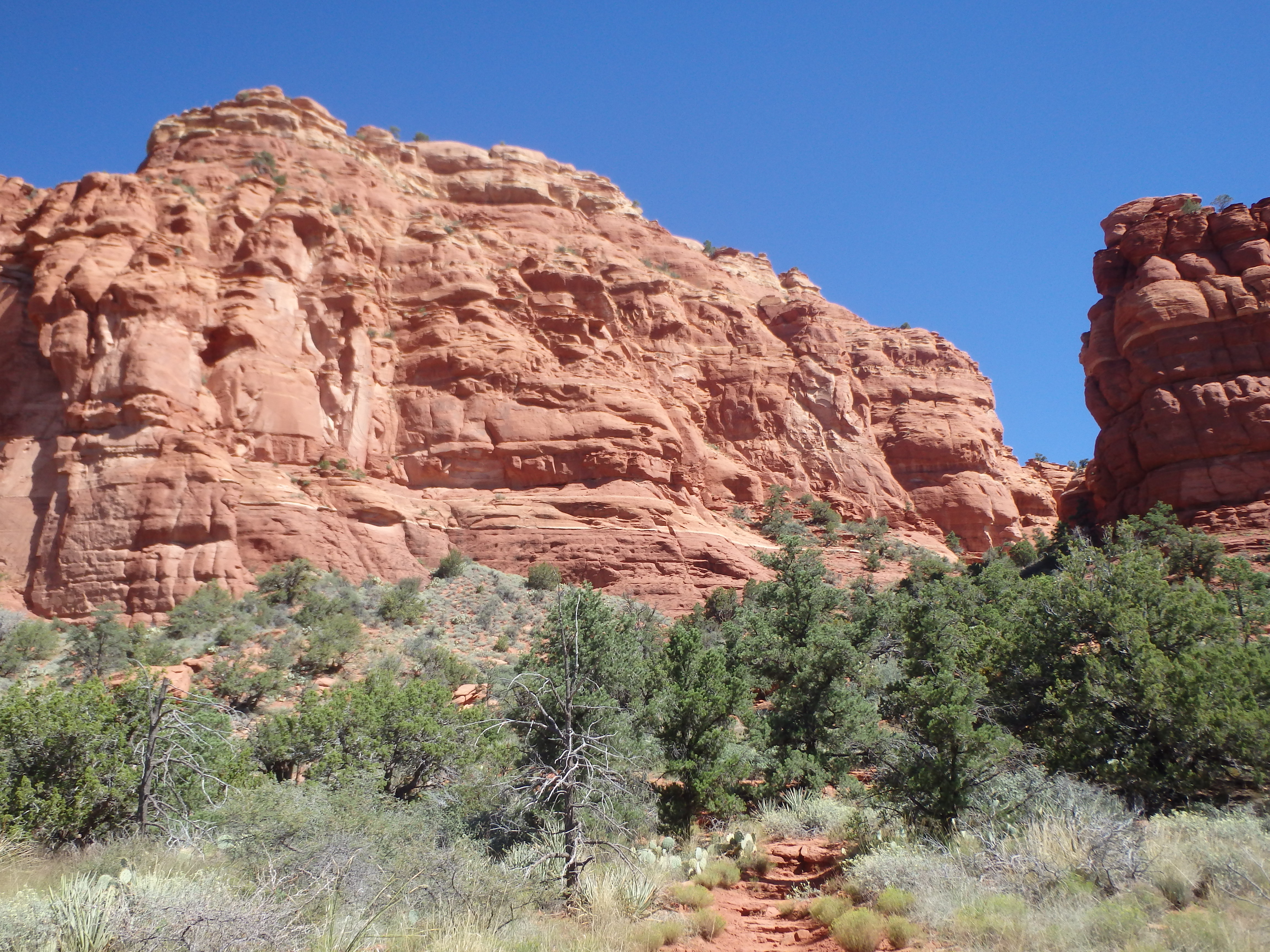
With no more red sandstone cliffs to ascend, it seemed we were already almost to the summit. In reality, this was only the halfway point, and the trail continued north across the plateau. There was a small drop halfway across, and we lost ~100′ before the summit push, still another 1000′ above. From below it looked as if we would be in high desert scrubs for the rest of the hike, but was pleasantly surprised to find a nice section of tan Kaibab sandstone for a few hundred feet below the summit. This sandstone had an interesting swirled appearance and looked more like the Red Rocks Area of Nevada or parts of Southern Utah, a unique feature in the Sedona area.

Some final steep switchbacks brought us to the end of the trail. The highest point of Bear Mountain is another mile north, and from other online accounts, an unenjoyable thorny bushwack with no views. I had no interest in committing myself or Holly to that for another 50′ in elevation, so we enjoyed the views from the unofficial summit across the Valley.

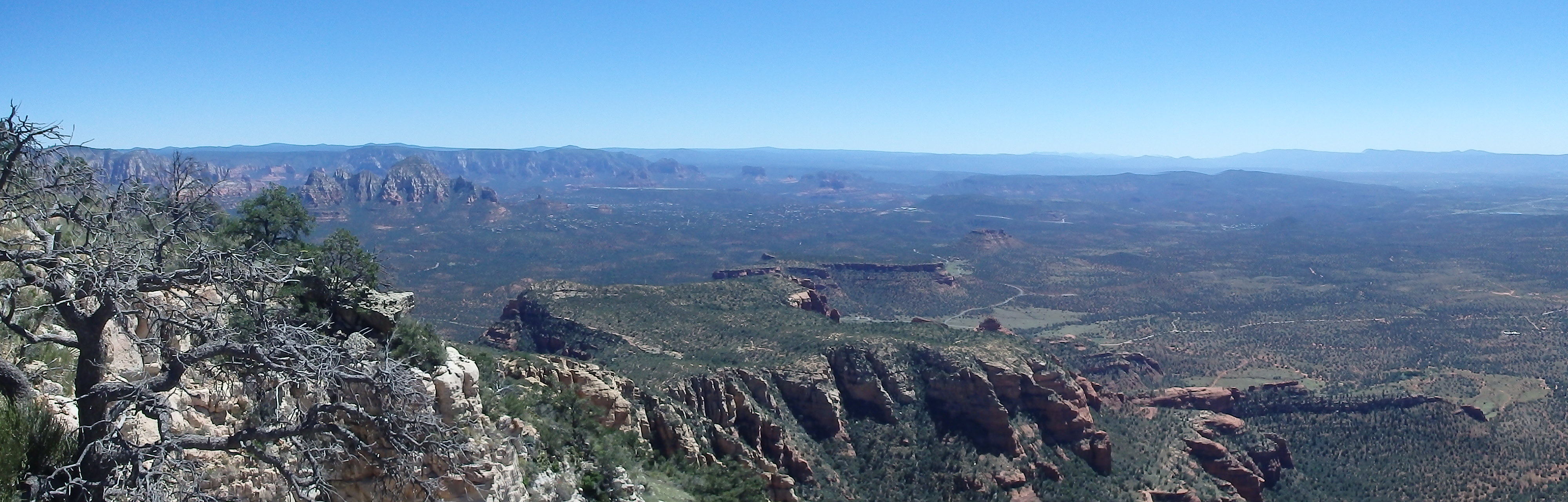
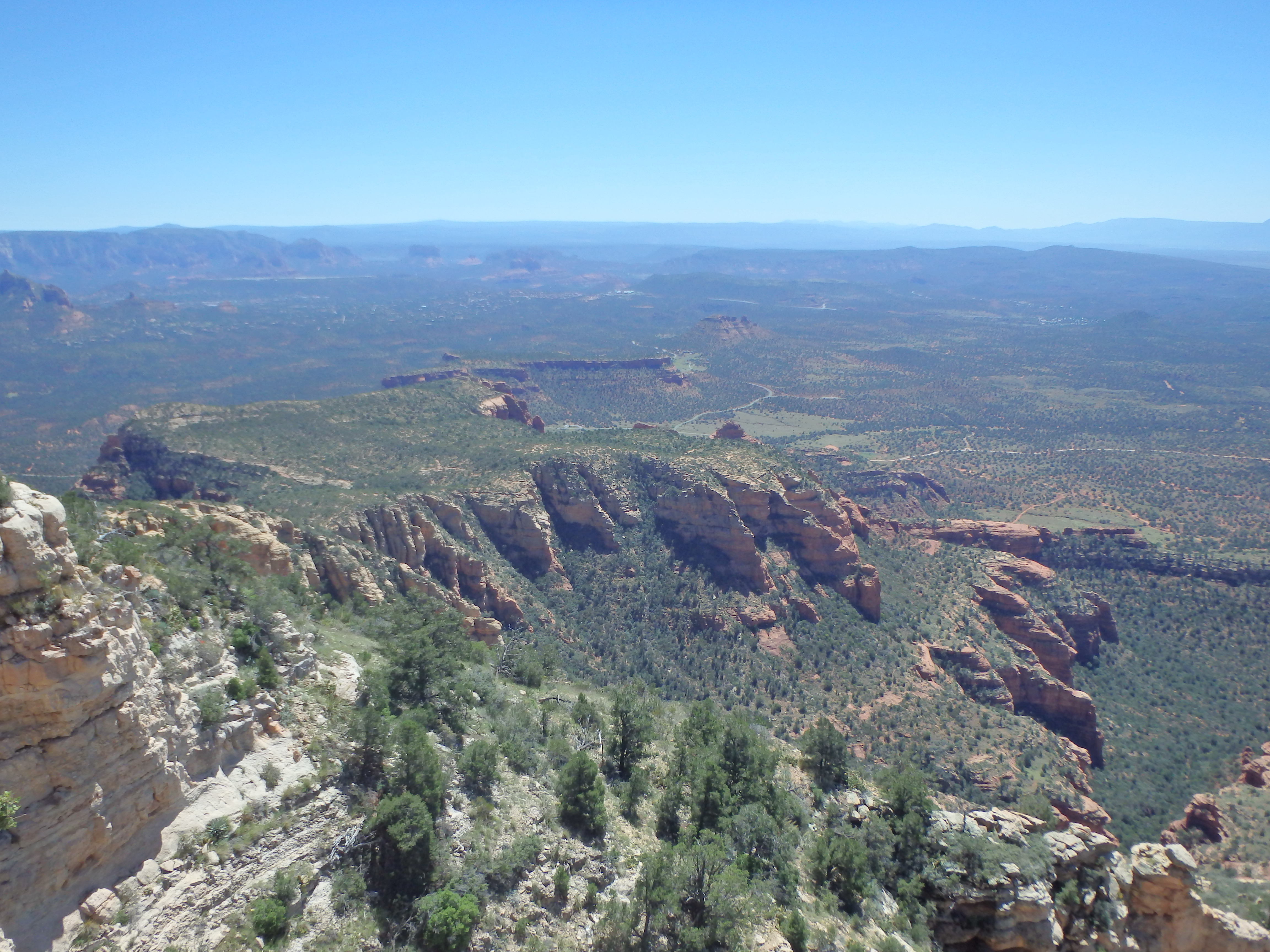
Not surprisingly, views were best to the Southwest, with Doe Mountain and the Cockscomb in the immediate area, Capitol Butte a bit further to the southwest, and Oak Creek with Courthouse Butte in the distance. A short walk to the western summit cliffs looked down on the small patch of grass and visitor center of Palatki Ruins. With a lunch down in Cottonwood in mind, we headed back down the trail and made it back to the car in one push, taking about 3.5 hours roundtrip with an enjoyable summit break. Next time in Sedona, I’ll have to introduce Holly into some off trail adventures…