
Escalante Butte 6536′, Cardenas Butte 6281′
Total Time: 6 hours
Round trip Mileage: 9.2
Total Elevation Gain: 3200′
Crux: Class 3
Trailhead and amenities: Tanner Trail at Lipon Point: Trash, no toilets or water.
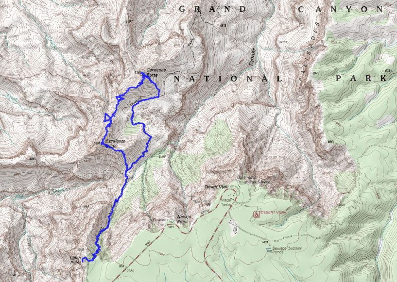
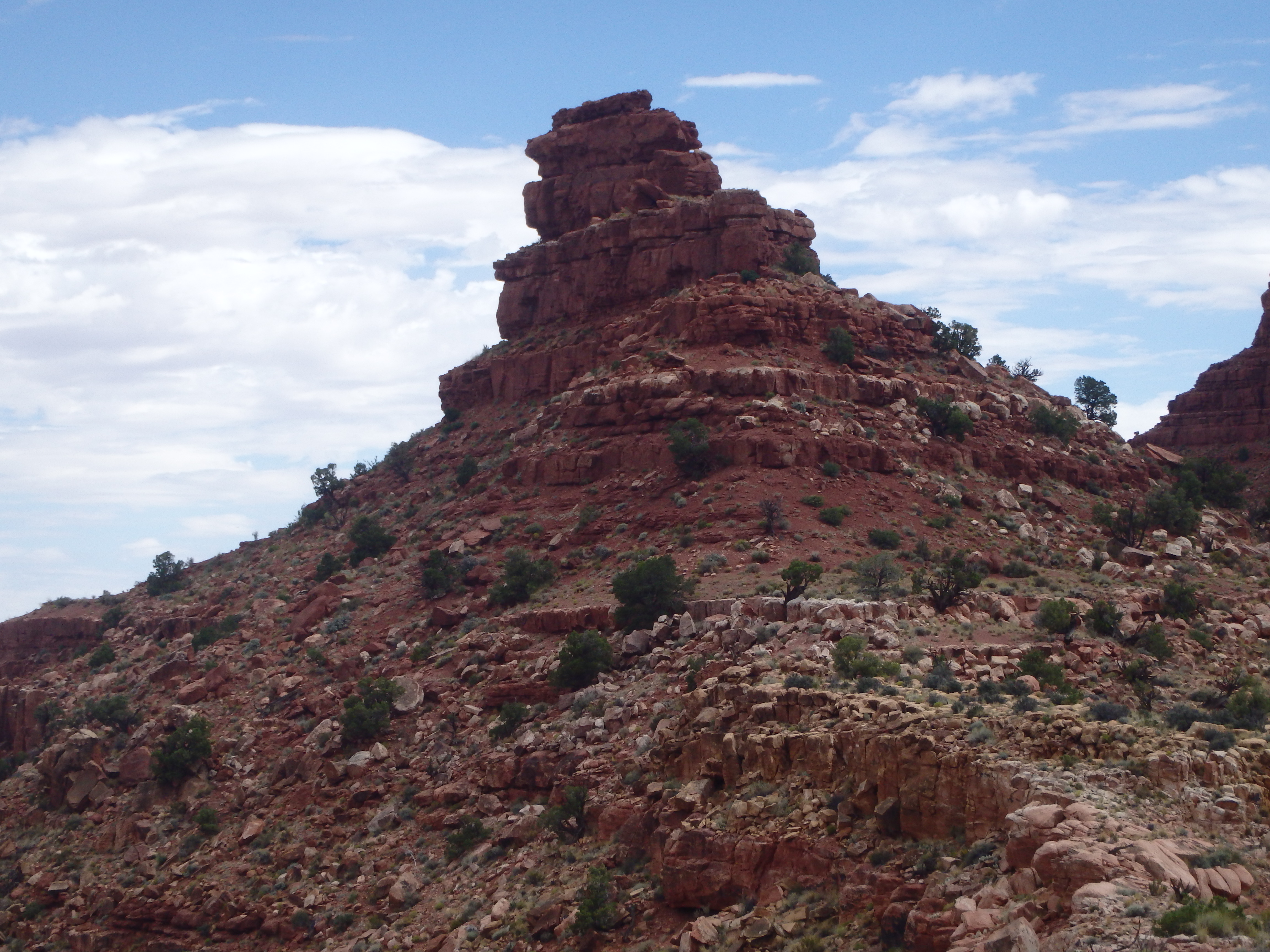
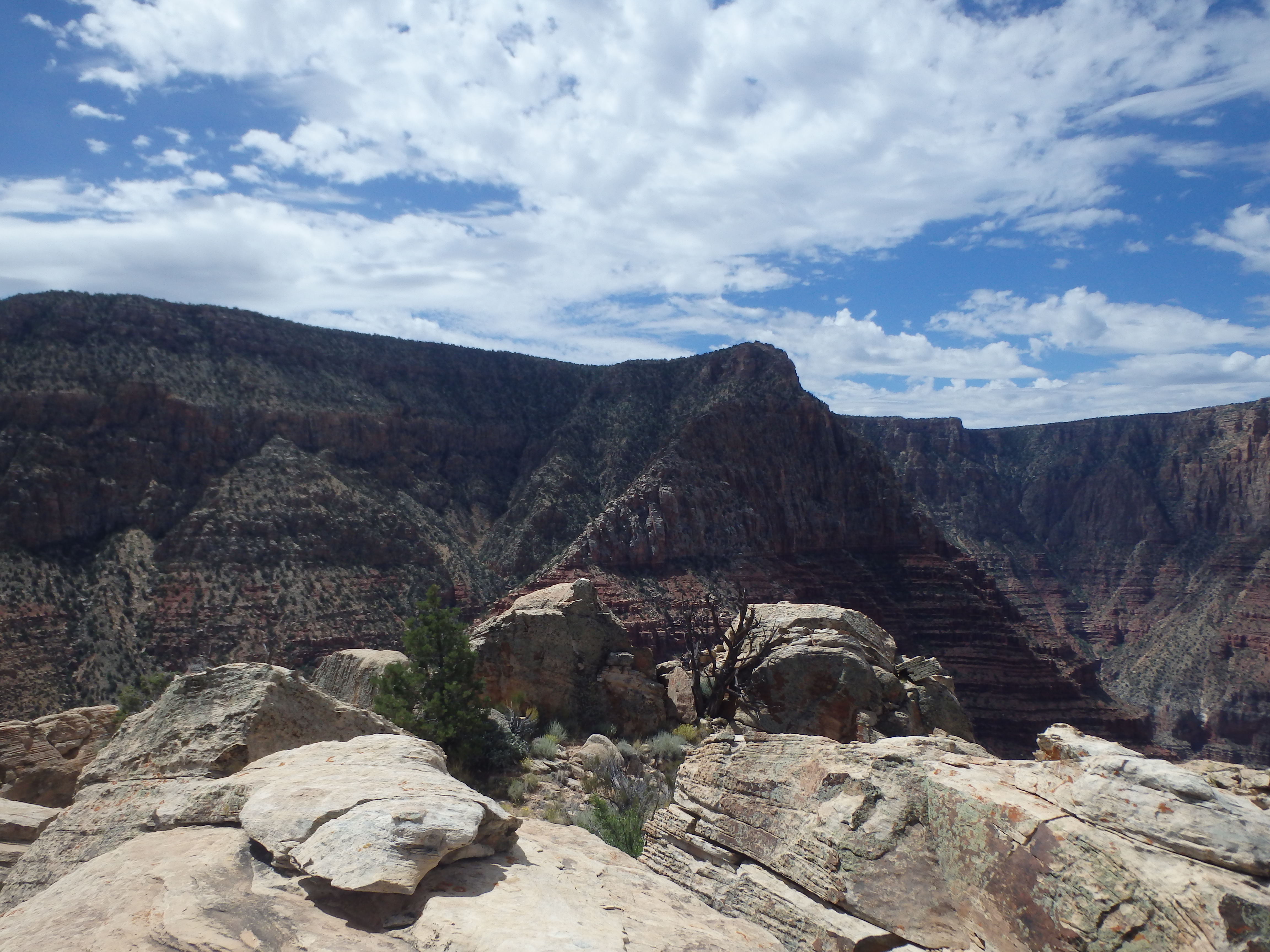
Escalante and Cardenas Butte are a pair of fairly prominent summits off the eastern South Rim of Grand Canyon National Park. They have their pictures taken by hundreds of people every day at Desert View from Mary Colter’s masterpiece “Desert Watchtower,” with no one ever knowing their names, blending into the stunning vista. Although their summits are connected by a short ridgeline and only several hundred feet apart in elevation, the two are dramatically different. Cardenas Butte features a caprock of red sandstone from the Supai Group, while Escalante is just high enough for the summit to contain a jumble of boulders from the Coconino Sandstone layer. They would be my objectives for the day.
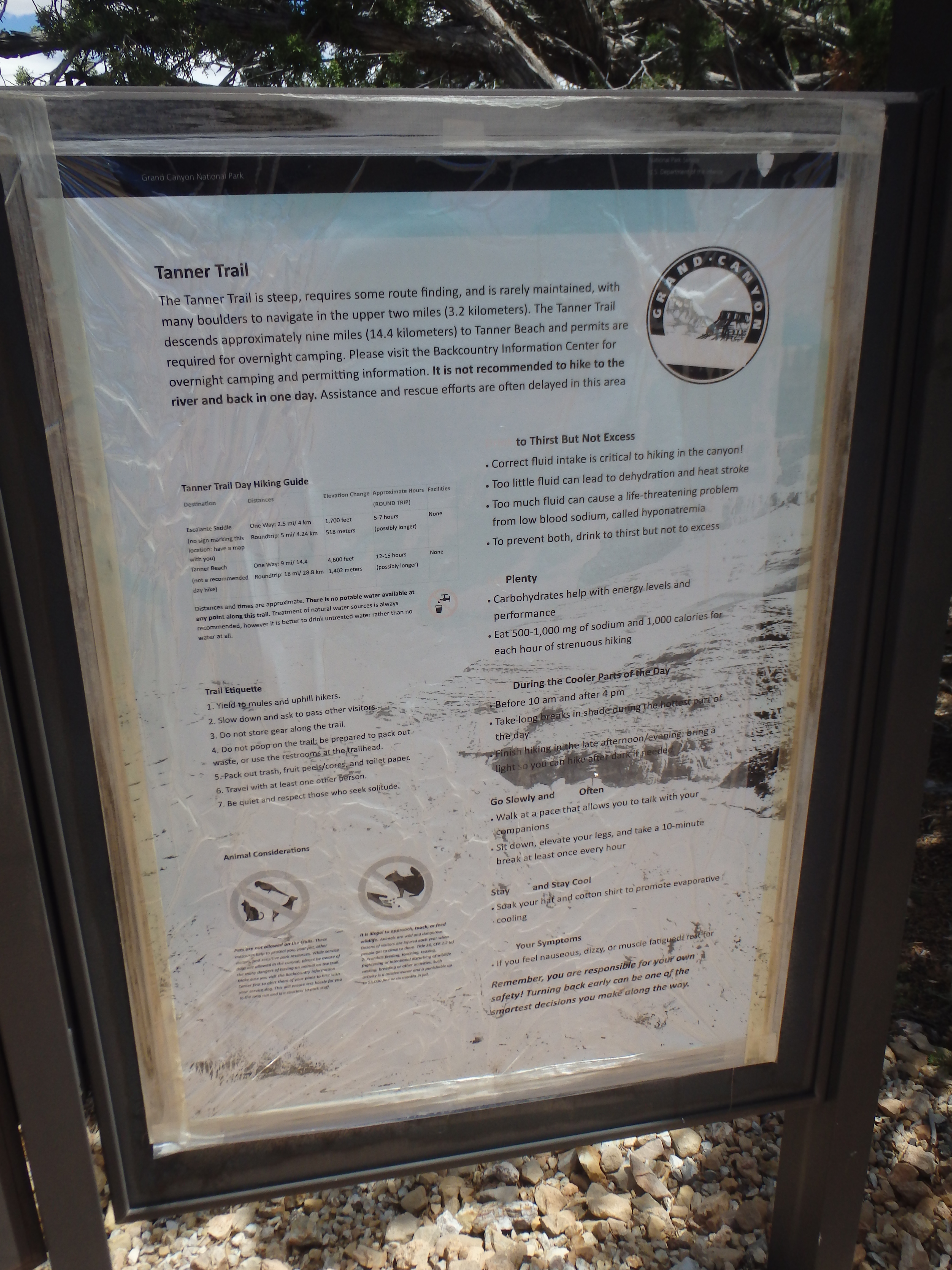
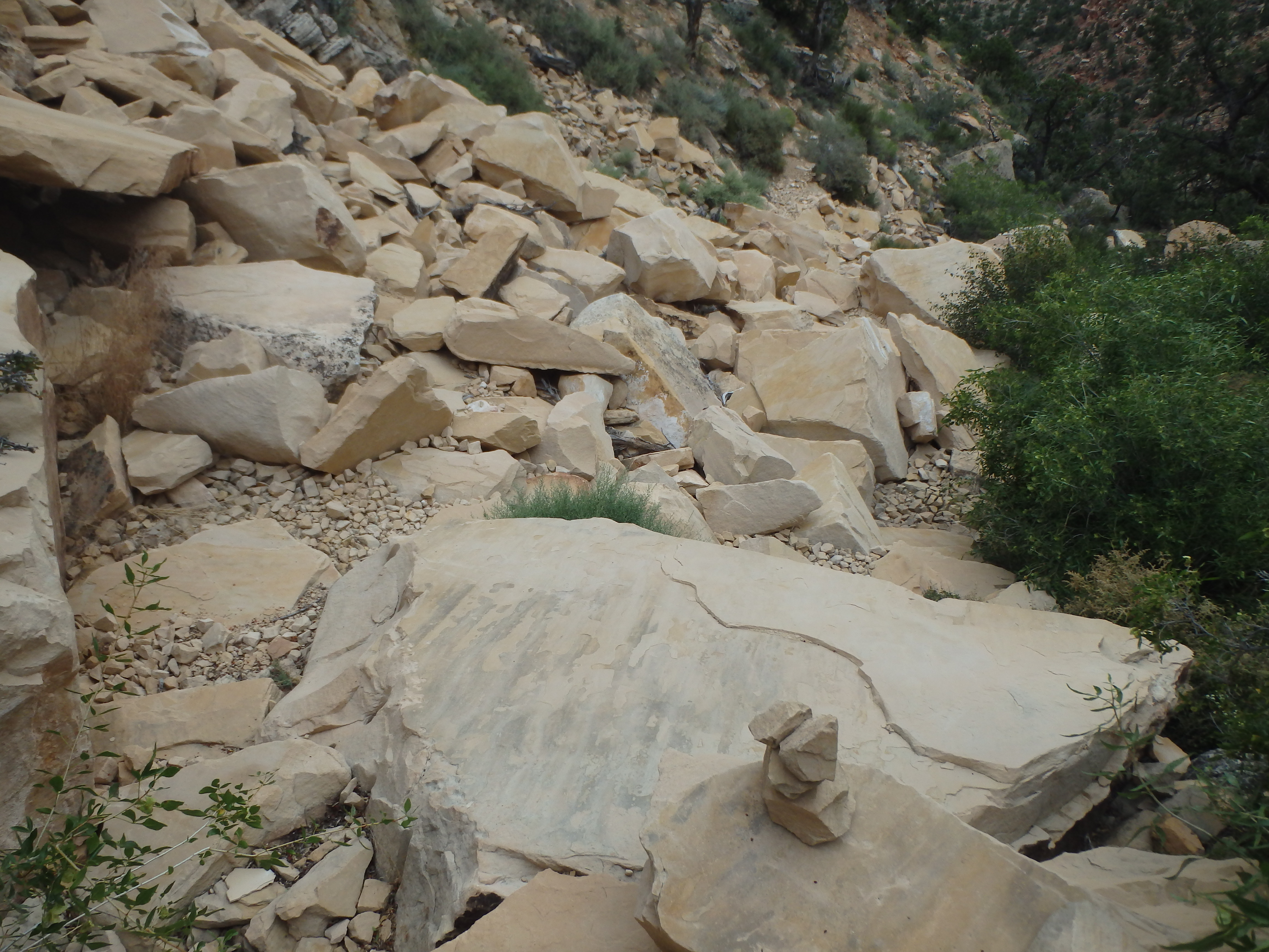
The trail starts of at the Tanner Trail, located a short walk back up the road from Lipon Point, a popular sunset spot given the great views of the Colorado River. Unlike the Bright Angel Trail, graded for mules and tourists, the Tanner Trail is unmaintained an steeply drops 1700′ in about 2 miles to Escalante Saddle. I was only on the trail for a short time before the difference became very apparent, with rocks across the trail making it uneven, and in places, was completely washed out. For the most part, the trail switches down a small side canyon of Tanner Canyon, not opening up to the view ahead until I was almost to the saddle two miles in.
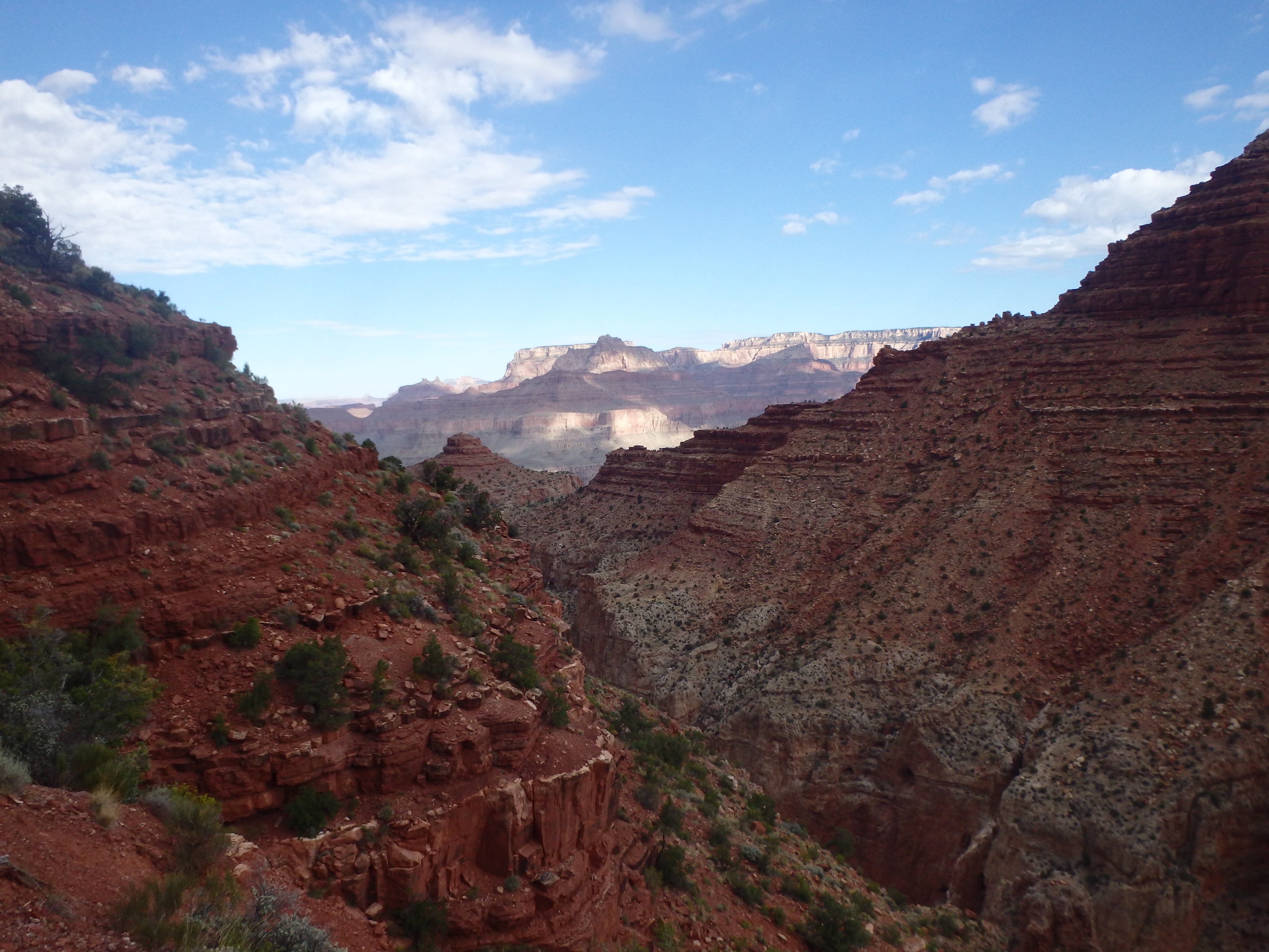
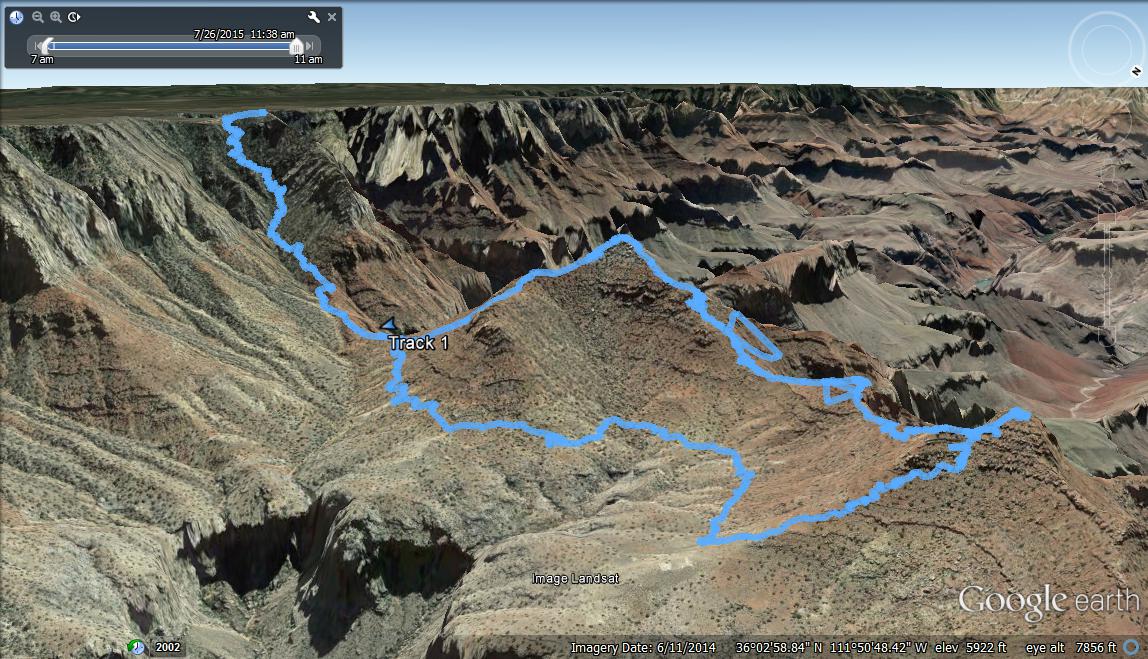
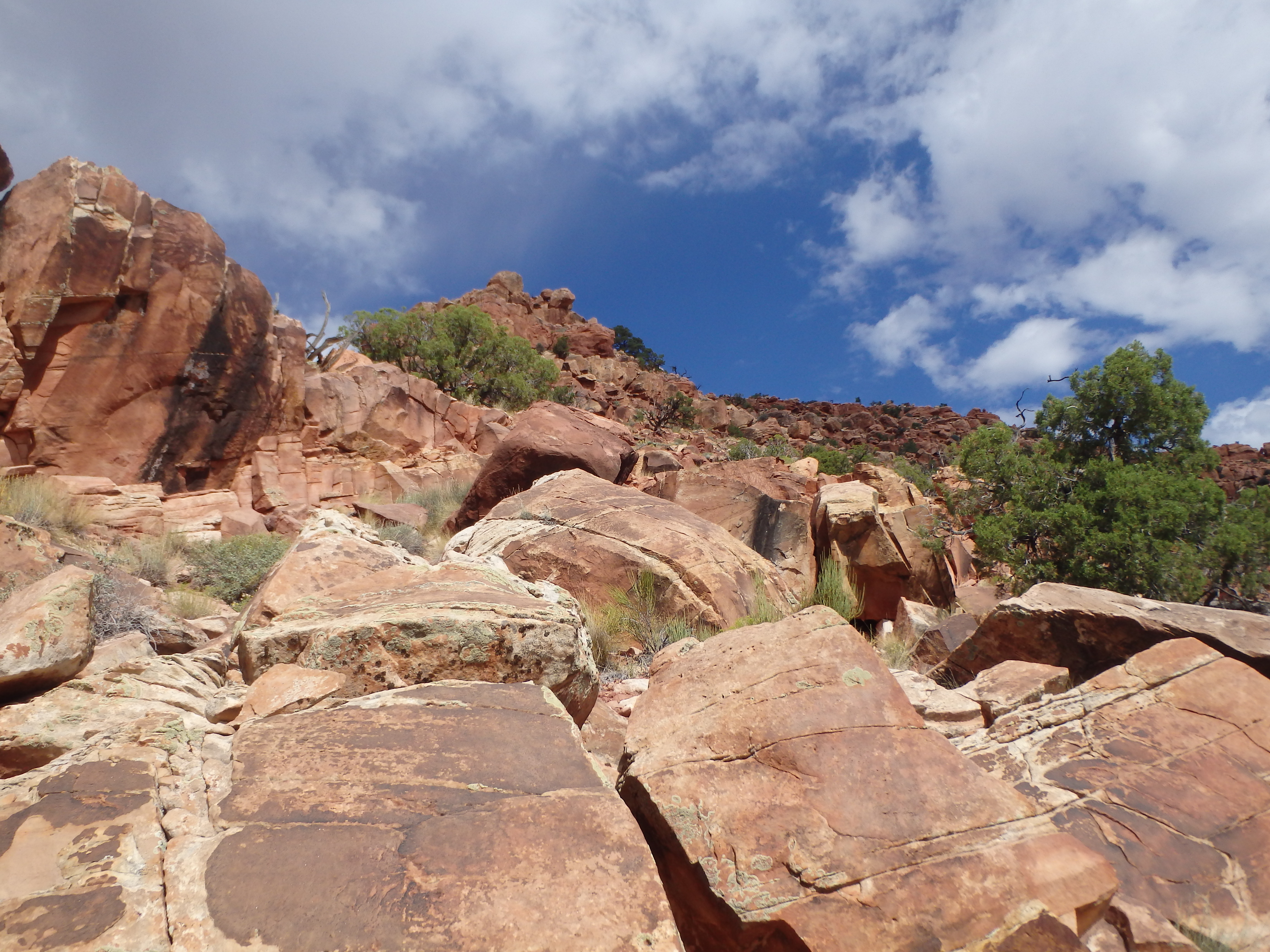
After the rapid descent to the saddle with Escalante, the trail eases up and stays more or less steady as it traverses east into a shallow basin. Once around Escalante’s SE ridge, I was able to get my first view of Cardenas Butte, where I was headed first. I followed the Tanner Trail around towards the base of Cardenas, and from there, left the trail up the Southeast Ridge. Cross country was fairly early in the lower sections, but became more challenging high up as the boulders became larger.

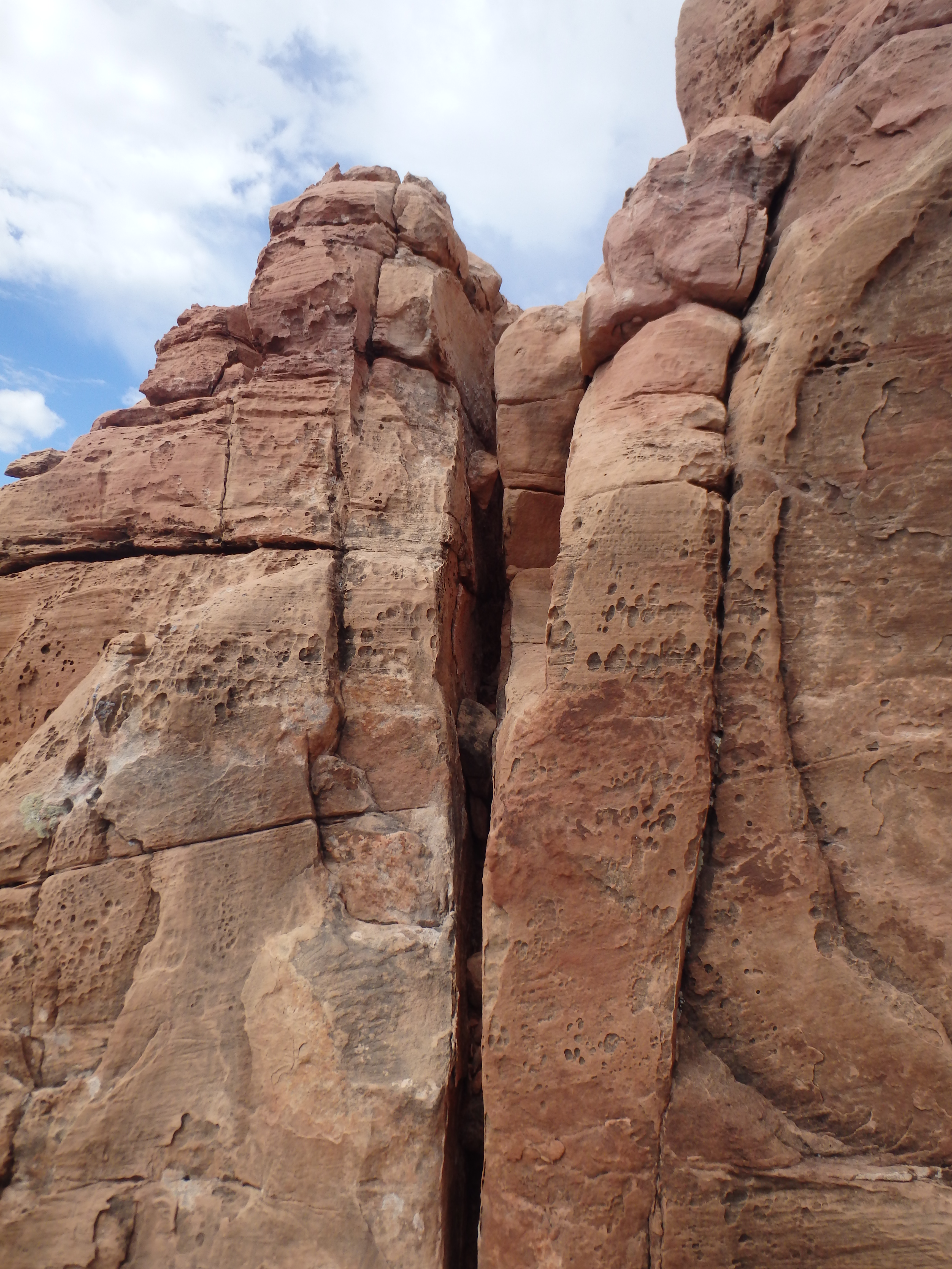
Eventually the ridge narrowed bringing me to the base of the summit capstone, with a dramatic dropoff to the west and a series of ledges in front of me. The summit was gained by a pair of short class III cracks/ chimneys, which were likely the crux of the day. I probably could have found a class II option if I had searched farther east, but they were easy enough that I didn’t look too hard for other options.


From there it was smooth sailing to the summit. I spent some time at the summit, signing the summit register, which was averaging about 9 people a year. I could see the entire length of the connecting ridgeline to Escalante from the summit, and I could see I had my work cut out for me with several dropoffs, and a small butte in between.


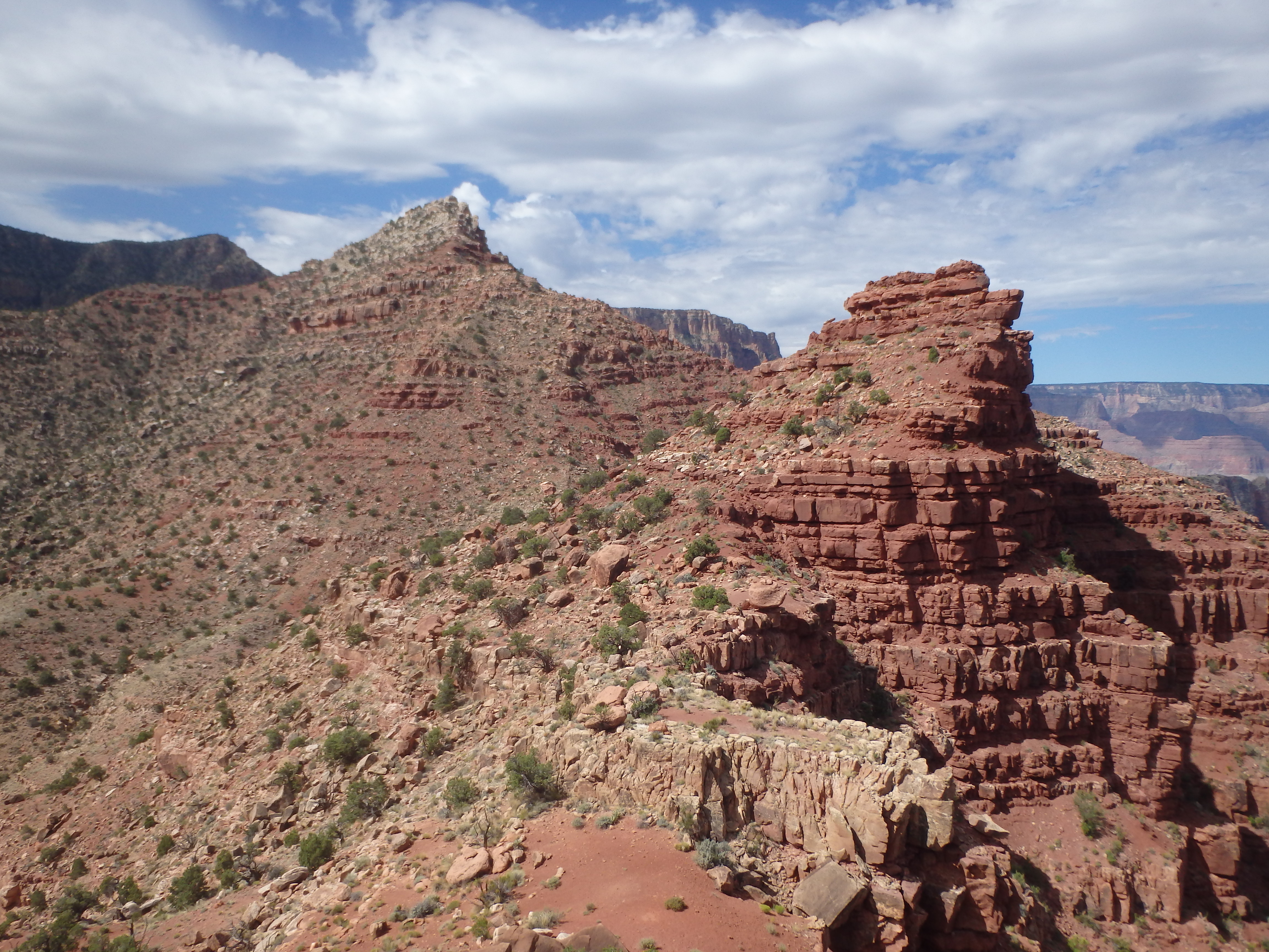
In between Escalante and Cardenas is a small butte unofficially named Escaldenas Butte, the love child of the two summits. After weaving back and forth around ledges to avoid some minor cliffs, I decided to head up this little butte on the way.
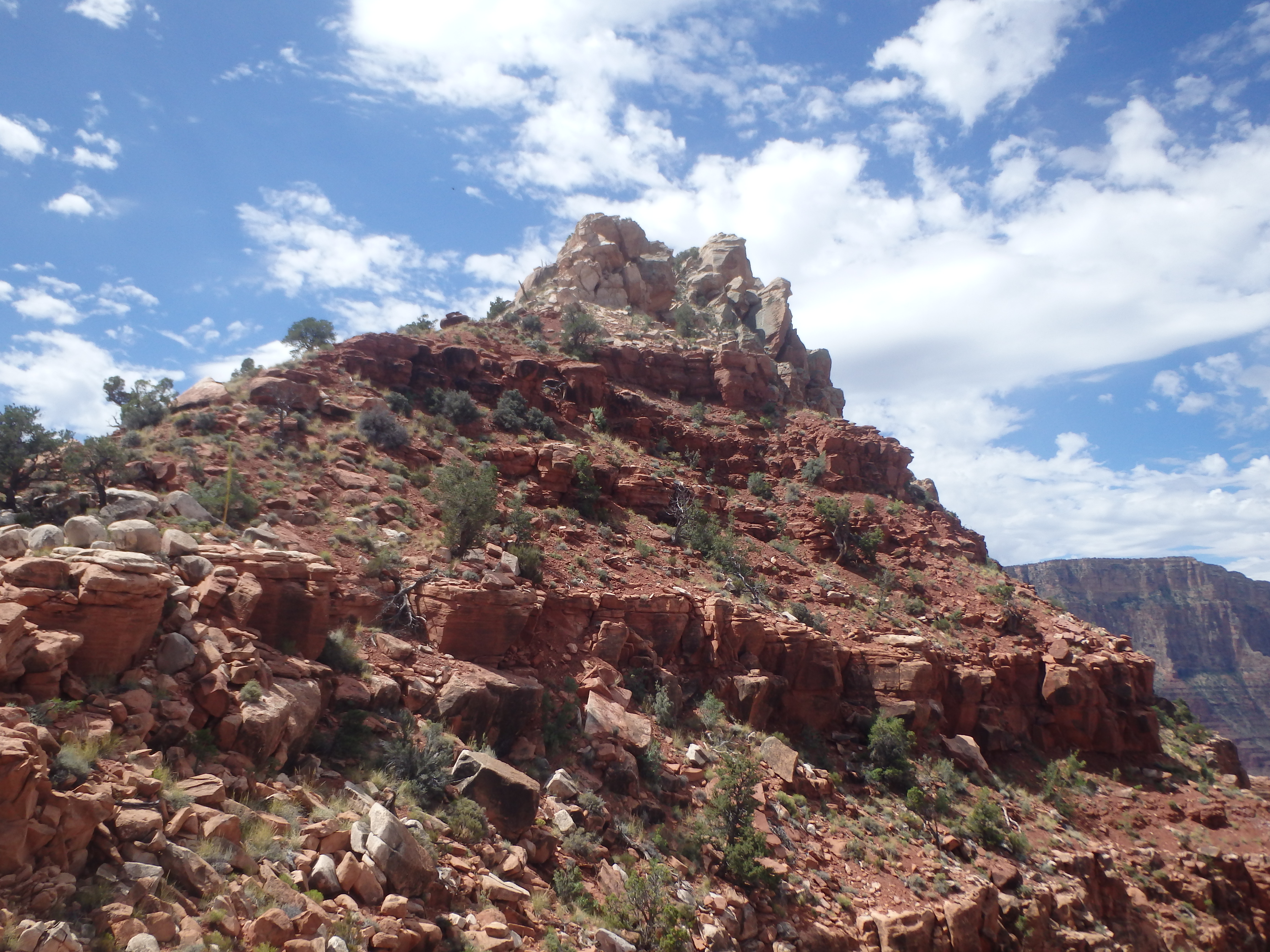
After the brief pitstop, I headed directly up Escalante’s North ridge. At first the scrambling with similar to Cardenas, moving around large red sandstone boulders from the Supai group. Then, about 300′ below the summit, the rocks dramatically change to a enormous white Coconino sandstone boulders.
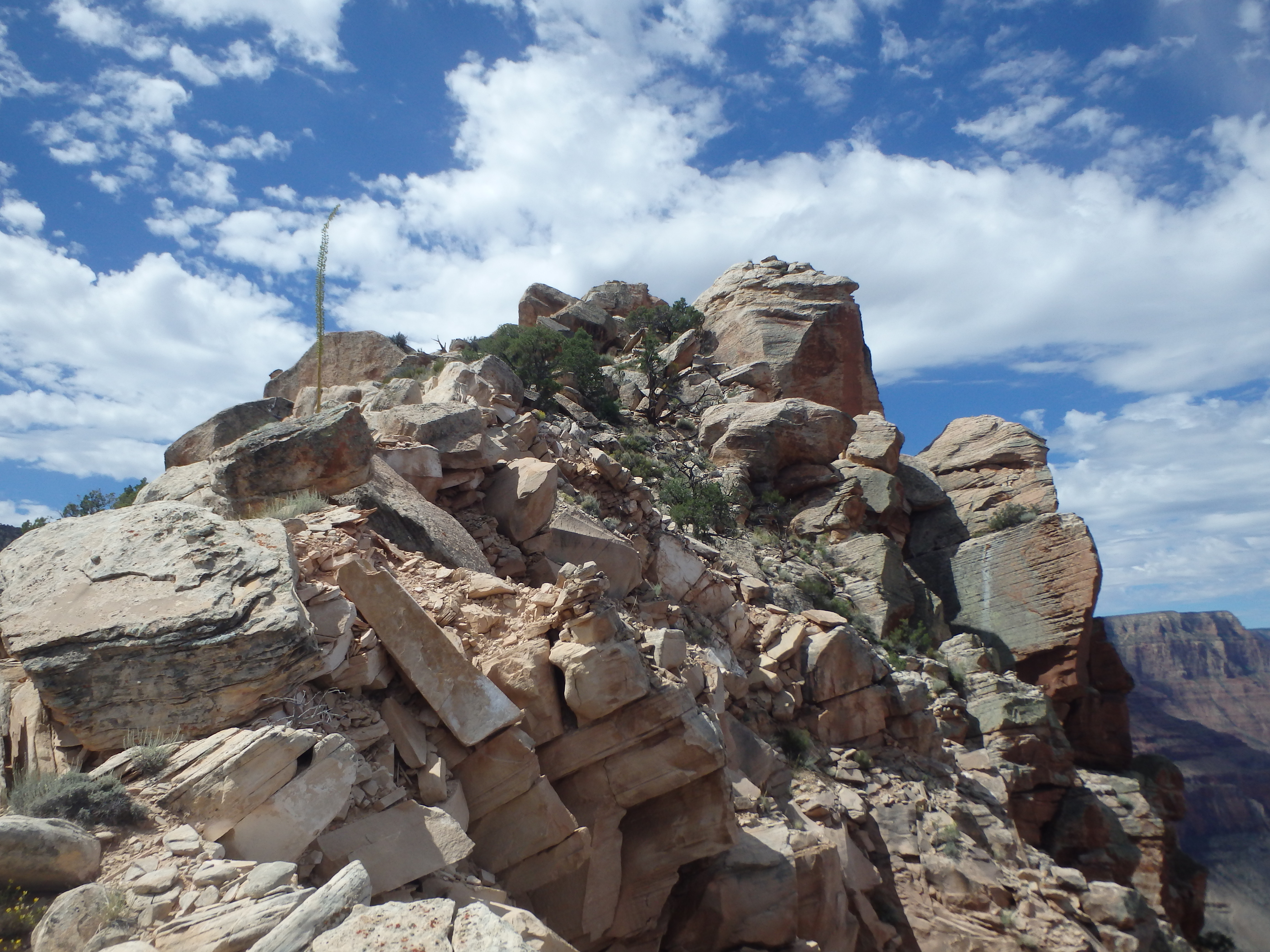
From there the climbing became a bit more challenging as the rocks were much larger to work around and over. When I was nearly at that top, I heard a huge rustle ahead and popped my head up to see two large, terrified Condors that were not expecting company. One was so startled and upset that he literally threw up all over the rocks. A little dramatic if you ask me.

Since they are federally protected endangered species, I gave them as wide a berth as I could on the narrow ridge and made it to the base of the summit block. Unlike the other Grand Canyon summits I had been to which featured a difficult capstone to get through but a broad, flat summit, Escalante has a huge 20′ high cleaved boulder claiming the sole highest spot. The southern half of the boulder is an easy class III exercise up, but the higher, north half is the higher end of class IV. Thus came then mental crux of the day, an airy step across from the southern half to the higher northern half.
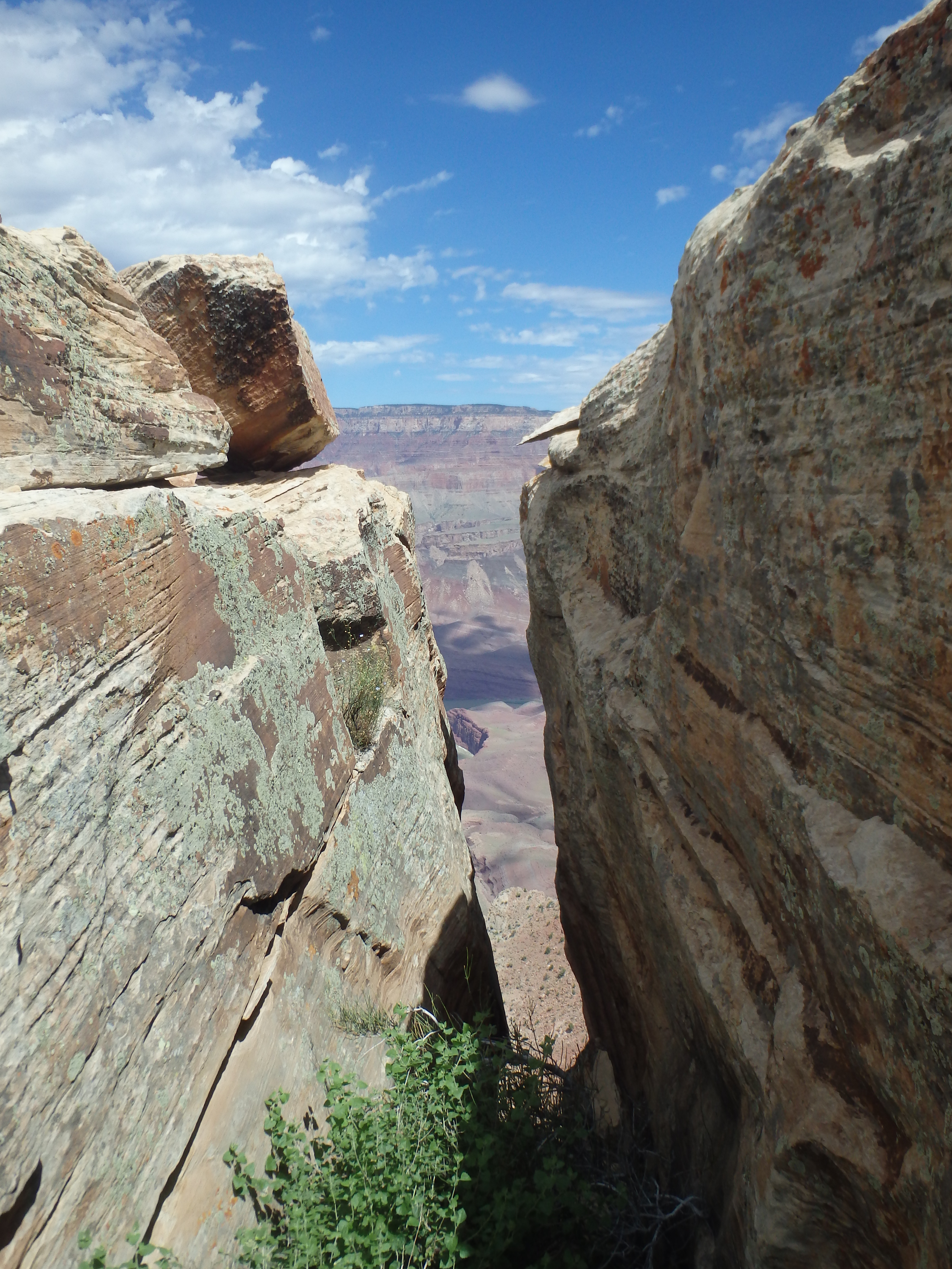
While the distance between the two blocks is probably about 2.5′ and I didn’t need to even actually leave the ground, the blocks hang off the mountain, and the thin area that is best to cross is hanging above several hundred feet of air, enough to turn your stomach in knots. Easy to physically do, but mentally terrifying. This summit also had a summit register, this one only seeing an average of 3 people/ year, much less popular, probably due to the slightly more difficult scrambling.

I dropped off the summit and hid in the shade for a bit, and ultimately descended directly off the south side to form a small loop, which was overall uneventful. If anyone wanted to only climb Escalante and not Cardenas, they could easily climb it directly from the south and shave some miles off the Tanner Trail.
Once back at the saddle, it was just 2.5 miles and 1700′ of steep, hot, dusty switchbacks to get me back to the rim. In the Grand Canyon, going down is optional, coming up in mandatory.
Fantastic views. I hope you always have your beacon???
Is my Strava app totally off? I just did it and it said 7.2 miles. Hmmm
I used a Trimble app for some of my earlier trip reports and just report whatever it told me. I wouldn’t be surprised if Strava was closer to the truth.