
The Flatiron 4861′ and Point 5024′
Total Time: 6 hours
Roundtrip Mileage: 6.7 miles
Elevation Gain: 3500′
Crux: Class 3
Companions: Holly, Cara Whittingham, Steve Whittingham
Trailhead: Siphon Draw- water, toilets, $7 fee


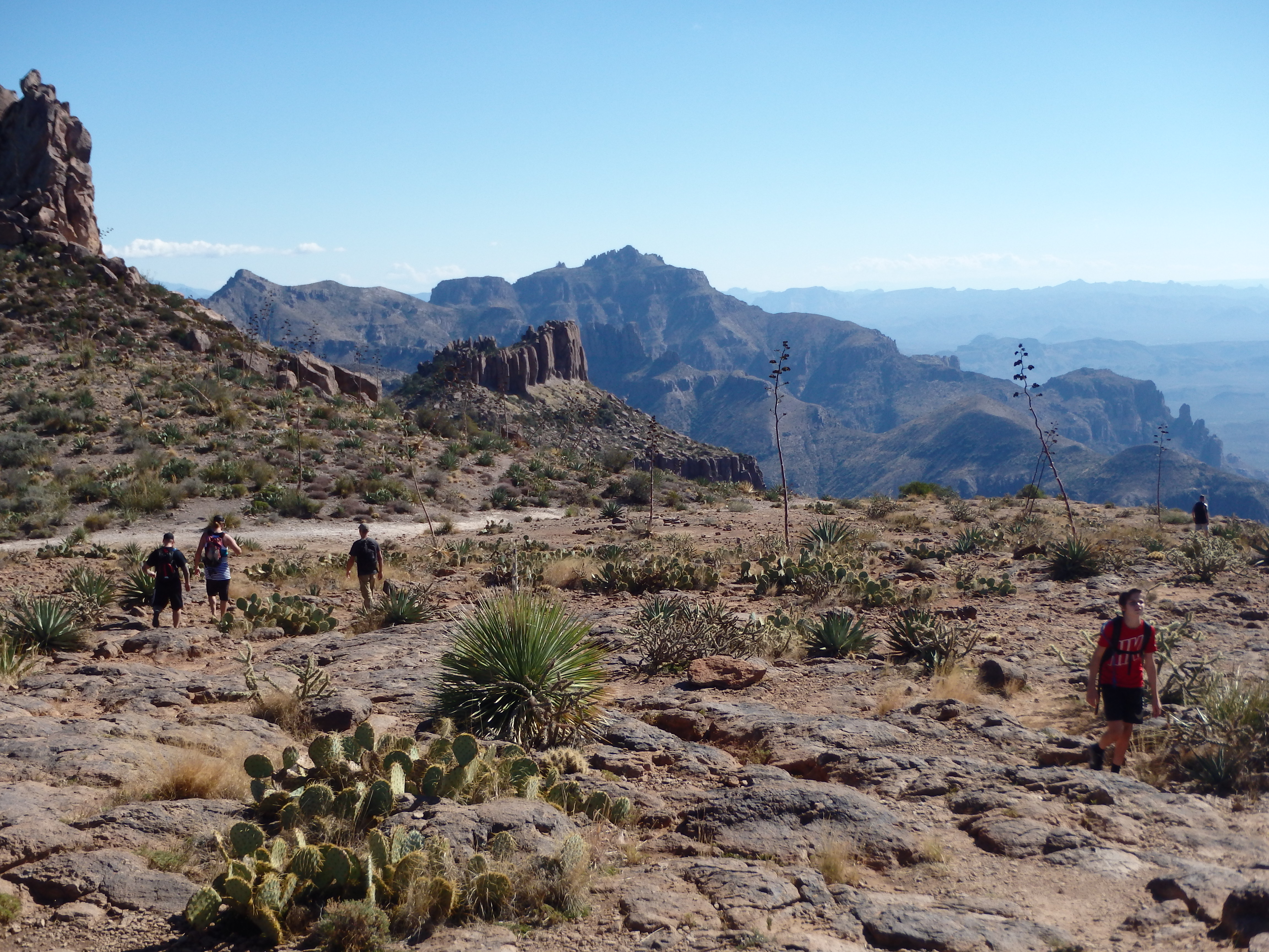
The Flatiron (I believe pronounced FLAT-EE-RON) is another Phoenix icon. Towering over Apache Junction SE of the city, rock spires and deep canyon shoot 3,000′ above the desert to form the western edge of the Superstition Mountains. Touted as “the most difficult hike in the valley,” a steep climb including several sections of scrambling and brings hikers to an open plateau that juts out from the Superstitions with the Valley of the Sun laid out to the west. While it’s easy to argue there are more difficult hikes, particularly if you’re willing to string some peaks together (such as the Superstition Ridgeline traverse) it is without a doubt one of the most scenic and rewarding hikes under an hour from Phoenix. Despite being so popular, I had yet to climb the Flatiron, in part because I wanted to hike it with other people. So with my sister Cara and brother-in-law Steve in town looking to do some hiking, this seemed like the perfect time. We were finally at a time of year that didn’t require a painfully early start to beat the heat, and made it to Lost Dutchman State Park to begin our hike around 9AM. The main lot was already full, so we set out from the Saguaro lot along the trail that skirts the adjacent campground. The Flatiron summit was barely in view but washed out from the low sun, and we hiked up the comparatively gentle grade into the start of Siphon Draw. The trail stayed above the brushy wash below, and as we entered the shade, we had our first glimpse of what lay ahead. The summit, rising a good 2000′ above, was less than 1.5 miles away. The well defined path gave way to volcanic slickrock with trace water from the recent storm.


We stopped here for a break, our work cut out for us. It seems as if this was where some people choose to turn back, getting a glimpse of the upper basin before committing to the scrambling. But scrambling was exactly what we were after, and we weaved back and forth across the basin. A faint trail leads to a notch in order to bypass a small dry waterfall, but we quickly dropped back into the wash and continued our ascent.


The trail is extremely popular, and we were constantly passing people already descending from an earlier start. Because of it’s popularity, braided use trails weave around the canyon made by other hikers, and about 2/3s of the way up, I took us up the wrong side canyon. There were plenty of footprints, showing other hikers had made the same mistakes, but the scrambling grew more difficult and I realized too late that we were one canyon over. As we reached the rim of the Flatiron, we were forced to climb a short exposed section that had everyone in the group cursing my routefinding skills.


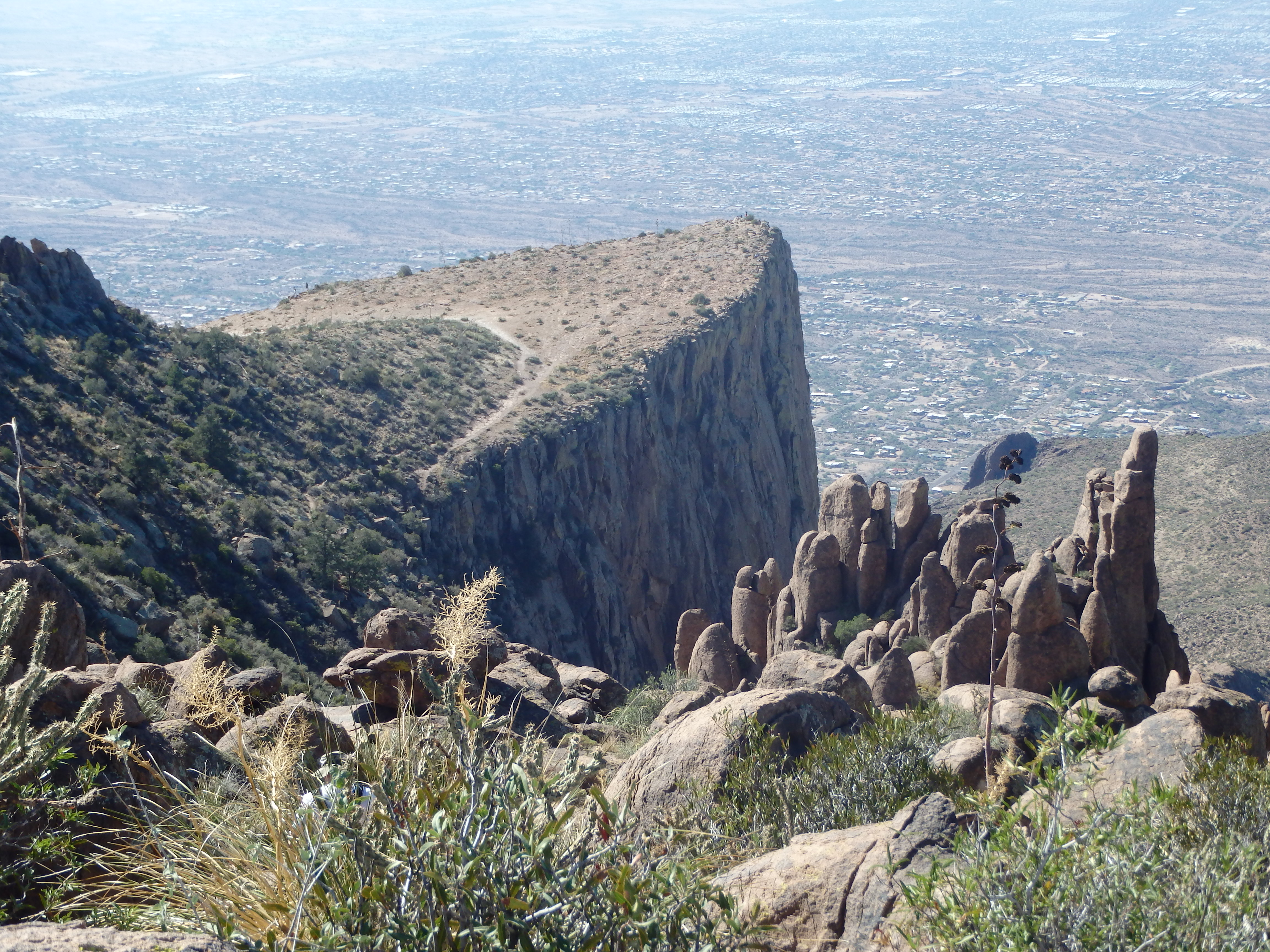
Thankfully, we regained the trail immediately after the sketchy spot and from there took a short walk across the plateau to the tip of the Flatiron. While a little bit hazy, we overall had spectacular views to Phoenix and south to the slightly higher Superstition Peak, which I had climbed the year prior. The summit was crowded on such a perfect day, and we found a spot on the rim to eat lunch, rehydrate, and discuss the finer points of GMOs and artisan cheese making (one hiker stopped us as we left to say he learned more from eavesdropping on our conversation in ten minutes than an entire year, and that we need to start a podcast immediately).


Despite my poor routefinding ability on the summit, everyone was in agreement to tag point 5024′, the highpoint of the northern end of the Superstition Ridgeline. We followed the use trail towards the highpoint, making note of the proper canyon to descend before climbing up a fairly well defined use trail. While the trail initially weaved through cacti and around brush, we encountered two short scrambles- the first up a short but steep slab, and the second through a pseudocave and up a crack to the left.


From there it was easy trail the remaining distance to the summit, with a few other adventurous souls already on top and away from the crowds on the Flatiron. I pointed out Weaver’s Needle to the group, although it hardly seemed as impressive from this angle, overshadowed by many other summits in the area. We took some more photos at this summit, including the only group photo of the day. Looking down on the Flatiron from the summit, it was now easy to understand how it got it’s name by it’s iron shape, more obvious from above.


We descended the way we came, and started down the proper gully back towards the base. While still steep in spots with 1 or 2 interesting sections of class III, this route was definitely easier than our ascent route, and we dropped over 1000′ in less than an hour to the bottom of the basin. With shade in most of the canyon, I was able to see the “Crying Dinosaur,” a dramatic volcanic spire in the canyon that is known as one of the Superstition’s best adventure climbs. Perhaps some day….

Leaving the basin, it was easy hiking across the desert back the car, the sun already low this late in the year. From there we headed directly to Wilderness Brewing Company, the only logical place to celebrate a Flatiron summit with burgers and brews….