
Mount Huethawali 6281′ and Fiske Butte 4748′
Total Time: 10 hours
Roundtrip Mileage: 14.0
Elevation Gain: 4550′
Crux: Difficult class 3
Trailhead: South Bass, no services


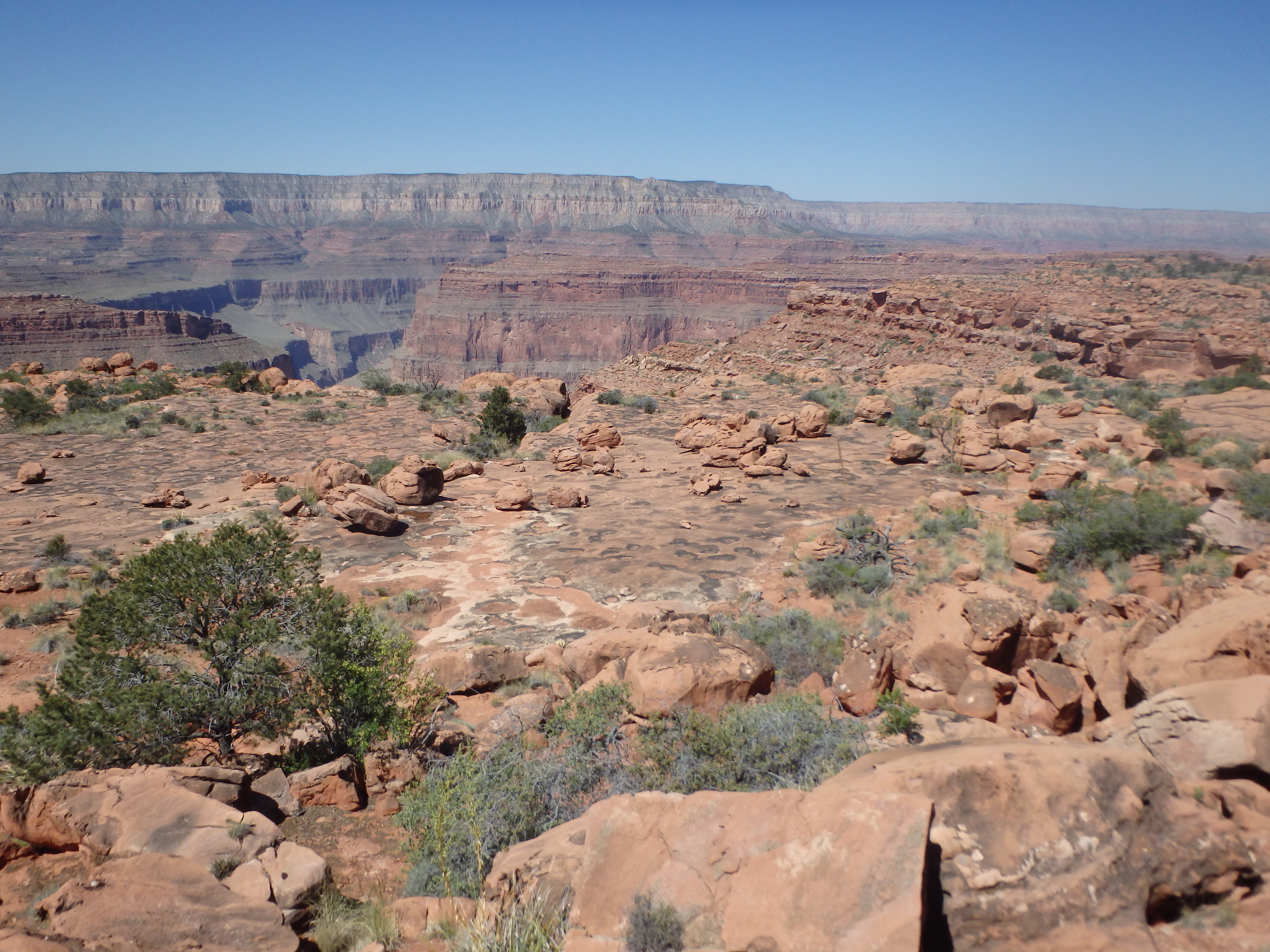
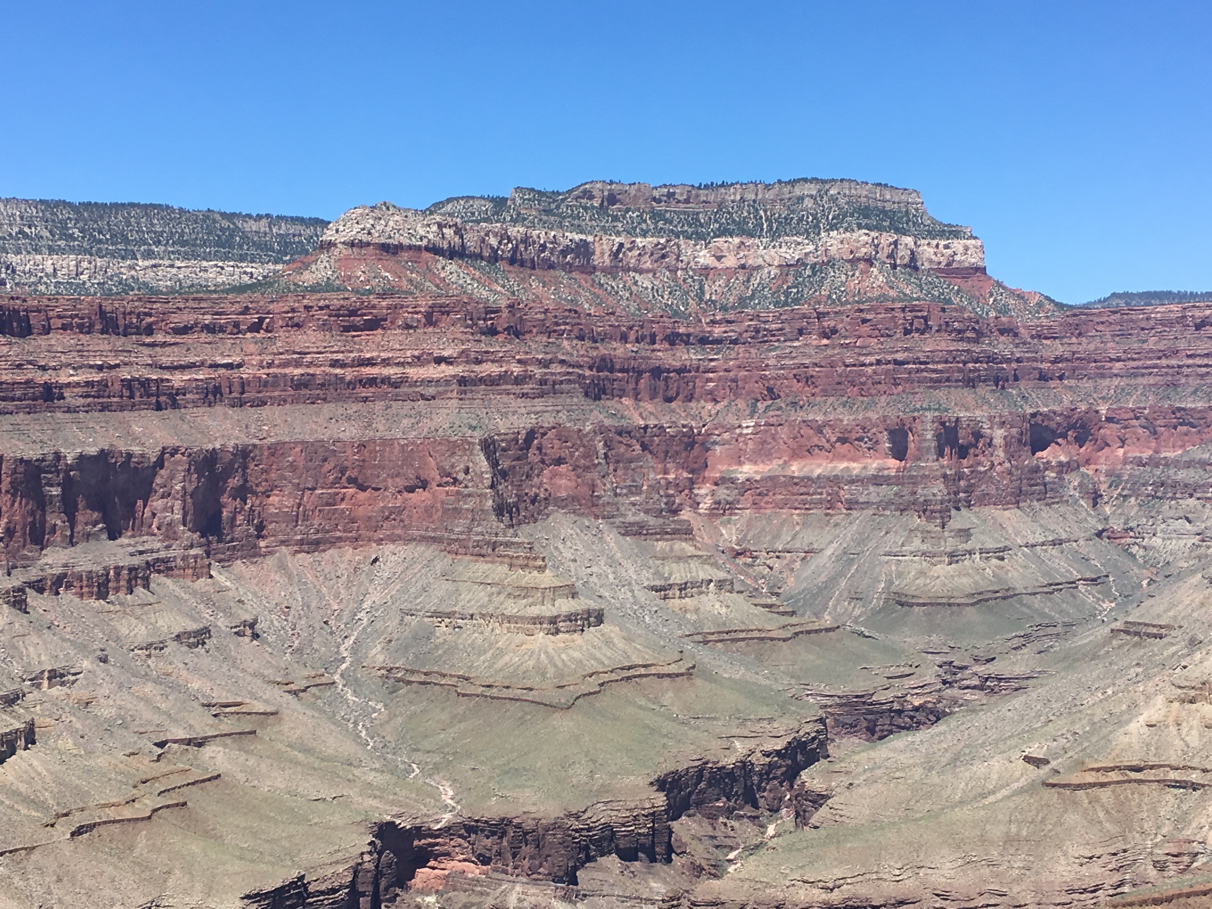
Mount Huethawali (pronounced Wee-the-wali) boasts one of the finest views of any summit in the Western Grand Canyon National Park. The peak is located just off the South Bass Trail, originally blazed by William Bass in the late 1800s, one of the true pioneers of the Grand Canyon. Over the river are the remnants of a cable system, the first rim to rim route across the canyon, long reclaimed by nature after the construction of the bridges crossing into Phantom Canyon. Given the proximity to the trail, Mount Huethawali, a Native American word for Observation Point, is considered one of the easier Grand Canyon summits, with only a little cross country to reach the base and fairly straightforward and easy class 2-3. It was this summit, along with Fiske Butte, Fossil Mountain and Mount Burro that brought me to this section of the Grand Canyon. I left Phoenix after work on Friday and headed north through Flagstaff, turning west just outside of Tusayan onto Forest dirt roads onto the painful rough drive to the South Bass Trailhead. The first few miles of the road were in decent shape, and there were plenty of campers dispersed along the forest road. As I left them behind closer to Tusayan, the road became rough with deep ruts, probably 8+ inches deep in spots. After over 20 miles of road, I reached the gate at Dodd Tank and the boundary with the Havasupai Tribal Lands, which needed to be crossed for about 3 miles. I had read that someone is occasionally stationed there and will charge a $25 fee to pass through (more on that on my Fossil Mountain trip report). No one was around at the late hour, so I pulled through the gate and continued on to Pasture Wash, where I turned north onto the further deteriorating road, crossing back into the National Forest and entering the National Park a few miles south of the rim. I reached the South Bass Trailhead at nearly 11PM and found one other group camped out at the trailhead and quickly inflated my sleeping pad and fell asleep in the back of my car. I woke up early the next morning, and after a quick breakfast, loaded my pack with a gallon of water and started down the trail. Mount Huethewali was directly in view from the start, glowing in the early morning light.

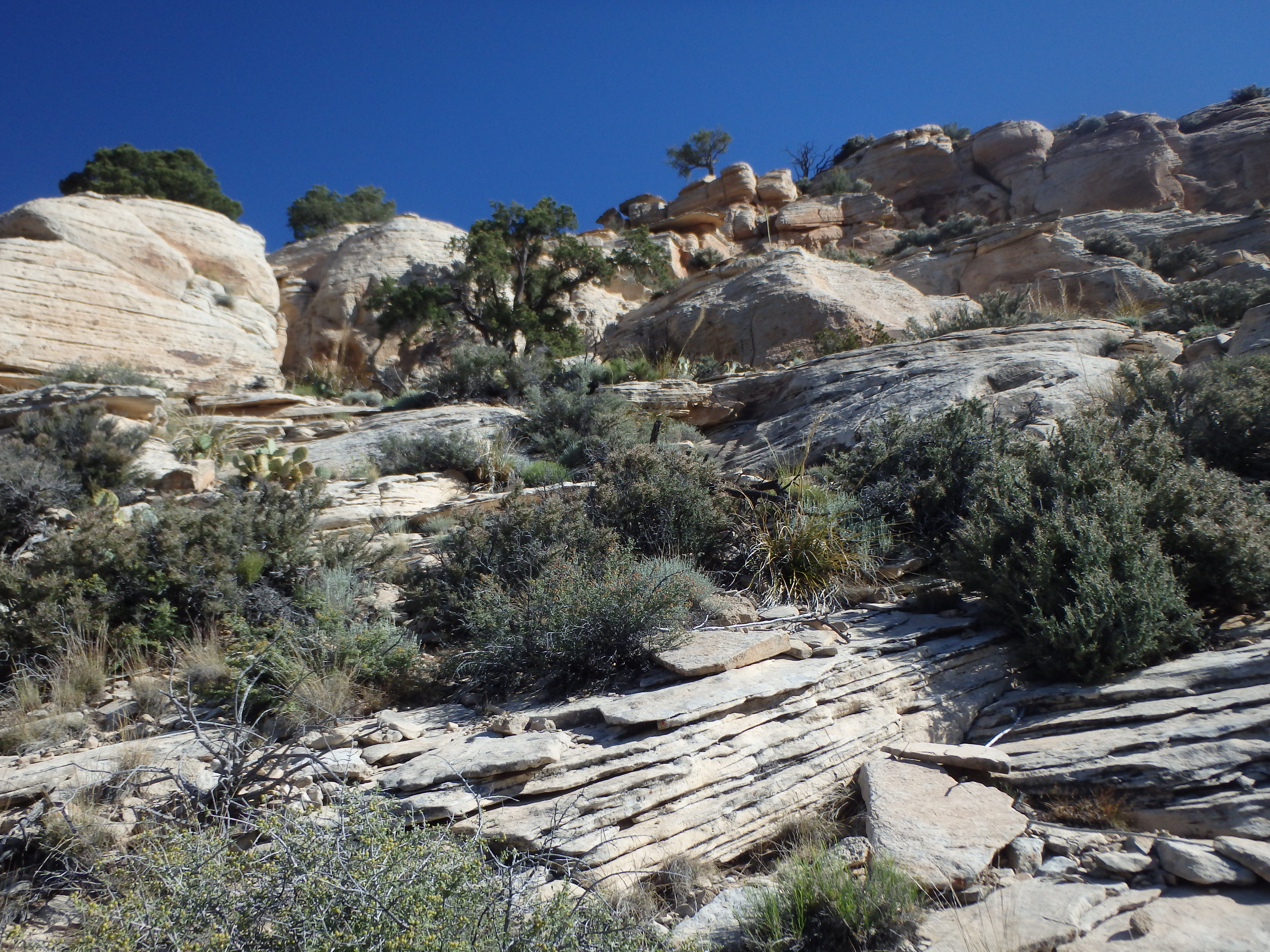
The South Bass Trail slowly winds around a high canyon before switching down a ramp in the Coconino, reaching the Darwin Plateau below. Nearing the plateau, I was surprised to find some Redwall cliffs blocking direct access to the base of Huethewali. The cliffs were less imposing a bit further east on the trail, and I left South Bass when I was in line with a small break in the cliff band. The easiest route up Huethawali ascends the SW face, utilizing class 2-3 slabs. I began an ascending traverse aiming for this face, and got a little too high too soon, resulting in some steep side-hilling before reaching the actual start of the route. There were some scattered cairns leading the way, but in truth there were a number of options in the rock face that would go, particularly if you were looking for more scrambling over the easier slabs.
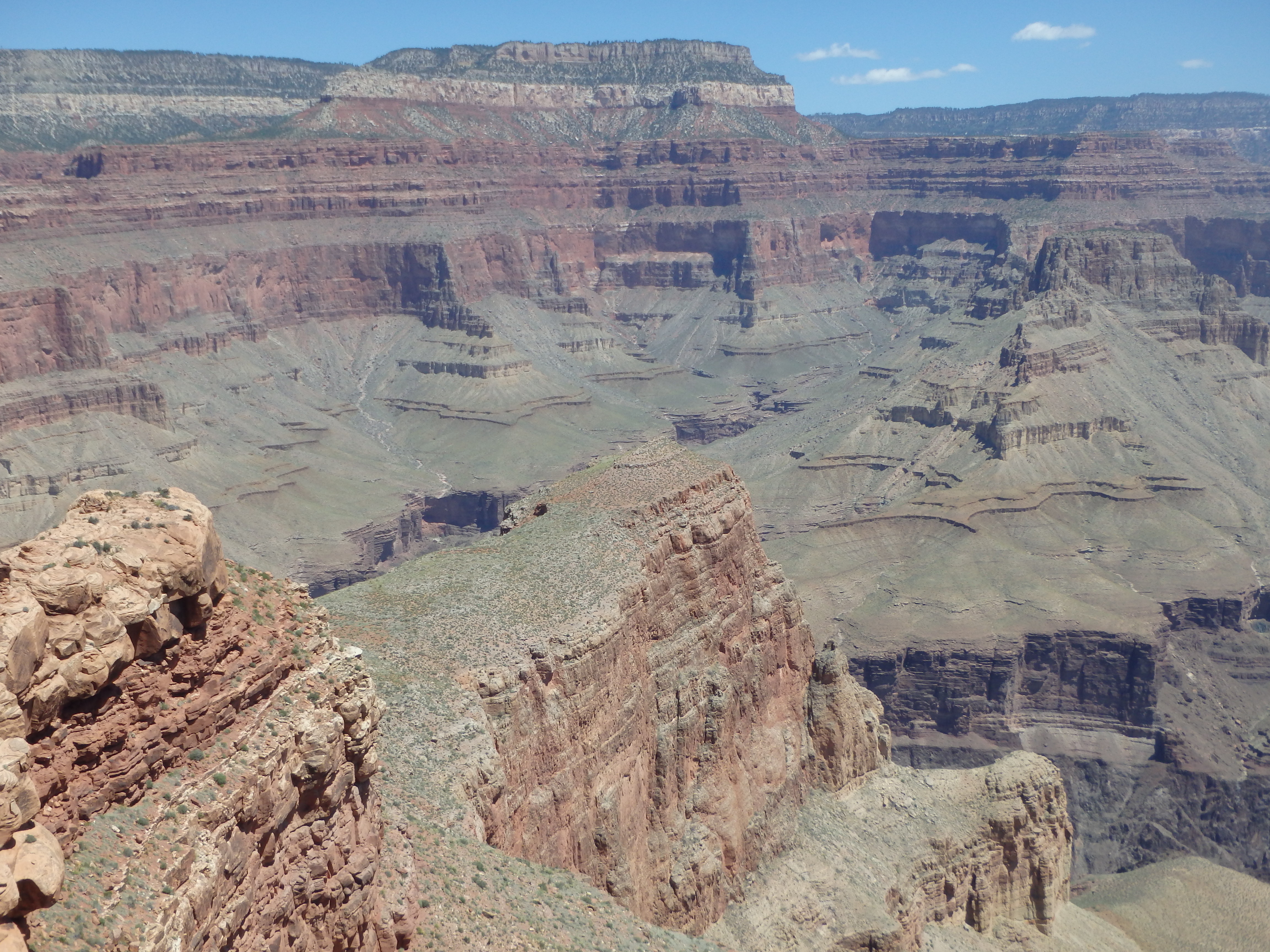
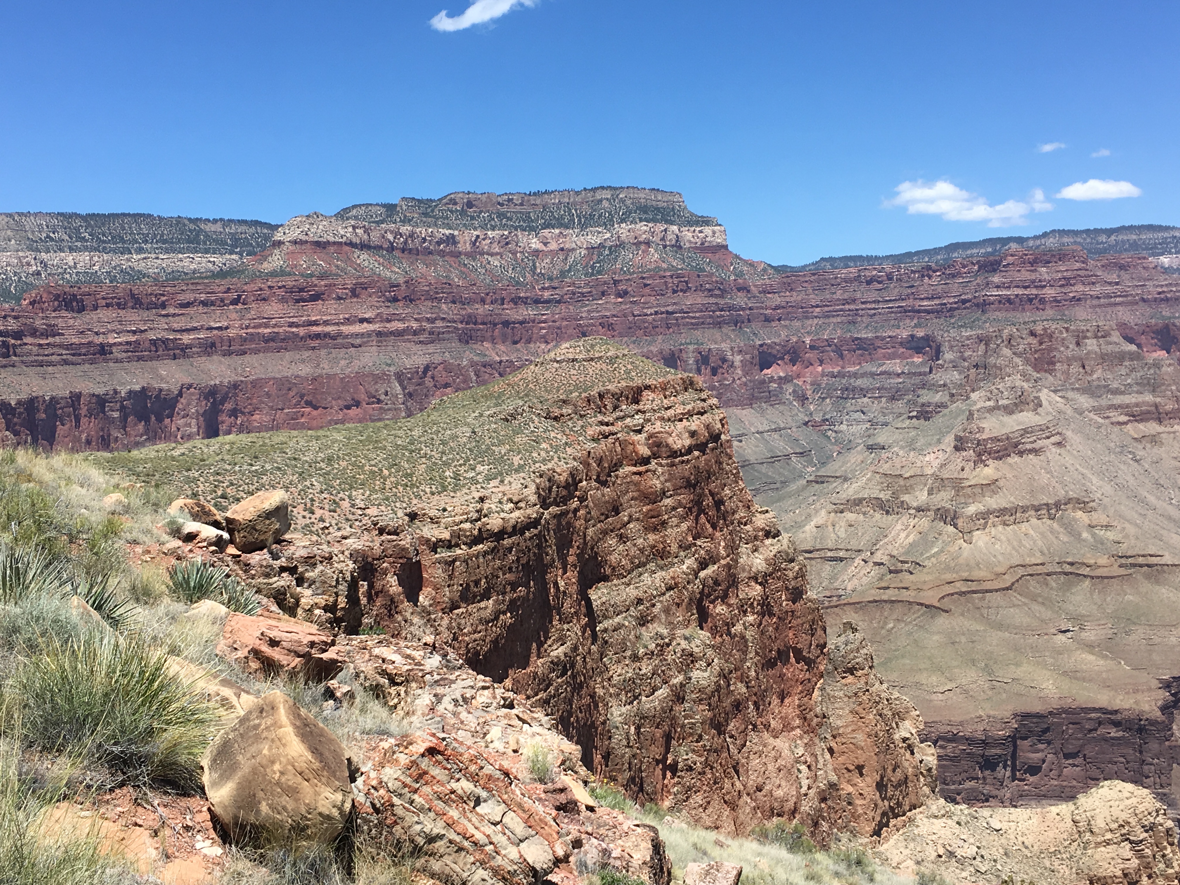
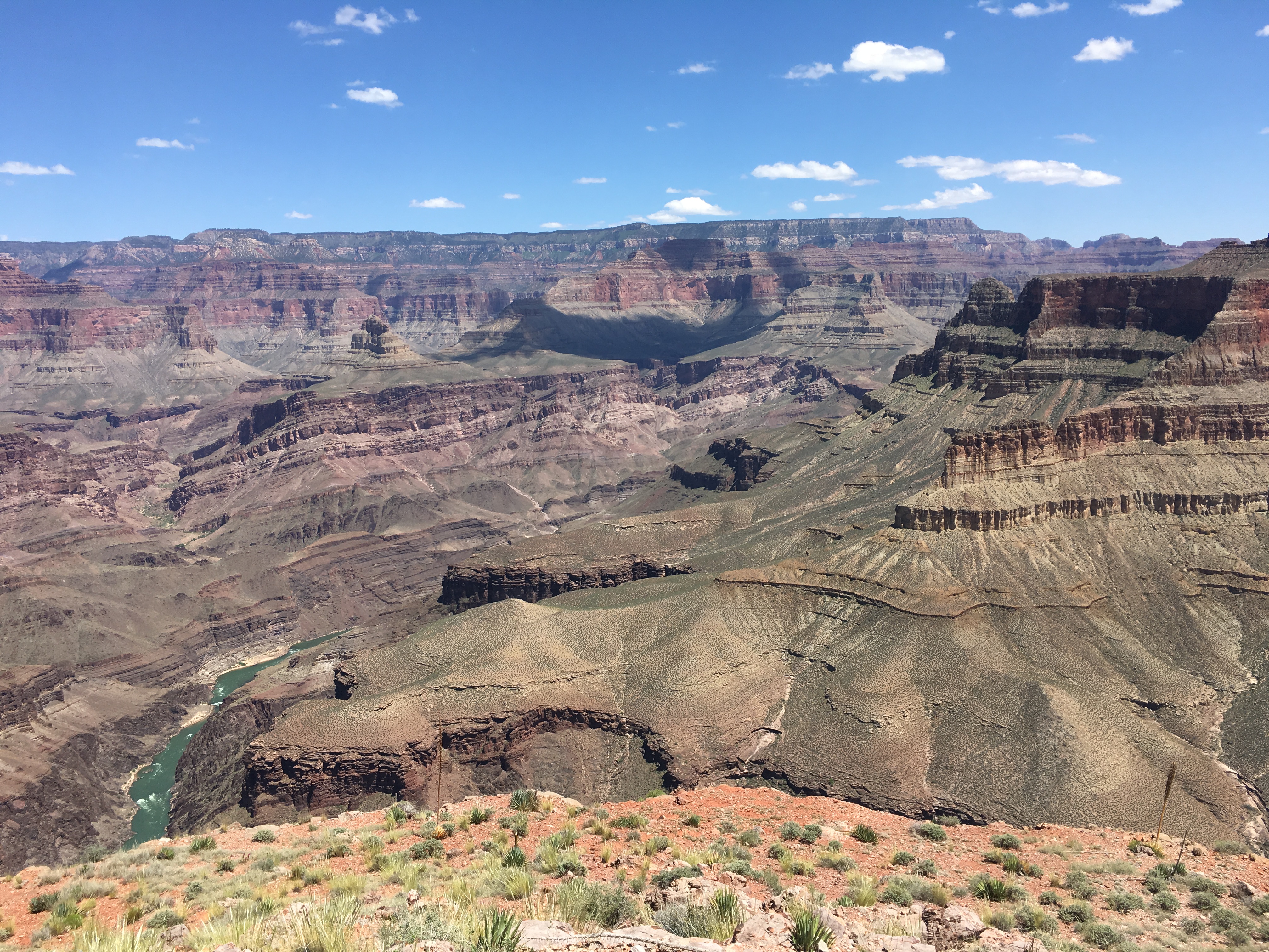
Reaching the summit ridge, I was surprised to find how narrow the mountain was, with the summit on a rather thin fin of rock. I topped out at the summit before 9AM, fairly pleased with my overall time. The views were most impressive to the east, although they were somewhat washed out by the low morning sun. From the summit of Huethawali, I could see Fiske Butte over 2000′ below. I knew from the map that it would be far, but I was unprepared for just how far it would look, the small summit at the end of a rock isthmus several rock layers and cliff bands below.


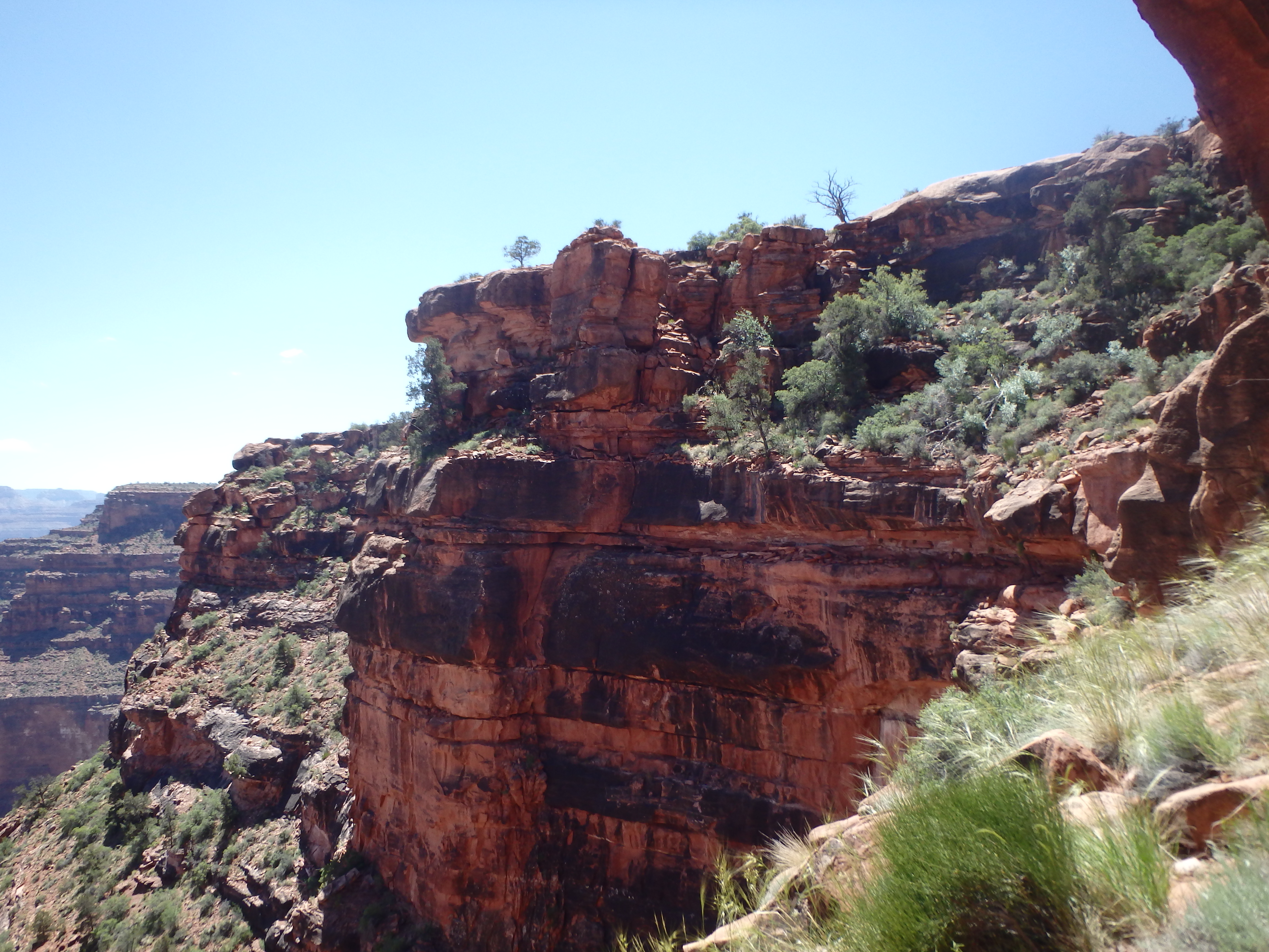
With a full day ahead, I did not stay on Huethawali long, and thought I might save time by dropping off the north face directly. This was a big mistake. I had descended only about 50′ before reaching a huge cliff band, dropping all the way to Darwin Plateau below. I decided to continue traversing at the top of the cliffs to the west, hoping to find a weakness I could utilize for a descent, all to no avail. Ultimately, I traversed all the way back to my ascent route, wasting a good 30 minutes in my attempted short cut. As I traversed around the west and north face of Huethawali, it was easy to see why I had trouble- the summit was guarded by 150′ cliffs on the northern face, making descent on that side impossible without a rope.

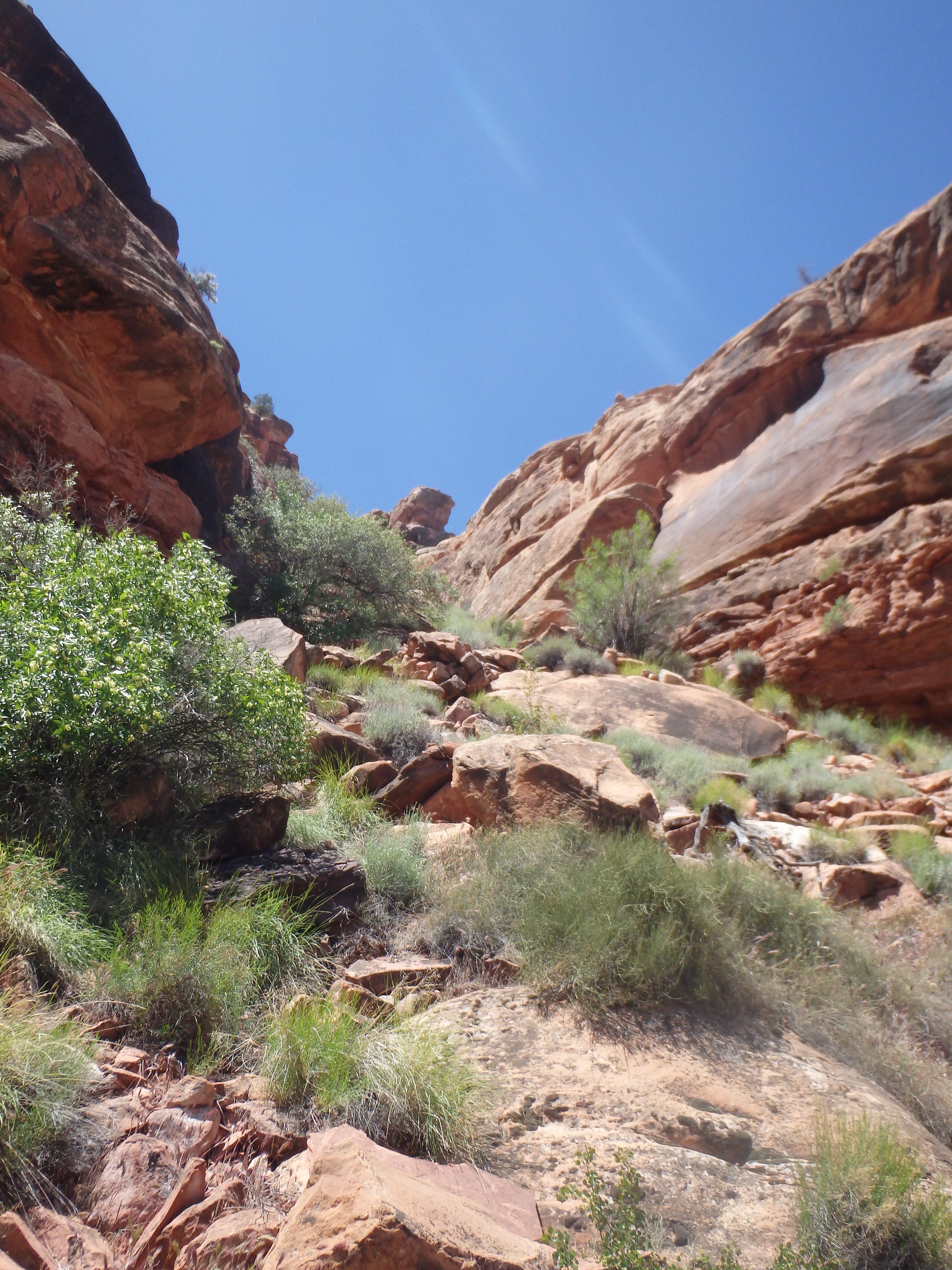
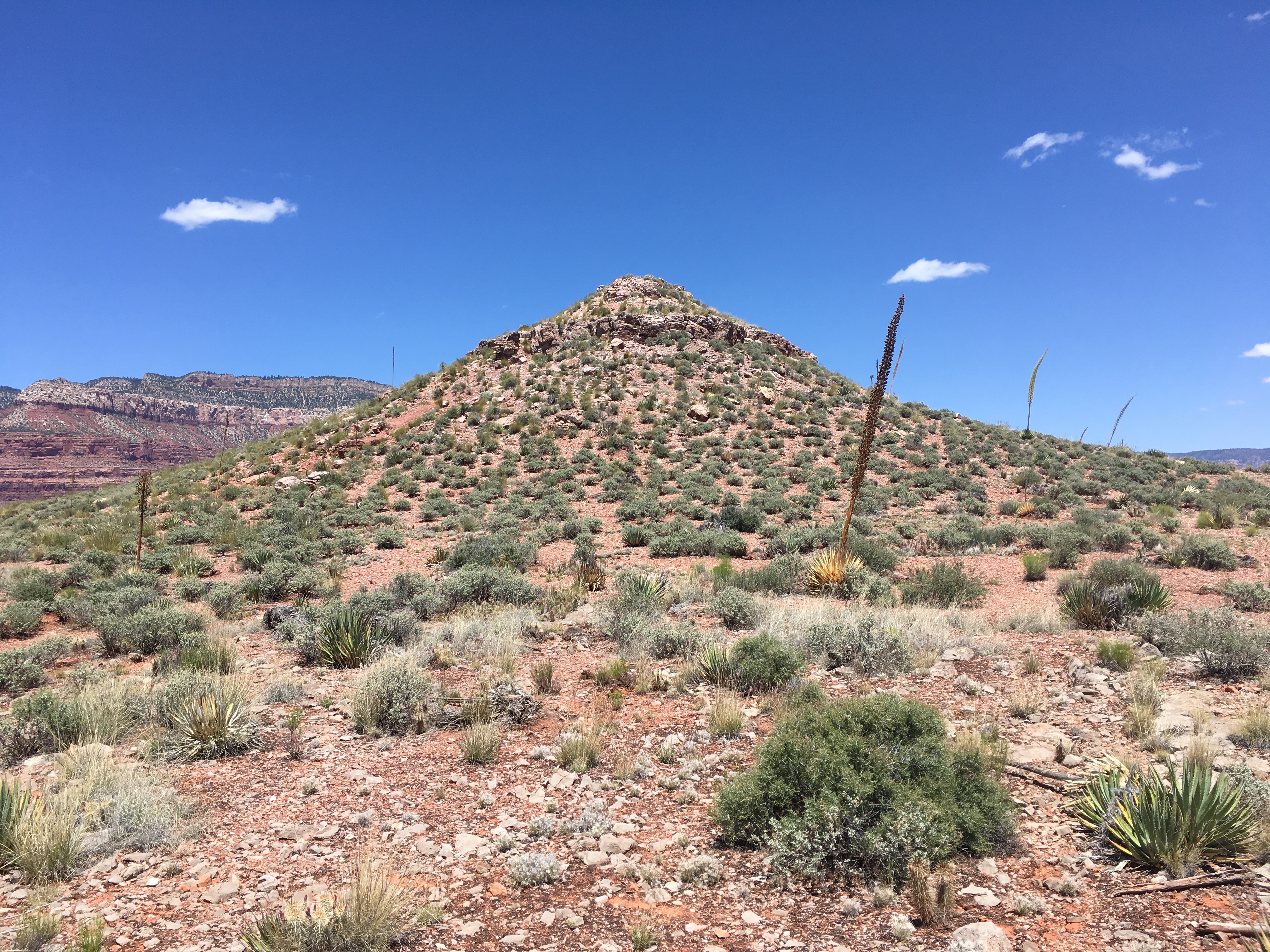
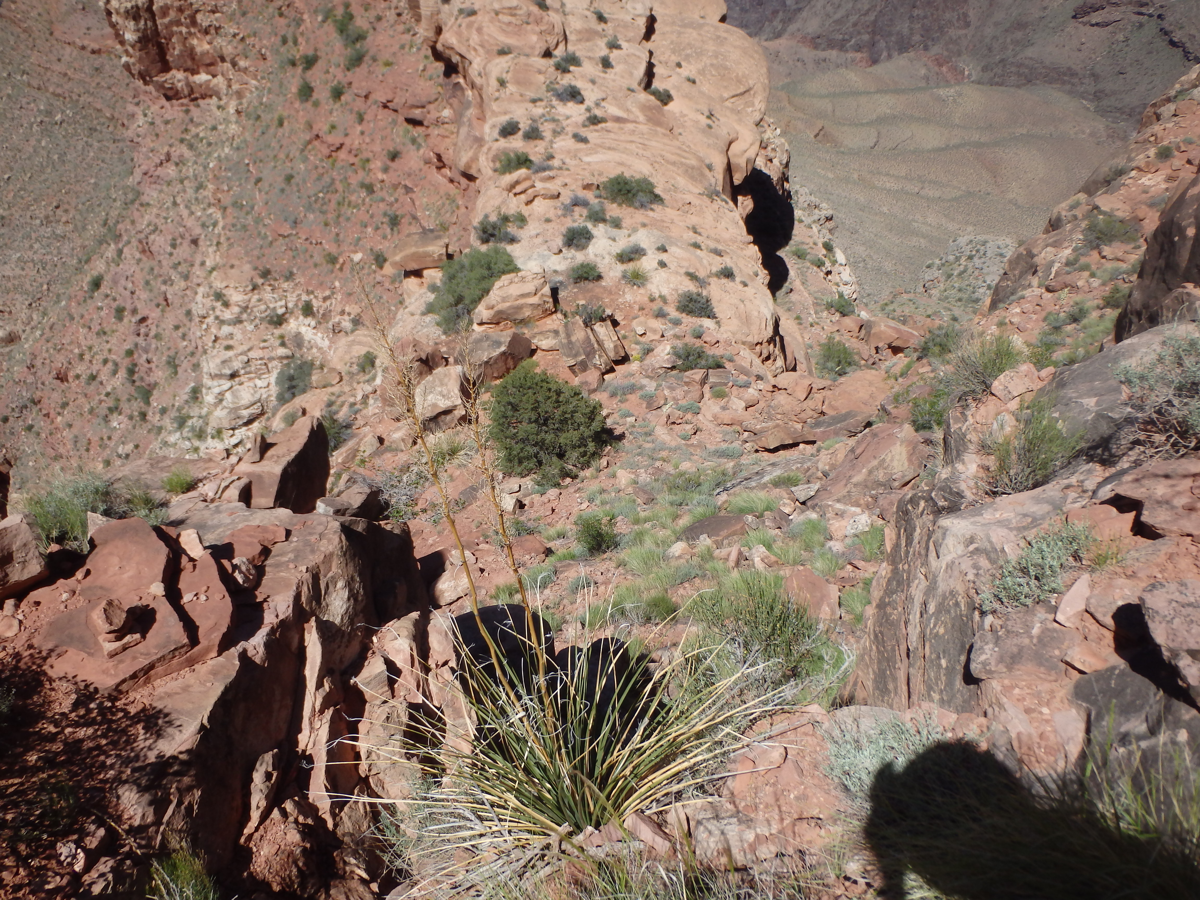
Back on easier ground, I continued across Spencer Terrace, a relatively flat 2 mile ridge of rock headed directly for Fiske Butte. About halfway from Huethawali, I reach Rock Garden, an area of sandstone slabs covering in large boulders, reminding me of glacial erratics in the Sierras.
I took a short break here to rehydrate and reapply sunscreen before continuing further north to the edge of the Terrace. I passed by the descent gully off the northeast face of the Terrace as I hiked to the tip, but realized my mistake and found the large cairn marking the descent through the first layer of cliffs. Fiske Butte was still nearly 1000′ below, and I quickly realized negotiating these cliffs bands would not be straightforward. Dropping down the first class 2 descent about 100′, I skirted cliffs and hiked north, finding another line down through the Redwall to the next layer.
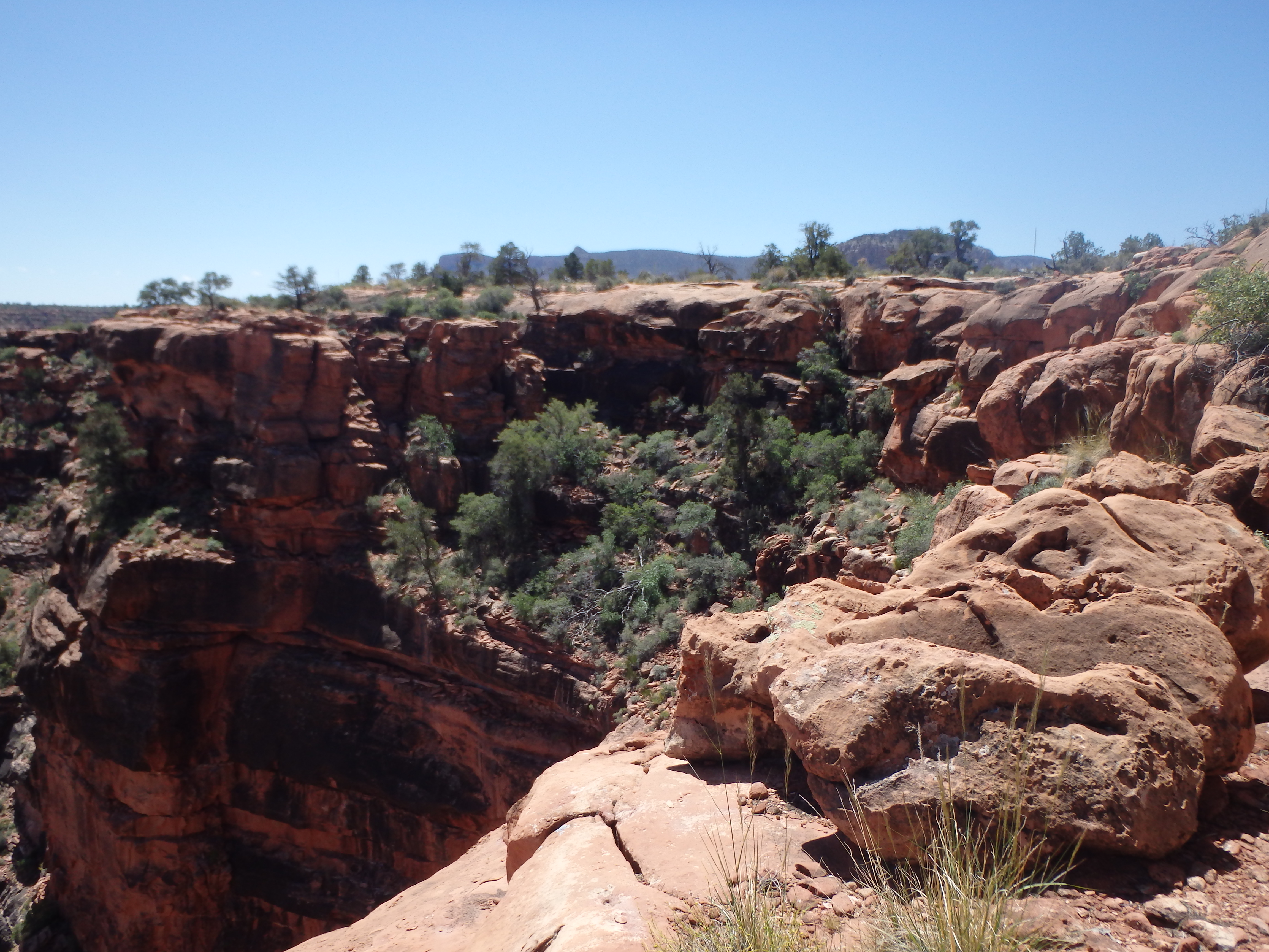
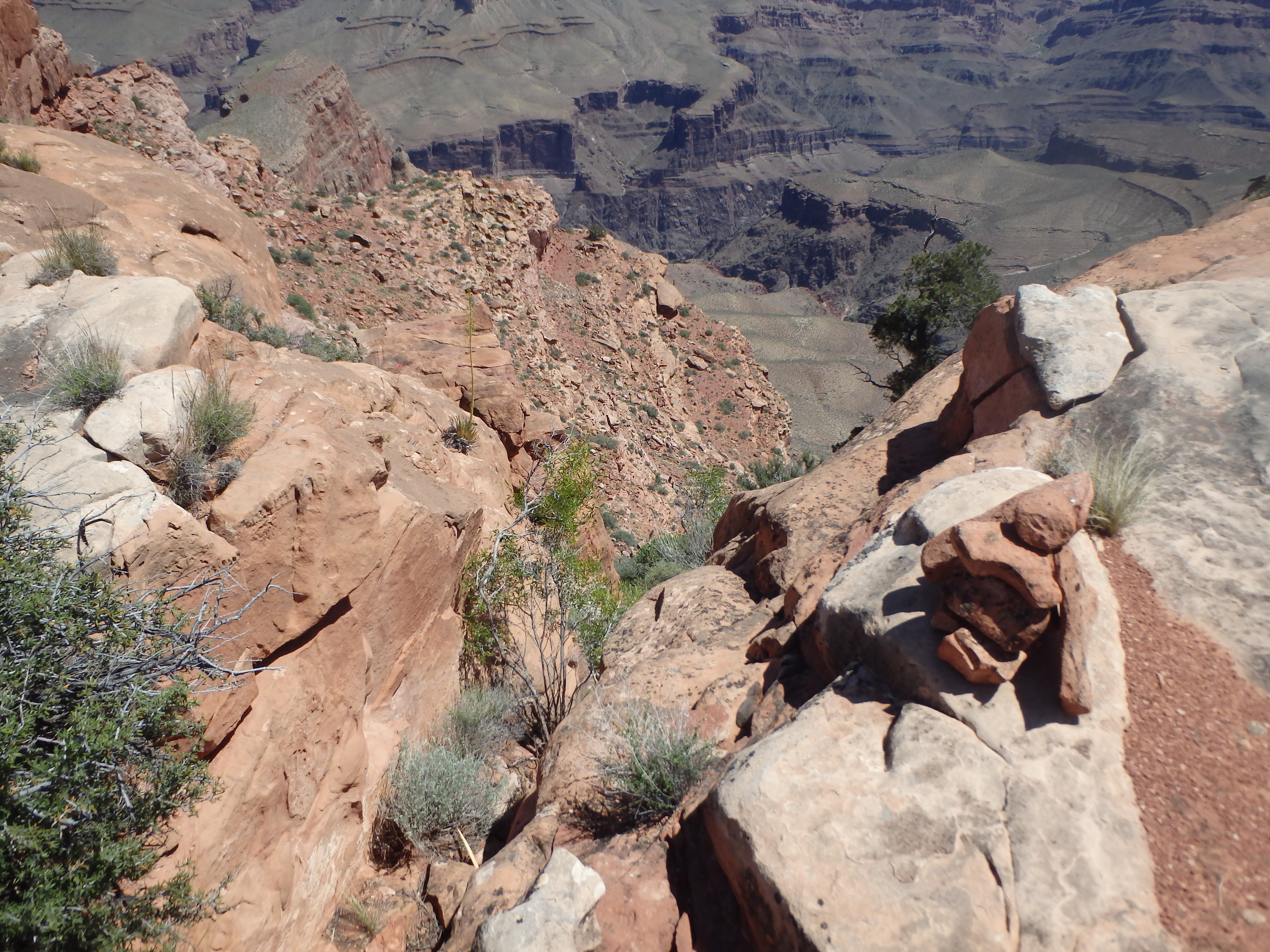
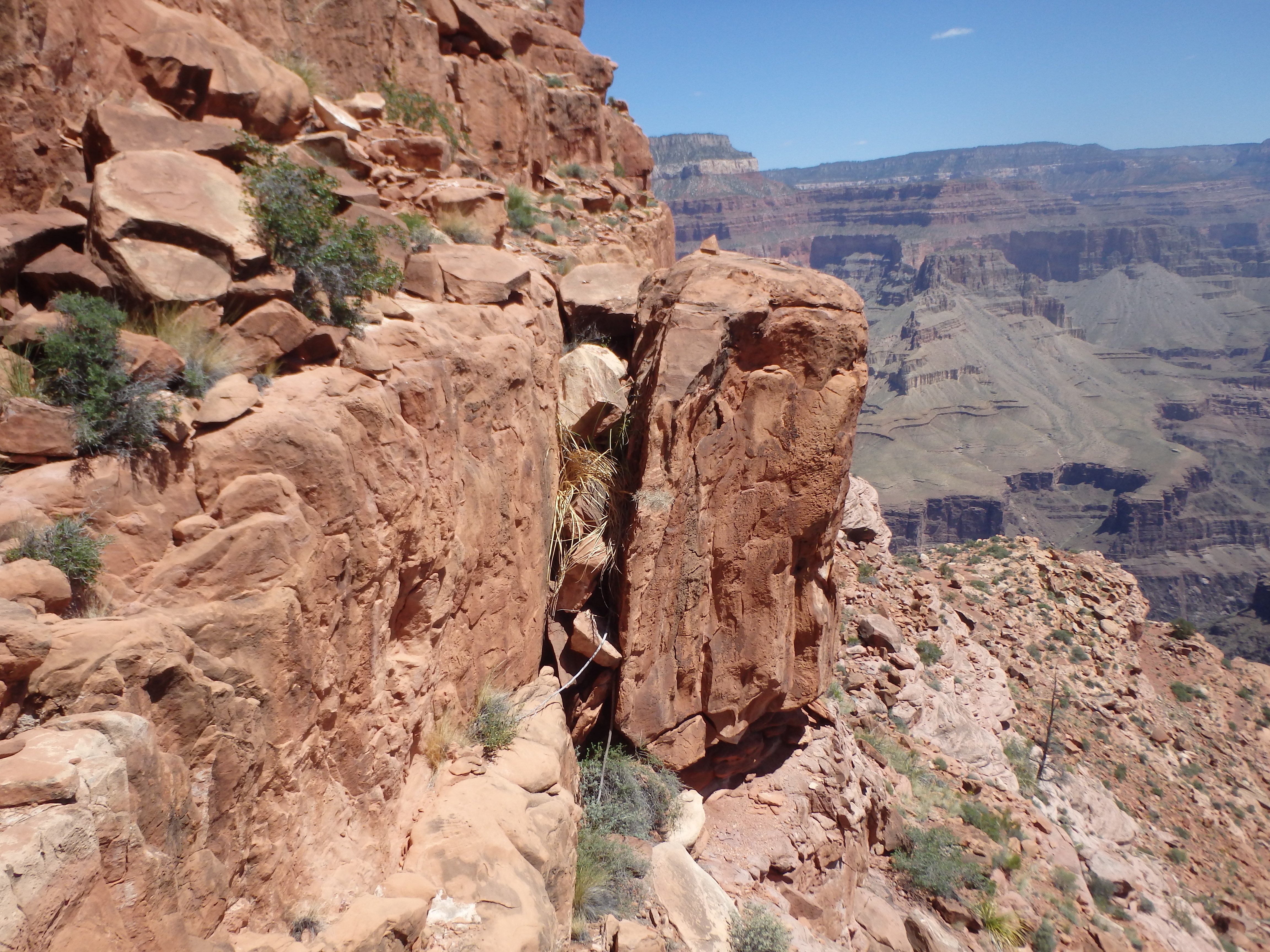
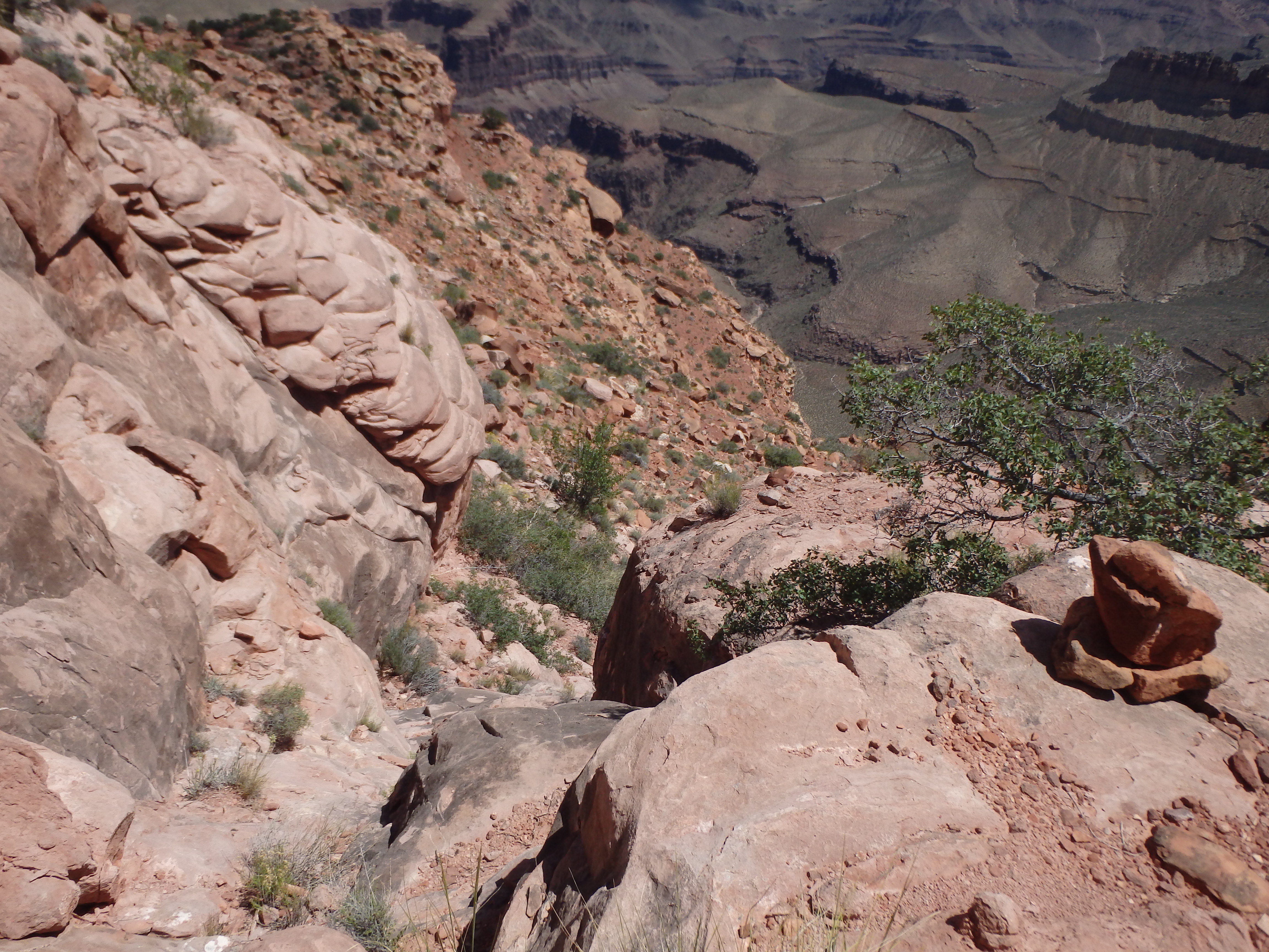
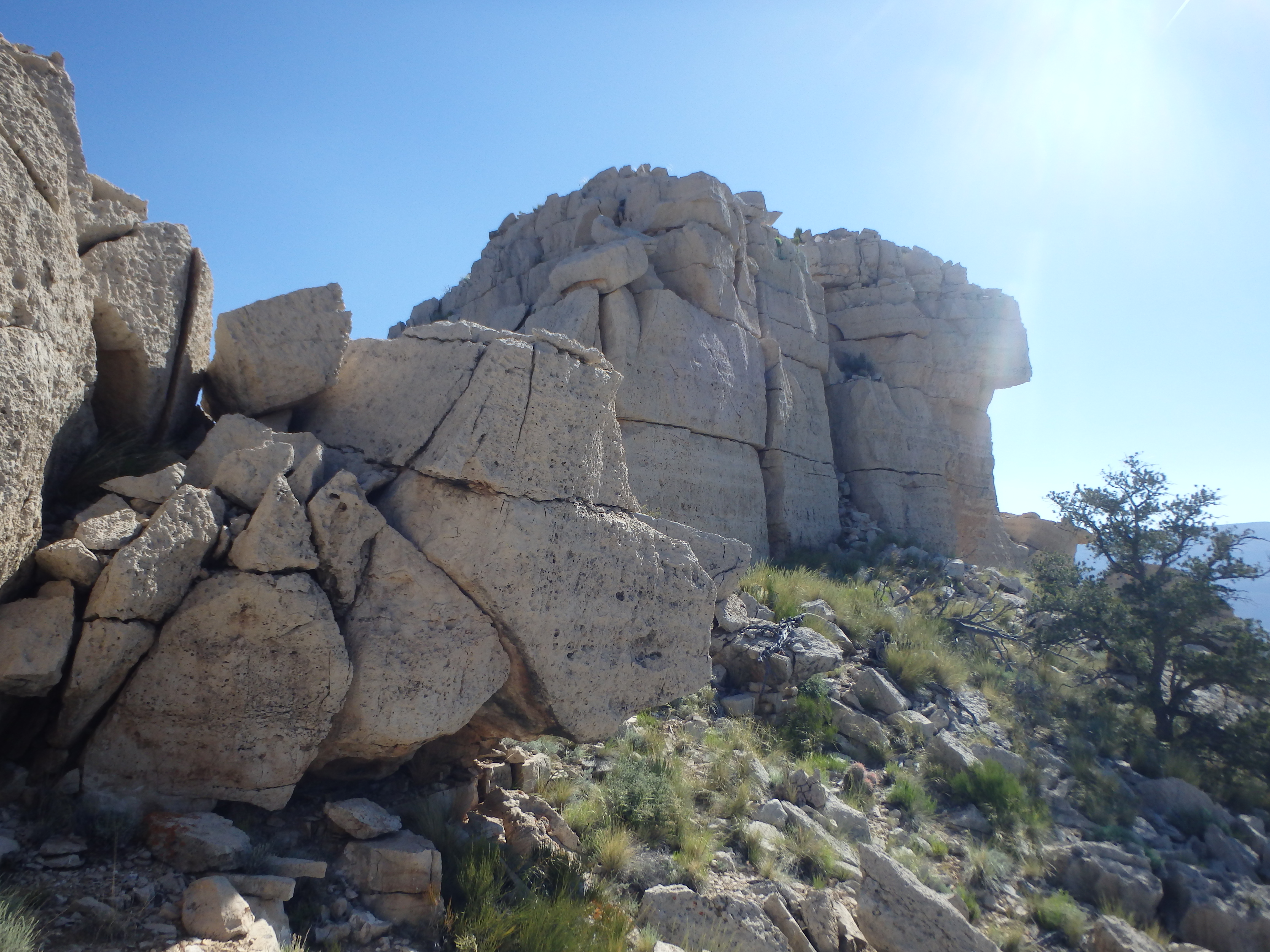
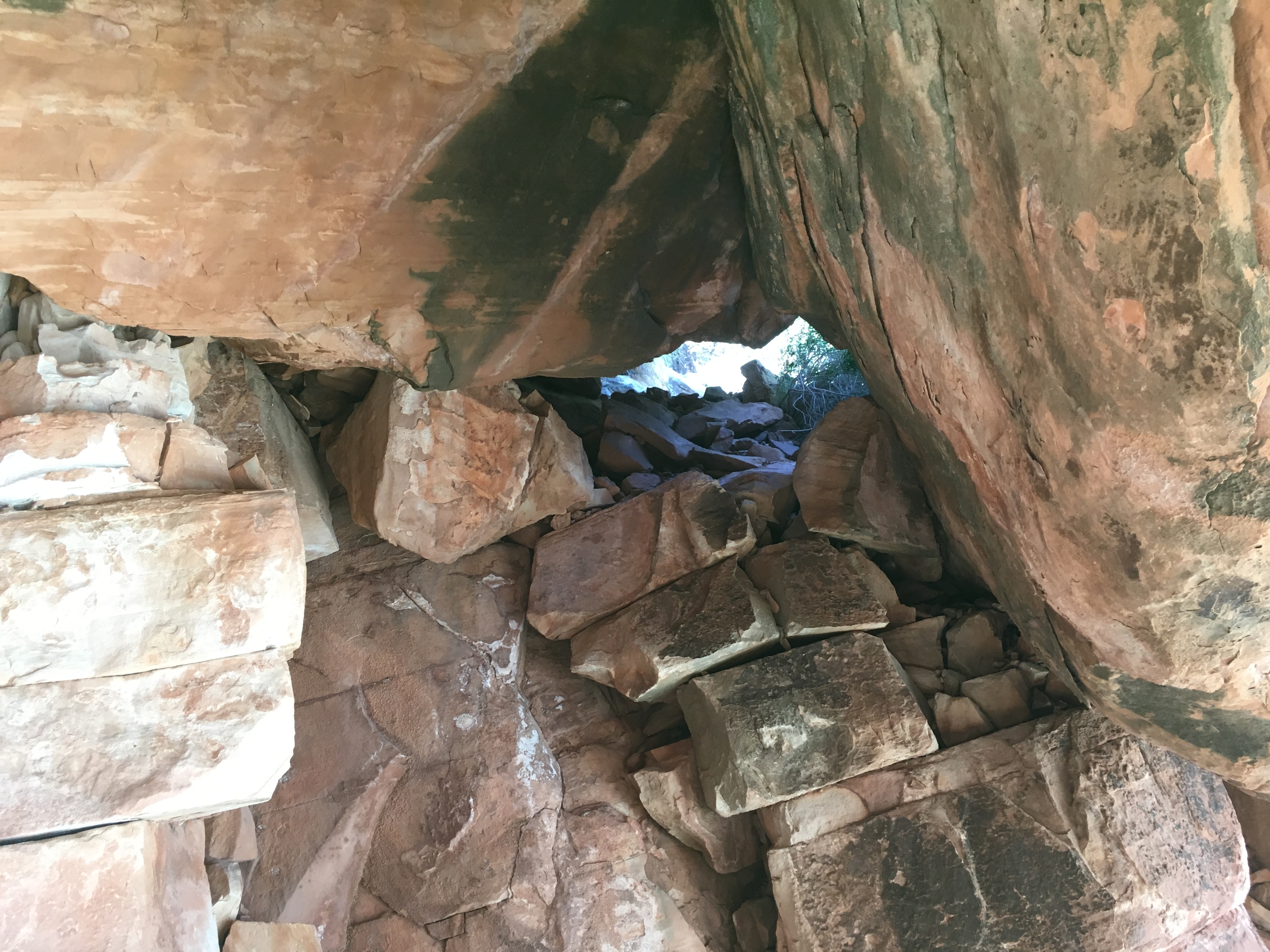
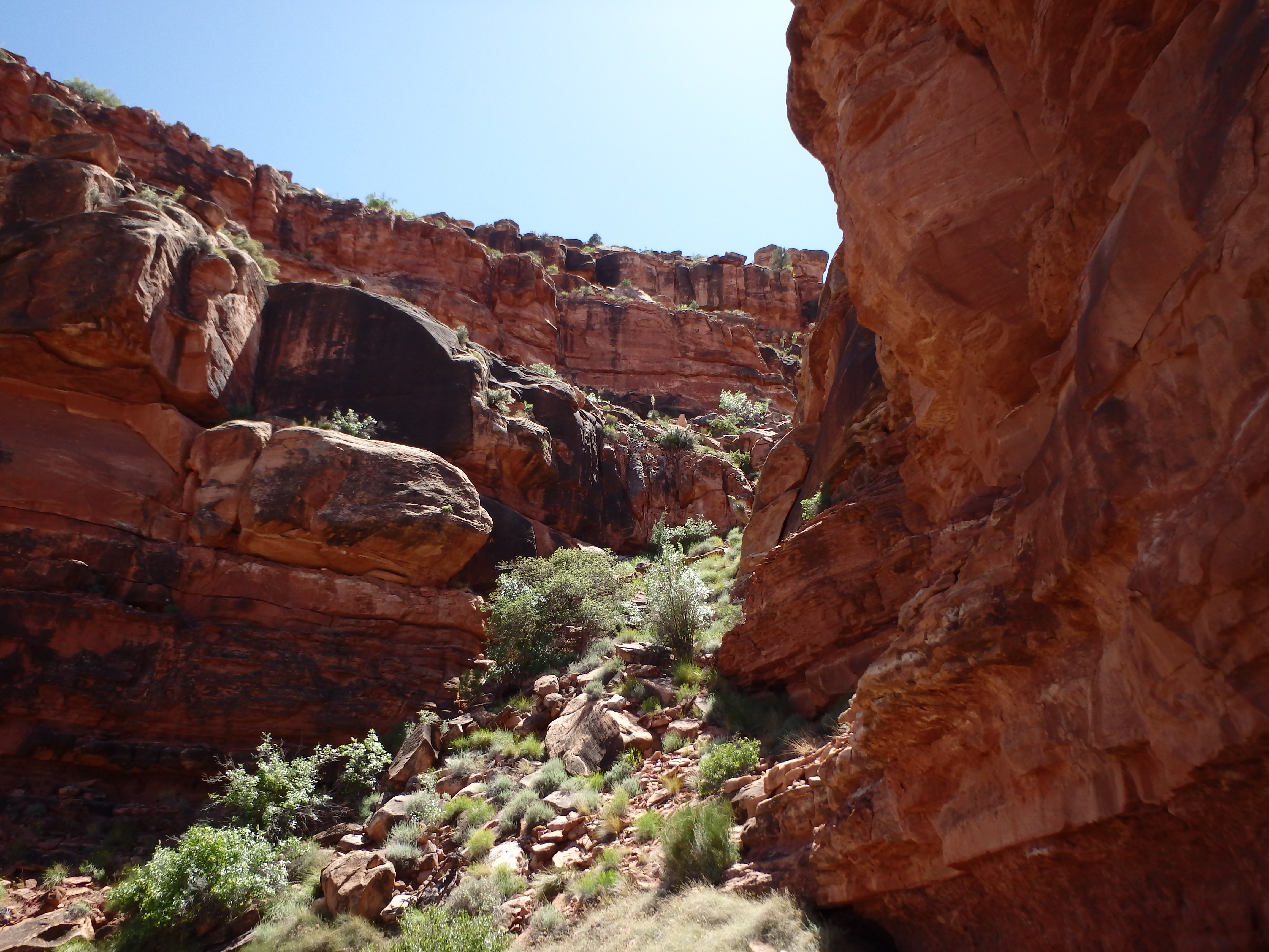
A smooth, cairned gully brought me down another 50′, and I felt like things were actually going pretty well despite the confusing cliff layers. The beta I had said to traverse to the south, so I started working back along the ledges south, finding a class 2 line another few layers below. I would find on the return that this is not the established cairned route that is most often utilized, but was actually easier than the class 3 climbing on the standard route, and one I would recommend. Reaching the top of what looked to be the last cliff band of about 100′, I couldn’t find a way down and began traversing north, ultimately joining the standard route and descent gully at the crux- two massive sandstone boulders the size of semi-trucks wedged over the gully forming a tunnel. Reaching it, I was surprised to find how exposed the route down was.

A cairn assured me the route was correct, and I started working among the rocks to look for an easier option. I moved to the north side of the rocks, and found a narrower crack that looked like it might go. I start squirming my way under the massive rock, but couldn’t feel any holds underneath me beyond the drop off. I backed off, starting to question the class 3 rating. I moved further north and tried to work down around the boulders with some thin ledges beyond the boulders, but couldn’t find a handhold to make the final move to the slabs below (although this would probably be the easiest option with a spotter or handline). I was growing extremely frustrated, and hiked the redwall shelves further north, looking for another option. I of course came up empty, Fiske Butte looking painfully close, only about 100′ below.
I hiked back to the crux boulders and sat down, ready to give up. As I sat, cursing my beta for the class 3 rating and assuming some key holds had broken off in a flood years ago, I noticed an additional opening into the tunnel I hadn’t seen before. This one had some poorly angled ledges about halfway down. I took off my pack (which also had my GPS and camera) and awkwardly stemmed and squirmed, needing to lower myself the last 4′ without holds to the tunnel floor.
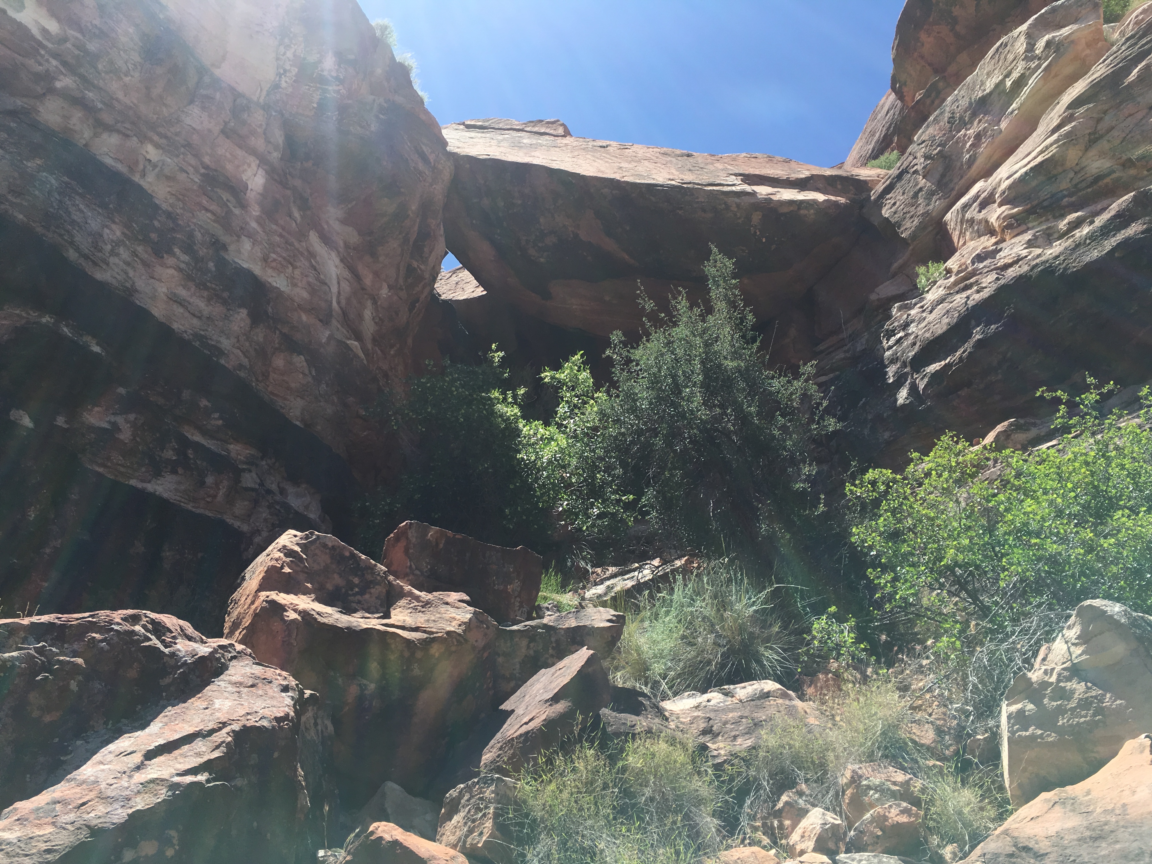
I was almost surprised when I reached the floor having tried to work through the problem for nearly an hour, but with my water and gear above me, I wasted little time descending one final small cliff band before traversing north the last half mile to the summit. Ironically, the summit isn’t much of a summit at all, probably only with about 60′ of prominence from the connecting saddle.
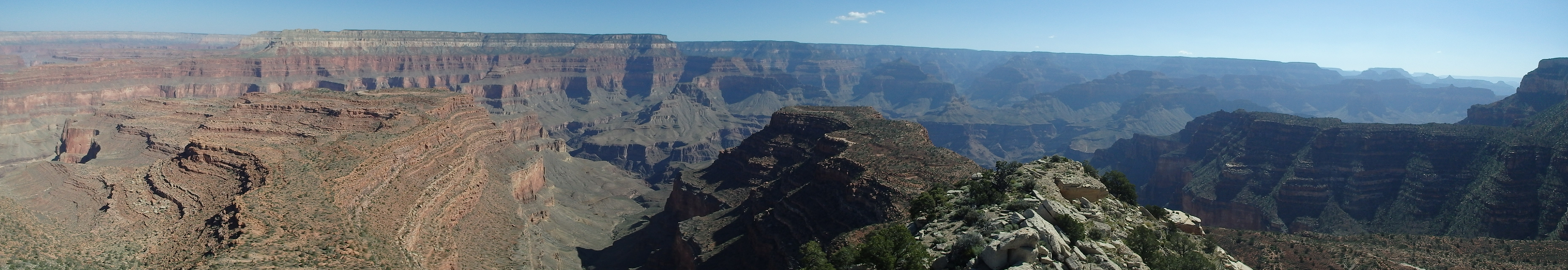
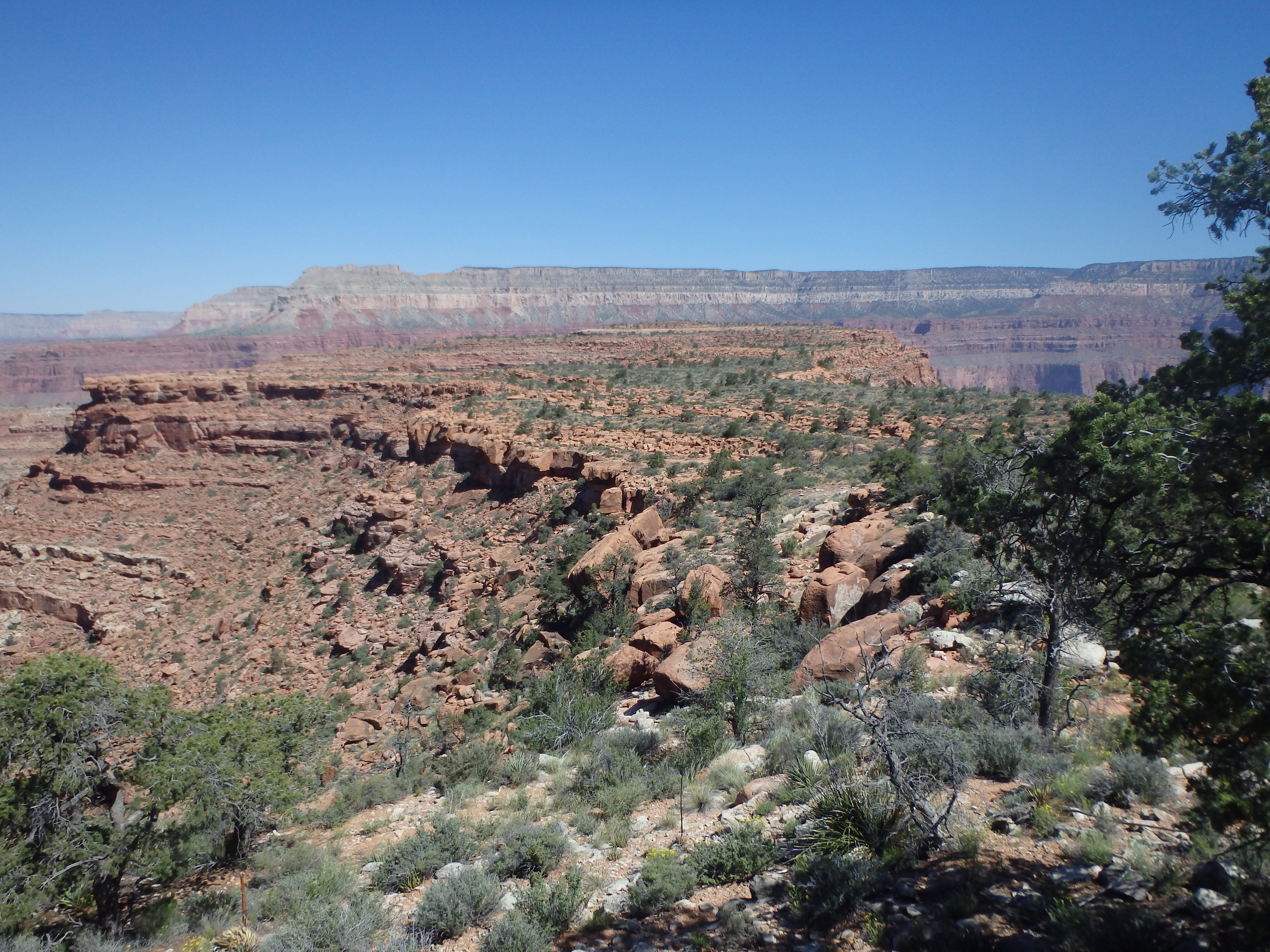
Despite the small size, the views were even better than Huethewali, looking straight down to the Colorado River both to the East and West. Across Evolution Basin was Tyndall Dome and Wallace Butte, and to the West was Explorer’s Monument. To the far east, I could see Shiva’s Temple, Isis Temple and several other features of the main canyon in the distance. I signed in to the register placed in 1992, with only 14 other parties having visited the summit since the register was placed. I would be #15 in 15 years.

With absolutely no gear or water with me, my time on the summit was unfortunately brief, and I started back to the south to ascend the crux. I found a good foot placement hidden from view during the descent to get me up to the first awkward shelf, and with a bit of grunting and absolutely no grace, I was reunited with my pack and water. I decided I would try the standard route for the ascent, and continued along the same gully until I reached the next series of cliff bands. A cairn near the top of a 10′ class 3 crack led me up the next cliff band, and I traversed south to the next cairn, climbing another class 3 crack to rejoin my original descent route.
With the most difficult moves behind me, I retraced my steps up the final series of cliff bands back to Spencer Terrace. All that was left was the slow and painful ascent back to the rim, with only 1 liter of water left to get me there. As I hiked south towards Huethawali, I cheated to the west side of the terrace, hiking along the easier slabs through the rock garden on the return.


I gave Huethawali a wide berth as I began to traverse to the west, trying to avoid the steeper slopes closer to the base of the mountain without adding too much extra mileage. Of course, this brought me to the small Redwall cliffs I had worked to avoid early that morning, and I had to continue along the cliff bands quite a ways east before finding a way through, taking me back to the South Bass Trail. I had less than half a liter for the remaining steep trail back to the rim, and slowly marched up the trail, my thoughts turning to the cold beer in a cooler in my car. I made it back to the rim at about 5:00, startling a couple enjoying the evening light across the canyon, not expecting to see a haggard, dirty hiker pop into view. They took off shortly after I returned and I enjoyed my cold beer, a hot sun shower and some chicken teriyaki for my double Grand Canyon summit day. As the sun set, I went to bed early with plans for another double header the next day, Fossil Mountain followed by Mount Burro, before the long drive home….