
Pass Mountain North 3312′
Total Time: 3:45
Roundtrip Mileage: 5.0 miles
Elevation Gain: 2000′
Crux: Class 3
Trailhead: Windcave Trail in Usery Mountains Regional Park, $6 entrance- water, trash, toilets
Companions: Holly


Usery Mountains Regional Park is a small county park bordering Tonto National Forest just to the northwest of the Superstition Mountains. Named for the local settler King Usery from the late 1880s, the park encompasses a portion of the Goldfield Mountains, a smaller version of the nearby Superstitions. The highpoint of the range and crown jewel of the park is Pass Mountain, known as “Scarface” to locals. With the high point guarded by cliffs along it’s western face, most visitors to the park visit the wind carved caves below the south summit. But some decent use trails (owing to the popularity of the park overall) allow you to visit the highpoint with great views of the Valley of the Sun and west into Tonto National Forest. So over Christmas weekend, our bodies slow from overeating, Holly and I headed to the small park to hike to the caves and hopefully tag the summits. The park was very full when we arrived, cars parked along the side of the road leading to the trailhead. The hike initially heads north, paralleling the long mountain weaving in and out of washes with little elevation gain.


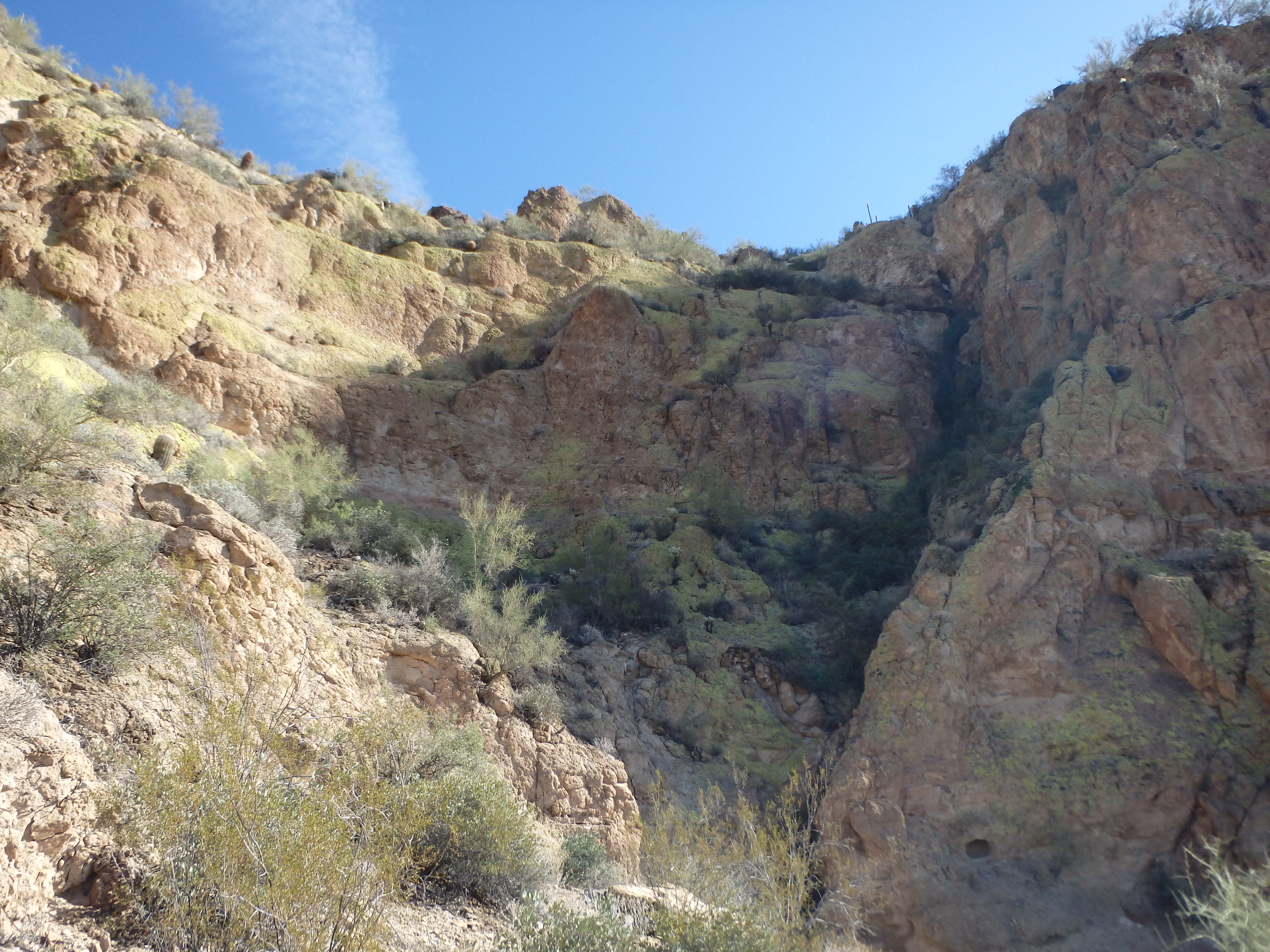
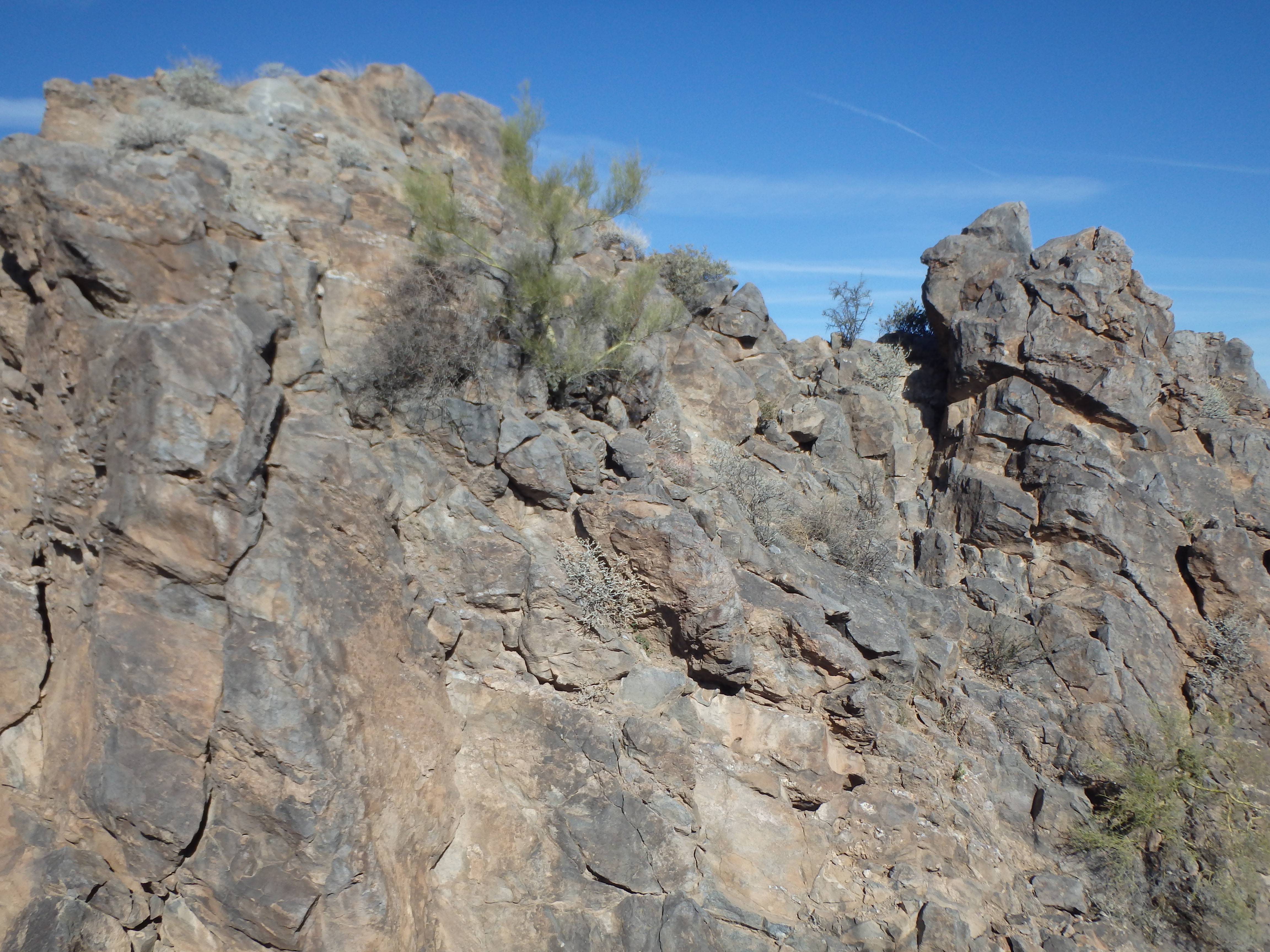
After about 1/2 mile, the trail cut back southwest and began to switchback up the western slopes towards the cliff bands above. The trail skirts the pale sandstone cliffs, and the geology was very similar to Battleship Mountain in the Superstitions, although nowhere near as dramatic. We could see several dozen people clustered at the wind caves, and we reached them in under an hour.
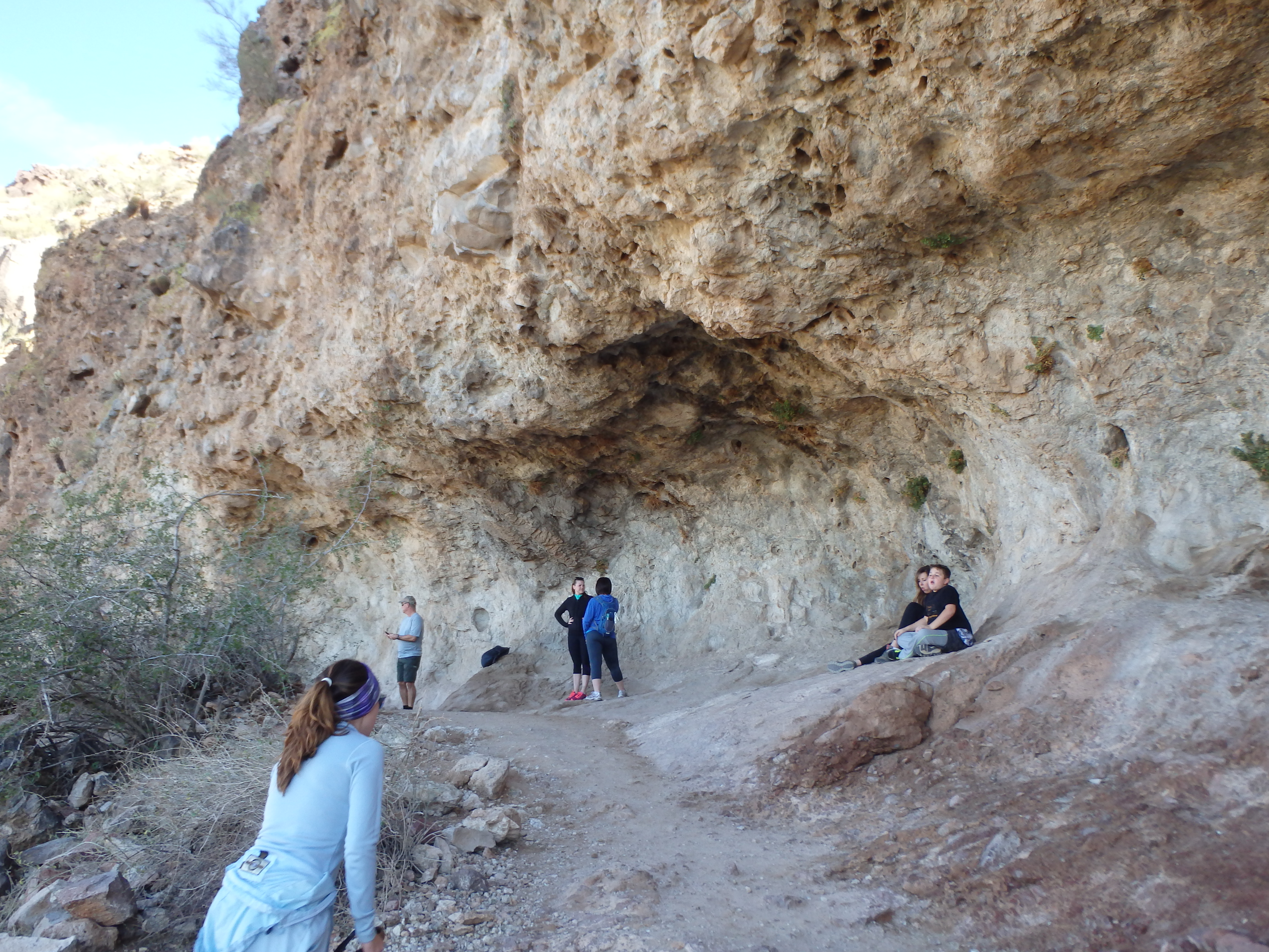
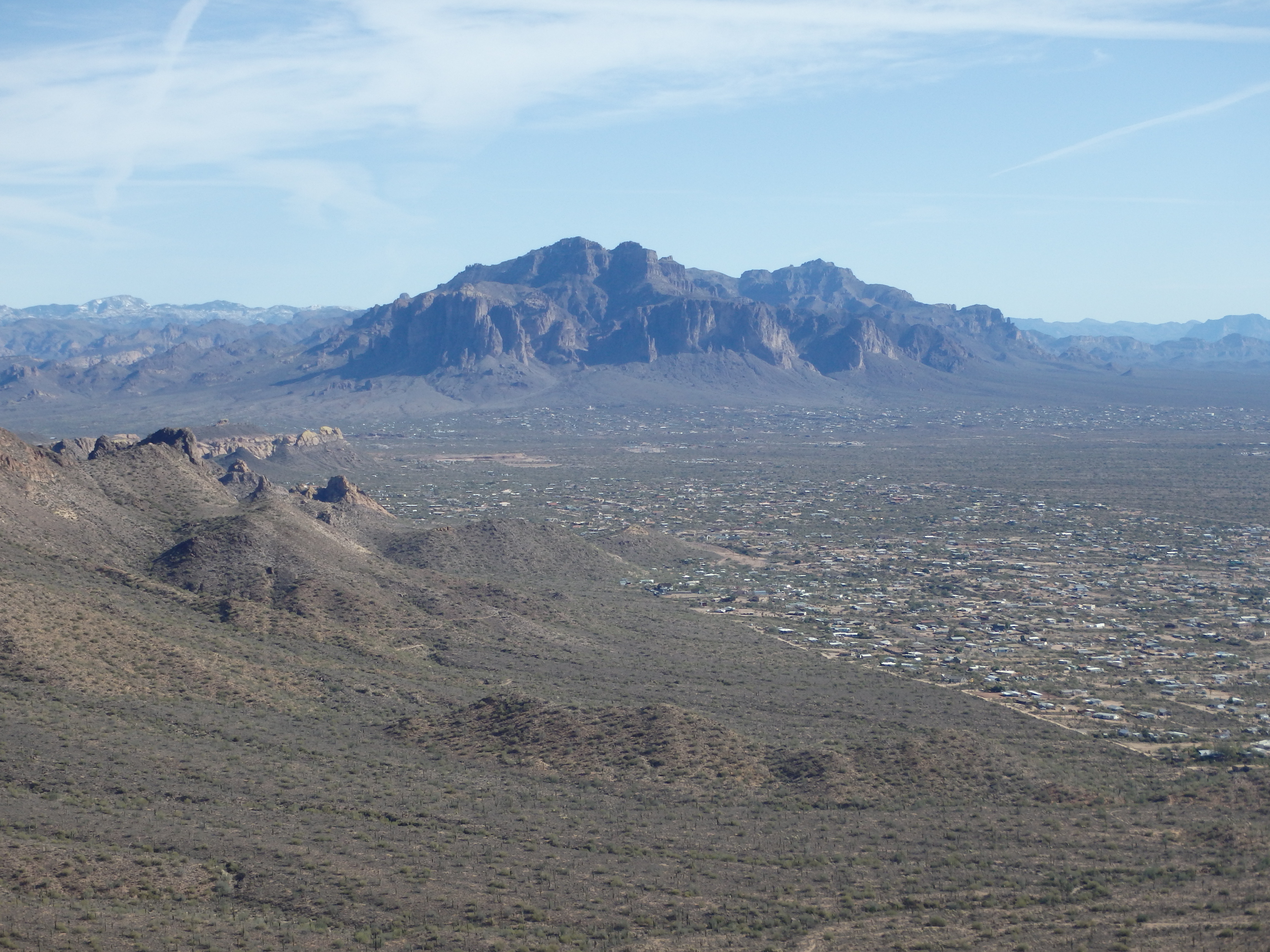
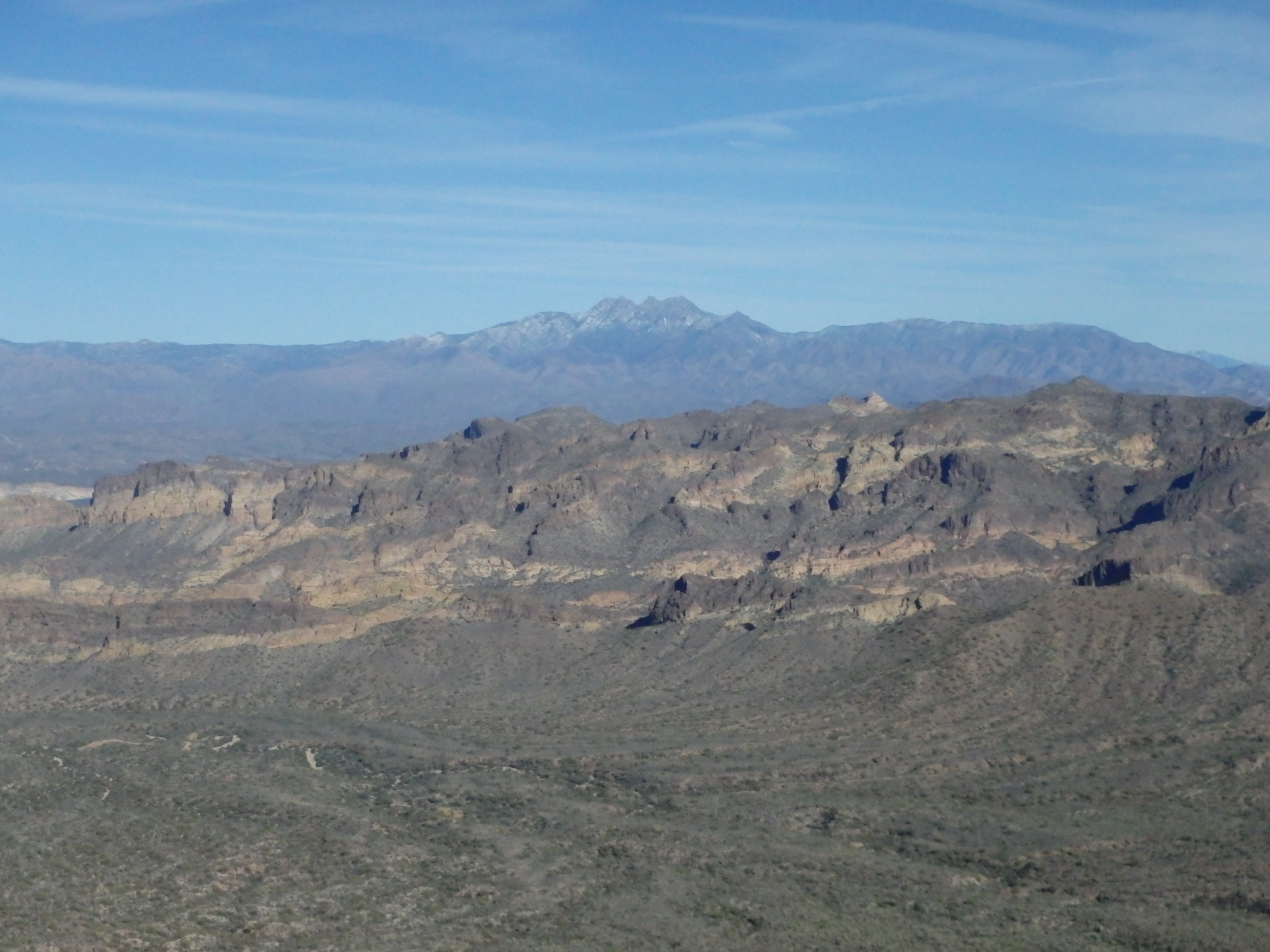
There were about 20 ground squirrels trying to sneak into people’s packs for food at the popular stop. With the caves crowded, we continued along the use trail, marked with a sign “Trail Not Maintained Beyond This Point.” A number of other groups ignored the sign like us, but many quickly turned back, finding the use trail much steeper and looser. The use trail cut hard south to get above the prominent western cliff bands before switching back and making use of some very short class 3 steps to bring us to the southern summit. The views from the lower summit were quite impressive in their own right, with The Flatiron to the southeast and Four Peaks with a fresh coat of snow. The north summit was over a mile away, with a good amount of intervening false summits.
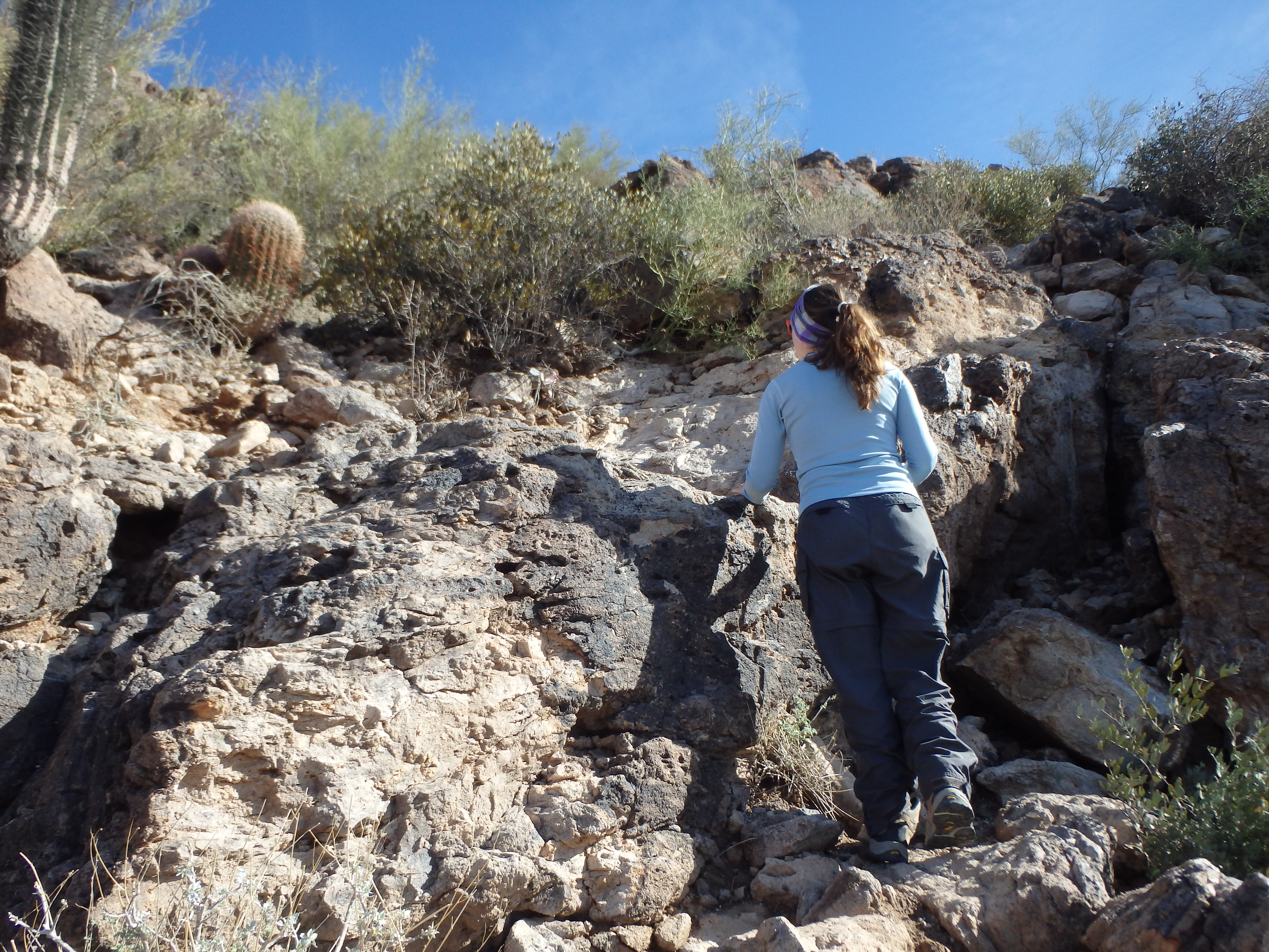
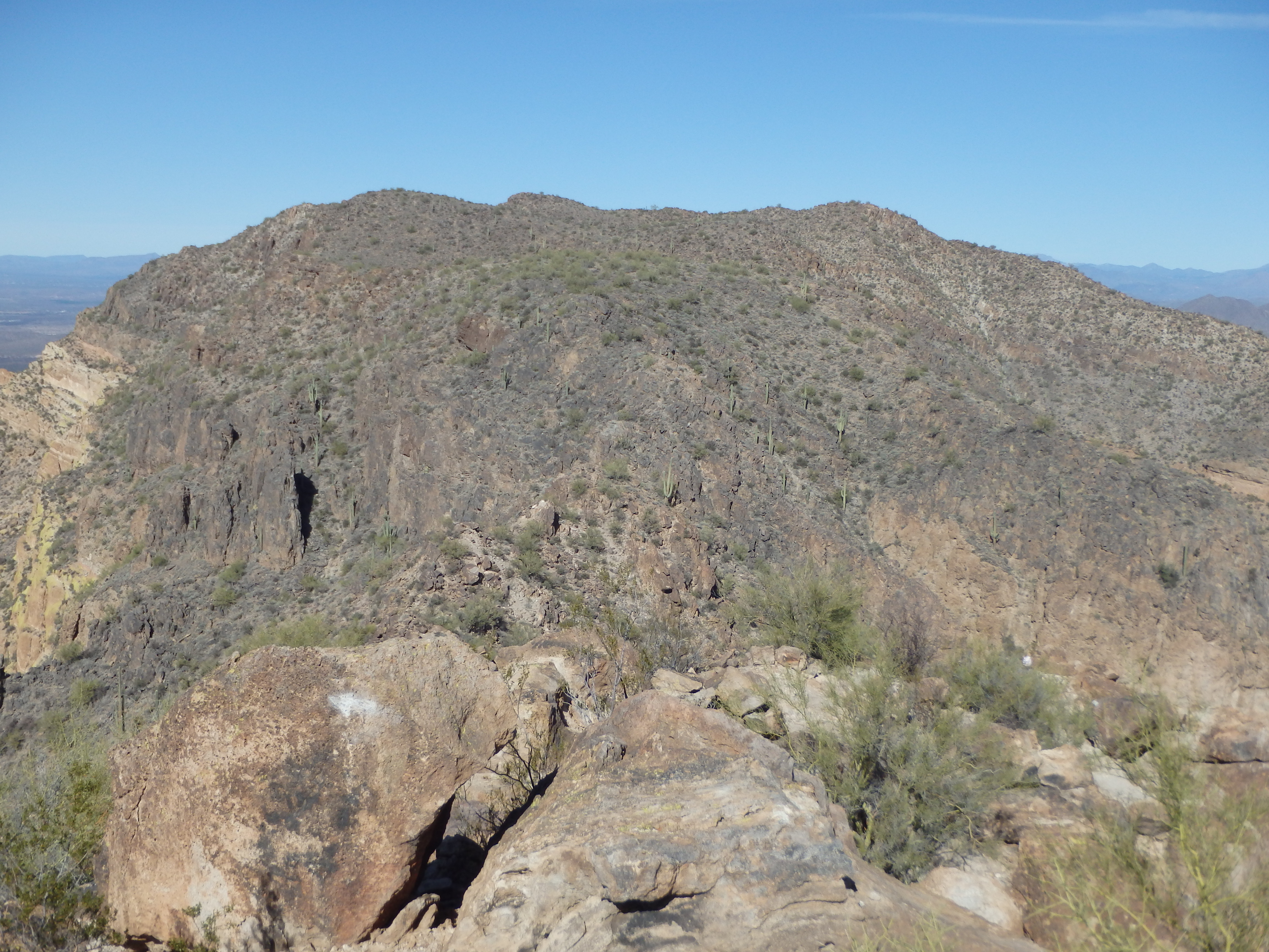
Eyeing the ridge, Holly said she would relax on the south summit and let me tag the highpoint solo, satisfied with the views from the south side. So I quickly dropped off the south summit to the north, following the undulating ridgeline. The low point of the ridge was soon after the south summit and featured a surprising spot of solid class 3 to overcome. Beyond that was mostly class 1-2, with a decent use trail following the ridgeline to the highpoint. It was obvious this trail was commonly used; someone had even decorated a Saguaro for Christmas just off the trail.

But I was alone today, and saw no one else along the use trail after leaving the south summit. I topped out on the rocky north summit about 20-25 minutes after leaving the south summit, keeping a fairly steady pace the entire route. I was surprised to find a summit register on this popular peak, and it seems to get visitors virtually every weekend, the loose pages not going back far. The north summit did offer better views north into Fountain Hills and the McDowells, one of the few angles where you can see East End clearly.


Grabbing a few pictures, I headed back to Holly, making it back to her a little past my 45 minute self imposed deadline. We dropped off the south summit, using faded pink flags tied to Palo Verde to stay on the main use trail to get back to the caves. Even later in the afternoon, the trail was still packed, and we weaved around people and made it back to the trailhead just as hunger started to overtake us. Thus, the only logical thing to do was head to AZ Wilderness Brewing for some beers and burgers before heading home…