Sinking Ship 7344′
Total Time: 3:30
Distance: 3.0 miles
Elevation Gain: 900′
Crux: Class 4, super chossy
Trailhead: Rte 64 just west of BuggeIn Picnic Area, toilets and trash at picnic area


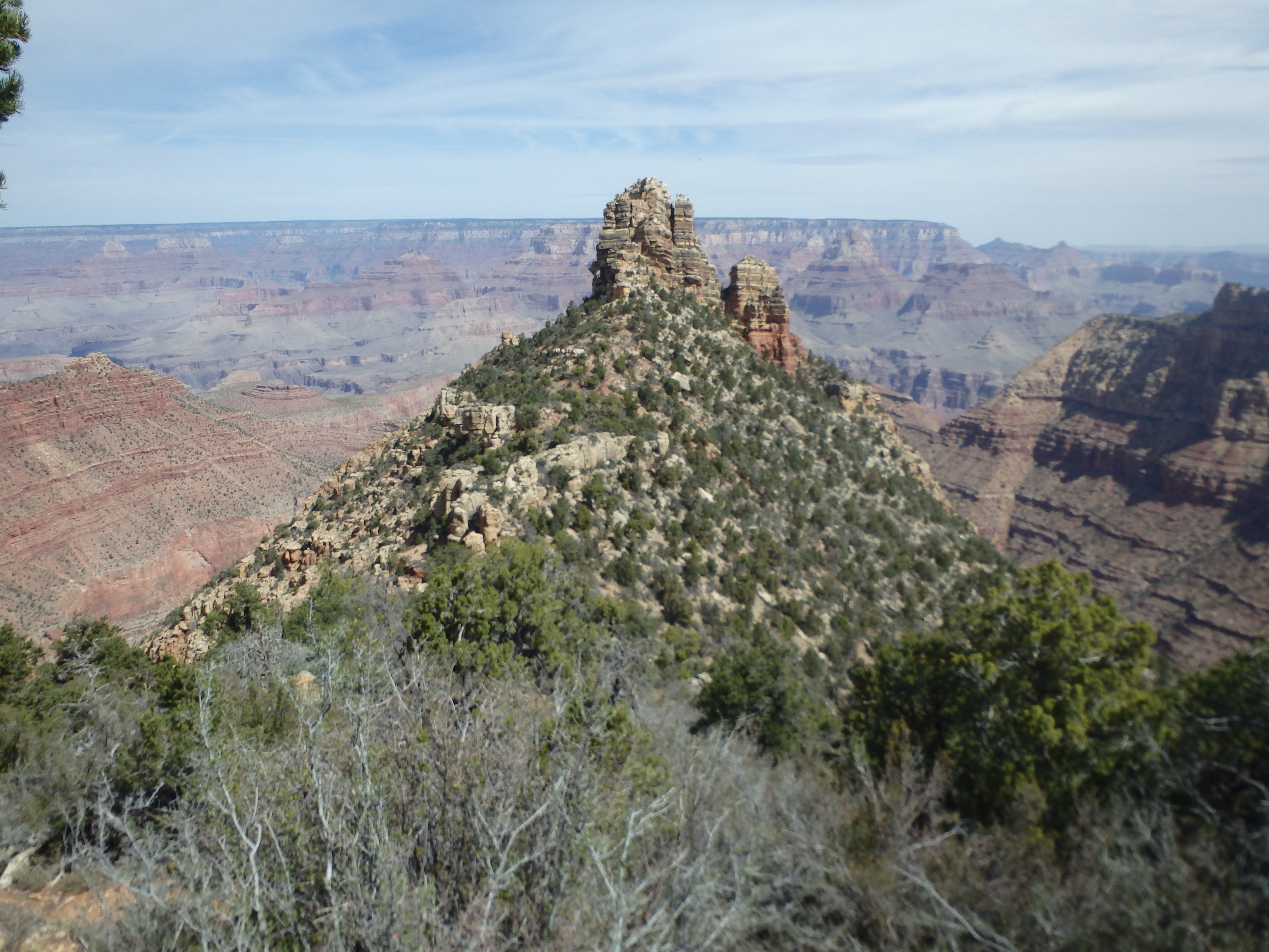
I awoke in the back of my car barely able to move after following the grueling 19 hour day on Brahma Temple. I had hoped to climb something easy in the canyon before heading home but I had some serious doubts as I pulled myself from my sleeping bag and stepped out into the sunshine. Hobbling around camp, I decided to reassess after breakfast and coffee, and drove into Tusayan and got some food at RP’s Stage Shop before heading back into the park. I started to feel a bit more human with some caffeine, and ultimately decided I probably had enough energy for Sinking Ship, something I had been saving for a less demanding day. I drove out towards the BuggeIn picnic area and parked at the apex of the road about 0.25 miles west of the picnic area and parked at a wide pull out. There were no signs to indicate I shouldn’t park there, so I packed my things and crossed the highway into the forest towards the rim. While I could have parked directly in the picnic area, this requires a traverse through a drainage to reach the connecting ridgeline to the peak, and I thought it would just be easier to head down the ridgeline directly. It took about 15 minutes of easy cross country before I began to see the canyon peeking through the trees, and I worked around various undulations in the rim until Sinking Ship came into view.
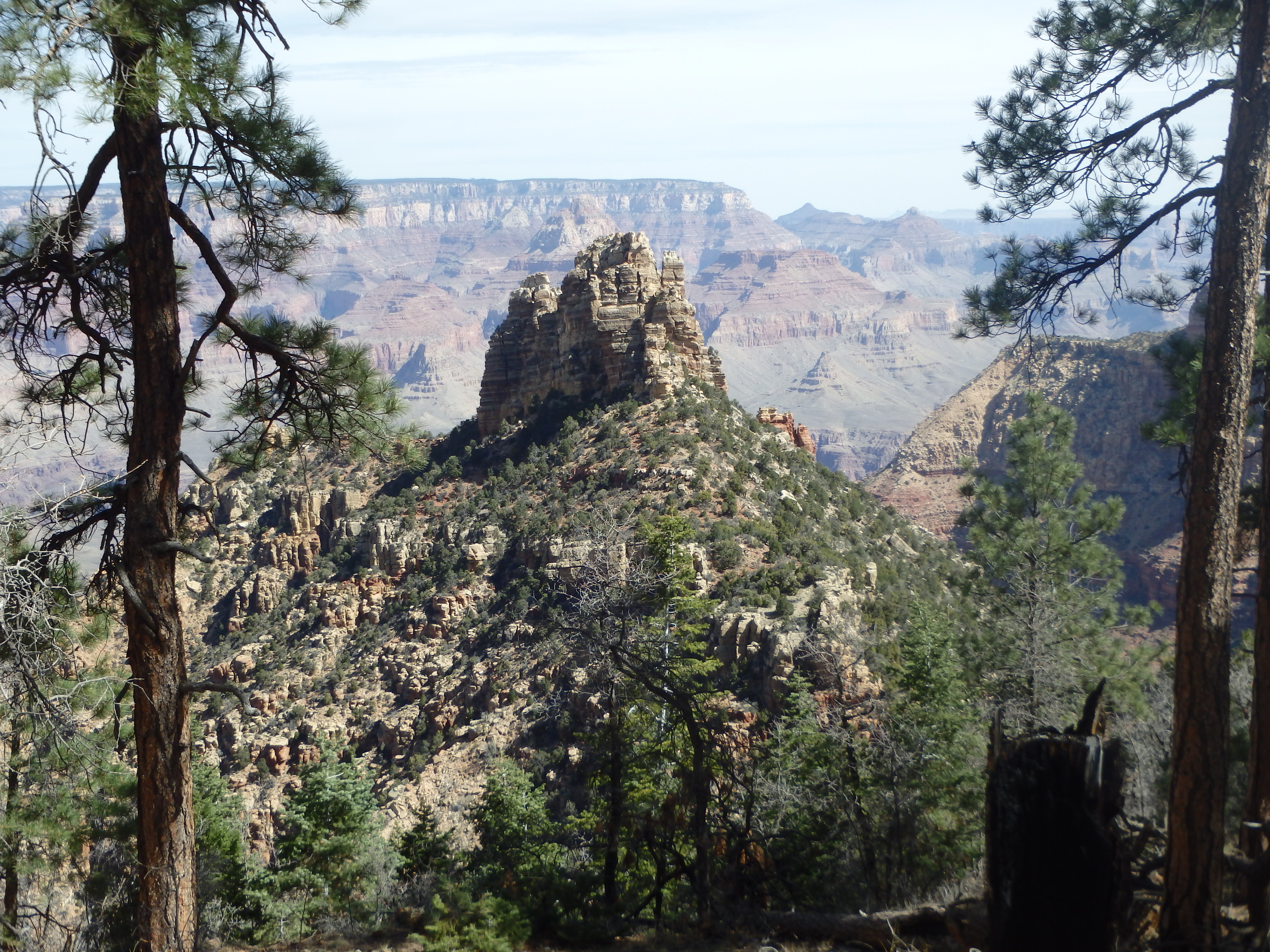
I was pleased to see that it actually looked fairly close, with a few hundred feet of descent between me and the blocky summit. I hit the rim a tad bit too far west, but a bit more cross country put me directly at the connecting ridgeline. A small upper cliff band was easily descended with a few feet of class 3 putting me directly on a steep but fairly defined use trail. As I descended the loose duff, the trail became more and more well defined, eventually merging with another use trail from the east from those choosing to park at the picnic area and traverse over to the ridge. A handful of blocky gendarmes and obstacles along the ridge were easily bypassed to the east, always sticking with the obvious trail as I reached the saddle between Sinking Ship and the rim.
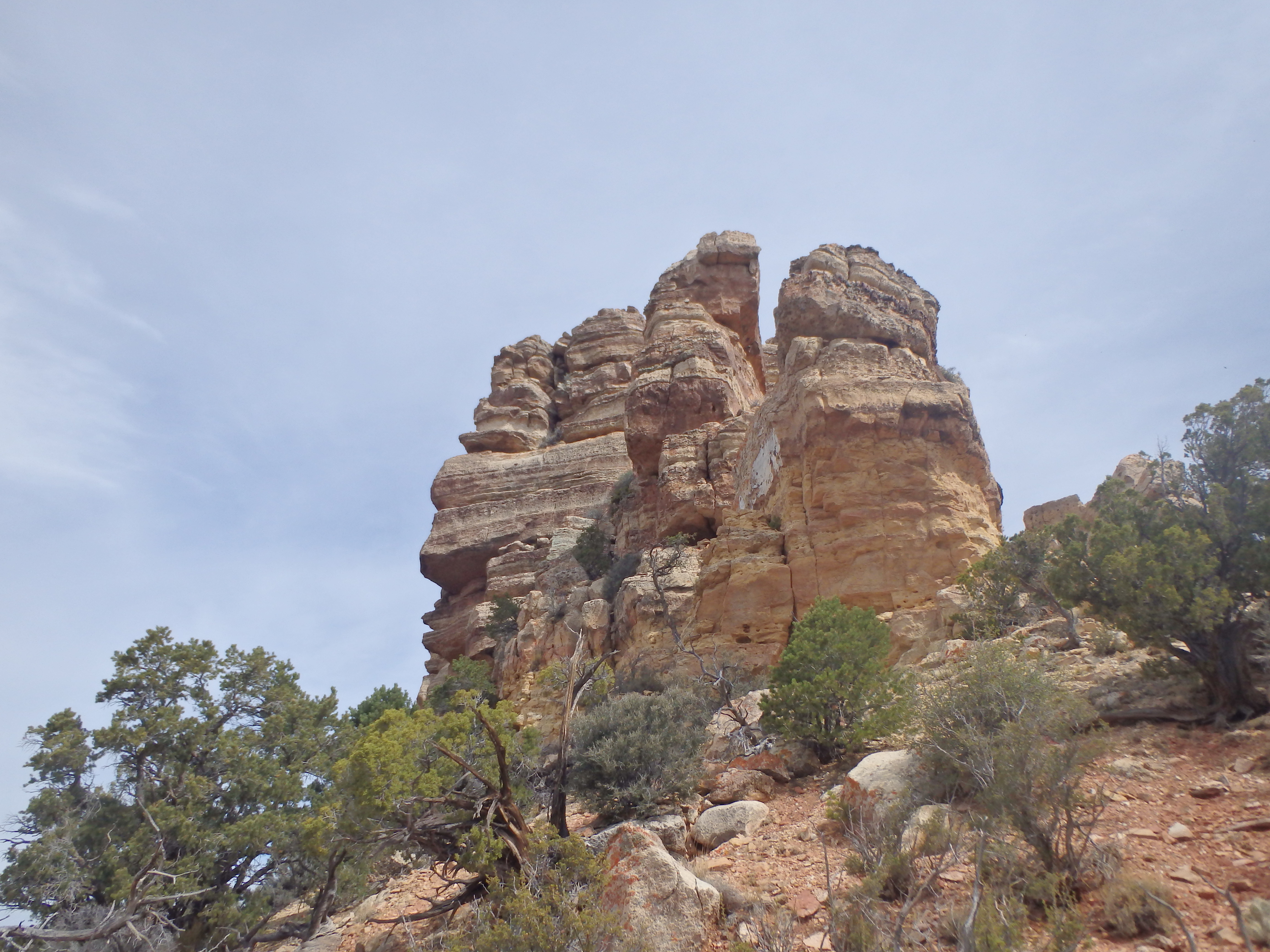
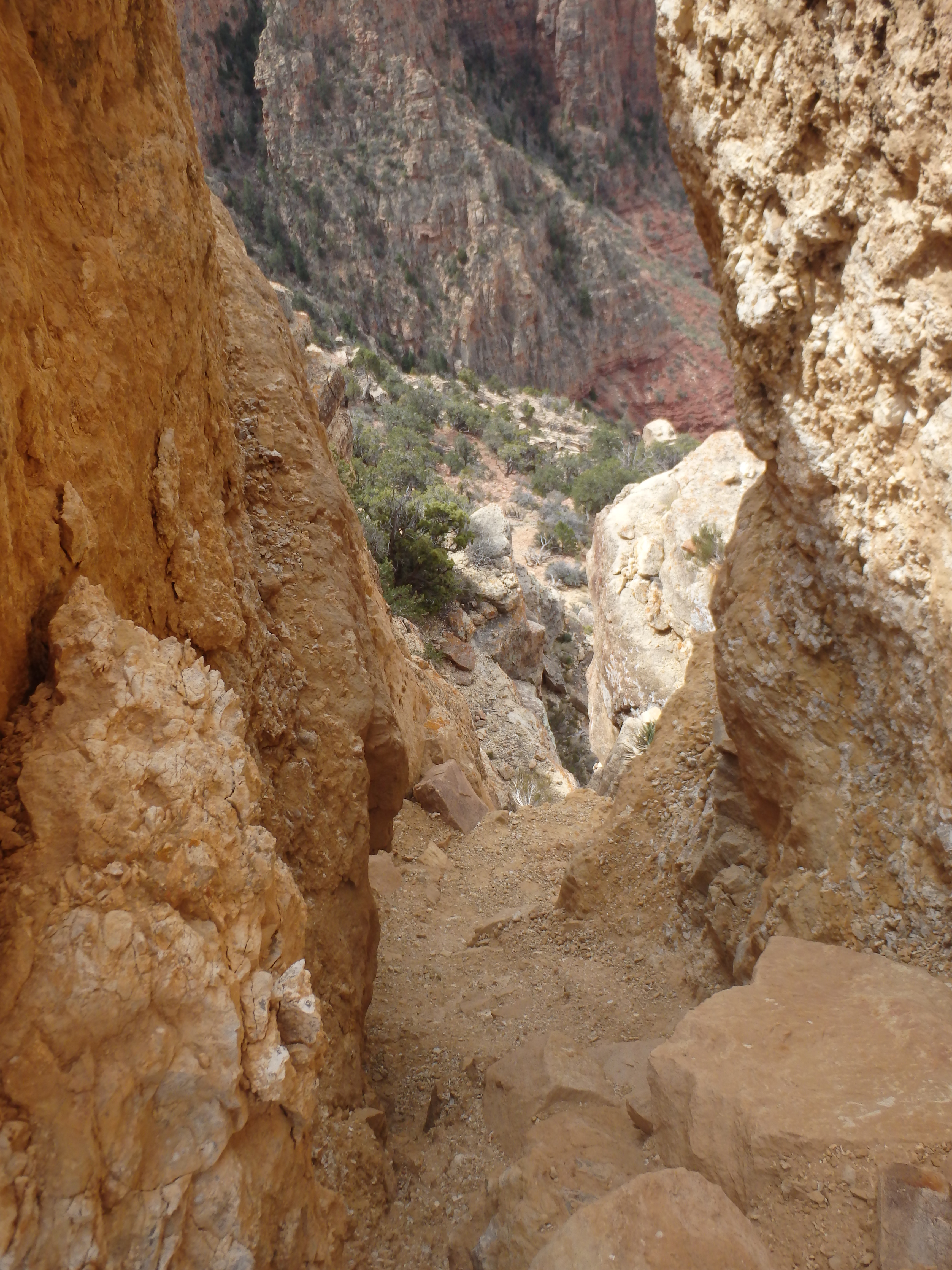
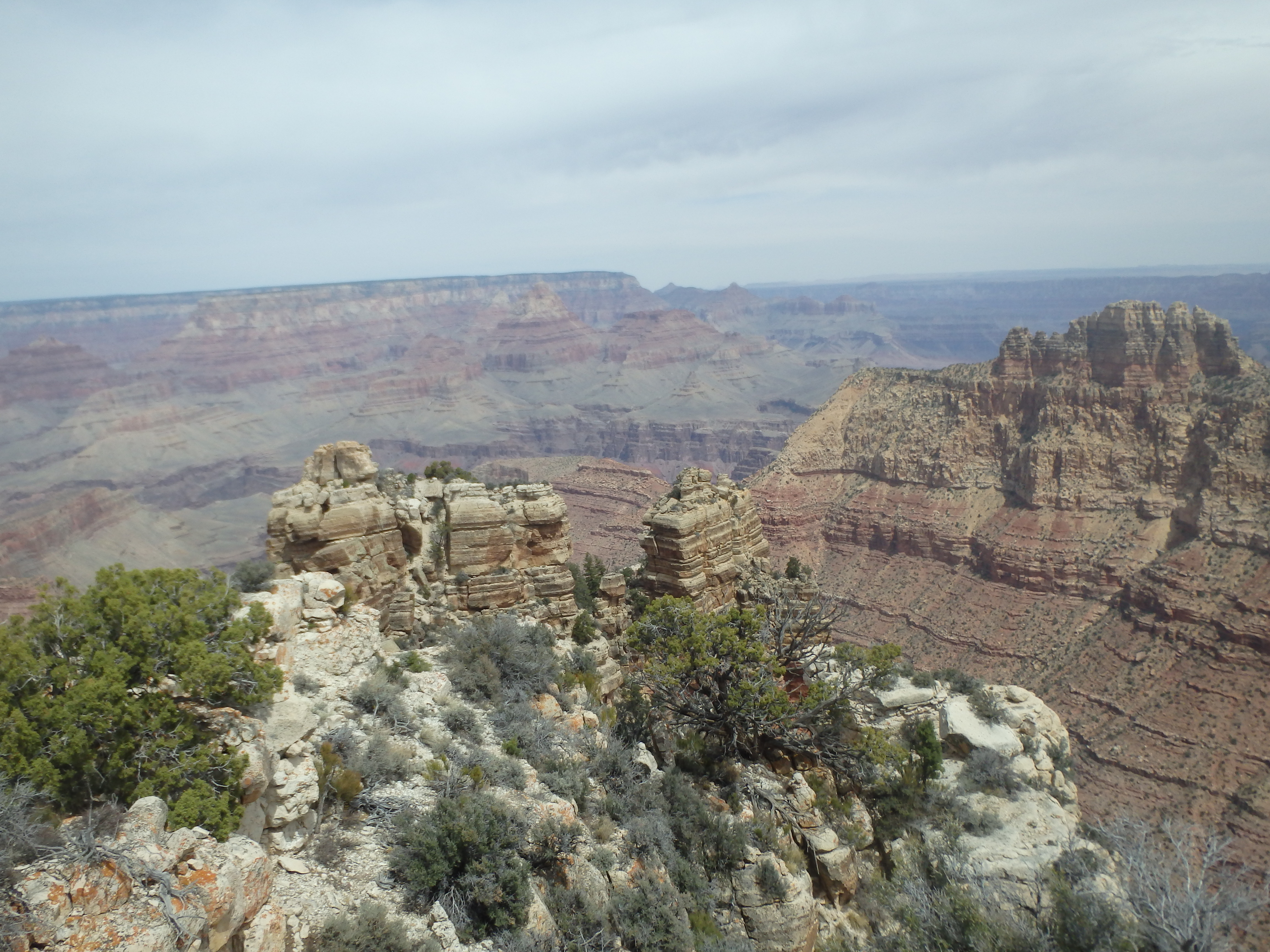
The trail started to fizzle beyond the saddle and by the time I reached the base of the formation it had deteriorated to the quality of a game trail. The formation was essentially a series of progressively taller blocky sub summits flanked by a system of ledges on both sides. It was difficult to tell if the highest sub peak in sight was the true summit (it’s not) or if it was further along the ridge. The route had some class 4 to contend with, and with some beta in my pocket, I started scrambling up cracks and ledges on the southwest side of the formation to a flat tier about 1/5 of the way up.
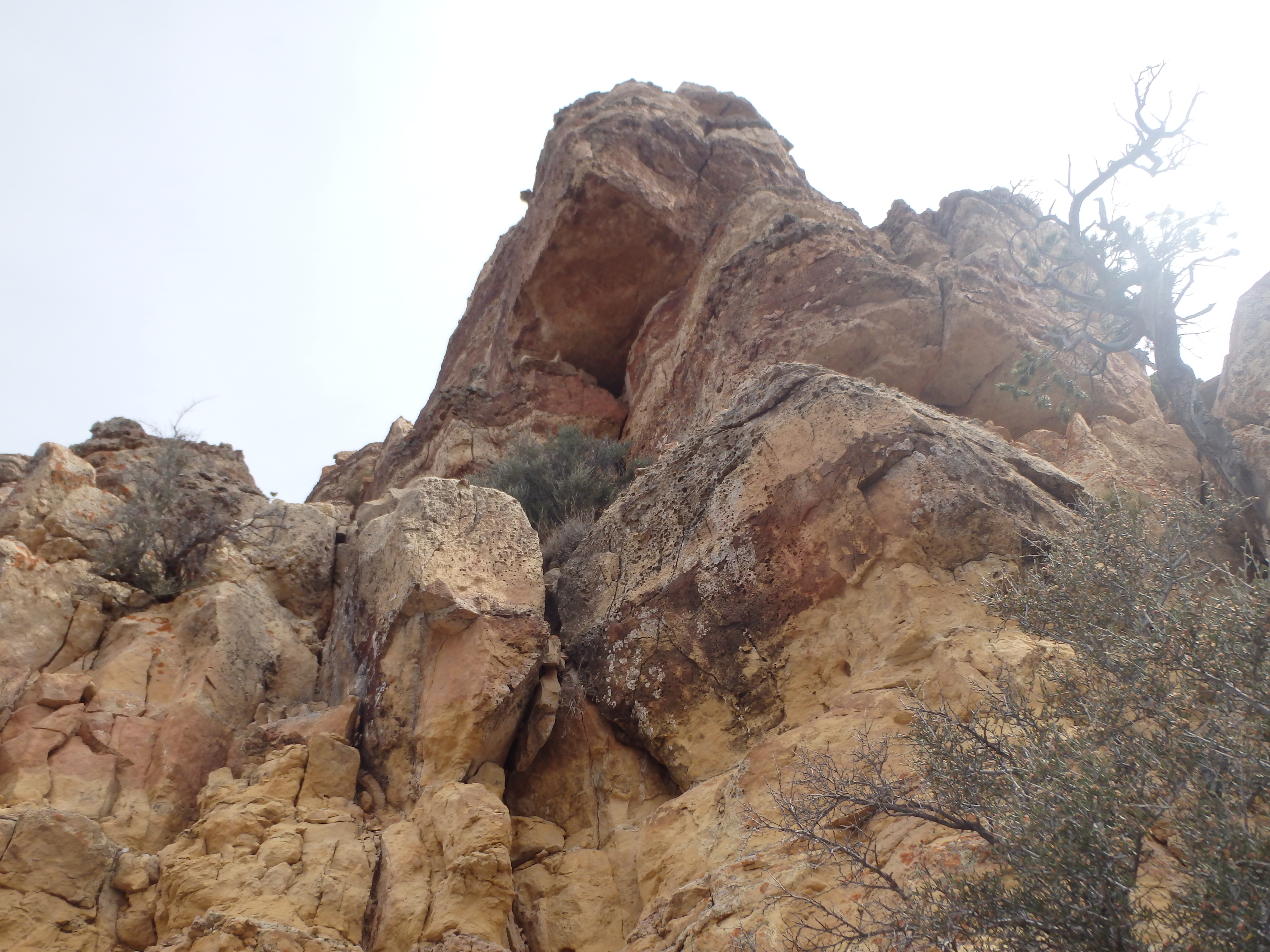
The instructions I had suggested I needed to cross over to the east side where I could continue my scramble, and I found some gaps in the rock to reach the other side. Some additional scrambling got me up another 20′, but everything above seemed well beyond class 4, even for the sandbagged Grand Canyon. There was a ledge with what looked like some stacked rocks around the bend, but when I scrambled up, I found nothing but big air. Well this wasn’t going that smoothly.
I scrambled back down to the base (on the east side, which was a little bit easier), then figured I had started up too soon and needed to look for another option on the southwest side. I scrambled back up the same series of cracks, but continued up another crack on the west side where I had cut over previously. This brought me up to a good sized pine tree with a prominent gully to the north with the sketchy crux in site. Ironically, this pine tree was near a gap between two of the shorter false summits, with a passage between them that I could have gone though earlier to get me to this same point. For a point of reference, the highest you can get on either side before needing to find this tree and gully on the west side is directly below the first sub-peak with a small pine on the top.
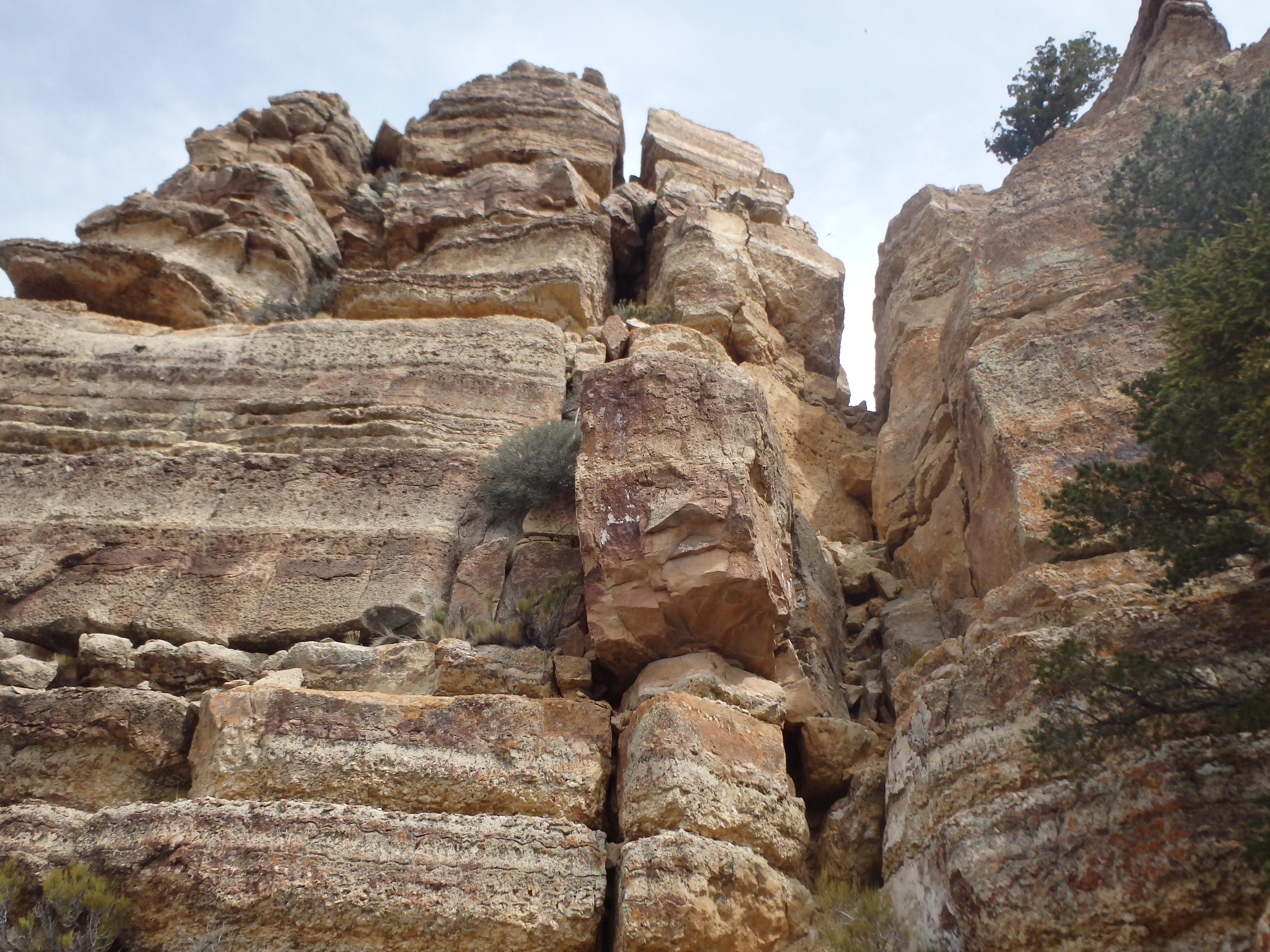
I continued up the gully now matching the route description in my pocket and found the crux, if not in the way of technical climbing, at least in terms of scariness. A chockstone had to be climbed which put me up into a very loose scree chute in the upper gully. The wall to the left of the chockstone had solid holds and pockets, but the upper chute was anything but solid, and I was happy once I had reached the saddle above, marked by a cairn.
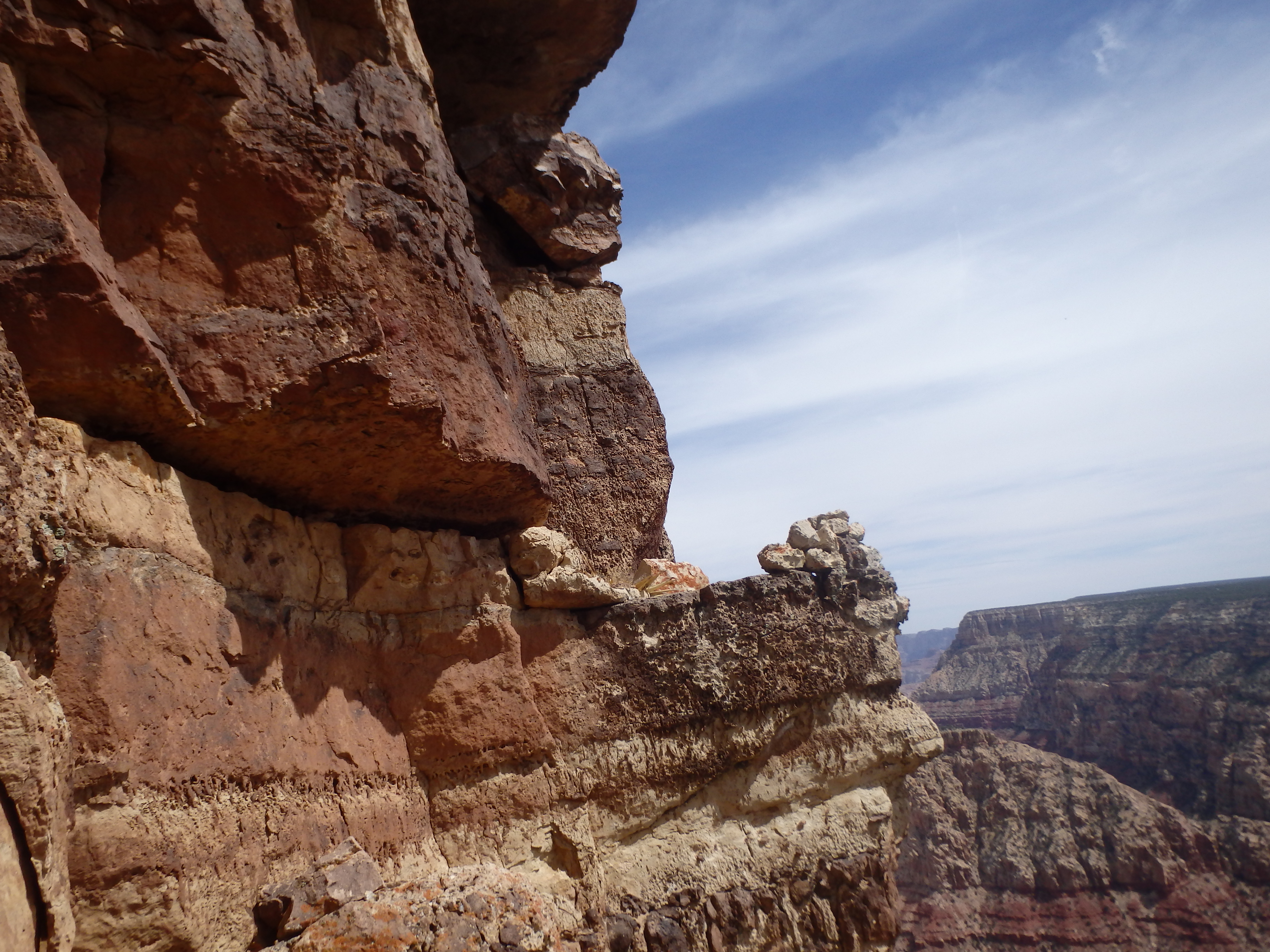
This was where I was supposed to cross to the east side, and scrambled along some short but exposed class 3 ledges towards the summit rocks, now in view. The route entered a small alcove with a narrow squeeze through some boulders and a pseudo-tunnel one more layer up to only about 15′ below the summit.
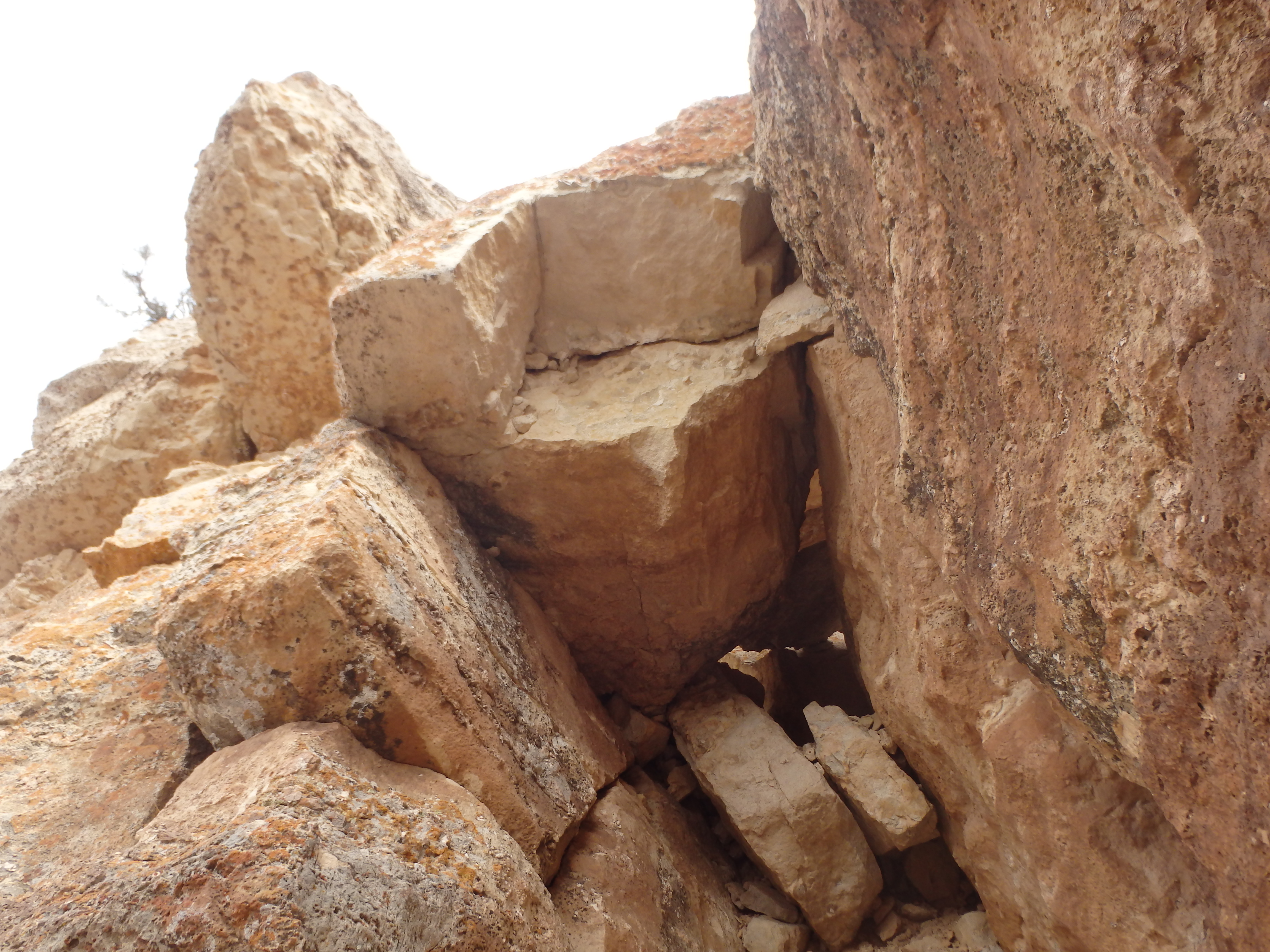
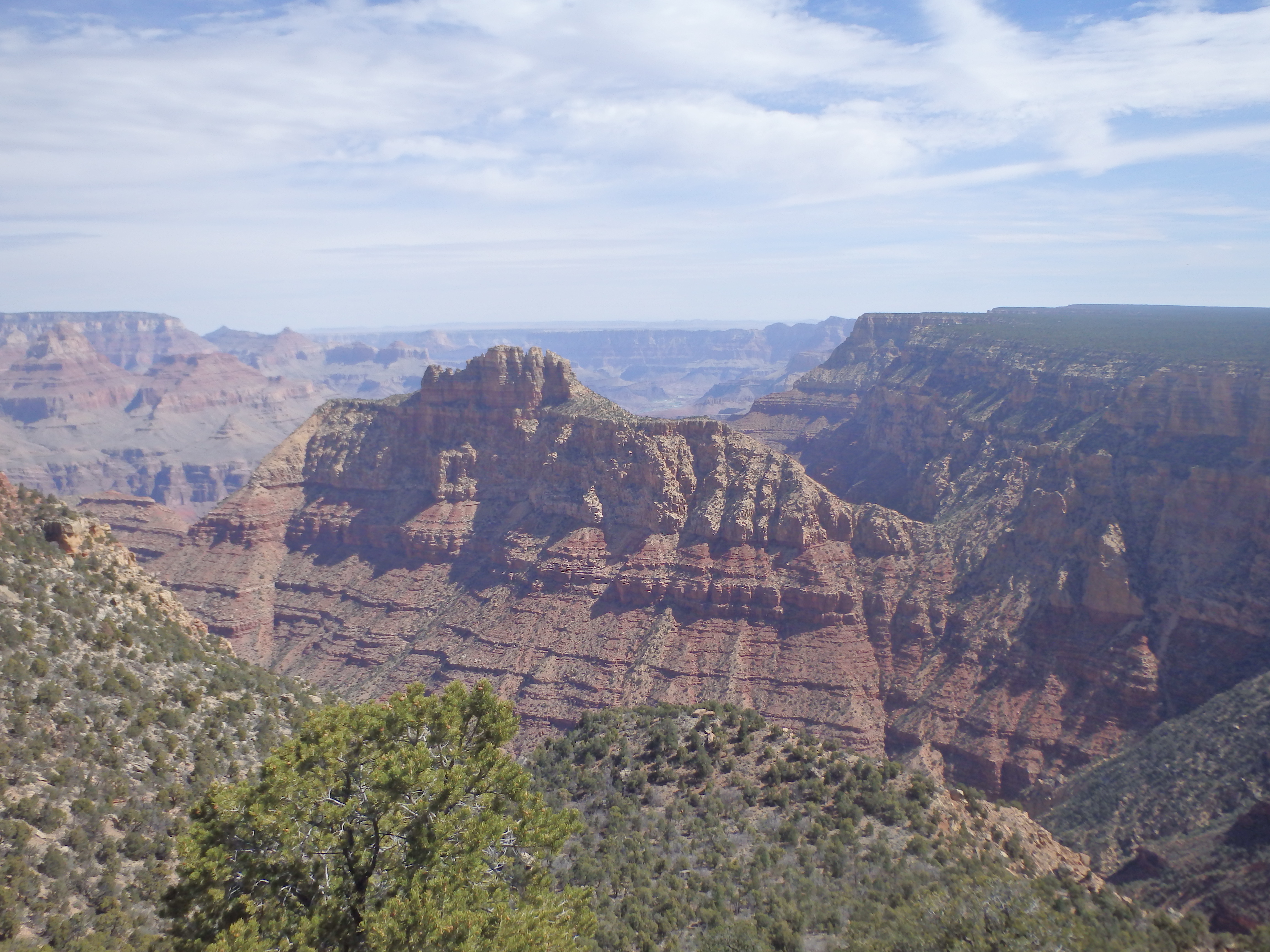
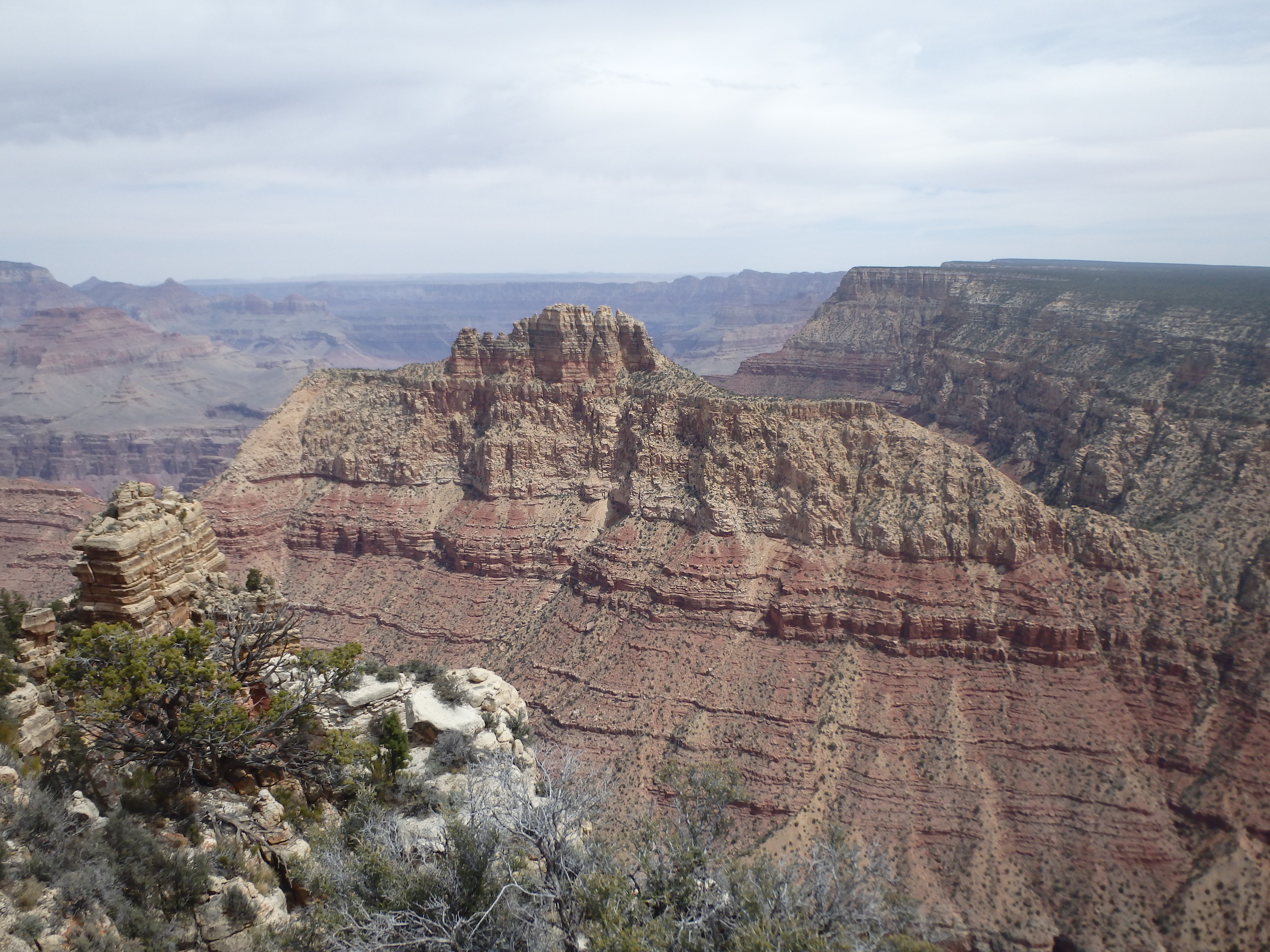
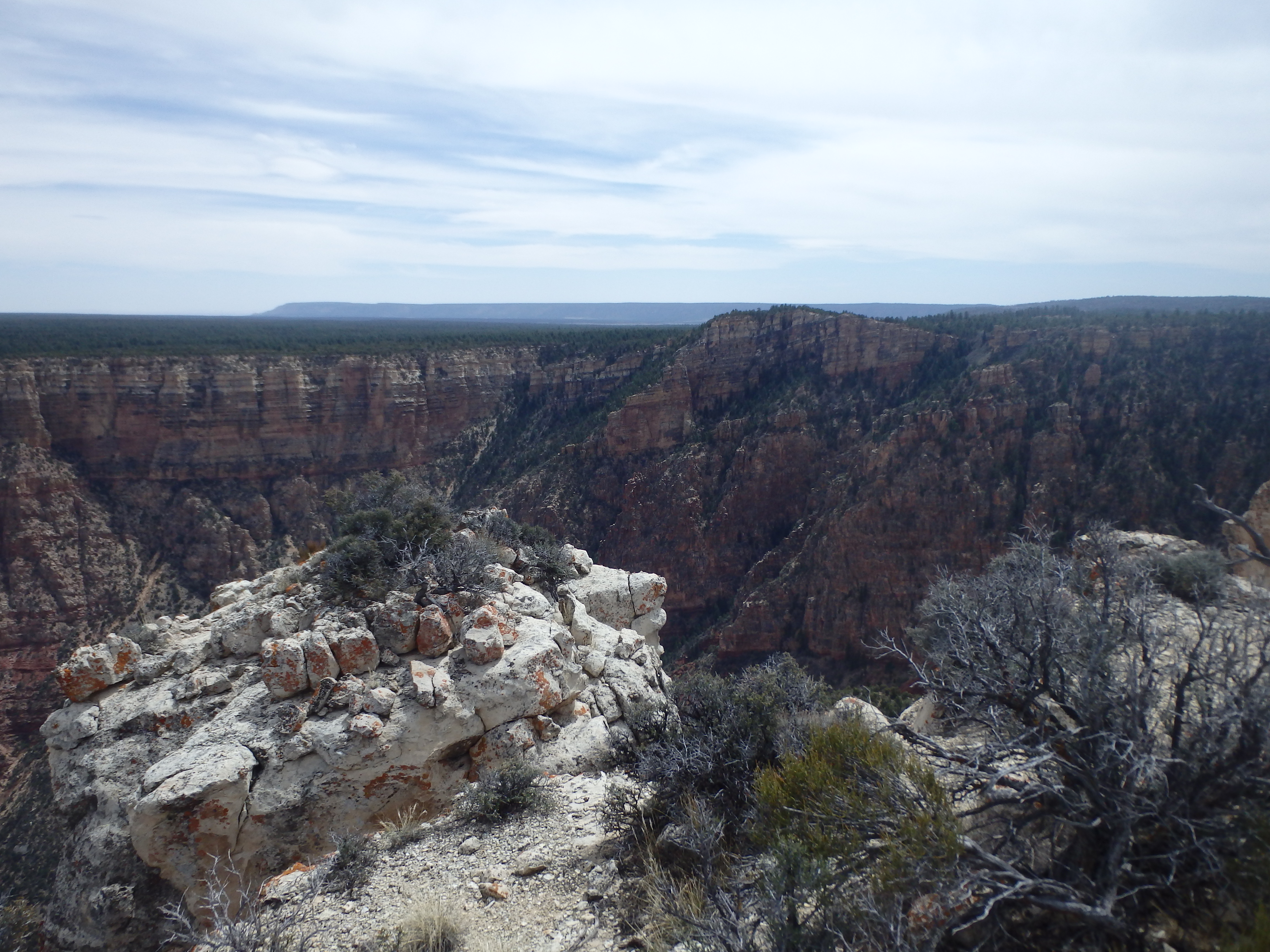
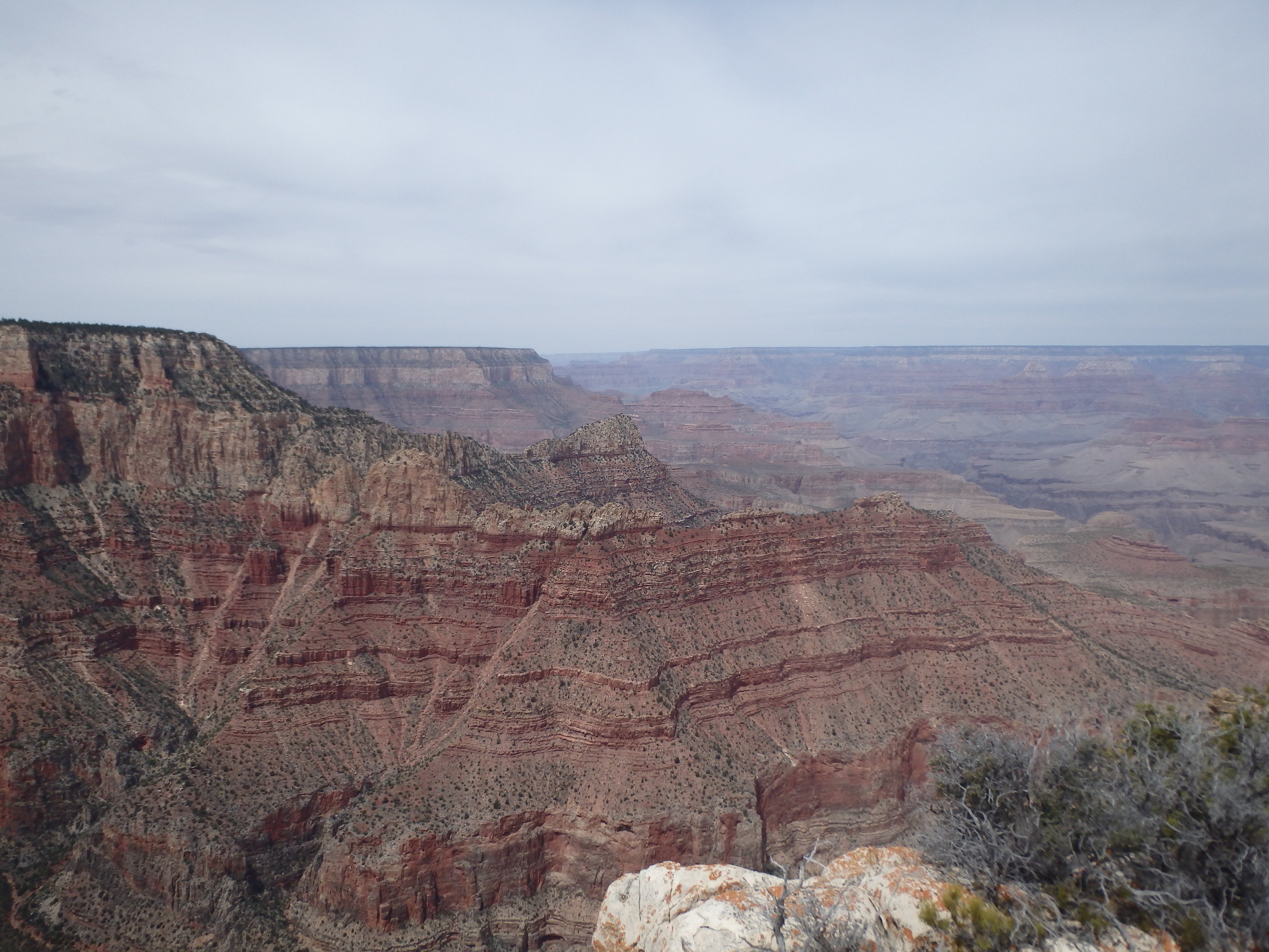
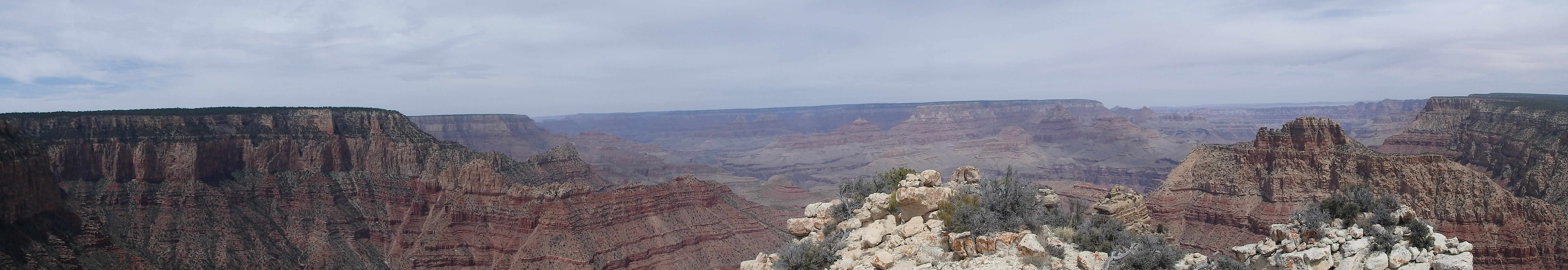
In the back of this alcove was a detached rock that you could easily stem up to a final series of easy ledges to the top. I did not notice this crack on my ascent, and instead did an exposed mantle out to the right to bring me up to the final ledges to the top. I found the summit register at the highpoint not going back all that far and with surprisingly few signatures, people either being spooked by the loose class 4 or unable to stay on route (I can empathize). The best view was to the east of Coronado Butte and Desert View Tower, with sweeping views north to Wotan’s Throne and Vishnu Temple, and Brahma Temple and Zoroaster to the northwest, my exhausting adventure the day before.

I had forgotten to pack my celebratory snacks for the summit, so I cut my time a bit short and started down the southwest side of the summit ledges, finding the crack that could be easily and safely stemmed back down to the alcove below and avoiding the exposed mantle. I squeezed back through tunnel and scrambled down the various ledges to the notch above the class 4 scree and chockstone. I tried to maintain traction by using rocks sticking out of the wall, then gingerly downclimbed back to the base. Back at the pine tree, I decided to cross over to the southeast side of the formation through the gap, finding the scrambling on that side to be a little easier than the southwest (although probably more confusing in terms of route finding). I briefly searched around the base for some Native American ruins reported to be in the area, but I had no luck in locating them, gave up, and started up the steep ridgeline back to the rim. I was happy with how quickly I was able to ascend the ridge, the elevation gain on the return almost trivial compared to most other GC summits. Once on the rim, I made a beeline for my car, made much easier with a little help from my GPS to try and keep on course. Hitting my car, I headed east for a snack at Desert View Tower before driving back to Phoenix.