
Superstition Peak 5057′
Trailhead: Carney Springs, no amenities


The Superstition Mountains are the most rugged, if not the most famous, range of mountains in AZ. Forming a wall to the SE of Phoenix, the range is comprised of dramatic cliffs, hoodoos, spires and bizarre rock formations. It is the setting of the famous legend of the “Lost Dutchman’s Gold,” a story of a hidden gold mine or cache hidden within the complex range. Many people have gone missing searching of the gold, and a few lives are claimed every year in the hundred + degree heat. I made my first trip into the range not in search of lost gold (though it would have been nice), but to take on Superstition Peak, highpoint of a ridgeline that ends at the Flatiron to the SE of Phoenix.

The trailhead I choose for the climb was Carney Springs, an old closed 4×4 dirt road that heads quickly through desert washes and up into canyons at the edge of the range. I had planned to use it to ascend Boulder Canyon to the ridgeline, then follow a solid trail all the way to the final bit of class III below the summit. I set out at about 8:30, following the old, relatively flat road to the Wilderness Boundary.

About here the trail starts to gain a bit of elevation, nearing a ridge that separates two canyons, one of which was Boulder Canyon that I planned on ascending, the other unnamed. Although the trail starts to narrow, it was easy to follow as it swung around the ridge into the canyon to the left, which I assumed (incorrectly) was Boulder Canyon. Entering the canyon, I could see a rocky Sandstone Cave about 1/3 way up.

The trail headed upslope and headed more or less directly for the cave. I arrived there in about an hour, finding a group of people already there. The cave, which I later learned was known as the “Wave Cave,” was quite impressive, probably 50′ deep, 100′ across and 20-30′ high. It is named for a unique, wave shaped rock coming up from the cave floor, making for some cool photos.

I took a short break here, listening to the ASU co-eds talk about their classes and Game of Thrones theories (John Snow can’t really be dead!?). I left the cave and started looking for a trail that would continue on up to the ridgeline. A faint use trail headed steeply upslope and at the time, seemed like the best option. The next 1.5 hours can be filed under misadventure. I quickly lost the game trail I had been following and my climb evolved into a steep bushwack, following faint game trails or using large boulders above the brush to make progress. Thankfully, it was so steep that there were many areas where the brush hadn’t taken hold, and I only had a few battles of fighting with some mean thorns.

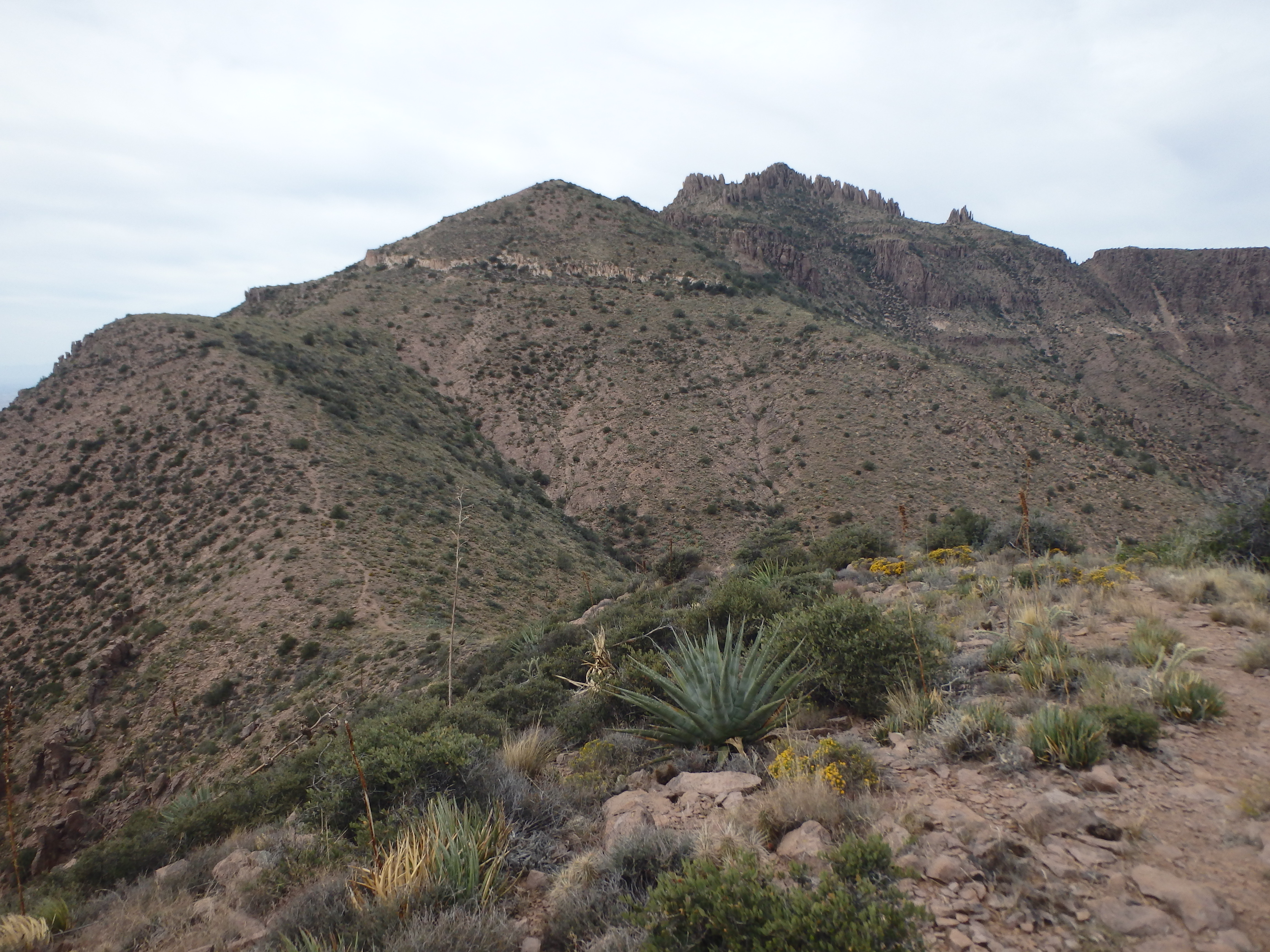
It was here that I finally decided to check my map, and realized that Boulder Canyon was one canyon to the west, and the reason I had been on a great trail up until that point was just to get to the cave. I had read some trip reports that talked about the cave so I figured there was probably a true use trail I could use to get up to the ridge. About 400′ below the ridgeline, I finally spotted a cairn and the use trail I should have been on at the bottom of the wash, now quite far below. I continued up canyon, trying to maintain the same elevation to meet up with the wash, ultimately converging on the barely distinct use trail the rest of the way to the ridgeline. On reaching the ridge, I found myself in a jumble of boulders and rock formations, with the summit now in sight, and Weavers Needle poking through to the NE.

On checking the map, the trail intersected the ridgeline exactly where I popped out before heading upslope again to gain some elevation towards the summit. I searched for the trail, and found a faint path that headed up the ridge, assuming that the bushwacking was now behind me. It was not. On a later, second review of the map, the actual trail runs about 50′ below the ridgeline and switches back onto the ridge a bit farther along. The incorrect trail I choose to follow led me to fight my way up plenty of steep brush, probably the worst of the day. My suffering finally eased as I topped out on the higher portion of the ridge and met up with the well-traveled actual trail. I took one last break to dig a huge cactus thorn that went straight through the bottom of my shoe into my foot and took off for the summit.

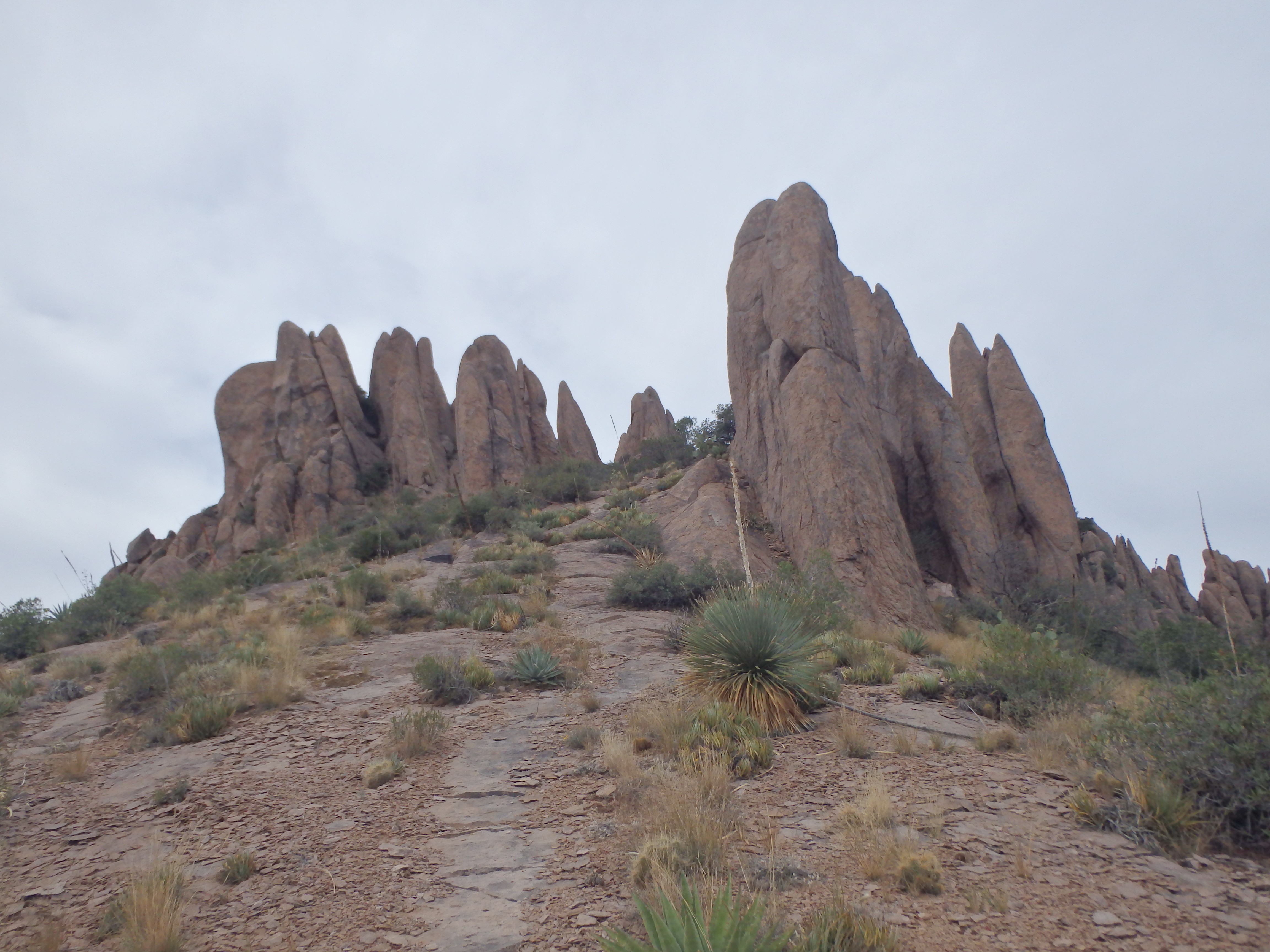
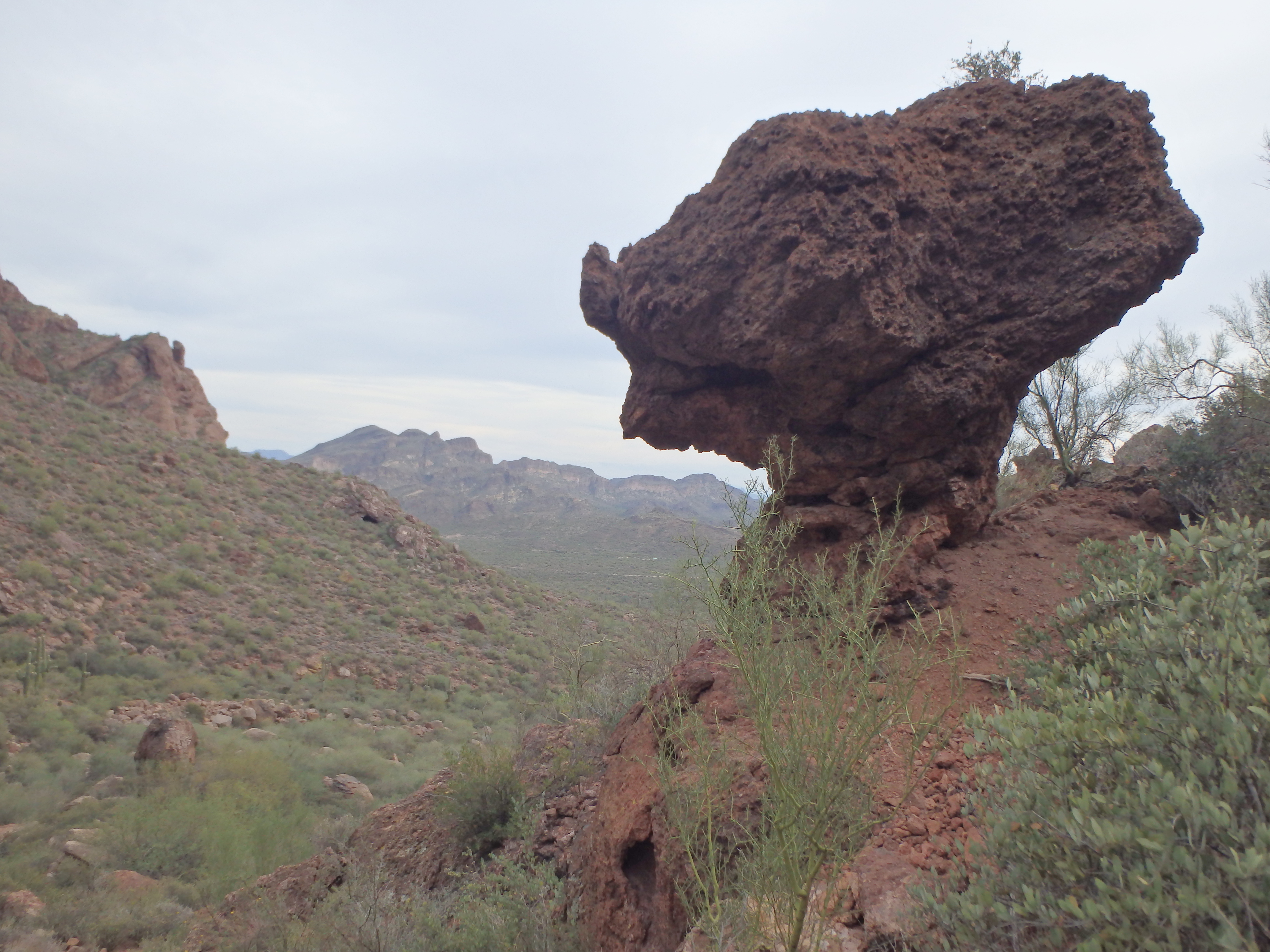
As I closed in, it looked more like a Battleship or Fortress, with 60′ rock pinnacles surrounding the summit on all sides. The trail lost a bit of elevation then began traversing underneath the ridge to avoid a false summit. When I topped out again, I was face to face with these enormous rock formations as the trail headed straight through them.
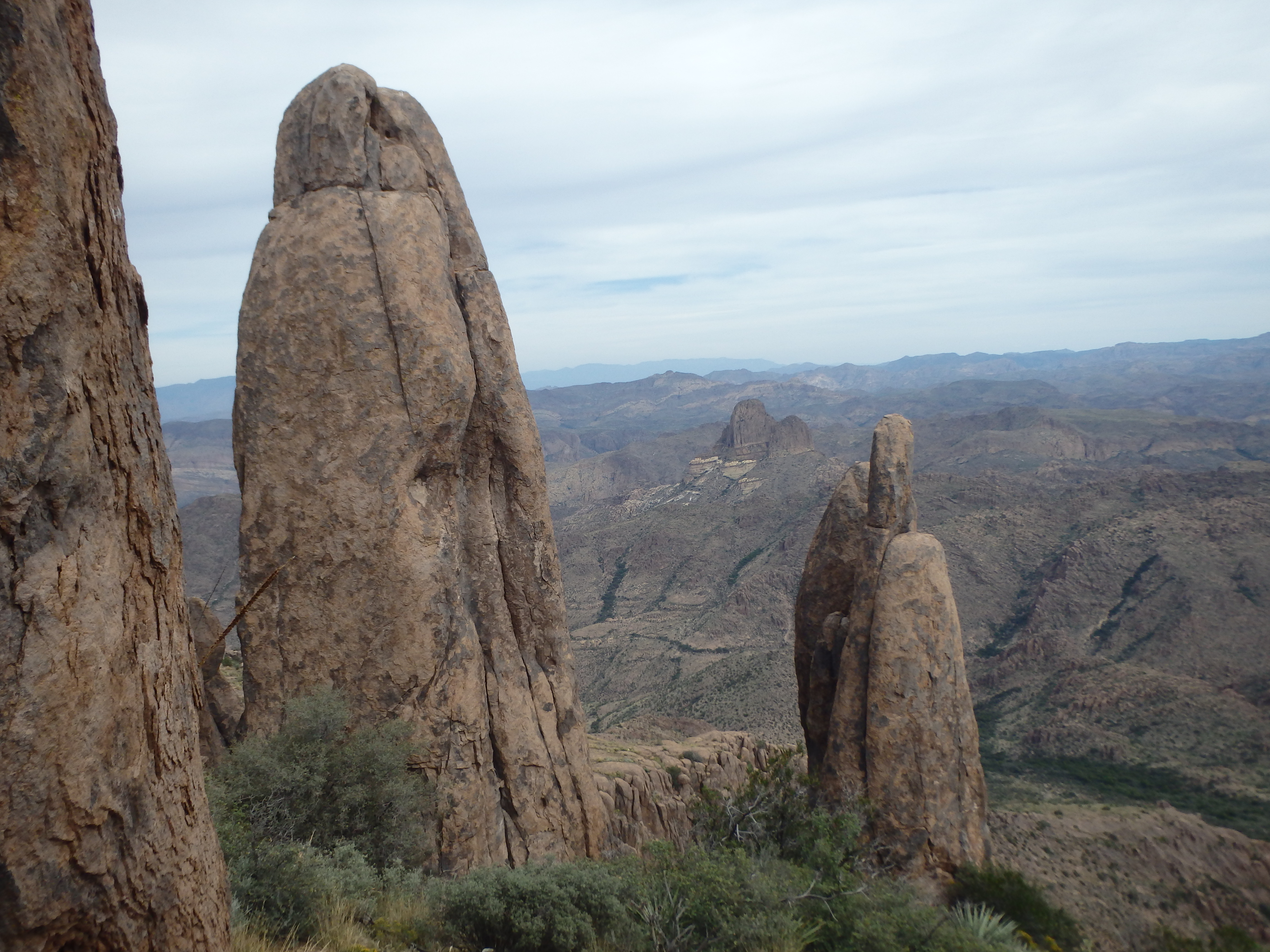
Views to the west continued to open up, with an interesting angle on Weavers Needle and Four Peaks.
The last push called for the only necessary climbing of the day, a few short, easy class III moves (some sources say class IV, but I’d say they were either off-route or horrible at assessing class) put me at the summit about 3.5 hours from the car.

The views on top were outstanding, with a straight shot down the Superstition Ridgeline to the north, ending with the infamous Flatiron.

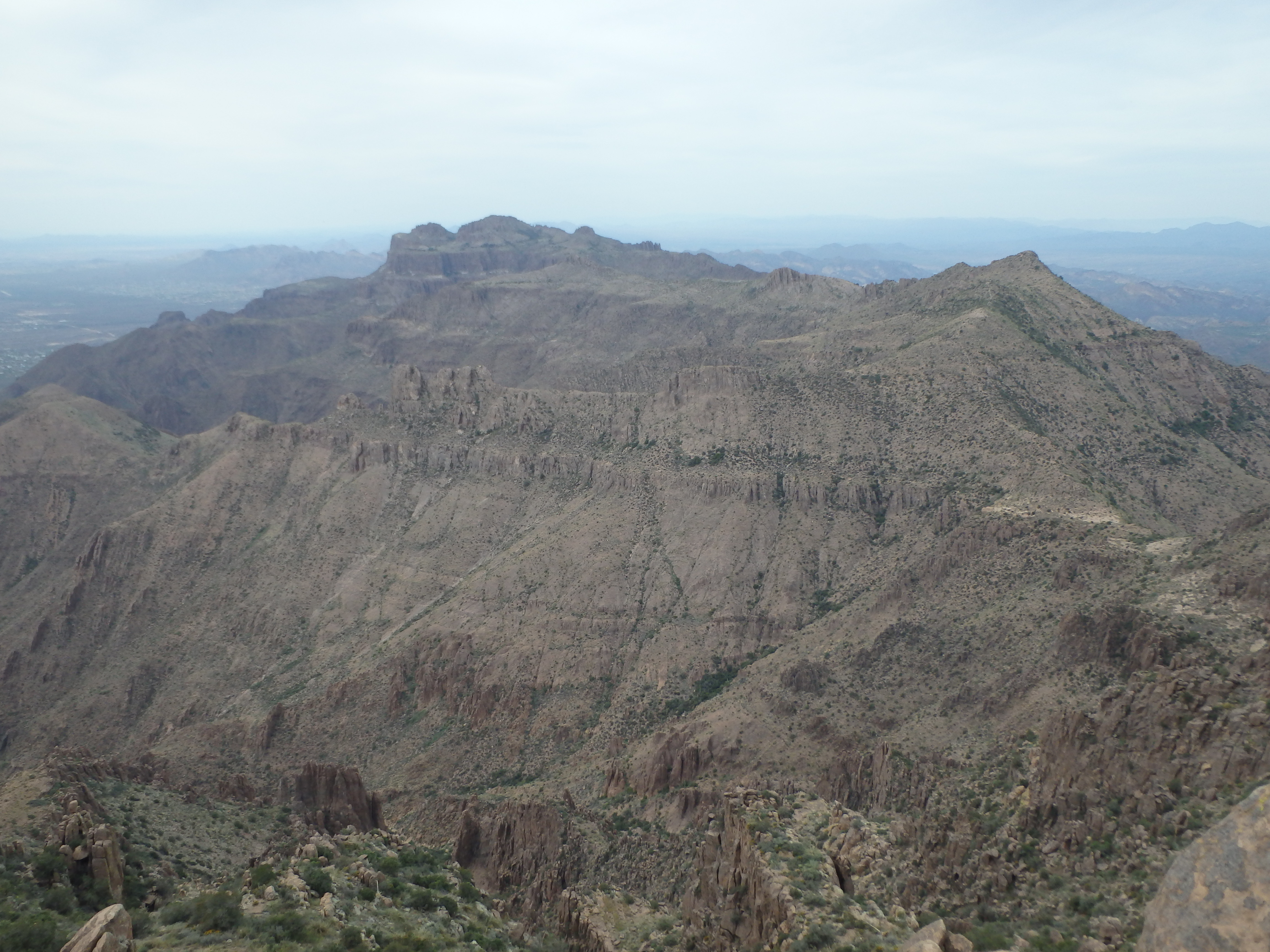

Weavers Needle looked tiny, with Four Peaks looming in the distance to the East. I lingered for some time on the summit, signing in to the quite full register, with four parties having been up just the day before. On the descent I decided to see what it would be like to keep to the actual trail the entire time and descend Boulder Canyon proper. I always prefer a loop, and wanted to minimize the chance of more bushwacking. The trail overall was quite easy to follow higher up. I did come upon one rocky outcrop where someone placed branches across the trail, seemingly trying to direct you elsewhere, with no obvious other trail to take.

Once off the ridgeline the trail cut across a high, rocky basin, and at times the trail was indistinct on the rock slabs, cairns guiding the way.

I passed where I had popped out of the wrong canyon earlier that morning, just 50′ from where I took my break, hidden by brush. Past that point, shortly before Fremont Saddle, the trail dips into a small wash, then gains elevation again to get around an intermediate high point. I felt like this was a place where one could easily lose the trail, as the trail become less distinct on the rock slabs and the best path is no obvious.

Finally, I hit the junction west of Fremont Saddle, with a sign saying the TH was only 1.8 miles away (but still over 1000′ of descent).

I wasted no time following the very steep and sometimes loose trail. Aside from the Wave Cave, I found Boulder Canyon to be more scenic than the one I ascended earlier, with interesting rock formations scattered throughout and a dry waterfall near the bottom.
Shortly before hitting the wilderness boundary, I found the junction that led me to the cave and not the canyon I wanted. The mistake would be easy for anyone to make, with people having laid branches across the Boulder Canyon Trail and arrows made of rocks pointing in the direction of the cave, assuming that everyone wants to go that way.

I left the branches alone and followed the old road back to the car to head home.